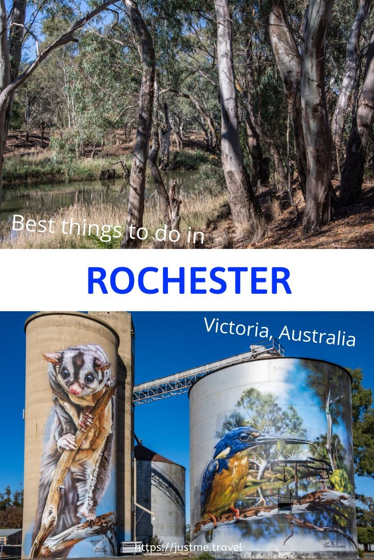
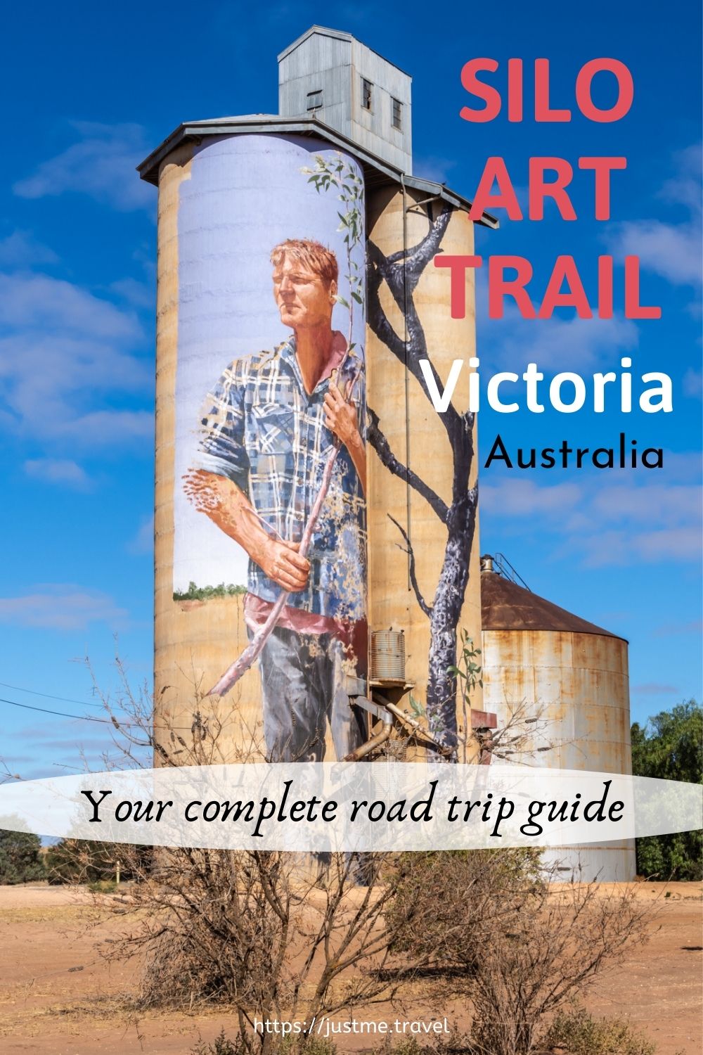
Visit Rochester Victoria – 3 Excellent Reasons to Plan Your Next Great Escape Are you looking for a day trip or overnight stay in rural Victoria? On the Campaspe…
Visit Rochester Victoria – 3 Excellent Reasons to Plan Your Next Great Escape
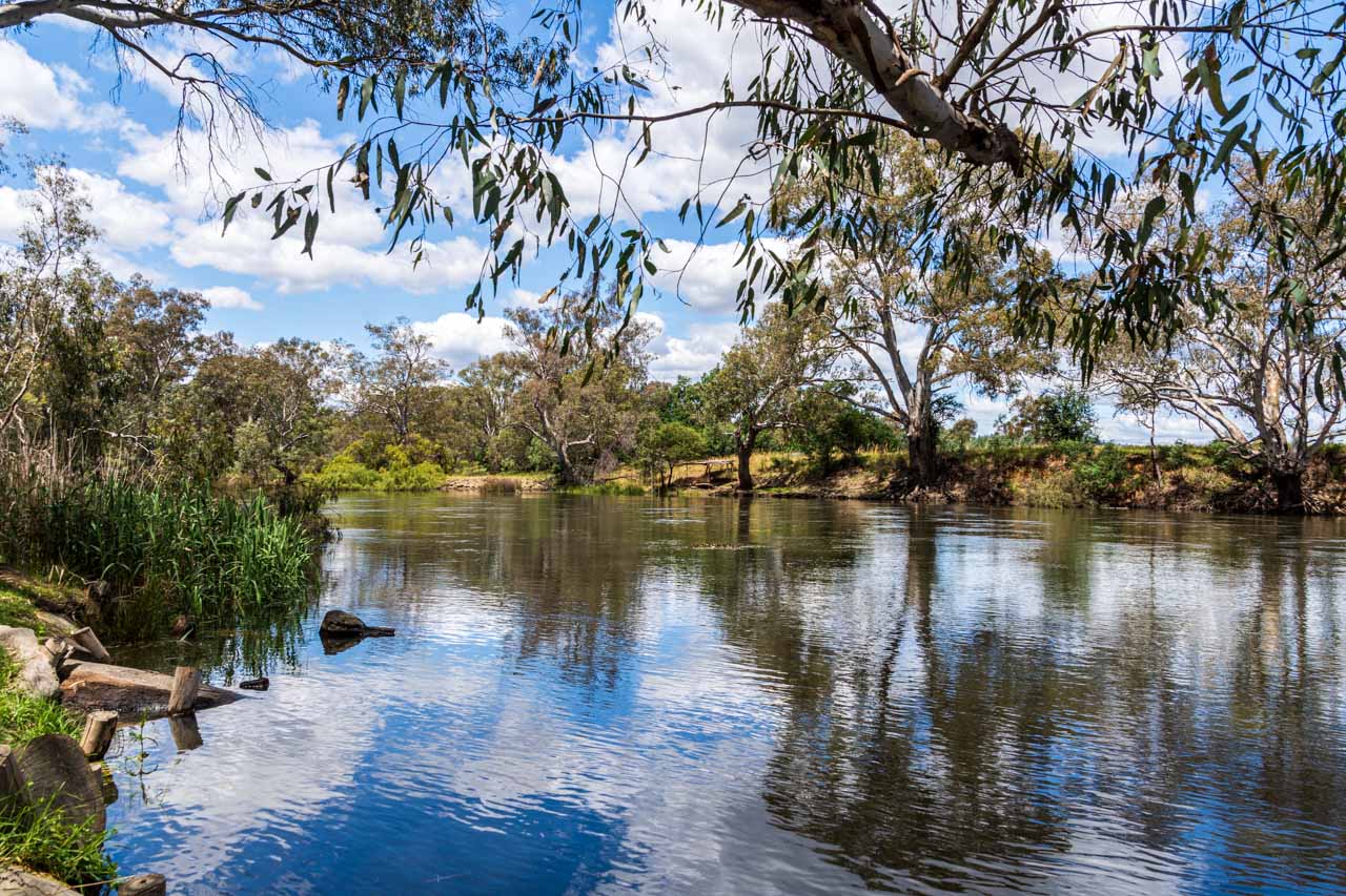
Are you looking for a day trip or overnight stay in rural Victoria? On the Campaspe River, Rochester is an idyllic spot to see silo art, take an informative walk through the Australian bush, and eat good food. My one-day guide will take you there.
On a 12-day road trip around Victoria, my sister and I stopped over in Bendigo and Ballarat, travelled the silo art trail, photographed our reflections on Lake Tyrrell, explored the Lakes District around Kerang, and walked the Koondrook Barham Redgum Statue Walk.
Rochester was our last stop, arriving late afternoon. The following day, we viewed Rochester’s silo artworks and took the river walk before heading home in the early afternoon. These are two of the best things to see and do in Rochester. The third best thing to do in Rochester was eating – well worth mentioning, given our food experience on this road trip.
Where is Rochester
Situated on the Campaspe River in Victoria (Australia), Rochester is 27 kilometres south of the Murray River Port of Echuca. The Murray River, in New South Wales, forms the border with Victoria and is Australia’s longest river.
Taking the fastest route, according to Google maps, Rochester is 187 kilometres north of Melbourne, 27 kilometres south of Echuca, and 240 kilometres south-west of the twin cities, Albury/Wodonga.
Silo artwork
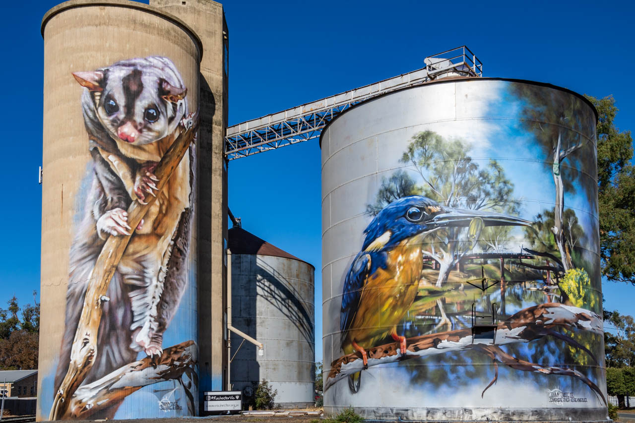
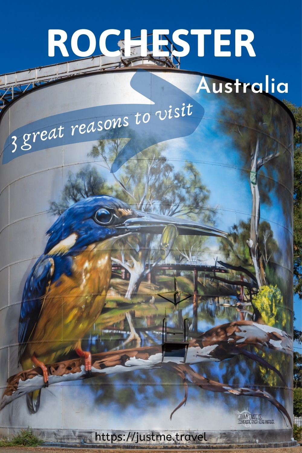
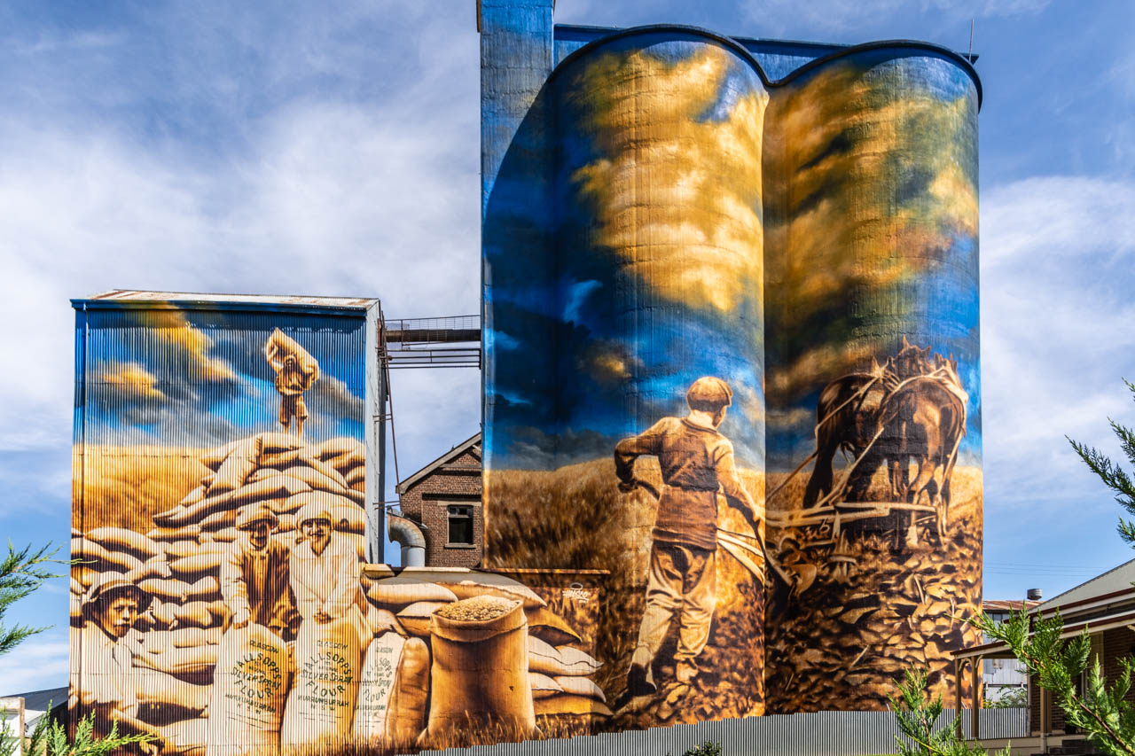
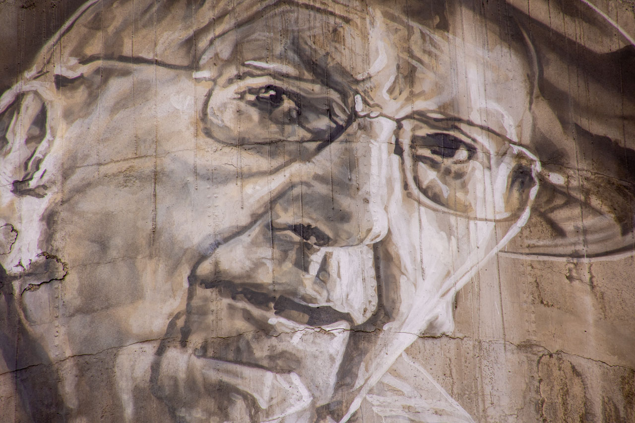
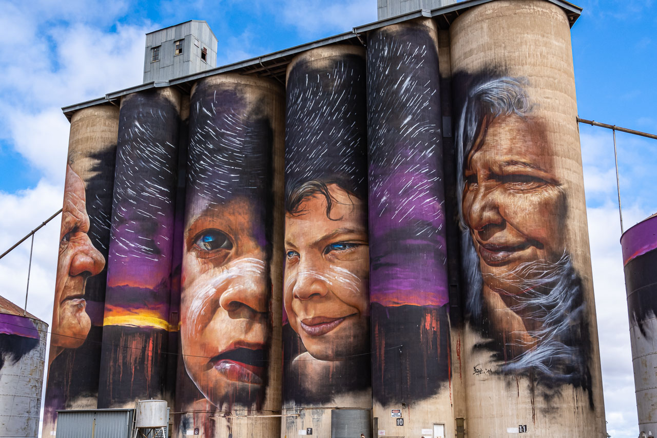
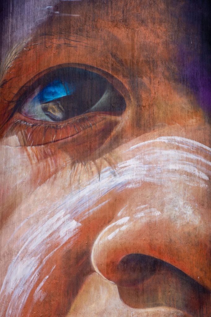
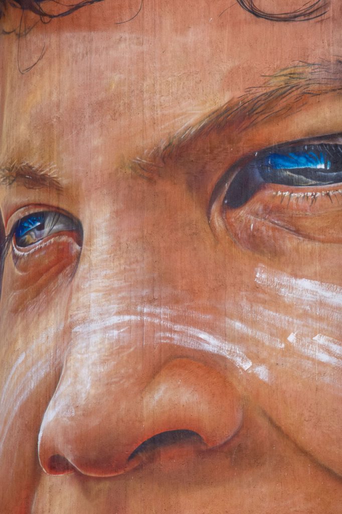
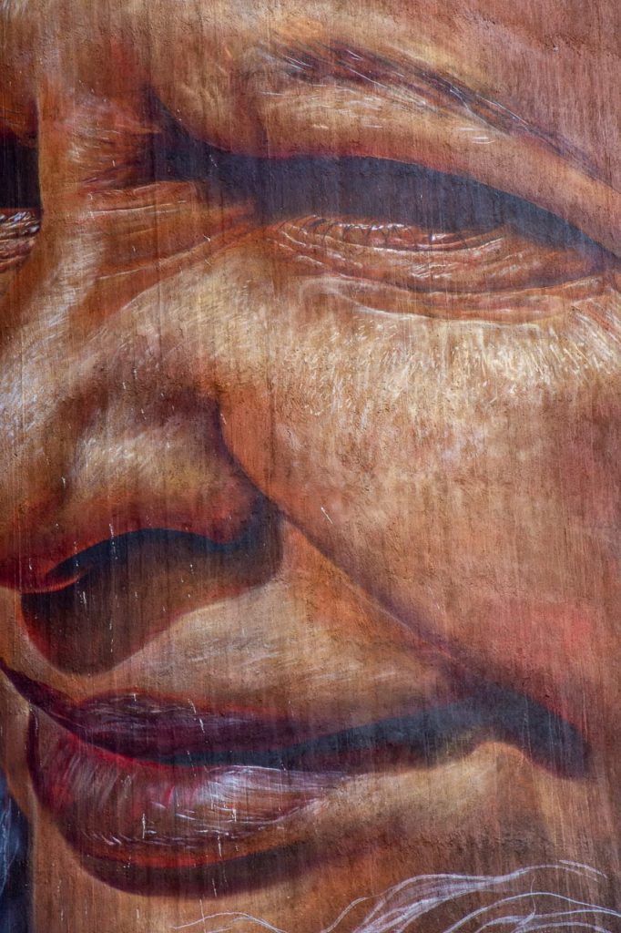
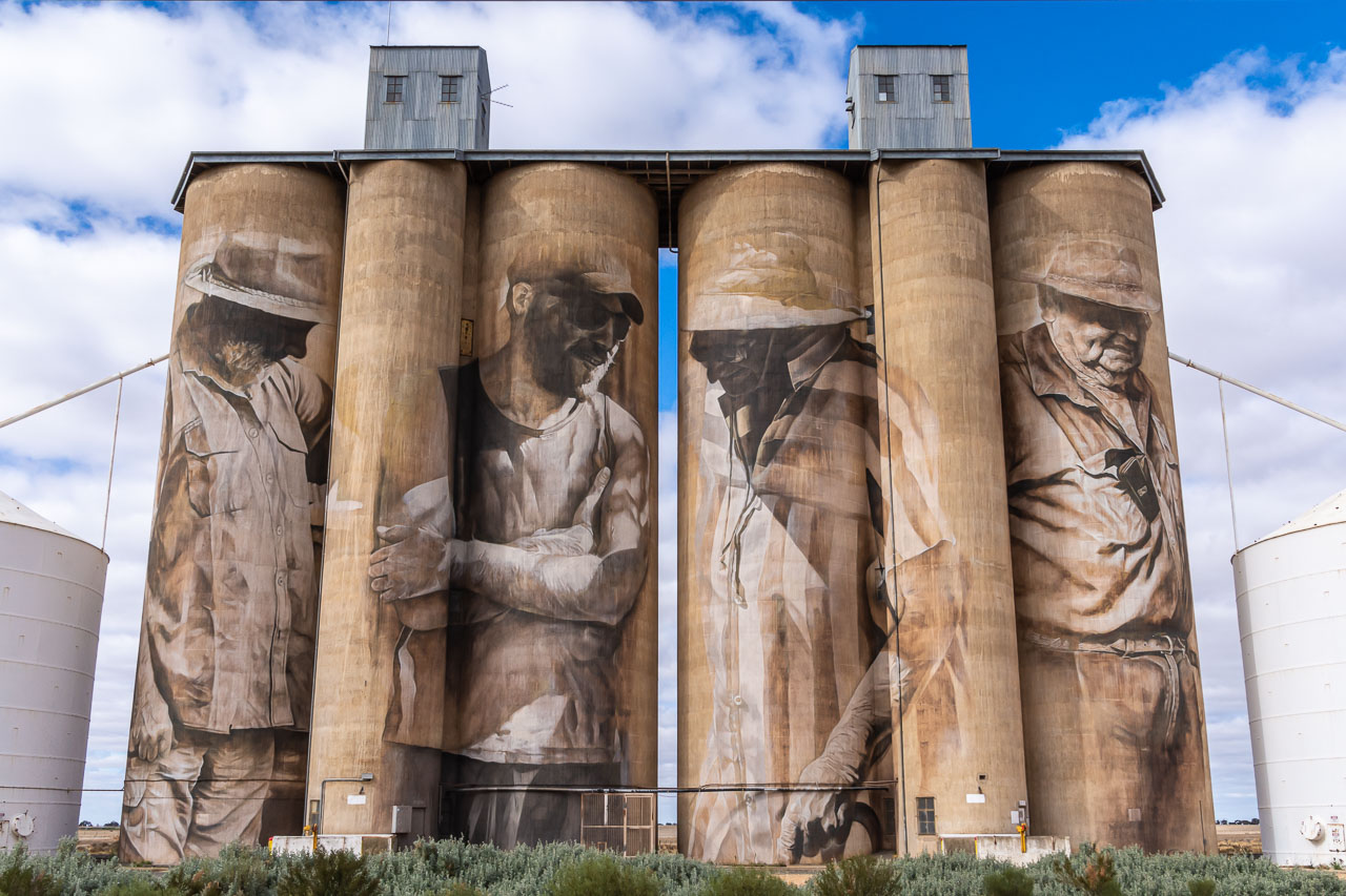
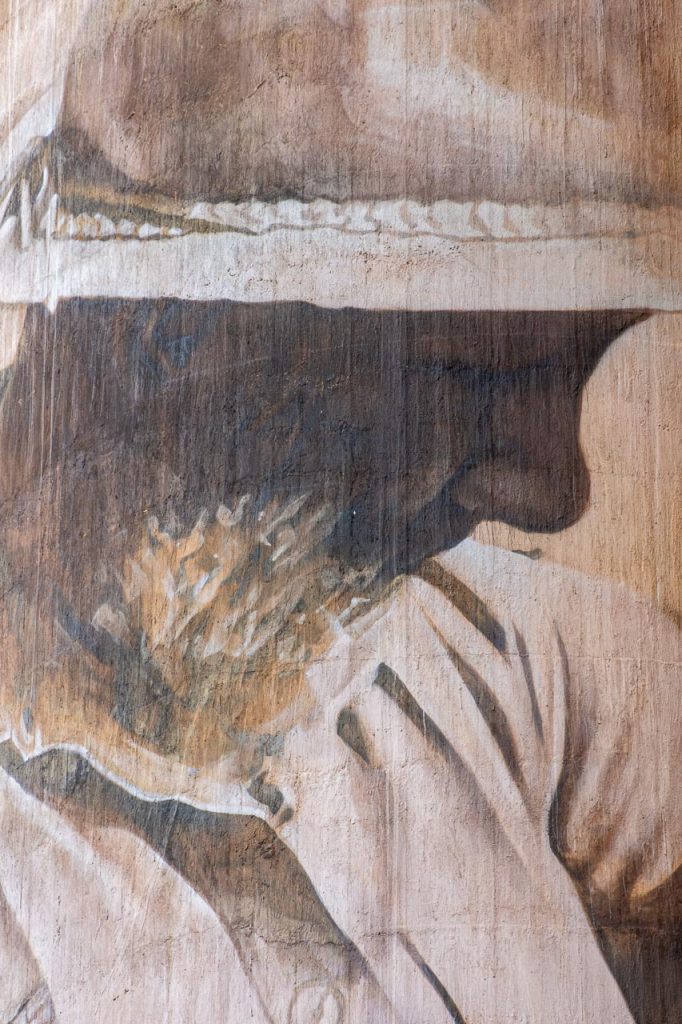
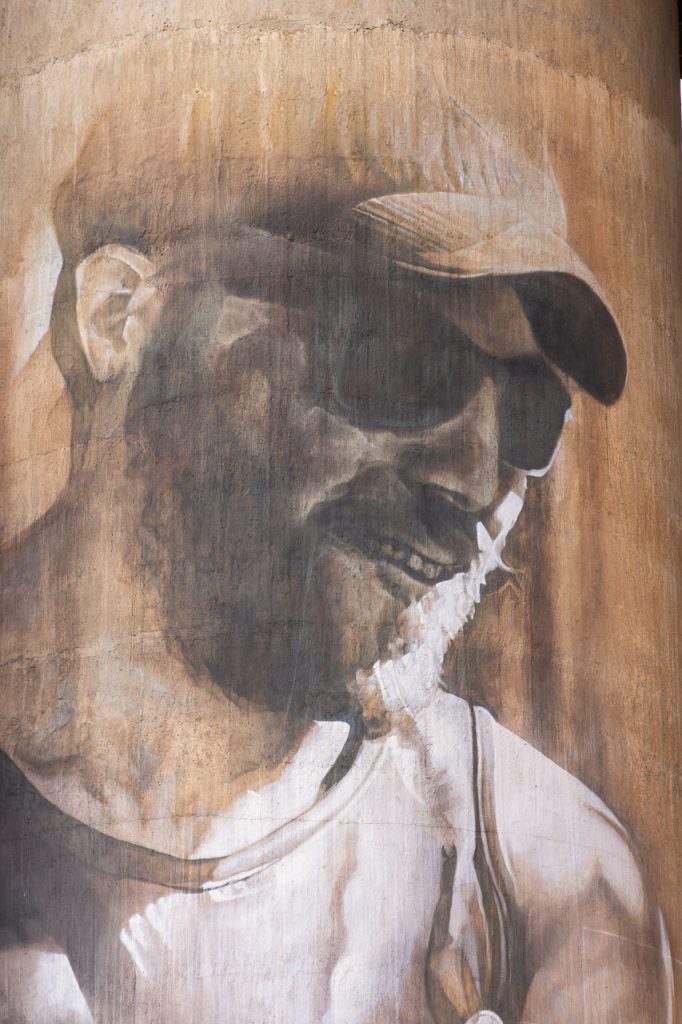
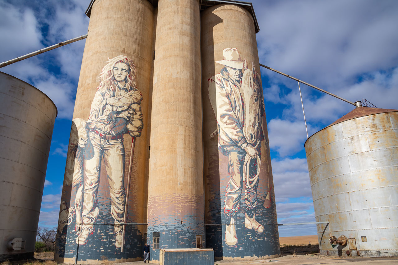
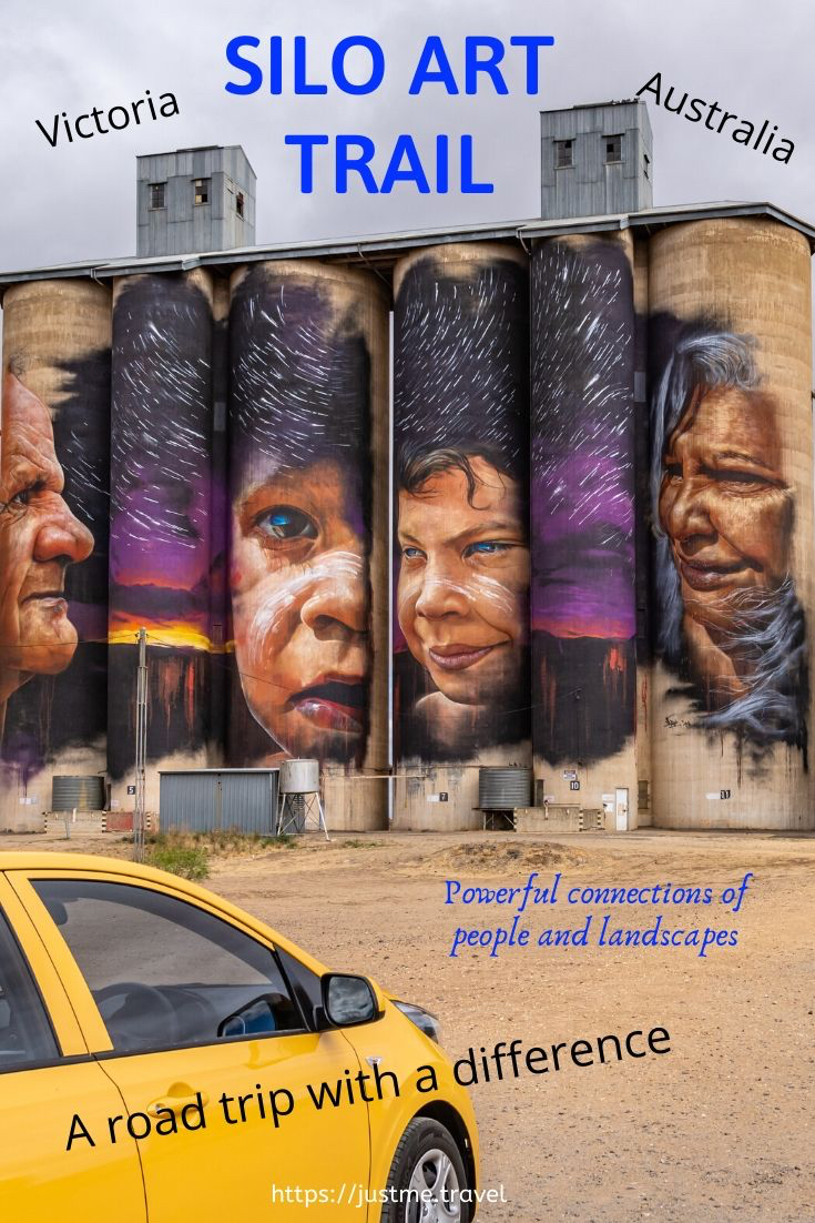
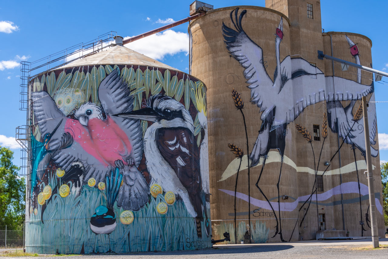
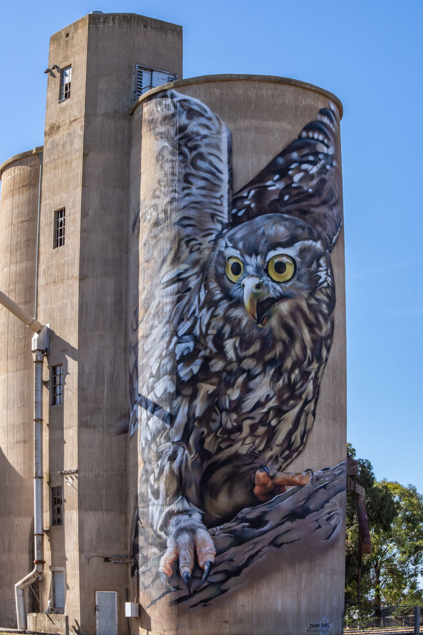
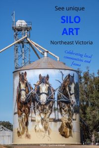
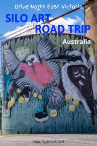
Silo artworks of Squirrel Glider and Azure Kingfisher at Rochester, Victoria.
Rochester’s Silo Art project was the initiative of Rochester Business Network, with support from local businesses and the community. GrainCorp provided the silos as ‘creative’ canvases for artworks on a massive scale. To give you an idea of perspective, the concrete silo is 22 metres high (approximately 72 feet), while the height of the metal silo is 18 metres (about 59 feet).
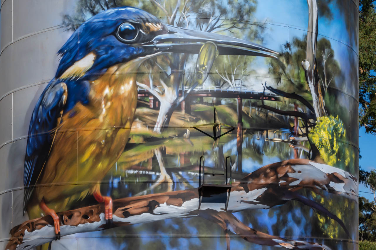
The painted silos are in the heart of town. They feature the endangered Squirrel Glider on the concrete silo and the Azure Kingfisher on the metal silo. Both are native to Australia.
The painted silos, completed in 2018, is an open-air gallery that never closes and is free to visit. It is street art at its best.
The artist who designed and painted these magnificent murals, Jimmy DVate, is the same artist who painted the silos at Goorambat in North East Victoria.
Jimmy is a Melbourne based artist and graphic designer whose talent is recognised nationally and internationally. He is passionate about conservation and is particularly keen to highlight the plight of endangered species. Painting threatened Australian native fauna is a ‘signature’ of Jimmy’s artwork.
Of all the silo artworks we saw on this road trip around Victoria, which took in the Silo Art Trail, the Rochester painted silos were my sister’s favourite. They rate very highly on my list too. I think I must have an affinity with Jimmy DVate’s artworks as his paintings on the silos at Goorambat are also at the top of my favourites list.
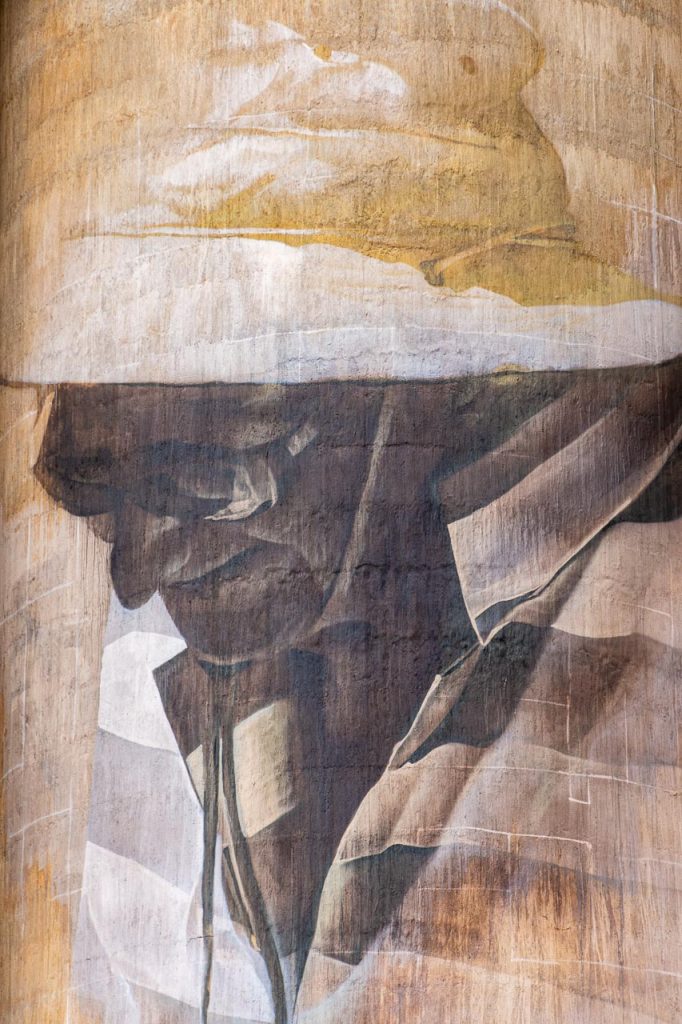
The endangered Squirrel Glider painted on Rochester’s grain silo
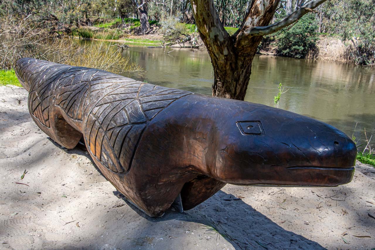
River Walk
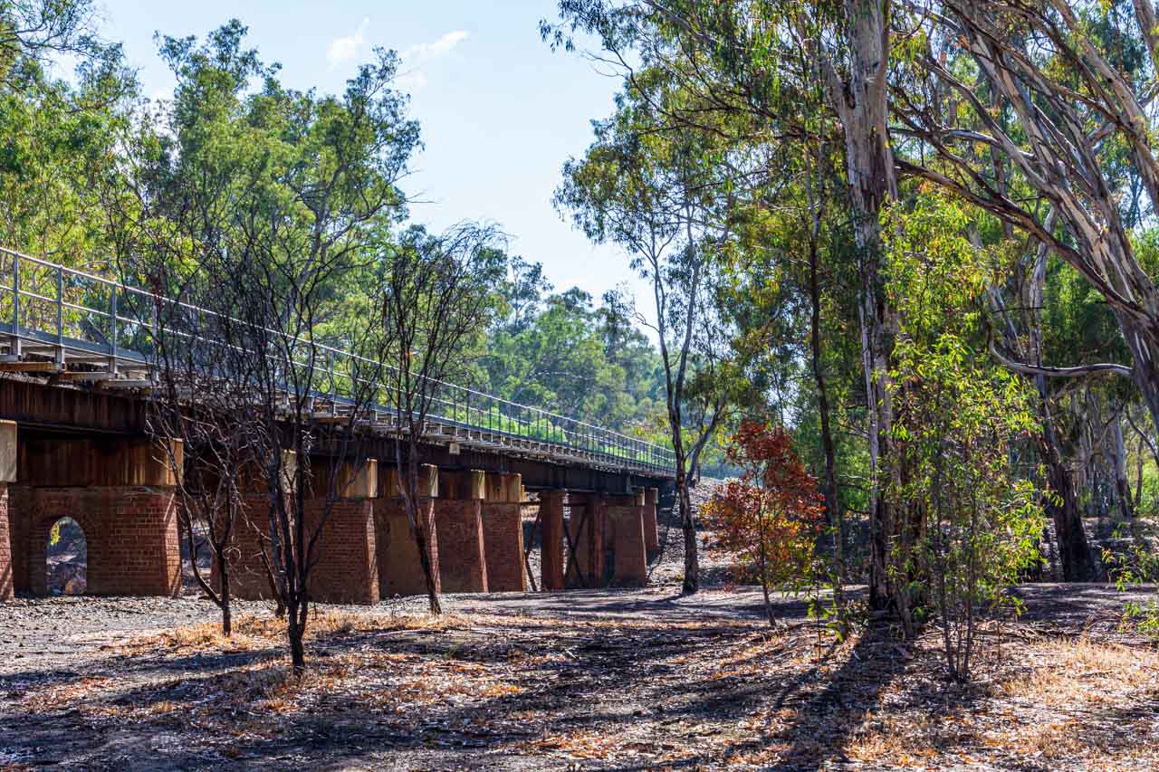
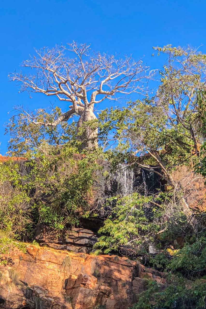
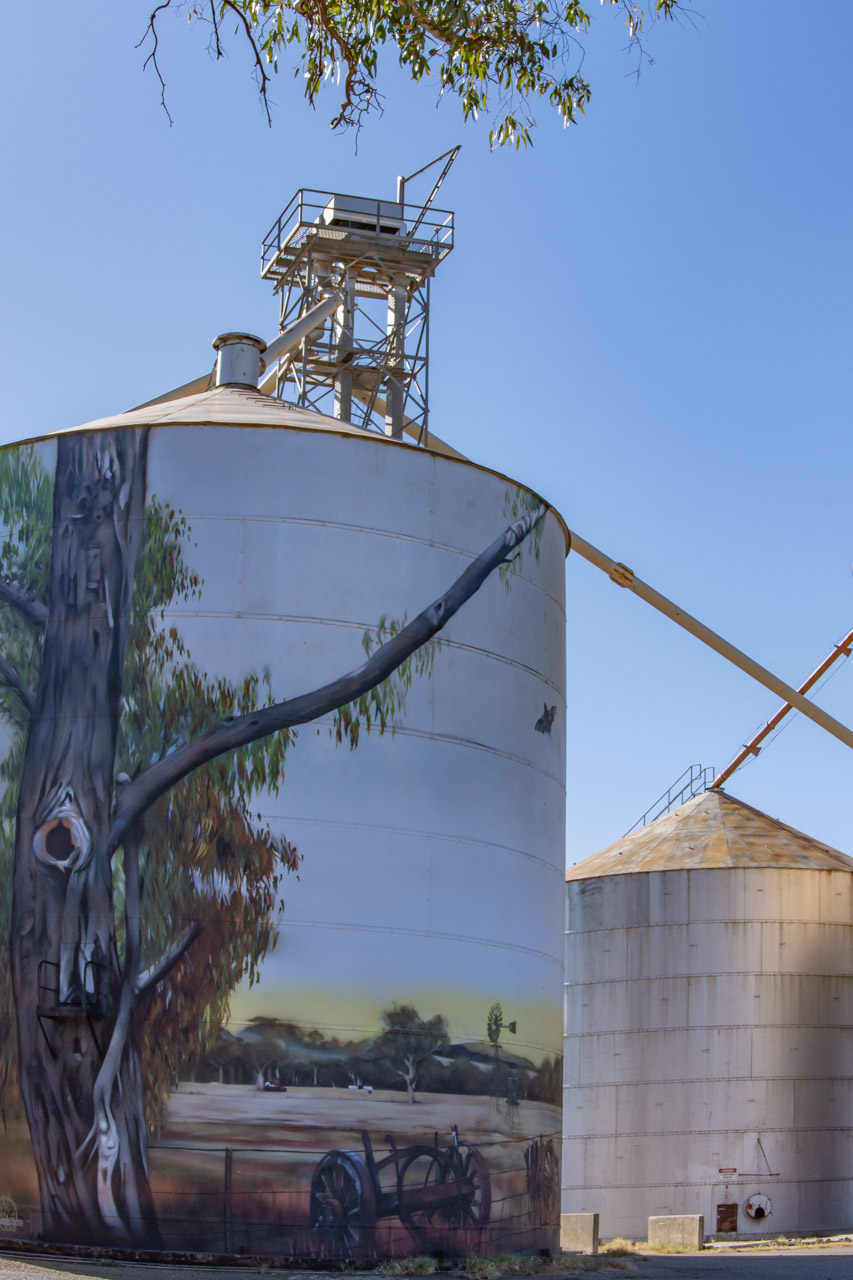
Walking from the painted silos, we made our way to Rochester’s Red Bridge, a timber rail bridge crossing the Campaspe River at the northern end of Ramsay Street. Built in 1876, the Red Bridge consists of three openings of 14 metres spanning the river and 16 openings of seven metres over the flood plain.
Red Bridge – the rail bridge crossing the Campaspe River at Rochester
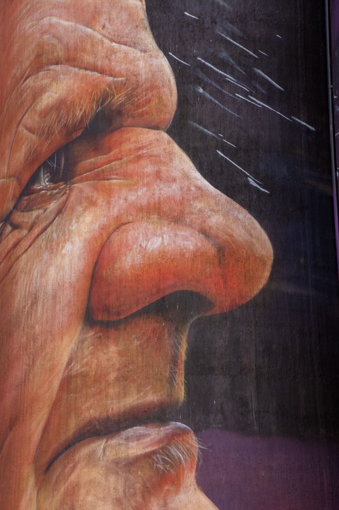
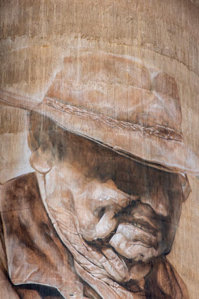
The Red Bridge features in the background in the silo artwork of the Kingfisher.
Rochester’s Red Bridge features in the background on the silo artwork of the Kingfisher
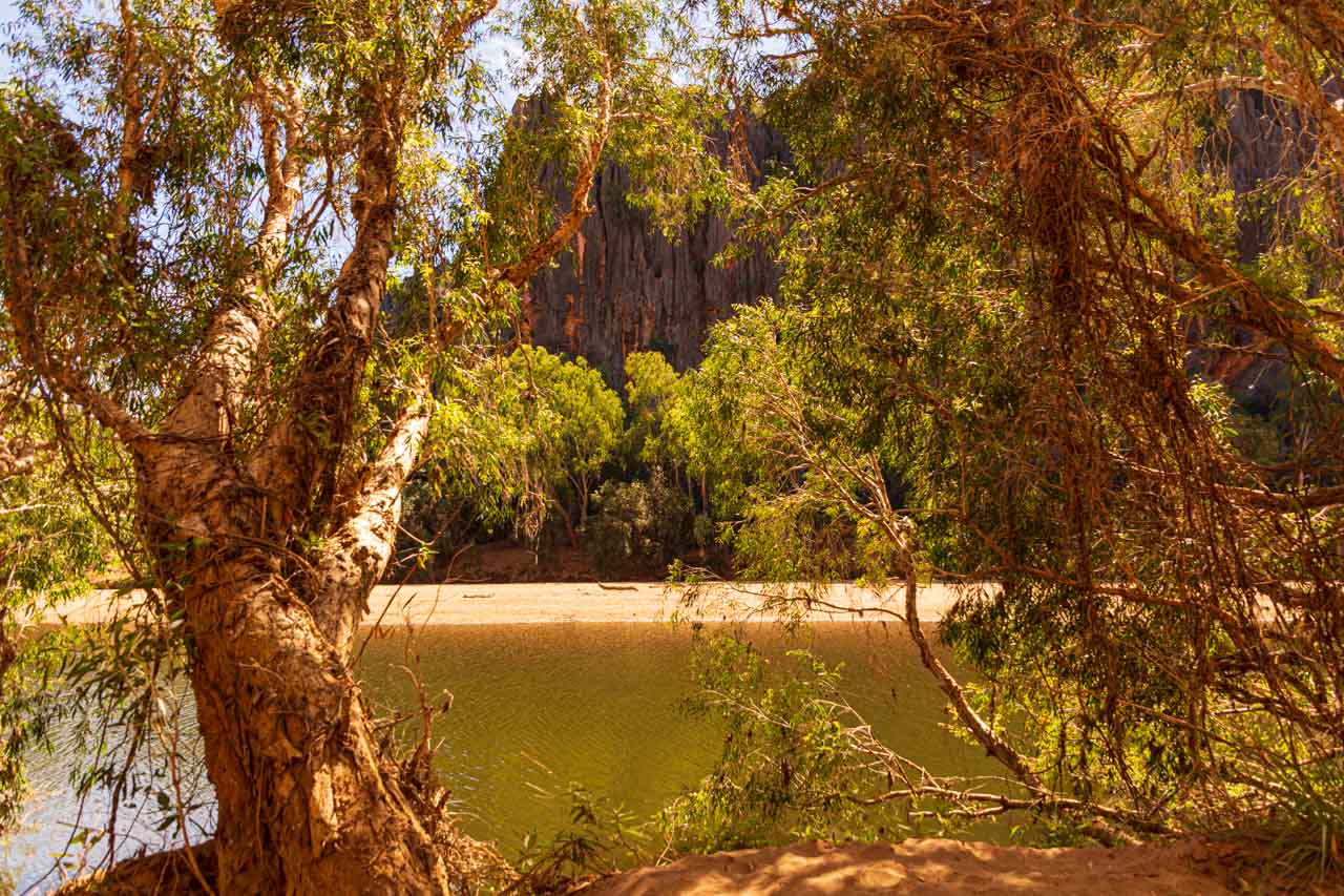
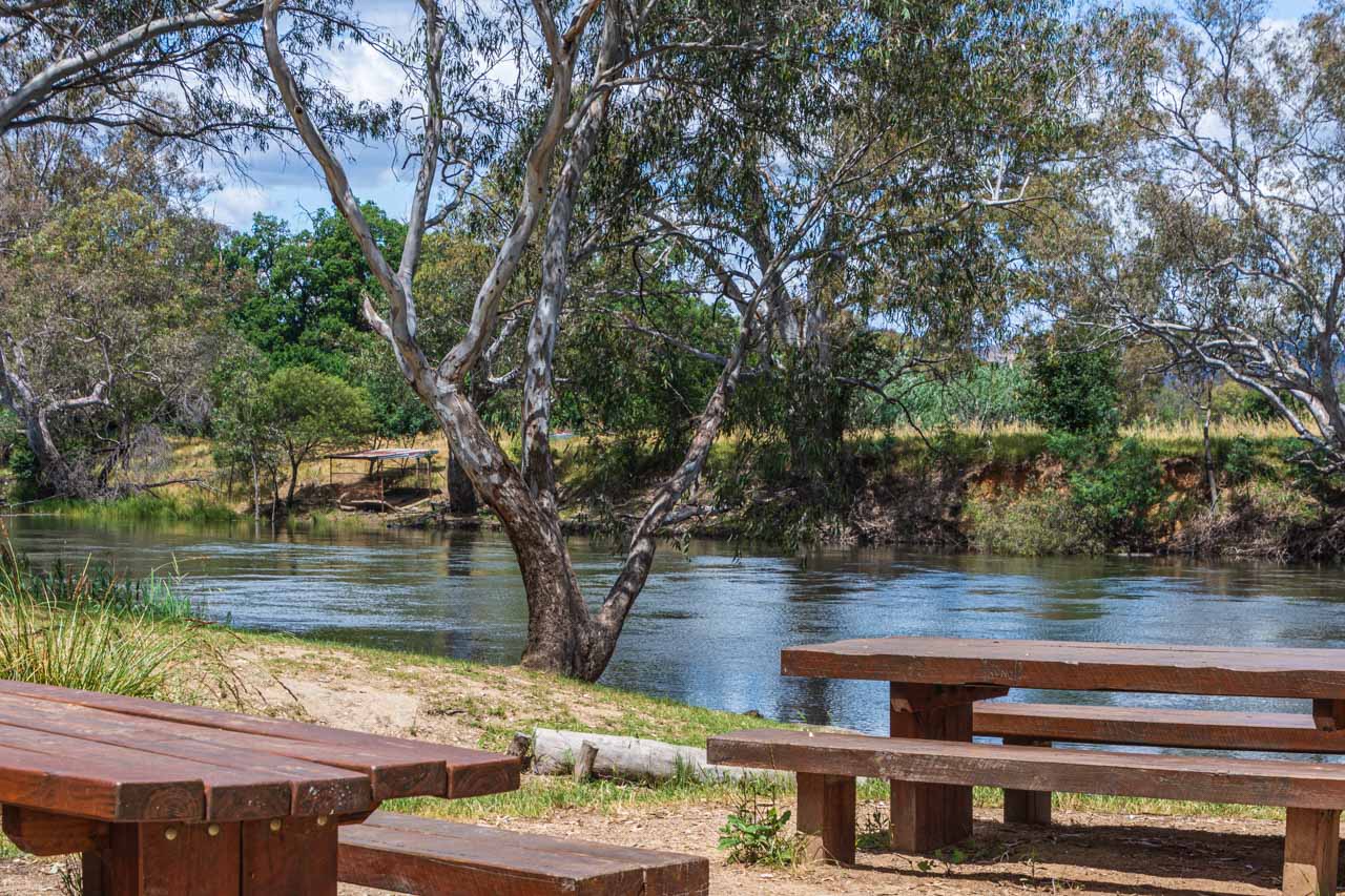
The Red Bridge was our starting point for the 3-kilometre signposted river walk through the urban bushland of the Campaspe River Reserve at Rochester.
The red dotted line indicates the river walk on the map below – taken from the brochure, Experience Rochester, courtesy of Rochester’s Visitor Information Centre.
Map of Rochester, Victoria, showing the river walk route
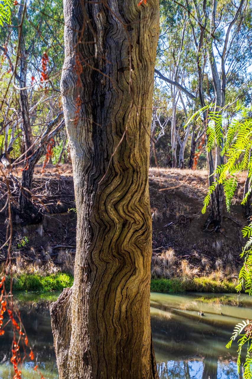
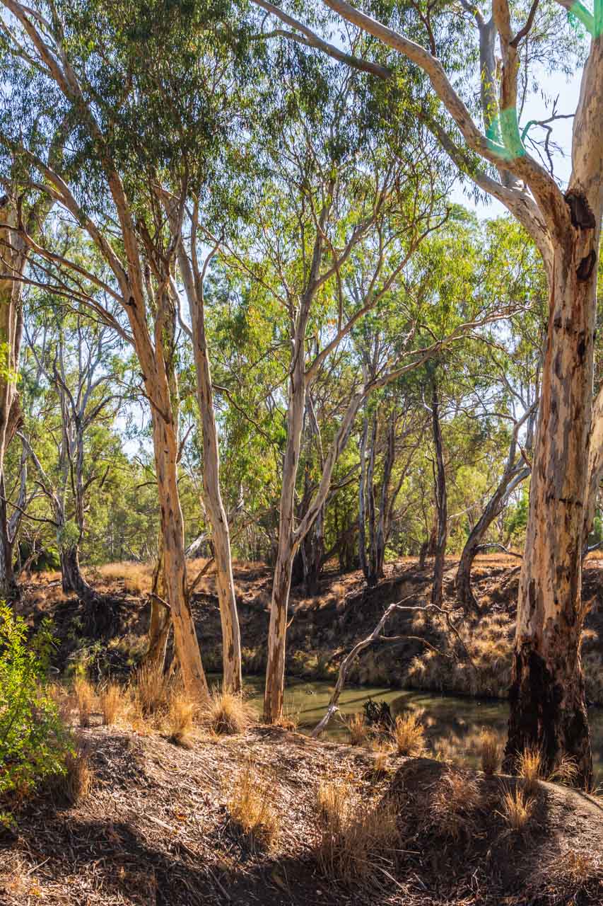
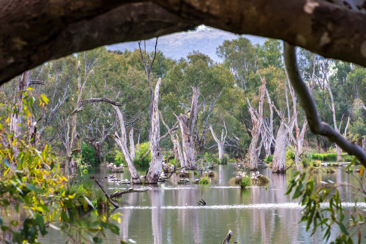
The trail meanders beside the Campaspe River through the iconic Australian bush. The Australian bush always gives me that sense of being home, no matter where I am experiencing it in Australia. And this walk did not disappoint. It was so peaceful. Just us two and birdsong.
The river walk was an easy 3-kilometre walk along the riverbank. Being flat, it was not in the least bit challenging. Benches provided a place to sit for a while and immerse yourself in the stillness and tranquillity.
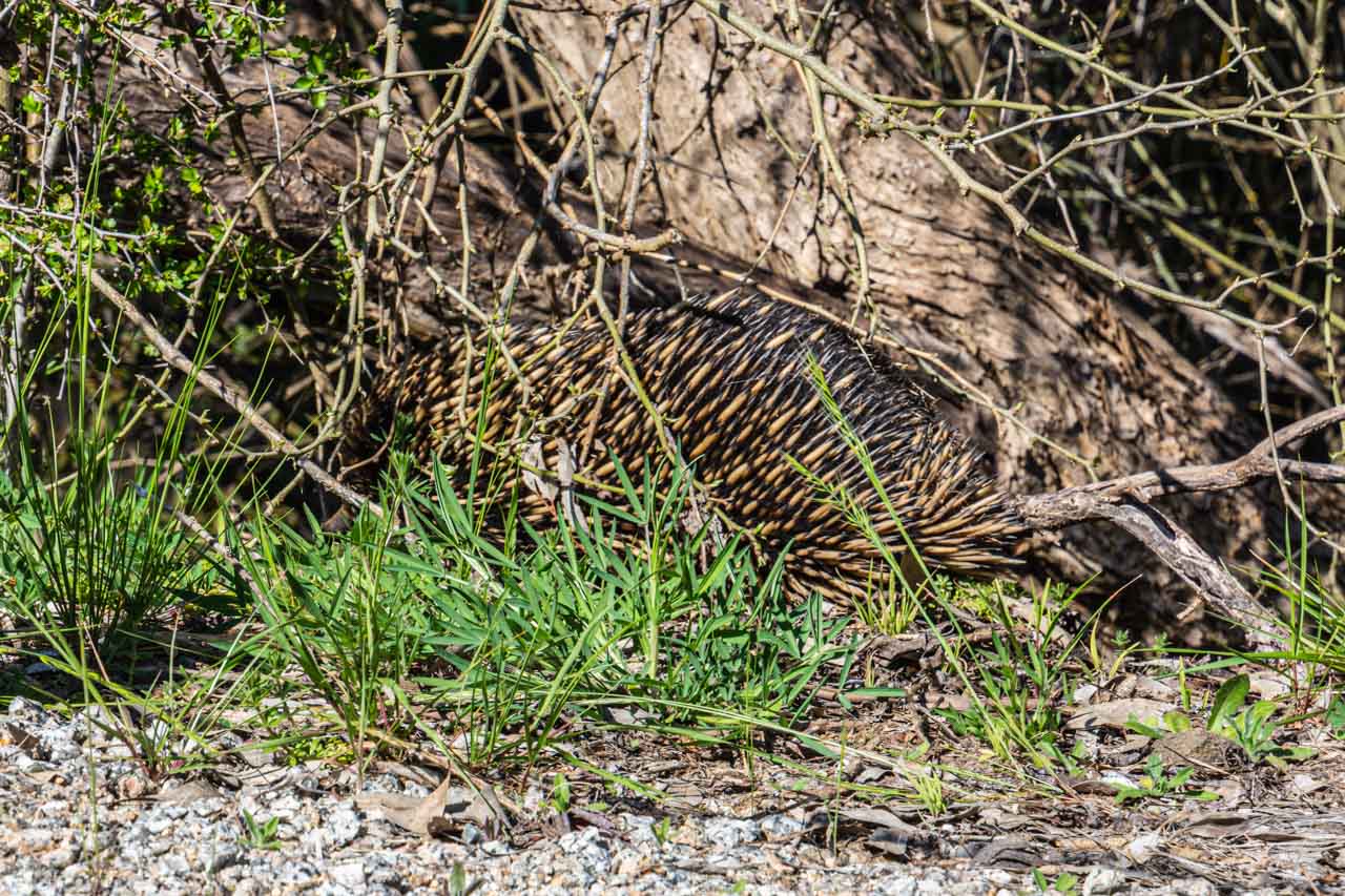
The trees provide a habitat for local wildlife. My sister enjoyed seeking and identifying the different species of native birds.
Rochester’s river walk through the Campaspe River Reserve is not just a bush walk but a history lesson along the way. Plaques dot the trail at specific points of local historical interest, providing insight into how the local Aboriginal people used the area. For example, pointing out ‘scarred’ trees caused when the Aboriginal people stripped the bark to make canoes, shields, containers, and shelters. And the grooved rocks from grinding their axes.
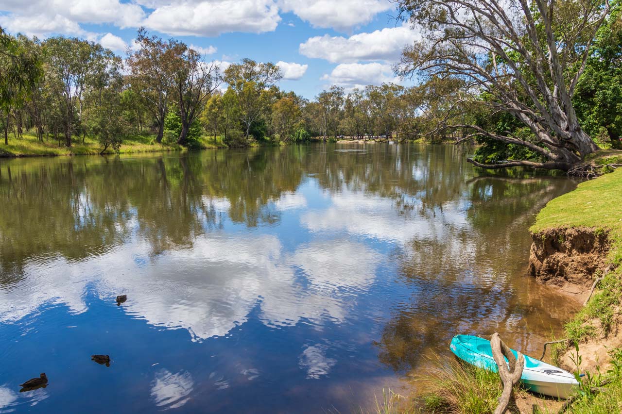
The Campaspe River is a tributary of the Murray River. It is slow-flowing along the Reserve’s walk – as evidenced in the photos I took of the bush reflected in its waters.
Walk along the banks of the Campaspe River in Rochester’s Campaspe River Reserve
Walking through the Australian bush along the banks of the Campaspe River in Rochester
When to go
We visited Rochester in the first week of May, towards the end of Australia’s autumn. In May, the average daytime temperature for Rochester is 17 degrees Celsius, with an average of 5 rain days for the month. The temperature was just right for a bushwalk along the river.
If you are looking at visiting Rochester at another time of year and wondering what the weather will be, you can find the information you need at FarmOnline Weather.
Where to eat
On our 12-day road trip around Victoria, we struggled to find decent food. Food that gives you that feeling of satisfaction. Food that lets you know you have eaten well. We could count on one hand the number of good meals we had on this road trip. But Rochester scored 2 out of 2 – dinner at the Shamrock Hotel and breakfast at Kits Kafe.
Our decision to try the centrally located, historic Shamrock Hotel for dinner was a good one (corner of Gillies and Moore Streets). I had crumbed lamb chops on a bed of mashed potatoes with seasonal steamed vegetables. My sister had the Thai Beef Stir Fry. We both agreed the food was excellent. These were some of the best pub meals we had ever eaten and were thoroughly enjoyed. Had we been staying another night, we would have gone back for seconds as there was much more on the menu we wanted to try.
Breakfast at Kits Kafe (51 Moore Street) was a yummy affair. We both had the pancakes – mine with maple syrup and bacon and my sister’s with fruit cumquat and bacon. The service was excellent, the food was delicious, and the coffee was worth going back for after our river walk.
We could see the silo artworks across the road from the Kits Kafe.
Where to stay
In Rochester, we stayed at the Rochester Motel, but there are other accommodation options available.
Next time I overnight in Rochester, I would like to stay at The Tavern (49 Moore Street) – bed and breakfast accommodation offering boutique queen rooms with ensuite.
Our main reasons for stopping overnight at Rochester were to break the journey between Kerang and Albury and see the silo artworks I had heard much about. The river walk was an enjoyable bonus, as was our food experience. In all, we came away feeling delighted with our visit to Rochester.
Editor’s Note: This blog post was originally published in July 2019 and has been updated for accuracy and comprehensiveness.
Comment below to share your thoughts on this blog post. Are amazing silo art, a beautiful river walk, and good food enough to tempt you to visit Rochester? What else would you recommend people see and do in Rochester?
Discover 7 Breathtaking Gorges in the Natural Landscape of the Kimberley The Kimberley in Western Australia is one of the world’s last true wilderness areas. Remote, unspoiled, and spectacular,…
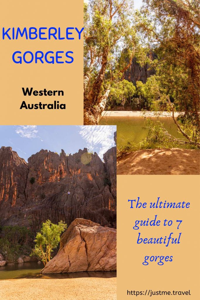
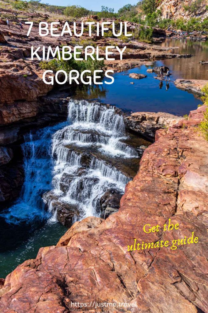
Discover 7 Breathtaking Gorges in the Natural Landscape of the Kimberley
The Kimberley in Western Australia is one of the world’s last true wilderness areas. Remote, unspoiled, and spectacular, Kimberley gorges have been evolving over more than 250 million years. Walking in these ancient gorges was a magical experience. Read on to discover the magnificent gorges I explored on an escorted road trip around the Kimberley.
The Kimberley is vast, covering 423,517 kilometres. To give this some perspective, the Kimberley is three times larger than England, twice the size of Victoria, or just slightly smaller than California.
The Kimberley is in the northernmost region of Western Australia. It is bordered on the west by the Indian Ocean, on the north by the Timor Sea, on the south by the Great Sandy Desert, and on the east by the Northern Territory. It is an isolated, rugged landscape of breathtaking beauty that leaves a lasting impression on your soul.
I was unable to determine just how many gorges there are in the Kimberley. However, I know that the seven gorges included in this blog post are but a drop in the Kimberley.
I came to the Kimberley on a 3-week holiday not knowing what to expect and not wanting to pre-empt what I would experience. I went with an open mind and left my heart there, tramped into the pindan (the red dirt that dominates the Kimberley landscape).
When it comes to describing landscapes, or in this case, gorges, a picture speaks a thousand words. I could use a thousand words for each description of the beautiful gorges in this post. Instead, I will provide a brief description of each gorge and let the images do the talking.
The locations of the gorges and the best time to visit them complete this guide to seven beautiful gorges in the Kimberley.
Map showing the locations of Kimberley gorges (Courtesy of Derby Visitor Centre)
Read on to discover seven of the Kimberley’s beautiful gorges or jump straight to a specific gorge.
The order of gorges presented in this post is simply determined by the order in which I visited them on a 15-day escorted four-wheel-drive (4WD) Adventure of the Kimberley with APT.
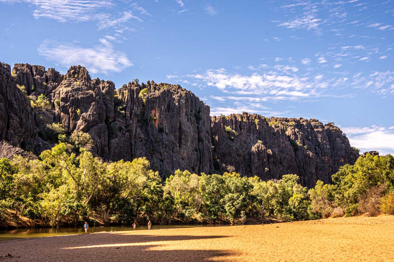
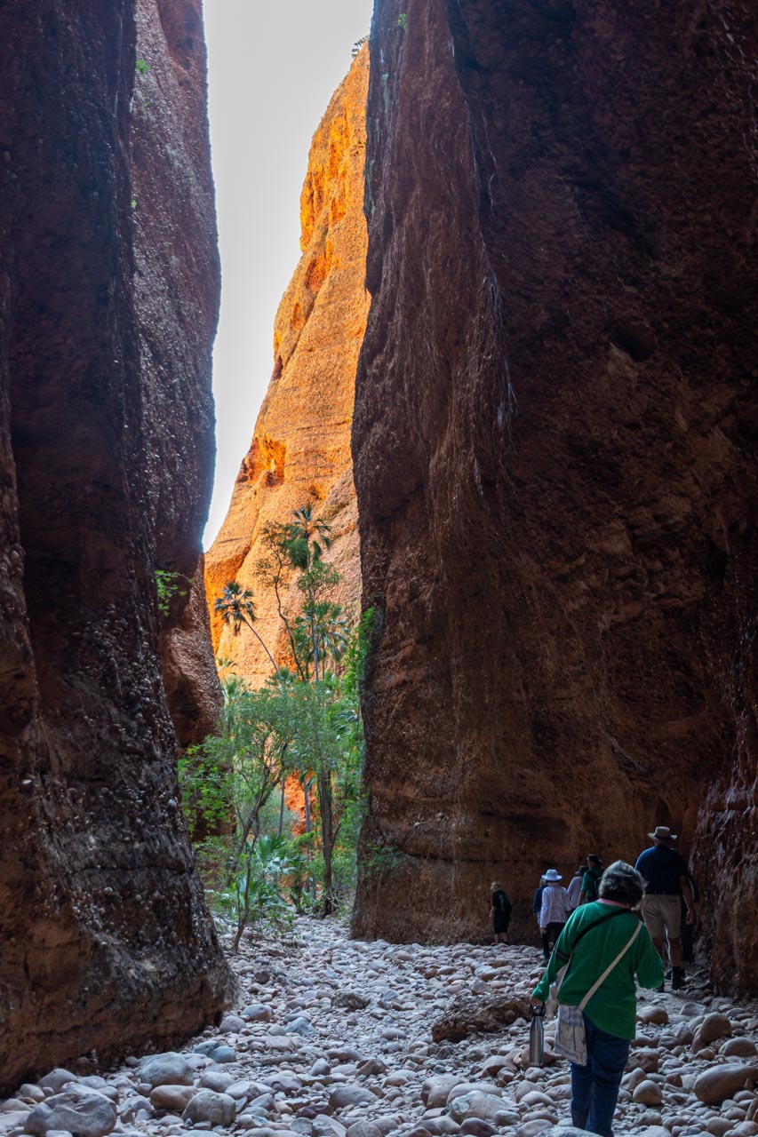
Windjana Gorge (Bandilngan)
Windjana Gorge
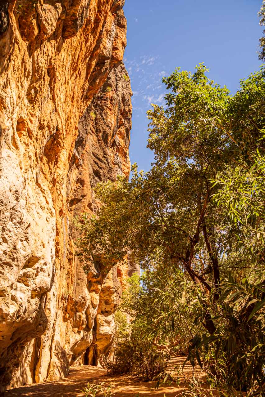
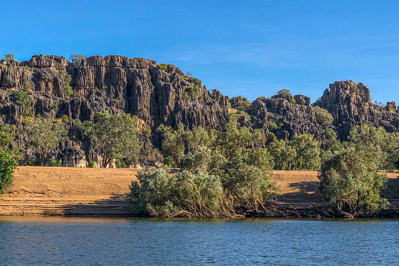
Windjana Gorge is known by its indigenous name, Bandilngan. Located in Bunuba country, in Bandilngan (Windjana Gorge) National Park, the 3.5-kilometre gorge cuts through the Napier Range.
Bangilngan is a stunningly beautiful gorge. Dominating the scene is the Lennard River running through the gorge and majestic water-streaked cliff walls that tower 100 metres above you.
Bangilngan was once part of an inland sea. As you walk along the flat, sandy path through the gorge, it is possible to spot marine fossils. I only saw a couple of fossils, just above head height in the cliff walls, on the gorge walk, but I must admit, I was more interested in the gorgeous scenery that was unfolding around me.
The Kimberley is croc country. Johnston’s (freshwater) crocodiles (known as freshies) inhabit this unspoiled wilderness. I saw many sunning themselves on the sandy riverbank and floating in the water. Unlike their much larger saltwater cousins, freshies are not considered dangerous to humans. However, they can become aggressive and cause injury if disturbed. It is safest not to approach or swim near freshwater crocodiles.
Your best resource for essential information about Bandilngan (Windjana Gorge), including sites and activities, downloads and resources, park passes and fees, camping, safety, and alerts, is Western Australia’s Parks and Wildlife Service.
Lennard River flows through Windjana Gorge
The walking path through Windjana Gorge
Windjana Gorge
Getting there
Bandilngan (Windjana Gorge) is located on the Fairfield-Leopold Downs Road, off Gibb River Road. It is 146 kilometres northwest of Fitzroy Crossing and 144 kilometres east of Derby.
The only access is by unsealed roads. A four-wheel-drive (4WD) vehicle is recommended to access the park. The park is closed during the wet season as the roads are inaccessible.
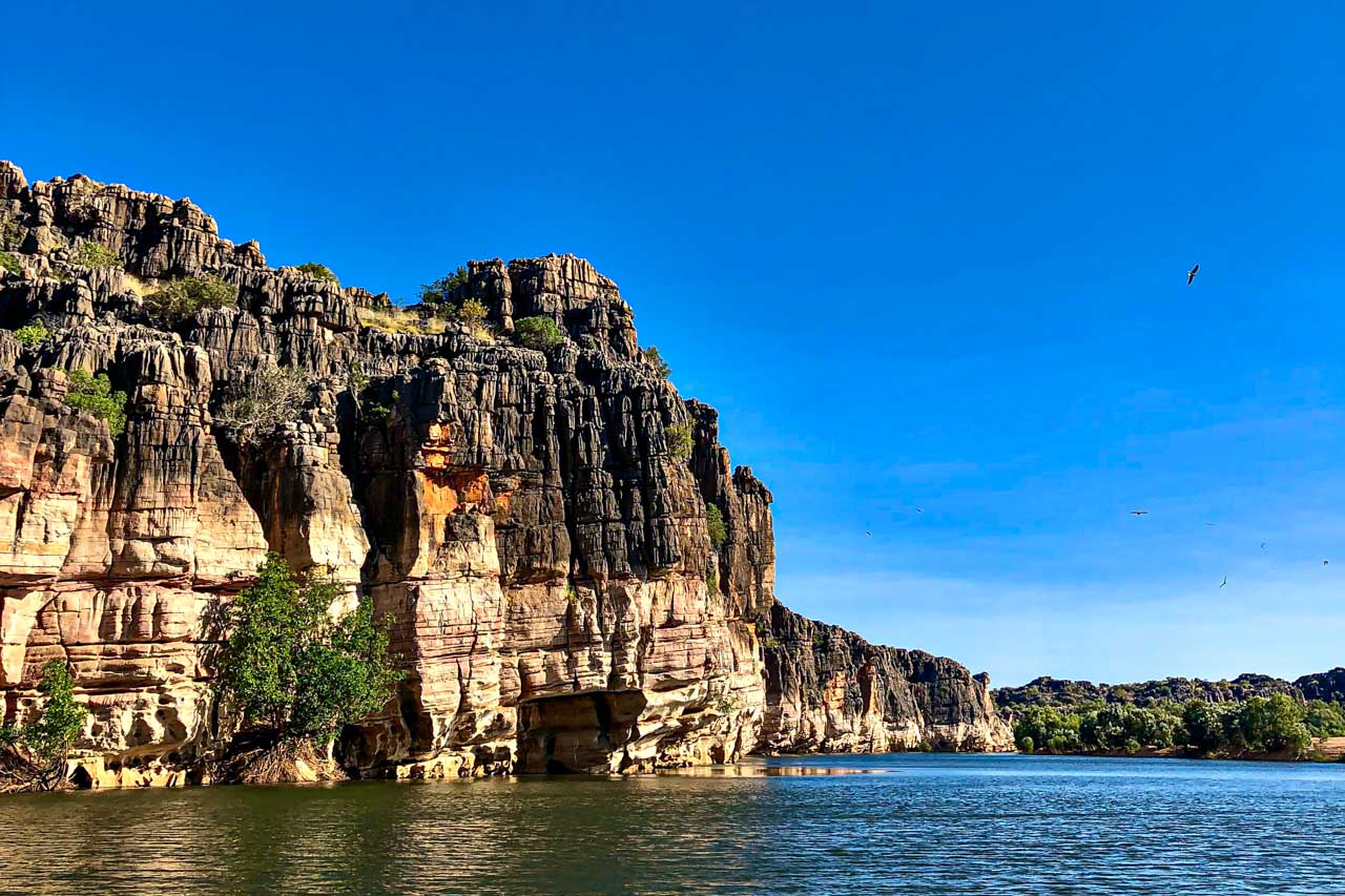
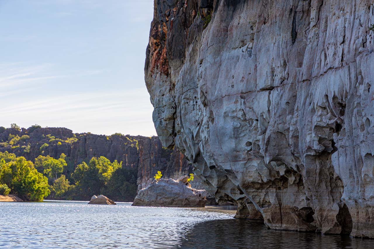
Geikie Gorge is known as Darngku by the Bunuba traditional owners. Located in Danggu Geikie Gorge National Park in the Wunaamin Miliwundi Ranges (formerly King Leopold Ranges), the 30-metre-deep gorge has been carved by the Fitzroy River. The park’s entrance is on Leopold Downs Road.
Danggu Geikie Gorge is a spectacular gorge famed for its sheer white and grey cliff walls. The bleaching of the walls is thanks to the Fitzroy River’s massive flooding during the wet season.
The Fitzroy River is the second largest in the world – second only to the Amazon River. The park ranger clarified “largest” as that being the volume of water flowing through the gorge.
During the wet season, the river rises between 10–16 metres, polishing the walls of the gorge white and the flooding sections of the park with up to seven metres of water. The dry season sees the river transformed into a peaceful stream beneath the towering limestone cliffs. Honeycomb weathering is a fascinating feature of gorge walls.
There are several riverside walks in Danggu Geikie Gorge National Park. However, instead of walking through the gorge, we took a one-hour cruise on the Fitzroy River with the Department of Parks and Wildlife Service operated boat tour. One of the park rangers was our guide on the boat tour. I recommend taking the boat tour because it gives a unique perspective of the park, and the ranger’s commentary on the wildlife and geology of the gorge is insightful.
Visit Western Australia’s Department of Parks and Wildlife Service for all your essential information on Danggu Geikie Gorge.
Fitzroy River, Geikie Gorge
Fitzroy River in Geikie Gorge
Getting there
Danggu Geikie Gorge National Park is the most accessible national park in the Kimberley.
Travelling the Great Northern Highway, the park is 417 kilometres from Broome, 278 kilometres from Derby, and only 20 kilometres from Fitzroy Crossing. A four-wheel-drive vehicle is not required.
From Fitzroy Crossing, take Russ Road for 3-4 kilometres before turning left onto Geikie Gorge Road. The park’s entrance is at the end of Geikie Gorge Road.
Danggu Geikie Gorge National Park is a day-use park only, open from 6.30 am to 6.30 pm but closed during the wet season. No entry fees apply.
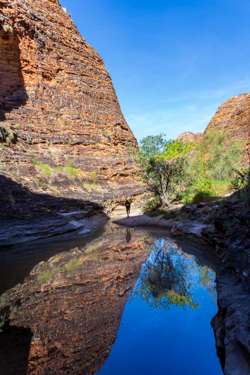
Cathedral Gorge
Cathedral Gorge in the Bungle Bungles
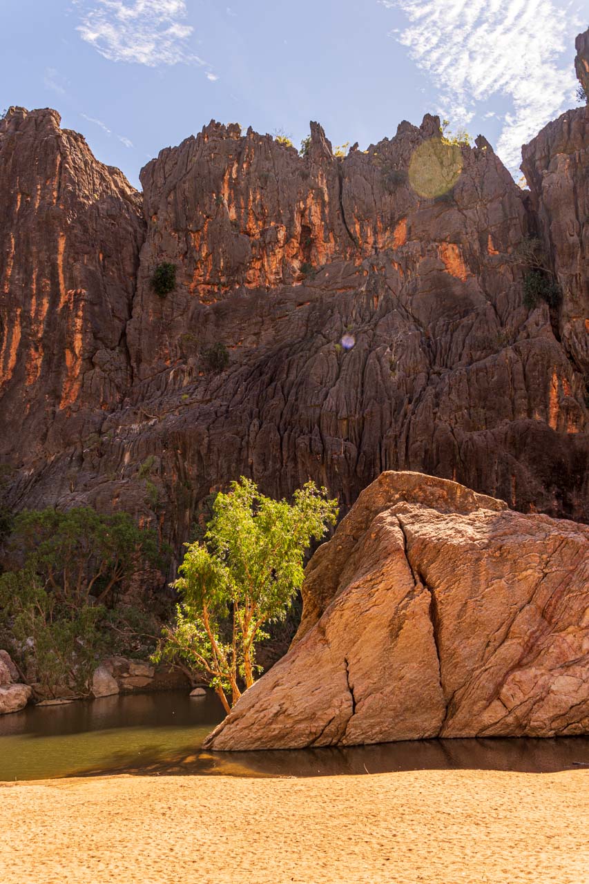
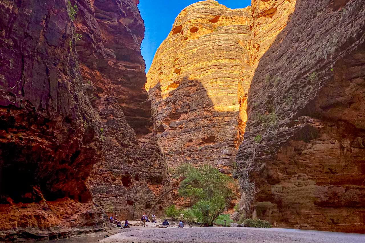
Cathedral Gorge is in the Bungle Bungle Range (also called the Bungle Bungles), in the UNESCO World Heritage-listed Purnululu National Park.
Cathedral Gorge is an enormous, circular cavern, forming a natural amphitheatre of red rock renowned for its acoustics. I have seen photos of orchestras playing in the cavern. While no one was singing to test the acoustics, I could hear conversations from around the cavern.
The waterfall that flows from the cavern roof can only be seen in the wet season when Purnululu National Park is closed. The day I visited, early in the dry season, there was no waterfall. But there remained a large pool of water in the centre of the cavern.
The walk into Cathedral Gorge is a two-kilometre return trail from Piccaninny Creek car park. The trail takes you past the orange and black striped domes, of which Purnululu National Park is most famous for. It is these characteristic striped formations that give the Bungle Bungles their nickname of ‘beehives’.
Classified as a moderate walk, the trail is rocky in parts, and there are metal ladders to help you up and down some tricky rocky sections.
The walk into Cathedral Gorge in the Bungle Bungles
Bungle Bungles beehive dome reflected in a pool of water
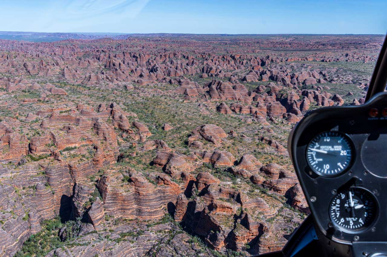
The Bungle Bungle Range has been around for 350 million years but was only ‘discovered’ in 1983 when a documentary team spotted it from the air and brought it to world attention.
I recommend a helicopter flight over the Bungle Bungles to get spectacular views and an accurate idea of their scale.
The Bungle Bungle Ranges viewed from a helicopter
Getting there
Purnululu National Park is remote. It is in the East Kimberley, about 100 kilometres north of Halls Creek and 250 kilometres south of Kununurra.
Access to the park is via Spring Creek Track, from the Great Northern Highway approximately 250 km south of Kununurra, to the track’s end at the Purnululu National Park Visitor Centre. The track is 53 km long and is usable only in the dry season and only by 4WD high clearance vehicles and off-road trailers. Safely navigating it takes approximately three hours. From the Purnululu National Park Visitor Centre, the trail is located a further 27 kilometres drive south.
It is advisable to check with the Department of Parks and Wildlife’s Kununurra office on 08 9168 4200 for the current weather forecast and road conditions before entering the park.
There is an entry fee to Purnululu National Park. Visitors must register at the Visitor Centre on arrival at the park.
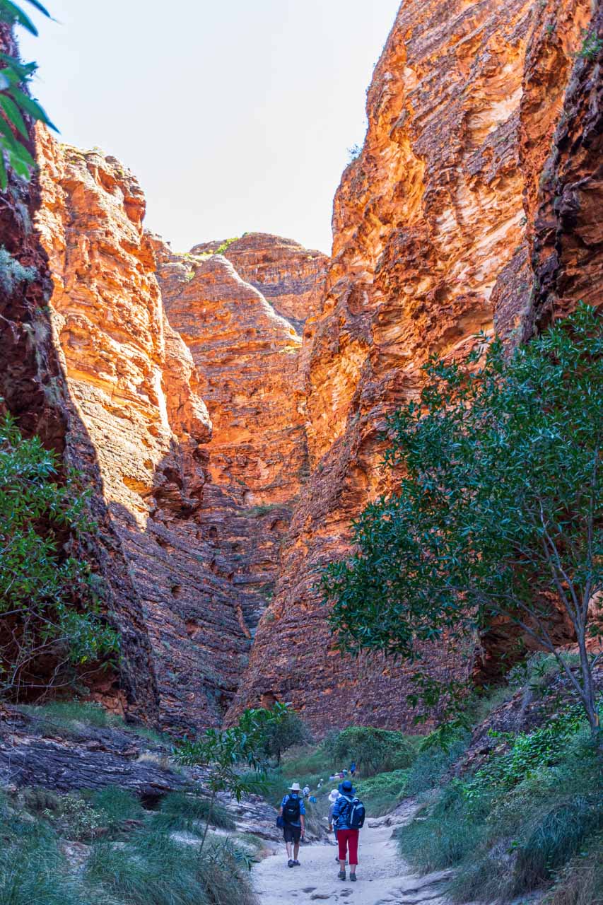
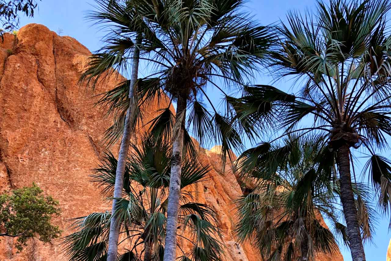
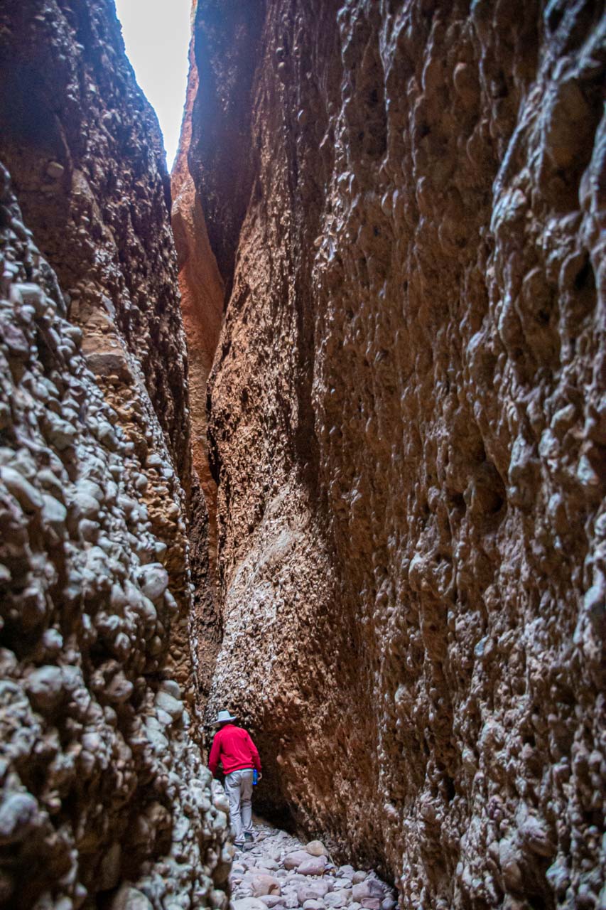
At the northern end of Purnululu National Park is the spectacular, 180-metre-deep Echidna Chasm.
The chasm’s soring 200-metre-high red walls seem to glow where the sun shines on them. The liberal scattering of Livistonia palms found in the early section of the Echidna Chasm Walk are breathtaking and seem out of place. ‘Breathtaking’ takes on a whole different meaning as the walls of this crack in the rock, which is Echidna Chasm, become progressively narrower to barely a metre wide in places.
The two-kilometre return walk into the chasm begins at Echidna Chasm car park. The path into the chasm follows a very uneven, stony, dry creek bed. To make it to the end of the chasm requires scrambling over large fallen boulders and scaling ladders. The last 100 metres is the most challenging.
Echidna Chasm – the path narrows
Echidna Chasm – walking out of the chasm
Getting there
The turn-off to Purnululu National Park is on the Great Northern Highway, approximately 250 kilometres southwest of Kununurra and 100 kilometres northeast of Halls Creek. From the turn-off, access to the park is via Spring Creek Track. This is a rugged track that is suitable for 4WD vehicles and single-axle off-road trailers only. Two-wheel-drive (2WD) vehicles may be refused entry. Caravans may be stored at the caravan park located at the turn-off (fees apply).
Spring Creek Track is a narrow, unsealed track with several creek crossings, some sharp corners, and ascents and descents. Allow approximately 2.5-3 hours for this 53-kilometre journey.
Echidna Chasm is 19 kilometres from Purnululu National Park Visitor Centre.
Entry and camping fees apply for Purnululu National Park. Visitors must register at the Visitor Centre on arrival at the park.
Purnululu National Park is closed during the wet season.
Manning Gorge is on Mount Barnett Station in the Wunaamin Miliwundi Ranges (formerly King Leopold Ranges).
The 5.6-kilometre return gorge walk starts at the Manning Gorge campground on Manning Creek, where you first must cross the creek to re-join the trail on the other side. You need to swim the 100 metres across Manning Creek, but there are available blue plastic drums cut in half to float your possession across the creek, keeping them dry as you swim. There is a rickety ladder, sort of secured to the riverbank, to help lower yourself into the creek.
The Manning Gorge walking trail follows an overland route rather than along the creek. It is a challenging walk over uneven, rocky terrain with some rock scrambling and climbing that gets progressively harder near the end. However, your reward at the end is a massive gorge with a huge waterfall-fed pool and smaller pools suitable for swimming.
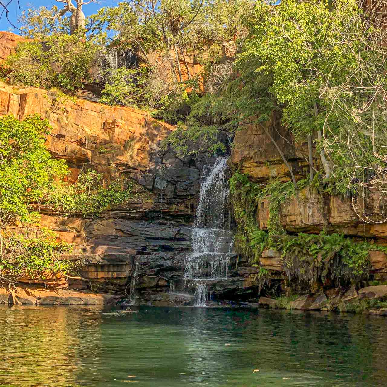
Manning Gorge offers some of the most picturesque and safe swimming holes in the Kimberley. Even if you don’t walk to the gorge itself, a swim in Manning Creek with its tree-lined sandy riverbank is a delightful way to while away a few hours. Take a picnic lunch with you.
The waterfall and pools in Manning Gorge (Depositphotos_210779876)
Getting there
Manning Gorge is approximately 315 kilometres northeast of Derby via the Derby-Gibb River Road and 398 kilometres southwest of Kununurra via the Gibb River-Wyndham Road.
Manning Gorge is accessible only by 4WD. Be warned, Gibb River Road is a seriously corrugated dirt road with several river crossings.
An entrance permit is required to access Manning Gorge, purchased at the Mount Barnett Roadhouse (one of the most remote roadhouses in Australia) – about seven kilometres from Manning Gorge campground.
Galvans Gorge
Galvans Gorge
Galvans Gorge is the most accessible gorge along Gibb River Road. It is located on Mount Barnett Station, one kilometre off Gibb River Road in the Phillips Range.
Galvans Gorge is a pretty, little gorge that has it all:
A multi-tiered waterfall plunging down the rocky gorge.
A horseshoe-shaped natural pool at the bottom of the waterfall, ideal for a refreshing swim.
An abundance of lush vegetation framing the pool and providing shade for most of the day.
An iconic Boab tree standing guard at the top of the falls.
Ancient Windjana rock art on the gorge wall.
Galvans Gorge is a delightful spot to relax.
The walk into Galvans Gorge from the roadside car park is an easy, mostly flat, one kilometre (one way) track with rocky surfaces in several sections.
Galvans Gorge
Galvans Gorge – a Boab tree stands sentinel at the top of the falls
Getting there
Galvans Gorge is located 14 kilometres from Mt Barnett Roadhouse, approximately 290 kilometres west of Derby on Gibb River Road.
Gibb River Road is only accessible during the dry season.
Entry to Galvans Gorge is free
Bell Gorge
Bell Gorge at the top of the waterfall
Beautiful Bell Gorge, with its stunning landscape, is a photographer’s delight. If asked which was my favourite gorge on my Kimberley adventure, without hesitation, my response would be Bell Gorge.
Bell Gorge is in King Leopold Ranges Conservation Park (now referred to by its Aboriginal name, Wunaamin Miliwundi Ranges Conservation Park). It is described as one of the most picturesque and scenic gorges in the Kimberley, where Bell Creek drops 150 metres into a gorge to form a wide, U-shaped, stepped waterfall cascading into a deep pool. Bell Gorge is a wonderful swimming spot.
From the car park, it is a one-kilometre walk along a challenging rocky dry creek bed to reach the gorge. I say ‘challenging’ for two reasons:
there is a moderate incline at the beginning of the track, which had me puffing when walking back up on my return; and
the rocks you are walking on are all loose, making it necessary to concentrate on your balance.
However, at the end of the track, the gorge opens up to an impressive vista and rock pools at the top of the waterfall. One of the rock pools is a natural infinity pool, allowing you to swim right up to the edge of the waterfall.
Then, there is the swimming option of the deep pool below the waterfall. According to my travel companions who walked to the bottom swimming pool, the one-kilometre return trek is manageable but will test your hiking skills. First, you need to cross Bell Creek to the opposite side. As the rocks where you cross can be slippery, our guide recommended wearing socks (no shoes) to cross the creek. Apparently, this worked a treat. Once across the creek, you climb down a steep, rocky track (which you must climb back up again) to access the bottom swimming pool and swim below the waterfall within the gorge. My fellow travel companions told me the swim was delightful and well worth the challenging hike.
Don’t forget your sunscreen and take plenty of water.
The rocky track into Bell Gorge
The waterfall with upper and lower pools at Bell Gorge
Getting there
Bell Gorge is about 247 kilometres east of Derby along Gibb River Road. Turning off the Gibb River Road, Bell Gorge car park is approximately 30 kilometres along Silent Grove Road, a corrugated road requiring a 4WD.
Bell Gorge is in a national park, so entry fees apply, paid at Silent Grove campground. It is inaccessible during the wet season. Before travelling to Bell Gorge, it is advisable to check for alerts and closures.
When to go
The Kimberley has no summer or winter, just wet or dry due to its tropical monsoon climate. The wet season is November to April, and the dry season is May to October.
I travelled to the Kimberley in June, early in the region’s dry season. The daily temperatures ranged from the high 20s to low 30s degrees Celsius. The nights were cooler, and the only rain I experienced was one night when back in Broome at the end of the escorted tour.
If you want to avoid oppressive heat and humidity, cyclones, and flooded rivers, then travel to the Kimberley in the dry season. Much of the Kimberley is impassable during the wet season. Flooded rivers isolate towns, accommodation, and inhabitants during the wet season.
The national parks in the Kimberley are only accessible during the dry season.
Road conditions in the Kimberley can vary greatly and change rapidly. Refer to Parks and Wildlife Service for all your essential information on the Kimberley’s national parks.
Getting there and around
The Kimberley is remote. Even so, you have several options for getting to the Kimberley. I took a direct flight from Sydney to Broome (the ‘capital’ of the Kimberley) but, alternatively, you could drive, hop on a bus, or take a guided tour.
After a week on my own in Broome, I joined APT’s 15-day escorted 4WD adventure tour around the Kimberley. Our ‘4WD’ was a bus on steroids – the body of a bus on a truck chassis. It was on this tour that I was able to experience the beautiful gorges described above.
A 4WD is necessary for travelling around much of the Kimberley if you leave the tarred highway. You should also consider travelling with a satellite phone as there were several areas where there was no mobile phone coverage. At times, I did not even have SOS access on my phone.
The pleasures of travelling on an escorted tour were not having to worry about visitor passes or wondering how I would get from A to B or concerned about damaging my car (if I owned a 4WD) on severely corrugated dirt roads.
Have you been to the Kimberley in Western Australia? Which gorges have you explored in the Kimberley that you would like to share with readers? Leave a comment below to share your thoughts on this blog post.
Unique Sculptures Beside the Murray River in Albury Celebrate Local Aboriginal Art and Culture The Yindyamarra Sculpture Walk is a shared walking and cycling path with the mighty Murray…
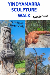
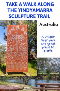
Unique Sculptures Beside the Murray River in Albury Celebrate Local Aboriginal Art and Culture
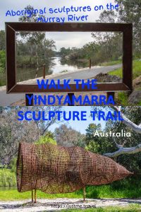
The Yindyamarra Sculpture Walk is a shared walking and cycling path with the mighty Murray River on one side and West Albury Wetlands on the other. What makes this path unique is the Aboriginal sculptures by local Indigenous artists installed along the way, sculptures that tell stories of Aboriginal culture and lore. Follow the Yindyamarra Sculpture Walk through the photographs in this post, learning about each sculpture as you go.
Murray River near Kremur Street Boat Ramp, Yindyamarra Sculpture Walk
West Albury Wetlands, viewed from the Yindyamarra Sculpture Walk
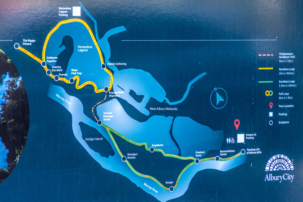
The Yindyamarra Sculpture Walk in Albury is a 5.6-kilometre (loop) section of the much longer Wagirra Trail (15 kilometres return, linking Wonga Wetlands with the South Albury Trail). Following the Murray River, the Yindyamarra Sculpture Walk stretches from the Kremur Street boat ramp (off Padman Drive in West Albury) to Horseshoe Lagoon (accessed via the Riverina Highway). You can do the walk in the reverse direction.
I first published THE UNIQUE YINDYAMARRA SCULPTURE WALK IN ALBURY, NEW SOUTH WALES on November 22, 2020. At the time, Albury City Council had announced three new sculptures would be installed in July 2021. So, I knew I would be updating this post within the year.
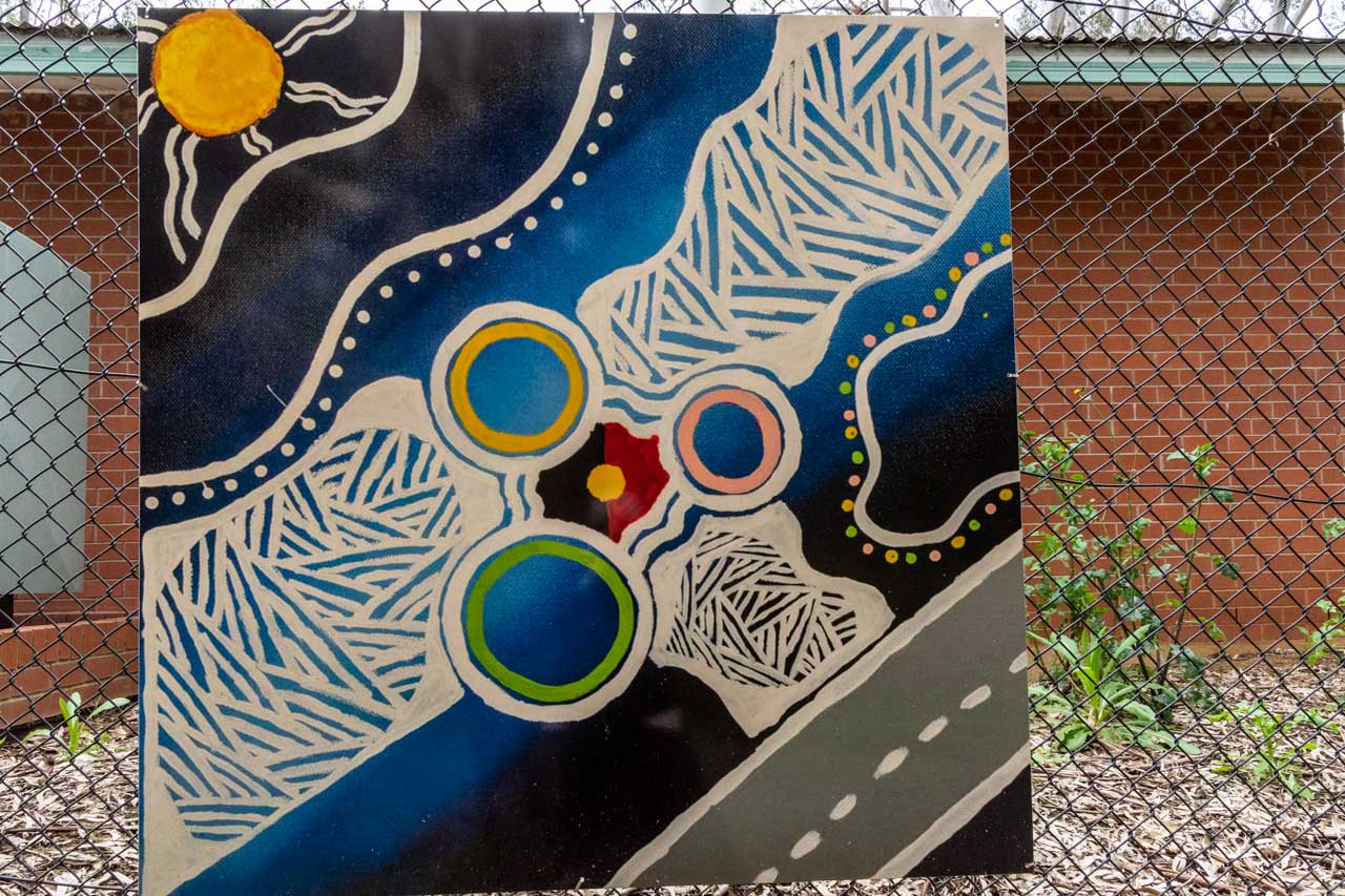
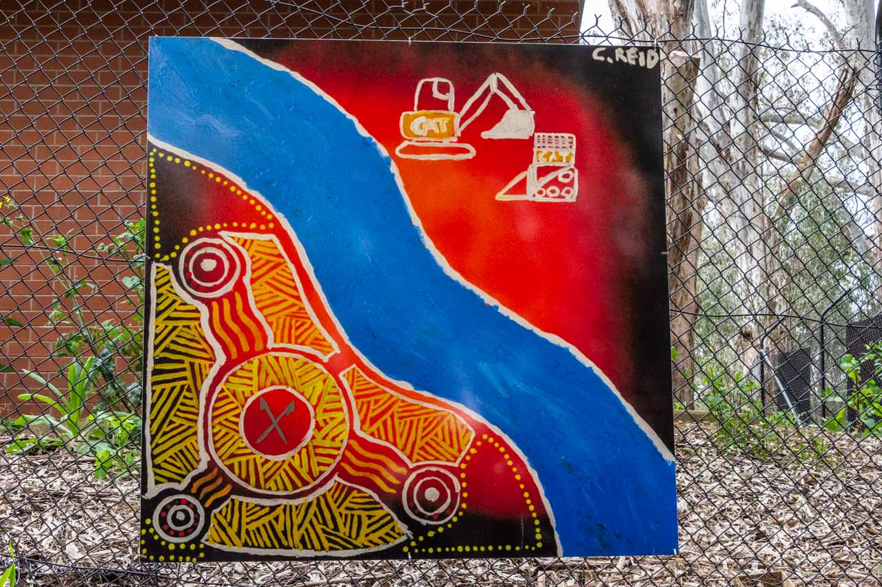
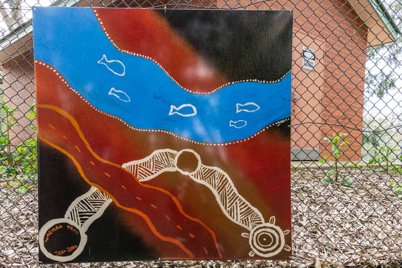
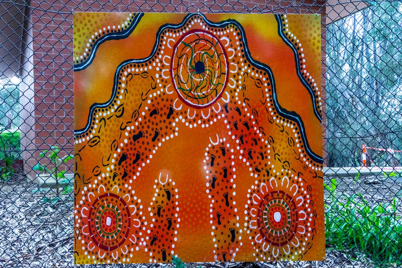
The first stage of the Yindyamarra Sculpture Walk was completed in December 2014. In July 2021, three new sculptures were added to the trail, and ten painted panels (‘Leaving Our Mark’) were installed along two fences near Horseshoe Lagoon. The contemporary artwork along the Yindyamarra Sculpture Walk has been created by local Indigenous artists telling stories of connection to country and living culture. The sculptures are a celebration of local Aboriginal culture.
Bicycle riders, walkers, and joggers share the predominantly flat, 2-metre-wide sealed path. Dogs on leads are permitted.
Albury, on the New South Wales side of the Murray River (Australia’s longest river), is located in Wiradjuri Country – the traditional lands of the Aboriginal Wiradjuri people.
Yindyamarra is a word from the Wiradjuri language, meaning respect, be gentle, be polite, and do slowly.
I have walked the Yindyamarra Sculpture Walk several times. Refer to the end of this post to know the lessons I have learned from walking the Yindyamarra Sculpture Walk.
Map of the Yindyamarra Sculpture Walk with the locations of the sculptures
The Sculptures:
The information provided below about the artists and the story behind the sculptures is taken from the interpretive panels presented at each sculpture site.
Starting the Yindyamarra Sculpture Walk from the Kremur Street Boat Ramp, I will take you on a visual tour of unique Aboriginal art by Indigenous artists along the banks of the Murray River in Albury. I aim to pique your interest enough for you to walk or ride this beautiful path for yourself.
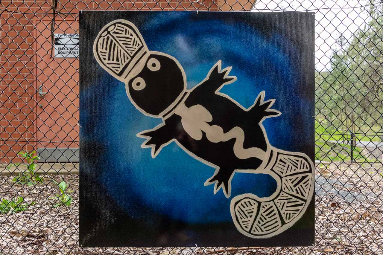
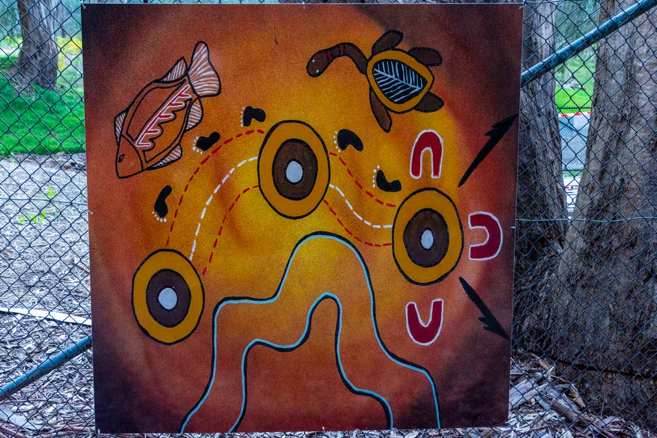
Teaming Life of Milawa Billa
Artists: Teaming Life of Milawa Billa (Murray River) was created by the Yindyamarra Sculpture Walk Steering Committee – Daniel Cledd, Robyn Heckenberg, John Murray, Aunty Edna Stewart, and Aunty Muriel Williams.
The Teaming Life of Milawa Billa sculpture signals the commencement of the Yindyamarra Sculpture Walk at the Kremur Street Boat Ramp picnic area. The design draws together significant elements from the natural environment of the Murray River – the birds, the fish, the reeds, and the yabby – telling the story of the health of the river and its cultural significance.
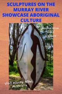
Reconciliation Shield
Artist: Tamara Murray. Tamara is a proud member of the Barkandtji tribe on her mother’s side and Yorta Yorta and Dhudaroah tribes on her father’s side.
For Tamara, the Reconciliation Shield represents bringing everyone together – working together, walking together, and living together; to make everything better, especially for the next generation. ‘The figure depicted is holding his hands in a position of submission. Enough is enough – we all need to walk together on this journey of reconciliation.’
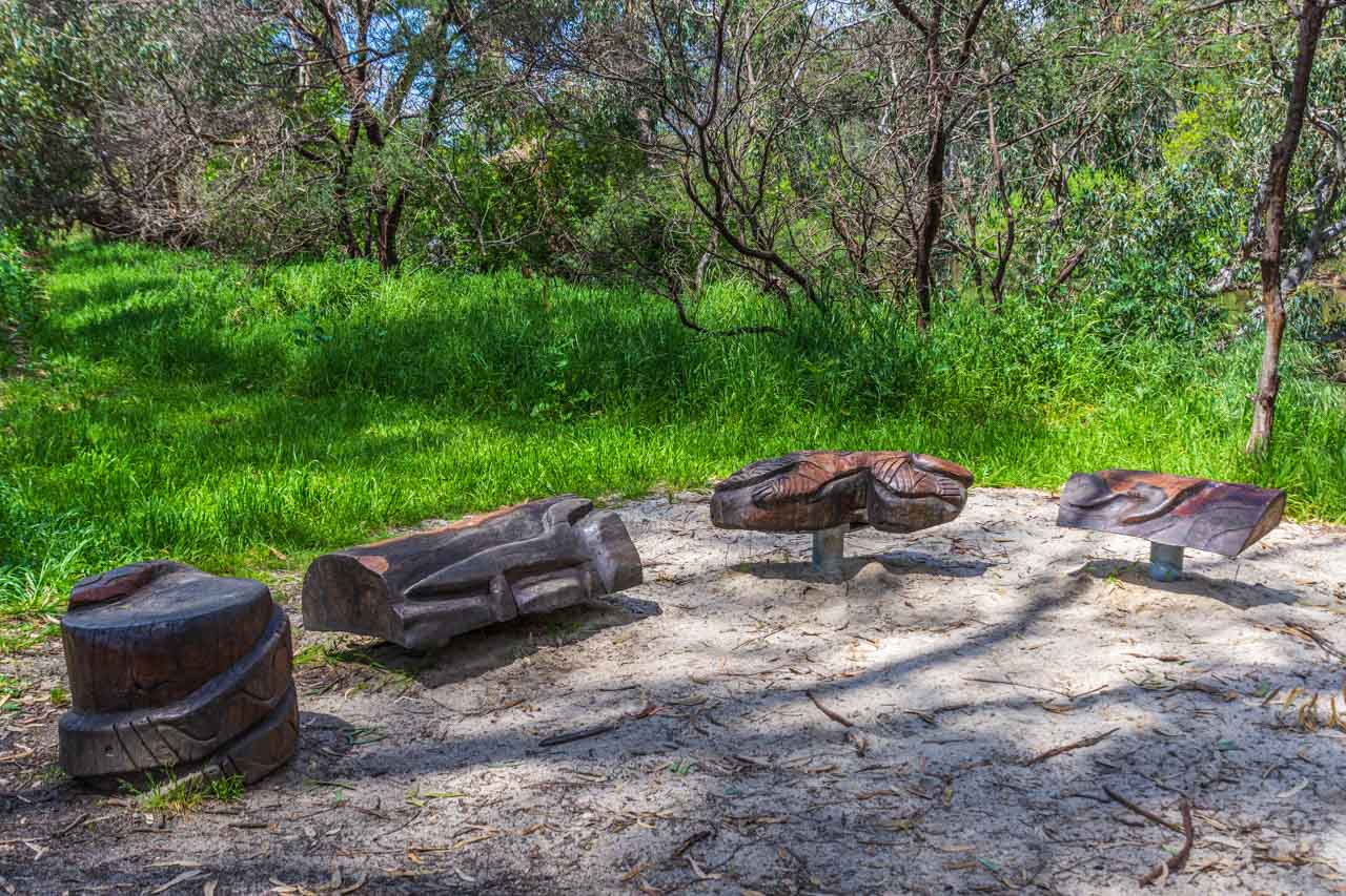
Creature Seats
Artists: James Fallon High School. The standing goanna by Liam Campbell (Wiradjuri), the turtle by Sara Jackson Edwards (Wamba Wamba), the snake by Raymond Jackson Edwards (Wamba Wamba), and the climbing goanna by Jaidyon Hampton (Malyangaba).
The students sculpted these creatures under the mentorship of the Aboriginal Men’s Shed and the local community. The students created a space where stories could be told and local animal life could be celebrated.
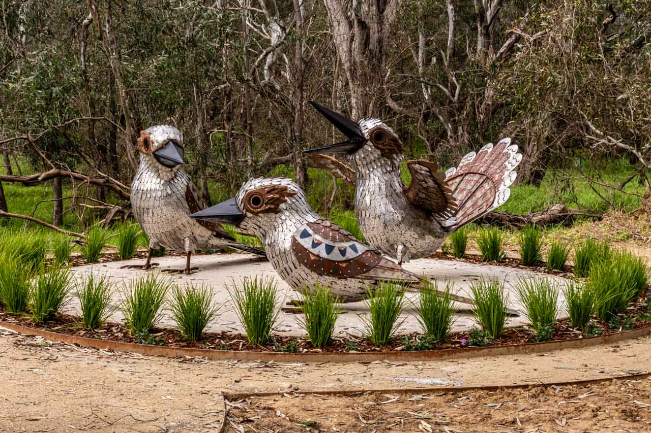
Guguburra
Artist: Peter Ingram. Peter is a local Wiradjuri man who enjoys making sculptures from metal and many other resources, creating artworks that bring to life country’s ancient stories of creation and lore.
Guguburra is the Wiradjuri word for kookaburra. It is seen as the most beautiful bird (budyaan) in Wiradjuri country, with wonderful attributes and character.
Guruburra is patient and kind. He will often let others before him but will defend his ground if required. He loves to laugh and reminds us to do so each day. He travels in family groups, is loyal, but sometimes ventures out alone to visit a friend and sing them a beautiful song. Guruburra shows us a wonderful way to live our lives – with joy, balance, and patience.
Vertical Message Sticks
Artist: Carmel Taylor. Carmel is a Wiradjuri woman.
The message sticks are a celebration of Carmel’s knowledge of the natural history of the river.
Carmel tells us she chose the theme of animals because she genuinely loves them, and they are native to the Albury area, bringing much joy to children and adults.
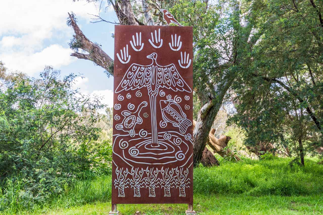
Bogong Moth Migration
Artist: Ruth Davys. Ruth is a proud Wiradjuri woman.
The Bogong Moth is a creature of cultural significance for Indigenous Australians.
Traditionally, each year the Indigenous people of southern New South Wales and northern Victoria would meet at Mungabareena Reserve (Albury) to perform ceremonies, exchange goods and discuss tribal lore. They would then travel to the high country (Victoria’s Alpine region) to feast on Bogong Moths.
Family Gathering
Artist: Michael Quinn. Michael is a locally based Wiradjuri man. Family is very important to Michael. They are his life.
Michael’s sculpture depicts how the family used to gather and represents the importance of the family group – their staying together and connection to the land. The circle represents this unity, and the rocks represent strength and the earth. Thereby, holding the group together.
Celebrate Together
Walk with us on Wiradjuri Country
Artist: Tamara Murray. Tamara is a proud member of the Barkandtji tribe on her mother’s side, and Yorta Yorta and Dhudaroah tribes on her father’s side. Having lived on Wiradjuri land for 14 years, Tamara tells us her spirit has never been more at peace than it is on this land.
This sculpture sends a strong message to all that we stand, walk and dance on Wiradjuri country. It is a message to Wiradjuri children to hold on to and celebrate their culture as their ancestors have done and are still doing.
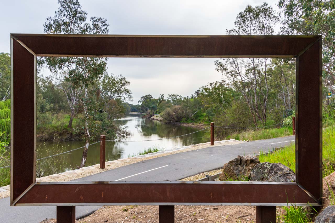
The Bigger Picture
Artist: Katrina Weston. Katrina is an Aboriginal person from the Barkindtji/Nyampa tribes.
According to Katrina, the purpose of the oversized picture frame is to see how the landscape changes within the frame over the years to come.
The picture within the frame is a moving, living landscape with many stories to be told and shared. It will bring people together to share traditional stories. The picture frame represents movement and change for Aboriginal people who are evolving to adapt to the ever-changing environment.
Leaving Our Mark
Artists: Various members of Albury City’s Wagirra Team – Curtis Reid, Jarret Trewin, Harry Dennis, Leroy Eggmolesse, Shane Charles, Noel Stewart, Ethan Moffitt, Richard Sievers, Keanu Wighton, and Toby Ardler.
Working on the Wagirra trail, a section of which is the Yindyamarra Sculpture Walk, connected the artists to country and culture. The images are their way of telling their story along the trail.
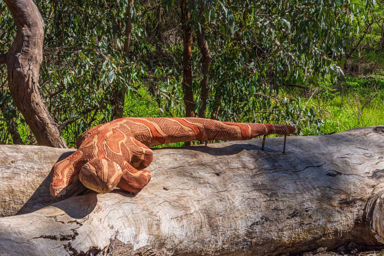
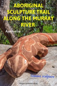
Goanna
Artist: Kianna Edwards. Kianna is a young Wiradjuri woman from Albury.
Kianna comments, “This Goanna represents one of the main totems for the Wiradjuri Nation. It holds a significant place in my spirit. It’s my totem. My story. My culture.”
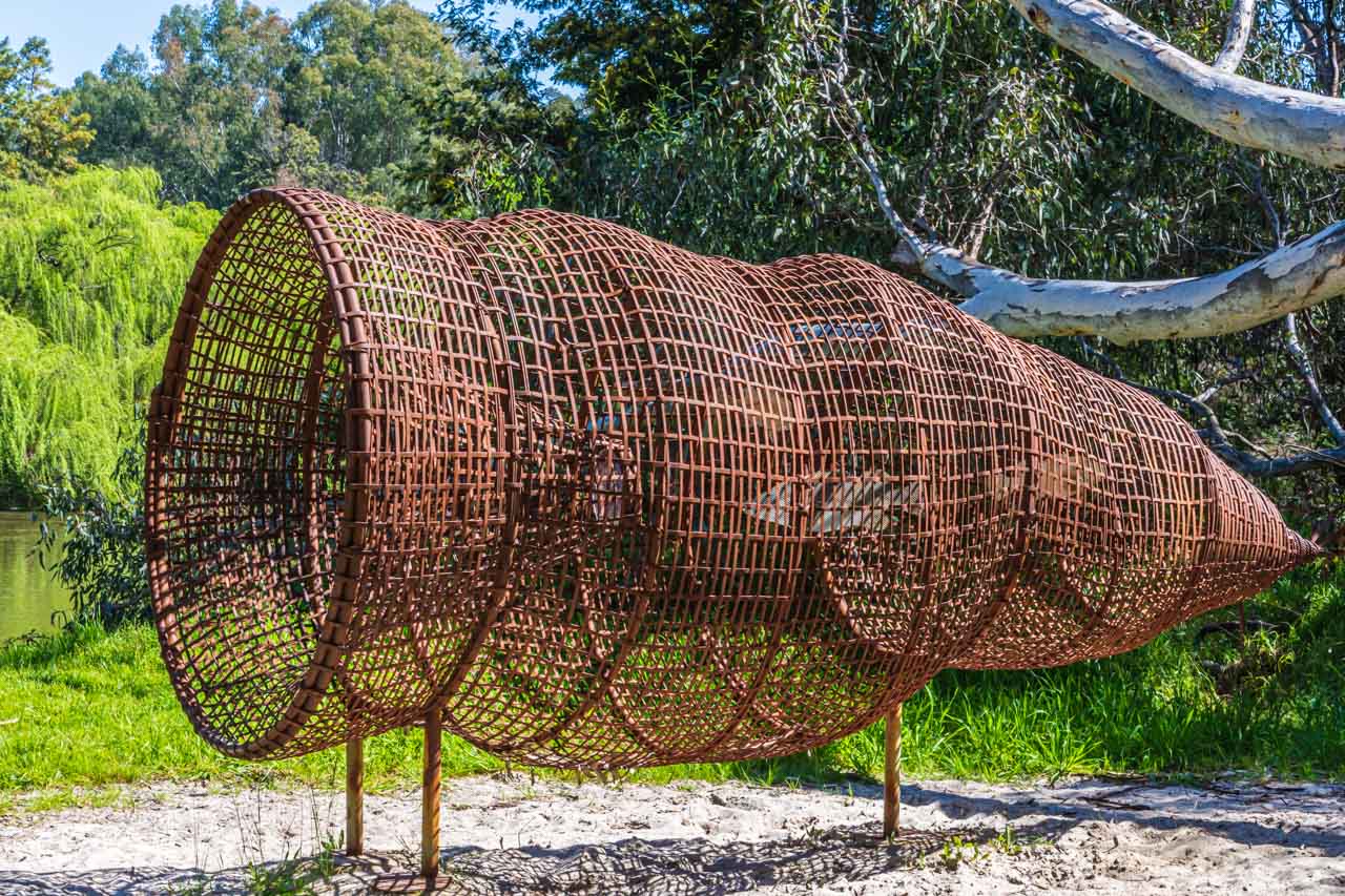
‘Maya’ Fish Trap
Artists: Uncle Ken (Tunny) Murray, Darren Wighton and Andom Rendell from the Aboriginal Men’s Shed.
This over-proportioned sculpture is of a funnel style fish trap that was commonly used by the Wiradjuri people in the Albury area. These traps were woven from reeds and could even be customised to trap specific fish as well as allowing smaller fish to escape, thus protecting the species for the future.
Wiradjuri Woman
Artist: Leonie McIntosh. Leonie is a proud Wiradjuri woman.
Leonie’s Wiradjuri Woman sculpture is based on the Possum Skin Cloak design burnt on her Nan’s cloak, which she wore for the opening ceremony of the Melbourne Commonwealth Games in 2006.
Leonie has created a sculpture of Wiradjuri Woman emerging out of this 350 – 400-year-old tree stump – ‘as if a spirit is breaking free’.
Googar
Artist: Darren Wighton. Darren is a community leader of Wiradjuri descent.
‘Googar’ is the Wiradjuri word for ‘goanna’. At 4 metres in length, Darren’s Googar sculpture is a larger-than-life version of a small wooden toy goanna that Wiradjuri children would play with and learn from in traditional times.
Useful information
At the Kremur Street boat ramp, you will find free parking, public toilets, and a picnic area.
Picnic area on the banks of the Murray River at Kremur Street Boat Ramp, Albury
Horseshoe Lagoon has parking off the Riverina Highway but has no toilets or picnic facilities. It is a couple of minutes walk from the parking area to join the Yindyamarra Sculpture Walk trail.
Albury is a large inland city in New South Wales on the banks of the Murray River – Australia’s longest river. It is 553 kilometres southwest of Sydney via the Hume Highway and 326 kilometres northeast of Melbourne.
The Murray River at Noreuil Park in Albury – a popular swimming spot
Lessons learned from having walked the Yindyamarra Sculpture Walk previously:
The first time I walked the Yindyamarra Sculpture Walk was with my sister. We commenced our walk at Noreuil Park and walked to Wonga Wetlands. As the car was at Noreuil Park, we had no alternative but to walk back the way we had come. This walk was a 14-kilometre round trip. By the time we were halfway back on our return journey, we could barely lift our feet and couldn’t talk to each other.
My second attempt at the Yindyamarra Sculpture Walk was with my daughter. We left the car at Noreuil Park (I must be a slow learner) and headed out on the walk. About a kilometre from Wonga Wetlands (6 kilometres walked), my daughter could see I was flagging. So, as you can imagine, I jumped at her suggestion to sit in the shade of a tree while she jogged back for the car. Oh, to be young and fit!
My third walk along the Yindyamarra Sculpture Walk was with two friends. I insisted we have a car at either end of the walk as I had now (finally) learned my walking limitations. On this occasion, we left a car at the Kremur Street Boat Ramp and drove to Wonga Wetlands, where we left the second car and commenced our walk.
An echidna scurries into the bush near Wonga Wetlands
When I initially wrote this article (November 2020), I recommended readers to walk between Horseshoe Lagoon and Kremur Street Boat Ramp (or vice versa), with a car at either end. It would seem, in the pursuing months, I have become fitter. On my latest venture along the Yindyamarra Sculpture Walk to take photos of the additional sculptures, I found the 5.6-kilometre loop an easy, enjoyable walk.
What my friends had to say about the Yindyamarra Sculpture Walk:
For those bird lovers out there, one of my friends recommends taking binoculars as there are several species of birds to spot along the walk.
Both friends thoroughly enjoyed the walk (described as a ‘leisurely stroll’ by one), and they commented on the number of birds, wildlife and plants seen along the way. As one friend said, seating along the walk would have been good – to absorb a sculpture, to sit and watch the river flow past, and to contemplate the landscape.
I have walked the Yindyamarra Sculpture Walk several times now and have not tired of seeing the sculptures. My friends felt the sculptures showcased the artistic abilities of the local men and women of the surrounding indigenous tribes while telling their own unique stories.
I, my friends, my daughter, and my sister, recommend the Yindyamarra Sculpture Walk. With the sculptures, the river, and the surrounding bush, it is an exceptional, unique walk. Ride your bike, walk the dog, or not, but see the sculptures for yourself.
Editor’s Note: This post was originally published in November 2020 and has been updated for accuracy and comprehensiveness.
Disclaimer: This post contains no affiliate links. All views and opinions are my own and non-sponsored. All photos are my own and remain the copyright of Just Me Travel 2021.
Comment below to share your thoughts on this blog post. Where else have you seen Aboriginal sculptures that you would like to share with readers?
Like this post? PIN it!
Related posts
Still on an art theme in Australia, check out the posts below I wrote on the unique silo art in Victoria and New South Wales. They are packed with amazing photos, information, and tips.
“There’s no better place to find yourself than sitting by a waterfall and listening to its music” – Ronald R Kemler Australia’s Southern Highlands in New South Wales is…
“There’s no better place to find yourself than sitting by a waterfall and listening to its music” – Ronald R Kemler
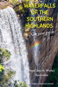
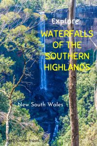
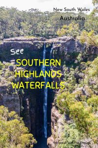
Australia’s Southern Highlands in New South Wales is a destination of scenic beauty. It is considered a foodie and wine region but is also renowned for its national parks and waterfalls. On a road trip around the Southern Highlands, I explored three waterfalls in two national parks.
‘Lush’ is the word that comes to mind when visualising the Southern Highlands in New South Wales. The landscape is green, painted with the odd red roof, black cows, and white sheep. Vineyards, forests, and skyscraper pine trees dot the rolling hills.
The Southern Highlands is around a 90-minute drive from Sydney and less than two hours from Canberra – 110 km southwest of Sydney CBD and 140 km northeast of Canberra. The Southern Highlands is an area centred around the picture-postcard heritage villages of Mittagong, Bowral, Berrima, Moss Vale, Bundanoon, and Robertson, and located in some of the prettiest landscapes I have had the privilege to see. Geographically, the Southern Highlands sits between 500-900 metres above sea level on the Great Dividing Range. The Great Dividing Range runs roughly parallel to Australia’s East Coast for 3,500 kilometres, from the tip of Queensland, through New South Wales and ending in Victoria’s Grampians National Park.
In the Southern Highlands, you will find three of the best waterfalls in two New South Wales national parks:
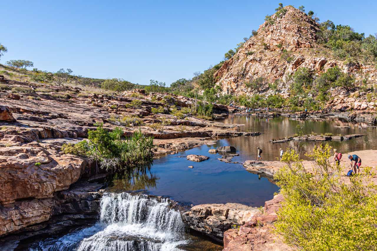
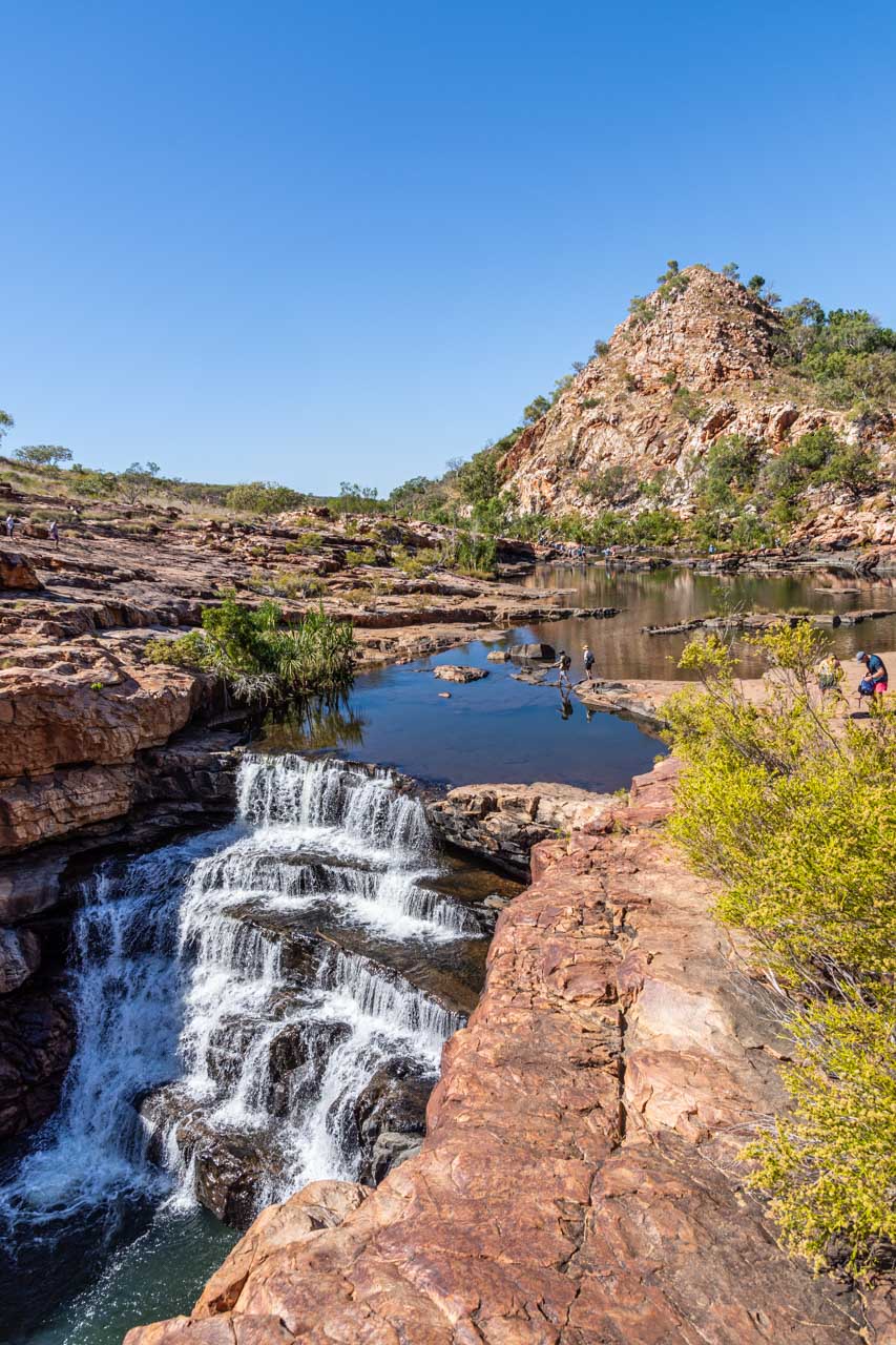
Carrington Falls in Budderoo National Park;
Belmore Falls in Morton National Park; and
Fitzroy Falls, also in Morton National Park.
All three waterfalls are within a few minutes drive of the historic village of Robertson on the lands of the Gundungurra Nation.
Carrington Falls is seven kilometres east south-east from Robertson;
Belmore Falls is approximately eight kilometres south from Robertson; and
Fitzroy Falls is about 15 kilometres southwest of Robertson.
I love waterfalls, but how do I describe why I love them. It’s not enough to say, “I just do”. I have travelled the world (well, some of it!), and I am obviously drawn to waterfalls when I look back through my photos. Waterfalls make me happy. Even though the cascading water can be thunderous and constantly moving, I find the sight and sound of waterfalls calming. I can sit and chill out for hours beside a waterfall.
New South Wales National Parks’ website provides up-to-date, detailed information on Carrington Falls walking track, Belmore Falls walking track, and Fitzroy Falls West Rim walking track. The website is a significant resource that provides trail maps and advises of park alerts, walking grades, safety, best times to visit, getting there and parking, accessibility, facilities, and the plants and animals you may see in each national park.
I recommend you call into the Southern Highlands Welcome Centre in Mittagong early in your visit to the area. I found them very informative and helpful about what to see and do in the area. They also advised on the best days to visit specific villages and towns so I wouldn’t be disappointed with closures. This latter made it easier to plan my days ahead, as I had come to the Southern Highlands with no specific itinerary in place.
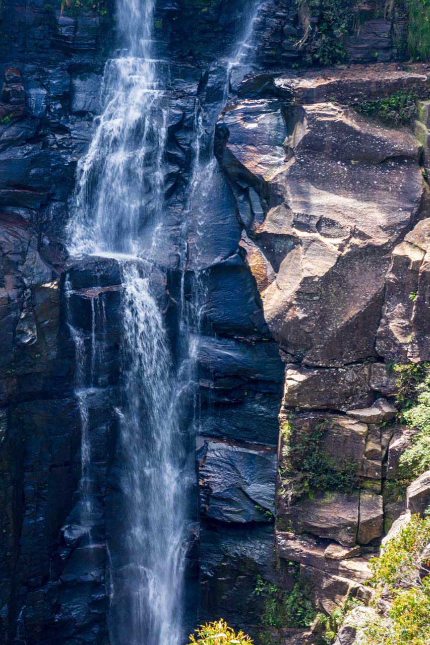
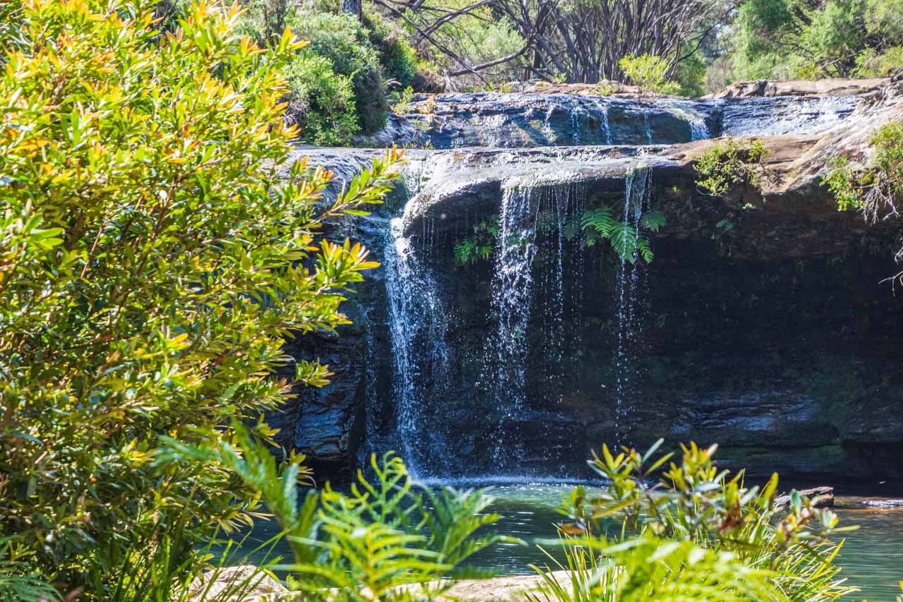
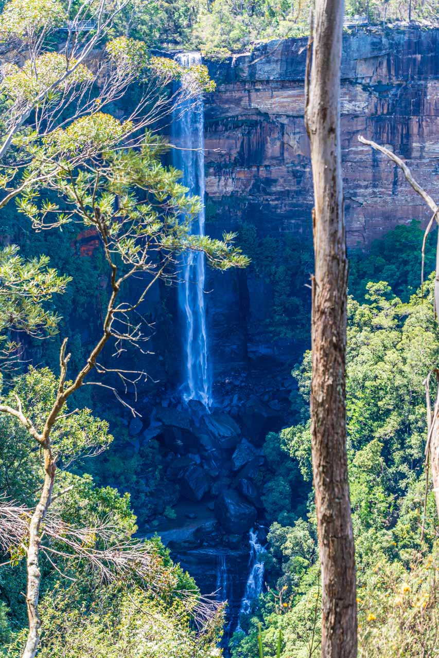
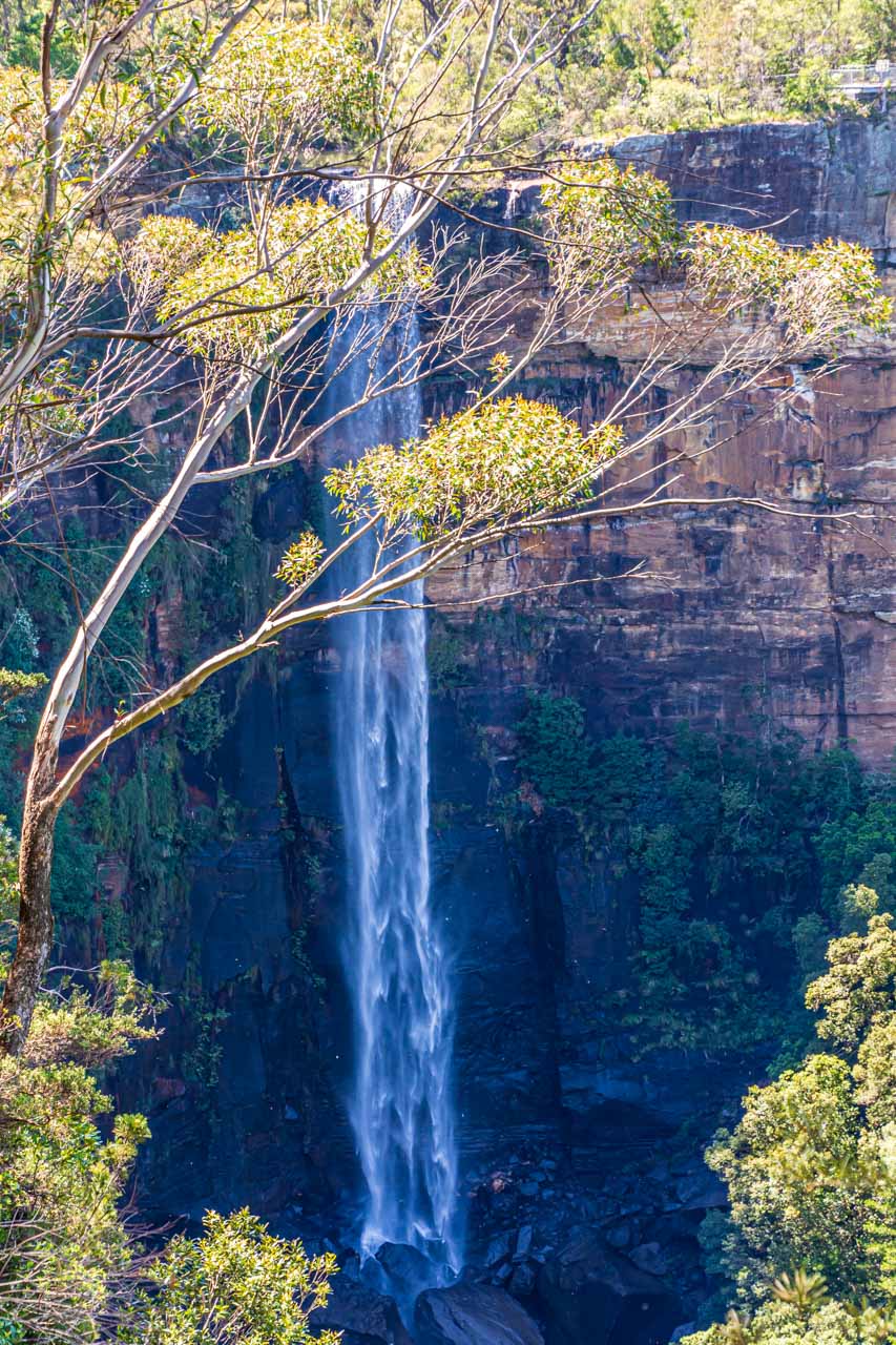
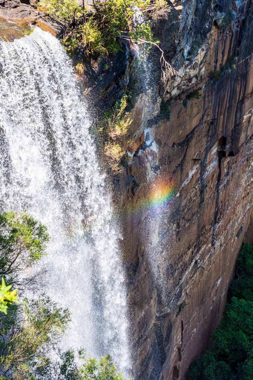
Carrington Falls
Carrington Falls, Budderoo National Park, Southern Highlands, New South Wales
Carrington Falls is in Budderoo National Park, seven kilometres from Robertson. Entry is free to the falls and walking tracks.
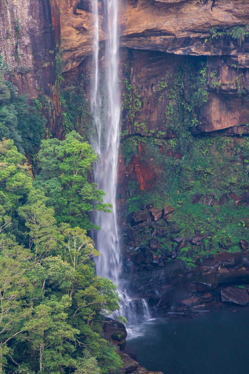
Carrington Falls is a result of the Kangaroo River plunging 90 metres over the escarpment. It is considered one of the most impressive and beautiful waterfalls in and around Sydney. You be the judge of that from the three waterfalls presented in this post.
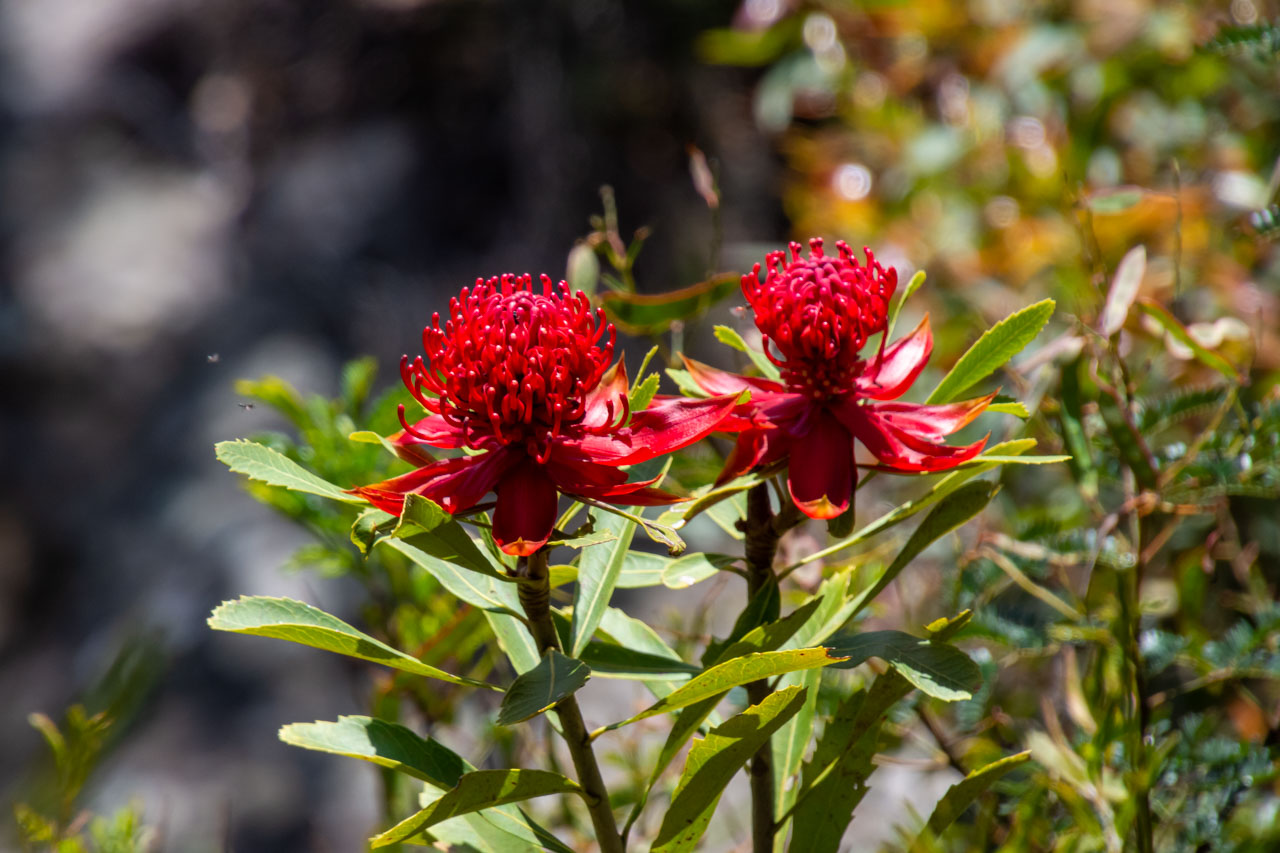
You can view Carrington Falls from three lookouts along a 600-metre loop walking track from Thomas’ Place picnic area – all giving a different view of the falls. The walk is a formed track and clearly signposted. But note, there is a steep metal stairway to descend and some short steep hills to ascend. Waratahs, an Australian native plant and the floral emblem of New South Wales, can be seen along the track in spring and summer.
Waratahs in bloom at Carrington Falls in Budderoo National Park
Thomas’ Place picnic area is the car park for Carrington Falls. Picnic tables and long-drop (non-flushing) toilets are available.
Getting there: In Robertson, take Jamberoo Mountain Road (opposite the famous Robertson Pie Shop) and continue for five kilometres. Turn right onto Cloonty Road at the Carrington Falls sign and continue for about two kilometres. Turn a sharp right onto Thomas Place Road and continue to the end, where you will reach the car park and picnic area.
Budderoo National Park is always open but may have to close at times due to poor weather or fire danger.
I saw people swimming at the top of the falls, but access to the base of the falls requires advanced navigation and bush survival skills. If you want a swim, make your way to Nellies Glen.
Carrington Falls
Carrington Falls
Carrington Falls
Carrington Falls
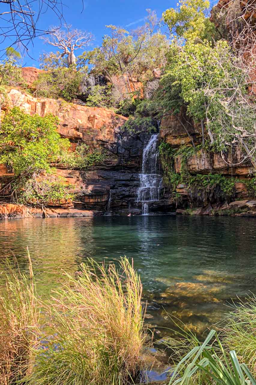
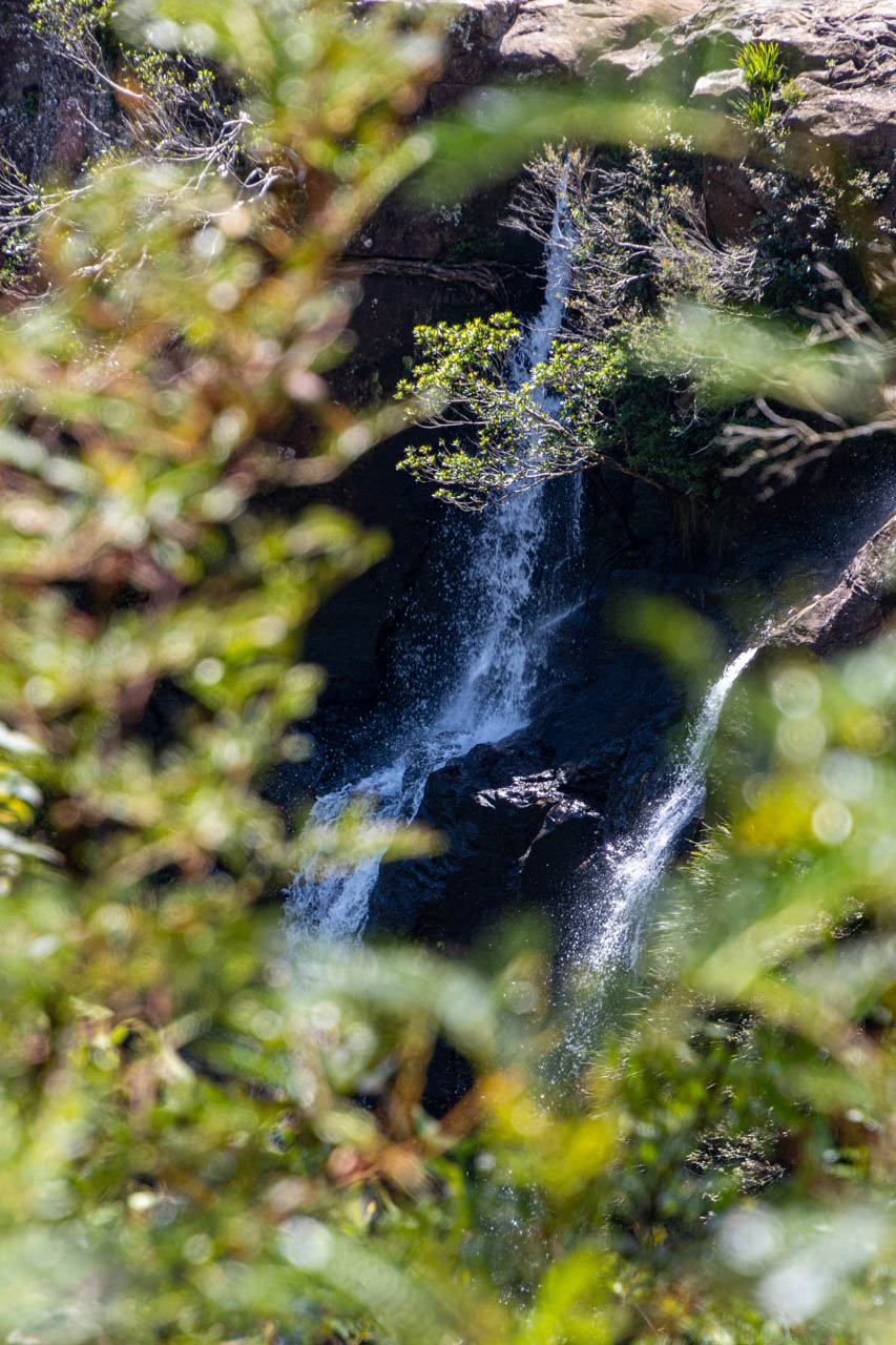
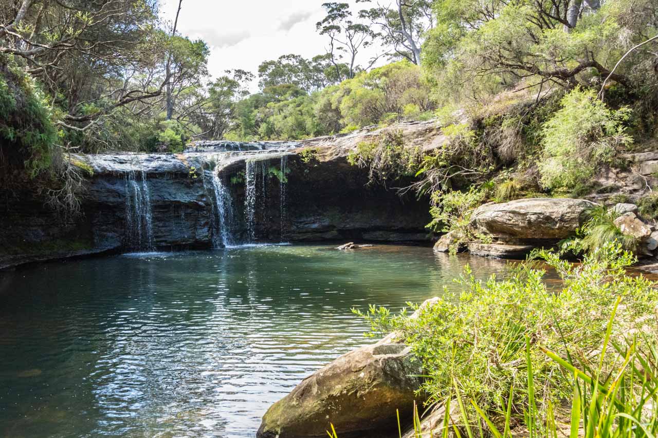
Nellies Glen
Nellies Glen swimming hole in Budderoo National Park, Southern Highlands, New South Wales
Nellies Glen is in Budderoo National Park, just 240 metres from Carrington Falls on the other side of the river. From Thomas’ Place picnic area, drive back to Cloonty Road heading north and turn left into Nellies Glen picnic area after crossing Kangaroo River. Entry is free. Facilities include car parking, long-drop toilets, and picnic tables.
The small waterfall and picnic area at Nellies Glen are just 100 metres from the car park on a flat, unpaved path. The natural rock pool, surrounded by ferns, is an idyllic place to swim.
NSW National Parks’ website on Nellies Glen provides directions, safety, and practical information, including the best time to visit and plants and animals you may see.
Nellies Glen in Budderoo National Park, Southern Highlands
If you haven’t brought a picnic lunch with you, then grab a pie at the famous Robertson Pie Shop – noted for its award-winning savoury and sweet pies. I had a steak and mushroom pie which was very tasty. However, I did not finish my apricot and cream pie because I found the pastry stodgy.
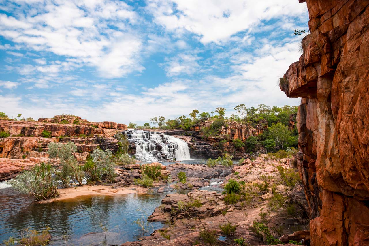
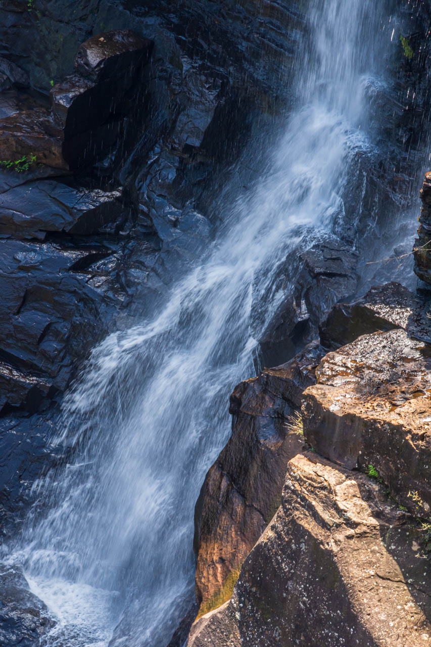
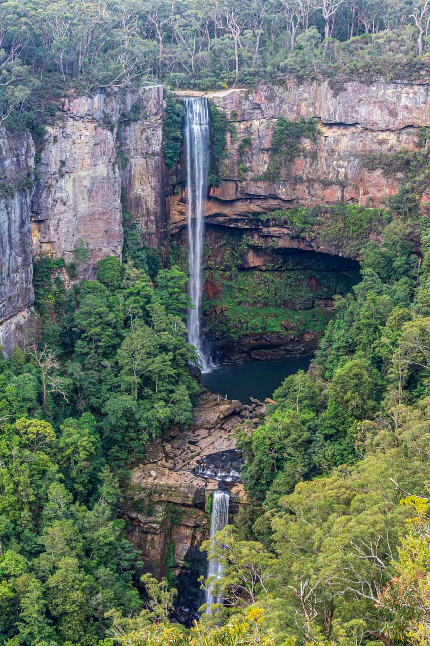
Belmore Falls
Belmore Falls in Morton National Park, Southern Highlands, New South Wales
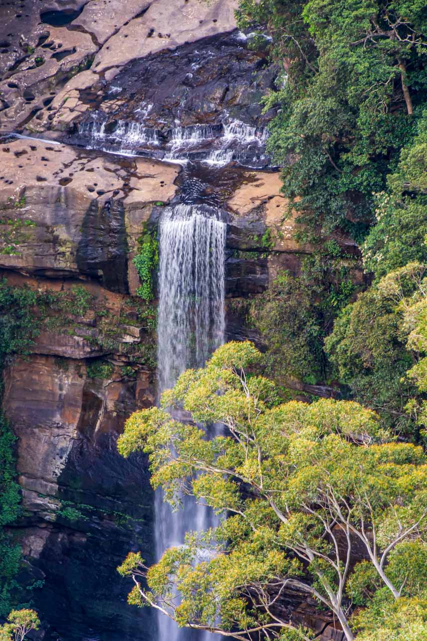
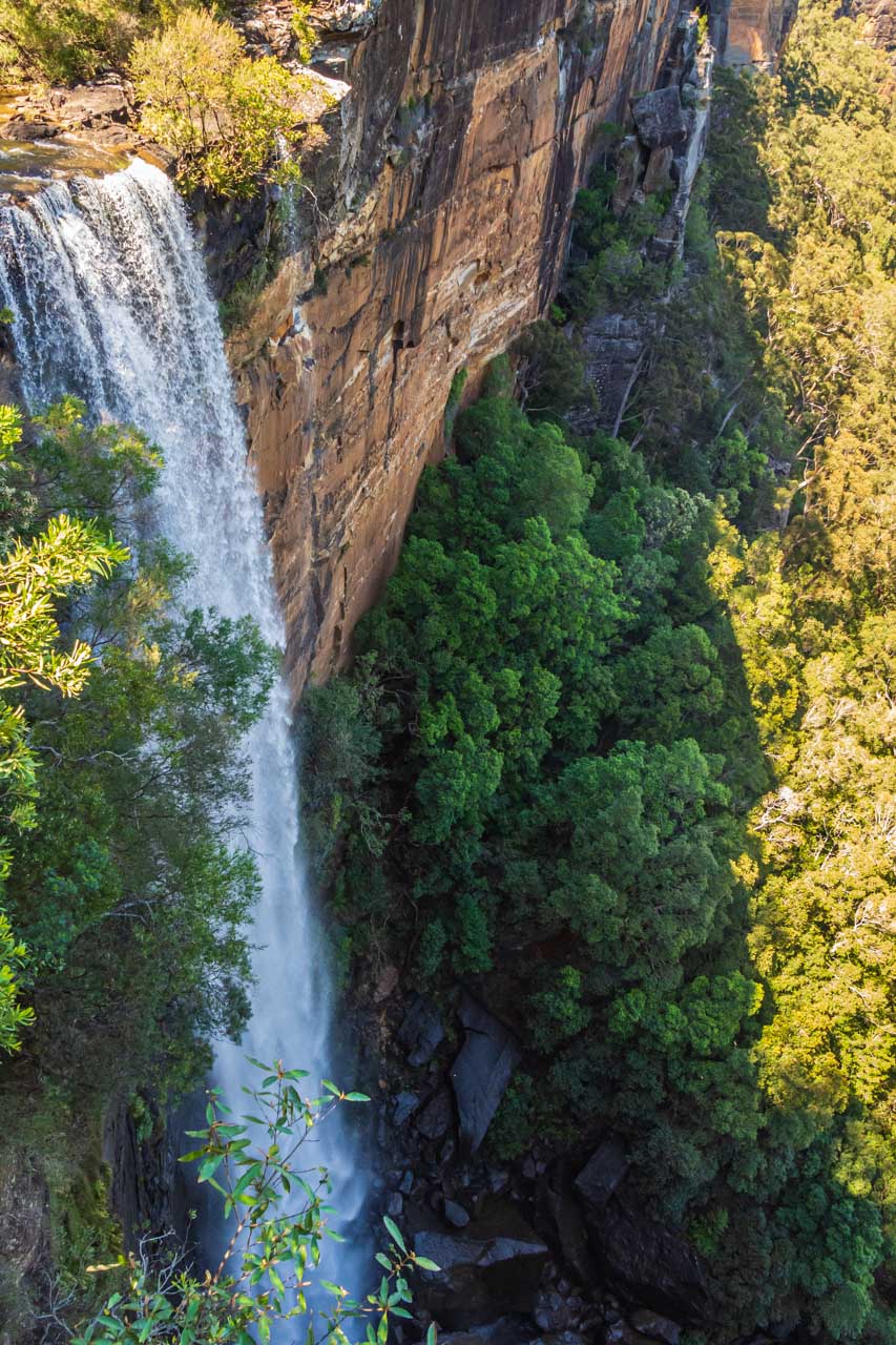
Belmore Falls is a two-tiered waterfall on the Barrengarry Creek. The waterfall’s overall drop is 100 metres, with the first drop plummeting 78 metres down the cliff face to a pool below before continuing its rush to the valley floor.
Located in Morton National Park, eight kilometres from Robertson, entry is free to Belmore Falls.
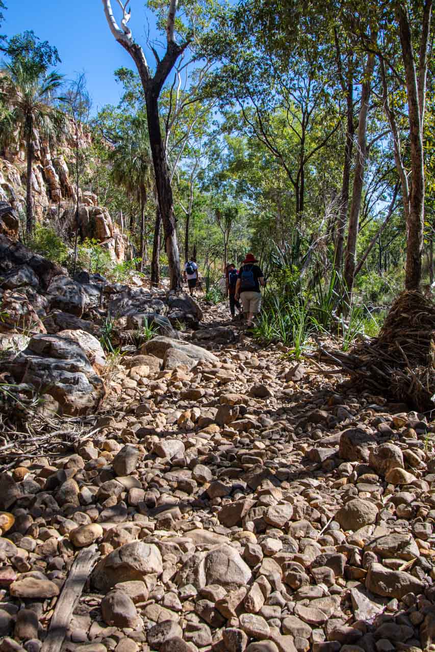
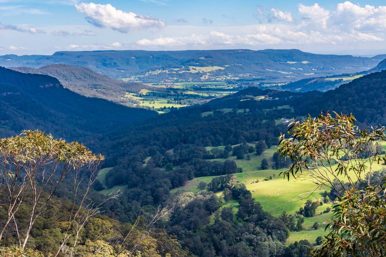
The Belmore Falls walking track is a 1.8-kilometre loop with three main lookouts. The dirt track is a Grade 3 with gentle hills and many steps.
Commencing at Hindmarsh Lookout (100 metres from the car park), this lookout provides spectacular, panoramic views of Kangaroo Valley.
View of Kangaroo Valley from Hindmarsh Lookout, Morton National Park, Southern Highlands
It is not until you reach the third lookout, Belmore Falls Lookout, that you are rewarded with the best views of the upper and lower falls.
Getting there: From Robertson, turn south on Meryla Street and right into South Street, then left onto Belmore Falls Road.
Belmore Falls
Belmore Falls
Belmore Falls
Belmore Falls
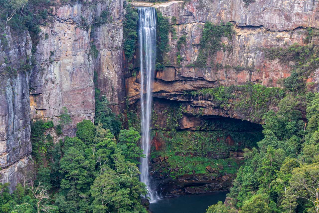
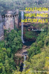
Fitzroy Falls
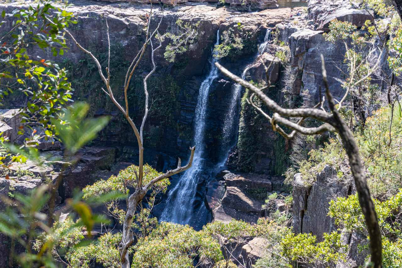
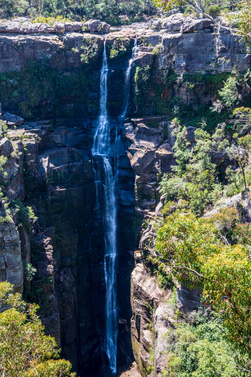
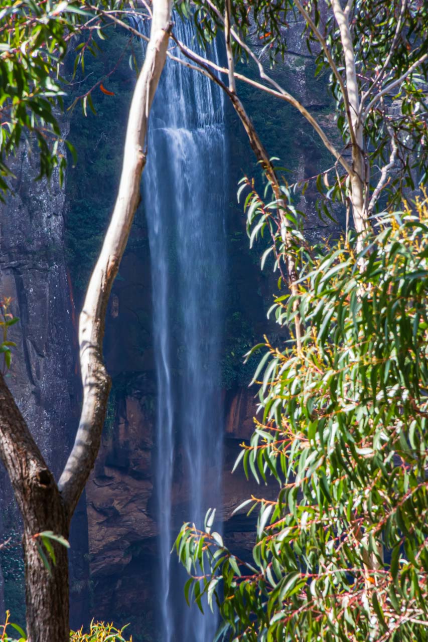
Fitzroy Falls, Morton National Park, Southern Highlands, New South Wales
Fitzroy Falls is in Morton National Park, 15 kilometres southwest of Robertson or 28 kilometres south of Mittagong, where I was staying in the Southern Highlands. The waterfall walk starts at the Visitor Centre, 1301 Nowra Road, Fitzroy Falls. Parking at the Visitor Centre for Fitzroy Falls – your only parking option – will cost you $4.00 per vehicle, but entry to the falls is free. The parking ticket machine takes coins only. If wanting to pay by card, you will need to pay in the Visitor Centre.
You need to take the moderate West Rim walking track for views of Fitzroy Falls – viewed from three lookouts along the 3.5-kilometre return track. Unlike the loop tracks at Carrington and Belmore Falls, you must return the way you came on the Fitzroy Falls walking track. The track follows the western edge of the horseshoe-shaped escarpment. It is a well signposted, formed track with many steps and gentle hills. About 400 metres along the track, a family had abandoned their stroller, opting to carry their baby instead. I came across the family at the next lookout. They said it was too difficult managing the stroller up and down the steps and over tree roots along the track.
Your first view of Fitzroy Falls, and the best, is at Fitzroy Falls Lookout, 150 metres from the Visitor Centre. From this viewpoint, at the top of the falls, the waterfall cascades 81 metres over the rim to the Yarrunga Valley floor. The further you walk around the rim, to Jersey and Richardson Lookouts, Fitzroy Falls becomes more and more distant. From Richardson Lookout, the track continues to Twin Falls (600 metres return). I was disappointed with Twin Falls. On the day of my visit in October, it was just a trickle running down the cliff face.
Fitzroy Falls
Fitzroy Falls
Fitzroy Falls
Fitzroy Falls
If you still feel energetic after completing the West Rim walking track and want to see something other than a waterfall, take the East Rim and Wildflower walking tracks. Starting from the Fitzroy Falls Visitor Centre, the Wildflower walk is the first 1.25 kilometres of these joined tracks, totalling 6.7 kilometres return. There are several lookouts along the tracks, offering views over the Southern Highlands.
When to visit the Southern Highlands
The Southern Highlands has moderate summer temperatures and mild winter temperatures. The volume of water in waterfalls is dependent on rain. The Southern Highlands has moderate rainfall throughout the year – averaging 54 millimetres in July to 103 millimetres in February.
Where to stay in the Southern Highlands
You are spoiled for choice when it comes to accommodation options in the Southern Highlands, meeting all budget types. There are camping grounds, motels, hotels and B&Bs, as well as luxurious retreats on vineyards and in historic manor houses.
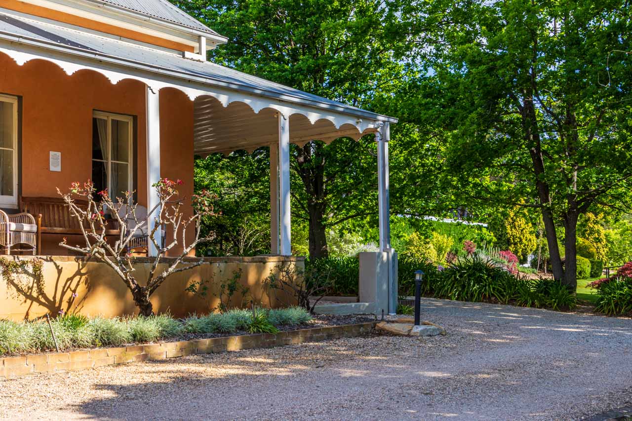
I stayed at the Fitzroy Inn Historic Guest House, 1 Ferguson Crescent, Mittagong. I was initially accommodated in a light, airy and spacious room in the main house. The room opened onto a wide veranda overlooking the rose garden, with dapple lighting created by old oak trees. I was very comfortable.
Fitzroy Inn Historic Guest House, Mittagong, Southern Highlands
On my second day, I was upgraded (due to a plumbing problem elsewhere in the house) to an even larger room in the School Master’s Cottage. I soon discovered that an upgrade comes with a spa bath and a shower, bath sheets instead of bath towels, and up-market toiletries.
Whether accommodated in the main house or the School Master’s Cottage, the rooms comprise quality furnishings, tea and coffee making facilities (always a winner for me), and free WiFi.
Don’t forget to say hello to the resident miniature dachshunds, Jack and Jill.
Fitzroy Inn Historic Guest House offers boutique accommodation in an environment where history meets luxury.
Where to eat
Be warned; it is not cheap to eat in the Southern Highlands. A Chicken Caesar Salad, a coffee and a cake cost me AU$43.85 at Magpie Café in Berrima. A similar lunch at The Shaggy Cow in Mittagong cost me AU$45.70. While the food at both cafés was delicious, I found the cost staggering. However, if you forget the ‘recommendations’, you can come up with some gems if you are prepared to explore cafés in the area. The Vale Café in Moss Vale (8/256 Argyle Street) and the Exeter General Store in Exeter (corner of Exeter and Middle Roads) served some of the best lunches I had at AU$21.00 and AU$20.00 respectively.
Going against my own advice, I did have lunch one day at the recommended, award-winning Robertson Pie Shop (4400 Illawarra Highway, Robertson). My savoury pie was delicious, but my sweet pie was indigestible.
Avoid dinner at the Mittagong RSL Club. After one meal at the Club, I bought food at the supermarket for my remaining dinners.
Know before you travel
It is crucial to check NSW National Parks’ website for any park alerts to avoid disappointment. Alerts can include road closures, fire bans, safety alerts, and closed areas.
Due to COVID-19, it is crucial to check government and business websites for specific details on opening times and any restrictions before travel. Check the NSW National Parks and Wildlife Service for their COVID-19 update.
Even though some of your travel in the national parks will be on narrow winding dirt roads, 2WD vehicles are suitable to access the waterfalls.
I found I was reliant on Google maps, connected through car play, to get around the Southern Highlands and ensure I arrived at the waterfalls with a minimum of fuss. Dora (my name for the lady speaking the directions on Google maps) led me astray only on the odd occasion. Dora loved Range Road. We seemed to travel it every day driving around the Southern Highlands.
Disclaimer: This post contains no affiliate links. All views and opinions are my own and non-sponsored. All photos are my own and remain the copyright of Just Me Travel 2021.
Comment below to share your thoughts on this blog post. Some consider Carrington Falls to be the most beautiful in the Southern Highlands. Of the three waterfalls featured in this post, which do you think is the most beautiful or most impressive?
Love this post? PIN it!
Related posts
While visiting New South Wales, consider travelling to see five fabulous painted silos, a sculpture trail celebrating indigenous culture, or nine beautiful waterfalls in the Blue Mountains.
Wonderful Accommodation in an Oasis of Tranquility in Sri Lanka Wallawwa is luxury accommodation at its best. It is all character and serenity. Read on to see why I recommend…
Wonderful Accommodation in an Oasis of Tranquility in Sri Lanka
Wallawwa is luxury accommodation at its best. It is all character and serenity. Read on to see why I recommend you experience Wallawwa for yourself.
Picture yourself relaxing by the secluded pool and being able to buzz for bar staff to attend to your needs. Imagine playing croquet on the manicured lawns before partaking in complimentary tea and cakes at 3 o’clock on the wide veranda. This was my reality of Wallawwa, a luxurious, boutique hotel whose former life was an 18th-century colonial manor house.
Set in acres of lush gardens scattered with daybeds and couches strategically placed around the main lawn, Wallawwa manages a feeling of intimacy.
Wallawwa’s 18 spacious rooms include two family suites and a two-bedroom suite with a pool. All rooms open onto a secluded veranda and tropical garden. My ‘Wallawwa Bedroom’ was comfortable, cool, and tastefully furnished. There was no missing the magnificent king-sized four-poster bed (twin beds are available). A large, polished concrete-lined bathroom with a rain shower, plush towels, and luxurious toiletries completed the room. The room amenities included tea/coffee making facilities – always a winner for me.
The staff were friendly, efficient, attentive and helpful.
The Verandah is Wallawwa’s open-sided restaurant serving top class Asian cuisine, with much of the produce used in the cooking coming from the hotel’s organic garden. Make sure you leave room for dessert because they are to die for.
For those looking for personal pampering, Wallawwa’s Z Spa offers a collection of relaxing treatments. Unfortunately, my stay at Wallawwa was only one night, and I could not treat myself to one of their signature massages. Next time.
If you must leave this piece of tranquillity, Wallawwa can arrange excursions for you.
Wallawwa, on Minuwangoda Road, Kotugoda, is just a 15-minute drive from Colombo International Airport and 30 minutes to the city.
Rooms start at USD390 per night, including à la carte breakfast.
6 Breathtaking Swimming Holes in the Natural Landscape of the Kimberley Swimming in water holes in the Kimberley, Western Australia, is a magical experience. However, the Kimberley is an…
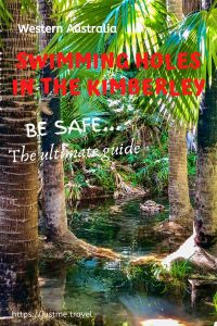
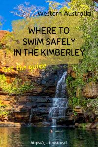
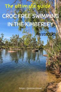
6 Breathtaking Swimming Holes in the Natural Landscape of the Kimberley
Swimming in water holes in the Kimberley, Western Australia, is a magical experience. However, the Kimberley is an ancient landscape with an ancient animal – the crocodile. Crocodiles inhabit many of the Kimberley’s waterways. So, where is it safe to swim? Where can you find crocodile-free swimming holes? Read on to discover the wonderful swimming holes I enjoyed on an escorted road trip around the Kimberley.
Be Croc Wise – crocodile safety signage
But first, be warned – crocodiles do kill. When travelling in the Kimberley, it is crucial to be croc wise. If travelling without a guide, read the croc warning signs and check with locals before swimming or even approaching the water.
The Kimberley covers hundreds of thousands of square kilometres across northern Western Australia – 423,517 to be exact. The Kimberley is vast, with cattle stations of a million acres or more. To give this some perspective, the Kimberley is three times larger than England or slightly smaller than California. As such, the six safe swimming holes I cover in this post are just a drop in the Kimberley.
I came to the Kimberley on a 3-week holiday not knowing what to expect and not wanting to pre-empt what I would experience. I went with an open mind and left my heart there, tramped into the pindan (the red dirt that dominates the Kimberley landscape).
The Kimberley is an area of breathtaking landscapes and scenery and rivers. I don’t know why I was surprised by the number of rivers we traversed. But it is those rivers that can provide some safe swimming holes in the Kimberley. And so, I say, “thank you” to the Kimberley for an extraordinary experience.
Knowing northern Australia is croc country, I was pleasantly surprised to find the Kimberley has so many safe swimming holes – safe from a predator thinking you are its next meal. Read on to discover six of the Kimberley’s safe swimming holes or jump straight to a specific waterhole.
The order of swimming holes presented in this post is simply determined by the order in which I swam in them on a 15-day escorted four-wheel-drive (4WD) Adventure of the Kimberley with APT.
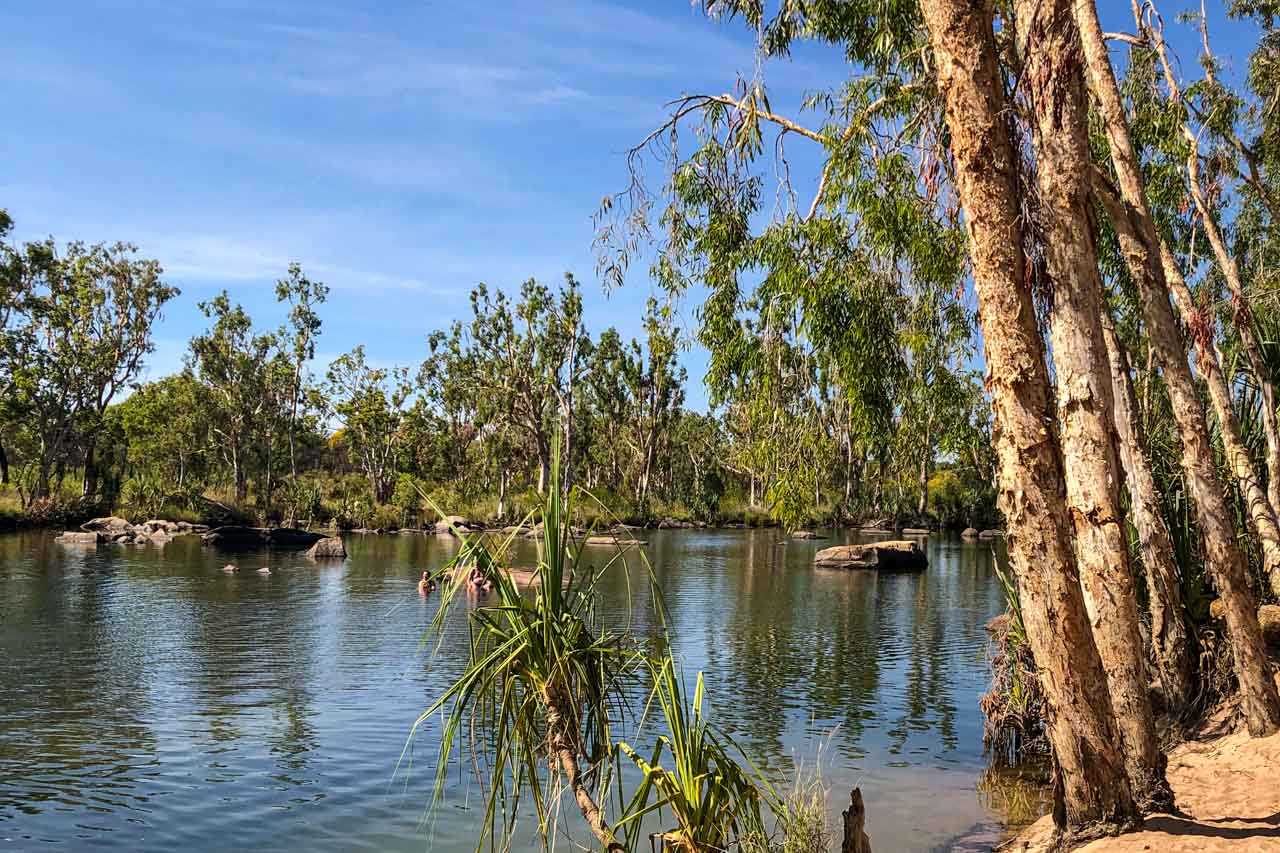
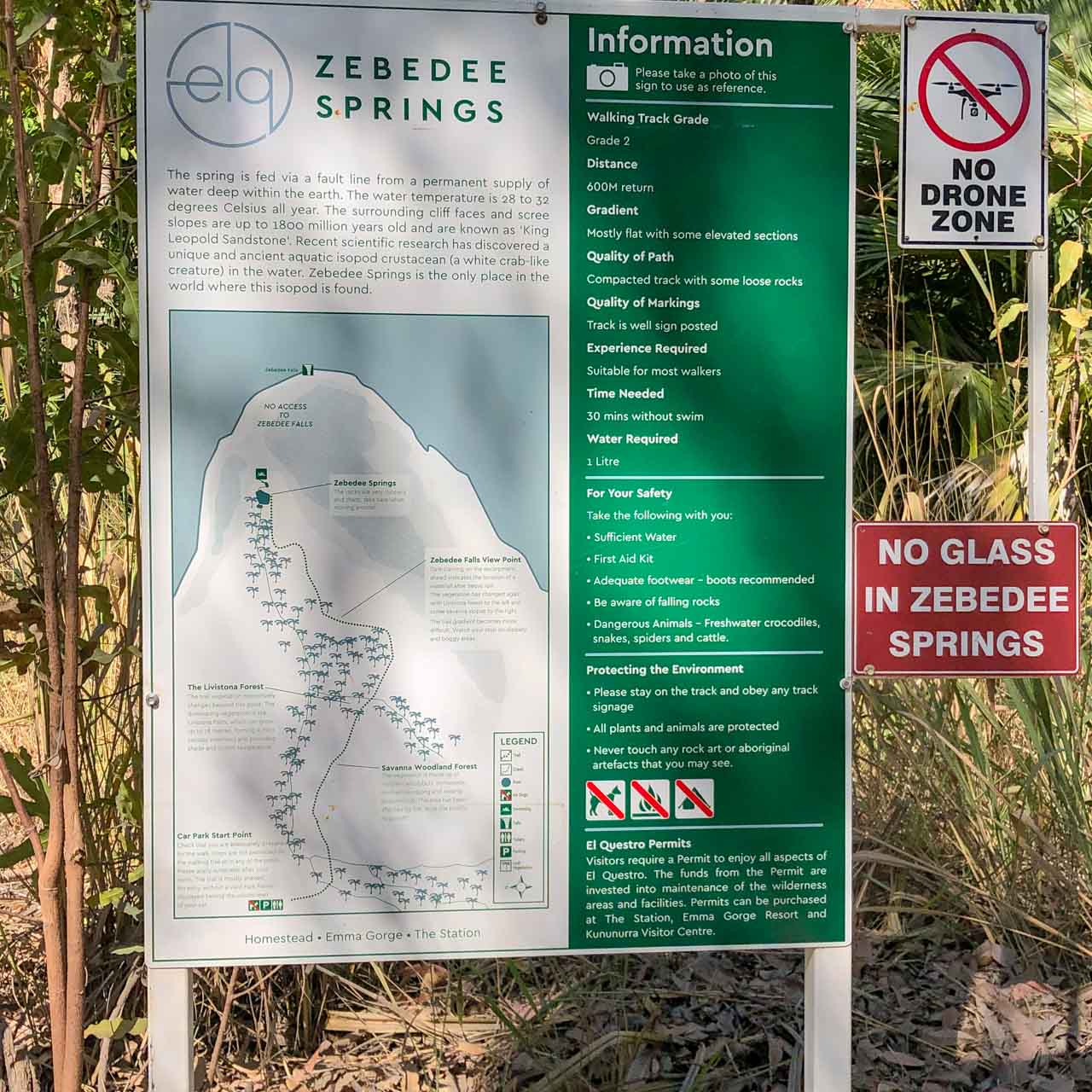
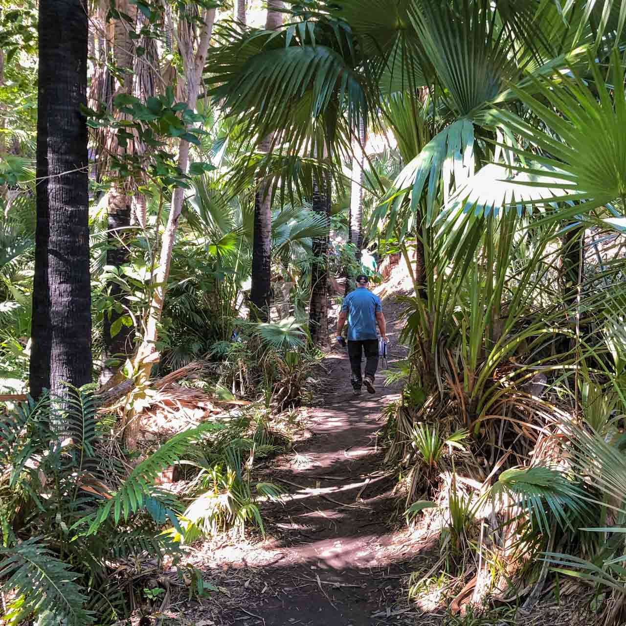
Zebedee Springs
Zebedee Springs in El Questro Wilderness Park
Relax and soak your cares away in Zebedee Springs – a series of rocky thermal pools and trickling waterfalls shaded by towering Livistona palms. Located in the El Questro Wilderness Park, Zebedee Springs is an oasis in the Kimberley.
The Springs are fed by a fault line from a permanent supply of water deep within the earth. The water temperature is a constant 28-32 degrees Celsius year-round.
Access to Zebedee Springs is only possible during the dry season – May to October. It is an easy, 10 to 15 minute walk (one way) into the thermal pools – approximately 600 metres return. The track is mostly flat with some loose rocks and the occasional muddy patch.
Take care entering the pools as the rocks can be slippery.
I had injured my shoulder prior to our visit to Zebedee Springs. I found the swim very therapeutic.
If self-driving, Zebedee Springs is open from 7 am to 12 pm. Entry into El Questro Wilderness Park requires a valid park permit. If on an escorted tour or staying at El Questro, afternoon visits to Zebedee Springs are available at allocated time slots.
El Questro is situated in the East Kimberley, 110 kilometres west of Kununurra by road. To reach Zebedee Springs and El Questro, you can drive from Kununurra on the 4WD Gibb River Road, book a transfer by road or air from Kununurra, or join a guided tour.
When self-driving into El Questro Wilderness Park or anywhere else in the Kimberley, it is crucial to remain up-to-date on road conditions and other relevant information.
Zebedee Springs information signage
Walking track to Zebedee Springs
Mitchell River
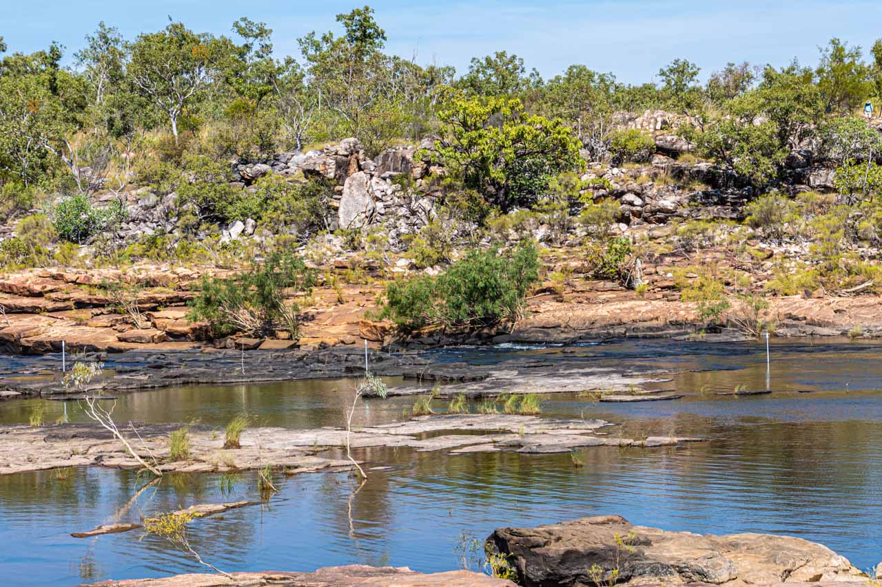
Cool off in the Mitchell River
The Mitchell River cascades 97 metres over four distinct tiers to form Mitchell Falls – one of the most iconic landmarks in the Kimberley. Swimming below the sacred falls is not allowed, but there is excellent swimming in the river above. And this is where I spent an enjoyable couple of hours with a picnic lunch and a swim to cool off.
I helicoptered onto a rocky plateau beside the Mitchell River. After a hike around the ridge for great views of Mitchell Falls, I was ready for a swim. Entering the river required some bottom sliding over slippery rocks. I found it necessary to be aware of what was underneath me in the water due to submerged rocks. But it was a great swim in a magnificent landscape.
Coming from an area in Australia where my local river originates high up in the Alps, I expected Mitchell River to be freezing, no matter how hot the day. I was pleasantly surprised at how warm the river water was. Obviously not fed by snowmelt!
Mitchell Falls is in the remote Mitchell River National Park in the Kimberley. Access to the Park is by 4WD only and is closed during the wet season (November to April).
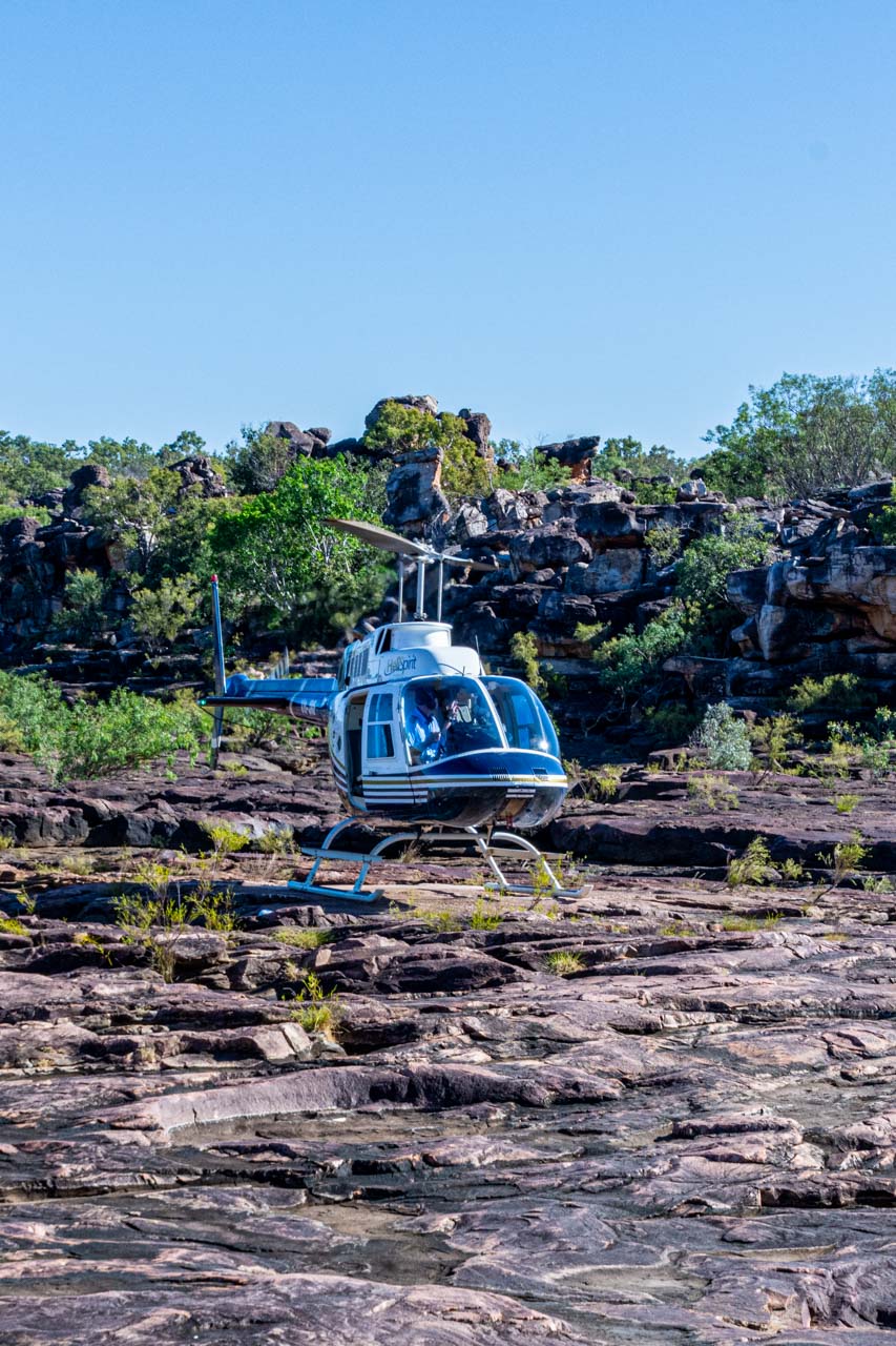
Once in the National Park, you can walk up to Mitchell Falls via a trail described as a moderate to difficult 8.6-kilometre return walk, requiring some rock hopping with areas providing little shade. Or, like me, you can get a helicopter to Mitchell River at the top of the Falls – an irreplaceable experience.
Helicopter landing on a rocky plateau beside the Mitchell River
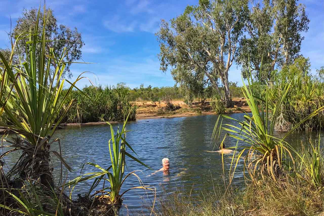
King Edward River
I take a swim in the King Edward river – photograph by Diana House
Still on Mitchell Plateau, a short walk from Munurru (King Edward River) Campground on Port Warrender Road, with Wandjina and Gwion-Gwion (Bradshaw) Rock Art Galleries nearby, the King Edward River provides an idyllic swimming hole.
The swimming hole offers deep, crystal clear water. There is even a pool ladder bolted to the rocks to allow easy access in and out of the water. The King Edward River is a great place to cool off from the dry season heat.
As children, my siblings and I were always told we must wait half an hour after eating before swimming. This warning, our parents told us, was to prevent downing due to having a full stomach. The walk from the shaded picnic tables where we had lunch was five minutes to our swim in the King Edward River. No one drowned!
Wunambal Gaambera Traditional Owners manage Mitchell Plateau. Please check which sites in Wunambal Gaambera Country require a Uunguu Visitor Pass to access.
Swimming in the King Edward River
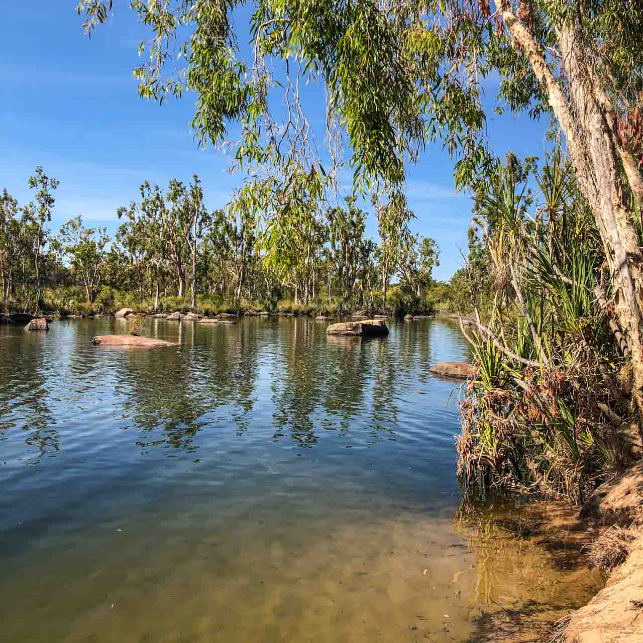
Manning Creek
Manning Creek swimming hole
Leaving Drysdale River Station, a million-acre working cattle station where we had spent the last two nights, we headed for our next two nights stop at Bell Gorge Wilderness Camp. After a short drive (in kilometres) on the seriously corrugated Kalumburu Road, we found ourselves back on the iconic Gibb River Road (also corrugated).
Today saw us experiencing two swimming holes – Manning Creek and Galvans Gorge.
Our first stop was at Manning Gorge campground for a picnic lunch on Mount Barnett Station in the King Leopold Ranges, North West Kimberley. A few minutes walk from the campground brings you to the picturesque Manning Creek, with its trees lining the sandy riverbank. There is a rickety ladder from which you can enter the creek. Don’t dive into the creek because rocks are submerged beneath the water.
As with our swim in the King Edward River, we did not wait the ‘obligatory’ half an hour after eating before plunging into the Manning Creek. No one drowned! I am beginning to think my parents were spinning a furphy. The trouble is, I passed the same myth onto my children.
An entrance permit is required to access the Manning Creek swimming hole, purchased at the Mount Barnett Roadhouse (one of the most remote roadhouses in Australia) – about seven kilometres from Manning Gorge campground.
Galvans Gorge
Galvans Gorge swimming hole
Still on Mount Barnett Station, Galvans Gorge is a pretty little gorge located along the Gibb River Road in the Phillips Range about 15 kilometres west of Mount Barnett.
My guidebook describes the access to Galvans Gorge as an easy, 750-metre walk from the car park off Gibb River Road. Our guide described the path as one kilometre (one way) of flat surfaces, followed by rocky surfaces, then more flat surfaces. Both were right.
Sit on a rock with the waterfall cascading onto your shoulders and down your back for an invigorating massage. While we were at Galvans Gorge, some young people were swinging from a rope on a tree overhanging the waterhole and jumping into the swimming hole. I have read the rope swing is maintained, but I wasn’t going to risk it. On the wall behind the rope swing, you will find ancient Windjana rock art.
The Boab tree standing guard at the top of the waterfall is a native of the Kimberley and an iconic Kimberley symbol.
The gorge and swimming hole are shaded most of the day, making it a perfect spot to escape from the heat. Entry is free.
The waterfall at Galvans Gorge gives a great massage
Galvans Gorge – a Boab tree stands sentinel at the top of the falls
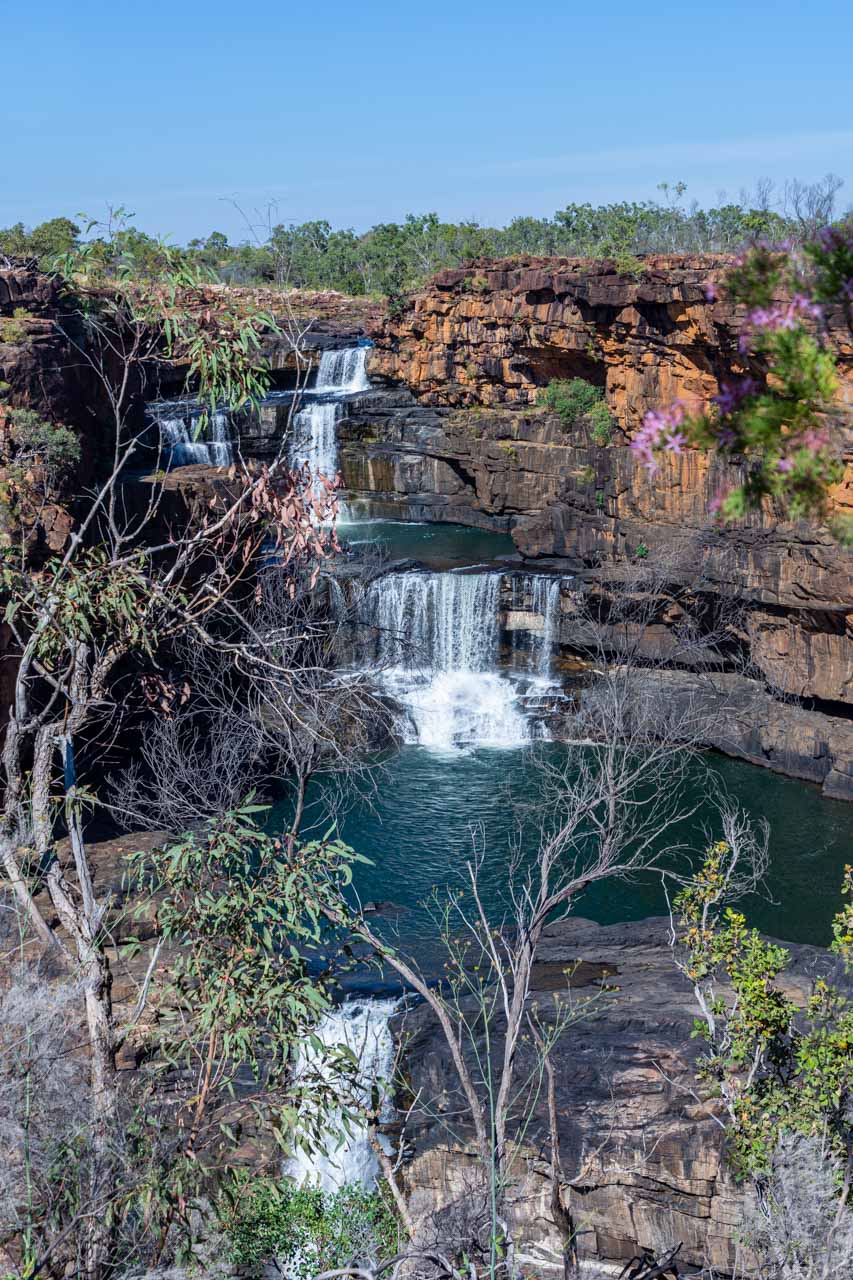
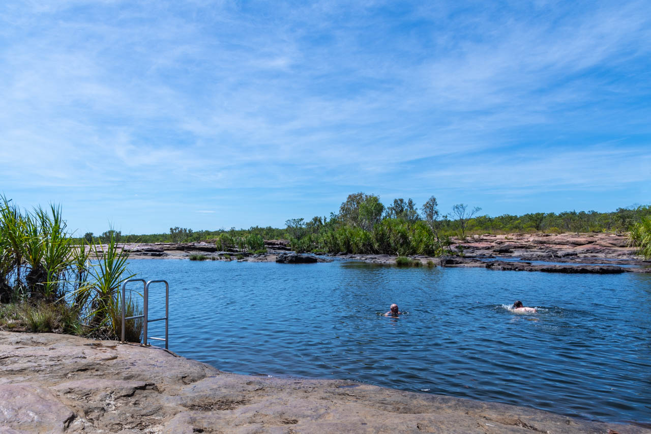
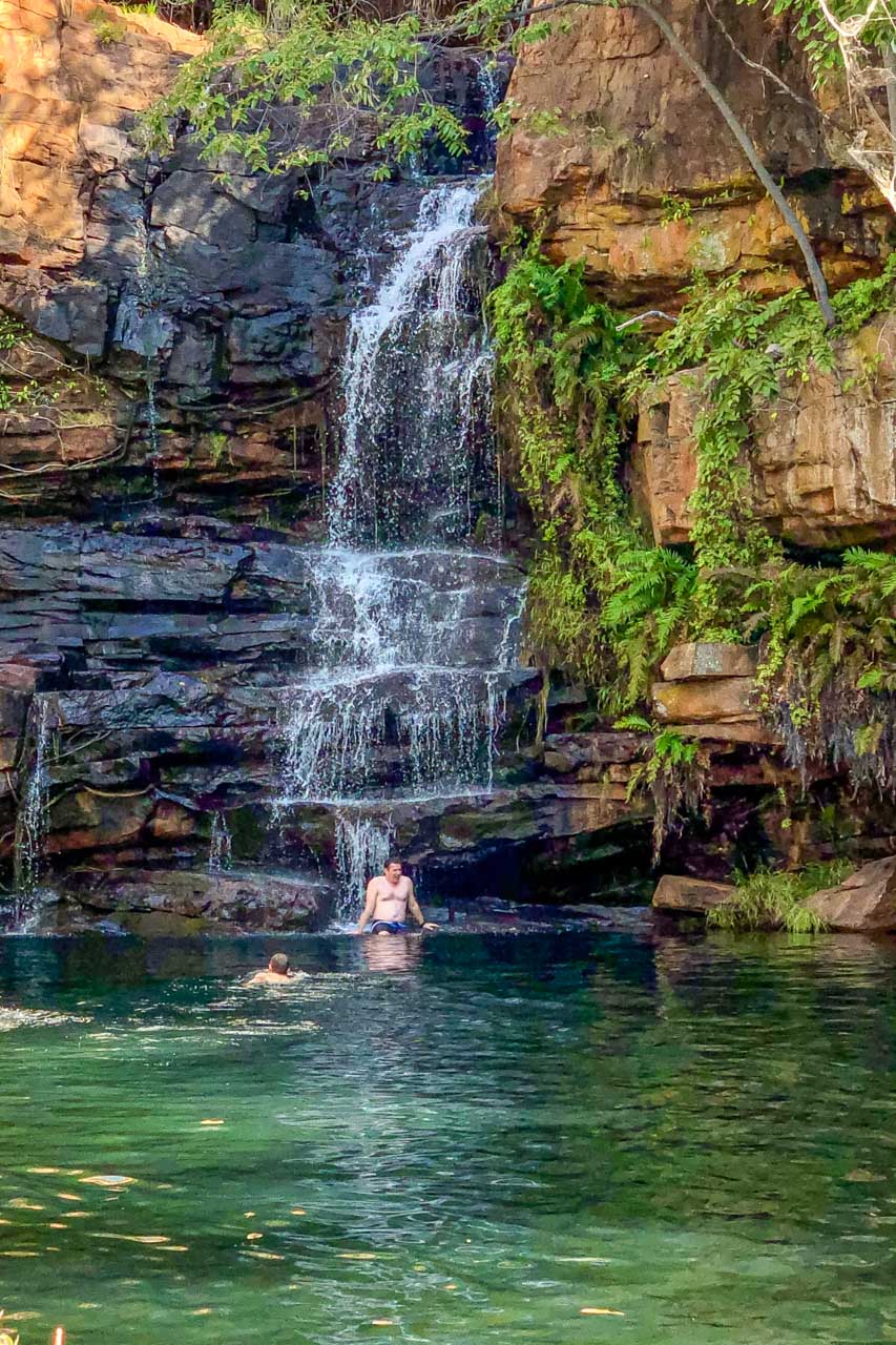
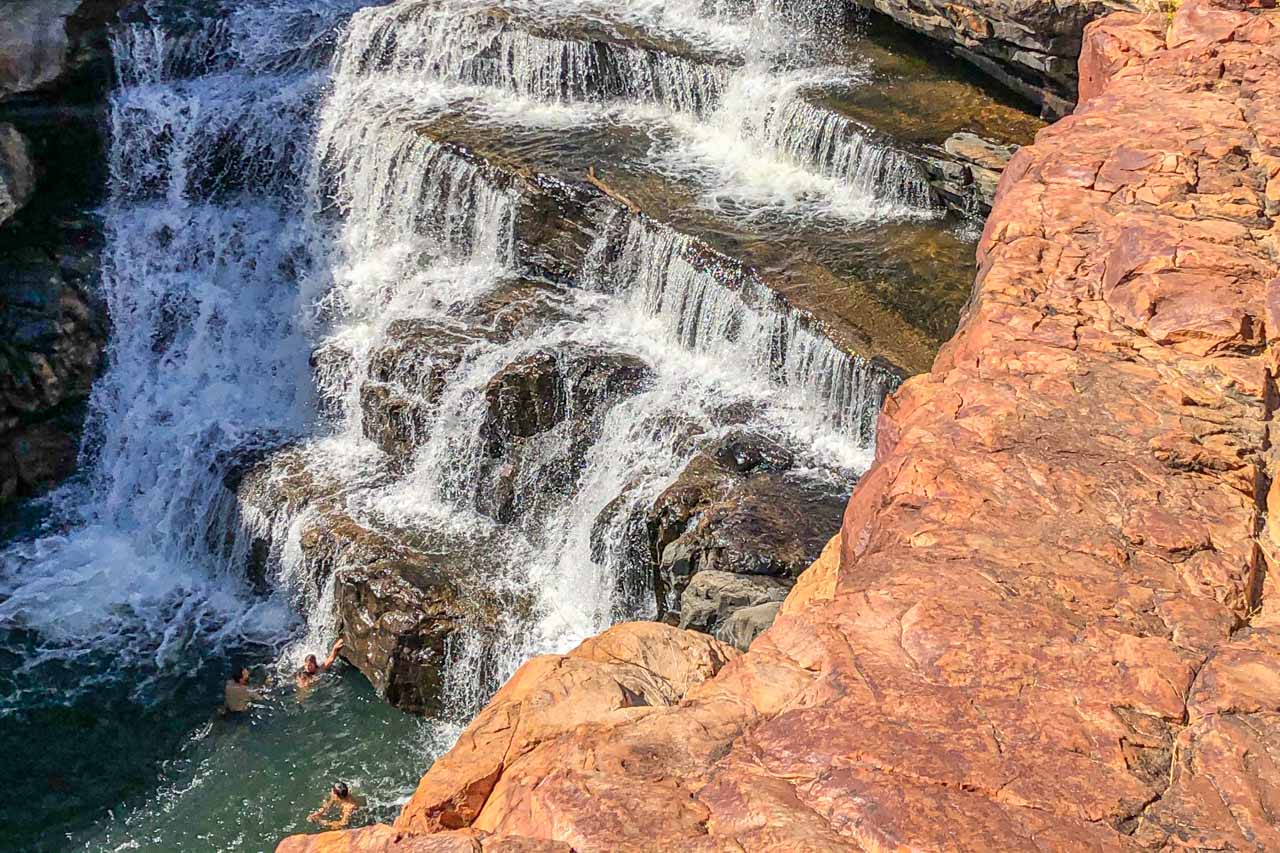
Bell Gorge
Swimming at Bell Gorge
If asked which was my favourite swimming hole, unhesitantly, my response would be Bell Gorge. Its spectacular landscape is a photographer’s delight, and the swimming holes don’t disappoint.
Bell Gorge is in King Leopold Ranges Conservation Park (now referred to by its Aboriginal name, Wunaamin Miliwundi Ranges Conservation Park) and about 247 kilometres east of Derby along the Gibb River Road. Turning off the Gibb River Road, Bell Gorge car park is approximately 30 kilometres along Silent Grove Road, a corrugated road requiring a 4WD.
From the car park, it is a one-kilometre walk along a challenging rocky track to reach the waterfall and swimming holes. I say ‘challenging’ for two reasons:
there is a moderate incline at the beginning of the track, which had me puffing when walking back up on my return; and
the rocks you are walking on are all loose, making it necessary to concentrate on your balance.
However, at the end of the track, the gorge opens up to a stunning vista and the rock pools at the top of the waterfall. One of the rock pools is a natural infinity pool, allowing you to swim right up to the edge of the waterfall.
The second swimming option at Bell Gorge is below the waterfall, where the falls form a deep pool. According to my travel companions who trekked to the bottom swimming hole, the trek is manageable but will test your hiking skills. First, you need to cross Bell Creek to the opposite side. As the rocks where you cross can be slippery, our guide recommended wearing socks (no shoes) to cross the creek. Apparently, this worked a treat. Once across the creek, you climb down a steep, rocky track (which you have to climb back up again) to access the bottom swimming hole and swim below the waterfall within the gorge. I was told the swim was delightful and well worth the challenging hike.
Bell Gorge is in a national park, so entry fees apply. It is inaccessible during the wet season. Before travelling to Bell Gorge, it is advisable to check for alerts and closures.
Don’t forget your sunscreen and take plenty of water.
The rocky track into Bell Gorge
Swimming in the pool below the waterfall at Bell Gorge
Except for Manning Creek, where you can change in the toilet/shower block, the swimming holes listed in this post do not have anywhere to change into your swimmers. Rather than bare my naked backside to my fellow travellers, I wore my swimmers under my clothes.
When to go
The Kimberley has no summer or winter, just wet or dry due to its tropical monsoon climate. I travelled to the Kimberley in June, early in the region’s dry season. The daily temperatures ranged from the high 20s to low 30s degrees Celsius. While this might sound high to some people, the humidity was so mild I didn’t feel especially hot but did appreciate the air conditioning on the bus and the wild swimming opportunities. The nights were cooler, and the only rain I experienced was one night when back in Broome at the end of the escorted tour.
If you want to avoid oppressive heat and humidity, cyclones, and flooded rivers, then travel to the Kimberley from May to October in the dry season. Much of the Kimberley is impassable during the wet season, from November to April. Flooded rivers isolate towns, accommodation, and inhabitants during the wet season.
The Gibb River Road is only accessible during the dry season.
Getting there and around
The Kimberley is truly remote. Even so, you have several options for getting to the Kimberley. I took a direct flight from Sydney to Broome (the ‘capital’ of the Kimberley) but, alternatively, you could drive, hop on a bus, or take a guided tour.
After a week on my own in Broome, I joined APT’s 15-day escorted 4WD adventure tour around the Kimberley. Our ‘4WD’ was a bus on steroids – the body of a bus on a truck chassis. It was on this tour that I was able to experience the safe swimming holes described above.
A 4WD is necessary for travelling around much of the Kimberley if you leave the tarred highway. You should also consider travelling with a satellite phone as there were several areas where there was no mobile phone coverage. At times, I did not even have SOS access on my phone.
The pleasures of travelling on an escorted tour were not having to worry about visitor passes or wondering how I would get from A to B or concerned about damaging my car (if I owned a 4WD) on severely corrugated dirt roads.
The only drawback of being on an escorted group tour was the lack of time to spend at the swimming holes; to thoroughly enjoy them and relax. Taking food and drink and a good book, I could easily have spent a whole day at each swimming hole. Instead, we were in and out of the swimming spots after a quick dip.
Never smile at a crocodile
No, you can’t get friendly with a crocodile
Don’t be taken in by his welcome grin
He’s imagining how well you’d fit within his skin
Disclaimer: This post contains no affiliate links. All views and opinions are my own and non-sponsored. Unless expressly stated, all photos are my own and remain the copyright of Joanna Rath.
Comment below to share your thoughts on this blog post. Have you been to the Kimberley? Do you have a safe swimming hole in the Kimberley you would like to share with readers?
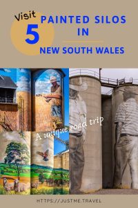
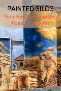
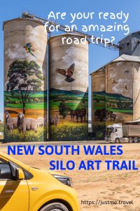
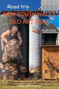
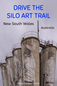
Join Me on a Road Trip as I Visit Painted Silos Around New South Wales’ Silo Art Trail in Australia Follow me on a road trip with a purpose…
Join Me on a Road Trip as I Visit Painted Silos Around New South Wales’ Silo Art Trail in Australia
Follow me on a road trip with a purpose as I travel the Silo Art Trail in New South Wales. Learn the location of the painted silos, who are the artists, and discover what else you can do in the silo art towns.
Following Silo Art Trails provide a focus for your road trip and is a great way to see rural Australia.
See how grain silos have been transformed into amazing, towering art canvases. Each canvas is unique, with murals reflecting the people, landscape and culture of the communities in which they appear.
I need to admit, I have become somewhat addicted to silo art, having visited the Silo Art Trails in Victoria’s Wimmera Mallee region and North East Victoria.
Silo Art Projects (with the first being completed in 2015) have become a national phenomenon in Australia, appearing in Western Australia, Victoria, New South Wales, South Australia, and Queensland. The silos provide a canvas for artworks that intend to boost tourism revenue in rural communities that have suffered from years of drought and other hardships. The silo murals take an average of six to eight weeks to complete.
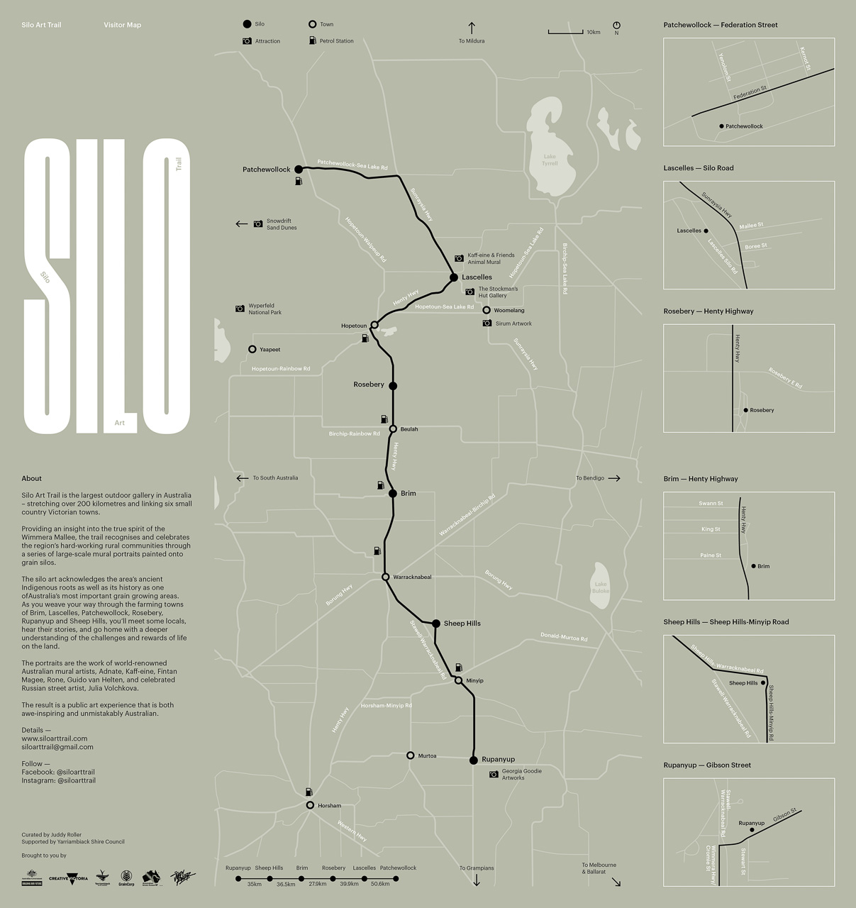
Silo Art Locations in New South Wales
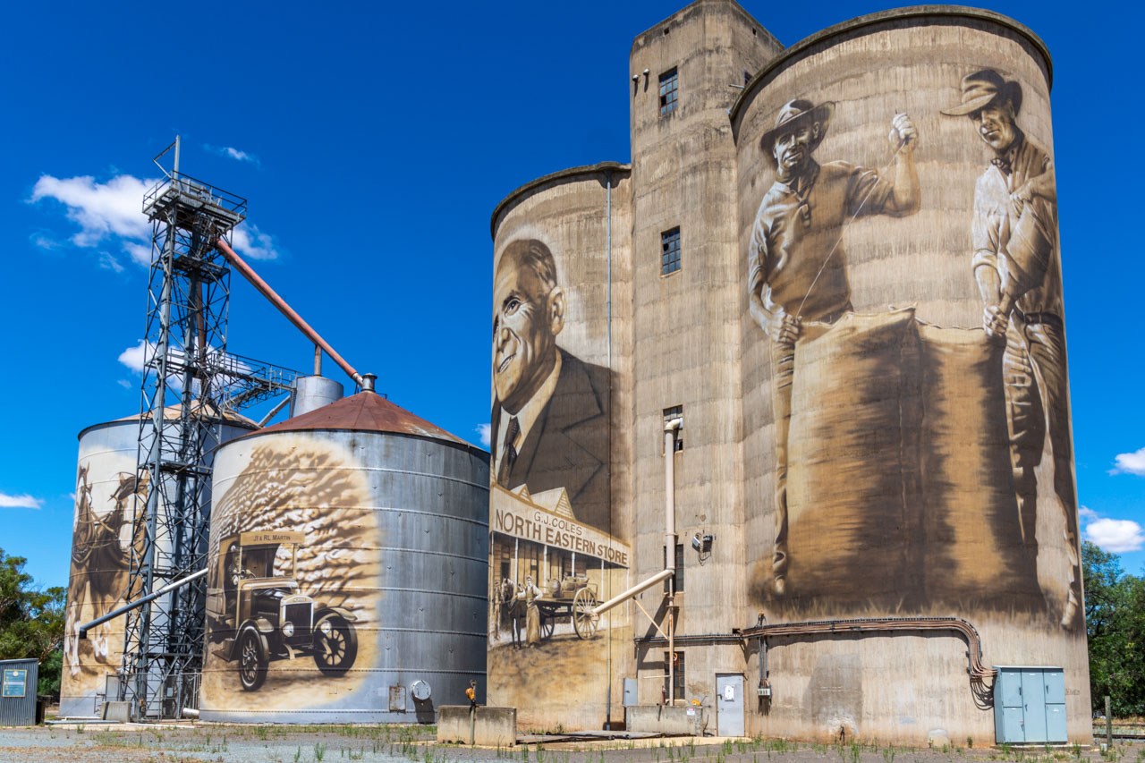
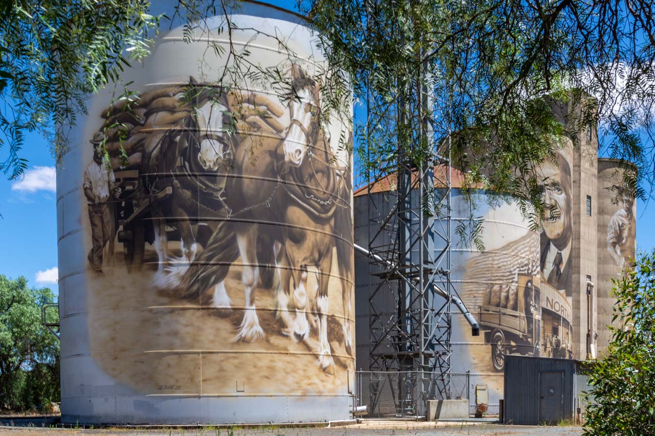
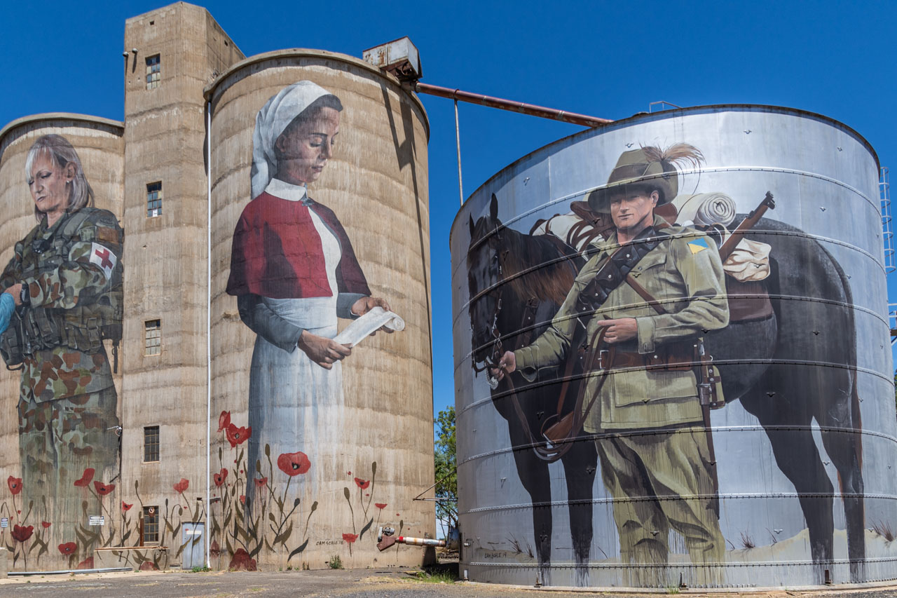
At the time of writing, there are eight painted silos in New South Wales. On a recent, extensive road trip through the Central West and Riverina regions of New South Wales, I deliberately made detours to include 5 of the silo artworks – at Murrumburrah, Grenfell, Portland, Dunedoo, and Weethalle.
The Central West region is west of the Blue Mountains, which are west of Sydney, while the Riverina is a region of south-western New South Wales. The painted silos in Murrumburrah, Grenfell, Portland, and Dunedoo are located in Central West New South Wales. The Riverina region is home to Weethalle’s silo art.
Map of the painted silos locations I visited on my NSW road trip
Why You Should See the Painted Silos
This is street art at its best.
The murals are painted on an unusual ‘canvas’.
The painted silos are in a public space; in open-air galleries, open 24 hours a day / 7 days a week. And they are free to visit.
It is artwork on a massive scale. How many paintings do you know that require an extended cherry picker to complete?
The murals painted on the silos depict local history and landscapes, giving an insight into the community.
The silos themselves have ‘painted’ Australia’s rural landscape since the 1920s.
Jump straight to a silo art location, including learning about the artist and what else you can do in the silo art town:
Murrumburrah and its twin town, Harden are on Burley Griffin Way. The closest capital city is Canberra. Murrumburrah is approximately equidistant from Canberra, Goulburn, and Wagga Wagga.
I specifically detoured to Murrumburra to see the silo art on my way from Wagga Wagga to Cowra. Wagga Wagga to Murrumburrah Silo Art is 127 kilometres, while Murrumburrah to Cowra is 102 kilometres.
Google maps show the painted silos on Albury Street, Murrumburrah, but the murals face Lyons Street. It is from Lyons Street that you will get the best view of the artworks.
Street parking is available for cars. However, the trees that line Lyons Street make parking difficult for travellers with caravans. So, too, does the 45-degree angle parking on the town’s main street. But Roberts Park on the corner of Neill and Iris Streets may provide a better option for caravaners.
A fenced-off private property stands between the murals and the public, creating a barrier to getting up close to the silos. However, the private property does not impede your view of Murrumburrah’s silo art. There is a short steep incline between the private property’s fencing and the road. To view the silo art, you do need to get to the top of the slope. At times I had to hang onto the fence to keep myself on the incline.
Murrumburra Silo Art by Heesco
The murals, completed in February 2021, depict people at work on a farm, reflecting the profound historical significance of the mills to the Harden-Murrumburrah community.
Who is Heesco Khosnaran?
Heesco Khosnaran, originally from Mongolia, is a Melbourne-based professional artist. Although his background is in fine art, illustration, graphic design, and print media, he has extensive experience in large-scale public murals. Heesco has an ever-growing national and international presence.
Heesco painted three of the five silo artworks I visited on my road trip through the Central West and Riverina regions of New South Wales – at Murrumburrah, Grenfell, and Weethalle. By the end of my road trip, I had become quite familiar with his style.
While in Murrumburrah
Call into the Visitor Information Centre for the story behind creating the Murrumburrah Silo Art – from the community’s involvement in the design to Heesco’s integration with the townspeople.
Murrumburrah is proud of its history as the birthplace of the Australian Light Horse. Staff at the Visitor Information Centre willingly chat with you about the significance of the town’s Light Horse Memorial, the bronze sculptures, and a horse named ‘Bill the Bastard’.
Murrumburrah is not short on choices for cafes. I had brunch at Barnesstore Emporium and Café at 356 Albury Street. Walking into the café, I thought it was pokey, with minimal seating. However, an opening to the left leads you into a substantial barn-like dining area with a warm ambience. Service was quick and friendly, and the food (poached eggs, bacon and tomato on toast) was excellent. I finished my meal with a coke spider – coca cola with ice cream in it. When I saw the coke spider on the menu, I happily forewent the coffee I thought I needed for the childhood memories this drink brought back for me.
From Murrumburrah, I took Wombat Road to get back on the Olympic Highway for Cowra.
Grenfell Silo Art by Heesco Khosnaran
From Murrumburrah, Grenfell is 83 kilometres. The closest town of note to Grenfell, at a distance of 56 kilometres, is Cowra. Cowra is on the Mid Western Highway, 160 kilometres from Canberra, the closest capital city.
I was staying in Cowra when I took a day trip to see the silo art at Grenfell.
Grenfell’s painted silos are located at 42 West Street, on the corner of South and West Streets. The silos, owned by Grenfell Commodities (a local grain trading business), commissioned Heesco to transform the silos into an impressive outdoor gallery. The artwork was completed in March 2019.
Grenfell Silo Art by Heesco
Painted on a continuous mural, the four concrete silos at Grenfell depict the local farming landscape. The artwork is a compilation of images taken by a local photographer. The Weddin Mountains National Park is shown in the background of the mural.
Parking is not an issue at the Grenfell painted silos, no matter what size your vehicle or caravan. There is space for many visitors at the same time.
Who is Heesco Khosnaran?
Heesco Khosnaran is a Mongolian-born, Melbourne-based artist who also painted the silos at Murrumburrah (above) and Weethalle (below).
While in Grenfell
The Henry Lawson Monument in Grenfell shaded by the sugar gum tree planted by Henry’s daughter
Grenfell is proud of its heritage as the birthplace of Henry Lawson, the famous Australian poet and writer of short stories, noted for his realistic portrayals of Australian bush life. Born on the goldfields at Grenfell, Henry Lawson can be seen around town. There is an interactive bust of Henry on Main Street, next to the ambulance station. Push the button and listen to some of Henry’s most famous poems. You can sit next to Henry (bronze statue) on a bench on the corner of Main and Forbes Street. There is a monument, the Henry Lawson Monument, marking the site of his birthplace, just a 2-minute drive from the town centre. A sugar gum tree, planted by Henry’s daughter Bertha in 1924, shades the area.
When I first drove up to the Henry Lawson Monument on Lawson Drive, Grenfell, I wondered why I had bothered because all I could see was a white obelisk. But I am glad I got out of the car for a closer look because the 12 interpretive plaques around the Monument tell the story of Henry’s life, his challenges and achievements, was very interesting. I did not know Henry was deaf!
I would have like to visit Wallangreen Sculpture Garden while in Grenfell, but, unfortunately, it was closed at the time.
Portland Silo Art by Guido van Helten
Portland is located just west of the Blue Mountains, with Lithgow being 25 kilometres to the east. The closest capital city is Sydney, at a distance of 163 kilometres.
I detoured to Portland on my drive from Bathurst to Mudgee. Bathurst to Portland is 49 kilometres, then the drive from Portland to Mudgee was 111 kilometres.
Officially named ‘The Foundations’, Portland’s painted silos are located in the centre of town on Williwa Street, where there is plenty of off-street parking available. The silos are accessible seven days a week, 10.00am to 5.00pm. During these hours, you can walk right up to the silos. When The Foundation’s gates are closed, you can still get a good view of the silos but cannot walk right up to them.
The Portland silos were painted by Guido van Helten, with completion in May 2018.
The Foundations – Portland Silo Art painted by Guido
Portland was the site of Australia’s first cement works and became known as “the Town that built Sydney”. The Cement Works closed in 1991. The figures painted on the silos, five men and one woman, are former workers of Portland Cement Works. Guido immersed himself in the town, the people, their histories, and connections to the Cement Works. Guido’s visits with Portland’s residents and tapping into their memories influenced the design and resulting artwork.
Jack Abbot – the face on the Portland silo
Who is Guido van Helten?
Guido is a world-renown Australian street artist. Celebrating everyday characters in forgotten places, Guido’s monochromatic, photorealistic style offers an intimate glimpse into the lives of others. His large-scale portraiture murals are found across the globe throughout Europe, Scandinavia, the United States, and Australia. They tell stories of culture, history, and identity to capture the soul of people and place.
There is no denying the brightly coloured silo artworks have the wow factor. But there is something about Guido’s artwork that draws me in; that makes me stop taking photos to contemplate what I am seeing. For me, he captures the heart and soul of the people he paints. Now, in my opinion, that takes real talent when painting on such a massive scale. You be the judge! I felt the same way about the silos he painted in Brim on the Victorian Silo Art Trail.
While in Portland
Signs of Yesteryear murals on a building in Portland
Take a walk down memory lane. To be specific, see the Signs of Yesteryear – murals of past advertising signs from historic brand names on the walls along Wolgan Street.
I recommend timing your visit to Portland on the weekend. I drove to Portland on a Wednesday and planned to have brunch in town. The only place open was The Corner Takeaway, where the coffee was undrinkable. The pub has a café, but the pub is only open from Thursday to Sunday. The museum was also closed.
In the yard of The Foundations, next to the painted silos, I could see some rusty iron sculptures. A Google search tells me these are the works of Harrie Fasher, the permanent Artist in Residence. I would have loved a closer look but was told at the café that the yard is only open to the public on the weekend.
From Portland, I continued my drive to Mudgee, where I stayed for six nights.
Dunedoo Silo Art by Peter Mortimore
Dunedoo, in Central West New South Wales, is 77 kilometres north of Mudgee and 97 kilometres northeast of Dubbo. From Mudgee, I was staying the night in Dubbo at Zoofari Lodge, Taronga Western Plains Zoo. My detour to see the painted silos at Dunedoo only added 41 kilometres to my trip, as Mudgee to Dubbo, without the detour, is 133 kilometres.
Dunedoo’s painted silos are in the centre of town, on the Castlereagh Highway, shown locally as Bolaro Street. There is generous off-street parking at the silo art. Toilets are available in the parking area.
Dunedoo Silo Art by Peter Mortimore (primary artwork)
Dunedoo Silo Art – a mural of Dunedoo’s rural landscape
The primary silo artwork honours local hero, champion jockey Hugh Bowman sitting on Winx, the Australian world record winning racehorse Hugh rode to fame. Hugh is shown with his winning, ‘she’s apples’ gesture – thumb and forefinger forming an ‘O’. Also featured in the mural is Winx’s trainer, Chris Waller.
Hugh Bowman was born and grew up in Dunedoo. Chatting to a Dunedoo resident while photographing the painted silos, it was evident she was proud of Hugh and what he has achieved in the world of horseracing. She told me how she remembers Hugh as a 3-year-old learning to ride in the local pony club.
The silo artwork also includes a mural of Dunedoo’s rural landscape, including black swans. The name ‘Dunedoo’ is derived from the Aboriginal Wiradjuri language for ‘black swan’.
What you see today was painted in July and August 2020. The artwork is yet to be completed.
Who is Peter Mortimore?
Peter is a self-taught Australian artist known for his Equine Art and ‘rural realism’ style. He has held successful exhibitions in Australia and overseas.
The painting of the murals on the Dunedoo silos was Peter’s first Silo Art Project, the first time he had painted anything on such a massive scale. Unlike established street artists, Peter used brushes and rollers rather than spray cans to paint the silo artworks.
While in Dunedoo
Dunedoo’s main street is lined by shops on one side and a narrow parkland, OL Milling Lions Park, on the other side, with the painted silos off to the side of the park. Displayed in Milling Park are several sculptures of local birdlife created from recycled metal and farm machinery parts. According to my local lady, “Sculptures in the Park”, which predates the silo artwork, was designed to get people to stop in the town. The sculpture of the Wedge-Tail Eagle in the photo below against the backdrop of the painted silos was created by Dunedoo Central School’s design and technology students.
Sculpture of Wedge-Tailed Eagle in OL Milling Lions Park, Dunedoo with the painted silos a backdrop
Sculptures in the Park: “The Swan” designed and constructed by David Sherlock
After viewing the sculptures, I suggest you grab something to eat from one of the cafés in town and eat at one of the picnic tables in the park.
Weethalle Silo Art by Heesco Khosnaran
I made a deliberate overnight stop in West Wyalong on my way from Forbes to Lockhart to give me time to view the painted silos at Weethalle.
Weethalle is a small farming town in the Riverina Region of New South Wales. It is a 59-kilometre drive from West Wyalong – a round trip of 118 kilometres as I had to return to West Wyalong to continue my journey to Lockhart. However, returning to West Wyalong allowed me to wander around the town; to check out its cafés and historic buildings.
The closest capital city to Weethalle is Canberra in the Australian Capital Territory, approximately 337 kilometres to the southeast.
Weethalle painted silos are on the main road through town, on Railway Street, along the Mid Western Highway. There is plenty of off-street parking at the silo, no matter the size of your vehicle or what you are towing.
Weethalle Silo Art by Heesco
Completed in June 2017, the Weethalle silos were the first to be painted in NSW. The mural portrays a shearer, a grain farmer, and sheep up on the balcony. It is a tribute to the rich agricultural heritage of the small community of Weethalle and the surrounding communities.
Weethalle Silo Art – sheep on the balcony
Who is Heesco Khosnaran
The Weethalle Silo Art was the third silos painted by Heesco Khosnaran that I visited on my road trip around New South Wales’ Central West and Riverina regions. I was, by now, familiar with his work.
Back in 2017, the Weethalle silos were the tallest ‘canvases’ Heesco had ever painted. He had previously painted on canvases four or five stories tall, but, at 21 metres high, the silos are close to eight stories. Using 200 litres of paint and 300 spray cans (for the finer details), Hessco took two weeks to complete the mural.
While in Weethalle
Have a meal at the roadhouse Road Kill Grillz at 13-15 Railway Street, Weethalle. I had the Hanky Panky hamburger with beetroot, tomato, onion, lettuce, and sauce. Delicious! Perhaps the best hamburger I have ever had! The coffee was also excellent. Friendly, helpful staff topped off my experience.
Someone at Road Kill Grillz is into boxing as there are posters all around the interior walls.
Road Kill Grillz roadhouse signage
Interior of Weethalle’s Road Kill Grillz roadhouse. Note the boxing posters.
After a drive of 272 kilometres from Weethalle and one more overnight stop, I arrived home safe and sound. And so, my road trip came to an end. I had travelled 2,614 kilometres – through sun, wind and rain, on highways, country roads and dirt roads. I drove through a locust plague, slept in a mouse plague, and navigated flooded roads. I had lunch with a stranger, chatted to locals, slept in a zoo, and visited five incredible painted silos. It was all a great adventure and experience that I will be talking about for a long time to come. One that I encourage you to experience for yourself.
Disclaimer: This post contains no affiliate links. All views and opinions are my own and non-sponsored. All photos are my own and remain the copyright of Just Me Travel 2021.
Comment below to share your thoughts on this blog post. Tell me which silo artwork featured in this post is your favourite. While the brightly coloured murals have that WOW factor, my favourite is the Portland painted silos. The muted tones used by Guido van Helten capture the heart and soul of the people he paints. Do you agree?
If you like this post, PIN it for keeps
To read my other posts on silo art in Australia, open the links below:
The Best Authentic Road Trip to Victoria’s Silo Art Trail and the Artists Behind the Murals Take a road trip with a difference – travel along the Silo Art Trail…
The Best Authentic Road Trip to Victoria’s Silo Art Trail and the Artists Behind the Murals
Take a road trip with a difference – travel along the Silo Art Trail in Victoria, Australia. See how disused grain silos have been transformed into unusual, towering art canvases. Each canvas is unique, with murals reflecting the people, landscape and culture of the community in which they appear.
Empty grain storage silos are scattered around rural Australia. Silo art projects (with the first completed in 2015) have become a national phenomenon, appearing in Victoria, New South Wales, Western Australian, South Australia, and Queensland. The silos provide a canvas for creations that are reinvigorating some of Australia’s smallest and most remote regional towns. They have become a lifesaver for rural communities, bringing tourism to towns that have been seriously struggling due to economic decline.
Perhaps the best-known silo art project is the painted silos in Western Victoria; in the Wimmera Mallee region. Here, six painted silos form a 200-kilometre route from Rupanyup in the south (if coming from Ballarat, as we did) to Patchewollock in the north. This is the Silo Art Trail.
My sister and I took a 12-day road trip around regional Victoria – from Albury to Bendigo, to Ballarat, to Hopetoun, to Sea Lake, to Rochester, and back to Albury. The road trip deliberately incorporated the Silo Art Trail in the Wimmera Mallee region as I had read so much about it and had a strong desire to see the murals for myself. My desire was heightened after visiting the painted silos in North East Victoria.
The Silo Art Trail is Australia’s largest outdoor gallery. The trail stretches over 200 kilometres in Victoria’s Wimmera Mallee region, linking the towns of Rupanyup, Sheep Hills, Brim, Rosebery, Lascelles, and Patchewollock.
Providing an insight into the true spirit of the Wimmera Mallee, the trail recognises and celebrates the region’s people through a series of large-scale mural portraits painted onto grain storage silos, many of which date back to the 1930s.
The national and international artists whose murals appear on the silos spent time visiting the region and meeting the locals before transforming each grain silo into an epic work of art. Each mural tells a unique story about the host town.
The level of detail the artists have achieved in their murals is impressive. Something I find astonishing given the scale of the artworks. How do you create such fine detail with an aerosol can?
The Silo Art Trail was conceived in 2016 after the success of the first artwork in Brim. What started as a small community project by the Brim Active Community Group to save their town from extinction resulted in widespread international media attention and an influx of visitors to the region. The idea for the Trail was born.
Whether in a car, motorhome or towing a caravan, parking is not a problem at any of the silos.
The Silo Art Trail website provides detailed information on other attractions to visit while in the area, including murals in some towns and painted silos at Nullawil, Goroke, Kaniva and Sea Lake. Taking in these additional painted silos extends the route to 330 kilometres from end to end.
Why you should visit the Silo Art Trail
This is street art at its best.
The murals are painted on unusual canvases.
The silo artworks are in public spaces; in outdoor galleries open 24 hours a day / 7 days a week. And they are free to visit.
It is artwork on a massive scale. How many paintings do you know that require an extended cherry picker to complete?
The murals painted on the silos depict local community members, giving an insight into the area.
Grain storage silos have been ‘painted’ on Australia’s landscape since the 1920s.
Victoria’s Silo Art Trail is Australia’s ultimate road trip.
Getting there
While you can travel the route in any direction, I will take you from Rupanyup in the south to Patchewollock in the north – the approach we took on our road trip.
-> From Melbourne to Bendigo is 151 kilometres (approximately a 2-hour drive). From Bendigo to Rupanyup is 169 kilometres (approximately a 2-hour drive)
-> From Melbourne to Ballarat is 112 kilometres (a 1-hour and 39-minute drive). From Ballarat to Rupanyup is 177 kilometres (a 2-hour drive).
As you can see, it is really neither here nor there as to whether you arrive in Rupanyup from Melbourne via Bendigo or Ballarat. My preference would be to travel via Bendigo, a historic gold mining town with some of the best food we had on the whole road trip. Historic Bendigo Pottery is worth a visit. Don’t miss Bendigo Pottery’s museum.
Other helpful distances:
> From Bendigo to Patchewollock is 284 kilometres. If stopping 30 minutes at each silo artwork, the entire trip would take approximately 6 hours, 11 minutes.
> From Ballarat to Patchewollock is 332 kilometres. If stopping 30 minutes at each silo artwork, the trip would take approximately 6 hours, 42 minutes.
> From Patchewollock to Sea Lake (possible accommodation option) is 73 kilometres – a 50-minute drive.
> From Patchewollock to Mildura (possible accommodation option) is 141 kilometres – a drive time of approximately 1 hour, 38 minutes.
> From Patchewollock to Swan Hill (possible accommodation option) is 145 kilometres – a drive time of approximately 1 hour, 36 minutes.
The distances from silo to silo:
Rupanyup to Sheep Hills is 35 kilometres;
Sheep Hills to Brim is 36 kilometres;
Brim to Roseberry is 28 kilometres;
Roseberry to Lascelles is 40 kilometres;
and Lascelles to Patchewollock is 51 kilometres.
Rupanyup Silo Art by Julia Volchkova
Rupanyup silo art of young people from local sporting teams on Victoria’s Silo Art Trail
Completed early 2017, the faces featured on the silos are those of Rupanyup residents and local sporting team members Ebony Baker and Jordan Weidemann. Dressed in their sports uniforms (netball and Australian Rules football, respectively), the mural captures the spirit of community while honouring the integral role that sport and community play in rural Australia.
Rupanyup’s silo art is the work of Russian mural artist Julia Volchkova. The monochromatic work is typical of Volchkova’s realist portraiture style. An avid traveller, her frequent travels have resulted in numerous large-scale murals of local people in Indonesia, Malaysia and elsewhere around the world.
Sheep Hills Silo Art by Adnate
Sheep Hills silo art of Aboriginal Australians on Victoria’s Silo Art Trail
Melbourne-based artist, Adnate, uses his artwork to tell stories of Indigenous people and their native lands, particularly Aboriginal Australians. He painted the mural on the silos at Sheep Hills in 2016 after spending four weeks with the community. He found his inspiration for the mural after developing a friendship with the Barengi Gadin Land Council in North East Victoria.
Through his portraits of Wergaia Elder, Uncle Ron Marks, and Wotjobaluk Elder, Aunty Regina Hood, alongside two young children, Savannah Marks and Curtly McDonald, Adnate celebrates the richness of the area’s Indigenous culture.
Sheep Hills silo art of the face of Wergala Elder, Uncle Ron Marks on Victoria’s Silo Art Trail
Sheep Hills silo art of the face of Aboriginal Australian child, Savannah Marks on Victoria’s Silo Art Trail
Sheep Hills silo art of Aboriginal Australian child, Curtly McDonald on Victoria’s Silo Art Trail
Sheep Hills silo art of Wotjobaluk Elder, Aunty Regina Hood on Victoria’s Silo Art Trail
The night sky in the mural represents elements of local dreaming, and the overall image signifies the critical exchange of wisdom, knowledge and customs from Elders to the next generation.
Featuring a bold use of block colours via acrylic and spray paint, Adnate’s portraits are known for introducing an energetic presence to their surroundings. Described as “life-like” and “emotive”, his large-scale murals can be found in various settings throughout Australia and worldwide.
Brim Silo Art by Guido van Helten
Brim silo art of multi-generational male and female farmers on Victoria’s Silo Art Trail
Although the third silo artwork along the Silo Art Trail (travelling from Melbourne), the mural painted on the disused GrainCorp silos at Brim, was the first to be painted in Victoria and was the inspiration for the Silo Art Trail.
Painted by world-renown Australian street artist Guido van Helten, his mural of four anonymous, multi-generational farmers (three men and one woman) was completed in January 2016. Guido’s subjects bear expressions that exemplify the strength and resilience of the local farming community as they face immense economic pressure and the tangible consequences of climate change. His work captures the spirit of the local area and connects the characters to their chosen place, infusing the landscape with a comforting, familiar presence.
Face of the middle-aged male farmer on the Brim silo on Victoria’s Silo Art Trail
Face of the youngest male farmer painted on the Brim silo on Victoria’s Silo Art Trail
Face of the only female farmer on the Brim silo on the Silo Art Trail
Face of the oldest male farmer on the Brim silo on Victoria’s Silo Art Trail
Celebrating everyday characters in forgotten places, Guido’s monochromatic, photorealistic style offers an intimate glimpse into the lives of others. His large-scale portraiture murals are found throughout Europe, Scandinavia, the United States, and Australia. They tell stories of culture, history, and identity to capture the soul of people and place.
Rosebery Silo Art by Kaff-eine
Rosebery silo art of female farmer and horseman with his horse on Victoria’s Silo Art Trail
The silo on the left captures the grit, tenacity and character of the region’s young female farmers, who regularly face drought, fires and other hardships living and working in the Wimmera Mallee. In her work shirt, jeans and turned-down cowboy boots, the young female sheep farmer symbolises the future.
The silo on the right portrays the strong connection between man and horse. The contemporary horseman appears in an Akubra hat, Bogs boots and oilskin vest – typical attire for Wimmera Mallee farmers. Both man and horse are relaxed and facing downward, indicating their mutual trust, love and genuine connection.
Completed in late 2017 by the successful, internationally renowned street artist, Kaff-eine, her Rosebery mural depicts themes that she says embody the region’s past, present and future.
Combining creativity with a strong social conscience, Kaff-eine makes art and film projects in marginalised communities around the world, with her work inviting audiences to engage with social and political issues. Kaff-eine describes her practice from photorealistic to darkly sensual stylised characters as “loaded with symbolism and narrative”.
Lascelles Silo Art by Rone
Lascelles silo art of local farmer, Geoff Horman on Victoria’s Silo Art Trail
Lascelles silo art of local farmer, Merrilyn Horman on Victoria’s Silo Art Trail
The artwork here of the local farming couple, Geoff and Merrilyn Horman can never be photographed together because they are painted on opposite sides of two grain silos.
The Horman’s are part of a family who has lived and farmed in the area for four generations. Painted by Rone in mid-2017, he wanted the mural to portray his subjects as wise and knowing, nurturing the town’s future with their vast farming experience and longstanding connection to the area.
Rone worked for two weeks to transform the two 1939-built GrainCorp silos. He went to great lengths to paint in the silo’s existing raw concrete tones to produce a work that would integrate sensitivity into its environment. Utilising this muted monochrome palette, he added water to his paint as a blending tool to create a ghostly, transparent effect – a signature of his distinctive painting style.
An influential figure in Australia’s early street art scene, Rone is perhaps best known for his large-scale “Jane Doe” portraits, featuring beautiful young women painted onto old, decaying backgrounds. This interplay between beauty and decay is a key theme throughout his work, emphasising the fleeting nature of beauty and encouraging audiences to appreciate it while it lasts.
Patchewollock Silo Art by Fintan Magee
Patchewollock silo art of local farmer, Nick “Noodle” Holland on Victoria’s Silo Art Trail
To prepare his Patchewollock mural, Brisbane artist Fintan Magee booked a room at the local pub to immerse himself in the local community and to get to know its people. When he met local sheep and grain farmer Nick “Noodle” Hulland, Magee knew he had found his subject.
The face of local farmer, Nick Holland on the Patchewollock silo on Victoria’s Silo Art Trail
Why Nick Hulland? According to Magee, the rugged, lanky local exemplified the no-nonsense, hardworking spirit of the region. Perhaps more importantly, though, Hulland had just the right height and leanness to neatly fit onto the narrow, 35-metre-high canvas of the twin 1939-built GrainCorp silos.
Completed in late 2016, Magee’s depiction of the famously reserved Nick Hulland portrays the classic Aussie farmer – faded blue “flanny” (flannelette shirt) and all. Hulland’s solemn expression, sun-bleached hair, and squinting gaze speak to the harshness of the environment and the challenges of life in the Wimmera Mallee.
Combining surreal and figurative imagery with a trained artist’s discipline and technical skill, Magee’s work explores global themes and climate change, displacement and migration, as well as environmental issues such as his family’s experience in the devasting 2011 Brisbane floods. Understanding that not everyone has access to art galleries, Magee aims to make art more accessible to isolated communities and the general public.
When to go
Autumn, in my opinion, March to May, is the best time in Australia. The sting of intense heat wanes, the bush comes alive, the landscape changes colour, the desert sprouts, and the people wake from their summer stupor.
Where to eat
Sub-standard food (with a few exceptions), poor food choices due to limited options, or non-existent food outlets, was typical throughout the whole road trip. At one point, my sister noted in her journal that the food situation was making her unhappy as she was not eating well (and not from choice).
I make two suggestions here:
Eat up big in Bendigo or Ballarat because it’s the last decent meal you will have until after you leave the Silo Art Trail; and
Buy snacks in Bendigo or Ballarat before heading up the Silo Art Trail. If you find you haven’t bought enough or are sick of what you did purchase, you can stock up at the supermarket in Warracknabeal. We made the mistake of eating lunch at the local Chinese restaurant in Warracknabeal because that was what we felt like. Big mistake! However, the chocolate biscuits I bought at the local supermarket were yum and eaten before my sister could blink. Did she want some?
We had several good meals in Bendigo. Our first breakfast was at The Boardwalk on Lake Weeroona (28 Nolan street). The service was faultless, and the food here was so good we ate breakfast at The Boardwalk each morning of our stay in Bendigo. I couldn’t resist the Gourmet Fruit Loaf with Bacon.
Have lunch at The Rifle Bridge Hotel, 137 View Street, Bendigo. Talk about a yummy salad – Chicken and Macadamia Nut Salad with Beetroot, Pear and Figs.
For dinner, Masons of Bendigo, at 25 Queen Street, is a must. Plating is modern Australian, with all dishes (starters, mains and desserts) designed to be shared. We received excellent service from friendly, informative staff. Reservations are essential.
On our first night in Ballarat, we ate at The Forge Pizzeria (14 Armstrong Street) because it was recommended in the Ballarat tourist information booklet. The restaurant was packed, which is always a good sign. My sister enjoyed her pizza, but it was a poor food choice for me, as I am not keen on pizza.
The next day we had lunch at L’Espresso café (417 Sturt Street, Ballarat). A trendy café (people waiting to be seated) with efficient service and, we both commented, excellent food. That night, we ate at The Gallery Restaurant in the Craig’s Royal Hotel (10 Lydiard Street), where we stayed in Ballarat. We had mixed feelings regarding our meals here. I thoroughly enjoyed my main course and dessert. But my sister was not impressed with her meal.
In Rosebery, after viewing the silo art, we passed an old church 228 metres down the road with a sign out the front advertising scones and cream. This couldn’t be real! We were in the middle of nowhere! Turning around, we discovered the old church was now a café, Mallee Sunsets Gallery Café, and it did indeed have scones with jam and cream on its menu. We couldn’t resist. Together with the best ice coffee I probably have ever had (I watched her put six scoops of ice cream in my ice coffee), I was in heaven.
The story of this once Presbyterian Church brought home how much these small, remote farming communities are struggling. It stopped being a church in 1990 because there were only five people left in the congregation. The church’s closure divided the community as those five people then had to attend services in Warracknabeal or Hopetoun. Three went one way, and two went the other.
The final painted silo on our Silo Art Trail road trip was at Patchewollock. Looking to eat lunch after viewing the mural of Nick “Noodle” Hulland, we had two options: the café that only sold sausage rolls they could heat in a microwave, or the Pub. We settle for toasted sandwiches at the “Patche Pub”.
From Patchewollock, we headed to Sea Lake for two nights. At the time, the only meals available for dinner were dispensed from a vending machine at the motel and were disgusting. There were two cafes open for breakfast, but one closed at 5.30 pm (too early for dinner), and the other advertised they close at 8.30 pm. But not this night! They had two tourist coaches in town and had shut the café to all other people. The hotel in Sea Lake has been renovated and is now open for accommodation and meals. Bonus!
So, being very, very hungry by this stage of our latter travels, on our second day in Sea Lake, we drove 45 minutes to Spoons Riverside Café and Restaurant in Swan Hill for lunch. Spoons Riverside is in a beautiful location, overlooking the Murray River. I ate far too much, but the food was so yummy.
Where to stay
Being influenced by tourist information advising that Hopetoun is an excellent base for exploring the gigantic artworks that comprise the Silo Art Trail, we broke our journey for the night in Hopetoun. Both my sister and I strongly recommend you don’t do this. The only accommodation in town was very basic (that I can live with), but my room was filthy. On top of this, our food choices were minimal and tasteless.
The Quality Hotel Lakeside in Bendigo (our ‘home’ for three nights), at 286 Napier Street, is located opposite Lake Weeroona and a stone’s throw from ‘The Boardwalk’, where we had breakfast each morning. A modern hotel, our balconied rooms were very large, with a king-size bed, comfortable lounge, writing desk and tea/coffee making facilities. The hotel also had a guest laundry.
In Ballarat, we stayed at Craig’s Royal Hotel – 10 Lydiard Street, South Ballarat. Located in the historical part of Ballarat across the road from Her Majesty Theatre, this luxury boutique hotel was comfort-plus with an old-world charm. Craig’s Royal Hotel has been a Ballarat icon since 1853.
The drive, via the Silo Art Trail, from Ballarat to Sea Lake, at 405 kilometres, or from Bendigo to Sea Lake, at 357 kilometres, can be done in one day. This is not excessive and easily accomplished with plenty of time to view each of the silo artworks. Don’t make the mistake we made stopping for the night along the Silo Art Trail.
In Sea Lake, we stayed at the Sea Lake Motel on the Calder Highway (93 Railway Avenue, Sea Lake). Our room (the only time we shared a room on this road trip) was small and basic but clean. The now renovated Hotel (pub) on the main street in town may be a better accommodation option.
Patchewollock silo art of Nick Holland and car. The end of Victoria’s Silo Art Trail
What did surprise me was the lack of infrastructure to support tourism along the Silo Art Trail. I’m not referring to the roads. They were in good condition that my little car had no trouble traversing. If the Silo Art Trail has any hope of encouraging the financial sustainability of the towns in questions through tourism and saving them from extinction, then appropriate places to eat and sleep are crucial. We would have seen a maximum of 3 other couples visiting these painted silos. I can understand people are hesitant to open cafes and accommodation when the tourists aren’t there to generate a viable business enterprise. It’s a bit like which comes first, the chicken or the egg. What are your thoughts on this?
I want to leave you with a comment from my sister as she summed up her experience of the Silo Art Trail.
“At first, I was not overwhelmed by the silo art. But on reflection, the use of these giant canvases to reflect community has been interesting and something to remember. Some of them, and their place in the landscape, have affected me. It would be good to go back and look at them quietly and reflect on the landscape.”
For my sister, the people in the murals were of the landscape. A need to further examine the connection between landscape and the art themselves fuelled her desire to return to the Silo Art Trail.
Editor’s Note: This post was originally published in January 2020 and has been updated for accuracy and comprehensiveness.
Disclaimer: This post contains no affiliate links. All views and opinions are my own and non-sponsored. Unless expressly stated, all photos are my own and remain the copyright of Joanna Rath.
Comment below to share your thoughts on this blog post. Tell me which of the painted silos in this post is your favourite.
Who Said Climbing Little Adam’s Peak Is An Easy Walk? Dear Meg, Hello from Ella in Sri Lanka. While here, I decided to walk up Little Adam’s Peak. The…
Who Said Climbing Little Adam’s Peak Is An Easy Walk?
Dear Meg,
Hello from Ella in Sri Lanka.
While here, I decided to walk up Little Adam’s Peak. The walk from Ella to Little Adam’s Peak’s summit is approximately 4.5 kilometres (return) and said to take about 45 minutes each way. The walk was described in four guidebooks as an easy, mostly flat walk, with a small amount of climbing at the end.
The hotel’s reference to Little Adam’s Peak summed up the experience:
This walk is unlikely to make you break out in a sweat, and the entire round trip can be completed in about two hours. The first part of the walk is quite flat … some climbing is required to reach the summit. The view from the top is more than worth the gentle exertion though, offering a splendid panorama of Ella Rock and The Gap.
Well, they were all wrong! All the guidebooks lied.
It was uphill all the way. There was no ‘flat’, and there was nothing ‘easy’ about the walk.
I did break out in a sweat – big time.
The walk was two hours one way.
‘The small amount of climbing at the end’ was not just uphill; it was more than 300 vertical steps.
As for ‘gentle exertion’. There was nothing gentle about the blood pounding in my head when I finally reached the summit. This was heart attack material!
Having reached the summit (at the height of 1,141 metres), I was too exhausted and out of breath to appreciate the ‘splendid panorama’. And I thought I was fit! There is nothing ‘little’ about Little Adam’s Peak.
I didn’t feel a sense of achievement but just felt jilted by the guidebooks. In hindsight, I should have stayed in Ella drinking coffee, and left the walk up to the others to complete.
Walking up Little Adam’s Peak would have to be one of the worst experiences of my life. Well, perhaps not, but it sure felt like it. I left the others at the bottom of the mountain and took a tuk-tuk back to the hotel. It cost me a lot of rupees, but it was worth every one of them.
View of Little Adam’s Peak – still a long way to walk
Disclaimer: This post contains no affiliate links. All views and opinions are my own and non-sponsored. All photos are my own and remain the copyright of Joanna Rath.
Comment below to share your thoughts on this blog post. Tell us about a climbing challenge you have faced. What was the outcome? Did you feel a sense of achievement or not?
If you like this post, PIN it for keeps.
To read more on what to see and do in Sri Lanka, click on the links below:
Take a Drive Along North East Victoria’s Silo Art Trail – Just 33 Kilometres From the First Silos to the Last In mid-April 2019, I travelled with a small…
Take a Drive Along North East Victoria’s Silo Art Trail – Just 33 Kilometres From the First Silos to the Last
In mid-April 2019, I travelled with a small group to view North East Victoria’s silo artwork. I returned in December 2020 because artists had completed painting silos or had painted additional murals since my last visit. My return trip included a friend who was eager for a day out and interested in viewing the updated silo artworks.
This post is an updated version of the original post, “Unique Silo Art Celebrates Local Communities and Fauna”. Originally published May 6, 2019, it was updated January 10, 2021; providing up-to-date information and photos.
Empty grain silos are scattered around rural Australia. Silo art projects (the first being undertaken in 2015) have become a national phenomenon, appearing in Victoria, New South Wales, Western Australian, South Australia, and Queensland. The silos provide a canvas for creations that are, hopefully, reinvigorating some of Australia’s smallest and remote regional towns. Considered to be a lifesaver for rural communities by bringing tourism to towns that have been seriously struggling due to economic decline, towns expect the painted silos will breathe new life into their districts.
Perhaps the best known are the painted silos in western Victoria; in the Wimmera-Mallee region. These six painted silos stretch for 200 kilometres from Rupanyup in the south to Patchewollock in the north.
Located in four small towns between Yarrawonga and Benalla – Tungamah, St James, Devenish and Goorambat – the painted silos of North East Victoria are relatively recent attractions to these towns, with the first painting completed in 2018. At a distance of 33 kilometres from the first silos to the last, they are close to each other.
Why you should see the silo artworks
This is street art at its best.
The murals are painted on an unusual ‘canvas’.
The artworks are in a public space; in open-air galleries, open 24 hours a day / 7 days a week. And they are free to visit.
It is artwork on a massive scale. How many paintings do you know that require an extended cherry picker to complete?
The murals painted on the silos depict local history and fauna; giving an insight into the area.
The silos themselves have been ‘painted’ on Australia’s rural landscape since the 1920s.
Getting there
Google map of Wodonga to Tungamah silo art
Coming from Wodonga, North East Victoria’s silo artworks are an easy one-day road trip. From this direction, the first painted silos are at Tungamah; about 1 and a half hours from Wodonga.
Leaving Wodonga on the M31 (Sydney to Melbourne freeway), turn off at the Rutherglen/Yarrawonga exit (B400; Murray Valley Highway). At Rutherglen, take the C372 to Tungamah; skirting the towns of Bundalong South, Yarrawonga South and Boomahnoomoonah (no, I have not made up this name).
Coming from Melbourne is not, in my opinion, a day road trip. The first painted silos from this direction are at Goorambat – a distance of 228 kilometres; taking about 2 and a half hours. Staying overnight in Benalla might be a good option.
From Melbourne, take the M31 (Melbourne to Sydney freeway) to Benalla. At Benalla, take the A300 to Goorambat.
Google map of Melbourne to Goorambat silo art
Tungamah silo art
The privately-owned Tungamah concrete silo highlights Australia’s dancing Brolga. Famed for their elaborate courtship dance, Brolgas are Australia’s most iconic birds. There is even an Australian Christmas carol about dancing Brolgas.
Several traditional Aboriginal legends and dances are associated with the Brolga, with movements mimicking their graceful performance.
The Kookaburra painted on the metal silo is a well-known symbol of Australia’s birdlife. The Kookaburra is also the inspirational subject of a children’s song.
The Brolgas and Kookaburra completed the first stage (February 2018) of the Tungamah silo artwork. In September 2019, the artist returned to paint other birdlife, filling in the silo around the Kookaburra. A Pink and Grey Galah, a Kingfisher, an Owl, a Sulphur-Crested Cockatoo, two Blue Wrens, and an Ibis were painted on the metal silo to complete the mural. Can you spot the Owl hiding in the leaves and the Ibis sitting among the grasses?
Australian native birds painted on the silos in Tungamah
Western Australian street artist, Sobrane painted the birdlife on the Tungamah silos using spray cans and roller. Internationally known for her signature bird-inspired art, Sobrane was the first Australian female artist to take on a silo art project.
St James silo art
The GrainCorp-owned wheat silos at St James, painted in sepia tones, represent the life of yesteryear. The portrait on the concrete silo to the left in the first photo below is that of Sir George Coles, the founder of Coles supermarkets and a local of St James. His first store opened in 1910 in St James township; with the shopfront captured on the silo under his portrait.
The murals were a work in progress at the time of my first visit in April 2019. The Clydesdale horses carting bags of wheat was being painted at the time of my visit in 2019. Depicting how farmers historically delivered their grain to the silos, motor vehicles eventually replaced the horse and cart.
The mural on the concrete silo to the right in the first photo below, a blank canvas in April 2019, shows two local men sowing up bags of wheat in readiness for transport.
The life of yesteryear depicted in the murals on the silos in St James
Yesteryear – horses, motor vehicle and portraits of men painted on the silos in St James
Local artist, Timothy Bowtell painted the murals on the St James silos. Timothy is due to complete the horse and cart mural by the end of April 2019.
Devenish silo art
Focusing on nurses’ role in service and how that role has evolved, this artwork is a visual tribute to the 50 young men and women from the Devenish community who enlisted in military service in the First World War. The paintings represent a First World War nurse’s historical image juxtaposed with that of a female combat medic, whilst highlighting the role women play in military service.
Melbourne street artist, Cam Scale, has captured the past and present and acknowledges the critical role our medical personnel play in caring for military and civilians during wars and national disasters, including peacekeeping and humanitarian operations.
Completed after my first visit to the North East silo artworks, Cam has painted a World War One Australian Light Horseman and his horse on Devenish’s final silo.
Medic, nurse, and Light Horseman with his horse painted on the silos in Devenish
Cam Scale is a well-renown fine artist and mural painter in Australia; exhibiting work in galleries across Australia and internationally.
Cam works primarily with aerosol, oil and acrylic, specialising in large-scale figures and portraits.
Goorambat silo art
The Barking Owl painted on the concrete silo is a tribute to this endangered species. With fewer than 50 breeding pairs in the wild, the Barking Owl is the most threatened owl in Victoria. North East Victoria remains a stronghold for wild populations.
Ironbark is the Barking Owl’s habitat. This tree is depicted in the forefront of the typical, Australiana farming scene on the second silo.
The third silo features three Clydesdale horses that resided in Goorambat. Clydesdales are an intricate part of the Goorambat area. They are literally the work-horses of the country and rural areas like Goorambat might not exist without them.
Barking owl mural on a silo art Goorambat, North East Victoria
Farming scene on the metal silo at Goorambat
Clydesdales mural at Goorambat
Jimmy Dvate is a Melbourne based artist and graphic designer. He is passionate about conservation and is particularly keen to highlight the plight of endangered species.
While in Goorambat, don’t miss the beautiful mural of “Sophia” painted by the artist, Adnate inside Goorambat’s Uniting Church. Painted in 2017, Sophia was created to depict the female aspect of the Holy Spirit. This tradition draws on God’s spirit as manifested in the Old Testament times and the post-Pentecostal period. Sophia is by nature wise, nurturing, comforting, inspirational and ever-present.
‘Sophia’ mural painting in the Uniting Church at Goorambat
You can visit “Sophia” daily from 9.00 am to 5.00 pm.
Where to eat
On my first visit to the North East Victoria silo artworks, we had morning tea, cake and coffee, at the heritage-listed Tungamah Hotel. I recommend the lemon slice.
However, I strongly suggest contacting Tungamah Hotel to check their opening hours if wanting morning tea. My friend and I arrived in Tungamah at 10.30 am, only to find the pub closed. I later found out the pub had opened specifically for the group booking in April 2019.
There is a general store across the road from Tungamah Hotel where my friend and I ordered coffee. I don’t know what beans they were using, but the coffee would have to be one of the worst I have ever tasted.
On the group trip (2019), we lunched at Goorambat’s Railway Hotel. With an extensive, reasonably priced menu, we were spoilt for choice. My hamburger was delicious.
As Benalla is only a 15-minute drive from Goorambat, and we were free agents not tied to the demands of a group, my friend and I decided, on this revisit trip, to lunch in Benalla rather than at Goorambat’s Railway Hotel. We lunched at Bouwmeesters Bakery on Bridge Street. With so many cafes available in Benalla, we could have made a wiser choice.
Disclaimer: This post contains no affiliate links. All views and opinions are my own and non-sponsored. All photos are my own and remain the copyright of Just Me Travel 2021.
Comment below to share your thoughts on this blog post. Tell me which of the silo art featured in this post is your favourite.
If you like this post, PIN it for keeps.
Pin It
Pin It
To read my other posts on silo art in Australia, open the links below: