Just Me Travel

Just Me Travel

Solo Travel Blogger

Category: Australia

THE BEST OF 4 DAYS ON KING ISLAND WITH KING ISLAND TOURS

Wild, Wonderful and Worth It! Ten Reasons to Tour King Island Tasmania.   King Island had been on my travel wish list for years, and four days with King Island…

Wild, Wonderful and Worth It! Ten Reasons to Tour King Island Tasmania.


King Island had been on my travel wish list for years, and four days with King Island Tours showed me why this small island in Bass Strait leaves such a lasting impression.

I came for wild coastlines, lighthouses, shipwreck history, and famous local produce, but what stood out most was how much variety the island offers in such a compact, uncrowded place.

In this post, I share the highlights of my guided four-day journey around King Island, along with photos and practical tips to help you plan your own visit.


King Island at a Glance

Sitting in the middle of Bass Strait, about halfway between mainland Australia and Tasmania, King Island measures 65 kilometres long and 27 kilometres wide. The island is home to only 1,600 permanent residents, yet it packs an impressive variety of landscapes into its compact size.

King Island is best known for its spectacular coastline. Rugged cliffs, windswept beaches, towering dunes and dramatic rock formations are found around much of the island, while its fertile farmland supports world-famous beef, cheese and seafood industries. The island’s clean air, rich pastures and pristine environment contribute to the exceptional quality of its local produce. At least 70 known shipwrecks lie off the coast, earning King Island a reputation as one of Australia’s most historically significant maritime regions.

King Island’s rugged coastline is one of its greatest attractions.


King Island is a haven for unique and abundant wildlife. Famous for its complete absence of foxes, rabbits, and wombats, the island thrives with diverse marsupials, marine life, and more than 180 bird species. The most visible wildlife on the island is the wallabies. With an estimated population of a whopping 700,000, wallabies are everywhere. That’s 437 times the human population!

Although it’s possible to explore King Island independently, many of its most spectacular locations are accessible only via unsealed roads, private properties, or remote tracks. Travelling with King Island Tours gave me access to places I would almost certainly have missed on my own. I would also have missed the fascinating stories our knowledgeable local guides shared about the island’s history, farming traditions, wildlife, and distinctive way of life, which highlighted the island’s unique personality.

Over four memorable days, King Island Tours connected those landscapes, stories, flavours, and local insights into a journey that felt both easy and deeply grounded in place.


Spotlight on Day 1 – Rugged Coastlines and Maritime History

Currie Lighthouse: Standing where King Island’s shipwreck stories began

Currie Lighthouse dominates the headland at Currie Harbour.


Standing beside the iconic historic Currie Lighthouse on King Island’s wild western coastline was one of those places that made me pause to take in the view. The Southern Ocean stretched unbroken towards the horizon as waves crashed against the rocky shoreline below – a sight I could not get enough of.

Built in 1879, the lighthouse stands as a reminder of King Island’s maritime past and the treacherous waters that earned this coastline its reputation for shipwrecks. Looking out across the ocean, it was easy to imagine how challenging these waters would have been for early sailors navigating Bass Strait.

What struck me most was the contrast between the rugged coastline and the quiet atmosphere around the lighthouse. There was a sense of isolation here that felt uniquely King Island — dramatic scenery without crowds.

For photographers, Currie Lighthouse is a rewarding stop. The white lighthouse, set against the coastal landscape, is a striking focal point, while sweeping ocean views offer endless opportunities for wide-angle photography.

Travel tips:

  • If photography is your focus, allow extra time here. The changing light and dramatic coastline make this one of King Island’s most photogenic locations.
  • If maritime history is your focus, the King Island Historical Museum, housed in the old Lighthouse Keeper’s Cottage beside the Currie Lighthouse, is a must-visit.

King Island Historical Museum: Discovering the island’s stories

King Island Historical Museum and Currie Lighthouse. (Source: King Island Tourism)


King Island’s rugged landscapes and wild coastline tell part of the story, but a visit to the King Island Historical Museum added another layer to understanding the island. Stepping inside offered a glimpse into the lives of early settlers and the challenges of living on an isolated island shaped by farming, fishing, and the sea.

The museum’s displays reveal King Island’s rich maritime heritage, early settlement, notorious shipwreck history, farming traditions, and community life, using photographs, artefacts, and local memorabilia. In The Quilt Room, a beautiful quilt wall hanging is on display. It was a community project commemorating Australia’s Bicentenary in 1988.

What held my attention most was the extensive collection of artefacts and stories, both heartbreaking and heroic, from the many 19th-century shipwrecks around the island. The treacherous waters around King Island have claimed more than 60 known shipwrecks. Three rooms are entirely dedicated to the Cataraqui, Australia’s worst civil maritime disaster in 1845, which resulted in the loss of 400 lives.

For anyone interested in local and maritime history, the museum offers a worthwhile stop that adds depth to a visit to King Island.

Travel tips:

  • 36 Lighthouse Street, Currie
  • Open Tuesday, Thursday, and Weekends, 2-4 pm. Closed June-August.
  • Allow enough time to browse slowly rather than rushing through.


Spotlight on Day 2 – 4WD Adventure

Smugglers Cove: Morning tea by the ocean

View of Smugglers Cover from the steps down to the cave where we had morning tea.


After spending the early morning exploring King Island’s southern landscapes by 4WD and making our own tracks across the island, stopping at the secluded Smugglers Cove for morning tea felt like one of those simple travel moments that stay with you long after the trip ends.

A rugged coastal destination, Smugglers Cove was the perfect place to pause before continuing the day’s adventure around the island. The remote setting enriched the experience, fostering a sense of simply enjoying the moment.

What struck me most was the sense of peace. There were no crowds, no noise beyond the sound of the ocean and occasional birdsong, just sweeping views of Bass Strait, fresh ocean air, and time to appreciate King Island’s wild beauty.

Wide-angle view of Smugglers Cover from the cave entrance, where we had morning tea before continuing our 4WD adventure across the island.


Morning tea stops can sometimes feel like a practical break during a tour, but this one felt like part of the experience. Sitting under a rock overhang with a warm drink, watching the waves crash against the rocks, was a reminder that travel memories are often made in the quieter moments between major attractions.

Travel tips:

  • Tucked away from the standard tourist routes, Smugglers Cove requires 4WD tracks and historic stock routes to reach. It is a regular highlight of King Island Tour’s bespoke 4WD island safaris.
  • It is a steep descent from the clifftop to the cave, where morning tea is served. However, a rope guide rail has been installed along the path for visitor safety.

Calcified Forest: Walking to one of King Island’s most unusual landscapes

Limestone formations that look like tree trunks and branches are scattered across a dune.

The limestone formations of the Calcified Forest create an eerie landscape.


Our 4WD day around southern King Island delivered one memorable stop after another, but the Calcified Forest stood out as completely different from anything else we saw on the island.

Reaching the site involved walking through coastal tea-tree heath before suddenly opening onto an eerie, alien-like landscape of ancient, twisted limestone formations that looked like tree stumps and fallen branches.

Despite its name, the Calcified Forest is not composed of fossilised trees. These formations developed over more than 7,000 years as coastal processes shaped and hardened the landscape, creating one of King Island’s most unusual natural features.

What struck me most was how unexpected it felt. King Island’s rugged coastline had already impressed me, but this landscape was entirely different, a stark contrast to anywhere else I had visited on the island.

Travel tips:

  • The track from the car park to the Calcified Forest is an easy 1.5-kilometre return walk.
  • There are a few stairs leading up to the viewing platform, which offers excellent views over the area.
Limestone formations on the sand that look like tree branches.

Closer detail of the textures and shapes of the limestone formations that make up the Calcified Forest.


Two people walking along a compact earthen path under the overhanging arch of tree branches.

The walking track from the car park to the Calcified Forest winds through native tea trees on a hardened or compacted surface.


Seal Rocks: Dramatic coastal views from the lookout

The spectacular Seal Rocks landscape, as seen from the lookout, with its rugged coastline and rocky outcrops.


King Island’s coastline constantly changes, and Seal Rocks showcases the most dramatic of the island’s wild natural beauty.

From the lookout, the rocky offshore formations sat surrounded by powerful ocean swells rolling in from Bass Strait. The landscape felt remote, rugged, and spectacularly untamed.

Despite the name, there are no seals, but the raw, windswept views are unforgettable. Standing at the lookout, watching waves crash against the rocks 60 metres below, reinforced just how exposed King Island is to the force of nature. This became even more apparent the next day at Cape Wickham Lighthouse.

The ocean’s swells, rolling in from Bass Strait, surround Seal Rocks’ rocky outcrops.


What stood out most was not just the sense of vastness as the ocean stretched endlessly towards the horizon, but how this wild coastline shaped my view, giving me a sense of freedom I found hard to articulate. I could have stayed here all day!

"Seal Rocks Lookout 80m"

The signage at the Seal Rocks car park directs visitors along the path to the lookout.


Travel tips:

  • The lookout is an easy 80-metre walk from the car park along a well-maintained boardwalk.
  • If conditions allow it, spend as much time as you can at the lookout. Places like this reveal different moods as the light shifts and the ocean changes.


Spotlight on Day 3 – Exploring King Island’s Wild North Coast: Lighthouses, Remote Beaches, and Rugged Coastal Beaches

Disappointment Bay: A coastline that doesn’t disappoint

Disappointment Bay offers a breathtaking panorama of endless white sand, rolling waves, and striking boulders – a scene that felt remote and untouched.


Nothing is disappointing about Disappointment Bay! Despite its name, it is a breathtaking, 1.7-kilometre-wide, curving beach on King Island’s northern coastline. Standing on the cliff below the car park, I was greeted by an endless panorama of pristine white sand, clear turquoise waters, rolling waves, and striking granite boulders. The scene felt both remote and untouched.

The bay is named after the tragic 1835 shipwreck of the British convict ship Neva, which struck a submerged rock. Of the 239 people on board, mostly female convicts and their children, 224 perished, making it one of Australia’s deadliest maritime disasters and adding historical significance to this striking coastal landscape.

As a photographer, I couldn’t get enough of photographing the massive boulders, smoothed by wind and sea spray and coloured red by living lichen growing on the ancient rock surfaces and by high concentrations of iron minerals in the rocks themselves.

The massive granite boulders stretching along Disappointment Bay’s beach were impressive. Their red colouring is caused by living lichen and high concentrations of iron minerals.


What I enjoyed most was the sense of space and isolation. There were no crowds or development, and the only other people on the beach were my fellow travellers. I felt so at peace. My disappointment came from having to leave the beach.

Large, smooth boulders dominate Disappointment Bay’s shoreline.


Travel tips:

  • Disappointment Bay Road, Wickham
  • Picnic facilities are situated near the main beach access.
  • Access to the beach is via wooden stairs near the car park.

Cape Wickham Lighthouse: Standing beneath Australia’s tallest lighthouse

Cape Wickham Lighthouse stands proud against the backdrop of Victoria Cove and Bass Strait’s rugged coastline. It guides ships through Bass Strait’s treacherous waters.


The impressive Cape Wickham Lighthouse, standing at 48 metres, is Australia’s tallest lighthouse. Built in 1861 in response to several devastating shipwrecks in Bass Strait, including the Cataraqui in 1845 (Australia’s worst maritime disaster), it has guided ships through Bass Strait’s notoriously treacherous waters for more than 160 years.

Standing at its base, I was struck by its scale. Photographs don’t convey how imposing the structure looks in person.

Rising above a rugged coastline and overlooking the spectacular Victoria Bay, the lighthouse dominates an equally impressive landscape. Dramatic cliffs, rolling grasslands, and expansive ocean views combine to make it one of the most photogenic locations on King Island.

Travel tips:

  • 687 Cape Wickham Road, Wickham
  • Explore the historical grave markers below the lighthouse that mark those lost in early shipwrecks.
  • Have lunch at the nearby, world-renowned Cape Wickham Links, with its spectacular coastal views from the clubhouse.

Martha Lavinia Beach: A stretch of sand that seems endless

Martha Lavinia Beach’s human-free landscape extends to the horizon, heightening its sense of isolation and inaccessibility.


After several days of exploring King Island’s rugged coastlines, Martha Lavinia Beach offered a different kind of coastal experience.

The wide sweep of sand, crystal-clear waters, and surrounding dunes created a scene that felt both peaceful and untouched. Looking along the shoreline, the beach seemed to go on forever, emphasising the scale of this remarkable location.

What stood out most was the sense of isolation. Despite it being regarded as one of King Island’s most beautiful beaches, we had the place to ourselves.

Martha Lavinia Beach is world-renowned among surfers for its perfect, circular “A-frame” surf breaks (barrels that break both left and right). But even for non-surfers, the scenery alone makes it worth a visit. The combination of wide-open space, pristine sand, and uninterrupted ocean views creates a memorable coastal landscape.

For me, Martha Lavinia Beach’s spectacular scenery, its sense of remoteness, and the opportunity to experience nature without crowds perfectly capture what makes King Island special.

Travel tips:

  • Martha Lavinia Road, Egg Lagoon
  • The beach is easily accessible via a 12-kilometre gravel road that turns off the main Currie-Wickham Road at Egg Lagoon.
  • The beach is completely isolated with no amenities.
  • Although it is a famous surf beach, swimming is discouraged due to the strong, unpredictable current and the lack of surf patrols.


Spotlight on Day 4 – Savouring King Island’s Flavours and Maritime Heritage

King Island Diary Cheese Store: Sampling King Island’s famous cheeses

I love cheese, and no visit to King Island would be complete without a stop at the King Island Dairy Cheese Store. King Island Dairy is famous for its award-winning handmade specialty cheeses, crafted from fresh milk sourced from a handful of local farms and made using traditional methods.

Stepping into the store and seeing the large glass display of cheeses was mouth-watering. Knowing I couldn’t take every variety home (I would have had a weight problem on the flight), I was stumped about which cheeses to buy. Luckily, King Island Dairy offers a complimentary cheese tasting, from creamy soft cheeses to full-bodied aged varieties. Needless to say, I bought several cheeses to enjoy at home over the coming weeks.

Tasting the cheeses where they are produced added another dimension to the experience that simply buying them in a supermarket can’t match.

For food lovers, this stop is as much about the experience as it is about the cheese itself.

Travel tips:

  • 869 North Road, Loorana, 10 kilometres north of Currie.
  • Think ahead and save yourself money by bringing your own cooler bag for those delicious cheeses you will inevitably buy. I brought a ‘lunch’ cooler bag, which was more than sufficient.
  • When travelling with King Island Tours, you receive a $25.00 gift voucher to spend in the King Island Cheese Store.

Currie Harbour: Where King Island’s fishing heritage lives on

King Island’s dedicated fishing fleet is anchored in Currie Harbour, the island’s safe harbour.


My final afternoon on King Island ended at Currie Harbour on the west coast, where fishing boats and neatly stacked lobster pots offered a glimpse of one of the island’s most important industries.

Unlike many picturesque harbours designed for tourism, Currie Harbour felt authentic and purposeful, supporting a dedicated local fleet that braves Bass Strait’s notoriously rough waters. While large-scale cargo shipping moved to Grassy Harbour on the southeast coast, Currie Harbour remains the island’s safe anchorage for King Island’s premium seafood industry. It is the base for harvesting some of Australia’s most sought-after marine delicacies, including Southern Rock Lobster (crayfish), abalone, and giant crab.

Neatly stacked lobster pots on Currie Harbour’s jetty wait to be loaded onto fishing vessels.


What struck me most was how naturally the harbour captured the island’s story. As I walked along the jetty, my view took in the fishing fleet, the Boathouse (the “Restaurant With No Food”), Currie Lighthouse, the rugged coastline, and the ocean beyond the harbour’s breakwater. A complete story in one view!

Currie Harbour’s breakwater protects King Island’s fishing fleet from Bass Strait’s notoriously rough waters.


Rather than ending the tour with another dramatic viewpoint, Currie Harbour offered a quieter, more intimate conclusion that celebrated the people and industries that have shaped King Island for generations.


Plan Your King Island Trip / Planning Your Visit to King Island

How to get to King Island

The only way to reach King Island is by air. Fortunately, several regional airlines offer direct flights from Victoria and Tasmania.

Current flight options include:

  • Rex Airlines (Regional Express), from Melbourne (Tullamarine) and Burnie.
  • Sharp Airlines, from Melbourne (Essendon), Burnie, and Launceston.
  • King Island Airlines, from Melbourne (Moorabbin).

If travelling from elsewhere in Australia, such as Sydney, Brisbane, Adelaide, or Perth, you will usually connect via Melbourne.

Because flight schedules can change seasonally, it is always worth checking airline websites for the latest routes and availability before booking.

How many days do you need?

After spending four days on King Island with King Island Tours, I felt it was the ideal length of time.

Four days allowed me to experience the island’s major attractions, explore its diverse landscapes, enjoy its exceptional food scene, and learn about its history and industries without feeling rushed. I left satisfied that I had seen everything I wanted to see, rather than wondering what I had missed.

If you are planning a self-drive itinerary, four to five days would also allow a comfortable pace for exploring the island.

Best time to visit King Island

King Island is a year-round destination, yet each season offers a different experience.

Summer (December to February)

Summer is the busiest time to visit, offering the warmest and driest weather, with daytime temperatures typically ranging from 20 °C to 24 °C. It is an ideal time to explore beaches, take coastal walks, sightsee, play golf, and dine outdoors. If you’re planning a summer visit, book flights and accommodation well in advance.

Autumn (March to May)

Autumn is often considered the ideal time to visit King Island. The weather remains mild, the winds are generally lighter, and the summer crowds have thinned. It’s also a wonderful time to enjoy the island’s renowned food scene, featuring fresh seafood, premium beef, artisan cheeses, local gin, and craft beer.

Winter and Spring (June to November)

King Island experiences the full force of the famous Roaring Forties in winter, resulting in cooler temperatures, stronger winds, and increased rainfall. While not ideal for beach weather, winter offers dramatic coastal scenery, storm watching, cosy accommodation, and fewer visitors.

Spring brings colourful wildflowers, green pastures, and abundant wildlife to the landscape.

Mobile phone coverage

One practical detail to note before you arrive is that Telstra is the only mobile provider on King Island.

If your mobile service uses another network, check coverage before travelling, as reception may be limited or unavailable. I am not with Telstra, and my experience ranged from no coverage to SOS-only coverage.

What to pack

King Island’s weather can change quickly, often several times a day.

Even during my visit (late March), conditions varied dramatically depending on where we were on the island. At Cape Wickham Lighthouse, the wind was so strong I felt as though I might be blown off the hill behind the lighthouse.

I recommend packing:

  • A windproof/waterproof jacket
  • Layers for changing temperatures
  • Comfortable walking shoes
  • Sun protection, including a hat and sunscreen
  • A reusable water bottle
  • A camera with plenty of storage space for all those photos you will take

If travelling with King Island Tours, you will receive a reusable water bottle to use throughout your trip and take home as a keepsake.

Getting around

King Island has no rideshares, taxis, or public transport. You can hire vehicles from local providers to explore the island’s 442 km of roads. Booking a car in advance is essential. As you will be travelling on unsealed roads, check that the car rental’s insurance covers driving on such roads.

While it is possible to explore King Island independently, many of the island’s most interesting locations are accessible only via unsealed roads, private property, or remote coastal tracks.

One of the advantages of travelling with a local tour operator is gaining access to places that are difficult to find on your own, while benefiting from local knowledge and insights into the island’s history, wildlife, agriculture, and culture.

Final tip

Come prepared for two things: spectacular scenery and exceptional cuisine.

King Island may be famous for its cheeses and beef, but during my four days on the island, I discovered so much more – from dramatic coastlines and historic lighthouses to fascinating geological formations and warm local hospitality. Whether you’re visiting for a few days or longer, King Island leaves a lasting impression.


Why I Think Booking with King Island Tours is Worthwhile

After spending four days exploring King Island with King Island Tours on their small group 4 Day Experience Tour, I came away convinced that a guided tour was the best way to experience the island.

The tour is operated by Lucinda Dengerink and Ian Johnson, who shared guiding duties throughout our four-day adventure. Lucinda was our primary guide, bringing the island’s history, industries, and local stories to life. At the same time, Ian led our memorable 4WD exploration on Day 2, using a purpose-built vehicle that comfortably reached remote parts of the island.

One of the biggest advantages of the tour was its outstanding value for money. The tour price included accommodation, all sightseeing, transport, breakfasts, lunches, dinners, and morning teas, leaving very few additional expenses during the trip. In fact, the only money I spent over the four days was on a small handmade bull kelp basket that now serves as a wonderful reminder of my visit.

Another highlight was the food. Three dinners were enjoyed at the award-winning Wild Harvest Restaurant, owned by Ian and Lucinda, where Ian is the master chef. Each evening showcased the island’s exceptional produce, culminating in a memorable degustation dinner featuring the very best of King Island’s “ocean to table, paddock to plate” philosophy. Combined with the excellent lunches and morning teas served throughout the tour, the food alone was one of the standout experiences of the trip.

The accommodation added another layer to the experience. We stayed at King Island Wilderness Retreat and Accommodation in Grassy, where guests had comfortable queen ensuite rooms with ocean views. A spacious upstairs lounge overlooking Grassy Harbour and Bass Strait became a welcoming place to relax each day, swapping stories over a drink as we watched the ever-changing coastal scenery.

A large room with two couches in the middle of the room and several lounge chairs lining two walls.

The Wilderness Retreat’s large lounge was an inviting place to unwind after a day of sightseeing.


Perhaps the greatest benefit of travelling with knowledgeable locals was gaining access to King Island beyond its scenery. Throughout the tour, Lucinda and Ian shared insights into the island’s history, farming traditions, wildlife, maritime heritage, and local community that a guidebook couldn’t have provided. Their passion for the island was evident in everything they did, adding genuine depth to every stop along the way.

If you’re visiting King Island for the first time and want to experience its spectacular landscapes, outstanding food, and fascinating stories without the stress of planning every detail yourself, I found King Island Tours to be an excellent choice.


Looking back on my four days on King Island, what stays with me most is how much character this small island holds: wild coastlines, rich history, exceptional produce, and a pace of life that feels refreshingly unhurried. 

Travelling with King Island Tours made the experience easy, memorable, and far more meaningful than it would have been on my own, thanks to local knowledge, thoughtful planning, and access to places I might otherwise have missed.

If you are looking for a destination that feels remote, rewarding, and genuinely distinctive, King Island deserves a place on your Australian travel list.


Disclaimer: This post contains no affiliate links. All views and opinions are my own and non-sponsored. All photos are my own and remain the copyright of Joanna Rath/Just Me Travel.

© Just Me Travel 2018-2026.


Have you visited King Island, or is it on your Australian travel wish list? I’d love to hear about your experiences or answer any questions in the comments below.


Like this post? Save it for later!


Author’s Note: Please check the latest travel restrictions before planning any trip and follow government advice.
 

Sign up to receive the latest in travel destinations, topics, resources and guides.


You might also like

View of a rugged coastline.TASMAN NATIONAL PARK, TASMANIA: 15 Photos to Inspire Your Visit. This post shares what it’s like to visit Tasman National Park’s iconic coastal sites, including Tasman Arch, Devils Kitchen, and the Tessellated Pavement, and to cruise beneath dramatic sea cliffs to Tasman Island. Read the photo story for travel inspiration.


Russell Falls, TasmaniaRUSSELL, HORSESHOE, AND NELSON FALLS: 3 Beautiful Tasmania Waterfalls to Visit. Explore Russell Falls, Horseshoe Falls, and Nelson Falls on easy rainforest walks through some of Tasmania’s most beautiful natural scenery. Perfect for nature lovers, photographers, and road trippers.


A steam locomotive with two carriages stands at a station.FROM QUEENSTOWN INTO THE WILDERNESS ABOARD TASMANIA’S HISTORIC TRAIN. Discover Tasmania’s West Coast Wilderness Railway: a historic steam train journey through rainforest, dramatic landscapes, and mining history, with premium onboard dining and immersive storytelling.


© Just Me Travel 2018-2026. All rights reserved.

No Comments on THE BEST OF 4 DAYS ON KING ISLAND WITH KING ISLAND TOURS

RUSSELL, HORSESHOE, AND NELSON FALLS: 3 Beautiful Tasmania Waterfalls to Visit

Enjoy the Natural Beauty Tasmania Delivers So Well at Three Accessible Waterfalls: Russell Falls, Horseshoe Falls, and Nelson Falls.   Tasmania is a dream destination for waterfall lovers. With its…

Enjoy the Natural Beauty Tasmania Delivers So Well at Three Accessible Waterfalls: Russell Falls, Horseshoe Falls, and Nelson Falls.


Tasmania is a dream destination for waterfall lovers. With its cool climate, ancient rainforests, and abundant rainfall, the island is home to some of Australia’s most beautiful and accessible cascades. The best part? You don’t need to hike for hours to see them, as some of Tasmania’s most photogenic waterfalls are just a short walk from the car park. 

On my travels around Tasmania, I visit three very different waterfalls: Russell Falls, Horseshoe Falls, and Nelson Falls. Each one offers something unique, from the iconic, picture-perfect tiers of Russell Falls to the quieter charm of Horseshoe Falls to the peaceful rainforest setting of Nelson Falls. Together, they showcase the diversity of Tasmania’s natural beauty and are achievable stops on any itinerary. 

Whether you’re planning a road trip around Tasmania or simply looking for short nature walks that don’t compromise on scenery, these three waterfalls deserve a place on your itinerary. Here’s what makes each one special and why each is worth a stop.


Why Tasmania is a Waterfall Paradise

Tasmania is often described as a waterfall paradise—and it’s easy to see why. The island’s cool temperate climate, high rainfall, and vast areas of protected wilderness create the perfect conditions for waterfalls to thrive. Rainforests blanket much of the landscape, feeding countless rivers and streams that tumble over cliffs, cascade down tiered rock faces, and spill into fern-lined gullies.

For waterfall seekers, this means the water never stops. Even in the drier summer months, Tasmania’s waterfalls maintain a respectable flow, as my photos in this post attest. I visited the falls in December (early summer).

Should you visit Tasmania in winter or spring (June to November), you will find the waterfalls in full force, thundering down the mountains.

What makes Tasmania especially appealing is the accessibility of many of these waterfalls, often just a short walk through pristine bushland rather than a long, demanding hike. From dramatic multi-tiered falls to delicate, hidden cascades, the variety is remarkable, offering something for every traveller, photographer, and nature lover.

The waterfalls covered in this guide lie along or near the main tourist route between Hobart in southern Tasmania and Queenstown on the west coast. They are accessible and rewarding additions to any Tasmanian itinerary.

Russell Falls – the icon

The multi-tiered Russell Falls in Tasmania’s Mount Field National Park.


Russell Falls is an iconic multi-tiered waterfall in Mount Field National Park, 74 kilometres northwest of Hobart. It is one of Tasmania’s most famous waterfalls, renowned for its picturesque, easily accessible natural beauty and possibly the most photographed.

The waters of Russell Falls Creek spill over two distinct tiers, framed by moss-covered rocks and ferns. A viewing platform at the base of the waterfall offers an excellent vantage point to take in the full scene.

Reaching Russell Falls is easy. The 1.4-kilometre return Grade 1 walk begins at the Mount Field National Park Visitor Centre and follows a well-maintained, paved path through a forest of swamp gums and ancient tree ferns. The path is suitable for prams, wheelchairs, and visitors of all ages and fitness levels.

The walking path from Mount Field National Park to Russell Falls is paved and flat.


Don’t double back from Russell Falls, as the trail loops back to the Visitor Centre and car park.

Russell Falls is consistently ranked among Tasmania’s must-see destinations. It is an impressive waterfall, even in summer when I stood in front of it. As it tumbles down 58 metres of rock face, I can understand why it is Tasmania’s most photographed waterfall.

Horseshoe Falls – the hidden gem

Don’t just walk to Russell Falls, take your photos and turn back. Doing so will mean you miss out on one of the loveliest waterfalls in Mount Field National Park.

Horseshoe Falls is a 400-metre walk beyond Russell Falls along the same trail, tucked into a curve of the valley where the forest grows particularly dense and quiet.

Horseshoe Falls is a pretty waterfall just metres from the more popular Russell Falls.


Horseshoe Falls is smaller and more understated than Russell Falls, but no less appealing. Where Russell Falls is wide, tiered, and made for photographs, Horseshoe Falls feels more private and personal. The water spills gracefully over a smooth, curved rock lip in a perfect horseshoe shape (hence its name) into a tranquil pool below, surrounded by rainforest ferns and moss-covered rocks.

The walk between Russell Falls and Horseshoe Falls is not for everyone, as the path is steep and uneven in places, with many steps and stairs. However, you will encounter fewer people along the way and at the falls.

Just some of the steps and stairs to be navigated on the track between Russell Falls and Horseshoe Falls.


You will need to walk down those steps and stairs back to Russell Falls to get back to the Visitor Centre and car park.

Of the three waterfalls I visited while in Tasmania, I found Horseshoe Falls the most appealing. I felt relaxed and lulled as I listened to the flowing water and the forest’s birdsong; I could easily have sat on one of those mossy rocks in quiet solitude for some time. Unfortunately, I was with a tour group and didn’t have that luxury.

Nelson Falls – the underrated showstopper

Nelson Falls is an unexpected find just off the Lyell Highway near Queenstown.


Situated 30 kilometres east of Queenstown on the Lyell Highway (A10) within the Franklin-Gordon Wild Rivers National Park, Nelson Falls is a picturesque single-drop waterfall cascading down a rugged rock face. Surrounded by lush, old-growth temperate rainforest, it offers a quiet, secluded atmosphere.

The trail to the waterfall is a 1.4-kilometre return Grade 1 walk along a flat, well-maintained gravel path and boardwalk through lush rainforest. With no steps or steep sections, it is suitable for all ages and fitness levels, including wheelchair users with assistance.

The boardwalk opens onto a wide, rocky viewing area, where Nelson Falls reveals itself in full: a broad curtain of white water plunging nearly 30 metres into a boulder-strewn gorge.

The walk to Nelson Falls features interpretation panels that explain the history and evolution of the surrounding habitat and highlight the ancient plants you see along the way.

If you are driving the Lyell Highway between Hobart and Strahan, build in a stop at Nelson Falls. You won’t regret it.

Practical Planning Guide – know before you go

Mount Field National Park requires a valid Tasmania parks Pass for entry to visit Russell and Horseshoe Falls. Passes include daily, annual, and 2-year options and can be purchased online or at the Mount Field National Park Visitor Centre. Because Nelson Falls is accessed via the Lyell Highway, there is no separate entry fee.

Mount Field Visitor Centre is open daily. It has a café serving food and drinks, public toilets, and picnic facilities, with electric barbecues available on the grounds. Public toilets are also available at the Nelson Falls car park, but there are no other facilities.

As with all waterfalls, they are at their best after rainfall. Tasmania’s waterfalls are most dramatic from winter to spring (June to November). That said, all three waterfalls mentioned in this post run year-round and are worth visiting in any season. Summer (December to February) offers the most reliable weather for hiking, though water volumes are smaller.


Russell Falls, Horseshoe Falls, and Nelson Falls may differ in size, style, and setting, but together they showcase exactly why Tasmania is such a special place for nature lovers. From the postcard-perfect tiers of Russell Falls to the quieter, more intimate feel of Horseshoe Falls, and the peaceful escape at Nelson Falls, each offers a distinct experience without demanding much time or effort.

What makes these waterfalls even more appealing is their accessibility, with short, well-maintained walking tracks. That makes them ideal stops whether you’re exploring Mount Field National Park, driving the Lyell Highway, or simply adding scenic highlights to your Tasmania itinerary. 

If you’re short on time but still want to experience the best of Tasmania’s waterfalls, this trio is hard to beat. Pack your camera, take your time on the walks, and enjoy the natural beauty that Tasmania delivers so effortlessly.


Disclaimer: This post contains no affiliate links. All views and opinions are my own and non-sponsored. All photos are my own and remain the copyright of Joanna Rath/Just Me Travel.

© Just Me Travel 2018-2026.


Which of these waterfalls would you most like to visit?

I’d love to hear your thoughts. Share it in the comments below.


Like this post? Save it for later!

The two-tiered Russell Falls in Tasmania's Mount Field National Park.

Horseshoe Falls in Tasmania's ancient rainforest, and the steps and stairs along the track to the waterfall.


Author’s Note: Please check the latest travel restrictions before planning any trip and follow government advice.
 

Sign up to receive the latest in travel destinations, topics, resources and guides.


You might also like

A photo of a wide waterfall dropping over two rock ledges onto rthe rocks below.9 BEAUTIFUL BLUE MOUNTAINS WATERFALLS + PHOTOS. Chasing waterfalls? Take a road trip to nine spectacular waterfalls in New South Wales’ Blue Mountains, complete with photos, practical tips, access details, and where to stay. Be inspired for your next road trip.


View of a rugged coastline.TASMAN NATIONAL PARK, TASMANIA: 15 Photos to Inspire Your Visit. This post shares what it’s like to visit Tasman National Park’s iconic coastal sites, including Tasman Arch, Devils Kitchen, and the Tessellated Pavement, and to cruise beneath dramatic sea cliffs to Tasman Island.


© Just Me Travel 2018-2026. All rights reserved.


No Comments on RUSSELL, HORSESHOE, AND NELSON FALLS: 3 Beautiful Tasmania Waterfalls to Visit

PORT ARTHUR AND SARAH ISLAND: Tasmania’s Two Harshest Convict Settlements

Port Arthur and Sarah Island, Tasmania’s Brutal Penal Colonies, Defined the Harsh Extremes of British Punishment. Visiting Both Sites is a Journey into Australia’s Darkest Colonial History and an Experience…

Port Arthur and Sarah Island, Tasmania’s Brutal Penal Colonies, Defined the Harsh Extremes of British Punishment. Visiting Both Sites is a Journey into Australia’s Darkest Colonial History and an Experience You Won’t Forget Anytime Soon.


Two remote locations in Tasmania once struck fear into the hearts of transported convicts. One was situated on a narrow peninsula guarded by water, soldiers, and dogs, while the other lay isolated in a vast harbour surrounded by dense wilderness. For prisoners sent to these settlements, life involved relentless labour, harsh punishment, and little hope of escape. Today, visitors can explore the haunting remains of these infamous penal settlements at Port Arthur Historic Site and Sarah Island. Together, they reveal some of the darkest chapters of Australia’s convict history.


Tasmania is home to some of Australia’s most formidable convict sites. Still, none are more notorious than Port Arthur on the Tasman Peninsula and Sarah Island on the remote west coast. Both places were established as destinations for convicts deemed beyond reform, and both have come to represent the brutality of Australia’s convict past.

I visited both Port Arthur and Sarah Island. Although they are separated by distance and share a reputation as the country’s two harshest penal establishments, the experiences of each couldn’t be more different. One is set in a peaceful coastal bay, carefully preserved and thoughtfully interpreted. The other lies isolated in the wild waters of Macquarie Harbour, where the rainforest and silence are slowly reclaiming the ruins.

Visiting these two sites reveals more than historical facts. It exposes a history of systematic cruelty intended to break even the most defiant prisoners. In this post, I explore the histories of Port Arthur and Sarah Island, what life was like for the convicts imprisoned there, and why seeing them both offers a powerful and sobering insight into Australia’s convict past.

Convict Transportation to Tasmania

Between 1788 and 1868, over 162,000 British and Irish convicts were transported to Australia as punishment, mostly for theft, to relieve overcrowded prisons and to support the settlement of the new territory. Around 73,000 to 76,000 convicts were sent to Van Diemen’s Land (now Tasmania), where they provided labour for a growing settlement.

Most convicts worked as forced labourers for free settlers or on government infrastructure projects, such as roads, bridges, and public buildings. However, those who reoffended or resisted authority could be sent to harsher punishment settlements. These secondary penal establishments were designed to break even the most defiant prisoners. Two of the harshest were Port Arthur and Sarah Island.

Port Arthur vs Sarah Island: A Quick Overview

At a glance, Port Arthur and Sarah Island might seem similar: both are historic convict settlements, UNESCO-listed sites, and key stops for those interested in Tasmania’s history. However, in reality, the visitor experience is markedly different.

Port Arthur is expansive, accessible, and highly interpreted. Visitors move along well-marked paths, through restored buildings and curated ruins, supported by signage, audio guides, and guided tours.

Sarah Island, by contrast, feels raw and unresolved, with an unsettling, brooding atmosphere. There are no reconstructed buildings and little interpretation on the island itself. The ruins sit quietly among dense vegetation, and the island’s story must be pieced together through imagination and the tales told by tour guides.

Sarah Island: Hell on Earth

Getting to Sarah Island

Sarah Island lies in the middle of Macquarie Harbour, at the mouth of the Gordon River on Tasmania’s remote west coast. It can only be visited by boat from the small town of Strahan, as it is not accessible by land. I visited Sarah Island on a guided tour with World Heritage Cruises.

As Strahan faded into the distance and the harbour widened, it was easy to see why Sarah Island was chosen as a penal settlement. Distance, water, and wilderness combine to create a sense of isolation that no walls could ever replicate.

Sarah Island sits in an isolated position in Macquarie Harbour.


A punishment within a punishment

Sarah Island, Tasmania’s oldest convict settlement, operated from 1822 to 1833 and was the most feared place of banishment for Australian convicts. It was intended as a harsh punishment for re-offending convicts who committed further crimes after arriving in the Australian colonies. Its inmates were regarded as the most hardened, troublesome, and dangerous within the transportation system – the worst of the worst. To be assigned to Sarah Island was to be told, in the clearest possible terms, that the authorities had given up on you.

Meant to strike fear into the hearts of convicts and described as ‘Hell on Earth’, the conditions lived up to that label. Convicts cut down Huon pine in the surrounding rainforest and hauled it back to the island’s shipyard, working in freezing water for hours on end. Huon pine was highly prized for shipbuilding, and Sarah Island became Australia’s most productive shipyard of its era. But labour was harsh, rations were minimal, and floggings were relentless. Even by the punishing standards of the time, Sarah Island’s commandants were known for their brutality.

Situated on the far western edge of today’s Tasmanian Wilderness World Heritage Area, with its seemingly impenetrable mountainous wilderness, the authorities believed escape from Sarah Island was impossible. They were wrong!

The information board listing convicts’ escape attempts from Sarah Island.


A short play, ‘The Ship That Never Was’, performed every evening for the past 28 years for visitors in Strahan, recounts the remarkable 1834 escape of ten convicts who hijacked the brig the Frederick and sailed it to Chile, arriving six weeks later. They were captured two years later by the British Navy and sent back to Hobart. The play’s title comes from the escapees’ argument at trial for piracy – that they hadn’t committed piracy because the Frederick had not been officially launched when they stole it, and therefore was not a legal ship. They were ultimately found guilty of piracy – a hanging offence – but not sentenced to death. They were transported to the notorious Norfolk Island penal settlement.

What remains of Sarah Island

Little remains of the original settlement, except for scattered foundations and ruins of the military barracks, bakehouse oven, solitary confinement gaol, and the commandant’s house. The island feels abandoned, with an eerie atmosphere I can only attribute to the ‘ghosts’ of the past.

The guide’s dramatic stories of convicts, punishments, and daring escapes, laced with a necessary interpretation of what we were seeing, were the only thing that gave any depth to the site’s history.

Standing among the remnants of Sarah Island’s convict settlement, I found it impossible to reconcile the wild beauty of the harbour surrounding the island and the lush rainforest encroaching on it with the cruelty that once occurred here.

Sarah Island was ultimately closed in 1833 because its remote location made supplying the settlement difficult and expensive. Its convicts were transferred directly to Port Arthur.

Port Arthur: A Harsh Penal Settlement on the Tasman Peninsula

Overview of Port Arthur 

The Penitentiary at Port Arthur Historic Site.


Arriving in Port Arthur is unsettling. How can an undeniably beautiful setting of rolling, tree-covered hills, pretty gardens, and expansive lawns on the calm shores of Carnarvon Bay be home to a history of harsh punishment?

Set on the isolated Tasman Peninsula, Port Arthur operated as a penal settlement from 1830 to 1877. Surrounded by water and linked to the mainland by the narrow Eaglehawk Neck land bridge, the site was chosen for its natural security. It quickly became one of the most significant penal settlements in Australia, housing approximately 12,500 convicts over its lifetime, and one of the most ambitious penal experiments in the world.

Port Arthur is surrounded by water and tree-covered rolling hills.


Today, it is the best-preserved convict settlement in Australia and a UNESCO World Heritage site, just 90 minutes from Hobart.

Port Arthur is a large site spanning more than 40 hectares, with more than 30 historic buildings, extensive ruins, and beautiful grounds and gardens to explore. Allow several hours for your visit, or better still, at least one day. On a coach tour of Tasmania, I spent four hours at Port Arthur, including a guided tour, a 20-minute cruise on the bay, and some free time. I felt rushed and disappointed that I couldn’t do the site justice.

The architecture of control

Port Arthur was not just a prison but a self-contained system built entirely around control. The peninsula itself, with the narrow land bridge at Eaglehawk Neck patrolled by guards and starved dogs, served as a security measure, making escape impossible. However, during the guided walking tour, the guide shared stories of the lengths convicts went to escape from Port Arthur.

Like Sarah Island, Port Arthur was intended for repeat offenders and those who committed crimes after arriving in the colonies. Convicts performed hard labour, discipline was strict, and punishments could be severe. Floggings with the cat-o’-nine-tails, witnessed by all prisoners, were the main punishment in the prison’s early years.

Floggings stopped completely in the late 1840s due to penal reforms that resulted in the most chilling innovation known as the “separate system”. The theory held that solitude would encourage reflection and reform.

In line with this new theory, one of Port Arthur’s most notorious features was the establishment of the Separate Prison in 1848, based on a system of silence and isolation. Here, prisoners were subjected to psychological rather than physical punishment, with the intent of breaking them mentally.

Port Arthur’s Separate Prison, where psychological torture was intended to reform inmates.


Prisoners were kept in total silence, forbidden from speaking or communicating. Hoods were worn whenever they were outside their cells to prevent identification, and they were addressed only by number. They attended the chapel, seated in individual booths where they could see only the chaplain. The system was designed for mental subjugation, but it often drove prisoners psychotic. The psychological torture was so successful at dehumanising prisoners that an asylum was built near the Separate Prison to house those who broke under these conditions.

Visiting Port Arthur today

The entry ticket to Port Arthur Historic Site is valid for two consecutive days. It includes interactive experiences in the Visitor Centre, an introductory walking tour, guided talks across the site, a harbour cruise, a self-guided audio experience, the museum, and access to more than 30 historic buildings, ruins, restored houses, heritage gardens, and walking trails.

One of Port Arthur’s greatest strengths is the way its history is interpreted. Information boards, audio guides, and guided talks provide context that turns the ruins into stories, bringing the settlement to life.

Unlike Sarah Island, where the visitor is left to imagine what happened there, Port Arthur names individuals, explains systems, and situates punishment within the broader thinking of the time. As I wandered among the buildings and ruins, it was easy to visualise the lives of the convicts who once suffered here. A sobering experience!

Port Arthur’s Memorial Garden

The Memorial Garden commemorates the victims of Australia’s worst mass murder, which occurred at Port Arthur on 28 April 1996. It led to legislative change in the nation’s gun ownership laws.

The garden, created as a place of remembrance and quiet reflection, incorporates the remains of Port Arthur’s Broad Arrow Cafe, where 20 people were killed in the massacre, a tranquil pool, and a memorial cross inscribed with the names of the 35 visitors and staff who lost their lives.

The memorial cross in Port Arthur’s Memorial Garden.


Visiting Port Arthur and Sarah Island is not about ticking off historic sites but about stepping into one of the harshest chapters of Australia’s history. It’s a journey that confronts a shared past told in two very different voices. Port Arthur explains, contextualises, and names the systems that shaped convict punishment, while Sarah Island leaves much unsaid, forcing visitors to sit with discomfort and imagine the lives deliberately broken here. Together, they reveal how far the British penal system was prepared to go to maintain control and how the environment itself was used as a weapon of punishment.

What stayed with me most was the contrast between beauty and brutality. Calm waters, landscaped grounds, and lush rainforests sit uneasily alongside stories of intentional isolation, enforced silence, psychological torture, and harsh labour. Walking through these places is sobering, not only because of what happened there, but because it’s impossible to fully reconcile the serenity of their settings with the suffering they once held.

I strongly encourage visiting both sites in a single trip, rather than choosing one over the other. Sarah Island and Port Arthur are not simply variations on the same theme. They represent different philosophies of punishment, distinct moments in colonial history, and unique relationships with the Tasmanian landscape. Seen together, they offer a powerful insight into Tasmania’s convict past and the stories of those who lived it. Seeing only one gives you half the story.


Disclaimer: This post contains no affiliate links. All views and opinions are my own and non-sponsored. All photos are my own and remain the copyright of Joanna Rath/Just Me Travel.

© Just Me Travel 2018-2026.


Have you ever visited two historic sites linked by the same story, yet experienced them in completely different ways? Which one stayed with you the most, and why?

I’d love to hear your story. Share it in the comments below.


Like this post? Save it for later!


Author’s Note: Please check the latest travel restrictions before planning any trip and follow government advice.
 

Sign up to receive the latest in travel destinations, topics, resources and guides.


You might also like

View of a rugged coastline.TASMAN NATIONAL PARK, TASMANIA: 15 Photos to Inspire Your Visit. This post shares what it’s like to visit Tasman National Park’s iconic coastal sites, including Tasman Arch, Devils Kitchen, and the Tessellated Pavement, and to cruise beneath dramatic sea cliffs to Tasman Island. Read the photo story for travel inspiration.


A steam locomotive with two carriages stands at a station.FROM QUEENSTOWN INTO THE WILDERNESS ABOARD TASMANIA’S HISTORIC TRAIN. Discover Tasmania’s West Coast Wilderness Railway: a historic steam train journey through rainforest, dramatic landscapes, and mining history, with premium onboard dining and immersive storytelling.


© Just Me Travel 2018-2026. All rights reserved.


No Comments on PORT ARTHUR AND SARAH ISLAND: Tasmania’s Two Harshest Convict Settlements

TASMAN NATIONAL PARK, TASMANIA: 15 Photos to Inspire Your Visit

Tasman National Park Explored from the Clifftop and the Sea is an Unforgettable Adventure.   There’s something compelling about standing at the edge of a coastline shaped entirely by wind…

Tasman National Park Explored from the Clifftop and the Sea is an Unforgettable Adventure.


There’s something compelling about standing at the edge of a coastline shaped entirely by wind and sea.

In Tasman National Park, cliffs rise sharply from the Southern Ocean, rock formations reveal centuries of erosion, and patterns etched into stone tell quiet geological stories. From the viewing platforms above Tasman Arch and Devils Kitchen to the intricate grid of the Tessellated Pavement, the landscape feels both dramatic and detailed. 

Later, stepping onto a boat at Eaglehawk Neck, the same coastline revealed itself again. This time, from below! The cliffs towered overhead, sea caves opened along the rock face, wildlife sunbaked on rocks, and Tasman Island emerged from the horizon, isolated and windswept. 

In this post, I’ll share my journey exploring Tasman National Park from both land and sea, with photos to inspire your visit.


About Tasman National Park

Way down south in Tasmania, about an hour and a half from Hobart, lies a wild stretch of coastline where nature’s forces have shaped the land for millennia. Tasman National Park protects the dramatic eastern and southern shores of the Tasman and Forestier peninsulas, which are joined by the narrow isthmus at Eaglehawk Neck and extend out to Tasman Island.

Map showing Tasman National Park (discovertasmanpeninsula.com.au/images/Tasman-Region-Map-2024)


Tasman National Park is a landscape shaped by wind, water, and time. It is renowned for its dramatic, 300-metre-high dolerite sea cliffs (the highest in Australia), unique coastal rock formations, and the iconic Three Capes Track. The park features a wild, rugged landscape with attractions such as the Tessellated Pavement, Tasman Arch, and the Totem Pole, along with diverse wildlife and pristine beaches.

This is a place where adventure awaits at every turn. Whether you’re gazing from the clifftops or cruising along the rugged shoreline, Tasman National Park is best experienced from both land and sea.

You must have a valid pass to enter any national park in Tasmania. These include daily, annual, and 2-year passes.

From the Clifftops: Iconic Coastal Formations

From the clifftops, formations such as Tasman Arch and Devils Kitchen dominate the horizon, while the Tessellated Pavement draws the eye down to intricate patterns carved by nature.

Tasman Arch

An bridge-like rock formation on the cliff coastline.

A clifftop view of the iconic Tasman Arch.


Just a short walk from a dedicated car park, Tasman Arch is a natural rock bridge carved by centuries of relentless wave action. With a ceiling rising more than 50 metres above the roaring Southern Ocean, it is the remnant roof of a collapsed sea cave and tunnel system, offering dramatic, easily accessible, and free coastal views.

Standing above Tasman Arch, it feels almost sculptural, with its clean, carved opening framed by rugged cliff edges. Watching the ebb and flow of the ocean through the arch was mesmerising.

Later, I would see Tasman Arch again from the sea, and it would feel entirely different.

Devils Kitchen

Near Eaglehawk Neck and a short walk from Tasman Arch, Devils Kitchen is a narrow, 60-metre-deep chasm with rugged cliff scenery. It was formed by the collapse of sea cave roofs due to intense, long-term erosion, and is named for the churning waters that crash onto the rocks.

A narrow, deep chasm.

Devils Kitchen viewed from the clifftop observation platform.


Visitors can view the Southern Ocean’s turbulent waters surging through the gorge from a safe observation platform with sweeping views.

Tessellated Pavement

Tile-like rock formation at the base of a coastal cliff.

Looking down on the Tessellated Pavement in Tasman National Park on the Tasman Peninsula.


Tessellated Pavement is an extremely rare, naturally occurring coastal rock formation named for the tiled appearance of the rocks along the water. It is found only in a few places on Earth. Created over millions of years by erosion, where salt spray from the ocean, combined with tidal action, has weathered the joints in the rock. The flat rock is divided into two main patterns: sunken “pans” and raised “loaves”.

Tasmania’s Tessellated Pavement at Pirates Bay, near Eaglehawk Neck in Tasman National Park, is one of the world’s best examples of this geological formation and is best viewed at low tide.

Tile-like rock formation partially covered in sea green moss.

The Tessellated Pavement, with Pirates Bay in the background.


From Clifftops to the Sea

After viewing the coastline from solid ground, it was time to see it from a completely different angle.

From land, you admire their formation. From the water, you feel their scale. Perspective changes everything.

Coastal Cruise: Eaglehawk Neck to Tasman Island

A Pennicott Wilderness Journey’s cruise boat departs Eaglehawk Neck for a cruise along the Tasman Peninsula’s coastline.


Cruising beneath the cliffs of Tasman National Park is a humbling experience. The shift in perspective is immediate, as the land’s scale, power, and movement are tangible in ways that clifftop views hint at but never fully convey.

As our boat moved into open water, those cliffs I had previously admired took on a whole new story. They had seemed tall when standing on them and looking down, but somehow, they rose even higher from sea level.

Every bend in the coastline revealed something new, from narrow inlets and jagged outcrops to sheer rock faces plunging straight into the ocean, their height and scale impossible to grasp from the clifftops. Towering dolerite columns rose vertically from the Southern Ocean as waves surged into hidden caves. Seabirds soared overhead, while seals rested on sunlit rocks, casting only the occasional glance in our direction.

From the water, the coastline I had earlier explored on foot looked significantly more dramatic and imposing.

Stunning Coastal Scenery

Tasman Arch – Seen from the Sea

Tasman Arch offered the clearest example of how perspective reshapes experience. From the clifftop lookout, I had watched waves surge through it far below. But only from the boat did I truly feel the immense height of the arch.

A bridge-like rock structure in the cliff face.

Tasman Arch viewed from the sea – a different perspective.


Incredible Rock Formations and Coastal Islands

Located off Cape Hauy, the iconic Totem Pole is a 65-metre-high dolerite sea stack. At only 4 metres wide at the base, it defies gravity as the Southern Ocean’s forces batter it. According to our boat guide, “It swings in the wind and shudders with each crashing wave”. However, this does not deter rock climbers, as it is considered one of the world’s most iconic and challenging rock climbs.

The narrow sea stack known as the Totem Pole.


Adjacent to the Totem Pole is The Candlestick, a broader, 120-metre-high dolerite sea stack. Like the Totem Pole, it is considered one of Australia’s most challenging and inaccessible rock-climbing sites, with access requiring a 10-metre swim.

Do rock climbers have a death wish?

Two famous sea stacks, the narrow Totem Pole and the wider Candlestick, stand side by side off Cape Hauy.


Tasman Island

Tasman Island is located at the south-eastern tip of the Tasman Peninsula, just 500 metres across the passage from Cape Pillar. It is a rugged, isolated, windswept rock with fortress-like grey basalt columns rising 240 metres straight out of the sea.

Tasman Island, with the steam winch used to hoist supplies up the island’s steep incline. Today, supplies are delivered by helicopter.


Atop the island is Tasman Island Lighthouse, one of Australia’s most inaccessible lighthouses. With its harsh, remote conditions, being posted there was so unpopular that it was once likened to the infamous American island prison, Alcatraz. It was even known to have driven numerous lightkeepers mad.

It is Australia’s highest operating lighthouse – a beacon for seafarers entering Storm Bay – and a key landmark for the famous Sydney to Hobart Yacht Race.

Tasman Island Lighthouse.


Wildlife Encounters

Tasman National Park is home to seals, dolphins, penguins and whales, as well as endangered bird species such as the Swift Parrot, Wedge-tailed Eagle and Tasmanian Sea Eagle.

How to Get There and Other Travel Tips

I visited Tasman National Park’s clifftop formations during a 10-day bus tour of Tasmania with Fun Over 50 Holidays. The itinerary included stops at Tasman Arch, Devils Kitchen, and the Tessellated Pavement en route to the famous penal colony of Port Arthur. However, day tours from Hobart to these destinations are also available through Viator and GetYourGuide.

The three-hour boat cruise along the Tasman Peninsula coastline, from Eaglehawk Neck to Tasman Island and back, was with Pennicott Wilderness Journeys on their “Tasman Island Wildlife Cruise”. It was taken on my second trip to Tasmania on a shore excursion from a cruise ship. However, you don’t need to be sailing on a cruise ship to experience Pennicott’s Tasman Island Cruise, as you can drive to Port Arthur, where the cruise departs, or join their full-day tour from Hobart.

You will get wet on this cruise. However, Pennicott Wilderness Journeys decked us all out in bright red raincoats that covered us from head to toe.

The waters of the Southern Ocean collide with the towering sea cliffs of the Tasman Peninsula, known for powerful swells and rough seas. On the day I took this cruise, there were extremely high winds, rough seas, and a large swell. Pennicott Wilderness Journeys offered us ginger travel calm tablets – a non-drowsy formula containing natural ginger root to help reduce motion sickness, nausea, and vomiting. As someone prone to seasickness, I took two tablets. I am pleased to report that I experienced no seasickness throughout the cruise.

Summer (December to February) is the best time to visit Tasman National Park, particularly the Tasman Peninsula. Days are warm and dry, making them ideal for hiking and wilderness cruises. Even in summer, Tasmania can experience four seasons in one day, so pack layers, including thermals, a fleece, and a rain jacket.


Looking back through these images, what stays with me most is not just the height of the cliffs or the precision of the Tessellated Pavement, but how differently the same coastline felt depending on where I stood. From the land, I noticed shapes, patterns, and sweeping views. From the water, I felt scale, movement, and the sea’s constant presence. Seeing Tasman Arch from above and then again from below made that shift unmistakable. The formation hadn’t changed, but my perspective had. 

If you’re visiting Tasman National Park, allow time for both experiences. The clifftop lookouts are accessible and striking, but the coastal cruise adds another dimension that brings you closer to the rock face, into the swell, and alongside the wildlife that calls this coast home. 

Whether standing at the edge of the Southern Ocean or moving beneath towering rock walls, Tasman National Park is a reminder that how you experience a landscape matters as much as where you go. Only from both perspectives do you fully understand this wild corner of Tasmania.


Disclaimer: This post contains no affiliate links. All views and opinions are my own and non-sponsored. All photos are my own and remain the copyright of Joanna Rath/Just Me Travel.

© Just Me Travel 2018-2026.


Have you ever experienced the same place in two completely different ways, and which perspective stayed with you the most? I’d love to hear your story. Share it in the comments below.


Like this post? Save it for later!


Author’s Note: Please check the latest travel restrictions before planning any trip and follow government advice.
 

Sign up to receive the latest in travel destinations, topics, resources and guides.

You might also like

A steam locomotive with two carriages stands at a station.FROM QUEENSTOWN INTO THE WILDERNESS ABOARD TASMANIA’S HISTORIC TRAIN. Discover Tasmania’s West Coast Wilderness Railway: a historic steam train journey through rainforest, dramatic landscapes, and mining history, with premium onboard dining and immersive storytelling.


© Just Me Travel 2018-2026. All rights reserved.


No Comments on TASMAN NATIONAL PARK, TASMANIA: 15 Photos to Inspire Your Visit

FROM QUEENSTOWN INTO THE WILDERNESS ABOARD TASMANIA’S HISTORIC TRAIN

My Unbiased Review of Tasmania’s West Coast Wilderness Railway.   Tasmania’s West Coast Wilderness Railway is much more than a scenic train ride, as the slower pace makes the journey…

My Unbiased Review of Tasmania’s West Coast Wilderness Railway.


Tasmania’s West Coast Wilderness Railway is much more than a scenic train ride, as the slower pace makes the journey itself the highlight. It travels through some of the island’s most remote and dramatic landscapes, following tracks built initially to serve the booming late-19th-century mining industry and now restored as a heritage experience. Dense rainforest, deep river valleys, and weathered remnants of the past unfold slowly outside the carriage windows.

I joined the West Coast Wilderness Railway in Queenstown for its Rinadeena, Rack & Rainforest expedition, travelling in the Wilderness (Premium) Carriage, where the combination of comfort, onboard dining, attentive service, and unhurried storytelling made the three-hour journey genuinely memorable.

This post is a detailed personal review of my experience and shares photos from the journey through one of Tasmania’s most remote regions.


About the West Coast Wilderness Railway

The West Coast Wilderness Railway is a historic 34.5-kilometre tourist railway linking Queenstown and Strahan on Tasmania’s rugged west coast, built through cliffs, rivers, and rainforest. It is renowned for using restored 120-year-old steam locomotives and the rare Abt rack-and-pinion (cogwheel) system to climb steep, dense rainforest terrain. Initially built in the 1890s to transport copper from the Mount Lyell mines, the railway offers heritage, wilderness, and dining experiences.

Rack-and-pinion railways are specialised mountain railways designed for extremely steep gradients. The West Coast Wilderness Railway has three kilometres of rack-and-pinion track to haul the train up the mountain between Rinadeena Station and Dubbil Barril Station. In this section, the train climbs from 90 metres above sea level to 270 metres over 2.5 kilometres, reaching a gradient of 1 in 16 and using 3,000 litres of water to cover that distance. It is the steepest steam railway journey in the Southern Hemisphere.

My West Coast Wilderness Railway steam train experience was on the “Rinadeena, Rack and Rainforest” 3-hour expedition, departing Queenstown and featuring off-train activities at Lynchford and Rinadeena stations, with views of the King River and ancient temperate rainforests.

The railway crosses the King River Gorge, a popular spot for river rafters.


This wilderness railway trip was an included excursion on Fun Over 50 Holidays’ 10-day Tasmina tour. It was one of the many highlights of the trip.

Choosing the Wilderness (Premium) Carriage

Travelling in the Wilderness (Premium) Carriage was the decision of Fun Over 50 Holidays when creating the itinerary – an excellent decision at that!

West Coast Wilderness Railway offers two very different carriage experiences. The Heritage (Standard) Carriage features upholstered seating and large windows for scenic viewing. The carriage can accommodate up to 40 passengers.

At the time of writing, the price for travel in the Heritage (Standard) Carriage is $95 per adult and $75 per child. Family tickets are available.

In contrast, the Wilderness (Premium) Carriage offers a more exclusive, relaxed, and personal travel experience:

  • Fewer passengers (a maximum of 26),
  • Spacious, comfortable leather booth seating with tables,
  • Attentive service,
  • Food and beverages served on board,
  • A dedicated host who shares stories and historical insights throughout the journey, and
  • A balcony for up close images as you wind your way through the rainforest.

At the time of writing, the price for travel in the Wilderness (Premium) Carriage is $135 per person. No family tickets are available.

Is the premium upgrade worth it? Absolutely!

The Journey: Highlights Along the Route

Map of the West Coast Wilderness Railway’s Rinadeena, Rack & Rainforest route, which starts and ends in Queenstown.


With its hillsides left bare by 19th-century copper mining, deforestation, and sulphur fumes, Queenstown is not a pretty town. However, soon after leaving the station, the train begins to wind its way through mountainous scenery characterised by dense, cool-temperate rainforest, steep, rocky terrain, and deep, lush gullies.

Railway track with cog-wheel tack in rainforest.

The train travels through cool-temperate rainforest as it climbs the mountainous terrain.


The journey includes several stops along the route, offering opportunities to stretch our legs, photograph the landscape, and learn more about the region’s mining history.

At Lynchford Station, in a historic former gold-mining area, we could try our hand at gold panning, explore the Pioneer Room to learn about the area’s history, or walk alongside the Queen River through the rainforest.

Don’t leave Lynchford Station without pouring a cup of black coffee into the orange-coloured Queen River beside the station. The river is so polluted from historic copper mining upstream that the black coffee turns green when it hits the water. The Wilderness Carriage host showed this ‘trick’ to a friend and me.

Lynchford marks the start of the steep, dramatic climb through temperate rainforest, mountainous terrain, and rugged wilderness towards Rinadeena. Before reaching Rinadeena, the train uses the three-kilometre rack-and-pinion system to ascend the steep grade, beginning just beyond Halls Creek Siding and ending just before Dubbil Barril Station. It is the steepest incline of any railway in the Southern Hemisphere.

The steam locomotive takes on water on the Rinadeena, Rack & Rainforest journey.


We stopped for half an hour at Rinadeena Saddle. The station offers breathtaking views of the surrounding mountains and untouched rainforest, especially from its overhead bridge. It is here that you realise how remote and inaccessible the area is.

The last stop was at Dubbil Barril Station on the northern bank of the King River. It is the turnaround point for the West Coast Wilderness Railway, where the steam locomotive is turned on a turntable to reconnect with the carriages for the return journey to Queenstown.

The time taken to turn the steam locomotive around allowed me to explore the rainforest adjacent to the station.

A walk through the rainforest at Dubbil Barril Station.


Food and Drink in the Wilderness Carriage

One of the perks of travelling in the Wilderness (Premium) Carriage was the onboard catering included in the fare, a service not provided in the Heritage (Standard) Carriage, where snacks and drinks can be purchased on board or at stations along the way.

Boarding our Wilderness Carriage, we were welcomed with a glass of wine or orange juice and canapés as we departed Queenstown Station. Morning tea and lunch were served at our table during the journey, allowing us to chat with new friends and watch the landscape slowly pass by.

The quality and presentation of the catering elevated the journey, turning the day trip into a dining experience as well as a historic steam train ride. It added a relaxed rhythm to the day and reinforced that this was indeed a premium experience to be savoured by all the senses.

Service and Onboard Experience

Service throughout the journey was warm, knowledgeable, and unobtrusive. The Wilderness Carriage host shared stories and historical context without overwhelming the experience, striking a balance between informative and relaxed.

Questions were welcome, and the host showed genuine pride in the railway and its history. Combined with the slower pace of travel, the service helped create an immersive atmosphere rather than a rushed one.


Travelling aboard Tasmania’s West Coast Wilderness Railway was not just a scenic train ride. As we travelled through dense rainforest, alongside rivers and past relics of a brutal mining past, the journey itself became the highlight. The combination of a heritage steam locomotive, the rare rack-and-pinion climb, and the attentive hospitality of the Wilderness (Premium) Carriage transformed the Rinadeena, Rack & Rainforest journey into an unforgettable adventure.

Whether you’re a railway enthusiast, a lover of the wilderness, or simply seeking a unique Tasmanian experience, the West Coast Wilderness Railway from Queenstown offers a journey that lingers long after you return home.


Disclaimer: This post contains no affiliate links. All views and opinions are my own and non-sponsored. All photos are my own and remain the copyright of Joanna Rath/Just Me Travel.

© Just Me Travel 2018-2026.


Are you planning your own trip to Tasmania and have questions about the West Coast Railway? Drop them below, and I’ll be happy to help.


Like this post? Save it for later!


Author’s Note: Please check the latest travel restrictions before planning any trip and follow government advice.
 

Sign up to receive the latest in travel destinations, topics, resources and guides.

You might also like

View of a rugged coastline.TASMAN NATIONAL PARK, TASMANIA: 15 Photos to Inspire Your Visit. This post shares what it’s like to visit Tasman National Park’s iconic coastal sites, including Tasman Arch, Devils Kitchen, and the Tessellated Pavement, and to cruise beneath dramatic sea cliffs to Tasman Island. Read the photo story for travel inspiration.


© Just Me Travel 2018-2026. All rights reserved.


No Comments on FROM QUEENSTOWN INTO THE WILDERNESS ABOARD TASMANIA’S HISTORIC TRAIN

SAVANNAH WAY ROAD TRIP: Cool Off in 5 Crocodile-Free Swimming Holes

From Mataranka Thermal Pool, Butterfly Falls, and Lorella Springs Wilderness Park to Hell’s Gate Roadhouse and Copperfield Gorge – Five Swimming Holes in Australia’s Top End.   Driving Australia’s Savannah…

From Mataranka Thermal Pool, Butterfly Falls, and Lorella Springs Wilderness Park to Hell’s Gate Roadhouse and Copperfield Gorge – Five Swimming Holes in Australia’s Top End.


Driving Australia’s Savannah Way is one of those epic outback adventures that stays with you long after the dust settles. Stretching over 3,700 kilometres from Broome in Western Australia to Cairns in Queensland, the route winds through monsoon rainforest, open savannah, and some of the most remote parts of northern Australia.

I travelled this legendary route with APT (Australian Pacific Touring) on their 12-Day Savannah Explorer 4WD Tour, journeying from Darwin to Cairns (a reverse trip from Cairns to Darwin is also available). With APT’s expert guides leading the way, the experience offered the right balance of comfort and adventure – from rugged landscapes to natural hot springs and hidden gorges. 

But there’s one question that comes up time and again when exploring Australia’s Top End: Can you swim here? 

In crocodile country, finding a safe swimming spot is like striking gold. While the region is famous for its wild waterways and thermal springs, you can never assume they’re crocodile-free. During my journey along the Savannah Way, I discovered several places where you can usually swim safely – though, as always, you must check with locals before diving in. 

Here are five refreshing (usually) crocodile-free swimming holes along the Savannah Way – from the Northern Territory’s tropical springs to Queensland’s rocky gorges.


Important Safety Note

Before you dip a toe in any northern Australian waterway, remember: no swimming spot is ever guaranteed to be 100% crocodile-free. Conditions can change overnight, especially after heavy rains, when crocodiles might move into new areas.

Always take these precautions before swimming:

  • Ask locals or park rangers about current conditions – they know best.
  • Look for warning signs and never ignore them.
  • Avoid swimming at dawn or dusk, when crocodiles are most active.
  • Never swim alone.

Respecting these simple safety rules ensures your outback adventure remains safe and memorable.

The Swimming Holes Along the Savannah Way

From thermal pools shaded by palm trees to deep outback gorges carved by time, these five swimming spots were highlights of my trip. They were ideal for soothing sore muscles or cooling off after long, dusty drives. I swam in all of them.

Mataranka Thermal Pool (Elsey National Park, Northern Territory)

[642 Homestead Road, Mataranka, NT 0852]

Mataranka Thermal Pool is a series of geothermal hot springs surrounded by paperbark trees and nestled in a lush palm forest within Elsey National Park. The pool has a sandy bottom, and its crystal-clear water stays a warm 34°C year-round. It felt like swimming in an open-air spa!

A person swimming in a hot spring that is surronded by gum trees and palms.

Swimming in the Mataranka Thermal Pool is like soaking in a hot bath!


The pool is an easy 500-metre return walk from the car park along a paved path. There are stairs with handrails leading into the pool.

Mataranka Thermal Pool is free to visit, and you don’t need a permit for the national park.

The area was made famous by the novel We of the Never Never, an Australian classic by Jeannie Gunn (writing under the name of her husband, Aeneas Gunn), which tells of her life on Elsey Station around 1902.

The Katherine Visitor Information Centre says Mataranka Thermal Pool is one of the few easily accessible spots in the region where you can swim without the threat of saltwater crocodiles. However, while generally considered safe for swimming, it’s best to check with park rangers first, as conditions can change.

Butterfly Falls (Limmen National Park, Northern Territory)

[via Nathan River Road, Limmen, NT 0852]

The drive to the remote Butterfly Falls passes through open savannah and along red dirt tracks. However, upon arrival, you find a serene oasis in an otherwise rugged landscape.

Three people swimming in a natural pool created by a waterfall cascading down red cliffs.

Escaping the heat in the clear pool surrounded by red cliffs at Butterfly Falls.


The waterfall cascades in the wet season and trickles in the dry into a beautiful, naturally formed waterhole surrounded by lush vegetation and red sandstone cliffs. It’s a magical spot to cool off.

Butterfly Falls is named for the thousands of Common Crow butterflies that fill the area in the dry season.

Common Crow butterflies cling to the cool of the cliff face at Butterfly Falls.


Butterfly Falls is the only crocodile-safe swimming spot in Limmen National Park. However, even here, always check with rangers to confirm it’s safe to swim, especially after heavy rain.

Limmen National Park requires visitors to have a Northern Territory Parks Pass, available online.

Lorella Springs Wilderness Park – Thermal Springs and Rosie Creek

[via Borroloola, NT 0854]

Few places capture the essence of outback adventure quite like Lorella Springs Wilderness Park. This one-million-acre outback cattle station, a wilderness of untamed beauty, offers visitors the chance to explore and unwind in a landscape of escarpments, billabongs, and hidden springs.

The thermal spring near the homestead, called “Magical Spring”, is one of Lorella’s top attractions. It features warm, clear, flowing water in a rock pool shaded by palm trees, creating an atmosphere of total relaxation.

A guest at Lorella Springs relaxes in the thermal pool near the homestead.


For something a bit more adventurous, head out to Stock Camp Swimming Hole on Rosie Creek, one of Lorella Springs Wilderness Park’s most peaceful and scenic waterholes – an outback oasis deep within the park.  Our APT guides referred to this swimming hole as the Stock Yards. The creek has a shallow, sandy bottom with tall paperbarks and pandanus palms lining its banks. The water was clear and refreshing.

Despite there being 18 of us swimming and picnicking on Rosie Creek, it was quiet and peaceful, like my own private sanctuary. It felt utterly remote!

People swimming in a shallow creek with gum trees lining its banks.

Stock Camp Swimming Hole on Rosie Creek is one of the most beautiful places to swim along the Savannah Way.


Lorella’s staff are always aware of crocodile movements and will advise you on safe swimming spots – essential in this remote part of the Gulf region.

Please note: Since 2023, Lorella Springs Wilderness Park has been closed to self-drive independent visitors due to Northern Territory bureaucracy and ‘red tape’. The park is now accessible only to visitors on pre-booked, organised outback tour groups.

Hell’s Gate Roadhouse (Cliffdale Station, Queensland)

[Westmoreland Road, QLD, on the Savannah Way]

Crossing into Queensland, about 50 kilometres from the Northern Territory border along a remote stretch of the Savannah Way, Hell’s Gate feels like the edge of the world, with its vast, open landscape and endless sky.

About 200 metres from the accommodation block, you’ll find a sandy-bottom swimming hole surrounded by the red dirt and eucalyptus trees typical of outback Australia – a refreshing spot to cool off.

A waterhole surrounded by gum trees and red dirt.

Who wouldn’t be tempted to take a dip in this picturesque swimming hole at Hell’s Gate Roadhouse?


Given how remote Hell’s Gate Roadhouse is, always check with the roadhouse staff before swimming. They’ll know whether it’s safe, as crocodiles can occasionally move through nearby creeks after rain.

Copperfield Gorge (Einasleigh, Queensland)

[Gregory Development Road, Einasleigh, QLD 4871]

Further east in Queensland’s Gulf Country, the landscape changes again, and Copperfield Gorge stands out as one of the region’s most striking natural formations, with its deep chasms, rockpools, peaceful beaches, and narrow channels.

A narrow gorge with basalt cliffs.

Swim with the locals at the stunning Copperfield Gorge.


Located just a short walk from the old copper mining town of Einasleigh on the Savannah Way alternate route, the gorge has been carved over time by the Copperfield River, creating sheer basalt walls that drop into a sandy riverbed and exposing ancient lava flow layers. It’s a stunning spot to walk along its walls, take a swim, and capture photos of the contrasting colours.

In truth, Copperfield Gorge isn’t ‘crocodile-free’, as locals say there are freshwater crocodiles in the gorge, but they will leave you alone if you do the same. Still, I feel it’s my duty to warn you that you swim at your own risk.

A note on freshwater crocodiles:

Freshwater crocodiles (Johnston River Freshwater Crocodiles) are less aggressive and dangerous than saltwater crocodiles (Estuarine Crocodiles). They are generally shy and will flee from people but will defend themselves if provoked – if they feel cornered, are startled, or are defending a nest. While bites typically cause injuries like puncture wounds and lacerations, there are no known fatalities from freshwater crocodile attacks in Australia.

How to avoid an attack from a freshwater crocodile:

  • Do not disturb or try to catch a freshwater crocodile.
  • Keep at least ten metres away from them, even if they seem to be sleeping.
  • Never feed wild crocodiles or leave food scraps near water sources, as this can encourage them to associate humans with food.
  • Keep pets on a lead and away from the water’s edge.
  • Be especially cautious at night, dusk, and dawn. Crocodiles are more likely to be hunting during these times and are harder to spot.

Practical Information – Planning Your Savannah Way Adventure

The Savannah Way spans a vast distance, connecting tropical rainforests, cattle stations, national parks, and small outback towns. To get the most out of your trip, plan carefully, especially when heading into remote areas.

Best time to go:

Travel the Savannah Way during the dry season (April to October) when you will experience cooler weather and easier access to remote areas.

Avoid the wet season (November to March), as sections of the Savannah Way can be affected by heavy rain, causing flooding, impassable river crossings, and bringing crocodiles into new waterways.

Road and travel tips:

  • Some stretches of the Savannah Way are unsealed and better suited to a 4WD vehicle.
  • Carry plenty of water, fuel, and food as services are far apart.
  • Stay in national park campgrounds, roadhouses, or remote stations for an authentic outback experience.
  • Check road conditions regularly through local councils or traveller information centres.

Crocodile Safety Summary

  • Always check with locals or rangers before swimming.
  • Obey any warning signs.
  • Avoid swimming at night, dawn, or dusk.
  • Stay out if you’re unsure – the outback is beautiful, but it demands respect.

If you’re tracing my route, these five swimming holes form a memorable line across the top of Australia – from Mataranka in the Northern Territory to Einasleigh in Queensland.


Exploring the Savannah Way is an adventure in every sense – wide horizons, rugged country, and those rare, magical moments when a cool, clear swimming hole appears in the middle of the outback. From the tropical warmth of Mataranka Thermal Pool and the tranquillity of Butterfly Falls to the remote serenity of Lorella Springs, the rugged beauty of Hell’s Gate, and the striking landscape of Copperfield Gorge, each stop offers a unique way to experience the heart of northern Australia.

While these swimming holes are usually considered crocodile-free, conditions can change at any time. Always speak with locals, rangers, or tour guides before entering the water to ensure conditions are safe on the day you visit. 

Whether you’re travelling independently or on a 4WD tour like APT’s Savannah Explorer, these refreshing pools, creeks, and gorges show that the outback isn’t just red dirt and wide-open spaces – it’s full of surprising, unforgettable places to swim, unwind, and connect with the landscape.  

If you’re planning your own Savannah Way trip, be sure to include these swimming holes. They’re some of the region’s true highlights.


Disclaimer: This post contains no affiliate links. All views and opinions are my own and non-sponsored. All photos are my own and remain the copyright of Joanna Rath/Just Me Travel.

© Just Me Travel 2018-2025.


If you could travel to one of the swimming holes in this post right now, which one would it be?

I love hearing from you and look forward to reading and responding to your comments. Please join the conversation by leaving a comment below.


Like this post? Save it for later!

An image with two photos: a creek with a beach and black and white butterflies clinging to a cliff face.

An image with two photos: a waterhole and a creek.


Author’s Note: Please check the latest travel restrictions before planning any trip and follow government advice.
 

Sign up to receive the latest in travel destinations, topics, resources and guides.


You might also like

A small, open boat cruises through a gorge with aqua water and towering cliffs.COBBOLD GORGE ADVENTURE: My Honest Review of the Official Guided Tour. Discover the beauty of Cobbold Gorge, a stunning natural wonder, in the heart of outback Queensland, Australia. I share my experience of the Cobbold Gorge tour and what made it special.


Three red heritage train carriages, under shelter and used as accommodation.UNDARA: SEE AMAZING LAVA TUBES AND STAY IN UNIQUE ACCOMMODATION. Few places combine natural history and heritage quite like Undara. Explore ancient lava tubes by day and sleep in a turn-of-the-century railway carriage by night. Read the post for tips, photos, and travel insights.


A creek running through rocky outcrops and tumbling into a waterfall. People walking and standing on the rocky ledge.

THE ULTIMATE GUIDE TO 6 SAFE SWIMMING HOLES IN THE KIMBERLEY, AUSTRALIA. Swimming in waterholes in Western Australia’s Kimberley is a magical experience that can be safe from crocodiles if you know where to go. Read the post to discover wonderful crocodile-free swimming holes.


Several people swimming in the clear waters of a river surrounded by rainforest.COOL OFF IN TROPICAL PARADISE: 5 Top Swimming Holes Near Cairns. Northern Queensland’s rainforest conceals some of the most refreshing swimming spots in Australia, from crater lakes to cascading waterfalls and ancient gorges. Visit five incredible places on day trips from Cairns. Discover them all in this blog post.


© Just Me Travel 2018-2025. All rights reserved.


No Comments on SAVANNAH WAY ROAD TRIP: Cool Off in 5 Crocodile-Free Swimming Holes

UNDARA: SEE AMAZING LAVA TUBES AND STAY IN UNIQUE ACCOMMODATION

Only in Undara Volcanic National Park, in Outback Queensland, Can You Combine a Guided Tour of Ancient Lava Tubes with a Stay in a Heritage Railway Carriage.   Deep in…

Only in Undara Volcanic National Park, in Outback Queensland, Can You Combine a Guided Tour of Ancient Lava Tubes with a Stay in a Heritage Railway Carriage.


Deep in the heart of outback Queensland lies one of Australia’s most fascinating geological wonders – the Undara Lava Tubes. Here, ancient volcanic activity has shaped vast underground tunnels, now silent witnesses to millions of years of natural history. My visit to Undara Volcanic National Park combined adventure and nostalgia – exploring the incredible lava tubes by day and sleeping in a beautifully restored turn-of-the-century railway carriage at Discovery Resorts – Undara by night. It was a perfect mix of geology, history, and outback hospitality.

I visited Undara Lava Tubes with APT (Australian Pacific Touring) on their 12-Day Savannah Explorer 4WD Tour, travelling from Darwin to Cairns along the Savannah Way.


About Undara Volcanic National Park

Situated on the McBride Volcanic Province, about 275 kilometres southwest of Cairns and around 420 kilometres northwest of Townsville, Undara Volcanic National Park is part of the Gulf Savannah region in outback Tropical North Queensland. The park features one of the world’s longest lava tube systems, formed over 190,000 years ago when the Undara Volcano erupted. This event caused molten lava to flow over 160 kilometres across the landscape, mainly down the western side of the Great Dividing Range – the world’s longest flow from a single volcano. This flow created the geological phenomenon now known as the Undara Lava Tubes.

As the outer layers of the lava cooled and hardened, the molten lava inside continued to flow, eventually draining away to create hollow tubes – nature’s own underground corridors. Today, the Undara Lava Tubes provide a rare opportunity to explore the remains of this ancient eruption and marvel at nature’s power.

‘Undara’ is an Aboriginal word meaning ‘long way’ – a fitting name for one of the world’s longest lava tube cave systems.

The Undara Lava Tubes Tour 

Access to the lava tubes is only possible through a guided tour to ensure visitor safety and protect the fragile environment.

After settling into our historic railway carriage accommodation at Discovery Resorts – Undara, our APT group joined our experienced Savannah Guide for the leisurely, two-hour Archway Explorer Lava Tube Tour.

Map displaying the Undara Lava Tubes and the accessible volcanic caves inside the tubes.


As it happened, our guide was a geologist who was very informative, easy to understand, and entertaining, keeping us engaged throughout the tour.

The Archway Explorer Lava Tube Tour is so named because of the archway formed when a weaker section of the lava tube’s roof collapsed. Descending through the archway and into the lava tube was an eerie experience, offering a breathtaking glimpse into the ancient forces that shaped Australia’s landscape. The drop in temperature, the increasing darkness, and the unique mosaic colours on the ceiling as I went further into the hollow lava tube felt like stepping into another world.

Descending the steps through the volcanic archway to the entrance of the lava tube.


The tour guides you along boardwalks and stairs with handrails that are suitable for most people. It is not accessible for wheelchairs or strollers.

Two woman descend stairs to the boardwalk that lead inside a cave.

The Archway Explorer Lava Tube Tour took us inside the hollow volcanic tube.


The unique mosaic appearance of the lava tube ceilings is created by mineral deposits seeping through the volcanic rock and by the oxidation of iron, which rusts over time.


Our guide took us to the entrance of a larger lava tube, but we weren’t allowed inside for safety reasons due to a recent roof collapse.

Tips:

  • Wear enclosed shoes, a hat, and sunscreen.
  • Bring a camera and a water bottle.
  • Tours run throughout the operating season (April to October) but can vary in duration and accessibility depending on the weather.

Staying at Discovery Resorts – Undara

Discovery Resorts – Undara is located on the edge of the Undara Volcanic National Park and is one with nature.

Our APT tour group was accommodated in the resort’s charming heritage railway carriages, which have won Australian Tourism Awards in the unique accommodation category. Built in the early 1900s, they have been lovingly refurbished to provide a cosy, comfortable stay. While each carriage retains its vintage character, with polished timber, brass fittings, and period furnishings, there is no shortage of comfort – with private en-suites, tea and coffee-making facilities, a small fridge, and air conditioning.

The historic, turn-of-the-century train carriage accommodation at Discovery Resorts – Undara.


The renovated railway carriage’s en-suite was small but sufficient.


There’s something delightfully nostalgic about falling asleep in a train carriage surrounded by the sounds of the Australian bush. It was the best night’s sleep I had all trip!

The railway carriages are not Discovery Resorts – Undara’s only means of accommodation, as they aim to cater to every budget with a variety of options – from Pioneer Huts and homesteads to powered and unpowered sites and swag tents.

Discovery Resorts – Undara doesn’t just stop at accommodation. I had a delicious lunch and dinner at the resort’s fully licensed restaurant, the Fettler’s Iron Pot Bistro. The meals were good country cooking, and the service was excellent.

Please note that all accommodation and dining facilities at Discovery Resorts – Undara are closed from November to March.

Other Things to Do While Staying at Discovery Resorts – Undara

One night’s stay at Discovery Resort – Undara was too short, as I didn’t get the opportunity to explore Undara Volcanic National Park’s walking trails. The resort offers self-guided bushwalking trails that wind through open savannah, leading to scenic viewpoints and wildlife-rich areas.

Also available is the Wildlife at Sunset Tour, where your guide will identify native wildlife and bird species as the outback sky turns fiery red and orange – all while enjoying sparkling wine and nibbles, before heading to the entrance of a lava tube to watch microbats emerge at night.

Don’t leave Undara without trying the resort’s Bush Breakfast served daily at Ringers’ Camp, just a short walk from the resort. Sitting on logs with ingenious cup holders, surrounded by the bush, and watched over by kookaburras, it’s a truly unique experience. Enjoy a continental and cooked buffet-style breakfast, along with freshly boiled billy tea as you toast your own bread over the campfire.

People gather around outdoor open fires and a bar-b-que, boiling tea and cooking breakfast.

The Undara Bush Breakfast – an experience you shouldn’t miss.


How to Get There 

Undara Volcanic National Park is located about a 3.5-hour drive southwest of Cairns along the Savannah Way in Tropical North Queensland. The journey itself is part of the adventure, taking you through remote outback scenery and small country towns.

The easiest way to reach Undara is by car, as it gives you the flexibility to explore at your own pace. The road to Undara is sealed all the way from Cairns, Townsville, and Georgetown, suitable for 2WD and 4WD vehicles and towing a caravan. Guided tours and transfers from Cairns are also available through several operators.

I visited Undara as part of APT’s 12-day Savannah Explorer 4WD tour, which follows the Savannah Way from Darwin to Cairns (a reverse trip from Cairns to Darwin is also available) – an excellent option for travellers who prefer a fully guided experience without the hassle of self-driving.

Please note that Discovery Resorts – Undara and the lava tube tours operate seasonally, open from 1 April to 30 October each year. Outside these dates, access to the resort and guided tours is unavailable, so plan your trip accordingly.

When to go 

The Undara Lava Tubes and Discovery Resorts – Undara are open seasonally, from 1 April to 30 October each year. This period corresponds with northern Queensland’s dry season, when the days are typically warm and sunny, humidity is low, and evenings are cooler – ideal for exploring the outback. During these months, roads are easily accessible, tours operate regularly, and walking trails are open.

From November to March, both the resort and lava tube tours close for the wet season, when heavy rainfall makes access difficult.

So, plan your visit between April and October when Undara’s landscapes are at their most inviting and you can fully enjoy both the geological wonders and the unique accommodation.


Visiting Undara Volcanic National Park was like uncovering one of Australia’s best-kept natural secrets. Exploring the Undara Lava Tubes showcased the incredible power of the Earth’s ancient forces, while sleeping in a heritage railway carriage at Discovery Resorts – Undara was a unique and nostalgic experience that captured the true spirit of the Australian outback.

Whether you come to marvel at the underground creativity of nature, explore the expansive savannah landscape, or enjoy unusual accommodation, Undara is a destination you shouldn’t miss. It’s a place where Earth’s history meets human ingenuity and where the outback truly comes alive.


Disclaimer: This post contains no affiliate links. All views and opinions are my own and non-sponsored. All photos are my own and remain the copyright of Joanna Rath/Just Me Travel.

© Just Me Travel 2018-2025.


If you were planning a trip to the Australian outback, would you choose a guided lava tube tour with an overnight stay in a heritage train carriage? Why or why not?

I love hearing from you and look forward to reading and responding to your comments. Please join the conversation by leaving a comment below.


Like this post? Save it for later! 

an image with two photos: descending wooden steps under a rock arch and a heritage red train carriage.

An image with two photos: a map showing lava tubes and caves and a wodden boaradwalk inside the lava tube.


Author’s Note: Please check the latest travel restrictions before planning any trip and follow government advice.
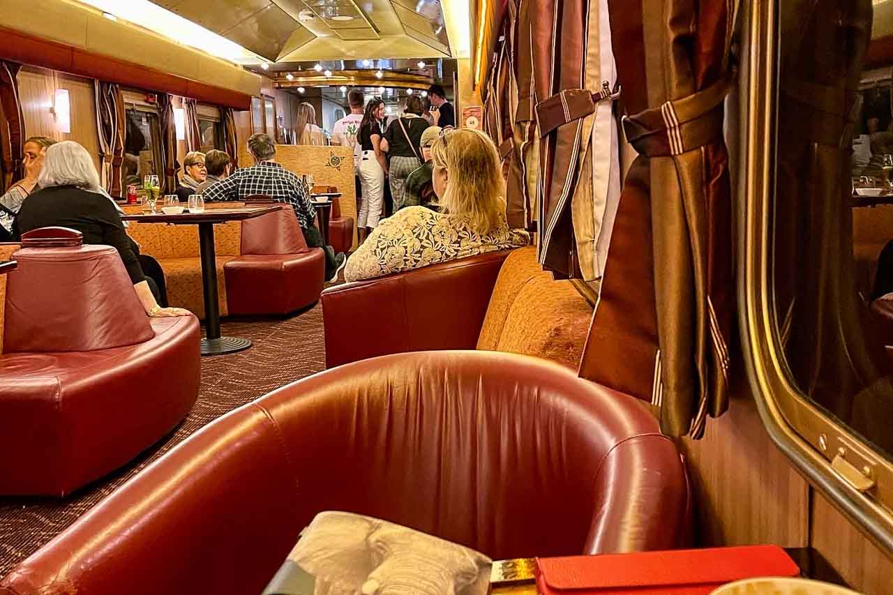
 

<insert MailChimp newsletter signup link>

You might also like 

A small, open boat cruises through a gorge with aqua water and towering cliffs.COBBOLD GORGE ADVENTURE: My Honest Review of the Official Guided Tour. Discover the beauty of Cobbold Gorge, a stunning natural wonder, in the heart of outback Queensland, Australia. I share my experience of the Cobbold Gorge tour and what made it special.


Several people swimming in the clear waters of a river surrounded by rainforest.COOL OFF IN TROPICAL PARADISE: 5 Top Swimming Holes Near Cairns. Northern Queensland’s rainforest conceals some of the most refreshing swimming spots in Australia, from crater lakes to cascading waterfalls and ancient gorges. Visit five incredible places on day trips from Cairns. Discover them all in this blog post.


A creek with paperbark tree and palms lining its banks.SAVANNAH WAY ROAD TRIP: Cool Off in 5 Crocodile-Free Swimming Holes. From Mataranka to Copperfield Gorge, explore five of the Savannah Way’s best, most crocodile-free swimming Holes. Includes safety checks and tour notes.


© Just Me Travel 2018-2025. All rights reserved.


2 Comments on UNDARA: SEE AMAZING LAVA TUBES AND STAY IN UNIQUE ACCOMMODATION

COOL OFF IN TROPICAL PARADISE: 5 Top Swimming Holes Near Cairns

A Traveller’s Guide to Wonderful Swimming Holes in Northern Queensland’s Rainforest.   Cairns may be best known as the gateway to the Great Barrier Reef, but venture inland and you’ll…

A Traveller’s Guide to Wonderful Swimming Holes in Northern Queensland’s Rainforest.


Cairns may be best known as the gateway to the Great Barrier Reef, but venture inland and you’ll discover another side of Tropical North Queensland – a lush world of rainforest, waterfalls, and natural swimming holes. With warm, humid weather all year round, there’s nothing more refreshing than plunging into a cool rainforest pool after a morning of exploring.

From volcanic crater lakes to postcard-perfect waterfalls, Tropical North Queensland is dotted with swimming holes that feel like hidden gems. The best part? Many of them are perfect for easy day trips from Cairns. 

During my four days in Cairns, I joined two tours to make the most of my rainforest swims. The Waterfall Wanderers Tour with Cairns Adventure Group took me to Lake Eacham, Millaa Millaa Falls, Josephine Falls, and Babinda Boulders – a full day of rainforest lakes and waterfalls. To round out the experience, I joined the Daintree, Mossman Gorge & Wildlife Tour with Tropic Wings Cairns Tours, which combined swimming at Mossman Gorge with a visit to a wildlife sanctuary and the chance to see one of the world’s oldest rainforests.


Why Swim in Tropical North Queensland’s Rainforest?

When most travellers think of Cairns, the Great Barrier Reef usually springs to mind. But venture inland and you’ll find another side of Tropical North Queensland – a lush, green landscape of waterfalls, crystal-clear creeks and rivers, and volcanic crater lakes tucked away in the rainforest. Here, swimming isn’t just about cooling off in the tropical heat; it’s about immersing oneself in nature at its most pristine.

Tropical North Queensland’s rainforest swimming holes are fed by clear mountain streams, shaded by towering trees, and teeming with wildlife – for the first time, I saw a platypus in its natural habitat. You won’t find chlorinated pools or crowded beaches here – instead, you’ll float beneath waterfalls, slide down smooth granite rocks, or wade into calm lakes formed thousands of years ago.

These waterholes also deepen our connection with the land. Some, like Babinda Boulders and Mossman Gorge, are important to Indigenous communities, reminding us to swim with respect and care. Safety remains crucial, as conditions can change rapidly in the tropics. Always follow local signs and advice.

Swimming in Queensland’s tropical rainforest is about more than just taking a dip – it’s an adventure that combines relaxation with the chance to connect with one of the most ancient landscapes on Earth.

The 5 Best Rainforest Swimming Holes Near Cairns

Tropical North Queensland’s rainforest is scattered with natural swimming holes, each offering its own appeal – from peaceful volcanic lakes to tumbling waterfalls and granite-edged gorges. Whether you’re after a refreshing swim, a chance to connect with nature, or that perfect photo spot, these five swimming holes near Cairns showcase some of the region’s top rainforest escapes.

Lake Eacham – A volcanic crater turned crystal-clear oasis

Lake Eacham’s calm, crystal-clear blue waters make it a tranquil, natural swimming spot.


Just over an hour’s drive from Cairns, Lake Eacham is part of Crater Lakes National Park and one of the Atherton Tablelands’ most inviting swimming holes. Formed more than 10,000 years ago by a volcanic eruption, this crater lake is now a tranquil pool of deep, clear blue water surrounded by dense rainforest.

The lake’s still surface makes it perfect for a refreshing swim or a leisurely float while soaking up the sounds of the rainforest. Unlike some of the region’s waterfalls, there are no strong currents here – just a peaceful, natural swimming hole to relax and take your time.

Facilities make it easy to enjoy a few hours at Lake Eacham. There’s a grassy picnic spot, toilets, and a shaded walking trail that goes around the lake. With water access points easy to reach, you can step straight in for a swim.

Lake Eacham feels miles from Cairns, but it’s close enough for a relaxed day trip. It’s a spot to unwind, take it easy, and swim in a lake formed by fire but cooled by the rainforest.

Don’t let the freshwater crocodile living in Lake Eacham deter you from swimming. Unlike saltwater crocodiles, freshwater crocodiles are usually shy and don’t threaten humans. However, this croc may become aggressive and cause injury if you threaten it.

Millaa Millaa Falls – Swim beneath Queensland’s most photographed waterfall

Several people swim in the pluge pool created by a waterfall.

Miller Millaa Falls is the most iconic waterfall in Queensland’s Atherton Tablelands and a popular swimming hole.


Millaa Millaa Falls is a state heritage-listed postcard-worthy waterfall on Queensland’s Atherton Tablelands. Featuring a stunning, curtain-like 18-metre cascade into a clear, natural pool, and surrounded by lush rainforest, Millaa Millaa Falls is famous for its picturesque beauty and is one of the most photographed waterfalls in Australia. The falls have been used as a backdrop for shampoo and beer ads and featured in the music video for Peter Andre’s “Mysterious Girl”.

The plunge pool at the base of the falls is safe and perfect for a swim. Step in and enjoy the refreshing water, or swim right up to the waterfall’s curtain for a revitalising shower.

Facilities at Millaa Millaa Falls include BBQs, picnic tables, shelters, toilets, and change rooms, making it an ideal stop for a day trip. The car park’s proximity to the falls ensures quick and easy access, allowing visitors to experience this natural wonder without having to walk far.

Josephine Falls – Slide into adventure at nature’s water playground

A multi-tierd waterfall, surrounded by rainforest, tumbles over massive granite boulders.

Josephine Falls is a picturesque, mult-level cascade waterfall in Far North Queensland.


Located in Wooroonooran National Park on Josephine Creek, Josephine Falls is the perfect spot for a mix of relaxation and fun. Fed by rainwater from Queensland’s highest peak, Mount Bartle Frere, this multi-tiered waterfall tumbles over massive granite boulders into emerald-green pools surrounded by tropical rainforest.

The lower swimming area is safe, with peaceful pools that are perfect for cooling off. However, the main draw for many visitors is the natural rock slide in the middle tier – a smooth granite slope where you can slide into the pool below. It’s nature’s waterslide, and it makes Josephine Falls one of the most exciting, adrenaline-pumping swimming spots in the region.

From Josephine Falls’ car park, the waterfalls, viewing decks, and swimming areas are accessed via a stunning 700-metre rainforest walk that is a bitumen-paved track and mostly uphill. The track is suitable for prams and wheelchairs.

A word of caution:

Conditions at Josephine Falls can be dangerous, particularly due to sudden flash floods at any time of year, slippery rocks, and submerged objects in the creek. For visitor safety, access to the top section of the falls is prohibited, as serious injuries and fatalities have occurred there. You must observe the signposted restricted access area.

At Josephine Falls, our Cairns Adventure Group tour guide provided a safety briefing before directing our access to the natural rock slide at the middle-tier waterfall.

Babinda Boulders – Sacred waters among giant granite boulders

A waterhole surrounded by rainforest.

A safe swimming spot at Babinda Boulders.


Babinda Boulders is a place of both natural beauty and deep cultural significance for the local Aboriginal people. Here, a clear mountain creek winds its way around massive granite boulders, forming natural swimming holes where you can swim in the shadow of rainforest-clad mountains.

The main swimming area is calm and safe, with sandy banks and shady picnic spots – perfect for a relaxed, refreshing dip. But beyond the designated swimming zones, the water flows through narrow chutes and powerful currents, especially around Devil’s Pool, making those areas off-limits.

Local signs and stories tell the Dreamtime legend of the site, reminding visitors of its spiritual significance to the Yidinjy people. Babinda Boulders is a popular swimming hole with a strong sense of place – a reminder to respect the landscape as much as we enjoy it.

A word of caution:

For the second time on this day trip, the Cairns Adventure Group tour guide gave a safety briefing, as Babinda Boulders is more dangerous than Josephine Falls. While it is generally safe to swim at the designated swimming holes, it is essential to be safety-conscious and avoid taking unnecessary risks. Twenty-nine people have died at Babinda Boulders after ignoring warning signs to stay clear of the fast-flowing water and slippery boulders at Devil’s Pool.

Mossman Gorge – A refreshing dip in the heart of the Daintree

People gather on the sandbank along a river, while others swim in the river, which is lined with green trees.

A sandy beach on the Mossman River – a pretty swimming spot in Mossman Gorge.


Mossman Gorge offers a rare chance to swim in clear waters, surrounded by the lush greenery of the World Heritage-listed Daintree Rainforest. This ancient rainforest, known for its incredible biodiversity and being one of the oldest ecosystems on Earth, provides a truly unforgettable spot for a refreshing dip. Just outside Port Douglas, this part of the Mossman River is renowned for its cool, clear waters flowing over smooth granite boulders beneath a lush green canopy.

Designated swimming spots along the river let you wade in safely and cool off while surrounded by the sounds of the rainforest. The water here is fresh and invigorating – a welcome relief on a hot, humid day.

Beyond swimming, Mossman Gorge holds deep cultural significance for the Kuku Yalanji people. Visitors arrive through Mossman Gorge Centre, where they can learn about Indigenous traditions or join a guided Dreamtime Walk. It’s a place where a simple swim connects you not only to nature but also to thousands of years of living culture.

Access to the gorge is via a shuttle bus from the Mossman Gorge Centre, with services departing every 15 minutes between 8.00 am and 4.45 pm. Tickets can be bought at the centre or online in advance. This shuttle system helps to protect the natural environment and manage visitor numbers, ensuring a safe and sustainable experience for all.

Practical Information – Planning Your Rainforest Swim

Before you dive into Tropical North Queensland’s rainforest swimming holes, a little planning will make your trip smoother and more enjoyable.

How to get there

You can visit all these swimming holes on day tours from Cairns, which is a convenient option if you prefer not to self-drive. Tours typically combine multiple experiences into a single itinerary, often including transportation, a guide, and sometimes lunch. If you like flexibility, self-driving gives you the freedom to spend as long as you like at each spot.

Distances from Cairns:

  • Lake Eacham = 67 kilometres
  • Millaa Millaa Falls = 101 kilometres
  • Josephine Falls car park = 75 kilometres
  • Babinda Boulders = 65 kilometres
  • Mossman Gorge Centre = 78 kilometres

Best time to go

The dry season (May to October) is the most comfortable time to visit, with warm days, lower humidity, and clear conditions for swimming. The wet season (November to April) brings heavy rain and stronger currents, which can make some spots unsafe, though the waterfalls are at their most dramatic.

Always check local conditions before swimming.

Essentials to bring

  • Swimmers and a towel
  • Hat
  • Sunscreen
  • Sturdy, reliable footwear
  • Drinking water
  • Insect repellent
  • Camera and waterproof phone case

Tour versus independent travel

Day tours are stress-free and great if you’re short on time, as everything is organised for you. Sadly, day tours can often feel rushed. However, with the two tours I took – “Waterfall Wanderers Tour” with Cairns Adventure Group and “Mossman Gorge, Daintree and Wildlife” with Tropic Wings Cairns Tour – the pace was relaxed and unhurried. Self-driving provides more freedom, but it requires careful planning and navigation. Either way, always respect signage, stay in designated swimming spots, and leave no trace behind.


Swimming in Tropical North Queensland’s rainforest isn’t just about cooling off – it’s about connecting with an ancient landscape that feels powerful and alive. Each swimming hole I visited had its own character: the calm serenity of Lake Eacham, the picture-perfect plunge at Millaa Millaa Falls, the playful rock slide at Josephine Falls, the sacred beauty of Babinda Boulders, and the crisp mountain waters of Mossman Gorge. 

If I had to choose a favourite, Josephine Falls captured my sense of adventure, while Mossman Gorge connected me with the world’s oldest rainforest. Whichever you visit, you’ll leave with memories of swims unlike anywhere else in the world. 

So pack your swimmers, respect the land and its cultural significance, and get ready to dive into the cool, clear waters of Tropical North Queensland’s rainforest – it’s an experience you won’t forget.


Disclaimer: This post contains no affiliate links. All views and opinions are my own and non-sponsored. All photos are my own and remain the copyright of Joanna Rath/Just Me Travel.

© Just Me Travel 2018-2025.


If you could add one more Queensland rainforest swimming hole to this list, where would it be?

I love hearing from you and look forward to reading and responding to your comments. Please join the conversation by leaving a comment below.


Like this post? Save it for later!

An image with two photos: people swimming in a river and people swimming in a waterfall's plunge pool.

An image with two photos: one of a woman cautiously walking across a waterfall's boulder and the other of people swimming in a river in the rainforest.


Author’s Note: Please check the latest travel restrictions before planning any trip and follow government advice.
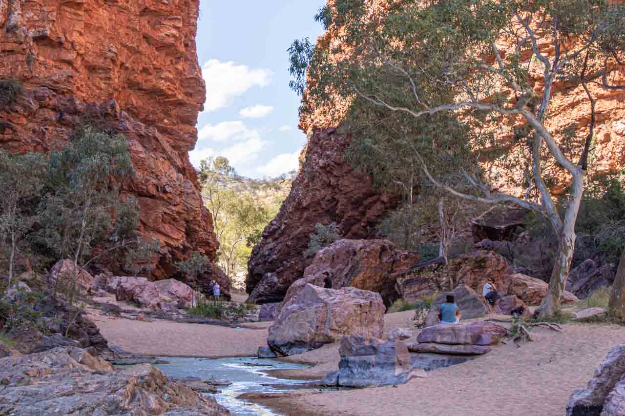
 

Sign up to receive the latest in travel destinations, topics, resources and guides.


You might also like

A small, open boat cruises through a gorge with aqua water and towering cliffs.COBBOLD GORGE ADVENTURE: My Honest Review of the Official Guided Tour. Discover the beauty of Cobbold Gorge, a stunning natural wonder, in the heart of outback Queensland, Australia. I share my experience of the Cobbold Gorge tour and what made it special.


Three red heritage train carriages, under shelter and used as accommodation.UNDARA: SEE AMAZING LAVA TUBES AND STAY IN UNIQUE ACCOMMODATION. Discover the ancient Undara Lava Tubes and sleep in a historic train carriage at Discover Resorts. Your guide to this unforgettable Outback Queensland adventure. Learn when to go, what to expect, and how to visit.


A creek with paperbark tree and palms lining its banks.SAVANNAH WAY ROAD TRIP: Cool Off in 5 Crocodile-Free Swimming Holes. From Mataranka to Copperfield Gorge, explore five of the Savannah Way’s best, mostly crocodile-free swimming holes. Includes safety checks and tour notes.


© Just Me Travel 2018-2025. All rights reserved.

No Comments on COOL OFF IN TROPICAL PARADISE: 5 Top Swimming Holes Near Cairns

COBBOLD GORGE ADVENTURE: My Honest Review of the Official Guided Tour

Is This Queensland’s Best Kept Secret? Discover the Beauty of Cobbold Gorge: a Hidden Gem on the Savannah Way.   Nestled in the heart of outback Queensland, Cobbold Gorge is…

Is This Queensland’s Best Kept Secret? Discover the Beauty of Cobbold Gorge: a Hidden Gem on the Savannah Way.


Nestled in the heart of outback Queensland, Cobbold Gorge is a stunning natural wonder that provides an immersive adventure into Australia’s rugged beauty. This ancient hidden gem in the heart of the Gulf Savannah region is one of the country’s youngest gorges. It features breathtaking sandstone formations, a tranquil waterway, and an unforgettable tour experience.

During my visit to Cobbold Gorge, I joined the three-hour official guided tour, including a scenic circular escarpment walk, an exhilarating glass bridge suspended over the gorge, and a peaceful cruise through the gorge’s serene waters on an electric boat. This unique experience provided a perfect blend of adventure and tranquillity, allowing me to appreciate the gorge from above and below, with each perspective unveiling something new and awe-inspiring.

In this post, I’ll share my experience of the Cobbold Gorge tour, my thoughts on what made it special, and essential practical tips to help you plan your own visit to this spectacular hidden gem in the Australian outback.


About Cobbold Gorge

Cobbold Gorge is located on a working cattle station, Robin Hood Station, 461 kilometres (about six hours) west of Cairns in Queensland’s remote Gulf Savannah region. The closest town is the historic gold mining town of Forsayth, about 45 kilometres away.

The gorge is part of a geologically ancient landscape slowly carved over millions of years by water erosion. Although this natural wonder is 135 million years old, Cobbold Gorge is Queensland’s youngest and narrowest gorge. Its narrow sandstone walls, some as close as two metres apart, make it one of the most unique gorges in Australia. Unlike larger, more open gorges, Cobbold Gorge offers an intimate, almost otherworldly experience, especially when seen from the water.

The area is culturally significant to the Ewamian people, the traditional owners of the land, who have inhabited this region for thousands of years.

The 3-Hour Cobbold Gorge Tour

The official guided tour is the only way to access Cobbold Gorge, as it is a protected nature refuge. This arrangement protects its fragile ecosystem while enabling visitors to fully appreciate its stunning beauty.

The well-organised three-hour guided tour, which included travel to and from the gorge, was split into two parts: an escarpment walk with the glass bridge crossing and a silent boat cruise through the gorge.

Escarpment walk to the top of the gorge

A creek flows through the Australian bush.

Cobbold Creek is the starting point for the guided walk up to the escarpment and over the gorge.


The adventure began with a 4WD bus ride from Cobbold Gorge Village to the gorge’s Interpretive Centre (bus shelter). From the Interpretive Centre, the dirt track to the top of the escarpment overlooking the gorge winds through weathered sandstone outcrops, rugged bushland, and panoramic viewpoints. We were told to look for wildlife, such as wallabies and goannas, but I didn’t see any.

While we walked, the guide shared intriguing insights about how the gorge was formed, how water sculpted the landscape, and pointed out fossils embedded in the rocks.

One of the tour’s highlights was the walk across Australia’s first entirely glass bridge at the highest point of the escarpment. The glass bridge spans the 11-metre gap between the gorge’s cliffs. It is made of 41-millimetre-thick glass, which I was assured was thick enough to prevent me from falling 17 metres into the water below. We had to wear blue booties over our shoes to prevent the glass from getting scratched.

View through the glass bridge to the water 17 metres below.


This transparent bridge, constructed in 2019, closed an inaccessible gap and provided extra viewing opportunities along the length of the gorge.

A glass bridge spans a gap between cliffs in a gorge.

Looking back at the glass bridge as we continued our walk over the gorge and down again.


I don’t fear heights, but I must admit that walking across the glass bridge sent adrenaline pumping through my body. I could hear my heart beating in my head!

The walking component of the tour was approximately 1.5 kilometres and took just over an hour to complete. While it was described as an easy to moderate walk, I wouldn’t recommend it for anyone who isn’t sure on their feet. The trail included narrow sections, loose shale, rocks, and ledges to navigate. To the guides’ credit, we were informed about the trail conditions before starting the walk, as it’s not possible to turn back once you commence. We had two people opt out of the walk, choosing to wait by the boats for the cruise component of the tour.

While we were assured the glass bridge is engineered to the highest standards and is perfectly safe, if having just a sheet of glass separating you from the gorge floor below is too much to handle, you might opt for the cruise only.

After soaking in the breathtaking views from the rocky escarpment, the tour descended the gorge through the bush for a completely different perspective – on the water itself.

Boat cruise through the gorge

Thanks to the electric-powered boats, the one-hour journey along Cobbold Gorge’s narrow waterway was peaceful, interrupted only by occasional birdsong, the splash of a fish, and the guide’s quiet storytelling.

Some sections of Cobbold Gorge were so narrow that, at times, I felt enclosed by the towering walls that almost blocked out the sky.

As the electric boat moved soundlessly, the tranquil atmosphere descended upon my mind, leaving me with an experience that would stay long after I left.

As we drifted through the cool, shaded passageways, the water reflected the sandstone walls, creating a mesmerising mirror effect that made me feel like I was floating through an enchanted gap in the earth.

The towering walls of Cobbold Gorge are reflected in the water as an electric boat vanishes into the narrowing passage.


Final Thoughts

Cobbold Gorge is one of those rare places that feels truly untouched. Whether standing high above the gorge, walking across a glass bridge, or floating silently through its waters, this tour offers a perfect blend of adventure, tranquillity, and two unique perspectives.

I only regret missing out on the scenic helicopter flight over the gorge for that third perspective. As a solo traveller, I could have been paired with other travellers. However, flights have a maximum of three passengers and are subject to strict weight limits per flight. As much as the Cobbold Gorge staff tried, the passenger-to-weight ratio didn’t work in my favour during my short stay. Bookings are essential!

Cobbold Gorge is a must-visit if you love off-the-beaten-path destinations, stunning landscapes, and unique experiences. It may be remote, but the reward is a hidden paradise that will be etched in your memory forever.

What You Need to Know

  • Cobbold Gorge is only open from 1 April to 31 October during the dry season.
  • You can only visit Cobbold Gorge on an official guided tour; bookings are essential. You will need comfortable, covered walking shoes, a hat, sunscreen, water, and a camera.
  • The most common way to reach Cobbold Gorge is by self-driving, a six-hour drive from Cairns. If you are comfortable driving on dirt roads, you should not be limited by the vehicle you drive or tow. However, if you hire a car to drive to Cobbold Gorge, you must check their policy regarding driving on dirt roads.
  • I arrived in Cobbold Gorge on APT’s 12-day Savannah Explorer tour from Darwin to Cairns. Some tour companies offer multi-day trips from Cairns, including a stay at Cobbold Gorge and the official guided tour.
  • Accommodation is available at Cobbold Gorge Village, which offers ensuite cabins, motel-style rooms, and camping and caravaning sites (powered and unpowered). The village has a licensed bar, bistro, and store to purchase souvenirs, gifts, and basic grocery items. Our tour group stayed two nights in the “Rouseabout” rooms. My room was comfortable with everything I needed for my stay, including air conditioning, a TV, a bar fridge, and tea and coffee-making facilities. I enjoyed sitting on the balcony of an evening watching the sun slide behind the Australian bush. My only criticism was the tiny ensuite bathroom, so small I had to dry myself in the room’s foyer.


When I left Cobbold Gorge, I felt a deep sense of awe and a renewed appreciation for the raw beauty of the Australian outback. The guided tour was a comprehensive and memorable experience, allowing me to fully appreciate this hidden gem’s unique features. Cobbold Gorge is a must-visit destination for an adventure combining stunning landscapes with insightful commentary. I hope my experience encourages you to discover this remarkable natural wonder for yourself.

Be sure to put Cobbold Gorge on your itinerary; you won’t be disappointed!


Disclaimer: This post contains no affiliate links. All views and opinions are my own and non-sponsored. All photos are my own and remain the copyright of Joanna Rath/Just Me Travel.

© Just Me Travel 2018-2025.


If travelling through Queensland, would you include Cobbold Gorge on your travel itinerary, or would its remoteness deter you?

I love hearing from you and look forward to reading and responding to your comments. Please join the conversation by leaving a comment below.


Like this post? Save it for later!

An image with two photos, one of a water-filled narrow gorge, and the other of a creek flowing through the Australian bush.

An image with two photos, on e of a section of a glass bridge and looking down to the water below and the other being on the water in the gorge and looking up at the glass bridge.


Author’s Note: Please check the latest travel restrictions before planning any trip and follow government advice.


Sign up to receive the latest in travel destinations, topics, resources and guides.


You might also like

Several people swimming in the clear waters of a river surrounded by rainforest.COOL OFF IN TROPICAL PARADISE: 5 Top Swimming Holes Near Cairns. Northern Queensland’s rainforest conceals some of the most refreshing swimming spots in Australia, from crater lakes to cascading waterfalls and ancient gorges. I visited five incredible places on day trips from Cairns, and each was unforgettable. Discover them all in this blog post.


Three red heritage train carriages, under shelter and used as accommodation.UNDARA: SEE AMAZING LAVA TUBES AND STAY IN UNIQUE ACCOMMODATION. Discover the ancient Undara Lava Tubes and sleep in a historic train carriage at Discovery Resorts. Your guide to this unforgettable Outback Queensland adventure. Learn when to go, what to expect, and how to visit.


A creek with paperbark tree and palms lining its banks.SAVANNAH WAY ROAD TRIP: Cool Off in 5 Crocodile-Free Swimming Holes. From Mataranka to Copperfield Gorge, explore five of the Savannah Way’s best, most crocodile-free swimming holes. Includes safety checks and tour notes.


© Just Me Travel 2018-2025. All rights reserved.

4 Comments on COBBOLD GORGE ADVENTURE: My Honest Review of the Official Guided Tour

LITCHFIELD NATIONAL PARK – See 3 Stunning Waterfalls on a Day Tour From Darwin

Breathtaking Waterfalls, Idyllic Plunge Pools, Iconic Magnetic Termite Mounds, and the Australian bush, Litchfield National Park Will Not Disappoint.   Litchfield National Park is one of the Northern Territory’s best-kept…

Breathtaking Waterfalls, Idyllic Plunge Pools, Iconic Magnetic Termite Mounds, and the Australian bush, Litchfield National Park Will Not Disappoint.


Litchfield National Park is one of the Northern Territory’s best-kept secrets and a must-see in Australia’s ‘Top End’. Home to spectacular waterfalls that plunge into crystal clear pools perfect for a swim and iconic magnetic termite mounds unique to northern Australia, visiting Litchfield National Park on a day tour at the end of 2022 was the highlight of my six days in Darwin. 

Read on to learn why Litchfield is my new favourite national park and why I recommend the day tour I did with AAT Kings. Hint: I love waterfalls, landscapes, the bush, and the unusual.


About Litchfield National Park

Litchfield National Park in the Northern Territory (Australia) is near the town of Batchelor, about 100 kilometres southwest of Darwin. The Park was named after Frederick Henry Litchfield, a Territory pioneer who explored areas of the Northern Territory in 1864. Litchfield National Park covers an area of approximately 1,500 square kilometres and was proclaimed a national park in 1986.

Litchfield National Park is an ancient landscape carved by water and is home to 15 waterfalls. The falls flow year-round but are particularly spectacular in the wet and early dry seasons.

As well as an abundance of waterfalls, Litchfield National Park is famous for its magnetic termite mounds and found only in Australia’s Northern Territory.

The Marranuggu, Koongurrukun, Werat, and Warray Aboriginal people consider Litchfield National Park an important cultural site.

A day tour from Darwin

I explored Litchfield National Park with AAT Kings on their Litchfield National Park Waterfalls day tour from Darwin.

I am drawn to waterfalls and the stunning landscapes in which they are located. Any tour that takes me to waterfalls will always grab my attention. So, with AAT Kings advertising a day tour visiting three waterfalls, I quickly grabbed my place.

The three waterfalls included in the tour were Florence Falls, Tolmer Falls, and Wangi Falls. As a bonus, we also saw the unusual magnetic termite mounds.

On a day tour, three waterfalls were an ideal number to visit as it allowed for a leisurely pace to see and swim at the falls. AAT Kings’ Litchfield National Park Waterfalls tour was well-planned, well-timed, and well-executed.

Florence Falls

A segmented waterfall (dividing into two branches) flows over rocks before plunging into the pool below.

Florence Falls photographed from the viewing platform.


Florence Falls was my favourite of the three waterfalls we visited. It is a cascade waterfall that becomes segmented before it plunges over the cliff into a crystal-clear plunge pool perfect for a swim and set in a pocket of monsoon forest (a tropical dry forest).

Take the 3-minute walk from the car park to the viewing platform to see Florence Falls in all its splendour.

From the viewing platform, take the 170 steps (135 steel steps, with the rest being stone steps) down to the picturesque plunge pool, where a swim is a must. Here Florence Falls plunges into the pool from a height of about 15 metres before the creek continues over rocks and through the ancient landscape.

Florence Falls in Litchfield National Park. The waterfall with two streams plunges into the pool below.

Florence Falls drops into the plunge pool.


A swimmer wearing a hat swims in a plunge pool up to the waterfall at Florence Falls.

Florence Falls Plunge Pool


I was pleasantly surprised by the pool’s water temperature. Coming from a town that sits on a river that originates in the Snowy Mountains, I expected the water to be freezing. However, the water was warm, but not so warm that you didn’t feel refreshed from a swim in the pool.

I recommend you walk down the steps to the plunge pool at the bottom of Florence Falls and take the Shady Creek Walk back up to the car park.

Shady Creek Walk

The image shows a pathway through a tropical dry forest in Australia's Northern Territory.

Shady Creek Walk meanders through Monsoon Forest


From the plunge pool at the bottom of Florence Falls, walk back to the car park via Shady Creek Walk – a Grade 3 (moderate) walk of one kilometre one way. The well-defined path meanders through the monsoon forest at a steady incline. There are some rock steps to negotiate, which are not particularly challenging and at various points along the way, the path crosses Shady Creek.

A creek flows over rocks through a tropical dry forest

Shady Creek Walk crosses Shady Creek at various points.


A small plunge pool on Shady Creek is 50 metres from the car park. Take a final welcome dip before getting back on the bus.

Tolmer Falls

A narrow waterfall drops over the escarpment into a pool below.

Tolmer Falls


Tolmer Falls is an impressive plunge waterfall with two drops at a total height of about 40 metres into the pool below. Swimming is prohibited at Tolmer Falls.

It is a 400-metre walk on a steep, sealed path from Tolmer Falls car park to the viewing platforms. The first platform provides magnificent views over the gorge, while the lower platform is the one you want for the best view of Tolmer Falls.

A creek splashes over rocks making mini waterfalls and then plunges over the cliff.

The top section of Tolmer Falls


The final drop of a waterfall as it crashes into the plunge pool.

Tolmer Falls crashes into the pool below.

Wangi Falls

Two waterfalls cascade down a cliff before dropping into a pool.

Wangi Falls


Wangi Falls is a segmented waterfall with a drop of about 50 metres. It is the most popular in Litchfield National Park as its large plunge pool is the most accessible.

Walking 125 metres along an easy, flat path will take you to the viewing platform, where the falls and plunge pool create a stunning panorama.

There was no swimming for us at Wangi Falls as it had been closed for the season for safety reasons after recent rains. The water had risen over the rocks that form a natural barrier against saltwater crocodiles entering the plunge pool. As such, the Park Rangers could not guarantee there were no crocs in the pool. Therefore, they closed the falls. Good Plan!

Two waterfalls cascade down a rock face before dropping into a large plunge pool.

The large plunge pool at Wangi Falls


Our included lunch at Wangi Falls Café consisted of cold meats and salads, with fresh fruit to follow.

Magnetic termite mounds

Termite mounds are found throughout Australia, but magnetic termite mounds are found only in the Northern Territory. And Litchfield National Park has a most impressive sight of hundreds of magnetic termite mounds standing up to two metres high on a vast flat plain. They look like tombstones spread over a large cemetery, all facing in the same direction.

A flat plain with hundred of magnetic termite mounds that look like tombstones.

Tombstone-like magnetic termite mounds


Around 100 years old, these peculiar mounds are mysteriously aligned to the earth’s magnetic field. Their thin edges point north-south, and their broad backs face east-west. Thereby, according to current theory, magnetic termites keep their homes comfortable.

“Northern Australia gets extremely hot during the day and cool at night, and researchers believe termites have somehow harnessed the power of the earth’s magnetism to strategically climate-control their homes.”

https://www.amusingplanet.com/2014/01/magnetic-termite-mounds.html

An accessible boardwalk skirts the plain of magnetic termite mounds, giving uninterrupted views.

When to visit

The northern part of the Territory, including Darwin and Litchfield National Park, has a tropical monsoonal climate with two seasons – a dry season and a wet season.

The dry season runs from May to October, with sunny days and cool evenings. The humidity is low, and the average daily temperature is around 32 degrees Celsius.

The wet season runs from November to April. It is a time of spectacular thunderstorms and cyclones. The humidity can rise as high as 98%, and the average daily temperature inland can hover around 39 degrees Celsius. However, balmy evenings provide some relief.

I visited Darwin in late October, at the very end of the Top End’s dry season. As the photos attest, the waterfalls were still flowing strongly.


Litchfield National Park is best known for its waterfalls, and a day tour must be on any traveller’s itinerary to the Top End. This is where I recommend AAT Kings’ Litchfield National Parks Waterfalls day tour from Darwin. Their tour was well-organised and conducted at a leisurely, relaxed pace. For once, on an escorted tour, I didn’t find myself rushed to take my photos. However, the tour has whet my appetite to see more of what Litchfield National Park has to offer. After all, I still have 12 waterfalls to explore!


Disclaimer: This post contains no affiliate links. All views and opinions are my own and non-sponsored. All photos are my own and remain the copyright of Just Me Travel.

© Just Me Travel 2018-2023.


While Wangi Falls is the most popular attraction in Litchfield National Park, Florence Falls was my favourite of the three waterfalls the tour included. If you could only visit one of the waterfalls I have described and shown in this post, which would it be? Leave a comment.


Like this post? Save it for later!

An image with two photos: a segmented waterfall (two branches) dropping into a plunge pool and a swimmer in the plunge pool.

The image shows two photos: a waterfalls dropping into a plunge pool and a flat plain of termite mounds that look like tombstones.


Are you looking for more waterfall destinations in Australia? Then don’t miss these posts:

SEE 3 OF THE BEST WATERFALLS IN THE SOUTHERN HIGHLANDS, NEW SOUTH WALES

9 BEAUTIFUL BLUE MOUNTAINS WATERFALLS + PHOTOS


Author’s Note: Please check the latest travel restrictions before planning any trip and follow government advice.

 

Sign up to receive the latest in travel destinations, topics, resources and guides.


No Comments on LITCHFIELD NATIONAL PARK – See 3 Stunning Waterfalls on a Day Tour From Darwin

Type on the field below and hit Enter/Return to search