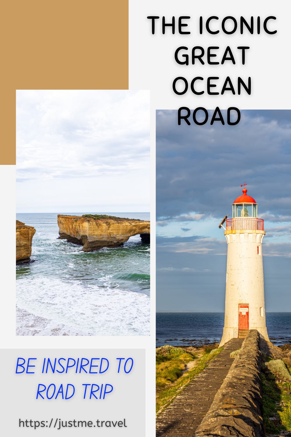
Experience One of Australia’s Most Iconic Road Trips Driving Victoria’s Great Ocean Road. The Great Ocean Road is Australia’s most famous coastal drive and one of the best road…
Experience One of Australia’s Most Iconic Road Trips Driving Victoria’s Great Ocean Road.
The Great Ocean Road is Australia’s most famous coastal drive and one of the best road trips in the world. Famed for its stunning scenery, what better way to show you the natural phenomena, incredible wild views, and beauty of the Great Ocean Road than through the photographs I took on a photo tour road trip. Enjoy!
Victoria’s Great Ocean Road was placed on the Australian National Heritage list in April 2011 as a place of outstanding national heritage significance. The 242-kilometre Great Ocean Road follows the stunning coastline of Victoria’s southwest from Torquay to Allansford. The road winds along clifftops beside breathtaking headlands, down onto the edge of beaches, across river estuaries and through rainforests, offering ever-changing diverse landscapes and views of Bass Strait and the Southern Ocean.
The Great Ocean Road was built by returned soldiers between 1919 and 1932 and dedicated to soldiers killed during World War l. The road is the world’s largest war memorial.
To take a road trip along the Great Ocean Road is a drive I have wanted to do for many years, but something always got in the way. So, when I came across the Great Ocean Road Photo Tour with Mark Gray Photography, I could think of no better way to combine my desire to drive the Great Ocean Road and my passion for travel photography.
As a keen amateur photographer, I often seek out photography tours around the world. I firmly believe I can never stop learning and what better way to learn and master landscape photography than out of the classroom with a professional photographer by your side guiding you along the way.
Mark Gray Photography’s tours are suitable for amateur to semi-professional photographers and are limited to 6-8 participants, ensuring everyone gets plenty of individual tuition at each location from the accompanying professional and experienced photographer. The Great Ocean Road Photo Tour locations, accommodation, and meals were well researched by Mark Gray Photography, with appropriate scheduling across the five days.
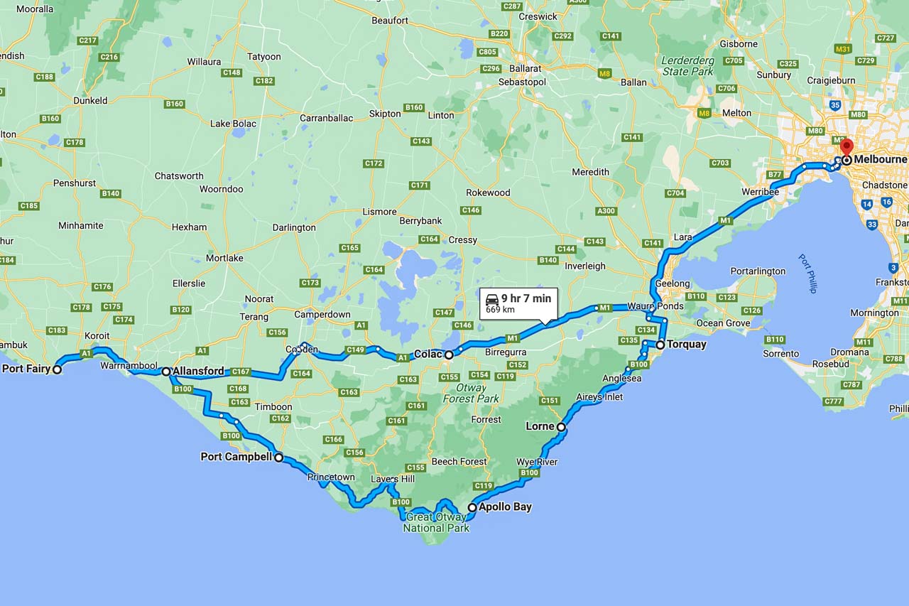
Great Ocean Road Photo Tour route
Great Ocean Road photo tour route from Melbourne return (Google Maps)
The pickup point for our Great Ocean Road Photo Tour was in Melbourne outside St Paul’s Cathedral, near Flinders Street Railway Station.
Our route over the five days took us along the Great Ocean Road through the Victorian towns of Geelong, Torquay (the start of the Great Ocean Road), Anglesea, Lorne, Apollo Bay, Port Campbell, Allansford (the end of the Great Ocean Road), Warnambool, and on to Port Fairy (our final stop). The return trip to Melbourne from Port Fair on day five, after a sunrise shoot, breakfast, and photo critiquing session, was via Colac, where we stopped for lunch.
The photos below are shown in the order in which they were seen and taken, giving a visual journey along the spectacular Great Ocean Road.
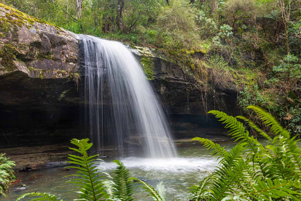
Lower Kalimna Falls, Great Otway National Park
Leaving from Sheoak Picnic Area near Lorne in the Great Otway National Park, the six-kilometre return walking track to Lower Kalimna Falls through the creek valley follows the old trolley way used many years ago for hauling timber to Lorne.
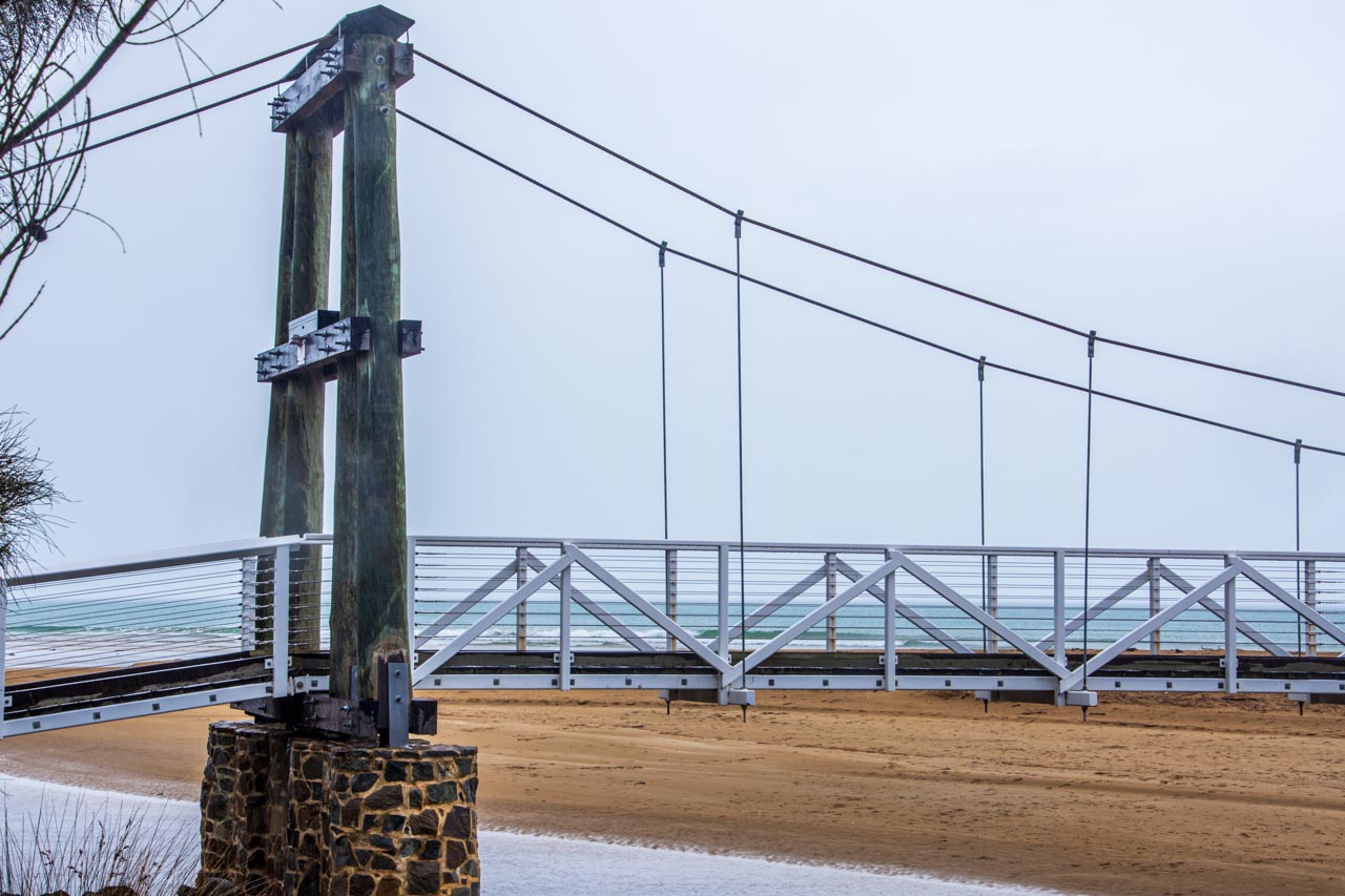
Lorne Suspension Bridge
The Lorne Suspension Bridge is a timber footbridge over the Erskine River near its mouth. An iconic landmark of Lorne, the bridge was completed in 1937.
Redwoods of the Otway Ranges
Beech Forest in the Great Otway National Park is home to a thriving small, sheltered grove of Coastal Redwoods – the world’s tallest tree species. Towering on the river flat at Aire Valley Plantation, these redwoods were planted in 1936 by Victorian foresters for experimental purposes. They were never cut down, and although still in their infancy growth phase, they now stand about 60 metres high. Even though ‘babies’, their height as they reach for the sky still left me in awe of the sight.
It was very peaceful walking through the grove as I listened to the rippling of the water from the river flowing beside the grove of redwoods.
There is a picnic area across the road from the redwoods.
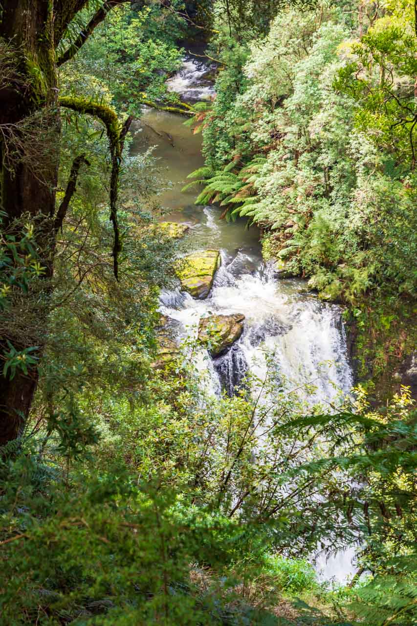
Hopetoun Falls, Great Otway National Park
Deemed by some as the most beautiful waterfall in Victoria, Hopetoun Falls in Beech Forest plummets 30 metres into the Aire River. Take in the view from the upper platform or descend around 200 stairs to the bottom of the falls.
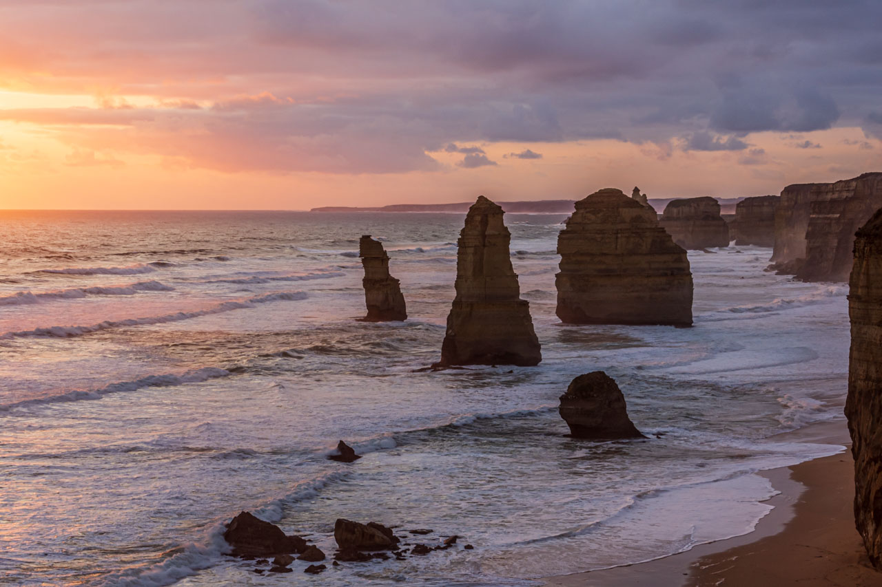
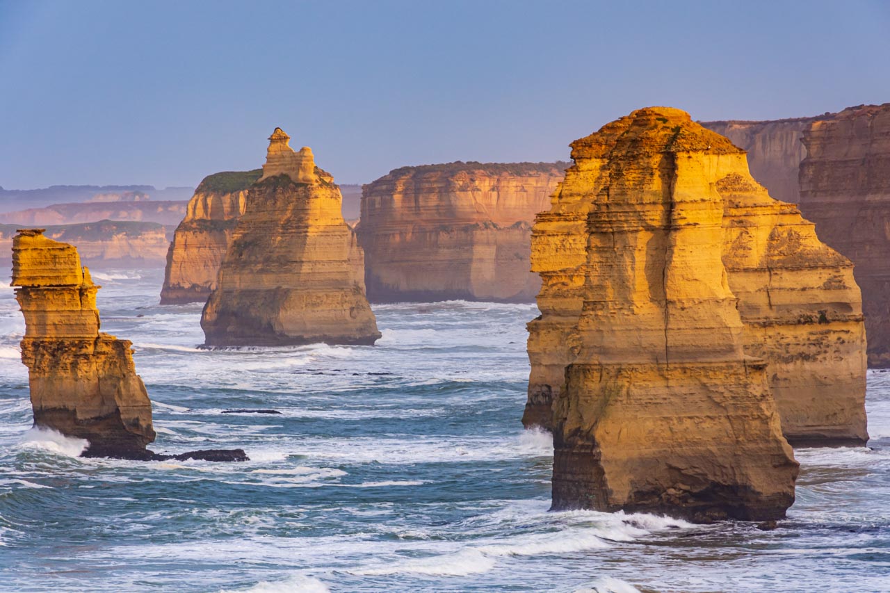
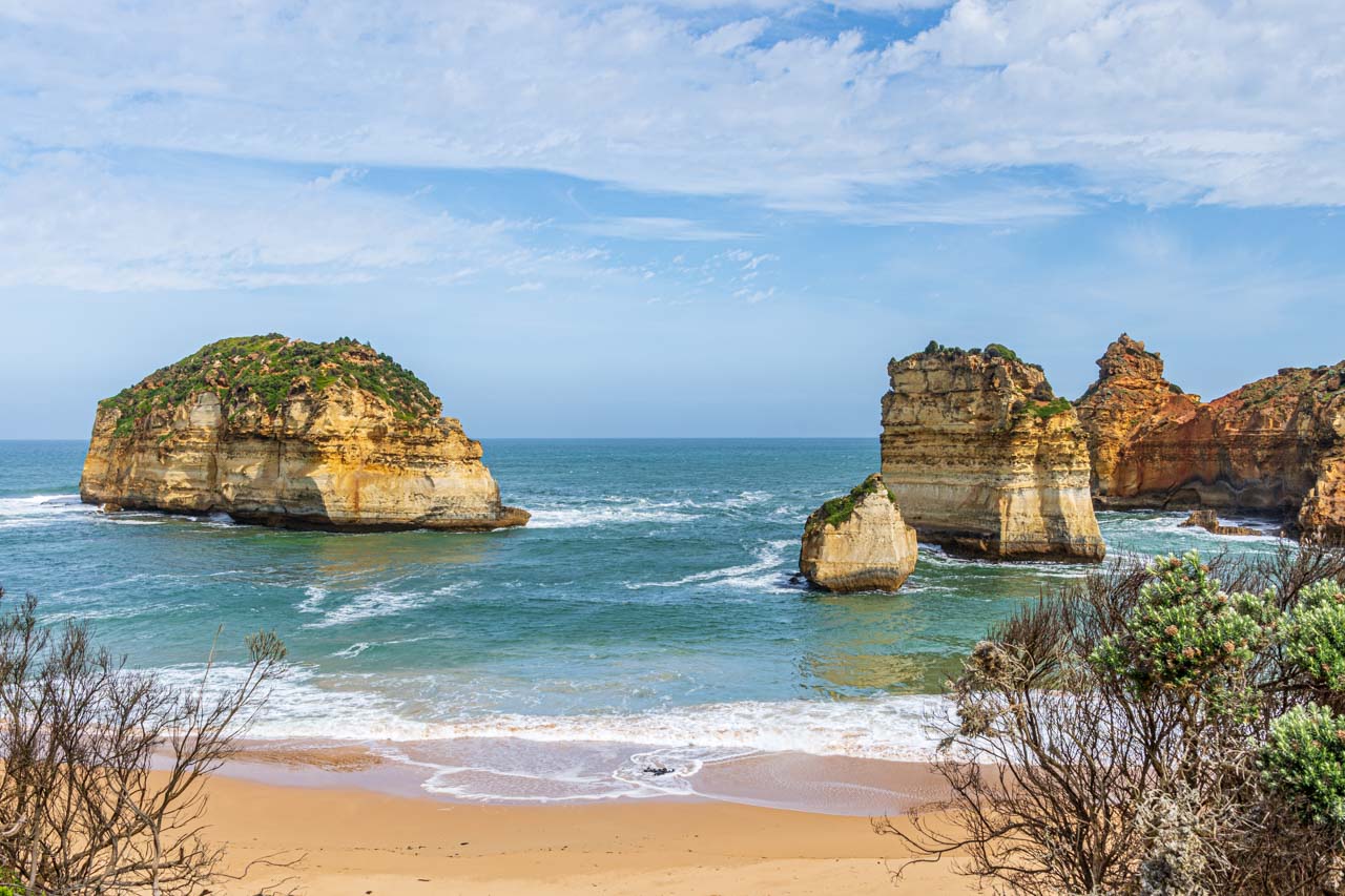
The Twelve Apostles, Port Campbell National Park
The setting sun turns the ocean pink at the Twelve Apostles
The rising sun is reflected on the limestone stacks of the Twelve Apostles
The Twelve Apostles is one of Australia’s iconic landmarks and the most photographed along the Great Ocean Road.
The Twelve Apostles is a collection of limestone stacks off the shore of Port Campbell National Park, formed by erosion over millions of years. The harsh and extreme weather conditions from the Southern Ocean along Victoria’s coast gradually erode the soft limestone to form caves in the cliffs, which become arches that eventually collapse, leaving rock stacks. Just as the winds and rough waves create the stacks, they also destroy them.
Despite the name, there were never twelve rock stacks, only ever nine. The nine became seven (according to Parks Victoria) after one collapsed in 2005 and another in 2009.
The Twelve Apostles was originally known as Sow and Pigs, with Muttonbird Island being the sow and the stacks being the pigs. The name change was solely due to marketing purposes, as the ‘Twelve Apostles’ had a better ring to it.
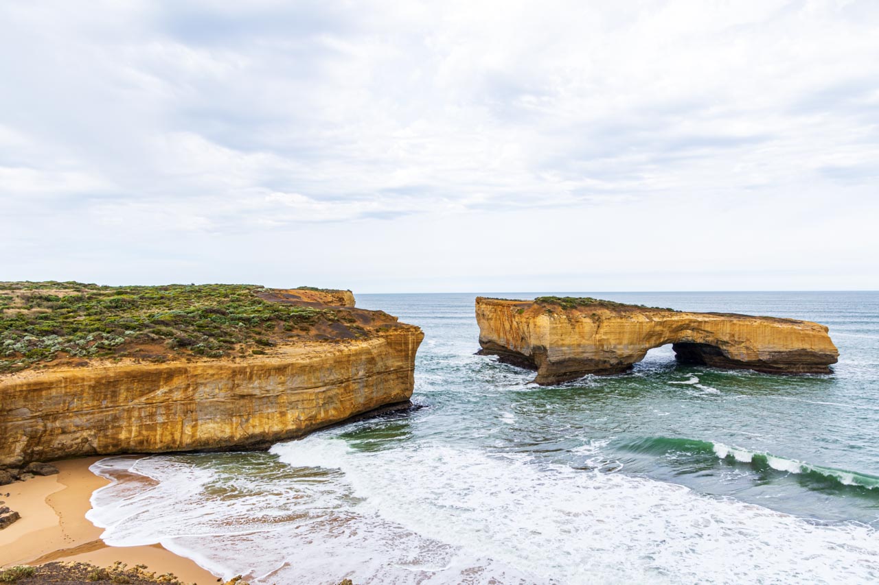
London Bridge, Port Campbell National Park
The arch of London Bridge was once connected to the mainland by a natural span that people could walk across, hence the name. The span collapsed on 15th January 1990, disconnecting the arch from the mainland forever. At the time of the collapse, two tourists were stranded on top of the arch and had to be rescued by helicopter. No one was injured in the event.
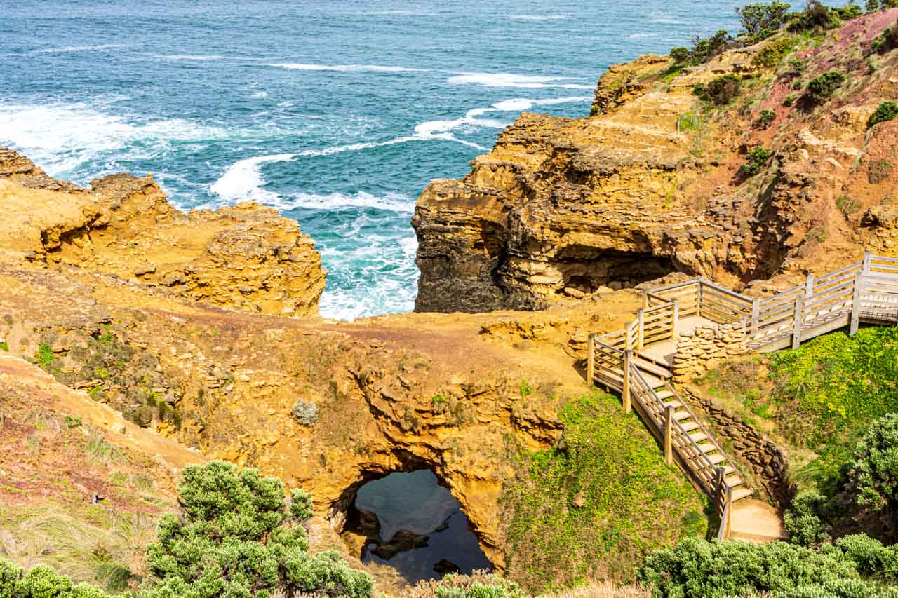
The Grotto, Port Campbell National Park
The Grotto, nine kilometres west of Port Campbell, is a cave, sinkhole, and archway all in one. The Grotto is a natural phenomenon formed over millions of years of crashing waves and high winds eroding the rocks, resulting in a caved sinkhole within the limestone cliffs.
You can reach the bottom via a wooden staircase that winds down the cliff face from the viewing platform at the top.
Sandy Cove, Bay of Islands Coastal Park
Characterised by offshore limestone rock stacks, Sandy Cove is a hidden gem along the Great Ocean Road.
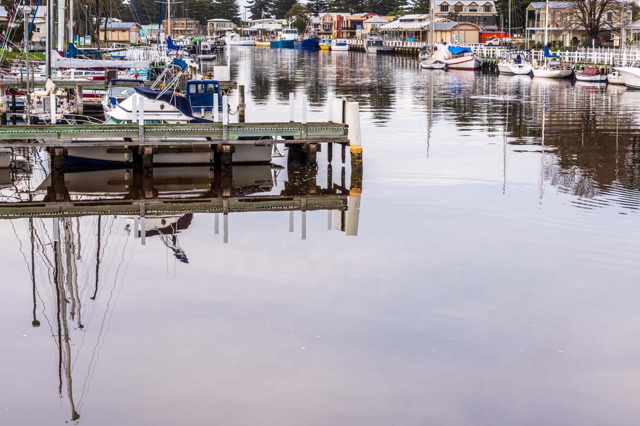
Moyne River boat moorings, Port Fairy
Port Fairy is a historic fishing town located on the Moyne River.
Griffith Island Lighthouse, Port Fairy
Sunset shoot of Griffith Island lighthouse
Griffith Island Lighthouse is situated at the end of a 400-metre walk along the causeway from Martin’s Point in the historic town of Port Fairy. It was built in 1859 and saw the last lighthouse keeper in the 1950s when the light, visible over 19 kilometres out to sea, was automated. The lighthouse is still fully operational, guiding ships into the Moyne River.
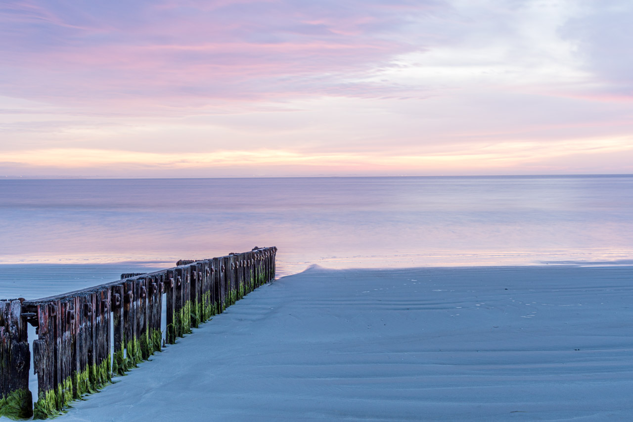
Port Fairy groynes
Sunrise shoot of the timber groynes at East Beach, Port Fairy
Groynes are structures (usually made of wood, concrete, or stone) built out into the sea from a beach to control erosion and drifting. Port Fairy’s groynes were placed at the southern end of the East Beach to stabilise the sand that had been eroding.
Tip: Fingerless gloves would be a good investment for sunrise shoots.
Where we stayed
I recommend the accommodation chosen by Mark Gray Photography on our Great Ocean Road Photo Tour.
On our five days / four nights trip, we stayed one night in Apollo Bay, two nights in Port Campbell, and one night in Port Fairy.
Seafarers Getaway, Apollo Bay, is situated opposite a private beach with all accommodation offering uninterrupted beach and coastal views. I had a well-equipped Beach Studio Unit with a furnished front deck and spectacular views of the breaking waves on the sand. The only downsides were six wall pegs in place of a wardrobe – okay for one night but would be annoying if staying longer – and the rug-less tile floors, which are great in summer but cold on the feet in winter.
Southern Ocean Villas, Port Campbell, is luxury accommodation on the edge of Port Campbell National Park and only a five-minute drive to the Twelve Apostles. Each villa is fully self-contained with two or three bedrooms, an open-plan kitchen and lounge/dining area, laundry, and an outdoor deck with table and chairs. While the bedrooms were dark (not an issue), the living area was light and airy.
Victoria Apartments, Port Fairy, is in the heart of the township of Port Fairy. I stayed in a one-bedroom suite, but other accommodation types are available. The suite’s living area was open planned, but the kitchenette was tiny. However, its winning features were a separate bedroom and a private courtyard. The accommodation was small and a bit cramped but adequate for a short stay for one person.
The 5-day Great Ocean Road Photo Tour with Mark Gray Photography was not a holiday but a dedicated photography workshop and is advertised as such. Our days were long and busy, often starting at sunrise, with little time to relax. But it was a unique way to visit the Great Ocean Road’s fantastic attractions and certainly met my long-term desire to ‘see’ the Great Ocean Road. Furthermore, I learned so much about my camera and landscape photography and came away with photos I am proud of.
You don’t have to be a photographer to appreciate the spectacular scenery and landscapes that the Great Ocean Road offers up at every turn. Take your time to discover and explore this most iconic Australian road trip along Victoria’s rugged southern coastline.
Disclaimer: This post contains no affiliate links. All views and opinions are my own and non-sponsored. All photos are my own and remain the copyright of Just Me Travel.
Melbourne’s Best High Tea On The River. High tea is always a special event. Combine that with a river cruise past Melbourne’s skyline, and you have something unique and…
Melbourne’s Best High Tea On The River.
High tea is always a special event. Combine that with a river cruise past Melbourne’s skyline, and you have something unique and truly memorable. Read on to learn where, how, and what you can experience high tea on the Yarra River.
I love having high tea and have indulged in a few worldwide. It always makes me feel pampered.
I love river cruises and find them incredibly relaxing. Having been on 15 cruises, I admit I am addicted to river cruises.
Bring the two together and I have an experience made in heaven.
What is high tea?
As offered by luxury hotels worldwide, high tea is, historically and traditionally, afternoon tea.
If we are going to be correct, what we call high tea – finger sandwiches, savoury and sweet pastries, cakes, and scones with jam and cream – is afternoon tea which became a tradition among the British upper class in the mid-19th century. It was a social event of a light meal of bite-sized food and never meant to replace dinner. Whereas, historically, high tea was a working-class evening meal consisting of hearty dishes of meat and vegetables served at the end of the working day.
Why do we call it high tea? Because it sounds fancier and means luxury hotels and the like that offer high tea can attract tourists.
Whether called high tea or afternoon tea, it’s all the same to me, and I will continue to seek it out wherever I travel. It’s the socialisation and food itself I seek, not the name.
A special occasion
The second Sunday in May is Mother’s Day in Australia. What better way to celebrate Mother’s Day than to spend it with my daughter? Her choice of celebration in 2019 showed just how well she knows me. My Mother’s Day treat that year was a high tea river cruise on Melbourne’s Yarra River.
Magic Charters in Melbourne operates the high tea cruise on the Yarra River. The two-hour cruise sails from Victoria Harbour, Docklands to Williamstown, Hobson Bay (return) on selected Sundays from 2.00 pm to 4.00 pm throughout the year. Check their website for details and available dates.
Boarding was done incredibly efficiently by the crew. At the gangway, we gave our booking name, were given a table number, and off we went. Our table was upstairs, and while the boat holds up to 130 people, we were not crowded, with plenty of space between tables. I had held concerns that we might be required to share a table with strangers, and I did not want to do this as I just wanted to spend the time exclusively with my daughter. But tables were set for two, three and four people, with larger groups also accommodated.
High tea was catered for inside the boat, allowing for all weather conditions. However, floor to ceiling glass walls provided uninterrupted views as we sailed the Yarra River. There was also the option to venture outside on one of the three decks.
The tables were set with white linen tablecloths and napkins, ceramic crockery, water and glasses, silver cutlery, and finished with a red rose. It all felt very posh and added to my feeling of being pampered.
Our high tea was a relaxed experience, and the crew were efficient, friendly, and attentive. We even had the option to help the captain sail the boat – a spacious catamaran.
The serving of food was well-paced throughout the cruise. Magic Charters were not stingy over the amount of food, and all that was provided was delicious.
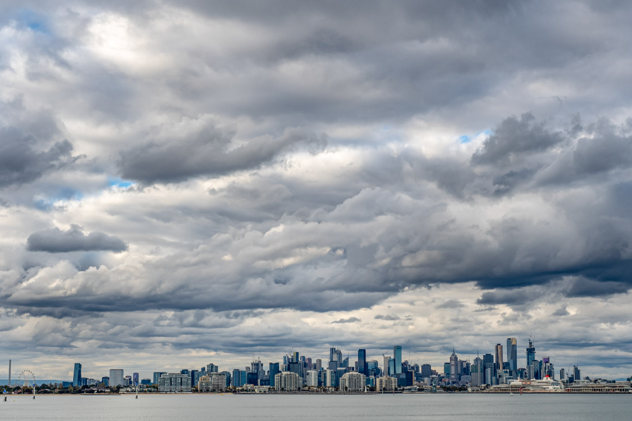
Leaving Victoria Harbour, you cruise under Bolte Bridge and historic West Gate Bridge, passing Melbourne’s industrial area before arriving at riverside parkland and fabulous views of Melbourne’s city skyline.
Melbourne city skyline from the Yarra River under a moody sky
High tea menu
As soon as we were seated, we were offered sparkling white wine, which flowed throughout the cruise. Orange juice was an available alternative.
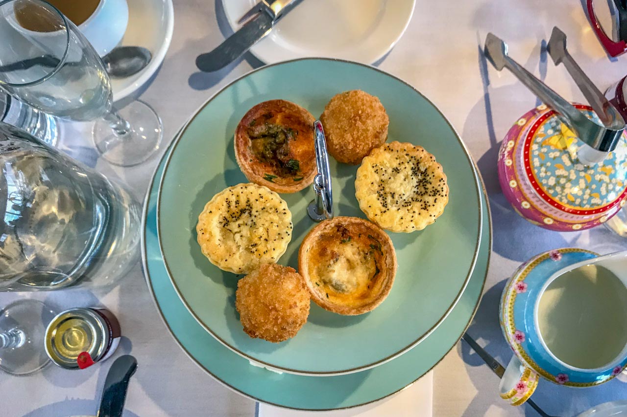
Tiered plates of hot and cold savouries were the first foods to appear on our table, consisting of finger sandwiches, rolls, pies, tarts and arancini balls.
The savoury menu was followed by tiered plates filled with warm scones, jam, and cream (plenty of cream) on the lower tier and various deserts on the top plated level. Deserts included tubs of panna cotta with raspberries, macaroons, chocolate brownies and cupcakes.
High tea savoury menu (May 2019)
High tea sweet menu (May 2019)
Tea and coffee were on offer continuously throughout the cruise.
Magic Charters can cater to some special dietary requirements, such as gluten-free and dairy-free. It is essential to advise them of your special dietary requirements when booking.
A note on cost
Magic Charters’ two-hour high tea cruise costs $118.00 per adult. However, booking Magic Charters’ high tea cruise, High Tea On The Sea, directly through their website reduces the price to $79.00 per adult, offering value for money.
Should you have a Sunday afternoon free in Melbourne, I recommend adding the high tea river cruise with Magic Charters to your itinerary for something different to do or plan for that special event, such as a birthday or Mother’s Day. This Melbourne high tea cruise is worth the experience.
Editor’s Note: This blog post was originally published in May 2019 and has been updated for accuracy and comprehensiveness.
Disclaimer: This post contains no affiliate links. All views and opinions are my own and non-sponsored. Photos by Meg Speak.
Please leave a comment below to share your thoughts. High tea or afternoon tea? If both were advertised on the same page at different venues, which would you be drawn to?
Like this post? PIN it for later!
Author’s Note: Please check the latest travel restrictions before planning any trip, and always follow government advice.
Old Beechworth Gaol – A Horrible History Tour. The Old Beechworth Gaol guided tour is much more than a walk through a heritage-listed building. It is the perfect way…
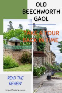
Old Beechworth Gaol – A Horrible History Tour.
The Old Beechworth Gaol guided tour is much more than a walk through a heritage-listed building. It is the perfect way to explore the gaol and have history come alive. Beechworth Gaol is a time capsule that offers an authentic and educational look into the past. Visit the cells that housed notorious bushrangers, learn about convict life, and uncover some of the gaol’s darker history. Step inside and go back in time with an expert guide.
Beechworth is North East Victoria’s best-preserved gold rush town, leaving a legacy of colonial architecture that boasts 32 heritage-listed buildings. Old Beechworth Gaol is one of those buildings, and it is heritage-listed by the National Trust for its historical, architectural, and archeological significance to the state of Victoria.
Getting there
A short drive from Albury (45 kilometres), Beechworth is in my backyard.
For those living further afield, Beechworth is a 3-hour drive northeast of Melbourne (284 kilometres), 4 hours southwest of Canberra (391 kilometres), and about 6 hours southwest from Sydney (593 kilometres).
Don’t have a car? From Melbourne, Canberra, and Sydney, take a train to Wangaratta and then the bus to Beechworth on Wangaratta Coachlines.
Old Beechworth Gaol is located on the corner of Williams Street and Ford Street, Beechworth.
Tours of Old Beechworth Gaol operate daily at 11.00 am and 1.00 pm and take about one hour. You can purchase your guided tour tickets at the Old Beechworth Gaol Cafe located in the gaol wall near the main gates. Alternatively, you can book your tickets in advance online. Please check their Facebook page, The Old Beechworth Gaol, for updates on tours.
Our guided tour of old Beechworth Gaol started with a double vaccination status check. Walking through the main gates, the courtyard provided a venue for Daniel, our tour guide, to give us an overview of the history of Beechworth gaol.
Taking approximately six years to build, Beechworth Gaol was opened in 1864 and initially housed men and women.
The outer stone walls are granite.
The razor wire on top of the gaol’s walls replaced the original barbed wire.
The current iron gates replaced the original wooden gates in 1879 when there was a suspected prison outbreak.
Beechworth Gaol was a medium-security prison.
The prison has a history spanning 140 years, closing in 2004.
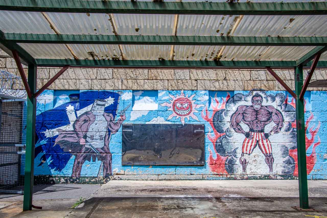
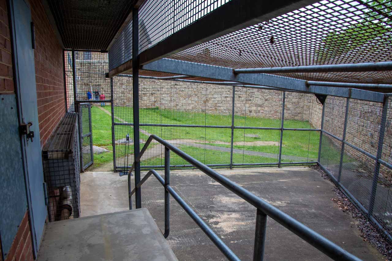
From the courtyard, our tour took us to the hard labour yard where male prisoners were put to work crushing granite rocks into gravel for roads and footpaths. The guards in the towers overseeing the hard labour yard worked 12-hour shifts.
The mural in the hard labour yard painted by the inmate, Woodsie
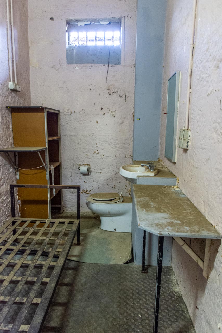
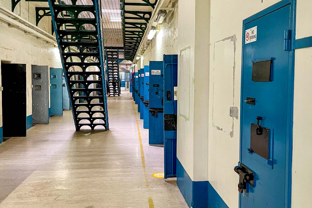
Moving into the cell blocks was like entering a time capsule, where time has stood still since the prison’s closure in 2004. The feeling of being locked in time was confirmed by Daniel when he advised the cells have not been touched since 2004.
A cell on old Beechworth Gaol – a time capsule
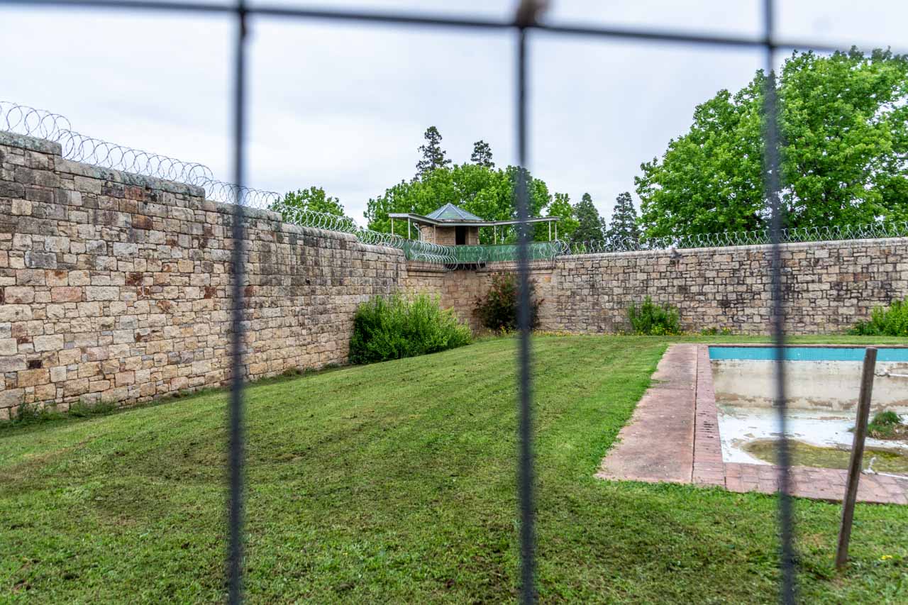
In the men’s cellblock, the gallows with the hangman’s noose was visible on death row – the top floor of the men’s cellblock. Eight men were executed in Beechworth Gaol between 1865 and 1881, and they are buried in unmarked graves in the exercise yard against the western wall.
The gallows and hangman’s noose on death row in the men’s cellblock
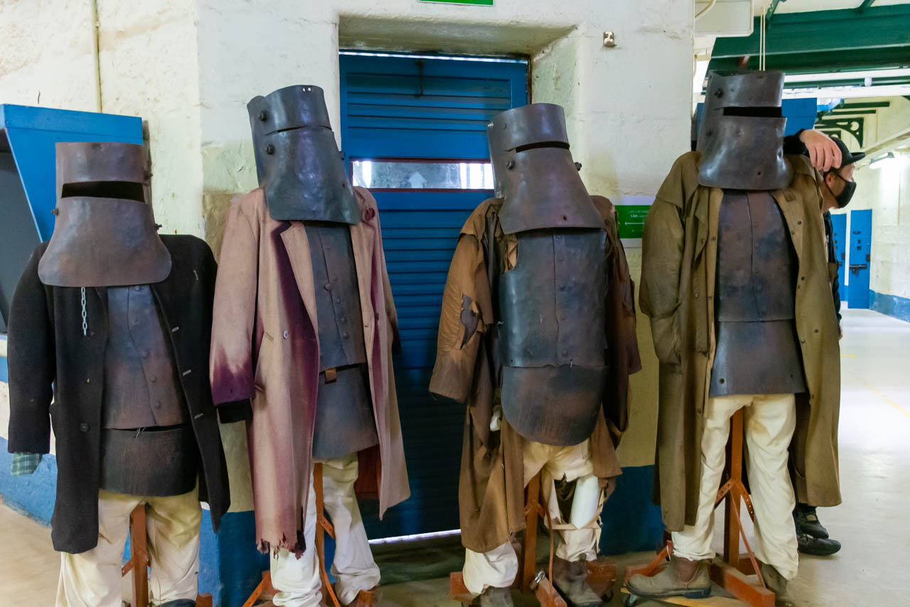
Daniel regaled us with stories of Ned Kelly’s misadventures (murder, assault, theft, and armed robbery) that landed him in Beechworth Gaol. Daniel was an entertaining storyteller. See below for details of who was Ned Kelly and his connection to Beechworth Gaol.
Effigies of Ned Kelly and the Kelly gang
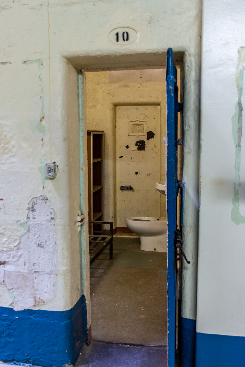
In the women’s cellblock, cell 10 was the designated mother’s cell with its two doors. One door (the front door) led into the cellblock, and a guard could open the back door to allow the mother to let her children outside to play. Daniel explained that the children were not prisoners but were locked up with their mother.
Cell 10 – the mother’s cell with its double doors
At the end of the women’s cellblock is the solitary confinement cell where a prisoner was locked in the cell 23 hours a day. The prisoner was allowed outside in a caged area for one hour a day.
The prisoner solitary confinement exercise cage
Our final tour stop was the exercise yard, the burial site of the executed men. An empty swimming pool dominates this lawned area.
Old Beechworth Gaol and the Ned Kelly connection
Ned Kelly was Australia’s most notorious bushranger and known for wearing a suit of iron armour during his final shootout with police. He was immortalised in the 1970 Ned Kelly movie starring Mick Jagger in the title role.
For those not familiar with Australian colonial history, escaped convicts who used the bush to hide from authorities were the original bushrangers. By the 1820s, the term had evolved to refer to those who took up armed robbery as a way of life, using the bush as their base.
Ned Kelly first became intimately acquainted with the inside of Beechworth Gaol at the age of about 13. Over the ensuing years, he became more familiar with the gaol on at least two other occasions.
Daniel was a wealth of information about Ned Kelly and his time spent in Beechworth Gaol. He held our undivided attention when telling of Ned’s imprisonment for lewd behaviour and assault when he was 16 years old. According to Daniel, Ned sent a package to a lady containing a man’s testicles and later assaulted her husband. There is great truth in the story as Ned did indeed send testicles to the lady. However, depending on your resource will determine the nature of the testicles. A man’s testicles, a calf’s testicles, two calves’ testicles – believe what you will. I suspect the story has grown legs.
For the lewd behaviour and assault crimes, Ned Kelly received 6 or 8 months (once again, depending on your resource) imprisonment in Beechworth Gaol.
Time for lunch
Whether you do the old Beechworth Gaol guided tour in the morning or afternoon, you must eat in Beechworth.
You are spoiled for choice for places to eat in Beechworth. I have eaten at several places and never had a bad meal.
On the day of my old Beechworth Goal tour, I ate at the Beechworth Pantry Gourmet Delicatessen & Coffee Shop on Ford Street. I ordered the Asparagus, Leek and Cheese Quiche with apple and Pear Salad and couldn’t resist the Hazelnut Meringue with Berries and Cream. I left the cafe very satisfied and with bars of fruit nougat in hand for later enjoyment.
My final review
If you plan to visit Beechworth, do yourself a favour and take a step back in time with a guided tour of old Beechworth Gaol. The tour provides all ages with an authentic and educational experience in which local, expert guides bring a dark history to life. It is a unique experience not to be missed and highly recommended.
The female cellblock in old Beechworth gaol
Disclaimer: This post contains no affiliate links. All views and opinions are my own and non-sponsored. All photos are my own and remain the copyright of Just Me Travel.
Please leave a comment below to share your thoughts. The only other prison tour I have taken was to Alcatraz when I was visiting San Francisco. Where have you taken a prison tour?
Like this post? PIN it for later!
Author’s Note: Please check the latest travel restrictions before planning any trip, and always follow government advice.
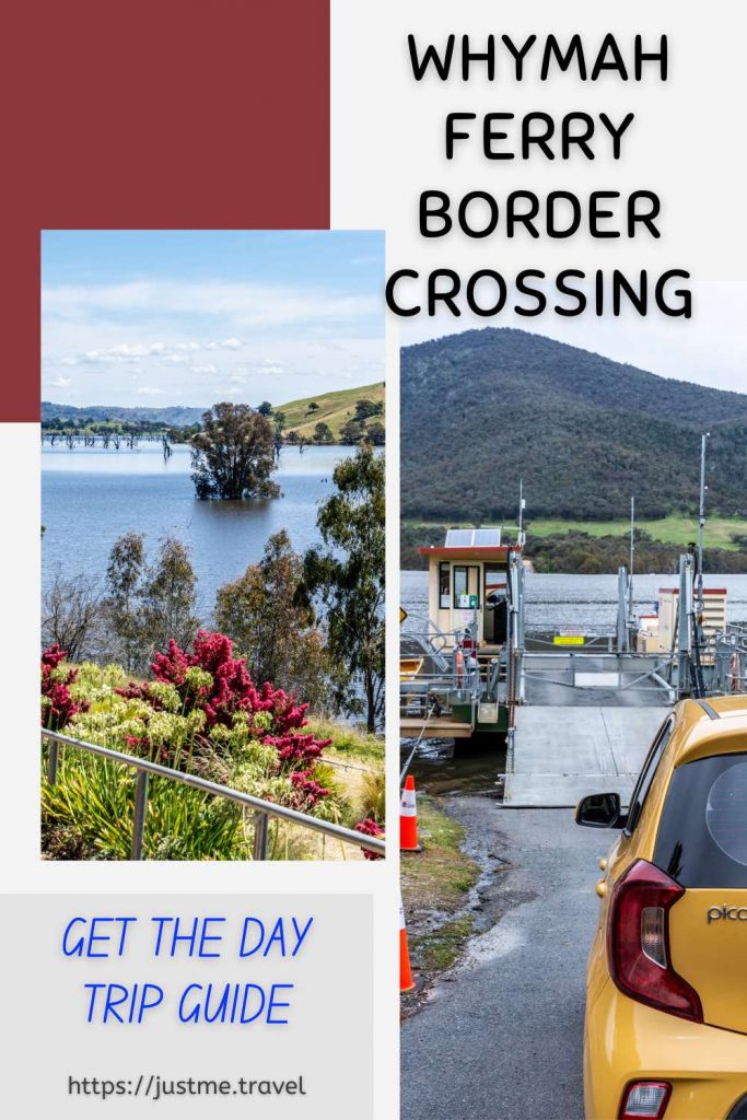
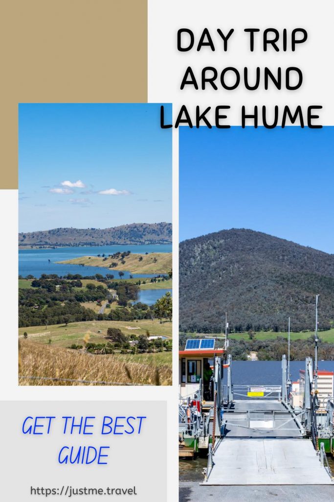
Explore Both Sides of the Border on a Day Trip from Albury. The New South Wales-Victoria border crossing on the Wymah Ferry is a unique experience. Combined with several…
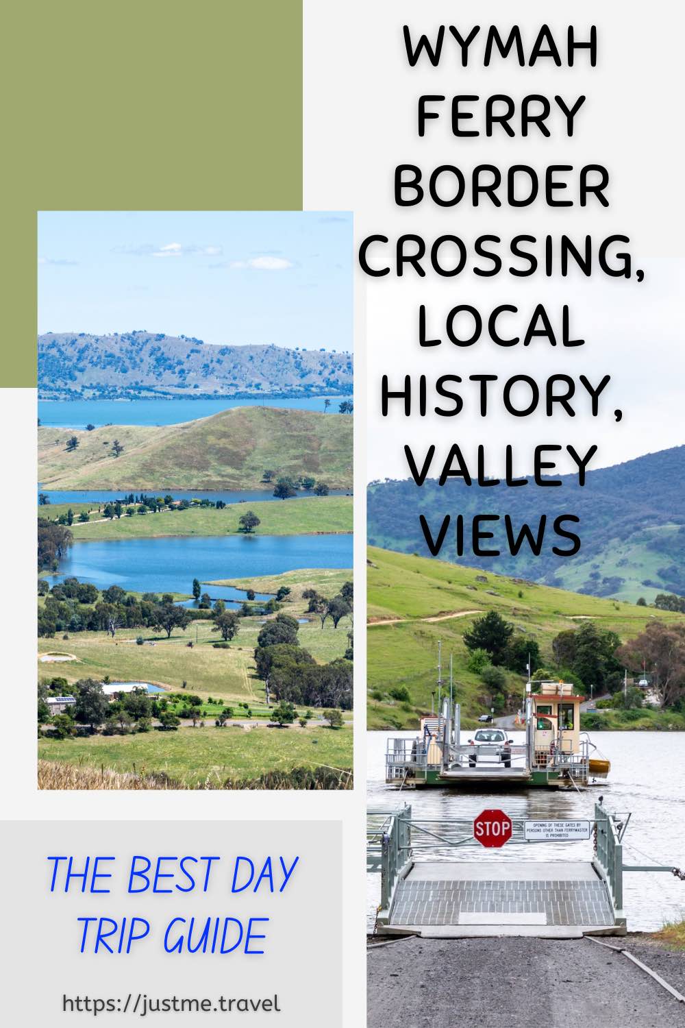
Explore Both Sides of the Border on a Day Trip from Albury.
The New South Wales-Victoria border crossing on the Wymah Ferry is a unique experience. Combined with several lookouts delivering magnificent valley views, learning some local history, and eating the best ice cream in town, you have the perfect day trip from Albury. Use my detailed guide for planning your day trip across the border on a ferry with things to do around Lake Hume. Or save it for future reference when looking for a special day out with friends, family, or just on your own.
Albury is a major regional city situated on the mighty Murray River in southern New South Wales. The Murray River is Australia’s longest river (flowing for 2,530 kilometres) and forms the border between the states of New South Wales and Victoria before flowing into South Australia.
Albury is strategically located for some of the best day trips in New South Wales and Victoria. A massive lake and river system, historic towns, mountains, national parks are just some of the adventures waiting for you on Albury’s doorstep.
Getting There
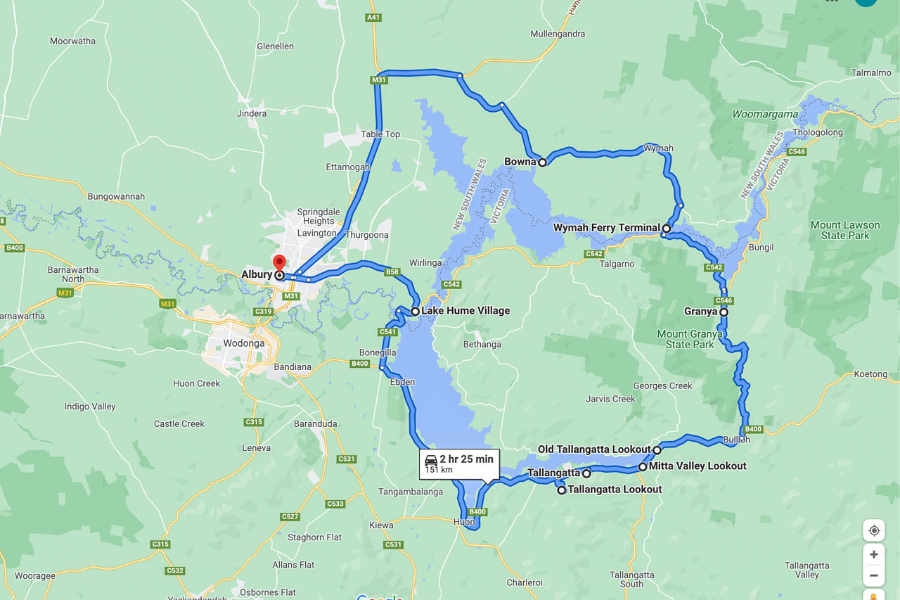
Wymah Ferry day trip route map (Google maps)
The Wymah Ferry day trip is a route driven in a loop and can be travelled in either direction:
Albury –> Bowna –> Wymah –> Wymah Ferry Terminal –> Granya –> Old Tallangatta Lookout –> Mitta valley Lookout –> Tallangatta –> Tallangatta Lookout –> Lake Hume Village -> Albury.
OR IN REVERSE
Albury –> Lake Hume Village –> Tallangatta Lookout –> Tallangatta, and so forth.
The drive is approximately 2 hours 25 minutes without stopping (151 kilometres). However, this is a day trip because we make several stops at places of interest along the way, take the Wymah Ferry across the Murray River, and stop for the best ice cream in town.
Albury to Wymah Ferry, New South Wales
Albury is the start and endpoint for this day trip. Driving north on the Hume Highway, you leave the highway at the Bowna Road turnoff. With Lake Hume on your right, approximately 5 kilometres along Bowna Road, turn right onto Wymah Road, heading to Wymah Ferry Terminal.
A hidden gem on this section of the route is Wymah School Museum. Make time to visit.
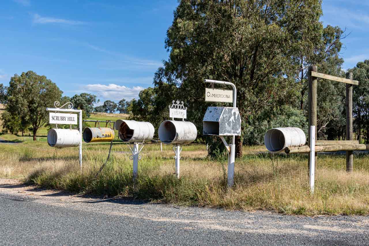
Bowna – the village that was
Bowna was a small village of about 150 people, but the decision to build a dam across the Murray River would foretell its demise. Bowna village was flooded in 1933 by the rising waters of Lake Hume. By 1935, the village had disappeared entirely, with traces only seen when Lake Hume is very low.
All you will see of Bowna village today on your day trip to or from Wymah Ferry are the letterboxes on Wymah Road in the photo below.
Bowna really is a case of ‘blink-and-you-miss-it’!
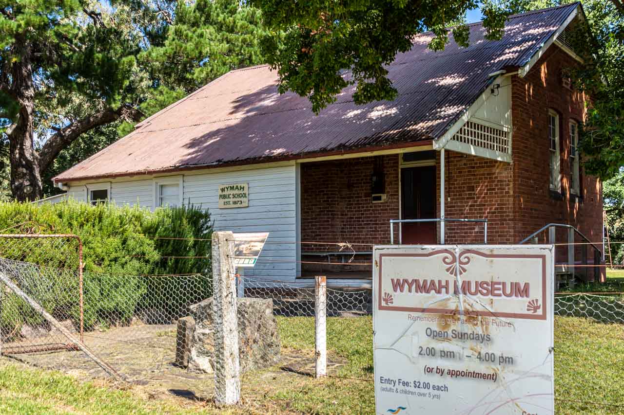
Wymah School Museum
Wymah (formerly Wagra) was a pioneer settlement with a small thriving township until the early 20th century. It featured one of the earliest Murray River ferry crossings, transporting people and livestock. Nothing remains today of the original township except Wymah School (closed in 1983), now a museum, the schoolhouse, and Dora Dora Pub at Talmalmo.
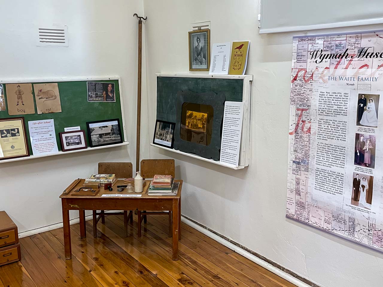
The Wymah School Museum (formerly Wymah Museum) was established in 2013. It is a small, delightful museum located in the old Wymah School. When I entered the museum, the first thing I noticed was the beautifully polished original floorboards. Aesthetics aside, the museum presents the opportunity to learn about the history of the original pioneering families, Dora Dora Pub, Wymah Ferry, Wymah School, the local Wiradjuri people, and more.
Wymah School Museum hosts an uncluttered collection, engagingly arranged and focused on local history. Peter was the volunteer on duty the day I visited. He was a wealth of local information, which he willingly shared. His stories were made all the more interesting with his being a local. He was even a pupil at the one-room, single teacher Wymah School.
A portion of the collection of artifacts and records in the Wymah Scool Museum
Wymah School Museum, at 2444 Wymah Road, Wymah, is open Sundays, 2.00 pm to 4.00 pm or by appointment. For an appointment, contact June 02 6020 2027 or Maree 02 6020 2005 or Judith 02 6020 2099.
Admission is $2.00 per person over five years.
Wymah School Museum is about a 30-minute drive from Albury. If looking for somewhere to go on a Sunday drive, you can’t go past a visit to this charming museum. Discover this hidden gem for yourself.
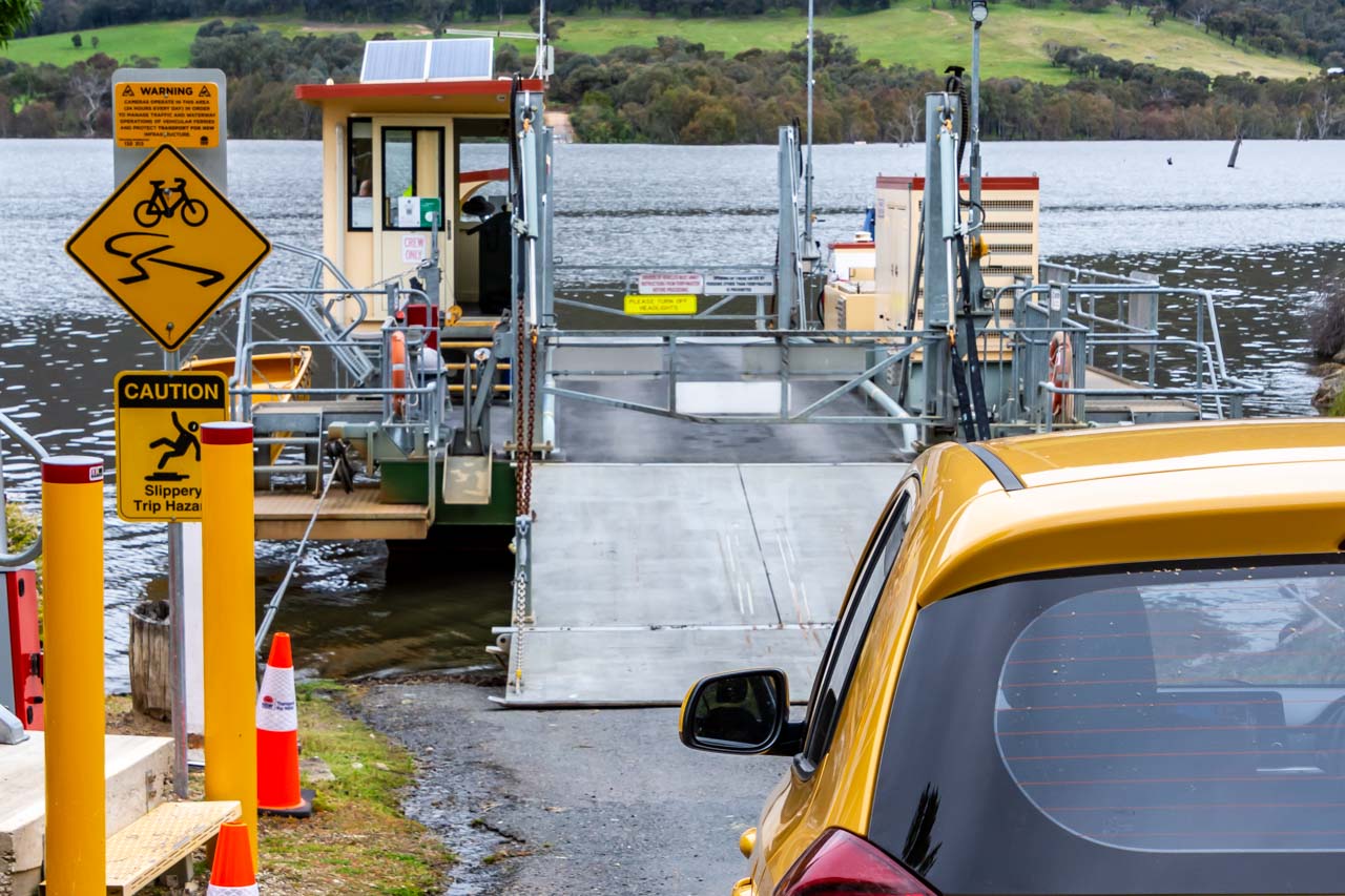
Wymah Ferry river crossing
Waiting to drive my car onto the Wymah Ferry at Wymah
The Wymah Ferry has a long history of service, beginning in the 1860s as a private ferry crossing the Murray River. According to local lore, a pub owner started the first ferry crossing to bring customers over the river to his hotel.
The first public ferry began operating in 1892. The current Wymah Ferry is the fourth public ferry, with two previous ferries sinking (one of which was re-floated) and another dismantled. The third public ferry was a two-car ferry decommissioned in 2013 to make way for the present-day, larger three-car ferry, the “Spirit of Wymah” (picture above).
The Wymah Ferry is a three-car cable ferry crossing the Murray River at Wymah in New South Wales and Granya in Victoria. Its carrying capacity is 35 tonnes – the equivalent of two fully laden fire trucks. Caravans and camper trailers are permitted if vehicle and caravan do not exceed 17 metres.
The Wymah Ferry is unique in several ways:
It is the only cable car ferry in the region.
It is an unusual and fun way to cross the Murray River between New South Wales and Victoria.
It is a heritage-listed cable ferry.
The only other cable ferry crossing the New South Wales-Victorian border is nearly 500 kilometres downstream at Swan Hill.
The Wymah Ferry runs seven days a week and operates 6.00 am to 9.00 pm September to April, and 7.00 am to 8.00 pm May to August, except on the first Wednesday of every month when it is closed between 9 am and 12 pm. The ferry closures for meal breaks are as follows:
10.00 am to 10.20 am,
12.40 pm to 1.00 pm, and
6.00 pm to 6.30 pm.
The trip takes about six minutes and is toll-free.
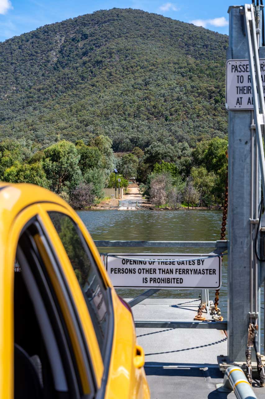
If the ferry is not at the terminal where you want to cross the Murray River – at Wymah or Granya – there is a button on a post to press to alert the Ferrymaster and call the ferry across.
The ferry service has been suspended on several occasions over the Wymah Ferry’s 150 years of operation due to low water. The service was also stopped in 2020 when the New South Wales-Victorian border was closed due to COVID-19. For up-to-date information on the operation of the Wymah Ferry, contact T: 02 6020 2038.
I have travelled on the Wymah Ferry three times in the last four months and feel a child-like thrill each time. At under 50 kilometres from Albury, enjoy this perfect experience for yourself. Don’t forget to combine the Wymah Ferry crossing with a visit to the Wymah School Museum.
On the Wymah Ferry leaving Granya
Wymah Ferry Day Trip Through Victoria
On the Victorian section of the Wymah Ferry day trip route, you will discover several lookouts with views over Lake Hume and Mitta River and lunch options in Tallangatta.
Old Tallangatta Lookout
View of Lake Hume from Old Tallangatta Lookout
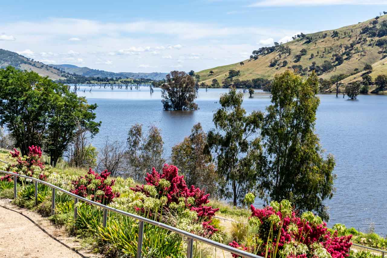
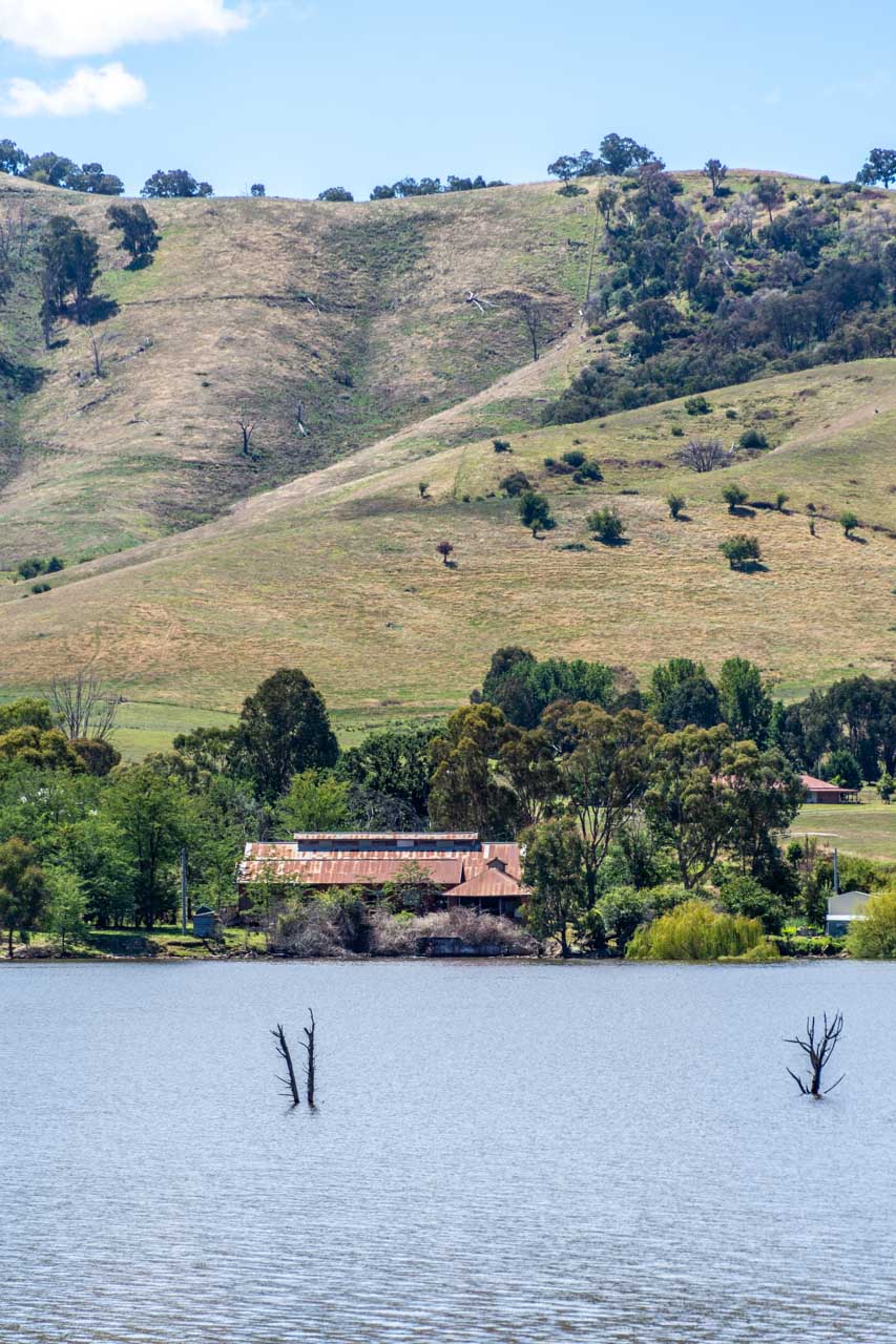
From the Old Tallangatta Lookout, you have stunning views over Lake Hume and across the lake to the prominent ruins of the (old) Tallangatta Butter Factory. The Butter Factory is all that remains of the old Tallangatta township, which was moved in the 1950s due to the expansion of the Hume Dam. Although the old town is now under water, when Lake Hume is very low, the remains of old Tallangatta can be seen above the water.
Old Tallangatta Butter Factory viewed across Lake Hume from Old Tallangatta Lookout
Located on the Murray Valley Highway, Old Tallangatta Lookout is eight kilometres from (new) Tallangatta town centre. There is off-road parking (no shade), information boards, and two picnic tables (one under trees and one undercover). There are no toilet facilities.
You can access the walking-cycle High Country Rail Trail from the lookout should you wish to stretch your legs a bit along the banks of Lake Hume.
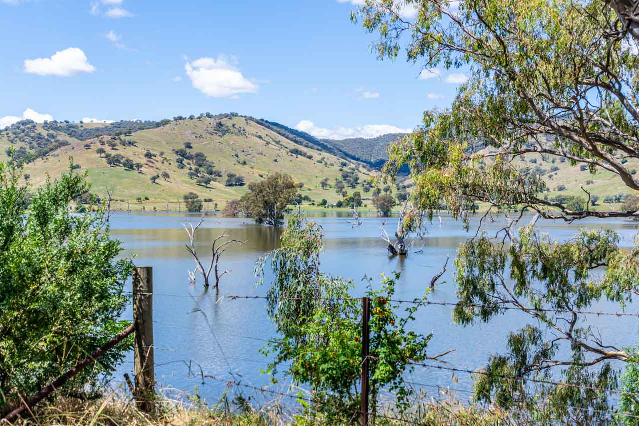
Mitta Valley Lookout
Mitta Valley Lookout is a scenic spot on the Mitta Mitta River, just six kilometres from Tallangatta town centre.
View from Mitta Valley Lookout
Located on the Murray Valley Highway, it is easy to miss the picnic table and signage tucked in amongst the trees on the side of the road. When driving in the direction from the Wymah Ferry towards Tallangatta, Mitta Valley Lookout is on the left at the end of the bridge across the Mitta Mitta River. Driving in the opposite direction (Tallangatta to Wymah Ferry), the lookout is on the right at the approach to the bridge.
A large tree provides good shade for your car should you decide to take a walk across the old railway bridge, now part of the High Country Rail Trail and running parallel to the road bridge.
There are no toilet facilities.
Tallangatta – the town that moved
Tallangatta is known as ‘the town that moved’ for obvious reasons – the town was forced to move 8 kilometres to its new, current location in 1956 when the old Tallangatta township was drowned with the expansion of Lake Hume. It is understandable then why Tallangatta appears stuck in the 1950s.
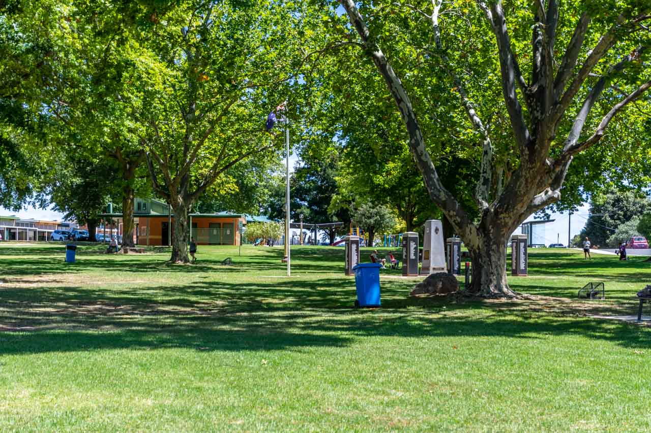
Tallangatta Triangles Park in the centre of town is a large green area shaded by beautiful plane trees moved to the park from old Tallangatta township. The park’s facilities include a children’s playground, barbeques and picnic tables undercover, benches, public toilets, and an information centre.
Triangles Park
Tallangatta has several options for breakfast, brunch or lunch. I have eaten lunch at Tallangatta Bakery (39 Towong Street) and Tallangatta Hotel (59 Towong Street). On my next visit to Tallangatta, I want to have brunch at the new cafe in town, Friday at Fika.
Friday at Fika, at 85 Towong Street, is open Friday 7.00 am to 1.00 pm, Saturday 8.00 am to 1.00 pm, and Sunday 8.30 am to 1.00 pm. The kitchen closes at about 12.30 pm.
Other options in Tallangatta for something to eat are Victoria Hotel (2 Banool Road), and Tallangatta Take Away (59 Towong Street). Or take a picnic and make use of the lovely park.
Tallangatta Lookout
Tallangatta Lookout is three kilometres from Tallangatta town centre and is accessed via Tallangatta Lookout Road, off the Murray Valley Highway.
You get stunning views of Lake Hume, Tallangatta township, and Sandy Creek Bridge from the lookout.
View of Lake Hume from Tallangatta Lookout
View of (new) Tallangatta township from Tallangatta Lookout
Facilities include a lookout platform, picnic tables and an undercover area. There are no toilets.
Tallangatta Lookout Road is steep, but I managed it effortlessly in my small, automatic two-wheel drive car. The road is sealed near the top of the hill and then gravel for the short distance to the lookout parking area and facilities. I used second gear to come down the hill.
The Homeward Leg – Back in New South Wales
By now, you must be ready for an ice cream, right?
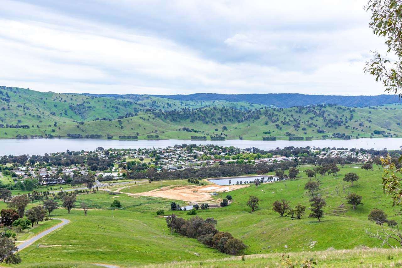
The best ice cream in town and Hume Dam
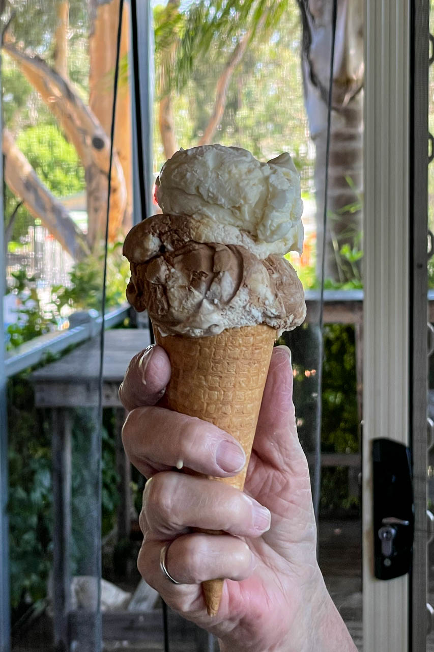
Lake Vue Cafe at 37 Murray Street, Lake Hume Village on the shores of Lake Hume, has the best ice cream in town. With 24 different flavours, you are spoilt for choice.
At only 12 kilometres (13 minutes) from Albury, an ice cream from Lake Vue Cafe puts the finishing touch on a perfect day out. The cafe is open Wednesday to Monday 9.00 am to 6.00 pm, and closed Tuesdays.
Take a walk down to Hume Dam while eating your ice cream and walk across the dam wall.
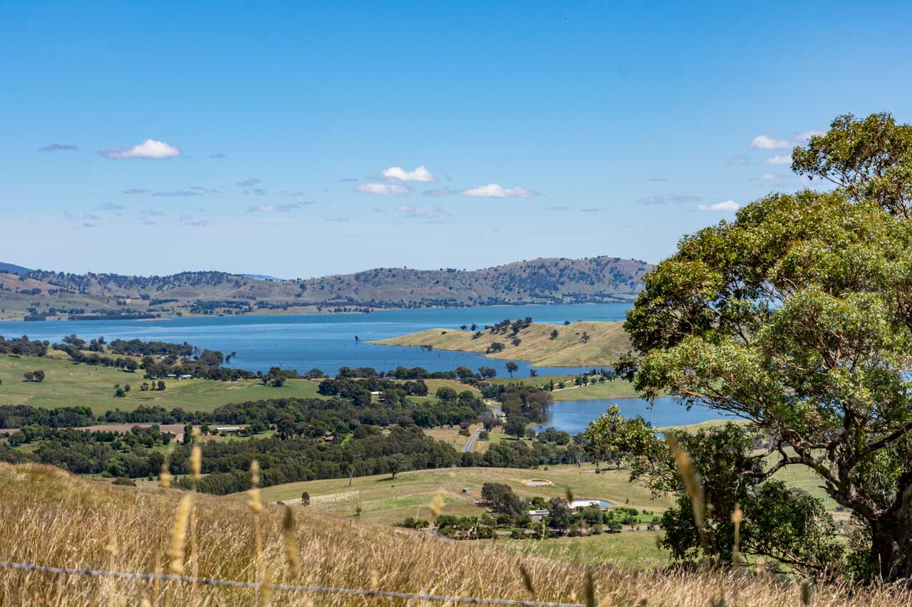
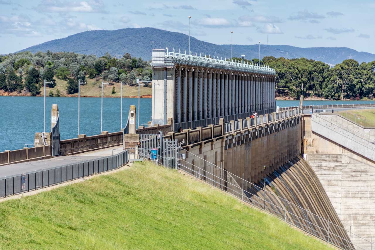
Hume Dam is a major dam across the Murray River, 13 kilometres from Albury. The reservoir behind the dam (Lake Hume) holds about six times the amount of water as Sydney Harbour and is an ideal spot for swimming, fishing, and watersports.
Hume Dam
Other activities:
Granya Pioneer Museum
After disembarking the Wymah Ferry in Victoria, the first village you come to is Granya. I have not visited the Granya Pioneer Museum, but if you have time and are interested, you may want to include the museum on your day trip.
Granya Pioneer Museum has a collection of about 500 items with records dating back to 1836, including historical photographs, land records, family histories. A recent extension contains horse-drawn farming equipment, mining and blacksmith tools, and other related artifacts.
Granya Pioneer Museum, at 5 Doubleday Street, is open by appointment only. Phone Lyn on 0457 062097 or Pam on 0407 005503.
Bonegilla Migrant Experience
Leaving Tallangatta Lookout and driving back to Albury on the Murray Valley Highway, you will turn right onto Bonegilla Road at Bonegilla, Victoria. At 1.3 kilometres along Bonegilla Road, you will see the signposted entrance to Bonegilla Migrant Experience, a heritage museum.
Bonegilla became the largest and longest operating migrant reception centre in the post-war era, with more than 300,000 migrants passing through its doors between 1947 and 1971. Today, Block 19 is all that remains of the original 24-block site. Bonegilla Migrant Experience brings to life the stories and experiences of the people who went through the centre.
One in twenty Australians have links to Bonegilla. I remember taking my daughter-in-law to Bonegilla as her father was at the centre as a small child. Do you have a link to Bonegilla?
The museum is open 10.00 am to 4.00 pm Mondays, Wednesdays, Thursdays, and weekends. Take a self-guided tour (site map available at the Welcome Centre) or join a guided tour (adults $5.00).
Day trips are a great way to get out and about while exploring the local area. Crossing the New South Wales-Victoria border on a heritage cable car ferry makes this day trip unique, with an element of fun. Valley views from lookouts along the way and a charming museum ‘alive’ with local history complete your day trip experience. Don’t forget to save this guide.
Disclaimer: This post contains no affiliate links. All views and opinions are my own and non-sponsored. All photos are my own and remain the copyright of Just Me Travel.
Please leave a comment below to share your thoughts. My purpose in writing this post is to convince you to experience a Murray River crossing on the Wymah Ferry, including a drive through two states around Lake Hume. Have I succeeded? Where have you taken a car ferry across a river?
Like this post? PIN it for later!
Are you looking for day trips in New South Wales? Read my guides…
Discover a Unique Culture and History in New Orleans – a vibrant city in Louisiana. New Orleans is a melting pot of French, African, and American cultures, the birthplace…
Discover a Unique Culture and History in New Orleans – a vibrant city in Louisiana.
New Orleans is a melting pot of French, African, and American cultures, the birthplace of jazz, the home of Voodoo in the United States, a living history, beautiful architecture, and great food. New Orleans is colour and vibrancy you don’t want to miss. My 6-day travel guide highlights the best things to do in New Orleans. Read on to discover why you should visit New Orleans.
There is something about New Orleans that gets under your skin. There are not many places I yearn to go back to a second time, but New Orleans (affectionately referred to as NOLA – New Orleans Louisiana) is the exception. Built on the banks of the mighty Mississippi River in southeastern Louisiana, the city is history, culture, music, colour, vibrancy, and life in a neat package
I was in New Orleans with my sister and brother-in-law to take a 7-night paddle steamer cruise on the Mississippi River. As we were embarking on the cruise in New Orleans, we had decided to spend six days exploring New Orleans before taking the cruise.
The following New Orleans itinerary was ours of the making and easy enough for anyone to follow. However, it is just as easy to manipulate the itinerary to your liking. After all, it is a guide. We allowed ourselves lots of free time while still doing all we wanted. We organised the tours of the plantations and bayous from Australia before we left on this trip. Six days was an ideal length of time to see New Orleans and its surroundings for the first time. Enjoy this visit through my eyes and see for yourself.
We stayed at New Orleans Jazz Quarters, a delightful Creole-style boutique inn dating from the 1800s. It is in a fabulous location (1129 St. Philip Street) opposite Louis Armstrong Park on the perimeter of the old French Quarter, with easy walking access to much of the city.
Jazz Quarters comprises 11 iconic Creole cottages and suites, all located in a gated complex with a high level of guest security. Free parking and WiFi are available.
We stayed in the two-bedroom Marsalis Luxury Cottage, with its high ceilings and decorated with classic period furniture from the 1800s. A large living room, a big bathroom with a deep bath, and a kitchenette completed the layout. We were very comfortable in this cottage and found the living room a great place to relax
New Orleans is home to several architectural styles. The Marsalis Cottage reflects the Shotgun House style of narrow rectangular homes raised on brick piers, with a covered narrow porch supported by columns. The term “shotgun” comes from the suggestion that you can shoot a bullet clear through every room when standing at the front of the house.
This morning we took a self-guided walking tour of the French Quarter – thoroughly exploring the Lower French Quarter. Being set in a grid pattern, the French Quarter, the historic heart of New Orleans, is easy to walk around and find your way. My sister was our guide, and Eyewitness Travel was her resource.
Heading from Jazz Quarters to the Mississippi River, we walked down Esplanade Avenue – a broad, tree-lined, 2-kilometre-long residential street bordered by beautiful old Creole homes. Our first stop was the flea market within the French Market, where I couldn’t resist buying a t-shirt emblazoned with a transfer of a voodoo doll with a pin stuck in it.
Map of Lower French Quarter – courtesy of Eyewitness Travel “Top 10 New Orleans”
Places of interest
Walking the length of the French Market, which also incorporates a farmer’s market and runs parallel to North Peters Street, we turned right into Ursulines Street. Our destination was the Old Ursuline Convent on the corner of Ursulines and Chartres Streets. Built in 1752, the Old Ursuline Convent is the oldest building in the Mississippi Valley. We took a walk through the Convent. Of most interest were the rooms telling the history of the Battle of New Orleans between Great Britain and the United States. According to the Eyewitness Travel guide, a stained-glass window depicting the Battle of New Orleans is in the Convent’s chapel. However, the window alluded us.
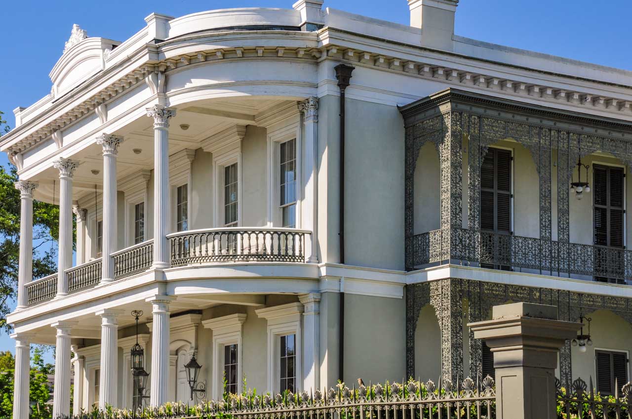
Opposite the Ursuline Convent is Beauregard-Keyes House and Garden. Built in 1862, many famous New Orleanians have lived in the house, the most notable being the Confederate General, Pierre Beauregard. General Beauregard only lived in the house for 18 months, but because he was a famous Civil War hero, the house still bears his name. The ‘Keyes’ part of the house’s name is attributed to the author, Frances Parkinson Keyes. I have to admit I have never heard of this author but have heard of General Beauregard.
The Beauregard-Keyes House is an example of the ‘raised centre-hall cottages’ architectural style, reflecting urban versions of French-Colonial plantations. Raised Centre-Hall Cottages are typically raised on piers to five feet or more above ground level. They have deep, covered front porches supported by symmetrically placed columns and accessed by a central stair.
We could not go into the house or gardens this day as a film crew was on site.
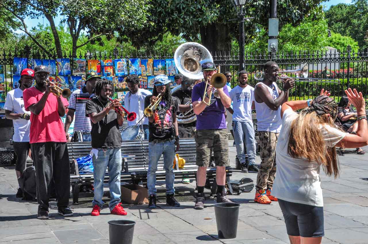
We then made our way to Jackson Square – a great place to sit and people watch as there is so much going on. Around the Square are artists selling their paintings, tarot card readers, and jazz bands competing for tourist attention. While my sister and brother-in-law went into St Louis Cathedral on Jackson Square, I spent a lovely half hour watching a band entertain the crowd who were enjoying their music.
A band entertains the crowds in Jackson Square
St Louis Cathedral, also called the Cathedral-Basilica of Saint Louis, King of France, is the oldest continuously active cathedral in the United States. Originally built in 1724, the cathedral has been rebuilt twice due to destruction from a hurricane and fire. Visitors are reminded this is a working church, with mass held daily.
We were now well and truly ready for coffee and headed to Café du Monde on Decatur Street, famous for its beignets. Beignets are square pieces of dough, fried and covered with powdered sugar, and Café du Monde has been serving them since 1862. They were yummy and worth fighting the crowds for a table. But then again, I do have a sweet tooth. I got the feeling my sister and brother-in-law did not share in my ecstasy.
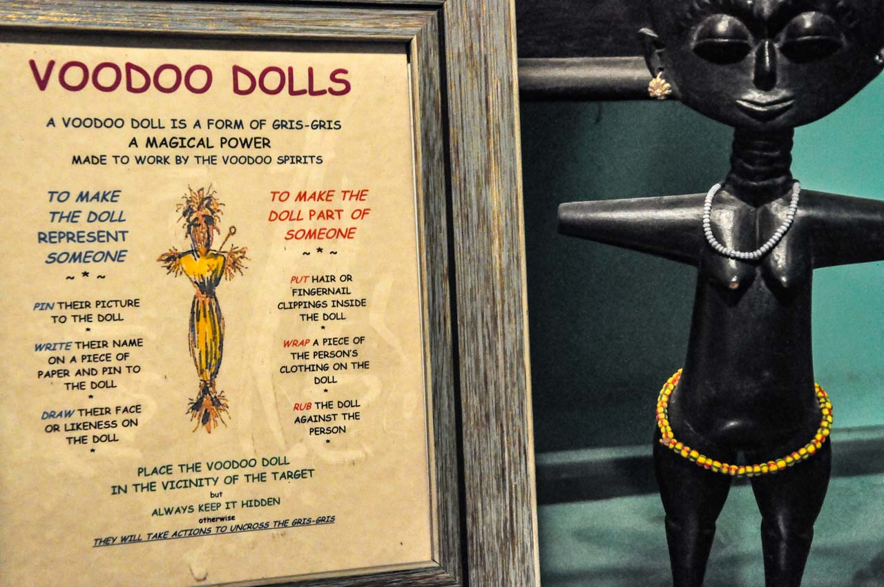
Before heading back to Jazz Quarters, my final stop was at The New Orleans Historic Voodoo Museum. Voodoo, brought to Louisiana by enslaved Africans from West Africa, is one of New Orleans’ many tourist attractions. According to guidebooks, the museum provides insight into Voodoo’s mysteries, legends, and traditions in its hallway and two small rooms packed with voodoo artifacts and examples of voodoo practices. I have to admit that I left the museum as bewildered and ignorant as I entered. And, if I am going to be honest, I found the museum a bit bizarre. Voodoo remains a mystery for me.
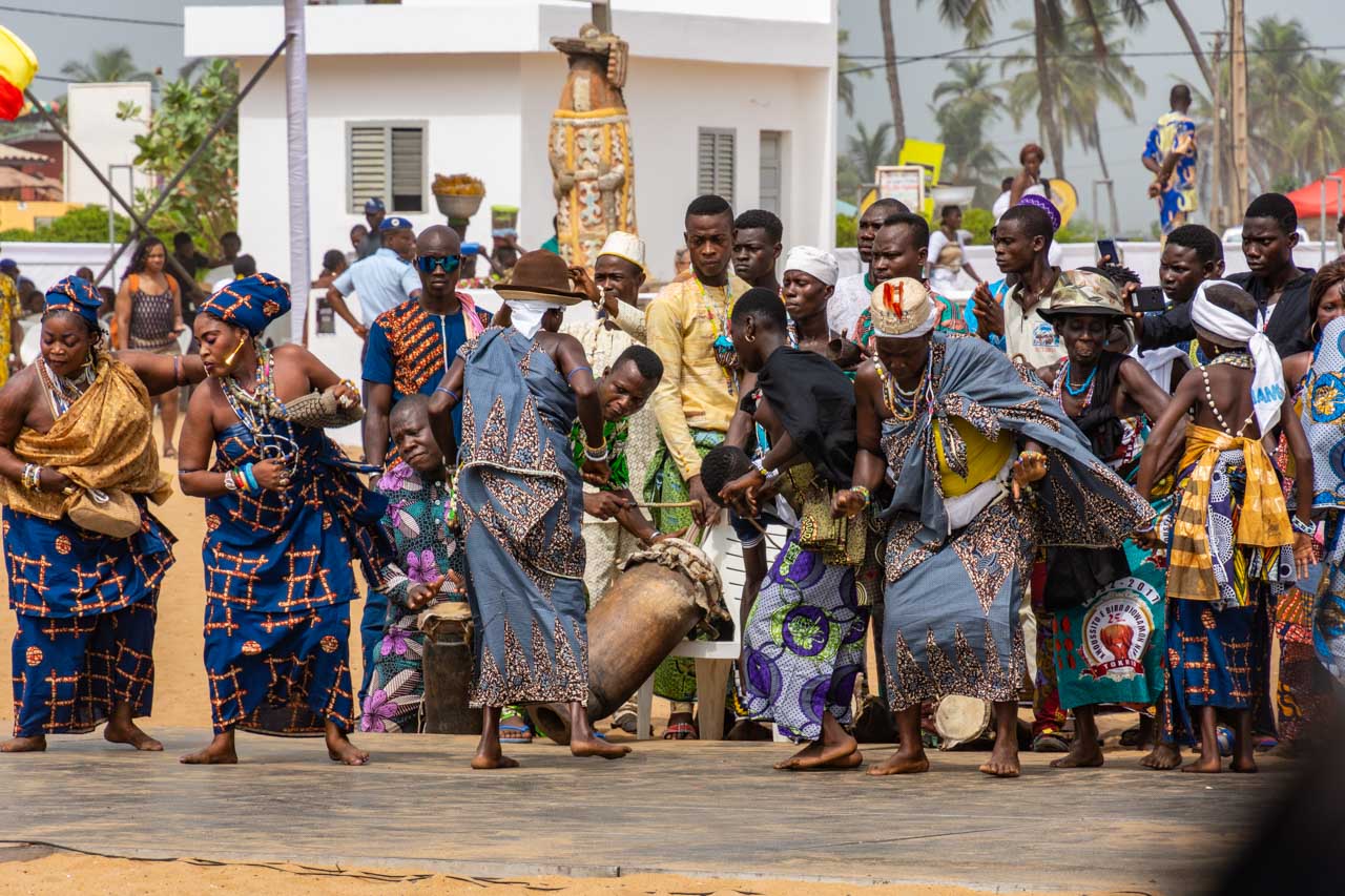
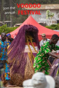
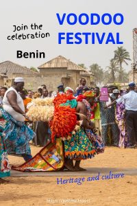
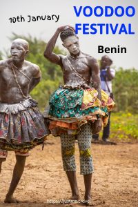
Since visiting New Orleans, I have attended the Voodoo Festival in Benin (West Africa). I now have a better understanding of Voodoo – perhaps one of the most misunderstood religions in the world.
Even without my newfound understanding of Voodoo, I recommend visiting the museum as it is unique where museums are concerned. I doubt you will experience anything else like it.
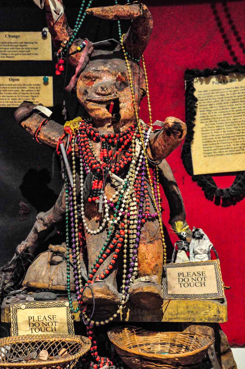
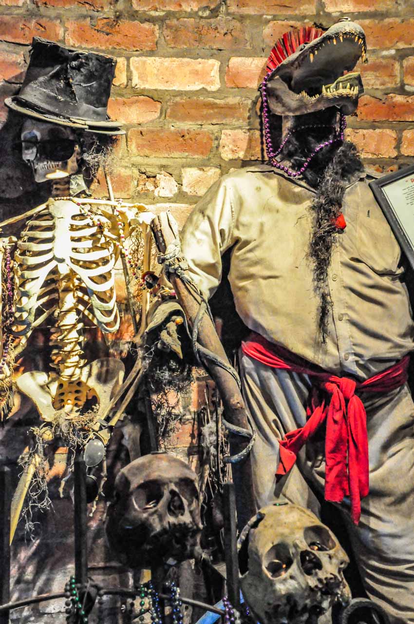
New Orleans Historic Voodoo Museum
Altar dedicated to the voodoo god Papa La Bas
The Ghede voodoo spirits
The Voodoo Museum, at 724 Dumaine Street, is open 10.00 am to 6.00 pm, seven days a week. General admission for adults is US$7.00. However, entrance to the gift shop is free. There is no formal tour of the museum.
Before leaving Australia, I researched voodoo dolls and was keen to buy one as my souvenir of New Orleans. The voodoo dolls sold in the Voodoo Museum’s gift shop were made of moss – Spanish Moss, to be exact. The museum staff informed me that the dolls made with moss are the more traditional voodoo dolls, and I specifically wanted a traditional voodoo doll. However, I was worried I wouldn’t get a ‘moss’ doll back into Australia. Australia has strict biosecurity requirements regarding plant material, and I would need to think about this one.
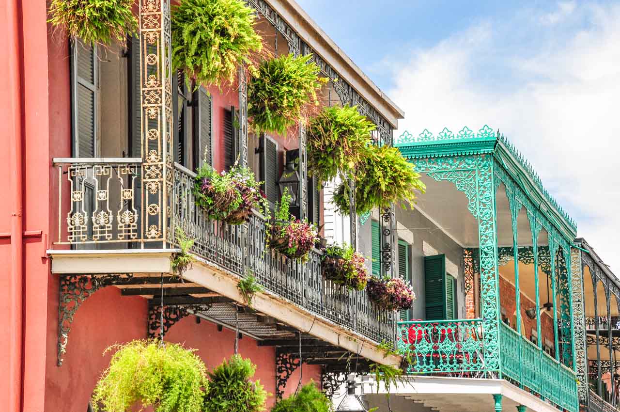
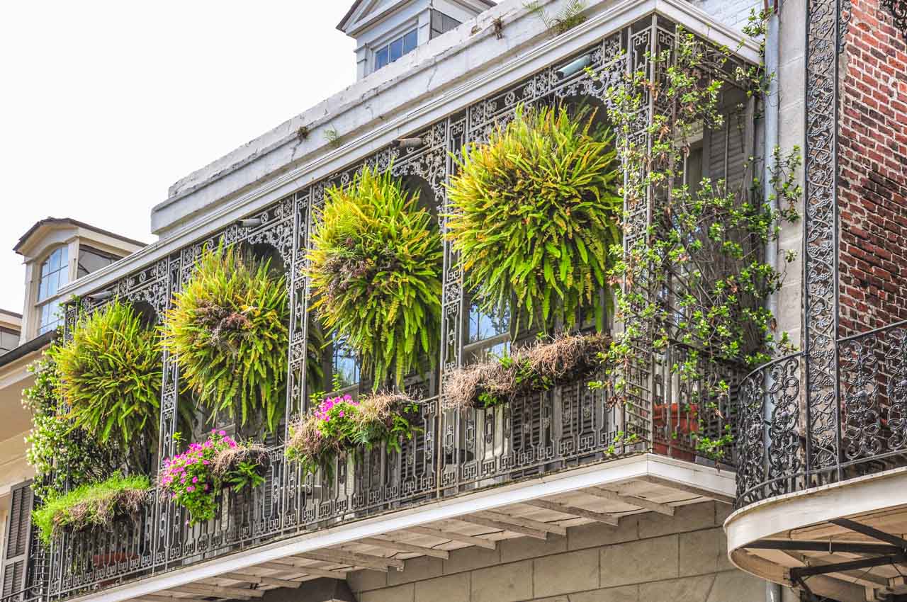
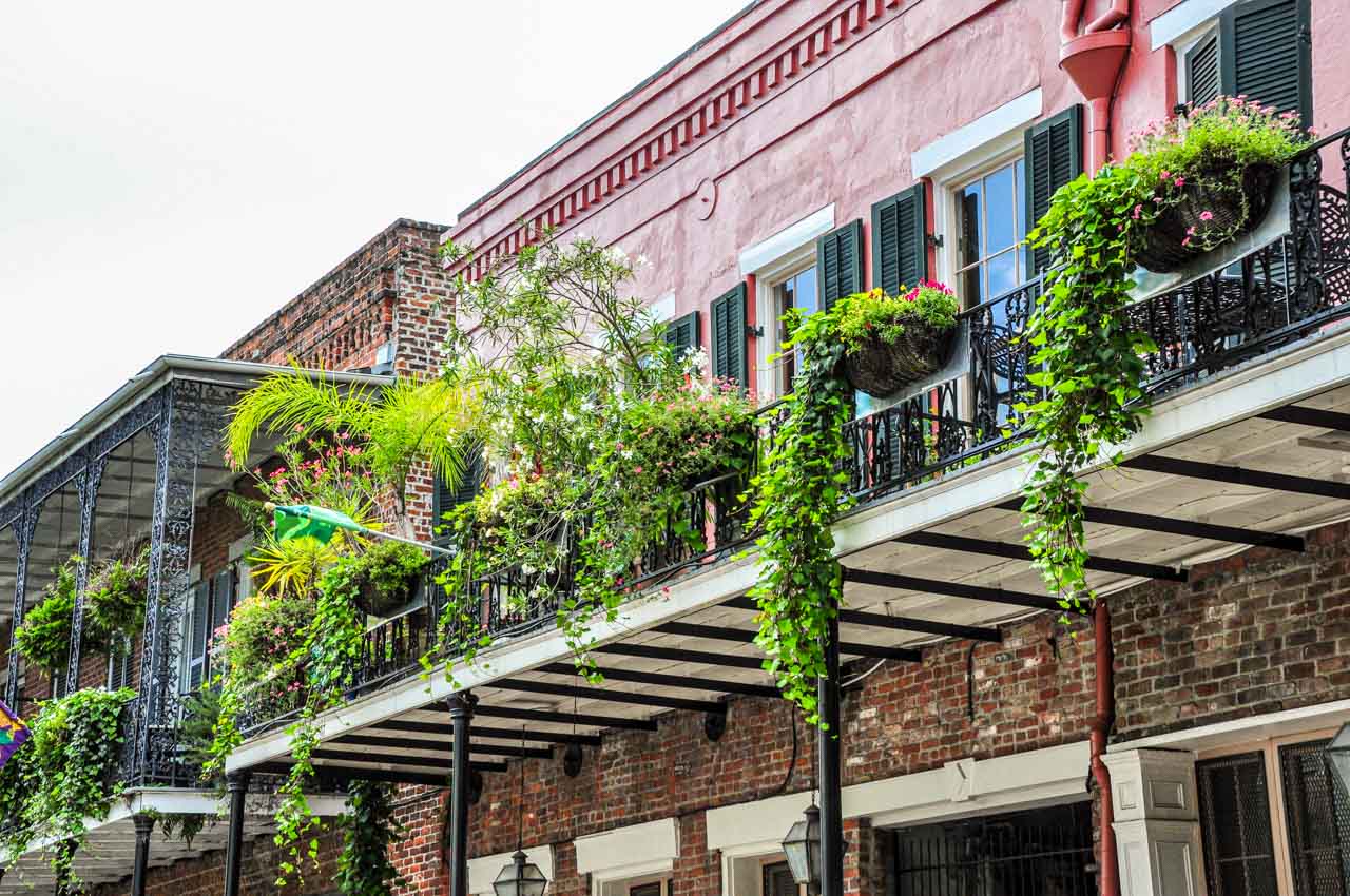
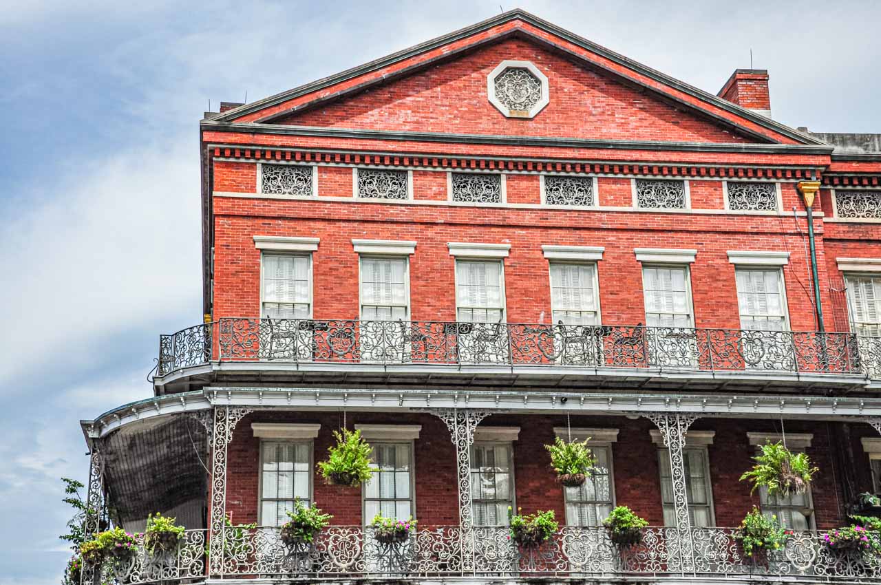
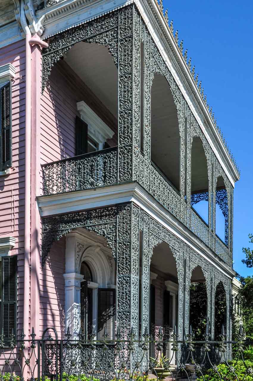
Walking around the French Quarter’s streets, the cast-iron balconies caught my eye, and I never tired of admiring them and taking photos.
Day 2: Voodoo and Wealth (and not in the same sentence)
This afternoon we went out to the Garden District. But this morning, I was on a mission to buy a voodoo doll.
My ‘no moss’ voodoo doll
My research in Australia had come up with several voodoo shops that sold voodoo dolls. I walked from shop to shop looking for a doll I liked that would not be confiscated by Australian quarantine. I ended up buying one of the voodoo dolls made with moss that I had seen in the Voodoo Museum yesterday. I decided I would risk how quarantine in Australia would deal with it. To be sure I ended up with something to put in my home, I bought a voodoo doll from Marie Laveau’s House of Voodoo on Bourbon Street made of calico and stuffed with cotton. No Spanish Moss anywhere! According to the label on the doll, it is a “voodoo doll for spiritual strength”. Marie Laveau (1794-1881) was the most powerful and eminent voodoo queen in New Orleans.
Catching a bus this afternoon to Canal Street, we took the St. Charles Streetcar out to the Garden District. Streetcars are icons of New Orleans and similar to Melbourne’s trams in Australia. The St. Charles Streetcar is the most famous as it is said to be the oldest continuously operating streetcar in the world.
The Garden District provides excellent insight into how wealthy New Orleanians live – in grand mansions on large blocks of land, with beautiful, lush gardens and well-kept lawns. These are the homes built by wealthy city merchants, bankers and planters.
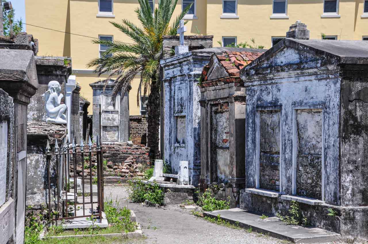
On a self-guided walking tour of the Garden District, our first stop was Lafayette Cemetery. However, we failed to realise there are two Lafayette Cemeteries. Turning right into Washington Avenue after getting off the St. Charles Streetcar instead of left, we ended up at Lafayette Cemetery No. 2. We had intended to visit the famous, walled Lafayette Cemetery No. 1 with its lavish, ornately decorated tombs, where tombs tell the story of a yellow fever epidemic.
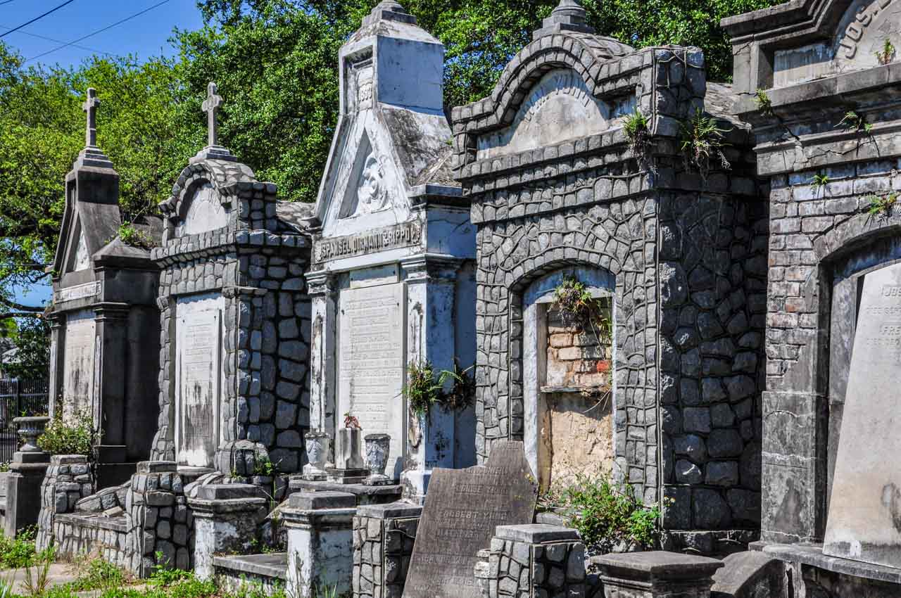
Lafayette Cemetery No. 2 was our first introduction to above-ground tombs and oven wall vaults, for which New Orleans is famous. Burying people in the ground is not manageable in New Orleans due to the city being below sea level.
The above-ground tombs in Lafayette Cemetery No. 2
What the walk to Lafayette Cemetery No. 2 did reveal was an apparent delineation between the haves and have-nots in the Garden District, as noted by the houses on either side of St. Charles Avenue.
Walking back up Washington Avenue and crossing St. Charles Avenue, we explored the area around Lafayette Cemetery No. 1. Our focus was on the homes of the Garden District, with their typical “raised centre-hall cottage” architectural style.
Our Garden District walk
The Gothic Revival styled Briggs-Staub House, at 2605 Prytania Street. This style of architecture is rare in New Orleans because Protestant Americans say it reminds them of Roman Catholic France.
Gothic Revival styled Briggs-Staub house
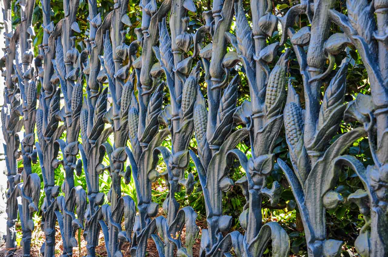
Colonel Short’s Villa, at 1448 Fourth Street. Built in 1859. This historic residence is one of the most stunning in the Garden District, and the house is famed for its cornstalk ironwork fence.
The cornstalk, ironwork fence at Colonel Short’s Villa
Robinson House, at 1415 Third Street, was built for a Virginia tobacco merchant. It is one of the grandest and largest residences in the Garden District.
Robinson House
Finally, we stopped outside the pink Carroll-Crawford House, at 1315 First Street, with its ornate cast-iron balconies.
Carroll-Crawford House
Our exploration of the Garden District was a lovely way to spend an afternoon. With all that walking, we were ready for a rest by the time we got back to Jazz Quarters.
Day 3: Bury Them High
After a morning of leisure, we took an afternoon tour of St. Louis Cemetery No.1. The entrance to the cemetery on Basin Street, just outside the French Quarter, was a 5-minute walk from Jazz Quarters.
It is not permitted to enter St. Louis Cemetery No. 1 without a licenced tour guide because the cemetery has been subjected to much vandalism over the years. We chose a tour with Save Our Cemeteries, a not-for-profit organisation “dedicated to the preservation, promotion, and protection of New Orleans’ historic cemeteries through restoration, education, and advocacy”. Booking a tour with Save Our Cemeteries appealed to us, as we felt we were contributing in a small way to the conservation of New Orleans’ history and culture.
Update: In a recent communication with Save Our Cemeteries, I learned they are no longer permitted to provide tours of St. Louis Cemetery No. 1. Cemetery Tours New Orleans are the only authorised company providing tours of St. Louis Cemetery No. 1.
Established in 1789, St. Louis Cemetery No. 1 is the oldest cemetery in New Orleans and the most famous. There is many renowned New Orleanians buried here. The most famous (or infamous, depending on where your views lie) is Voodoo Queen Marie Laveau. According to our guide, people leave offerings at her grave because they believe she continues to work her magic from beyond the grave.
The actor Nicholas Cage has purchased his future, pyramid-shaped tomb in St. Louis Cemetery No. 1.
Should you aspire to be buried in this famous cemetery, the going price for a plot is US$40,000 (approximately AU$56,247).
Eyewitness Travel tells you the above-ground tombs are due to New Orleans being below sea level; that, before above-ground tombs, the bodies would float to the surface when the Mississippi River flooded. However, our guide told us that having above-ground tombs was to copy the French burial style. Who do you believe? There is, no doubt, truth in both versions. Whatever the reason, the above-ground tombs are fascinating to see. Some are very ornate, some have fallen into decay, whilst the largest contains 70 oven wall vaults. Interred in a single tomb are several generations of a family, in vaults on top of each other.
The above-ground tombs in St Louis Cemetery No. 1
Oven wall tombs St. Louis Cemetery No 1
Please note: The tour of St. Louis Cemetery No. 1 takes 1.5 hours. There is very little shade in the cemetery, and New Orleans can get hot. I recommend you take plenty of water, dress lightly, wear a wide-brim hat and use sunscreen.
New Orleans is the birthplace of jazz, and the two are synonymous. As such, we felt we could not come to New Orleans without experiencing a jazz club. With this in mind, we had dinner this night at Three Muses on Frenchmen Street – a jazz club offering tapas-style share plates, cocktails, and live music all under the same roof. Three Muses is open Thursday to Sunday, 4.00 pm to 10.00 pm and bookings are essential.
The food was delicious. I recommend the mac and cheese. However, jazz is not a genre of music I like. So, I can’t say I enjoyed the experience.
Day 4: A Step Back in Time
Once again, a lazy morning before taking an afternoon plantations tour with Tours by Isabelle. Our “Small-Group Louisiana Plantations Tour from New Orleans” tour took in two sugar cane plantations – St Joseph Plantation and Houmas House Plantation and Gardens – with pickup from Jazz Quarters.
The plantations on this tour still feature in tours offered by Tours by Isabelle but not in this combination.
We deliberately chose a tour that took us to different plantations from that offered as a shore excursion on the Mississippi River Cruise – the famous Oak Alley with its much-photographed tree-lined path to the front door. We wanted to get a varied view of Louisiana’s famous plantations.
St. Joseph Plantataion
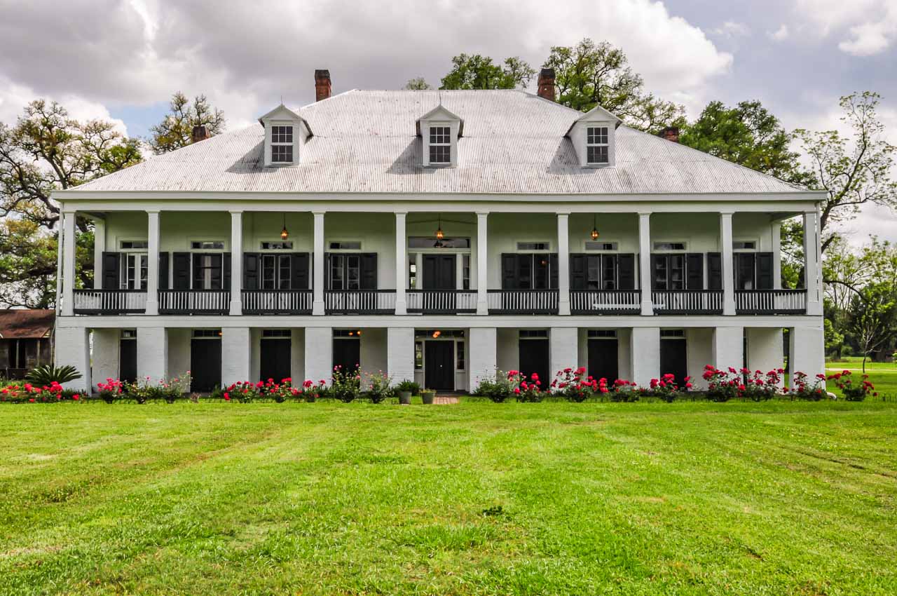
The plantation house on St. Joseph Plantation House, Louisiana
The 1000-acre St. Joseph Plantation is a historic plantation located on the banks of the Mississippi River. It is one of the few fully intact, still working sugar cane plantations in Louisiana. The plantation house was built in 1830.
I enjoyed the tour of St. Joseph Plantation house. Our guide was a distant family member, and I got an authentic feel for how the families lived and their relationships. She brought the rooms we explored alive with her stories.
You are free to explore the grounds, including buildings (cabins, kitchen, schoolroom) that were a part of the historical slave quarters. And there is a gift shop if you are so inclined.
Houmas House Plantation and Gardens
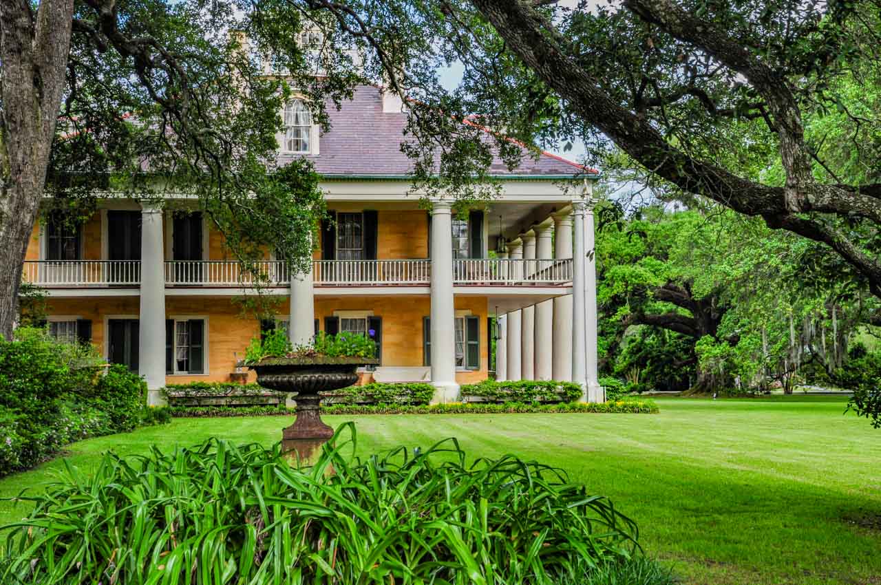
Houmas House Plantation and Gardens, Louisiana
Houmas House was built in 1840 and set in beautiful gardens with giant, old oak trees leading up from the river (from the levy bank, to be precise) to the front of the house. Called (according to its brochure) the “Crown Jewel of Louisiana’s River Road”, the 16-room house and gardens reflect the opulent lifestyle and grandeur of the prosperous sugar barons who once lived in Houmas House. The restoration of Houmas House is of a higher standard than the house on the St. Joseph Plantation. Although well organised, I found the tour of Houmas House, conducted by guides in period dress, to be very dull as it primarily focused on descriptions of the furnishings. I left the tour about halfway through (I had seen enough and heard enough) to explore the extensive, formal gardens on my own. The gardens alone are worth the visit to Houmas House.
Day 5: Swamps and Bayous
Our organised tour today wasn’t until early afternoon. So, we spent the morning resting, reading, and laundering (not me).
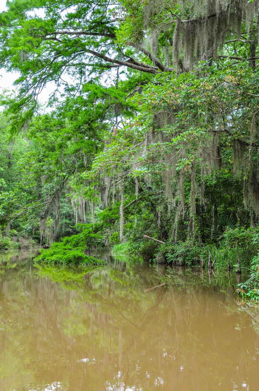
In the afternoon, we were picked up from Jazz Quarters by Pearl River Eco-Tours for their 3-hour “Six Passenger Swamp Tour” (now taking ten passengers). After an hour’s drive from New Orleans, we arrived at the Honey Island Swamp – one of the least altered river swamps in the USA.
We chose the tour with the smaller boat (skiff) as we thought it would give us a more personal experience than the larger, 18-26 passenger boat. And it did! The smaller boat was able to go into swamps and bayous that the bigger boats could not navigate.
The Mississippi River Delta is famous for its bayous, particularly the bayous of Louisiana and Texas. They are wetlands and eco-systems like I had never seen before. We saw alligators, bald eagles and other birdlife, snakes (venomous and non-venomous), diverse plant life, and hardwood (Cypress) swamps. Many trees were shrouded in Spanish Moss. [There’s that moss again!] Honey Island Swamp is true Cajun country.
Our guide was very informative, and I came away knowing much more than when I started. Pearl River Eco-Tours was well organised, and our pickup from Jazz Quarters was on time. We thoroughly enjoyed the Six Passenger Swamp Tour and recommend it to others.
Louisiana alligator in Honey Island Swamp
Honey Island Swamp
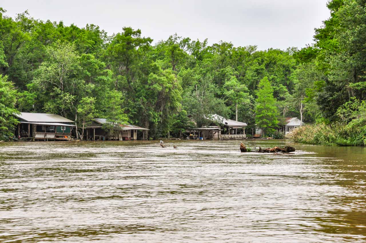
Homes in Honey Island Swamp (literally)
The Six Passenger Swamp Tour with Pearl River Eco-Yours was organised from Australia without a hitch.
Day 6: A Unique Sculpture Garden
We weren’t required to board the boat for our Mississippi River cruise until mid-afternoon. So, we took the Canal Street streetcar to City Park at the end of the line.
Covering an area of 1,300 acres, City Park is one of the biggest urban parks in the United States. The New Orleans Museum of Art and Sydney & Walda Besthoff Sculpture Garden are located in the park. The sculpture garden now occupies approximately 11 acres of City Park, with over 90 sculptures from national and international artists. I found some of the sculptures quite bizarre. There are two I will remember for a long time to come:
The first is a sculpture of a man covered in small birds pecking him.
The second was also of a man but this sculpture is a man hanging from a scaffold by his feet.
I kick myself now for not taking photos of these sculptures.
Entrance to Besthoff Sculpture Garden is free and open seven days a week. Summer opening hours are 10.00 am to 6.00 pm, while winter hours are 10.00 am to 5.00 pm.
Before embarking on our boat, I couldn’t resist buying a bracelet from Tiffany’s.
Our time in New Orleans was relaxed and set at a leisurely pace. The city is flat and easy to walk around, and we gave ourselves time to see all we wanted without being rushed and allowing plenty of free time. What a great city!
Our New Orleans itinerary was successful, and our time was well spent. There was nothing I regretted doing and nothing I wished I had done.
Save this guide and visit New Orleans soon.
A word on safety
As a female traveller, I did not go out at night on my own (my usual precaution). However, I always felt comfortable and safe walking around on my own during the day. And I did so on many occasions for several hours.
Footnote: The moss-made voodoo doll did not make it past quarantine in Australia, and I was not even allowed to have it zapped – gamma radiation to render it safe for keeping.
Editor’s Note: This blog post was originally published in June 2019 and has been updated for accuracy and comprehensiveness.
The prices and opening times quoted in this post are correct at the time of this update.
Comment below to share your thoughts on this blog post. Have you been to New Orleans? What was your favourite thing to do, attraction to see, or place to eat? What would you recommend to other travellers?
Like this post? PIN it for later!
Author’s Note: Please check the latest travel restrictions before planning any trip, and always follow government advice.
Lockhart – where art, history, and metal come together for a great day trip destination from Albury. Join me on a day trip to Lockhart from Albury, a hidden…
Lockhart – where art, history, and metal come together for a great day trip destination from Albury.
Join me on a day trip to Lockhart from Albury, a hidden gem in regional New South Wales. Lockhart is a town steeped in history and art. Use the day trip guide to discover Lockhart’s award-winning museum, historic architecture, rusty metal sculpture trails, unique wool art, pioneering history, and more. With many things to do in Lockhart, see why this charming town should be a ‘must-visit’ destination.
The Riverina is an agricultural region in south-western New South Wales and home to the Murrumbidgee River (Australia’s second-longest river). The Riverina has an abundance of natural wonders and outdoor experiences. Lockhart is a prime example of all the Riverina has to offer – heritage architecture, a history steeped in its pioneering past, outdoor sculpture galleries, unique wool art portraits, and bush trails.
Lockhart is a true hidden gem. I am amazed by the depth of history and art for visitors to explore and discover in such a small rural town (town population, 818 people; shire population, 3,119)).
I have lived in Albury for nearly 30 years and have not been to Lockhart prior to my initial day trip in October 2020. I was recently telling my daughter about all I have discovered in Lockhart. She wanted to know why we had never been there. I had no answer but promised we would take a day trip to Lockhart next time she’s in Albury.
Getting there
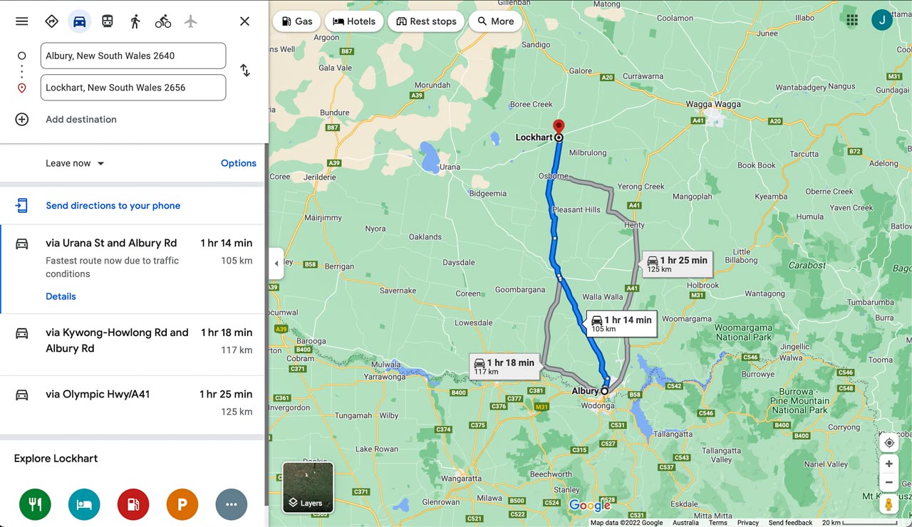
Albury to Lockhart route and distance. Credit: Google Maps
Albury is situated on the Murray River and a major regional city in New South Wales, Australia. The Murray River is Australia’s longest river and forms the border between New South Wales and Victoria.
The trip from Albury to Lockhart is a drive of 1 hour, 14 minutes (105 kilometres).
Lockhart is 43 minutes (64 kilometres) from Wagga Wagga.
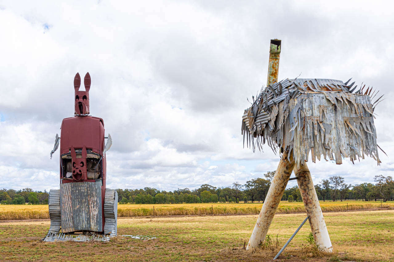
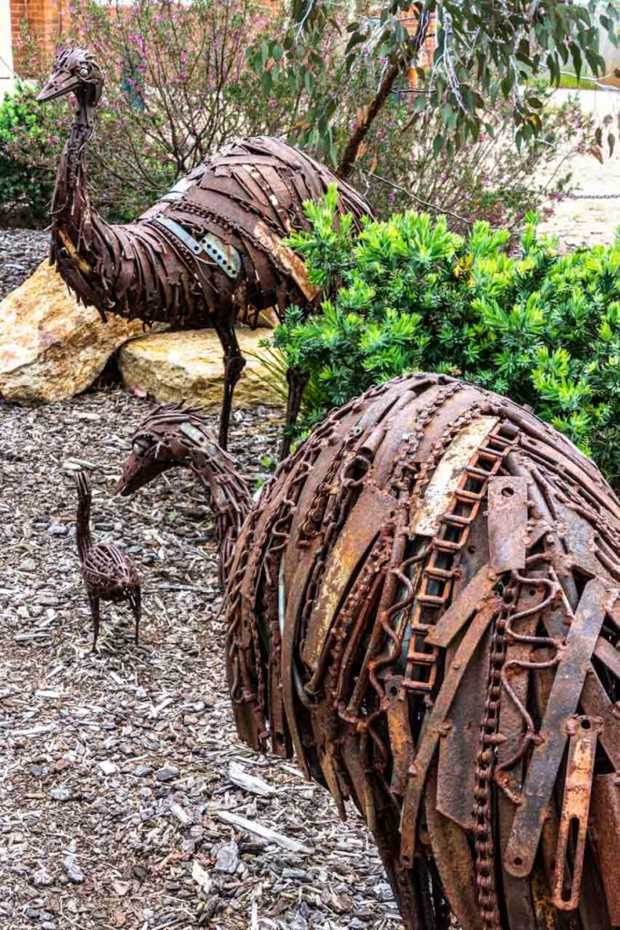
The Big Kangaroo and Big Emu
About two kilometres from Lockhart, you will find these two sculptures of Australian icons in a paddock beside the road. Check out the joey in the kangaroo’s pouch.
The impressive Kangaroo and Emu sculptures stand roughly seven metres high. Residents created them over two days in 2011 during a series of community farm art workshops in Lockhart.
The Kangaroo and Emu sculptures have been constructed entirely from scape metal, including old ute and car bodies, 44-gallon drums, galvanised iron, and unused farm materials donated by locals. The sculptures are excellent examples of rural recycling where nothing is thrown away in case it may have a use in the future.
Things to do in Lockhart
The Lockhart Sculpture and Heritage Trail is Lockhart township’s overarching art and history discovery theme and includes all the things to do in this post.
Lockhart Shire has published a detailed brochure on historic Lockhart to assist you on your self-guided sculpture and heritage walk. Download a copy of the two-page Lockhart Sculpture and Heritage Trail brochure – an excellent resource.
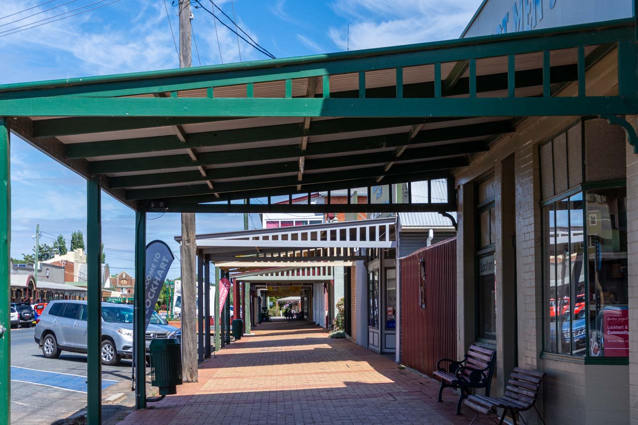
Lockhart Verandahs
Lockhart is known as the ‘verandah town’ due to its main street lined with verandahs dating back to the Federation years (around 1890 to 1915). The wide shady verandahs and historic shop fronts were restored in the early 1990s and have earned the town’s architecture classification on the National Trust Australia (NSW) list.
Historic Etched Pavers
The Wright family paver. Jack Wright was a builder, hence the etching of a house.
On the footpath below the verandahs on both sides of Lockhart’s main street are over 400 pavers with images etched on them. The etchings tell the story of the progress and history of the township and represent those families, past and present, who contributed to the district’s growth.
The etchings are a unique, historical legacy of the early life and times, and the families’ businesses in the district, from the illustrious pastoral years, through Federation and the wars, to a more recent past.
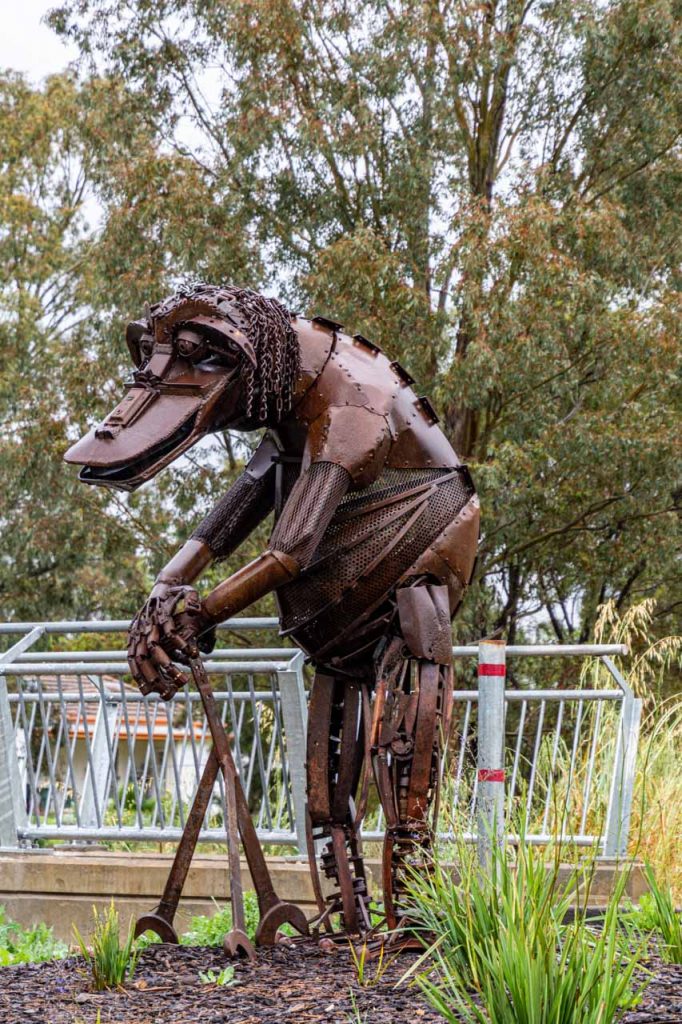
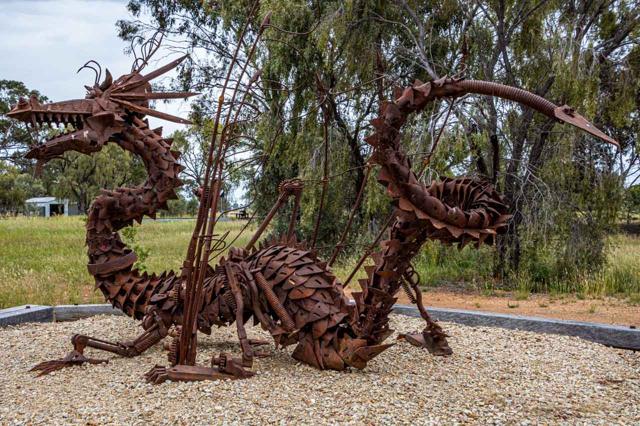
Farm Art Sculpture Trail
Sculpture – Bunyip of Burra Creek by Sean Meany
Sculpture – Emu Family by Stuart Taylor
Lockhart’s Farm Art Sculpture Trail is an easy, flat walk taking you on an artistic journey around the town centre. Be amazed at the talent as you discover over 20 incredible sculptures on permanent display. The sculptures have been created from rusted and recycled farm materials and reflect the land’s natural elements.
Many of the sculptures are award-winning National Farm Art pieces from Lockhart’s annual Spirit of the Land Festival, a celebration of the resilience of those who live and work on the land.
My initial day trip to Lockhart in October 2020 (I have returned on two more occasions) was a suggestion to friends we check out the rusty farm art sculptures of which I had heard so much. We were not disappointed. I love this type of art and the open-air, public galleries in which they exist. I am in awe of the talent to create unique animal sculptures from bits of farm materials that look like the animals they are meant to represent. As we searched for sculptures (no Sculpture and Heritage Trail brochure on this first-day trip), I found myself excited with anticipation as I wondered what we would discover next.
Sculpture – Australian Rain Dragon by Andrew Whitehead
Sculpture – Good Old Days by Keith Simpson
Sculpture – Going to the Dance by Stuart Spragg
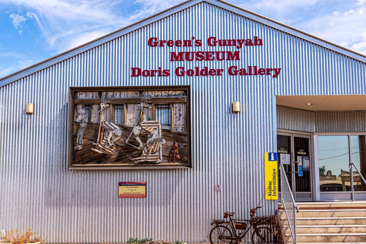
Greens Gunyah Museum
The award-winning Greens Gunyah Museum is a wander through Lockhart’s heritage past. With its impressive collection of historical, traditional, and interactive exhibits, the story of Lockhart unfolds before your eyes.
The museum’s collection of historical artefacts, photography and machinery is extensive. Highlights include a telephone exchange, World War ll memorabilia, shearing memorabilia, an original slab hut, the old blacksmith, old town business histories, and vintage town footage. There is also a room dedicated to Tim Fisher – a former Deputy Prime Minister from the Lockhart region.
You will find Greens Gunyah Museum at 39 Urana Street, at the Narrandera end of Green Street (Lockhart’s main street). Entry to the museum is $5.00.
The artwork on the museum’s façade is “Click go the Shears” by Stuart Spragg and features in Lockhart’s Farm Art Sculpture Trail.
At the time of writing, the museum is closed indefinitely due to low visitor numbers and rising COVID-19 numbers. However, you can arrange a private visit to the museum. Refer to Lockhart’s Greens Gunyah Museum Facebook page for details on arranging a personal visit.
The museum is also home to the renowned Doris Golder Wool Art Gallery.
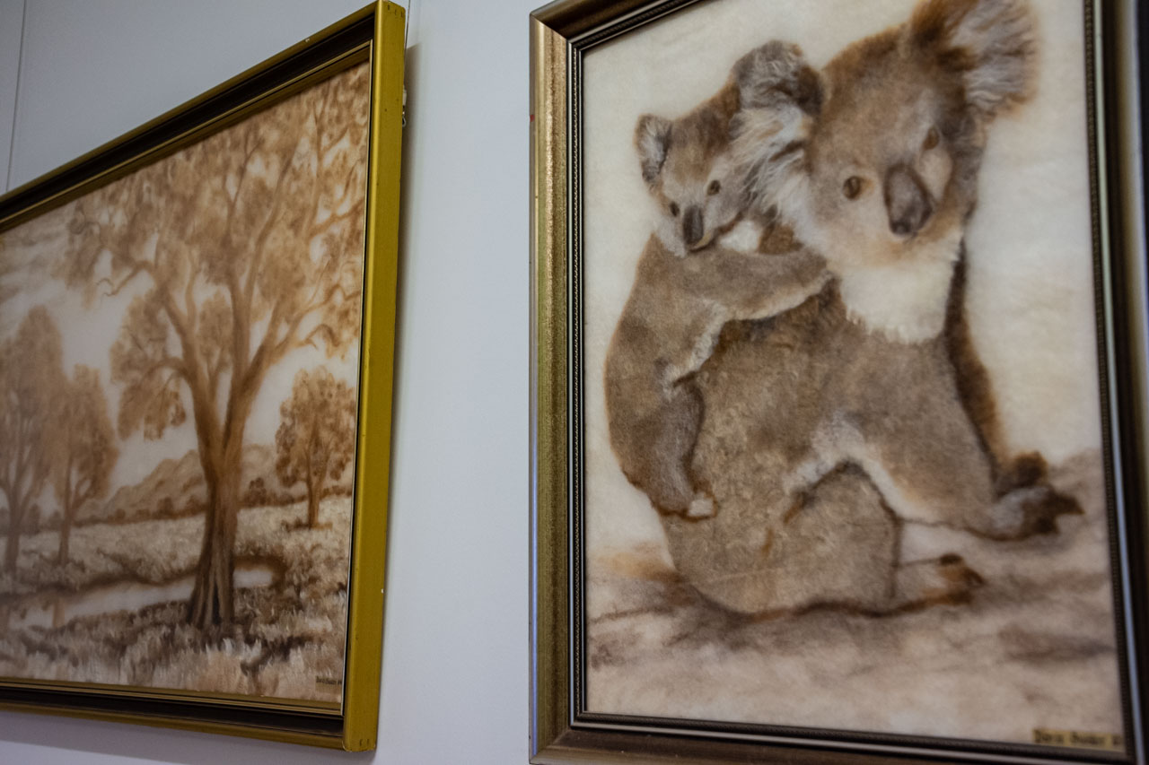
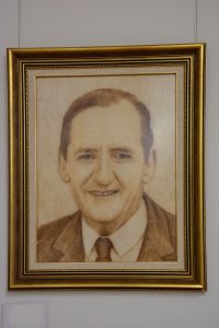
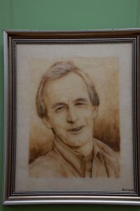
Doris Golder Wool Art Gallery
Wool art – Koalas and Australian landscape by Doris Golder
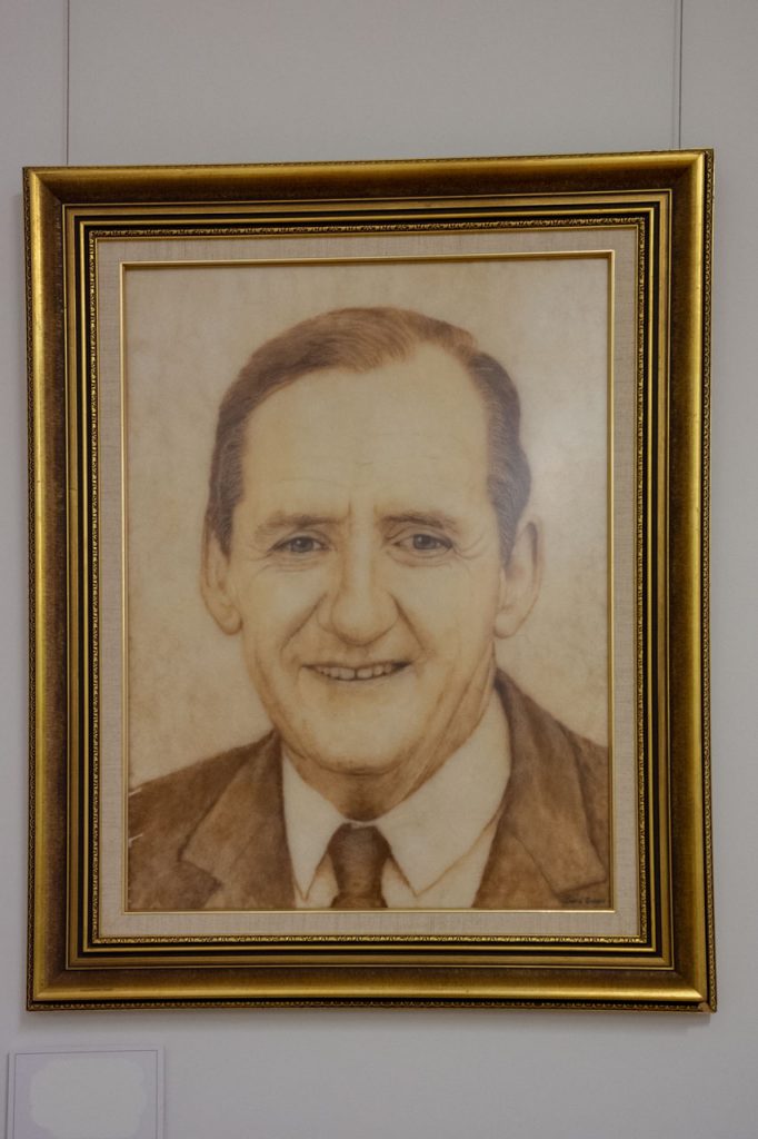
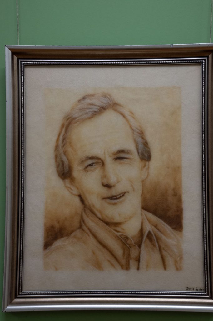
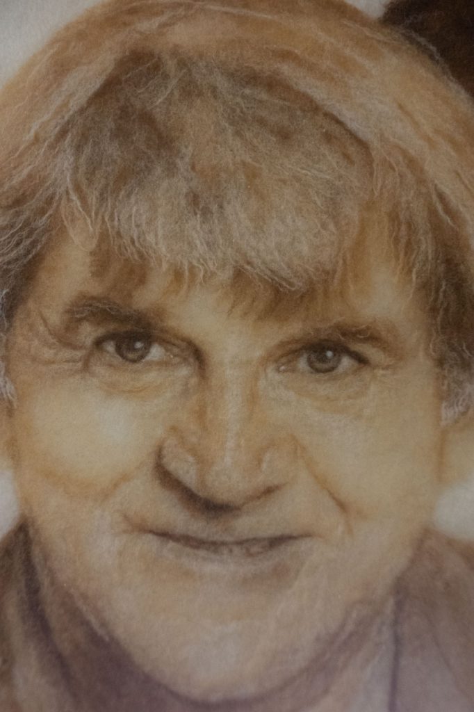
Local artist Doris Golder is one very talented artist. Her layered wool art is truly unique, the only pictures of their type in the world.
By using washed, combed, and undyed sheep’s wool, Doris has been able to create remarkably life-like portraits of well-known identities as well as landscapes. Each portrait took approximately three months to complete. The exception to this was the portrait of Fred Hollows, his wife, and his small children. This portrait took 18 months to complete due to the complexity of capturing the essence of the children.
Over 14 years, Doris created over 30 portraits, 26 of which are hung in Lockhart’s Doris Golder Wool Art Gallery.
I recently returned to the Doris Golder Art Gallery in Lockhart to renew my acquaintance with the artworks. I remain in awe of Doris’ extraordinary creative ability and the patience required to complete her artworks, especially in creating wrinkles.
Do you recognise the famous Australians in these four wool art portraits by Doris Golder? Answers at the end of this post.
The combined Greens Gunyah Museum, Doris Golder Wool Art Gallery, and Visitor Information Centre is staffed by volunteers who willingly share their wealth of local knowledge.
The $5.00 entrance fee to Greens Gunyah Museum includes entry to the Doris Golder Wool Art Gallery.
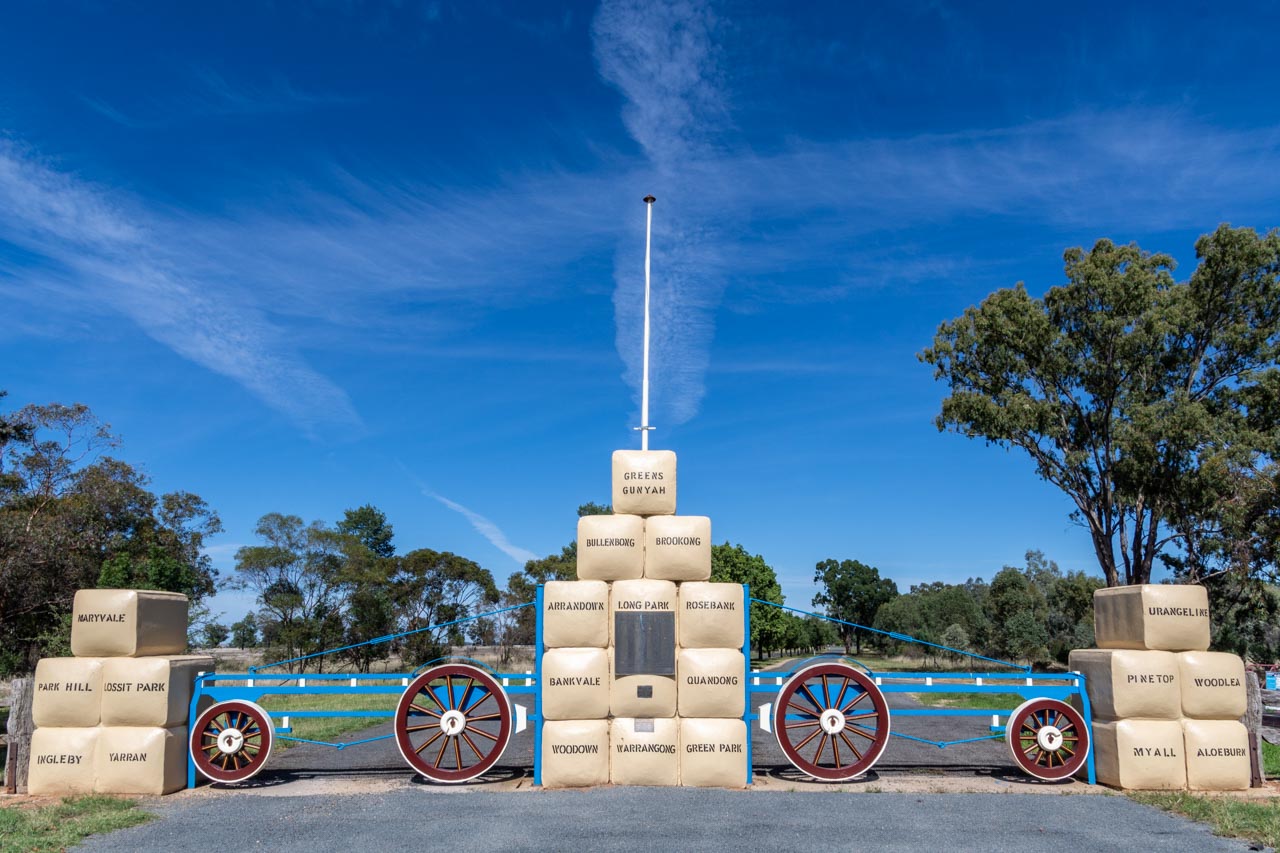
Pioneers Memorial Gateway
Pioneers Memorial Gateway is a tribute to Lockhart’s early settlers. It is situated at the entrance to Lockhart’s Showground on Urana Road.
The 22 life-sized replica bales of wool forming the columns of the entrance gates each bear the stencilled wool brand of the original sheep stations of Lockhart district.
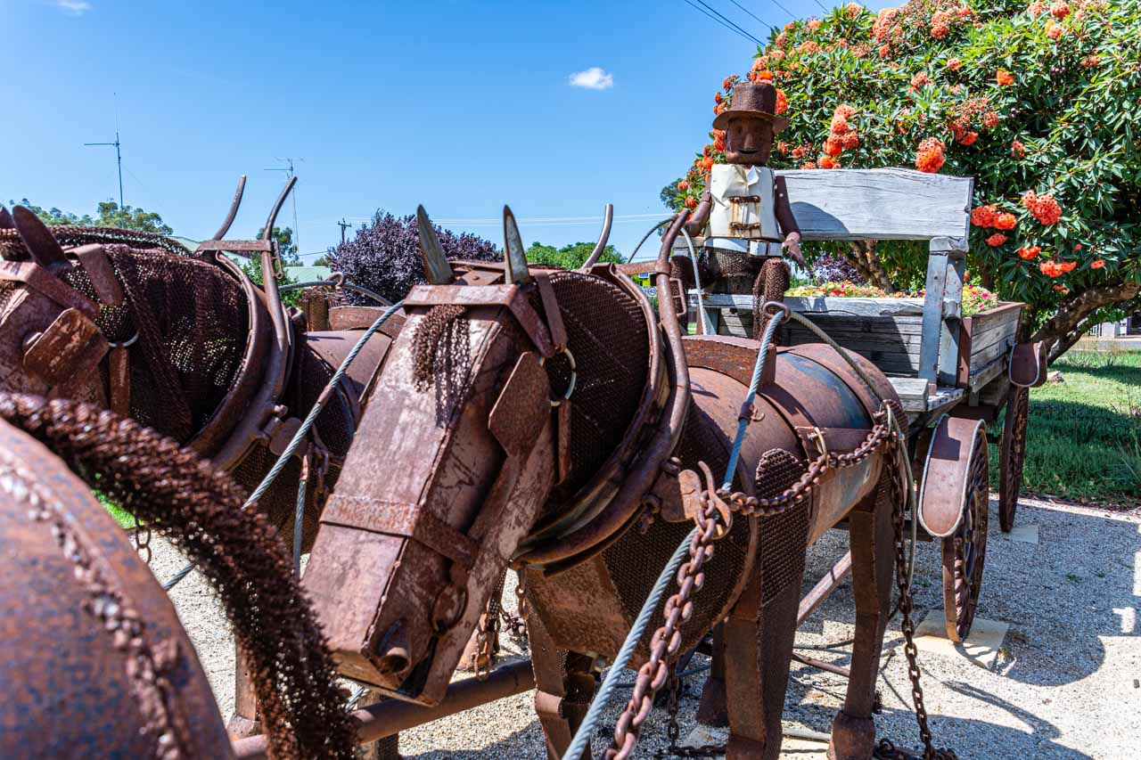
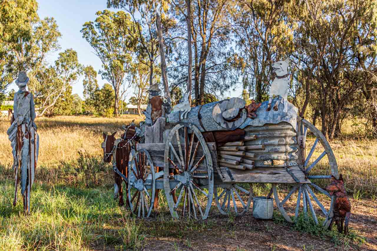
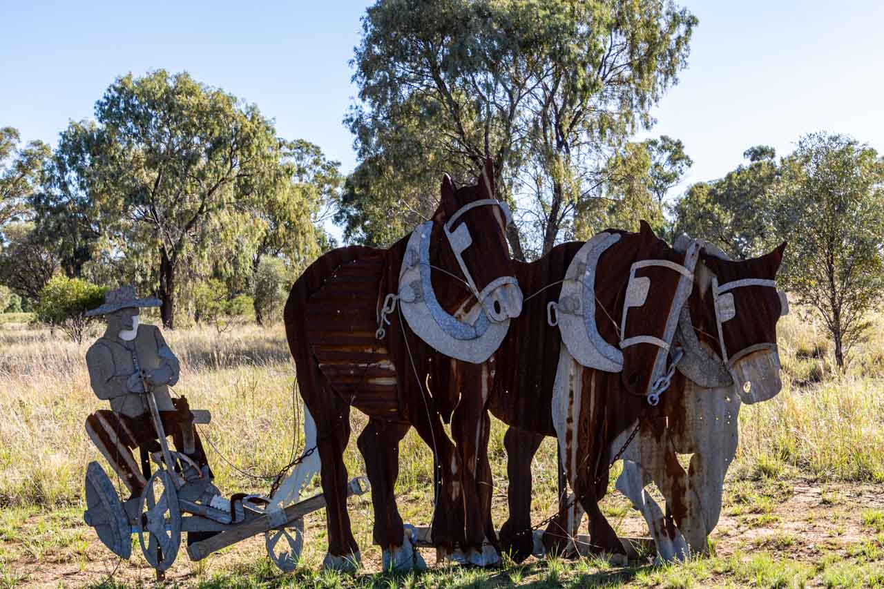
Pastoral Shadows of Brookong
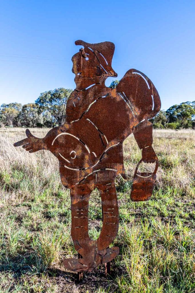
Sculpture – A Drover’s Life by Stuart Spragg
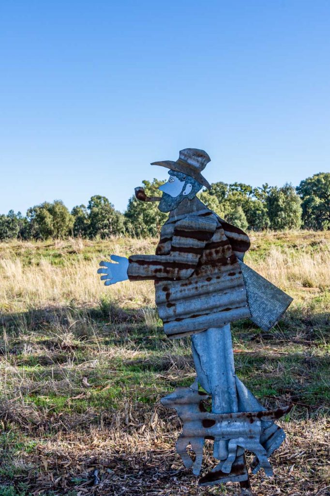
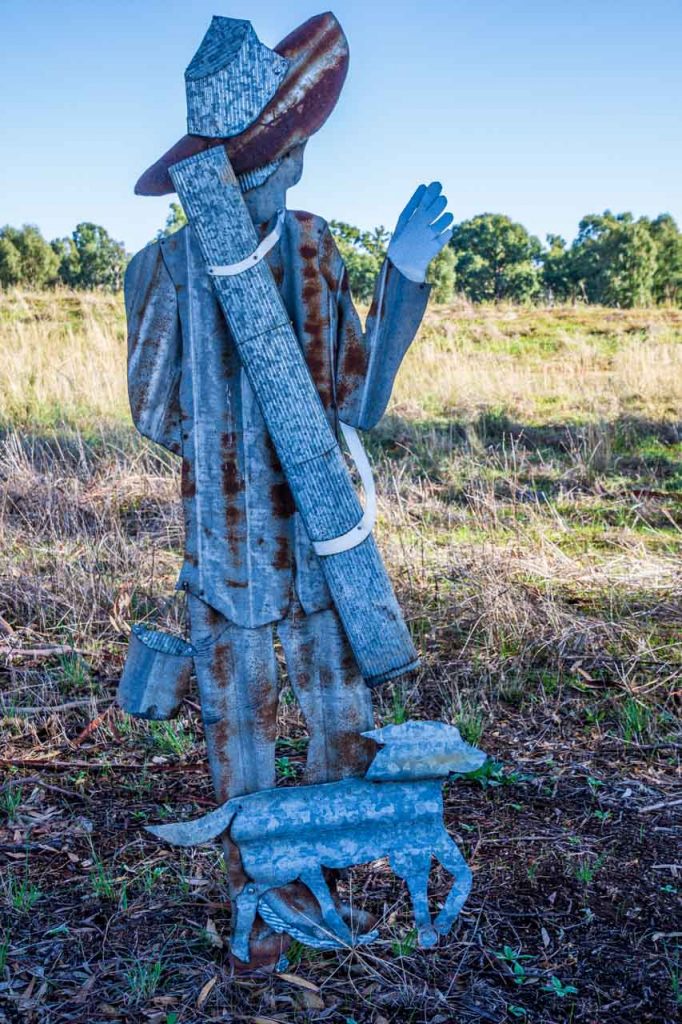
Pastoral Shadows of Brookong is a collection of sculptures and silhouettes created from rusty iron, scapes of metal, and other natural materials. The sculptures are designed to bring history to life, telling the story of Lockhart’s rural life in the 1880s, when Lockhart and the area to the west of the town was a vast sheep station.
Pastoral Shadows of Brookong is situated on the edge of town, on the road to Wagga Wagga, across the road from the Lockhart Motel. The unsealed path taking in the sculptures is an easy, flat 15-minute circular walk – longer, if, like me, you take lots of photos. As you stroll through the sculptures and silhouettes, you will meet settlers, stockmen, drovers, and swaggies, as well as sheep, farm dogs, and kangaroos. Accompanying each sculpture is signage detailing the sculpture’s name and artist.
Brookong was a huge sheep station in the district of 200,000 hectares. In 1888, the Shearer’s Riot at Brookong played a pivotal role in developing Australia’s political history.
Sculpture – Stump Jump Plough by Stuart Spragg
Photos from left to right:
Raymond the Swaggie – designed and constructed by Craig Lally
Settler “Burt” Searching for Land by Myra and Tom Jenkins
Swaggie “Fred” Looking for Work by Myra Jenkins, Neil Jeffries, and Des O’Connell
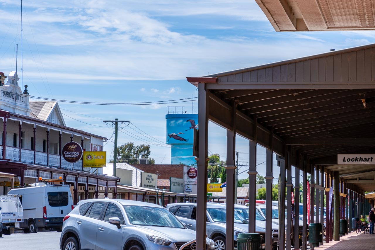
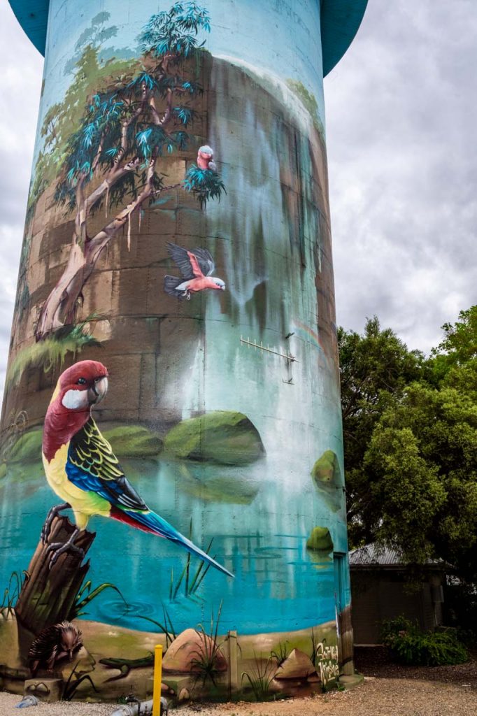
Water Tower Mural
Not silo art, which I am partial to, but the mural on Lockhart’s water tower is a remarkable piece of public art.
The mural features a cascading waterfall surrounded by many of the unique native fauna and flora found in the local landscape. The mural was painted in 2018 by Blue Mountains artists Scott Nagy and James Birkner (Krimsone) using spray cans.
Set close to Lockhart’s historic main street (Green Street) in a pretty, small park, the water tower mural is easily accessible. You will find clean public toilets next to the water tower.
Interior of Latte Da Cafe, Lockhart
Latte Da Coffee Bar
All this walking will make you thirsty and hungry.
You are not spoiled for choice for cafes in Lockhart. However, Latte Da Coffee Bar is an excellent choice for breakfast, brunch, lunch, or to relax with a cake and coffee in the cafe’s indoor or outdoor setting. Takeaway is also available.
Offering fresh food – gourmet sandwiches, toasted Turkish rolls, pies and sausage rolls, cakes, and slices – Latte Da is located at 133 Green Street (Lockhart’s main street through town). Don’t forget to check out the Specials Board. I recommend the wraps.
The cafe is open 8 am to 4.30 pm Monday to Friday, 8.30 am to 1 pm Saturday, and closed Sunday.
Other activities:
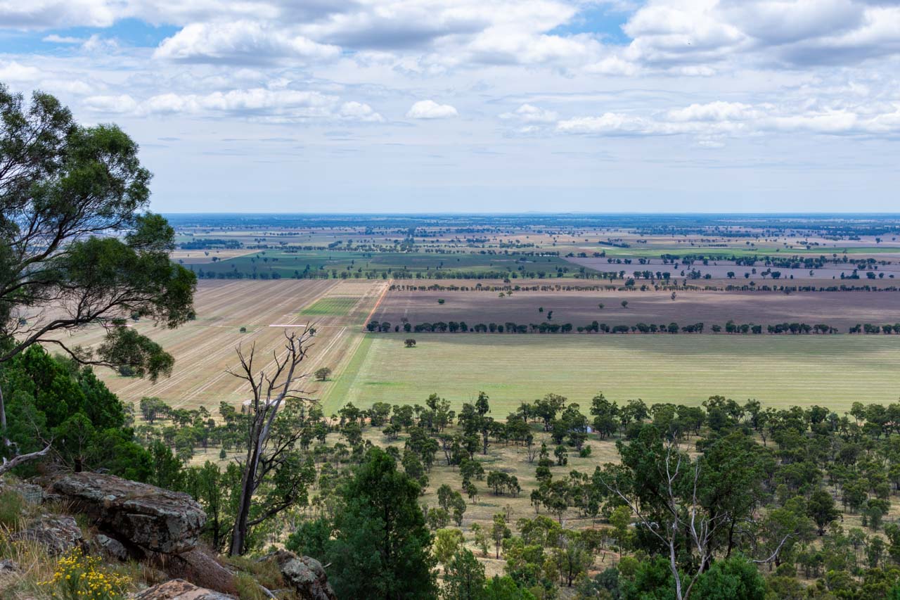
Galore Hill Scenic Reserve
Just 15 kilometres north of Lockhart, off the Sturt Highway between Narrandera and Wagga Wagga, the top of Galore Hill Scenic Reserve is an impressive landmark in a seemingly never-ending flat but changing landscape.
The drive to Galore Hill Scenic Reserve is well signposted, and the gravel road from the Sturt Highway to the top is well maintained. Near the top of the hill, you can continue left to the Summit and right to the Saddle. Travelling with a friend on a second visit to Lockhart, we headed to the Summit, the Lookout Tower and walking tracks.
The views from the top of Galore Hill of the surrounding countryside are stunning.
The Summit is well-appointed with toilets, picnic tables undercover and in the open, barbeques, and ample parking.
One walking track in the Reserve takes you to the caves used by the infamous bushranger, ‘Mad Dog’ Morgan, who terrorised the region in the early 1860s. We walked the Saddle Loop Trail – a 45-minute return from the Summit. The trail was a narrow, rocky gravel track through the Australian bush that hugged the side of the hill. We lost the track about halfway along the Saddle Loop Trail and had to return the way we had come.
Considering the state of the trail, I recommend a good level of fitness for the walk, and sturdy walking shoes or hiking boots are a must. A hat, water, sunscreen, and insect repellent are also essential. I got eaten alive by mosquitoes on one section of the Saddle Loop Trail.
On a day trip to Lockhart, you should make time to take a drive to Galore Hill Scenic Reserve to soak in the views. Walking one of the trails will best be left for another time if you want to get back to Albury before dusk to avoid hitting kangaroos. We plan to return to Galore Hill Scenic Reserve to walk the Morgans Caves Loop Trail from the Summit.
Lockhart is a wonderful town where history, heritage, and art are forever intertwined. There is something for everyone with its Federation verandahs, historic etched pavers, pioneering history, unique wool art and rusty metal sculptures, and water tower mural. Lockhart deserves a visit. Don’t leave it for 30 years as I did! Make Lockhart your next day trip destination, and don’t forget to save this guide.
Please leave a comment below to share your thoughts. My purpose in writing this post is to convince you to take a day trip to Lockhart. Have I succeeded?
Like this post? PIN it for later!
Are you looking for another day trip in New South Wales? Read the guide to Adelong…
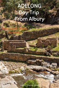
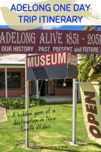
Drive to Historic Adelong, a Hidden Gem of a Destination in the Snowy Valleys. Join me on a one-day drive through regional New South Wales, from Albury to picturesque…
Drive to Historic Adelong, a Hidden Gem of a Destination in the Snowy Valleys.
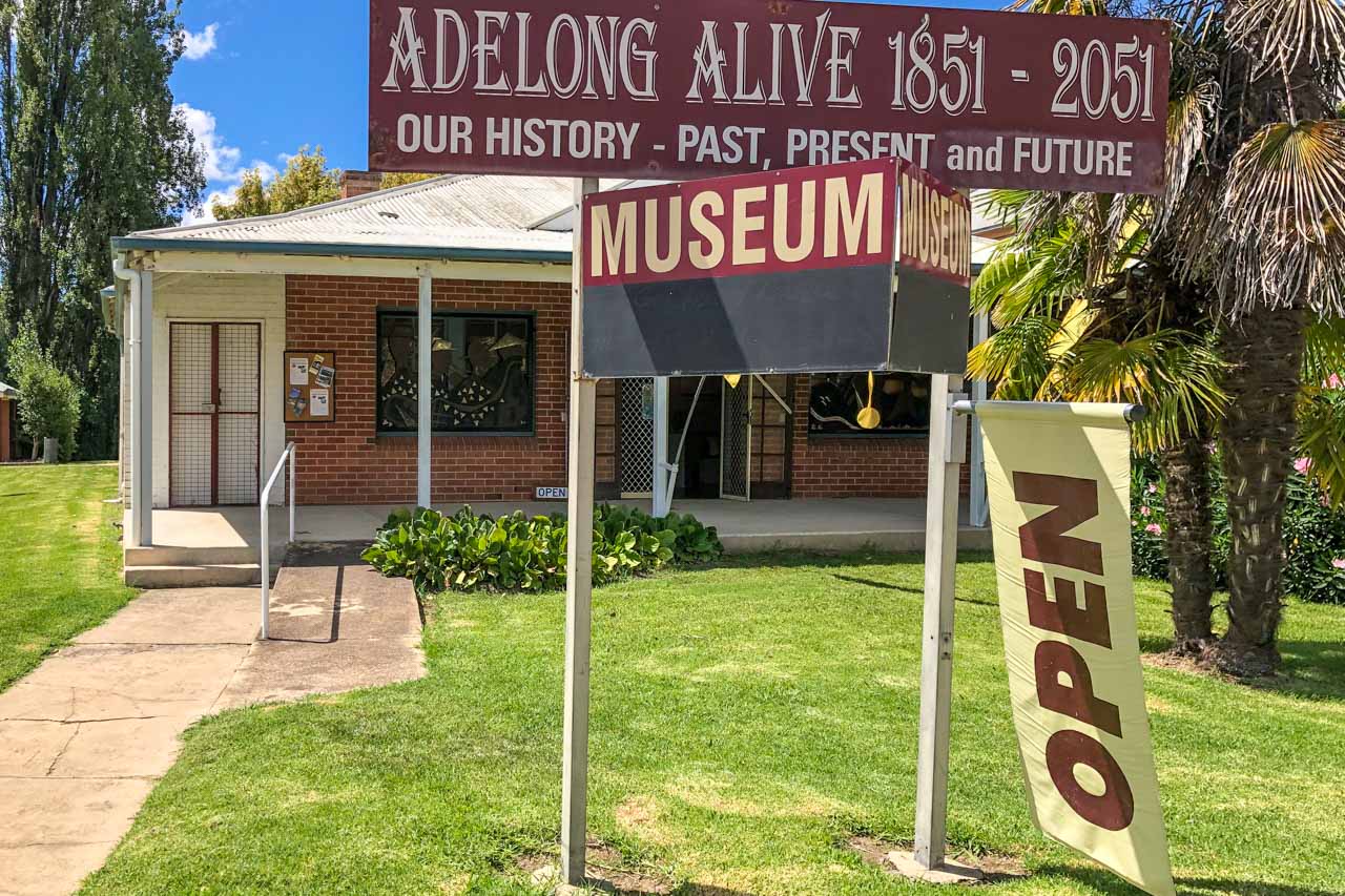
Join me on a one-day drive through regional New South Wales, from Albury to picturesque Adelong. With a history steeped in pioneering and gold, Adelong is a delightful and fascinating day trip destination. It is the town where time stood still. Discover some of the best-preserved remnants of Adelong’s gold mining era, historic buildings, great walks, and more.
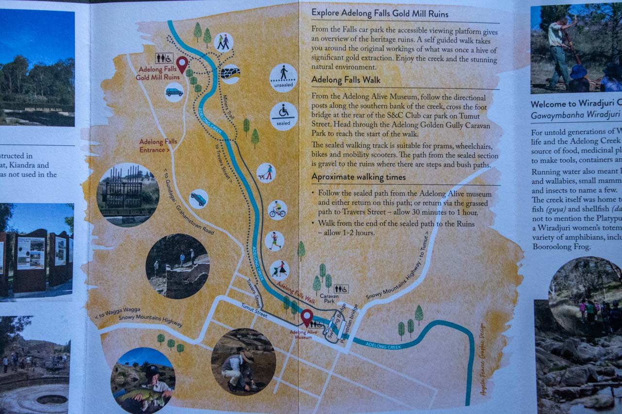
I have lost count of the number of times I have driven past the turnoff to Adelong on my way up the Hume Highway to Sydney, always wondering what the town has to offer. So, I jumped at the chance when a friend suggested we take a road trip to Tumut because this meant we could stop in Adelong and visit the famous Adelong Falls Gold Mill Ruins. As it turned out, Adelong is a hidden gem with much more to offer the visitor. Read on to learn why you should take a day trip to Adelong.
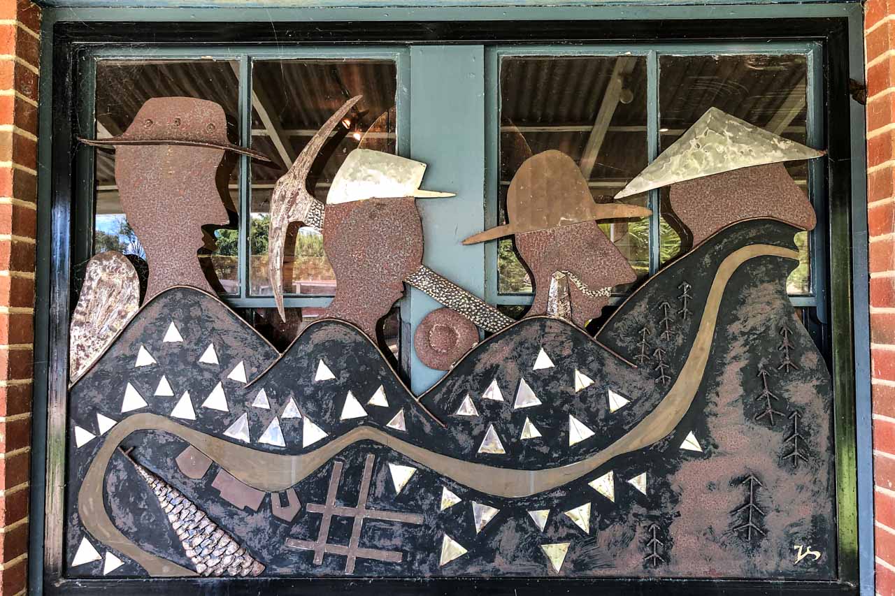
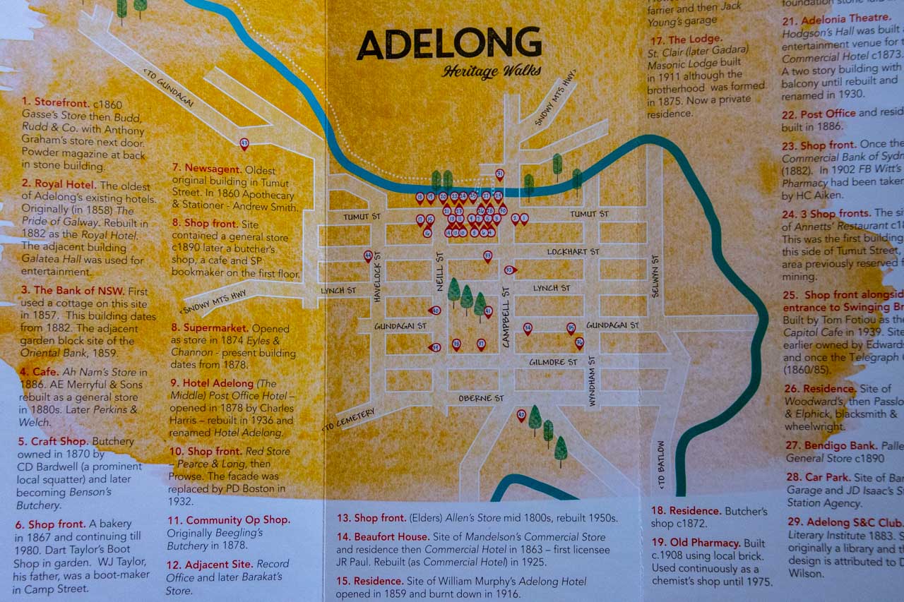
Adelong is a picturesque town built along the Adelong Creek, where gold was discovered in 1852. It is the heritage gateway to the Snowy Mountains. The tree-lined main street (Tumut Street), with its beautiful veranda-fronted buildings dating back to the gold rush in the 1800s, and Adelong Falls Gold Mill Ruins are New South Wales National Heritage Trust sites.
Adelong is easy to bypass (I can attest to that), but it is the hidden gem in the Snowy Valleys area. With so much history to discover, scenic walks to meander, friendly locals to chat with, and great food, why would you not want to take a day trip to Adelong?
Getting there
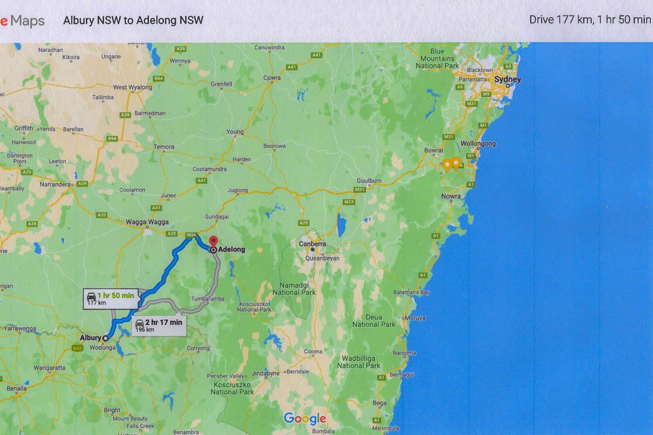
The Albury to Adelong day trip in New South Wales – courtesy of Google maps
Albury, on the Murray River, is a major regional city in New South Wales, Australia. The Murray River is Australia’s longest river and forms the border between New South Wales and Victoria.
The trip from Albury to Adelong is a drive of 1 hour, 50 minutes. As such, it just falls within my ‘2-hour-drive-from-Albury’ criterion for where to go on a day trip.
Coming from Albury, Adelong is 28 kilometres off the Hume Highway, on the Snowy Mountains Highway.
Adelong is 1 hour, 4 minutes (85 kilometres) from Wagga Wagga and 2 hours, 16 minutes (195 kilometres) from Canberra.
Enroute from Albury to Adelong, we detoured off the Hume Highway for a late breakfast in Holbrook. We cruised the main street seeking out Holbrook’s cafe options. We settled on J & B’s Gourmet Cafe (for no particular reason), where we had an excellent, hearty breakfast.
Our drive from Albury to Adelong took 3 hours 11 minutes:
We left Albury at 8.35 am.
We arrived in Holbrook at 9.20 am.
We did not rush breakfast, leaving Holbrook at 10.20 am.
We arrived in Adelong at 11.40 am, having missed the turnoff to the Adelong Falls Gold Mill Ruins – our planned first stop.
Turning around, we found the turnoff to the Adelong Falls Gold Mills Ruins 1.5 kilometres back the way we had come.
We arrived at the Adelong Falls Gold Mill Ruins at 11.46 am.
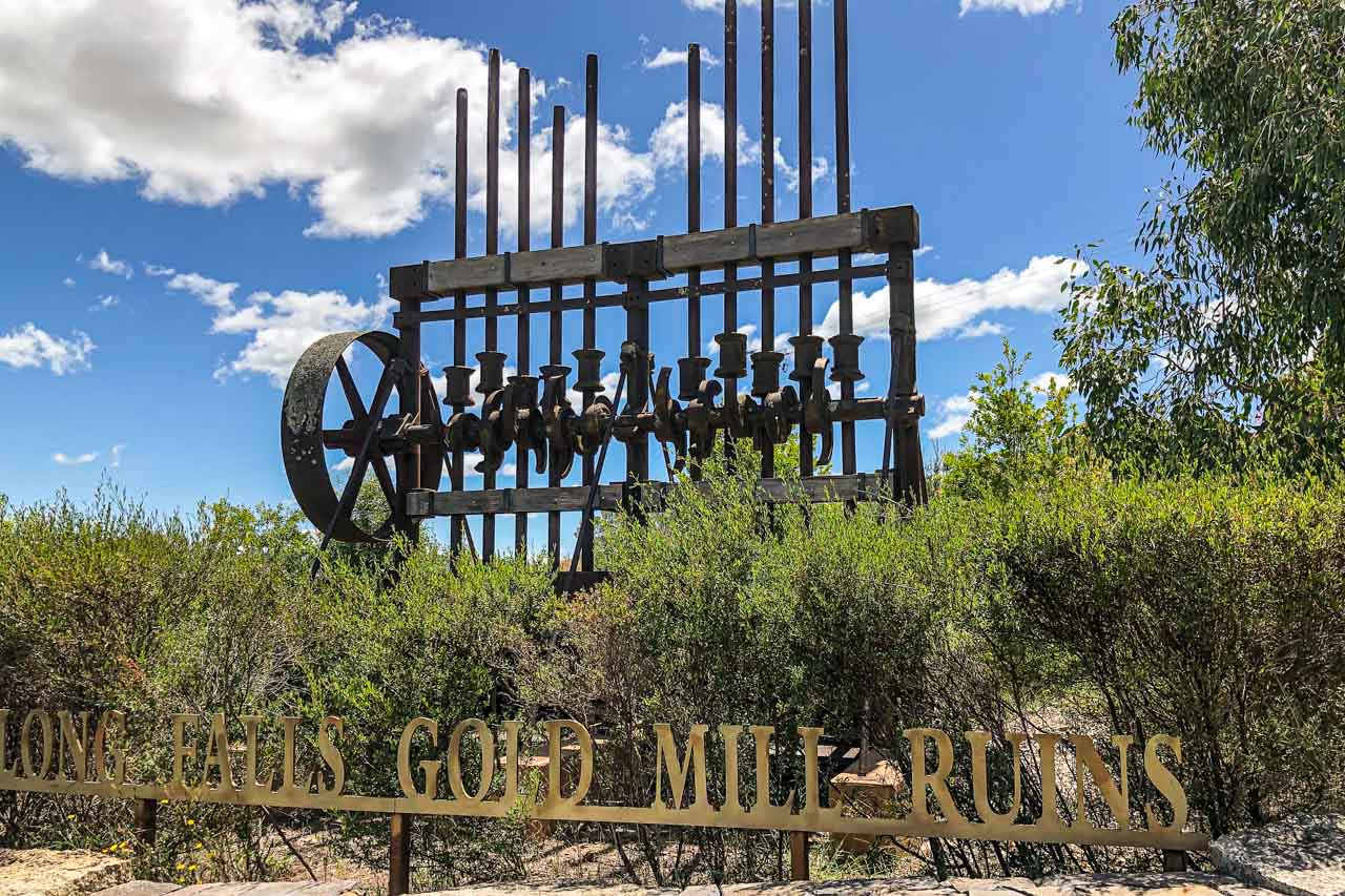
Driving into Adelong from the Hume Highway along Snowy Mountains Highway, this piece of gold mining machinery and signage (photo above) was only visible in the car’s rear-view mirror. That’s my excuse for missing the turnoff to the Adelong Falls Gold Mill Ruins!
Things to do in Adelong
Adelong might be a small town (population of 943), but there is much to see and do, keeping you occupied for the day and commending it as a worthy place to go for a day trip in New South Wales.
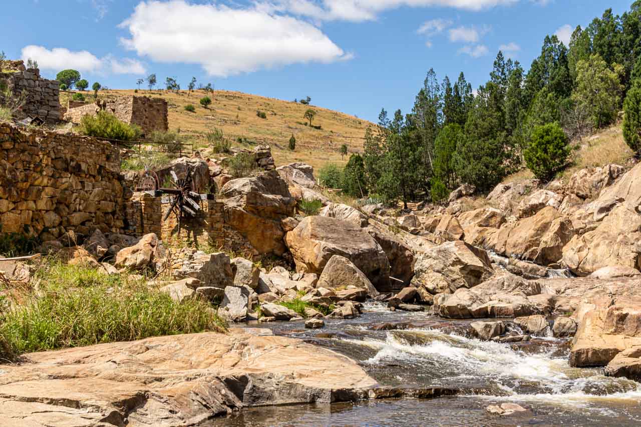
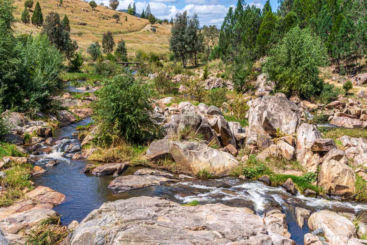
Adelong Falls Gold Mill Ruins
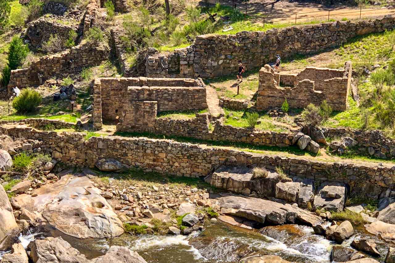
Gold Mill Ruins – photo taken from the viewing platform
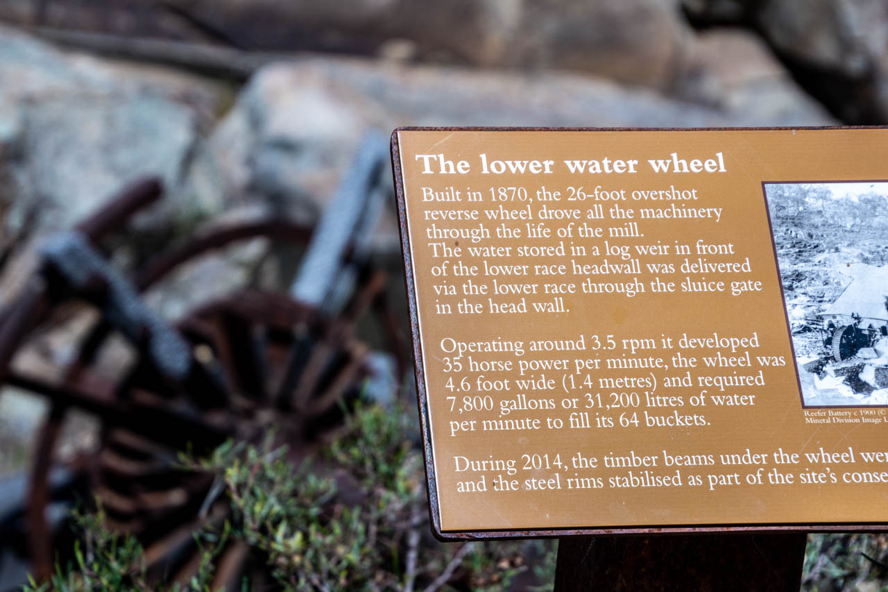
Alluvial gold was discovered in Adelong in 1852 and reef ore in 1856.
The Adelong Falls Gold Mill Ruins is a heritage-listed (New South Wales) industrial site. It features a remarkably preserved collection of stone ruins bearing witness to the 1869 Reefer ore crushing mill and the remains of the ingenious Reefer ore crushing machine. The mill ceased operation in 1914.
Directions to the Adelong Falls Gold Mill Ruins:
From the Hume Highway, take the Snowy Mountains Highway turnoff and continue for 26 kilometres. Turn left onto Quartz Street and continue for 950 metres. At a fork in the road, turn right onto Adelong Falls Road, where the road ends 400 metres at the visitor car park. If you end up in Adelong township, then, like me, you have missed the Quartz Street turnoff.
At the visitor car park, there is ample parking, toilets, and a covered picnic area. Entry to Adelong Falls Gold Mill Ruins is free.
The wheelchair-accessible viewing platform near the visitor’s car park provides an excellent view of the gorge and ruins below.
From the viewing platform, my friend and I took The Ruins Walk down to Adelong Creek and spent a very informative hour walking around the ruins and gaining insight into the history of the Adelong goldfield.
The interpretative signage describing what you see as you walk around the ruins is excellent, making it easy to take yourself on a self-guided walking tour. You can also click here for a pamphlet on a brief history and plan of the Adelong Falls Gold Mill Ruins.
The lower water wheel at the Adelong Falls Gold Mill Ruins
Adelong Falls Gold Mill Ruins
You don’t have to drive to the Adelong Falls Gold Mill Ruins. You can walk there via the Adelong Falls Walk.
Adelong Falls Walk
Map of Adelong Falls Walk – brochure courtesy of Visit Snowy Valleys
The Adelong Falls Walk links the town of Adelong to the Adelong Falls Gold Mill Ruins. The sealed section is an easy, flat walk along the banks of the stunning Adelong Creek.
The Adelong Falls Walk begins at the Adelong Alive Museum on the town centre’s main street (Tumut Street).
The sealed section of the Adelong Falls Walk takes about half an hour, one way. The walk from the sealed path to and around the Adelong Falls Gold Mill Ruins is gravel with steep sections and stairs. Allow approximately 2.5 hours (return) to walk from the museum through to and around the ruins.
Adelong Creek
MKS Cafe
MKS Cafe (88 Tumut Street) is situated beside the park and is open for breakfast, brunch and lunch. The cafe owes its old-world charm to its location in one of Adelong’s heritage buildings – The Old Pharmacy, dating from 1877.
We enjoyed good coffee and delicious cake in MKS Cafe’s tree-shaded courtyard.
Adelong Alive Museum
Adelong Alive Museum (86 Tumut Street) tells the stories of Adelong and district, beginning with the gold rush period of 1852 and continuing to the present day. The museum has a scale model of the Reefer ore crushing mill and working models of ore crushing machinery. There is even a room dedicated to the history of the Adelong CWA (Country Women’s Association).
Finding the museum open would seem to be a matter of chance. The Australian Museums and Galleries’ website advises the Adelong Alive Museum is open from 11 am to 3 pm Saturdays and Sundays and by request. Another website I checked informs the reader the museum is open some weekends. The museum’s Facebook page notifies opening hours as Saturdays only, from 11 am to 1 pm. Confused? We were there on a Friday and delighted to find the museum open without prior arrangement. Go figure! Admission is a gold coin donation.
Gary Gately, our friendly and knowledgeable museum volunteer, took the time to show us through the museum, providing detailed information on Adelong’s extensive and colourful history.
A sculpture dominates a window of the Adelong Alive Museum
Adelong Heritage Walks
Take a walk around this historic gold mining town, exploring buildings dating back to the second half of the 19thcentury.
Map of Adelong Heritage Walks – brochure courtesy of The Royal Australian Historical Society
In Adelong, Tumut Street (the town’s tree-lined, veranda-fronted main street) is heritage-listed by the National Trust of Australia (NSW).
The Adelong Heritage Walk takes about an hour and passes most of the town’s noteworthy and National Trust-listed buildings.
If you don’t have time to complete all of Adelong’s Heritage Walk, I suggest you walk along Tumut Street, where most of the town’s heritage buildings are concentrated.
I picked up the Adelong Heritage Walks brochure at the Adelong Alive Museum. However, there is no guarantee the museum will be open. The brochure is available at Tumut Region Visitor Information Centre but driving onto Tumut will add 38 kilometres (30 minutes) return to your day trip drive. I was unable to find the brochure online. However, click here for a description of the walking route and heritage buildings.
Other activities:
In the warmer months, take a swim at the Adelong Falls.
With gold still to be found in Adelong Creek, try your hand at gold panning.
Adelong deserves a visit. With its pretty main street, vibrant museum, pleasant walk along Adelong Creek, and excellent remnants of its gold mining era, Adelong oozes times past still intact. With so much history in one place, Adelong is a hidden gem where time has stood still, unchanged since the 1940s. Adelong is a must-see day trip destination.
Would you visit Adelong? With a population of 943, is it realistic to call Adelong a town or is it better described as a village? Please leave a comment below to share your thoughts.
Like this post? PIN it for later!
Are you looking for another day trip in New South Wales? Read the guide to Lockhart…
An Annual Celebration Not to Be Missed is Benin’s Voodoo Festival in Ouidah Picture colour, music, singing, dancing, and a joyous party attracting national and international visitors. This is…
An Annual Celebration Not to Be Missed is Benin’s Voodoo Festival in Ouidah
Picture colour, music, singing, dancing, and a joyous party attracting national and international visitors. This is not Carnival in Rio de Janeiro or Venice. Add religion and culture, and you have Benin’s Voodoo Festival in Ouidah. With 13 photos to inspire your curiosity, wanderlust, and travel plans, join me in my experience of Benin’s Voodoo Day national celebration.
Voodoo Day in Benin falls on January 10 each year. It is a national holiday celebrating the country’s heritage of the West African religion of Voodoo.
Benin (officially the Republic of Benin) is a sliver of a nation in West Africa on the Atlantic Ocean. It borders Togo to the west, Nigeria to the east, and Burkina Faso and Niger to the north. Ouidah is a city on Benin’s narrow strip of coastline and was the ancient port of the slave trade.
Map of West Africa
Attending Benin’s Voodoo Festival in Ouidah was my primary reason for travelling to West Africa.
Voodoo is one of Benin’s official religions, while Ouidah is considered the birthplace of Voodoo. It is probably one of the most misunderstood religions in the world. West African Voodoo is a complex religion rooted in healing and doing good to others. It is not the stuff of Hollywood – of witchcraft and black magic or sticking pins in dolls.
I must admit it was curiosity that fed my travel plans to include the Voodoo Festival in Ouidah. I wanted to witness this annual celebration of Benin’s heritage and traditional culture and to experience a unique festival.
My participation at the Voodoo Festival commenced with a visit to Ouidah’s Temple of Pythons – one of Voodoo’s most revered places and home to some 60 pythons. The pythons are a significant symbol for followers of Voodoo. They are not feared but are revered and worshipped. These pythons were said to be docile, which was just as well because they roamed freely. It was here, through a break in the trampling crowd, that I momentarily sighted the Voodoo Pope who had come to pay homage at the Temple of Pythons.
Some of the 60 pythons in the Temple of Pythons
Voodoo Pope (man in blue) at the Temple of Pythons
Female Voodoo devotees at the Temple of Pythons
From the Temple of Pythons, the Voodoo Pope led a procession along the historical, 3-kilometre Slave Road to the ‘Door of No Return’ (of slave trade infamy) on Ouidah’s beach on the Atlantic coast. It was on this stretch of sand that the celebrations of the Voodoo Festival truly got underway.
And what a celebration!
With the dignitaries’ speeches over (this took over an hour), it was party time. But first, the spirits and Voodoo gods needed to be appeased with the sacrifice of a goat. The Voodoo Pope carried out this ritual behind a circular wall of blue plastic away from public view. Animal sacrifice is a fundamental element in Voodoo. No Voodoo ceremony is worth its salt without an animal sacrifice in exchange for favours from the spirits.
Immediately following the sacrifice, the Voodoo Pope made his way to his throne in the shadow of the Door of No Return. I say ‘throne’ because the festival hosts referred to him as “His Majesty the Pope”.
The Voodoo Pope (in blue robes) on his throne
With the Voodoo Pope seated, the atmosphere changed. The speeches gave way to vibrant displays of dancing and the throbbing of drums. I witnessed ‘exorcisms’ in which a seemingly possessed person would run away from a group of people, only to be caught, dragged to the ground, and sprinkled with powder. The crowd became particularly excited when coloured haystacks appeared, spinning around the grounds. I learned these ‘haystacks’ are Voodoo spirits known as Zangbeto and are the traditional Voodoo guardians of the night – the Nightwatchmen. They are the unofficial police force and dispensers of justice. I did not envy the human police who battled to keep the crowds from encroaching on dancers and Voodoo spirits.
With so much going on around me, I wandered around aimlessly. I didn’t know which group to stay and watch or where to go next. But I was intent on seeing it all. I moved around the festival for a couple of hours until I decided it was time to sit down and people watch.
Overall, the celebration at the Voodoo Festival in Ouidah was a hive of activity in which people would swarm from one dance display to another. A kaleidoscope of colour from the attire worn by attendees and a cacophony of noise from the frantic pounding of drums dominated the festival. The crowd was buzzing.
But perhaps, the best way to describe the Voodoo Festival and my experience is to share some of my photos with you.
Ouidah’s Voodoo Festival was a never to be forgotten experience.
Which festival have you attended that has been a ‘never to be forgotten experience’ for you? Tell us about it. Please leave a comment below to share your thoughts.
15 Photos for 15 Reasons Why You Should Holiday in Tropical Broome, the ‘Capital’ of the Kimberley Broome’s physical environment and cultural richness offer a wide variety of unique experiences…
15 Photos for 15 Reasons Why You Should Holiday in Tropical Broome, the ‘Capital’ of the Kimberley
Broome’s physical environment and cultural richness offer a wide variety of unique experiences for every visitor, whatever your budget. The photos in this post take you on a virtual tour of my experiences and discoveries over six days in Broome.
Broome is the gateway to the spectacular Kimberley region in tropical northern Western Australia – where one of the world’s last wilderness areas meets the Indian Ocean. Broome is about 2,048 kilometres northeast of Perth and approximately 1,871 kilometres southwest of Darwin.
Why should you visit Broome? Below I have focused on 15 personal reasons, presented through 15 photos to tempt you to visit this laid-back town that gets under your skin. With pristine waters, sandy beaches, abundant wildlife, tropical climate, breathtaking colours, and magnificent landscapes, Broome is a unique destination with so much to see and discover.
The Yawuru (pronounced Ya-roo) people are the traditional owners of Broome and surrounding areas.
Pearl Luggers
There is a local saying that Broome was built on buttons.
On Dampier Terrace in Chinatown, Pearl Luggers is a unique museum providing insight into Broome’s pearling industry – an industry that commenced life supplying mother-of-pearl for the European market for buttons, combs, and other high-end fashion accessories, to Broome now being the home of the South Sea Pearl.
Peal Luggers features two fully restored wooden pearling luggers (sailing vessel with specific rigging) and 150 years of pearl diving memorabilia. The divers would stay out to sea on the luggers for months at a time.
I was interested in the pearling history of Broome and found the Pearl Luggers tour was a great introduction to that history. It was educational, informative, entertaining, visual, tactile, and insightful. I learned pearl divers risked their lives due to drowning or decompression sickness (the bends) every time they dived for pearl shells. I learned the pearl divers wore 180 kilograms of weights each time they dived, which limited their diving life to 10 years due to carrying all that weight. Many divers now rest in the Japanese cemetery.
The 1.5-hour tour operates daily, concluding with a free sample of the rare pearl meat. I didn’t try this costly delicacy as I wasn’t game to test if my seafood allergy ran to pearl meat.
Japanese Cemetery
Pearling was a dangerous pursuit. The Japanese Cemetery on Port Drive in Broome is the largest Japanese cemetery in Australia. The memorial on the stone wall at the entrance to the Japanese Cemetery reads …
The Japanese cemetery at Broome dates back to the very early pearling years and bears witness to the close ties Japan has with this small north west town. The first recorded interment in this cemetery is 1896.
During their years of employment in the industry, a great many men lost their lives due to drowning or the diver’s paralysis [decompression sickness (the bends)]. A large stone obelisk bears testimony to those lost in the 1908 cyclone. It is also recorded that the 1887 and 1935 cyclones each caused the death of 140 men. In the year 1914 the diver’s paralysis claimed the lives of 33 men.
There are 707 graves (919 people) with them having headstones of coloured beach rocks.
The sheer enormity of the number of deaths among the Japanese pearl divers and the sacrifice they made with their lives to Broome’s pearling industry moved me. The serene beauty of the memorials created an atmosphere for reflection.
Willie Creek Pearl Farm
The pearl found in the oyster that was harvested on my tour and was valued at $750.00
Broome was built on its pearling industry. As such, you should not miss a tour of a working pearl farm.
Willie Creek Pearl Farm is a working pearl farm where you can learn all about the process of modern cultured pearl farming – from the birthing and harvesting of oysters through to valuing the pearls, the creation of jewellery, and how to care for your pearls. The tour includes a boat trip on Willie Creek to view the live oysters in panels suspended from lines. The tour finishes with morning or afternoon tea.
Roebuck Bay
Roebuck Bay is a spectacular landscape
Roebuck Bay is one of Broome’s most beautiful and dramatic natural attractions. The bay’s colours are spectacular, and the enormous tidal variations (up to 10 metres between low and high tides) are remarkable. Town Beach is the best place to sit and observe the ever-changing Roebuck Bay.
Also worth noting: Roebuck Bay is Australia’s newest Marine Park and a national heritage site. Often seen playing, swimming, and fishing in Roebuck Bay is the Australian snubfin dolphin, recognised as a new species in 2005. The bay is also a bird lover’s paradise as it is a great place to view vast numbers of migratory birds.
Gantheaume Point
Gantheaume Point is at the southern end of Cable Beach, six kilometres from Broome’s town centre. If you don’t have a car, a tour could be your best option for viewing Gantheaume Point’s vibrant red rock formations that drop down to the Indian Ocean.
Fun fact: Gantheaume Point is a national heritage site famous for its dinosaur footprints. If wanting to see the dinosaur footprints, check the tides. The footprints are only visible at low tides below 1.3 metres.
Matso’s Broome Brewery
Stop in for a drink at Matso’s Broome Brewery on Roebuck Bay – Australia’s most remote microbrewery and the only brewery in Broome. Sample Matso’s famous alcoholic Ginger Beer or try their Mango Beer or Chilli Beer.
Breakfast, lunch, and dinner are available at this award-winning venue.
Also at Matso’s: Sobrane, the artist who painted the murals on the silos at Tungamah in North East Victoria, lives in Broome and has a gallery within Matso’s grounds. Her artwork is delightful and primarily focuses on Australian native birds. Take a wander through her gallery.
Town Beach Café
Town Beach Cafe – breakfast with a view
Town Beach Café has the best views in town. As the name suggests, the café is at Town Beach overlooking Roebuck Bay.
Broome is a bit short on cafés. However, Town Beach Café won me over with its beautiful view over the azure waters of Roebuck Bay and its excellent food. I ate here a couple of times for breakfast and brunch. My favourite meal was ‘Stacks on Shorty’ – fluffy pancakes, fresh bananas, syrup, berry compote, and mascarpone. Yum! It makes my mouth water just writing about it. An iced coffee completed my meal.
At the time of writing, Town Beach Café is closed for the wet season, reopening in March 2022.
Sunset Pictures
Sun Pictures is an outdoor cinema in Broome’s Chinatown. It is the world’s oldest operating open-air picture garden and is heritage listed (Western Australia).
Movies run nightly, but be warned, Sun Pictures is located under the airport’s flight path. It is not unusual for your movie to be interrupted by the sudden and loud noise of a plane flying over low enough to feel you can reach up and touch it.
Sun Pictures is a major tourist attraction. If you don’t want to see a movie but would like to check out the inside of the cinema, tours are available.
Fun fact: Sun Pictures is the only picture theatre in the world to be subject to continual tidal flooding. Until Broome’s levee bank was built in 1974, moviegoers would have to lift their feet as the tide came in. Rumour has it that you could catch a fish during a screening!
Cable Beach camel ride
No trip to Broome is complete without hopping on the back of a camel for a ride along Cable Beach as the sun goes down over the Indian Ocean. A sunset camel ride along Cable Beach is one of Broome’s most iconic experiences.
Cable Beach sunset
Visit Cable Beach to watch the spectacular sunset over the Indian Ocean.
Gantheaume Point sunset
Gantheaume Point provides a less crowded alternative to Cable Beach for watching the sun drop below the horizon. With its rock formations, it also offers a different perspective from that of Cable Beach.
Unfortunately, on the evening of my sunset tour to Gantheaume Point, there was thick cloud cover. Even so, I found the sun escaping through the clouds to be visually pretty and quite different to that of Cable Beach’s lens-filling red.
Staircase to the Moon
Staircase to the Moon photo credit: Tourism Western Australia
Staircase to the Moon is an optical illusion created by a natural phenomenon. This spectacular vision occurs when a rising full moon is reflected in the exposed mudflats of Roebuck Bay at extremely low tide. Thus, creating the illusion of a stairway reaching to the moon.
Staircase to the Moon happens for 2-3 days each month between March and November. The best place to witness the Staircase to the Moon is at Town Beach.
Dates and times to observe Staircase to the Moon are available from Broome Visitor Centre.
Whale Watching and Sunset Cruise
A sunset cruise along Western Australia’s coastline with the chance to see Humpback whales is a relaxing way to spend four hours in the late afternoon.
The cruise I took was on a catamaran with a fully licensed and serviced bar onboard. Fresh canapes, fruit, cheese platter and non-alcoholic drinks were complimentary. Unfortunately, no whales were sighted.
Courthouse Markets
The Broome Courthouse Markets are held in the heritage-listed gardens of the Broome Courthouse. The markets are a significant tourist attraction in Broome and host up to 115 creative stalls in the dry season.
Hours: The Courthouse Markets run annually on Saturdays from 8 am – 1 pm and the same hours on Sundays between April and October.
Town Beach Night Markets
The Town Beach Night Markets are held every Thursday night (4 pm – 8 pm) from June to September. The markets are located at Town Beach Reserve on Hamersley Street.
The day I arrived in Broome (3rd June) was the first Town Beach Night Markets held for the season. I wandered around the various stallholders displaying a variety of crafts and wares, checked out the food vans offering international and local cuisine, and listened to live music while I ate my dinner.
Getting around
Broome is flat and easy to walk around. When I wasn’t walking, I took the Broome Explorer Bus. The map and timetable are accessible online (and from the Visitor Centre and hotels). 24- and 72-hour passes are available online. I opted to purchase a single ticket on the bus for each trip I took. A single ticket (return tickets are not an option) costs $4.50 (adult) per trip for one to unlimited stops.
Take the time to visit Broome Visitor Centre at 1 Hamersley Street for all your travel needs: what to see and do, activities, tours, getting around Broome, and places to stay. I found the staff most helpful, friendly, knowledgeable, and willing to spend as much time with me as I needed. They suggested activities, booked tours for me, checked tours availability, and provided maps – all with a smile. In the Visitor Centre, you will find better quality souvenirs to take home.
I did buy myself a souvenir but not from Broome Visitor Centre. I purchased a traditional carved pearl shell (Riji) by indigenous Bardi elder and artist Bruce Wiggan. Each of Bruce’s carvings is unique and tells a story of culture through the red and ochre lines. My Riji is ‘Old People Teaching’. It is about the old people teaching the young ones the stories and traditions of making the raft (goolwa) – where to find the best mangrove wood and how to shape them. The outside lines depict the currents and tides best for riding. I bought the traditional carved pearl shell at Cygnet Bay Pearls in Broome’s Chinatown, 23 Dampier Terrace.
My Riji purchase: ‘Old People Teaching’
When to go
Broome has no summer or winter, just wet or dry due to its tropical monsoon climate. The wet season is November to April, and the dry season is May to October.
If you want to avoid oppressive heat and humidity, cyclones, and flooded rivers, then travel to Broome and the Kimberley in the dry season. Much of the Kimberley is impassable during the wet season. Flooded rivers isolate towns, accommodation, and inhabitants during the wet season.
Have you been to Broome in the Kimberley, Western Australia? Which activities would you like to share with readers? If you haven’t visited Broome, is this a destination that tempts your wanderlust? If you only had time for one activity, which would that be? Please leave a comment below to share your thoughts.
Visit Rochester Victoria – 3 Excellent Reasons to Plan Your Next Great Escape Are you looking for a day trip or overnight stay in rural Victoria? On the Campaspe…
Visit Rochester Victoria – 3 Excellent Reasons to Plan Your Next Great Escape
Are you looking for a day trip or overnight stay in rural Victoria? On the Campaspe River, Rochester is an idyllic spot to see silo art, take an informative walk through the Australian bush, and eat good food. My one-day guide will take you there.
On a 12-day road trip around Victoria, my sister and I stopped over in Bendigo and Ballarat, travelled the silo art trail, photographed our reflections on Lake Tyrrell, explored the Lakes District around Kerang, and walked the Koondrook Barham Redgum Statue Walk.
Rochester was our last stop, arriving late afternoon. The following day, we viewed Rochester’s silo artworks and took the river walk before heading home in the early afternoon. These are two of the best things to see and do in Rochester. The third best thing to do in Rochester was eating – well worth mentioning, given our food experience on this road trip.
Where is Rochester
Situated on the Campaspe River in Victoria (Australia), Rochester is 27 kilometres south of the Murray River Port of Echuca. The Murray River, in New South Wales, forms the border with Victoria and is Australia’s longest river.
Taking the fastest route, according to Google maps, Rochester is 187 kilometres north of Melbourne, 27 kilometres south of Echuca, and 240 kilometres south-west of the twin cities, Albury/Wodonga.
Silo artwork
Silo artworks of Squirrel Glider and Azure Kingfisher at Rochester, Victoria.
Rochester’s Silo Art project was the initiative of Rochester Business Network, with support from local businesses and the community. GrainCorp provided the silos as ‘creative’ canvases for artworks on a massive scale. To give you an idea of perspective, the concrete silo is 22 metres high (approximately 72 feet), while the height of the metal silo is 18 metres (about 59 feet).
The painted silos are in the heart of town. They feature the endangered Squirrel Glider on the concrete silo and the Azure Kingfisher on the metal silo. Both are native to Australia.
The painted silos, completed in 2018, is an open-air gallery that never closes and is free to visit. It is street art at its best.
The artist who designed and painted these magnificent murals, Jimmy DVate, is the same artist who painted the silos at Goorambat in North East Victoria.
Jimmy is a Melbourne based artist and graphic designer whose talent is recognised nationally and internationally. He is passionate about conservation and is particularly keen to highlight the plight of endangered species. Painting threatened Australian native fauna is a ‘signature’ of Jimmy’s artwork.
Of all the silo artworks we saw on this road trip around Victoria, which took in the Silo Art Trail, the Rochester painted silos were my sister’s favourite. They rate very highly on my list too. I think I must have an affinity with Jimmy DVate’s artworks as his paintings on the silos at Goorambat are also at the top of my favourites list.
The endangered Squirrel Glider painted on Rochester’s grain silo
River Walk
Walking from the painted silos, we made our way to Rochester’s Red Bridge, a timber rail bridge crossing the Campaspe River at the northern end of Ramsay Street. Built in 1876, the Red Bridge consists of three openings of 14 metres spanning the river and 16 openings of seven metres over the flood plain.
Red Bridge – the rail bridge crossing the Campaspe River at Rochester
The Red Bridge features in the background in the silo artwork of the Kingfisher.
Rochester’s Red Bridge features in the background on the silo artwork of the Kingfisher
The Red Bridge was our starting point for the 3-kilometre signposted river walk through the urban bushland of the Campaspe River Reserve at Rochester.
The red dotted line indicates the river walk on the map below – taken from the brochure, Experience Rochester, courtesy of Rochester’s Visitor Information Centre.
Map of Rochester, Victoria, showing the river walk route
The trail meanders beside the Campaspe River through the iconic Australian bush. The Australian bush always gives me that sense of being home, no matter where I am experiencing it in Australia. And this walk did not disappoint. It was so peaceful. Just us two and birdsong.
The river walk was an easy 3-kilometre walk along the riverbank. Being flat, it was not in the least bit challenging. Benches provided a place to sit for a while and immerse yourself in the stillness and tranquillity.
The trees provide a habitat for local wildlife. My sister enjoyed seeking and identifying the different species of native birds.
Rochester’s river walk through the Campaspe River Reserve is not just a bush walk but a history lesson along the way. Plaques dot the trail at specific points of local historical interest, providing insight into how the local Aboriginal people used the area. For example, pointing out ‘scarred’ trees caused when the Aboriginal people stripped the bark to make canoes, shields, containers, and shelters. And the grooved rocks from grinding their axes.
The Campaspe River is a tributary of the Murray River. It is slow-flowing along the Reserve’s walk – as evidenced in the photos I took of the bush reflected in its waters.
Walk along the banks of the Campaspe River in Rochester’s Campaspe River Reserve
Walking through the Australian bush along the banks of the Campaspe River in Rochester
When to go
We visited Rochester in the first week of May, towards the end of Australia’s autumn. In May, the average daytime temperature for Rochester is 17 degrees Celsius, with an average of 5 rain days for the month. The temperature was just right for a bushwalk along the river.
If you are looking at visiting Rochester at another time of year and wondering what the weather will be, you can find the information you need at FarmOnline Weather.
Where to eat
On our 12-day road trip around Victoria, we struggled to find decent food. Food that gives you that feeling of satisfaction. Food that lets you know you have eaten well. We could count on one hand the number of good meals we had on this road trip. But Rochester scored 2 out of 2 – dinner at the Shamrock Hotel and breakfast at Kits Kafe.
Our decision to try the centrally located, historic Shamrock Hotel for dinner was a good one (corner of Gillies and Moore Streets). I had crumbed lamb chops on a bed of mashed potatoes with seasonal steamed vegetables. My sister had the Thai Beef Stir Fry. We both agreed the food was excellent. These were some of the best pub meals we had ever eaten and were thoroughly enjoyed. Had we been staying another night, we would have gone back for seconds as there was much more on the menu we wanted to try.
Breakfast at Kits Kafe (51 Moore Street) was a yummy affair. We both had the pancakes – mine with maple syrup and bacon and my sister’s with fruit cumquat and bacon. The service was excellent, the food was delicious, and the coffee was worth going back for after our river walk.
We could see the silo artworks across the road from the Kits Kafe.
Where to stay
In Rochester, we stayed at the Rochester Motel, but there are other accommodation options available.
Next time I overnight in Rochester, I would like to stay at The Tavern (49 Moore Street) – bed and breakfast accommodation offering boutique queen rooms with ensuite.
Our main reasons for stopping overnight at Rochester were to break the journey between Kerang and Albury and see the silo artworks I had heard much about. The river walk was an enjoyable bonus, as was our food experience. In all, we came away feeling delighted with our visit to Rochester.
Editor’s Note: This blog post was originally published in July 2019 and has been updated for accuracy and comprehensiveness.
Comment below to share your thoughts on this blog post. Are amazing silo art, a beautiful river walk, and good food enough to tempt you to visit Rochester? What else would you recommend people see and do in Rochester?