A visit to Perth, Australia, is a Journey of Discovery of Unique Things to Do.
Perth is the most isolated capital city in the world, with Adelaide, the nearest city, 2,104 kilometres away. Perhaps its isolation is part of its appeal. It certainly hasn’t limited what Perth has to offer the visitor for things to do in Perth and day trips from Perth – all unique to this beautiful city sitting on the Swan River. Discover, explore, and enjoy the world’s largest city park, the happiest animal on earth, a massive wave-shaped rock in the middle of nowhere, the largest dam mural in the world, one of the world’s biggest musical instruments, and more.
Perth, the capital city of Western Australia, is Australia’s fourth largest city by population. With a population of just over two million, Perth is small enough to feel personal; visiting the city feels like visiting family. I felt I was immersing myself in a community rather than losing myself in an urban jungle. Perth’s ranking as the sixth most liveable city in the world in 2021 was well deserved.
Perth enjoys more hours of sunshine than any other Australian capital city – reason enough to visit. Other reasons why you should visit Perth are:
- It has a laid-back, relaxed, and welcoming vibe.
- Being mostly flat, it is easy to walk around.
- It is a spacious city where you don’t feel hemmed in.
- As a solo traveller, I always felt safe.
- Swim in the sapphire blue ocean and lay on beautiful white sand beaches.
My first and lasting impression of Perth is a city of green space, public sculptures, and beautiful architecture.
I stayed ten days in Perth in May 2022. The day trip destinations and things to do suggested in this post are from my own experience as a solo traveller to Perth. Read on to discover seven top day trips and things to do in and from Perth or jump straight to a specific activity.
Take a Perth and Fremantle city tour
When I visit a city I haven’t been to, I like to take an escorted city tour. Whether by foot or bus, a city tour is an excellent way to orientate to the city and check out the places I would like to revisit in more detail.
On my first full day in Perth, I took the Half Day Morning Perth and Fremantle City Explorer with Australian Pinnacle Tours. The drive around the city took us past the famous Western Australian Cricket Ground (WACA) and Optus Stadium. I was particularly taken with the architecture of Matagarup Bridge crossing the Swan River from East Perth to Optus Stadium and knew I would be back to photograph the bridge.
The tour also took in a drive through the more affluent area of Perth known as Millionaire’s Row, past Cottesloe Beach on the Indian Ocean, and the University of Western Australia. However, the highlights for me were the 45-minute stop at Kings Park and the one hour we had to explore Fremantle.
I couldn’t get enough of the spectacular river and city views at Kings Park and knew I would be back for more.
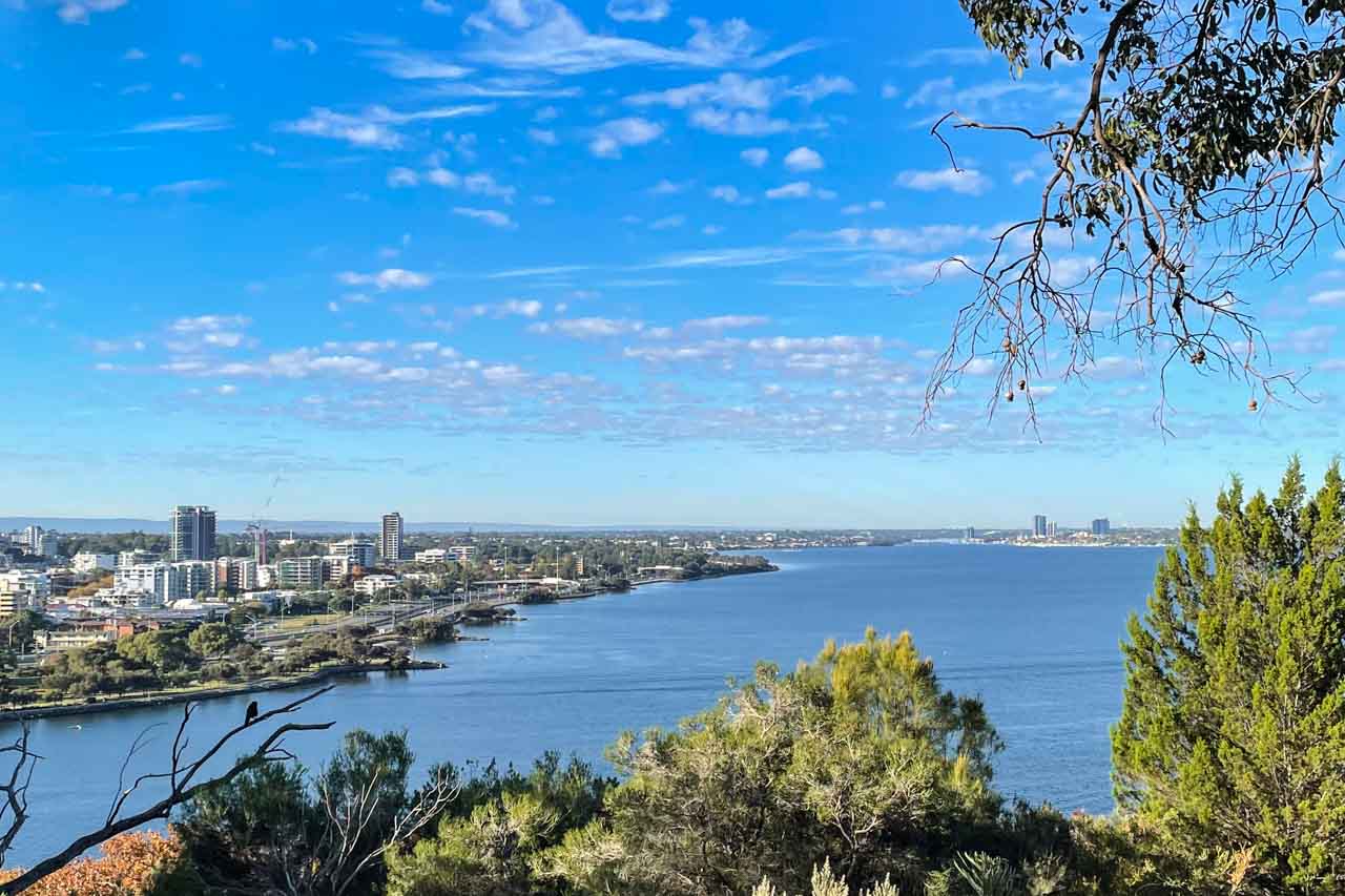
View of Perth City and the Swan River from Kings Park
While there, I found the meeting place for free guided walks in the park, operating daily at 10 am and 1.00 pm. I gathered more information at the Visitor Information Centre in the park and put the walk on my ‘must do’ list for another day.
After leaving Kings Park, we headed to the port city of Fremantle. With an hour to explore, I couldn’t resist the historic Fremantle Markets, especially as, by now, I was hungry. The markets have been operating in this heritage-listed building for over 100 years. Focused on food, I found plenty of culturally diverse options for lunch, but I was drawn to the colourful displays rendered by the fruit and vegetable stalls.

Fruit and vegetable stalls in Fremantle Markets
I particularly liked this tour because it wasn’t just driving around Perth and Fremantle, but we left the bus for a decent amount of time at strategic points of interest.
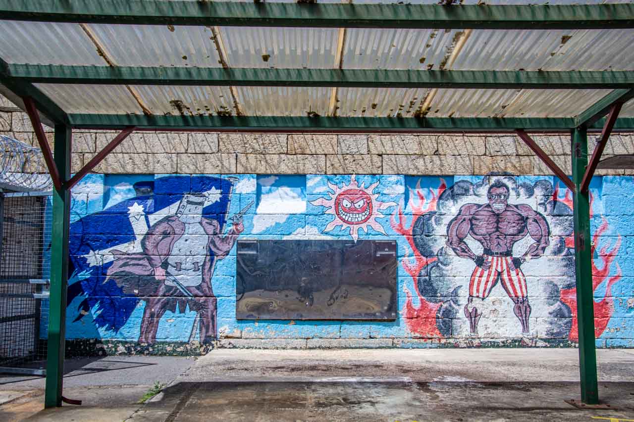
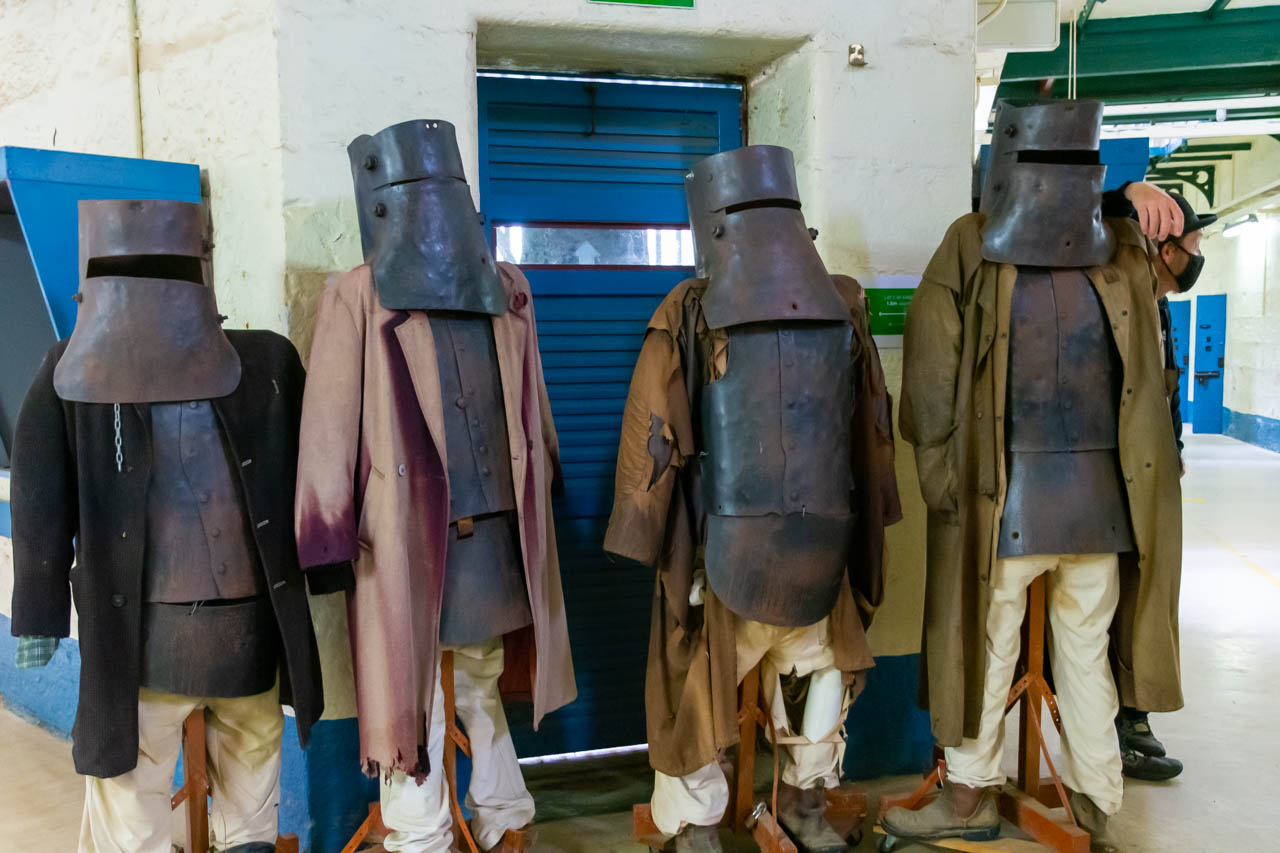
While I saw much more of Perth throughout my ten-day stay, I didn’t do Fremantle justice, only visiting again after this tour to catch the ferry to Rottnest Island and to have lunch with friends I met on the APT Kimberley tour last year. I would have liked to explore the port city in more depth, which is only half an hour from Perth by train and take a tour of the prison. With an area known as ‘Cappuccino Street’, it would seem Fremantle has a better coffee culture than Perth – definitely worth discovering.
Photograph a massive mural on a dam wall
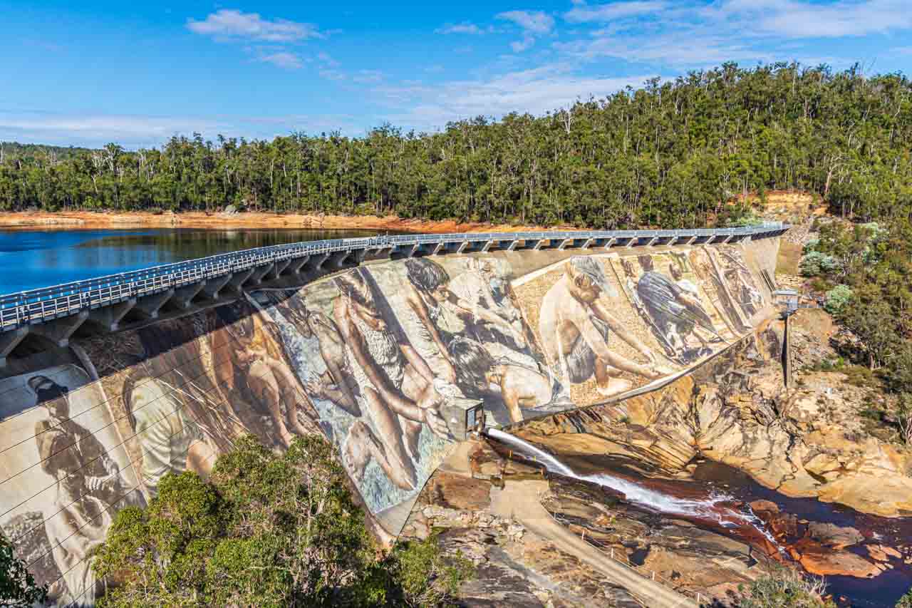
The magnificent Wellington Dam mural by Guido van Helton
When I first saw photos of Guido van Helton’s mural on Wellington Dam on Facebook over 12 months ago, I knew that if I ever got to Perth, I would have to see it for myself, and I wasn’t disappointed. Magnificent! The artwork is one impressive mural, and Guido is one of my favourite artists. [Check out his painted silos at Brim in Victoria and Portland in New South Wales.]
The mural covering 8,000 square metres of the Wellington Dam wall is the largest dam mural in the world. The mural took Guido van Helton, an internationally renowned Australian artist, four months to complete (in February 2021), with Guido camping in the bush for the duration. As with Guido’s silo artworks, local stories, and photographs inspired the Wellington Dam mural. Titled “Reflections”, the mural features images of two migrant workers who worked on the dam build, kids playing in the sand, Aboriginal children playing in the water and a boy with a fish, a dad with two kids, and, finally, an Aboriginal couple.
Wellington Dam is in Wellington National Park, just west of the town of Collie, about two hours from Perth. Rather than hire a car, I took a day trip to Wellington Dam with Australian Pinnacle Tours. The tour included morning tea at Harvey Cheese with a cheese-making demonstration, Wellington Dam, a two-course lunch at Dardanup Tavern (which was delicious), a wine tasting at St. Aidan winery, and a stop at Gnomesville before returning to Perth.
We spent over an hour at Wellington Dam, where I could view and photograph the mural from the specifically installed lookout and walk down to the dam’s base for more photographs.
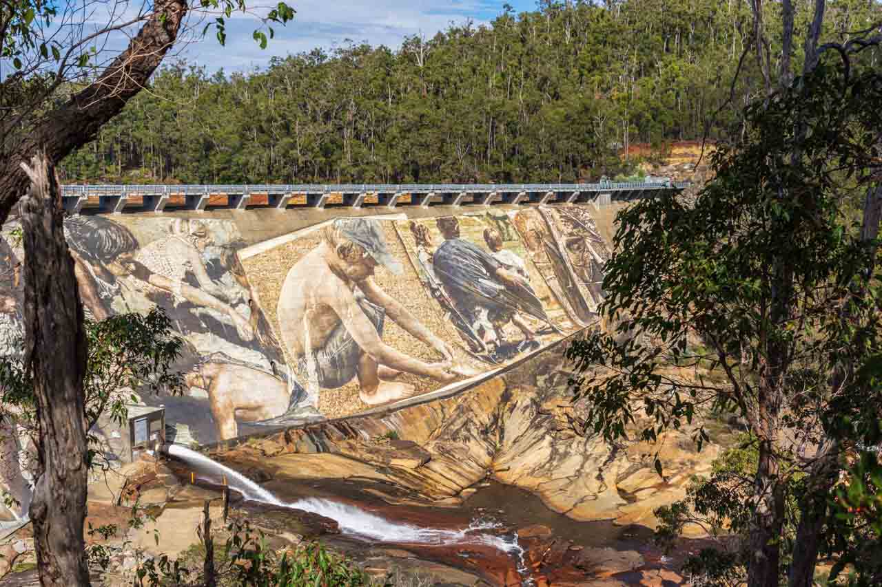
A section of the Wellington Dam mural by Guido van Helton
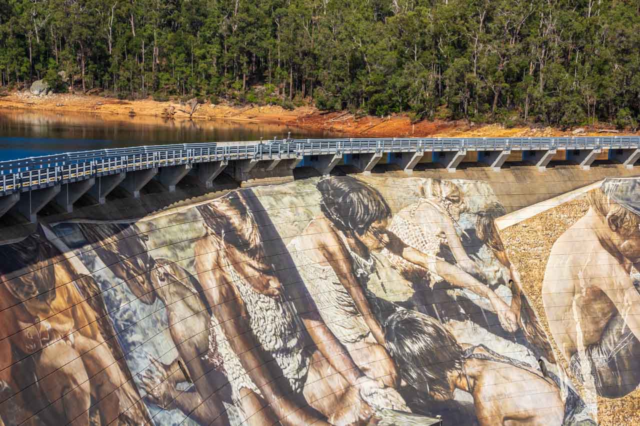
A section of the Wellington Dam mural by Guido van Helton
About Gnomesville
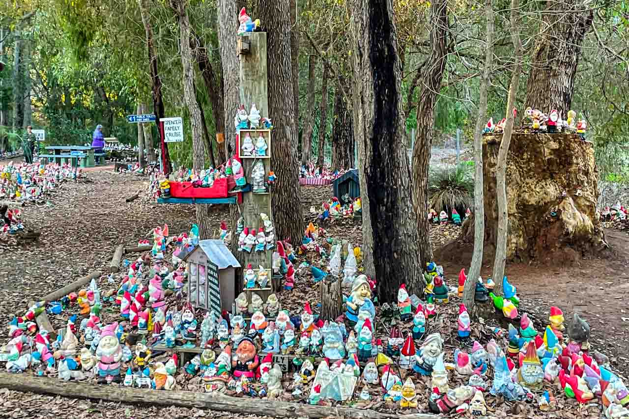
A small section of Gnomesville
Gnomesville has to be seen to be believed. At the roundabout where Wellington Mill Road and Ferguson Road converge (about a 15 minutes drive from Dardanup) and extending along a creek and into the bush, you will find thousands of garden gnomes – over 10,000 at the last count. Legend has it that the first gnome was placed at the site in the 1990s.
Myths surround the creation of Gnomesville – that a single garden gnome appeared at the site and others followed suit or that the workers working on the roundabout created a Gnome Cricket Game and others joined in. The latter seems more fascicle than the former. However, according to the tour bus driver, the story of the creation of Gnomesville goes something like this:
A lady phoned a Perth radio station to say she had many gnomes she wanted to give to a good home, but no one wanted them. Other people then phoned in to say they had the same problem. A farmer, hearing about this, donated land for a home for the gnomes. And people have been leaving gnomes ever since. However Gnomesville started, a tourist attraction was born.
Most of the people on the bus tour had brought a gnome to leave at Gnomesville. I hadn’t, as I knew nothing about Gnomesville and obviously didn’t read the tour itinerary information to be curious enough to learn about it beforehand.
When I told my sister about Gnomesville, she thought it was great fun. Me? I found it bizarre and a bit tacky. Let me know what you think.
Walk over Matagarup Bridge
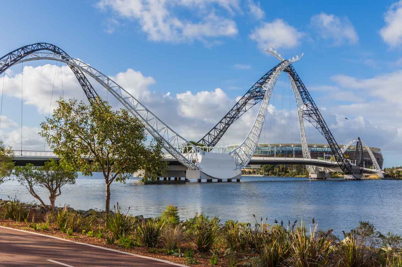
Matagarup Bridge with Optus Stadium in the background
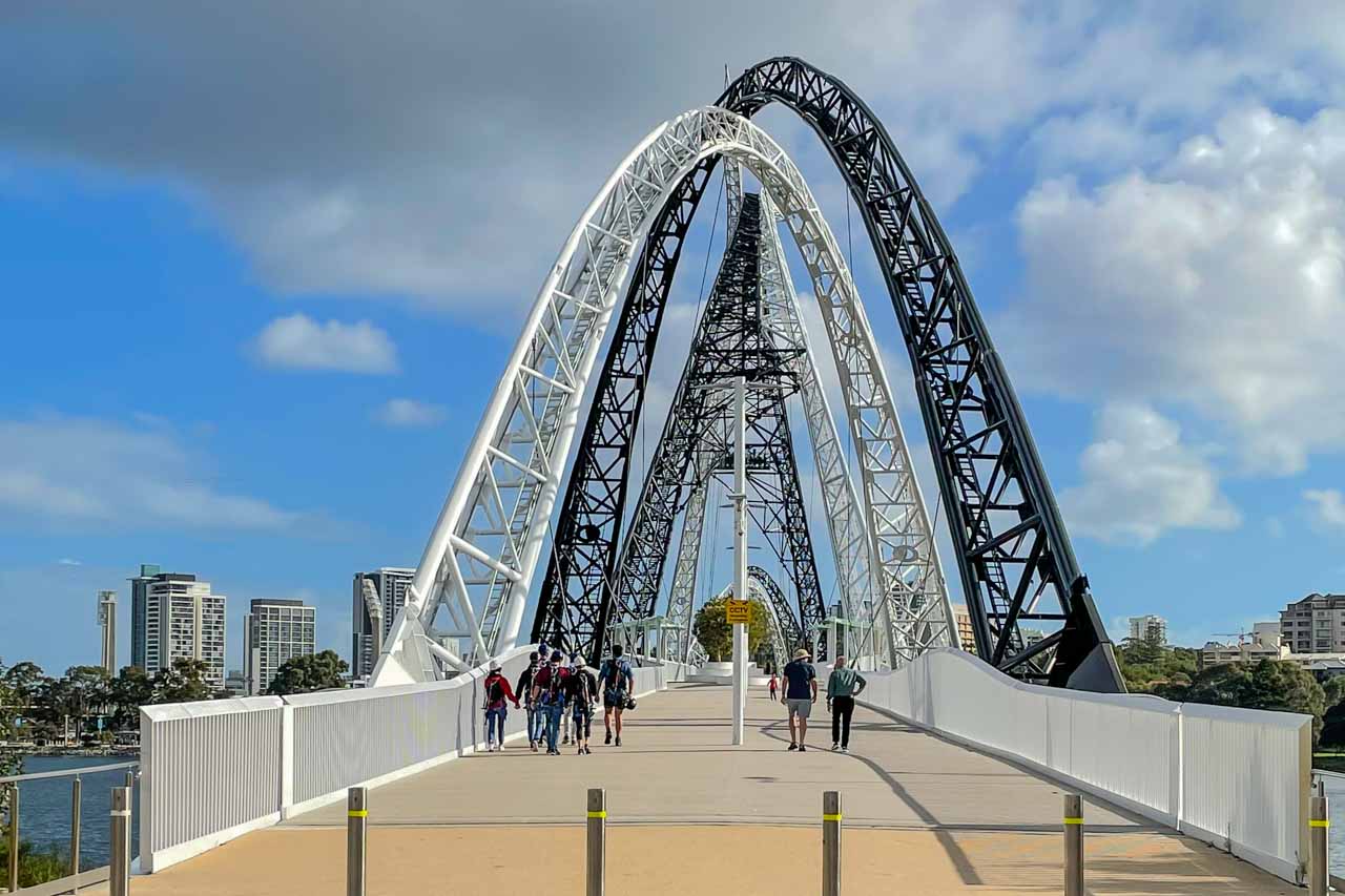
On the Perth city tour, I took a liking to the architectural style of Matagarup Bridge and wanted a closer look. So, catching the Blue and then the Red CAT buses (see ‘Getting around Perth’ below for more information), I made my way to Matagarup Bridge on the East Perth side of the Swan River.
Matagarup Bridge (completed in 2018) is a suspension, pedestrian-only bridge crossing over the Swan River from East Perth to Optus Stadium on the Burswood Peninsula. The arches are said to represent a pair of flying black and white swans, with the bridge arches representing the wishbones, a swimming dolphin, or the Wagyl, a water serpent of significant importance to the local Noongar culture – symbolising a coming together of diverse cultures.
Symbolism aside, Matagarup Bridge is a beautiful piece of architecture. You be the judge.
An information panel in the middle of the bridge provides building statistics and information on the design, name, lighting, and more.
Matagarup Bridge
According to the Perth and Fremantle City Tour bus driver, the bridge was built to get people across the Swan River from East Perth to Optus Stadium. Now, there’s a dedication to football for you!
While I had only set out to photograph and walk across Matagarup Bridge, you can climb the bridge to an open-air viewing platform 72 metres above the river. From the viewing platform, you can ride the 400-metre-long zipline to Burswood Peninsula, reaching speeds of 75 kilometres per hour. The zipline looked like fun. If I had been with someone to share the experience with, I would not have hesitated to do it.

Zipline from Matagarup Bridge
Take a free guided walk in Kings Park and Botanic Garden
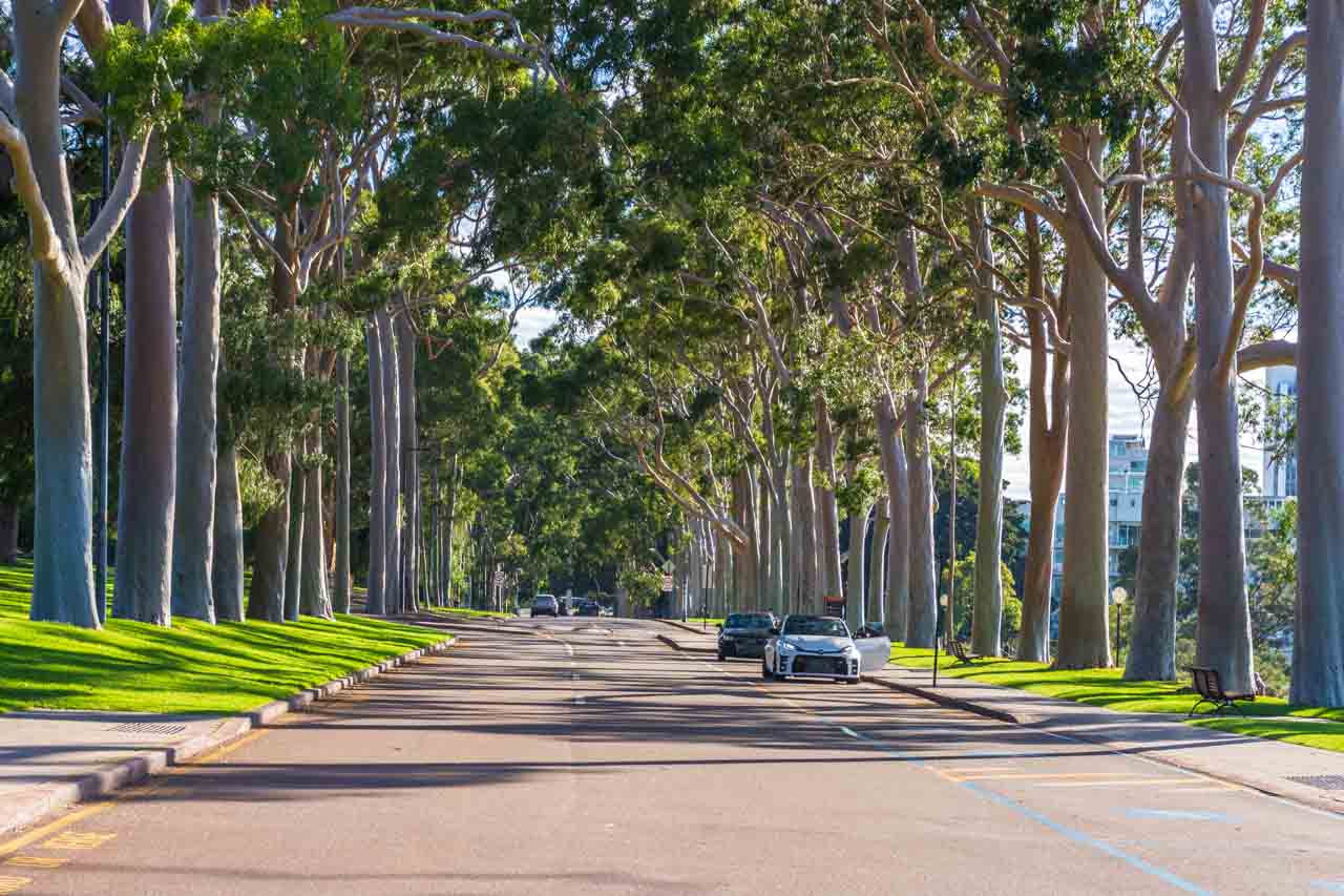
Fraser Avenue, Kings Park
At 400 hectares, Kings Park is the world’s largest inner-city park – larger even than New York’s Central Park, which is 370 hectares. With spectacular views of Perth City and the Swan River, botanic gardens, walking and cycling paths, a tree top walkway, memorials, cafe, picnic and bar-b-que areas, children’s play area, and more, it is easy to understand why Kings Park sees over six million visitors a year.
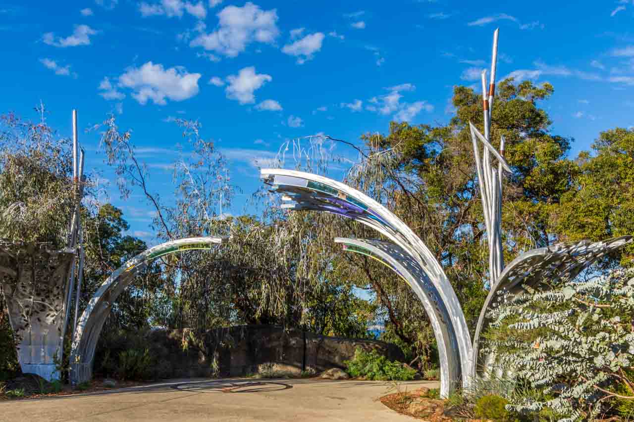
Sculpture and mosaic at the entrance to the Western Australia Botanic Garden in Kings Park
The 90-minute free guided walk in the park is run by volunteers twice daily at 10.00 am and 1.00 pm and takes you through several sections of the wonderful 17-hectare Western Australia Botanic Garden, located within Kings Park.
Western Australia is home to half of Australia’s 25,000 plant species, most of which are found nowhere else on earth. The Western Australia Botanic Garden proudly showcases over 3,000 species of Western Australia’s unique flora in stunning garden displays.
While I am a terrible gardener (I can’t keep anything alive), I get a lot of enjoyment out of walking around gardens. There are interpretive signboards throughout the Botanic Garden. But I didn’t need those as my guide was a wealth of information on the numerous gardens we walked past, each dedicated to a specific region of Western Australia, thereby increasing my knowledge of Australian plants and enhancing my enjoyment.
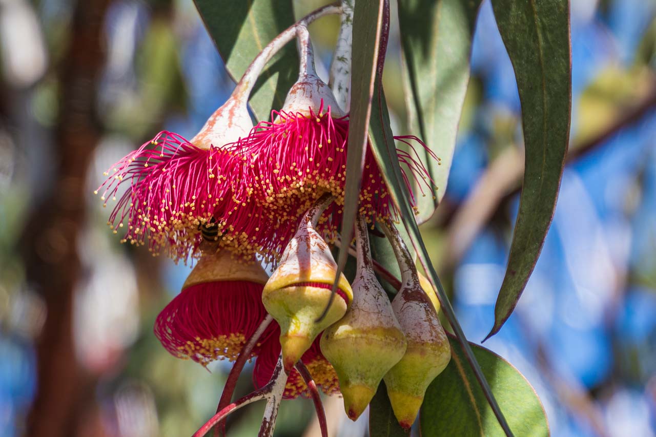
Red flowering gum endemic to Western Australia
The guided walk in the park included walking the 620-metre long Lotterywest Federation Walkway within the Botanic Garden – a combination of pathways, an elevated walkway in the treetops, and a glass bridge allowing uninterrupted views of the valley floor 16 metres below. The walkway’s highest point is on the glass bridge, providing a panorama of the Swan and Canning Rivers. The elevated section of the Lotterywest Federation Walkway is open daily from 9.00 am to 5.00 pm and is accessible by wheelchair.
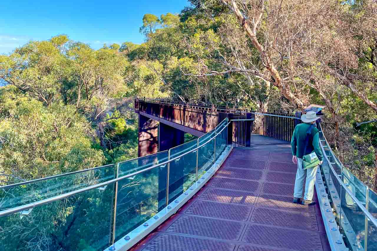
Lotterywest Federation Walkway’s glass bridge in the treetops
Kings Park and Western Australia Botanic Garden are free to enter and open 24 hours a day. A digital visitor map is available on the Botanic Garden and Parks Authority website. Printable versions are also available on the same website but will no longer be updated.
There are several means of getting to Kings Park:
- Kings Park is an easy 1.5 kilometres from Perth CBD.
- There are two options here, both free. Option 1 > Transperth Bus #935 travels from St George Terrace (Perth’s CBD) into Kings Park. This service operates every 10 minutes on weekdays and 15 minutes on weekends and is free for passengers travelling from the CBD to Kings Park. Option 2 > The Blue CAT Bus travels between Perth Busport and Kings Park via Perth Station and Elizabeth Quay Bus Station. The service is free and runs every 15 minutes. See ‘Getting around Perth’ below for more information on CAT buses.
- Free parking is available only for park visitors. You are not allowed to park your vehicle and then leave Kings Park boundaries by any other means (on foot, by bus, or in another vehicle).
View a tsunami of a rock formation
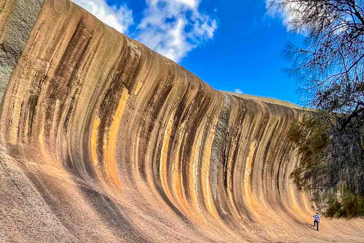
Wave Rock
At 15 metres high, Wave Rock towers over you like a tsunami ready to crash on the landscape. This extraordinary natural granite rock formation shaped like an ocean wave (but not in the ocean) was formed more than 2700 million years ago but only ‘discovered’ in the 1960s.
Wave Rock is about four kilometres from the small wheatbelt town of Hyden, but first, you must get to Hyden, which is a four-hour drive from Perth. Rather than drive myself, I decided to travel to Wave Rock in a more relaxed manner and go with Australian Pinnacle Tours on their full day Wave Rock, York, Aboriginal Culture and Seasonal Wildflowers tour.
Note: September is the best month in Western Australia to see wildflowers, and I was there at the end of June and saw no wildflowers.
Our first stop on the way to Wave Rock was in the town of York, where we had enough time for a coffee and a stroll along the main street. Situated on the Avon River and established in 1831, York is the oldest inland town in Western Australia. It is a pretty town renowned for its heritage buildings and colonial architecture lining the main street, and I couldn’t resist the old-fashioned lolly shop.
Having arrived in Hyden, we stopped at Hippos Yawn for a photo stop before lunch.
Hippos Yawn is a 12.6-metre-tall rock formation said to resemble a yawning hippopotamus. You can walk to Hippos Yawn from the Wave Rock car park on a flat, easy 1.7-kilometre return path.
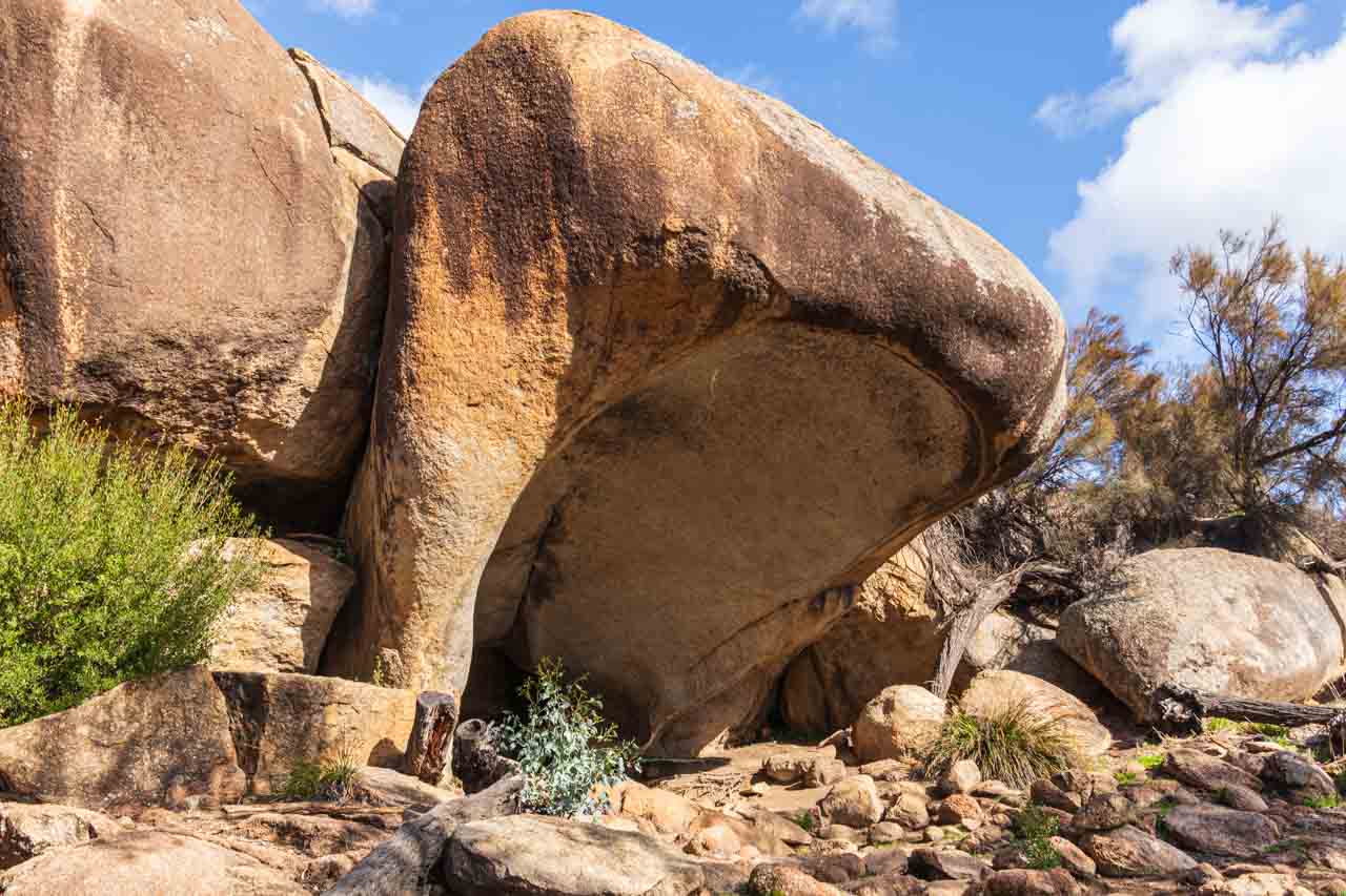
Hippos Yawn
Australian Pinnacle Tours organised lunch at the Wildflower Shoppe Cafe in Hyden. Unfortunately, the buffet chicken and rice were disappointing.
After lunch, we visited Mulka’s Cave to view Aboriginal rock art and handprints significant to the Nyoongar people. In Mulka’s Cave’s three chambers, 452 handprints and paintings have been recorded. Legend has it that the handprints are those of Mulka the Terrible (an Aboriginal evil spirit) who was known as a murderer and cannibal and lived in the Mulka Cave. The tribe eventually killed him after he killed his mother for scolding him for eating children.
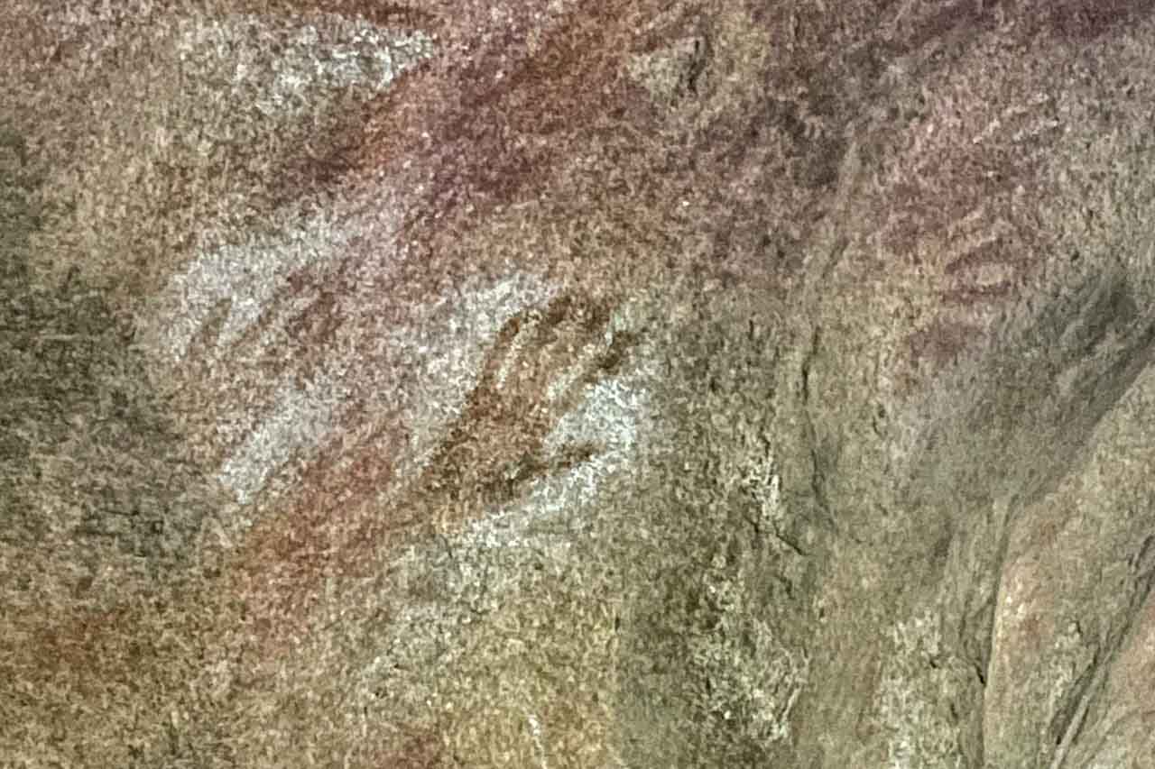
Aboriginal rock art (handprints) in Mulka’s Cave
Wave Rock is a unique and beautiful rock formation with its wave-like shape caused by the water below ground before the rock was exposed by erosion. The ‘wave’ is even more accentuated by the vertical orange, brown, yellow and grey streaks that stain the surface. The colours in Wave Rock, created by water runoff reacting with the minerals in the rock, are magnificent, and even more so when the sunlight hits the rock.
A low stone wall on top of Wave Rock was built by the Water Authority in 1951 to channel water into the Hyden Reservoir. Initially used as an emergency water supply for livestock, it became the town water supply for Hyden in the early 1960s. It is still used for this purpose but is now supplemented by a larger dam out at The Humps.
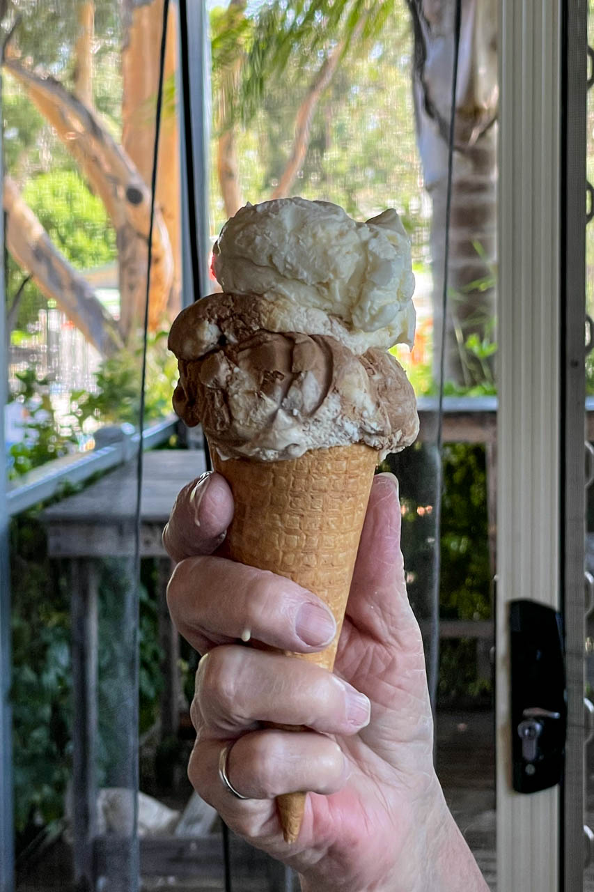
We had 60 minutes at Wave Rock which was plenty of time to walk along the 110 metres rock face and the top of the rock and to grab an ice cream at the caravan park store adjacent to Wave Rock before boarding the bus for the drive back to Perth.
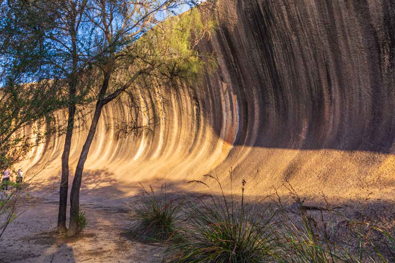
Wave Rock
Explore Rottnest Island
Rottnest Island is a major tourist attraction with over 500,000 visitors a year and is famous for its native quokka population, said to be the happiest animal on earth. So, I thought I better see for myself what all the hype is about.
Dosed up with sea sickness tablets, I caught the train to Fremantle, from where I took the 9.00 am ferry to Rottnest Island – a 30-minute trip across the Indian Ocean.
Quokkas are native to Rottnest Island but also, less commonly, found on mainland Western Australia. They are found nowhere else on earth. They are also known as the short-tailed scrub wallaby and are about the size of a domestic cat. In my opinion, they look like a cross between a large rat and a small wallaby. I can understand why the Dutch sailors who first landed on Rottnest Island reported to their captain that the island was infested with large rats and named it Rottenest Island (“Rat’s Nest Island” in English). The ‘e’ was later dropped.
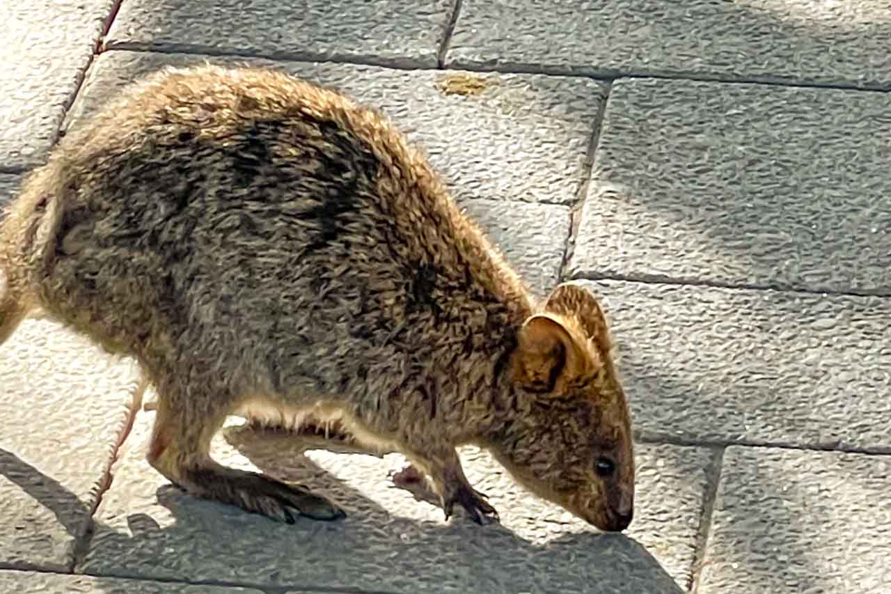
A quokka on Rottnest Island
Quokkas are mainly nocturnal animals, but tourism on Rottnest Island seems to have flipped their internal clock as they were everywhere around the cafes scavenging food. And no, I did not take a selfie with a quokka – apparently, this is THE thing to do on Rottnest Island!
Rottnest Island is 11 kilometres long and 4.5 kilometres wide at its widest point. Locals describe the island as a favourite holiday destination for Western Australians because of its pristine beaches ideal for swimming, beautiful bays to explore, coral reefs and shipwrecks to snorkel around, and cycle paths (cars are not allowed on the island) and walking tracks.
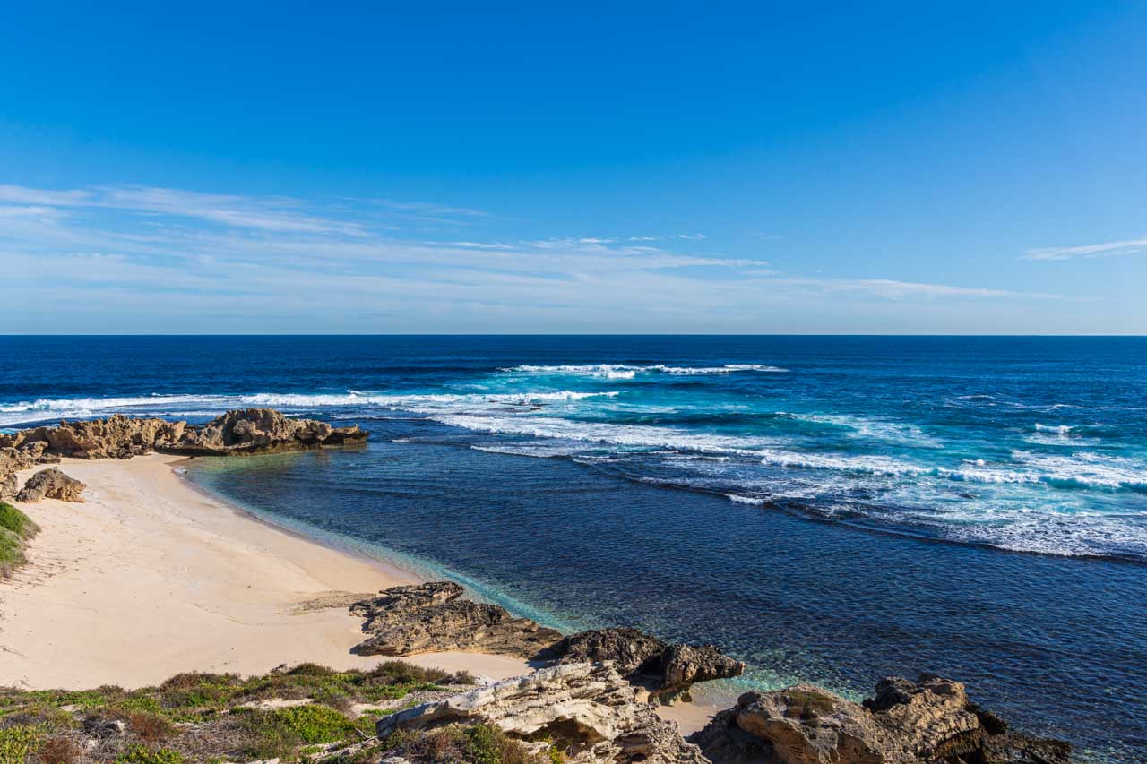
Fish Hook Bay, Rottnest Island
My visit to Rottnest Island was organised through SeaLink, taking their Rottnest Bayseeker Package. The package included the return ferry with Sealink WA and a 90-minute bus tour of the island, disembarking briefly at a couple of viewpoints around the island. With my bus tour not until 1.45 pm and arriving off the ferry at about 9.45 am, I had several hours to kill. To fill in my time between arrival and the bus tour, I checked out the shops at Thomson Bay, the island’s central hub and referred to as The Settlement, had lunch in one cafe and coffee and cake in another, went for a walk, and visited Wadjemup Museum.
Wadjemup Museum
If you want to learn about Rottnest Island’s unique and diverse history, including its dark history as a penal settlement for Aboriginal prisoners, visiting the Wadjemup Museum is a must. The museum is a delight to explore as it is laid out in easy-to-follow themes, including cultural connections, early exploration, Aboriginal incarceration, and milestones such as how the island was used as internment camps in World War l and ll and as a COVID-19 quarantine station in 2020. A theatrette, audio interactions, an interactive touchscreen for kids, and outdoor sculptures complete your museum experience.
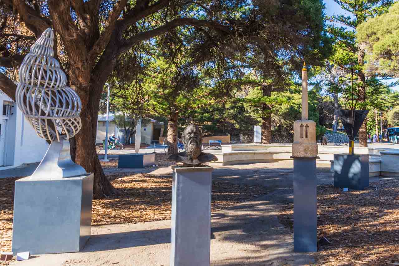
Wadjemup Museum outdoor sculptures
I enjoyed looking through Wadjemup Museum, finding it thought-provoking and engaging. Should you be on Rottnest Island, I recommend visiting the museum.
The museum is in the Old Mill and Hay Store behind the Rottnest Bakery and General Store in Thomson Bay Settlement. Opening hours are 10.00 am to 3.30 pm daily. Entry to the museum is by donation.
While I liked the Wadjemup Museum experience, I was, on the whole, disappointed with my visit to Rottnest Island and, frankly, bored. At one point, I asked myself why I was there. My disappointment stemmed from too much time around Thomson Bay Settlement waiting for the bus tour and a bus tour that made too few stops around the island with minimal time at each of those stops (never a good combination for a keen photographer). In hindsight, I would have been better off taking the Rottnest Express ferry from Barrack Street Wharf over to the island and then using Rottnest Island’s Hop On / Hop Off Bus to explore the island on my own, at my pace.
Chime a massive bell in The Bell Tower
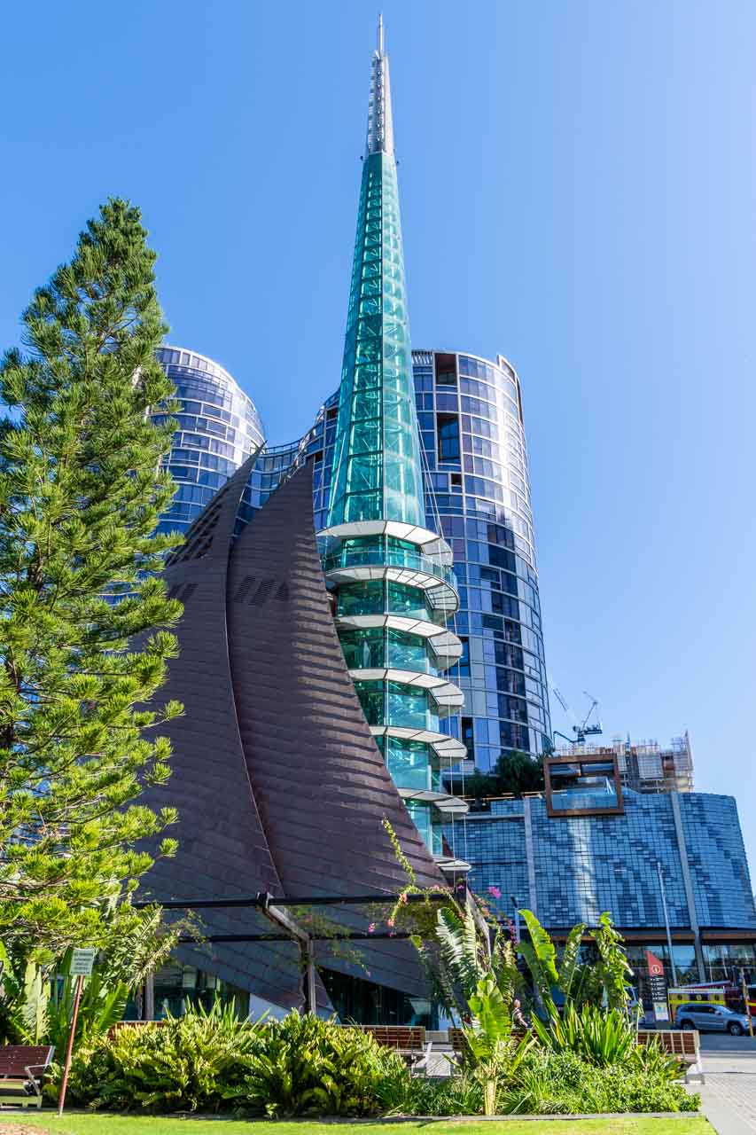
The iconic Bell Tower
The distinctive design of the towering glass spire of The Bell Tower (resulting from an architectural competition and the world’s only bell tower) has become an icon for Perth and Western Australia. The Bell Tower was custom built to house the twelve historic 18th century Bells of St Martin-in-the-Field (one of London’s most famous churches) and five specially cast bells gifted to the people of Western Australia in 1988 in commemoration of Australia’s bicentenary. The Western Australian Government commissioned a sixth new bell to mark the second millennium, making a total of 18 bells in The Bell Tower.
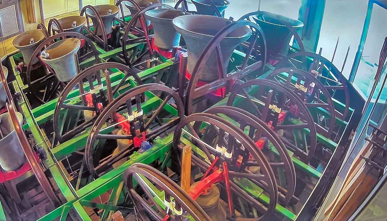
Bells of St Martin’s
The Bell Tower, located in Barrack Square, is one of the largest musical instruments in the world and a unique, interactive Perth tourist attraction. Open Thursday to Sunday from 10.00 am to 4.00 pm, with the last entry at 3.45 pm. Tickets can be purchased online or directly at the Bell Tower.
A General Entry ticket gives you access to the Bell Tower’s six levels on a self-guided tour, with the opportunity to see the St Martin bells ring by the professional bell ringers if you time your visit between 12.00 pm and 1.00 pm on a Thursday or Sunday. The General Entry ticket does not include chiming the bells yourself.
Level 6 is the open-air Observation Deck, where you get stunning views of the Swan River and Perth City.
I chose the 45-minute ‘Bell Tower Experience’ tour because I wanted more than just to learn about the history of The Bell Tower and the famous royal bells. I wanted to step behind the scenes with access to the Bell Tower ringing chamber to chime the historic bells, and I have the certificate to prove I chimed a bell. I learnt that chiming a bell is not just a matter of pulling the rope, but it is about how the rope is pulled. I also discovered how hard it is to pull the rope to make a sound from the bell.
Don’t be disappointed; buy your ticket ahead of your preferred visit time.
For $35.00, couples can announce their everlasting love to the world with an engraved Love Lock and attach it to the chain fence at the entrance to The Bell Tower.
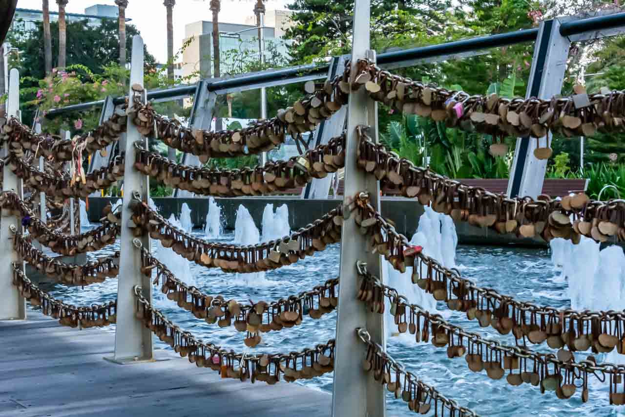
Chain of Love Locks at the Bell Tower
Australian Pinnacle Tours
You will have noticed I used Australian Pinnacle Tours on serval occasions for sightseeing trips in Perth and beyond. Their tours were well organised with appropriate timing at each stop to explore, discover and take heaps of photos, and the drivers a wealth of information. My only suggestion to Australian Pinnacle Tours is to change the lunch venue on the Wave Rock tour.
Australian Pinnacle Tours’ Perth office in Barrack Square was three doors from where I was staying. When I saw a poster in their window for a tour to Wellington Dam (a place I was eager to visit for its massive dam wall mural), which fitted in with the dated I was in Perth, I immediately went in to chat with the staff. I found the staff above and beyond helpful. Perhaps it also helps to have all your tours booked with one company? The staff rearranged my booked tours to enable me to join the Wellington Dam tour, they looked up the weather to ascertain which days would be best for which tours, and they gave me suggestions as to the best spots to take photos of the mural on the dam wall.
When Australian Pinnacle Tours cancelled my Margaret River tour due to not being able to get a driver because of COVID-19 depleting driver numbers, staff explored every possible avenue available to them to get me on the tour another day. Unfortunately, it was not to be, giving me another reason to return to Perth.
I can’t thank the Australian Pinnacle Tours staff enough for their undivided help and attention, friendliness and professionalism. I highly recommend doing business with Australian Pinnacle Tours.
Getting around Perth
In moving around Perth, I walked (Perth is easy to walk around) and used CAT buses. Transperth’s CAT (Central Area Transit) buses operate in the Perth CBD, Fremantle, and Joondalup. They are free and frequent and use a colour-coding system in each area to identify the different routes. You may get off and on them as often as you like without paying a fare.
Click HERE for CAT route maps and timetables, clicking on the PDF symbol next to the relevant timetable.
On two occasions, I needed to get to Fremantle, and I used the train at those times – a 30-minute ride from Perth Railway Station, leaving from Platform 7. Good to know when purchasing a train ticket: Fremantle is in Zone 2 from Perth. A ‘one-way’ ticket is good for one hour, and if returning more than one hour later, you must purchase a Day Pass.
Where I stayed
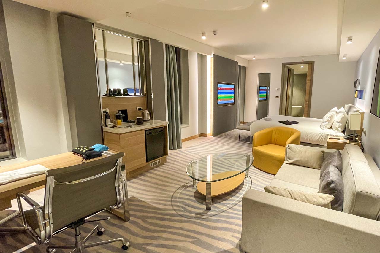
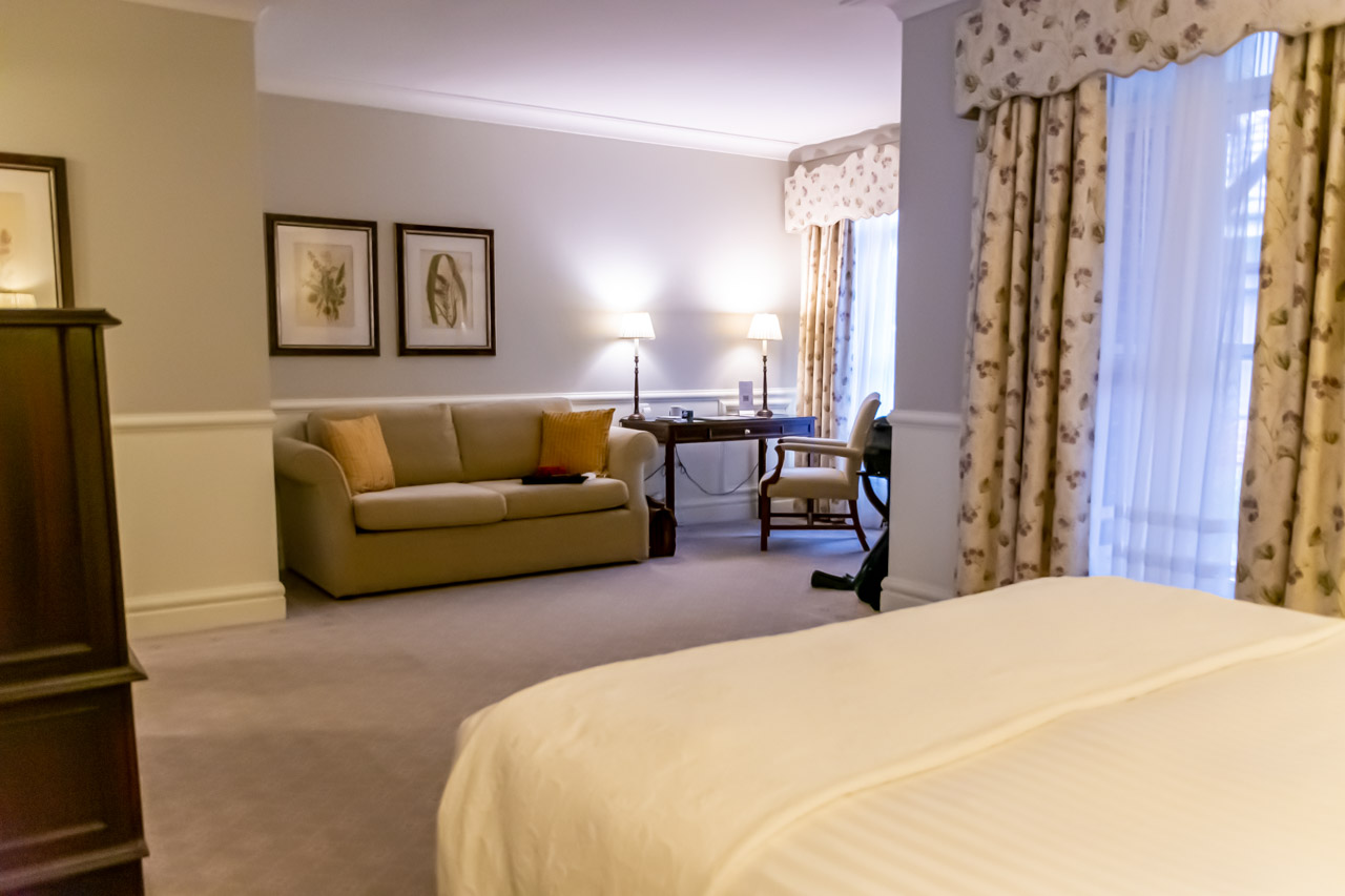
My room for 10 days in the Doubletree by Hilton Perth Waterfront
While in Perth, I stayed at Doubletree by Hilton Perth Waterfront at 1 Barrack Square. I had a deluxe room with a king bed and panoramic river view. Being situated on the corner of the building on the 17th floor with large windows all around, I had fabulous views of the Swan River and Perth City.
The room was light, spacious, and comfortable, and I never tired of the views. It had everything I needed for a 9-night stay, except a microwave, and a microwave would have been useful given the length of my stay. When seeking information, I found the hotel reception staff helpful and knowledgeable.
I first visited Perth in 1981 on my way back to Namibia, where I was living at the time. It has taken me 41 years to return, and I certainly will not leave my next visit for so long as Perth has much more for me to discover, explore and enjoy.
Disclaimer: This post contains no affiliate links. All views and opinions are my own and non-sponsored. All photos are my own and remain the copyright of Just Me Travel.
© Just Me Travel 2018-2022.
Please leave a comment below to share your thoughts. Is Perth on your bucket list as my return is on mine?
Like this post? Save it for later!
Are you looking for more ideas on destination Western Australia? Then don’t miss these posts:
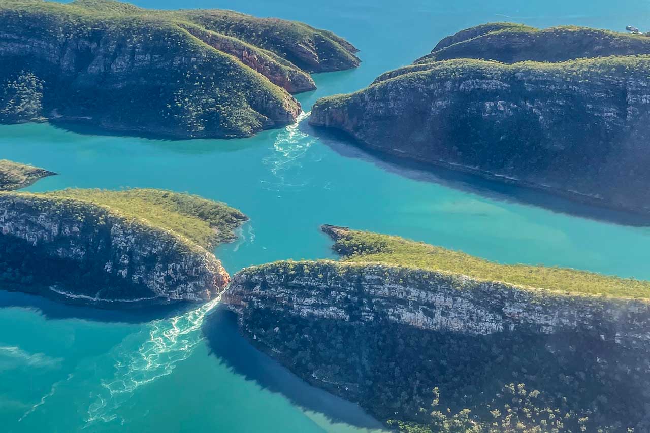
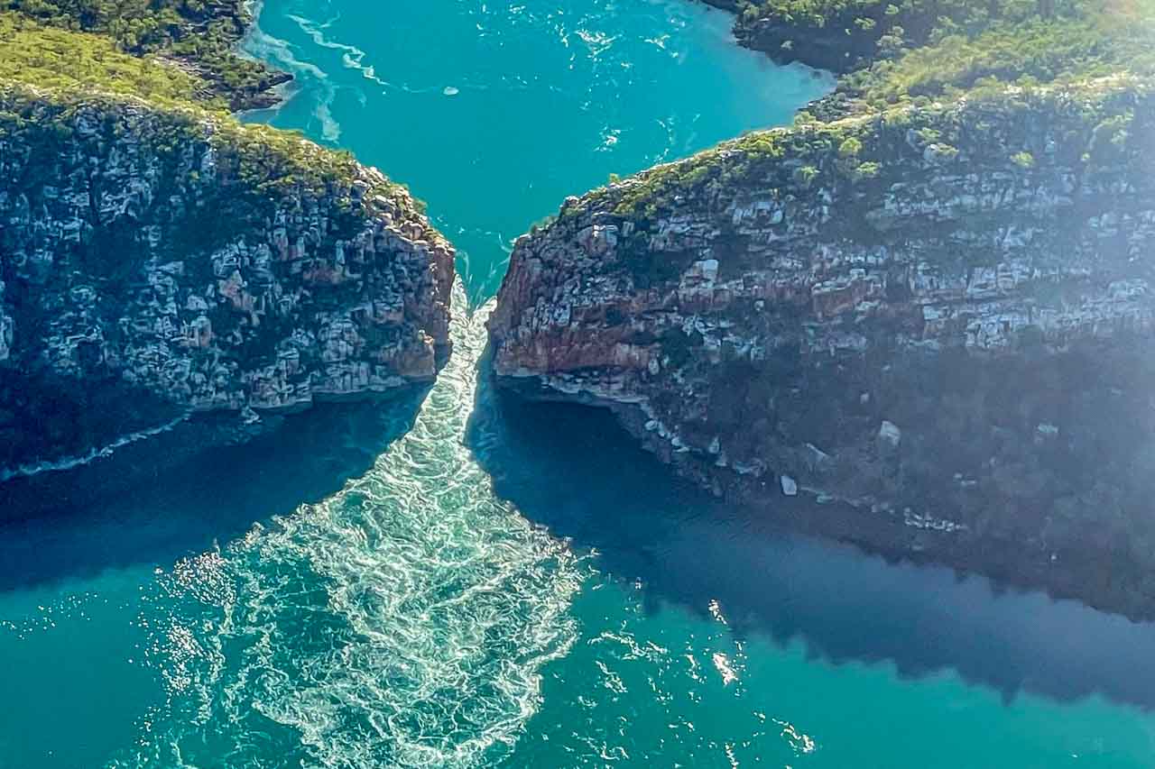
HOW TO SEE HORIZONTAL FALLS AND EPIC TIDES, AUSTRALIA
23 GREAT PHOTO SPOTS ON THE ROAD FROM PERTH TO BROOME, AUSTRALIA
15 PHOTOS TO INSPIRE YOU TO VISIT BROOME, WESTERN AUSTRALIA
SEE 7 BEAUTIFUL GORGES IN THE KIMBERLEY – the ultimate guide
THE ULTIMATE GUIDE TO 6 SAFE SWIMMING HOLES IN THE KIMBERLEY, AUSTRALIA
Author’s Note: Please check the latest travel restrictions before planning any trip, and always follow government advice.