Ethiopia’s Coffee Ceremony is Deeply Rooted in Tradition and Social Significance. Journey to the birthplace of coffee itself – Ethiopia – where coffee isn’t just a drink but a…
Ethiopia’s Coffee Ceremony is Deeply Rooted in Tradition and Social Significance.
Journey to the birthplace of coffee itself – Ethiopia – where coffee isn’t just a drink but a ritual steeped in tradition and social significance. This is the Ethiopian coffee ceremony, where time stands still to honour hospitality and respect, strengthen bonds, and foster conversations.
This post illustrates this timeless ritual, from the meticulous preparation of the coffee to the communal enjoyment that follows. Get ready to be immersed into the heart and soul of Ethiopian culture through its world-renowned coffee ceremony. It is a truly wonderful and unique experience!
I love coffee. I have drunk it in many countries with varying degrees of appreciation. Well, now I have found coffee heaven. It’s in Ethiopia, and there is a whole ceremony surrounding its making and drinking.
Ethiopia is the home of coffee. The coffee plant originated in Ethiopia, with the beans first brewed in the 11th century. So, Ethiopians have had a lot of practice doing stuff with coffee, to the point where a whole ceremony developed around brewing and drinking coffee. The coffee ceremony is an integral part of Ethiopian culture and hospitality. It is a significant social occasion.
Ethiopians have a delightful story around the discovery of the benefits of coffee. A goat herder noticed his goats acting excitedly and ‘dancing’ on their hind legs after eating the bright red berries from a particular tree. When he tried the berries himself, he felt energised. He grabbed some berries and rushed home to tell his wife, who told him he must share these “heaven-sent” berries with the monks in the nearby monastery. The monks did not share the goat herder’s elation, believing the berries to be sinful and the work of the Devil. They tossed the coffee berries into the fire. However, the smell of the roasting coffee beans made the monks rethink their view of this sinful drug, and they removed the coffee beans from the fire. They crushed the coffee beans to extinguish the glowing embers and covered them with hot water to preserve them. The aroma of the coffee made all the monks want to try it. After this, they vowed to drink coffee every day because they found the coffee’s uplifting effects helped keep them awake during their holy devotions. And so, Ethiopia’s coffee tradition and culture were created.
I loved the ceremony as much as the coffee itself. Unlike Italy, where coffee is drunk quickly whilst standing, preparing and drinking coffee in Ethiopia is not to be rushed as the hostess must not miss any step.
Wherever I travelled in Ethiopia, the coffee ceremony was always the same. There was something reassuring in this familiarity of freshly roasting coffee beans and the smell of fresh-cut grasses that were invariably laid on the ground. The laying of cut grasses on the floor sets the scene for the coffee ceremony.
When ordering coffee in a Western-style restaurant in Ethiopia, the coffee is brewed following the established ritual in a reserved area of the restaurant and served on a tray lined with fresh-cut grasses.
Coffee is served on a tray with fresh-cut grasses.
Ethiopian coffee ceremony: the traditional steps
Coffee berries growing on the tree.
First, the raw coffee beans are rubbed together in water in a pan to remove the skins on the beans. Then, they are roasted over a charcoal brazier, releasing the aromatic oils from the beans. The hostess – I never saw this ceremony conducted by a man – brings the pan of smoking, roasted beans around for you to waft the smoke towards you, to draw in the aroma of the roasted beans.
Washing the raw coffee beans.
Once roasted, the beans are ground with a mortar and pestle. Traditionally, the mortar and pestle are made of wood.
Grinding the roasted coffee beans.
While grinding the beans, the hostess is boiling water in a terracotta “jebena” over an open fire. A jebena is a traditional Ethiopian clay coffee pot with a bulbous, round bottom, a long, narrow neck topped with a wooden or straw stopper, and a handle.
The jebena I bought in a local market in Bahir Dar.
Once the coffee beans are ground, the resultant powder is added to the boiling water in the jebena. The combined water and ground beans are boiled for a couple of minutes and then rested to allow the coffee powder to sink to the bottom of the pot.
By this stage, if you are a coffee lover like me, the smell of freshly brewed coffee will have your mouth watering in anticipation of what will come.
Finally, the coffee is poured into small, handleless porcelain cups (similar to Chinese tea cups). The pouring is done from as high as possible above the cups – about a foot above the cups. The hostess will usually serve coffee with popcorn or peanuts.
Ethiopian coffee ceremony: a social event
Coffee isn’t just a drink in Ethiopia. It is an essential component of Ethiopian culture and society. Being invited to coffee in Ethiopia is considered a sign of friendship and respect. It is a time to extend the hand of hospitality, promote social relations, and catch up on neighbourhood news.
A girl pours coffee for customers in a coffee house in Lalibela.
A coffee house at the remote Blue Nile Falls.
Ethiopian coffee is drunk sweet, and black. In fact, very sweet – 2 to 3 teaspoons of sugar. Mind you, the teaspoons are minuscule. I learnt to enjoy black coffee. However, by the time I left Ethiopia, I was drinking my coffee with a lot less sugar.
When drinking coffee in Ethiopia, etiquette requires you to have three cups of coffee. The first cup is to welcome you, the second is about friendship, and the third is to say goodbye. Denying coffee at any of the three servings is considered rude. Remember, these are tiny cups, so having three is less in quantity than a mug of coffee.
Ethiopian coffee is the best I have ever tasted. The two women I was travelling through Ethiopia with told me I said, “Oh, that’s good coffee”, every time I had a cup of coffee. This must have driven them mad because we had lots (and I mean lots) of cups of coffee. Finally, one of my travel companions told our diver-guide that Ethiopia needs to change its tourism slogan from “13 Months of Sunshine” to “Oh, That’s Good Coffee”. He just laughed.
So, if you ever find yourself in Ethiopia, immerse yourself in the magical and captivating experience of the coffee ceremony. You won’t be disappointed!
To learn about Ethiopia’s coffee ceremony’s cultural and social history, visit the Institute of Ethiopian Studies Ethnological Museum in Addis Ababa. This well-organised, delightful museum on Addis Ababa University’s main campus is dedicated to preserving, studying, and presenting Ethiopia’s rich cultural heritage.
The Ethnological Museum is open daily, excluding public holidays, with entrance fees charged at different rates for adults, students, and those wanting to take photographs. Engage one of the available guides who provide valuable information and insights about the museum’s collections.
The Coffee Story, Ethnological Museum.
From the first crackle of roasting beans to the three rounds of shared cups, the Ethiopian coffee ceremony is more than a mere caffeine fix. It is a ritual filled with tradition, hospitality, shared moments, and a deep appreciation for the humble coffee bean.
The ceremony unfolds in deliberate steps: roasting beans over coals, grinding them by hand, and brewing them in a traditional pot. Each step contributes to the welcoming atmosphere and deep-rooted traditions that define the Ethiopian coffee ceremony.
Whether you have experienced it firsthand or are curious about it from afar, the Ethiopian coffee ceremony stands as a testament to the beauty of cultural rituals and the power of a shared cup of coffee to bring people together, wherever they may be.
Editor’s Note: I originally published this blog post in March 2019 and have updated it for accuracy and comprehensiveness.
Disclaimer: This post contains no affiliate links. All views and opinions are my own and non-sponsored. All photos are my own and remain the copyright of Just Me Travel.
International travel will inevitably lead to translation challenges. Read about my communication issue in Ethiopia’s Simien Mountains, which I can laugh about now but, at the time, impacted my physical comfort.
Postcards From Spain: Your Ultimate Iberian Bucket List for Creating Unforgettable Memories in Spain. Are you travelling to Spain? Are you looking for things to do, places to visit,…
Postcards From Spain: Your Ultimate Iberian Bucket List for Creating Unforgettable Memories in Spain.
Are you travelling to Spain? Are you looking for things to do, places to visit, sites to see in Spain? This post covers an extensive list of top places of interest and things to do in Spain to ensure your Spain bucket list is complete.
The post is not an exhaustive list of the incredible things you should not miss while in Spain. For example, the theatre, amphitheatre, and bridge are not the only Roman sites Merida has to interest the visitor. And there is a fabulous archaeological museum worth visiting.
I have presented my Spain bucket list as postcards (often multiple postcards per destination), with each postcard an authentic personal experience. From historic landmarks and hidden gems to cultural marvels and breathtaking landscapes, my Spain Bucket List of 47 Incredible Things You Should Not Miss is designed to be your go-to resource for planning the journey of a lifetime.
About My Spain Bucket List
I have compiled my Spain bucket list from my personal experiences of spending almost three consecutive months in Spain.
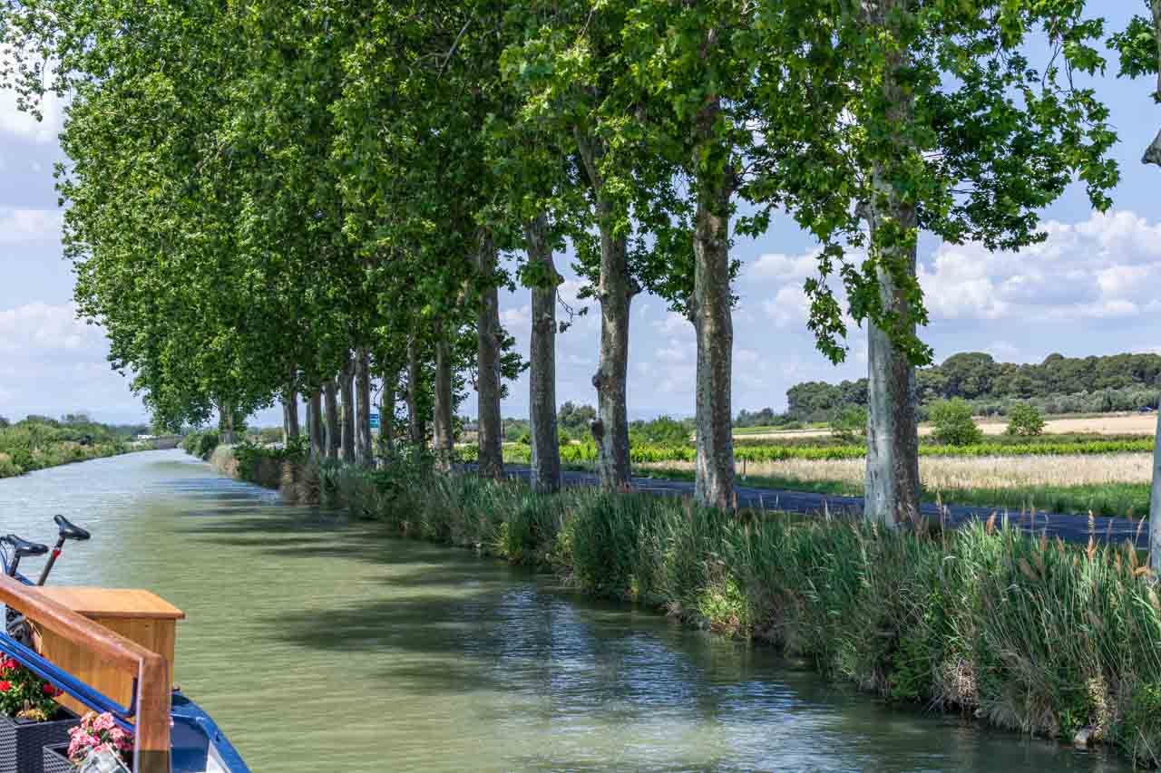
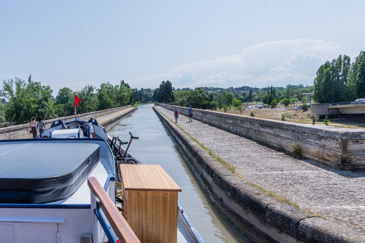
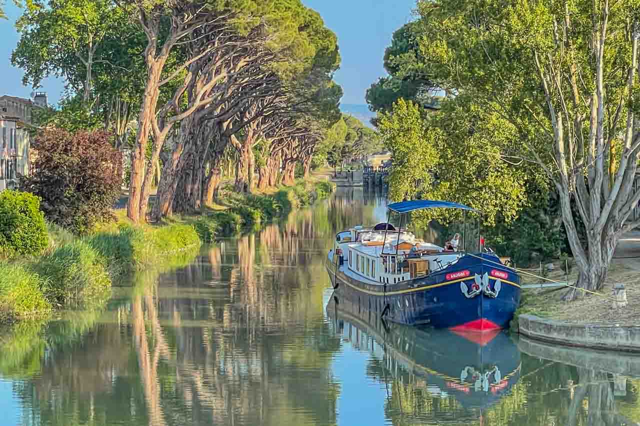
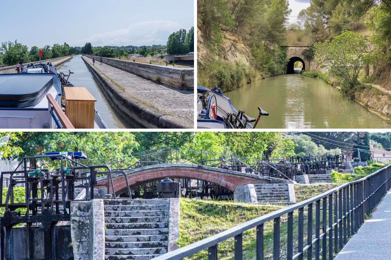
Before arriving in Spain, I spent one week in France on a barge cruise travelling on the Canal du Midi.
My first 18 days in Spain were on the Spanish Heritage Tour with Insight Vacations. This tour almost internally circumnavigated Spain, helping me to familiarise myself with the country, the people, and the culture.
For the remainder of my time in Spain, I travelled solo, basing myself in Seville (three weeks), Merida (one week), Barcelona (four weeks), and Girona (one week). North, south, east, and west, I covered much of Spain in almost three months while allowing time and space to immerse myself.
When I travel, I send digital postcards of the highlights of my travel experiences to family and friends, sharing what I have seen and done. Each entry in this post includes those postcard-worthy moments that vividly capture the essence of each unmissable experience.
Spain has many UNESCO World Heritage Sites, 49 to be precise. It wasn’t until I wrote this post that I realised how many of those sites I visited.
How This Post is Structured
Welcome to Spain, a land of rich history, diverse cultures, and stunning landscapes. Planning a trip to this captivating country can be overwhelming, given its wealth of experiences. Fear not, for I present you with the ultimate trip-planning resource – a comprehensive list of 47 unmissable things to see and do in Spain.
The links immediately below take you to many cities, towns, and villages (in alphabetical order) I visited in Spain. I have then made suggestions, based on my personal experience, of things to see and do within those cities, towns, and villages.
Join me as we travel through my Spain Bucket List postcard series.
My Spain Bucket List isn’t just a checklist but an invitation to plan what to do and see during your visit to Spain to make the best of your trip. So, join me as I unveil the 47 incredible things that make Spain a destination like no other. Let’s go!
BARCELONA
Barcelona is on the Mediterranean coast in the northeast of Spain and is the capital of Spain’s Catalonia region. It is known for its art and legendary architecture.
Basilica i Temple Expiatori de la Sagrada Familia
Otherwise known as Sagrada Familia.
Barcelona and the Sagrada Familia are synonymous – you can’t have one without the other. It is the most-visited monument in Spain and is the only temple in the world still under construction. The Sagrada Familia has been under construction since 1882 and is estimated to be completed in 2026. However, according to my guide, this completion date is not likely to be met because of COVID-19. The building of Sagrada Familia relies heavily on tourist dollars, and none came in while the basilica was closed during the pandemic.
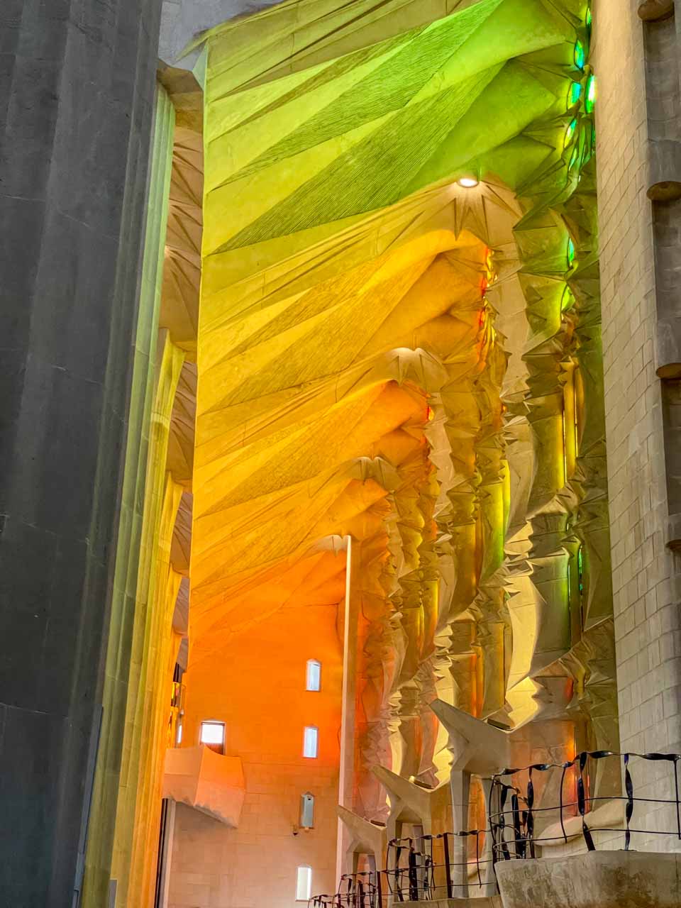
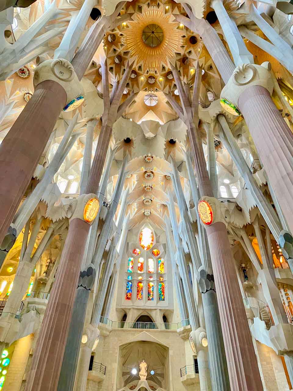
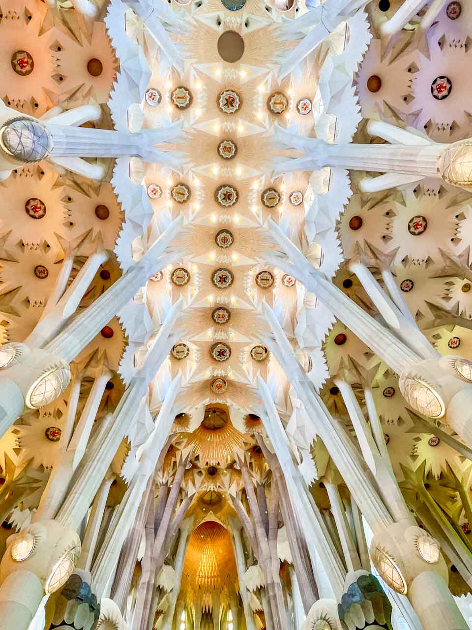
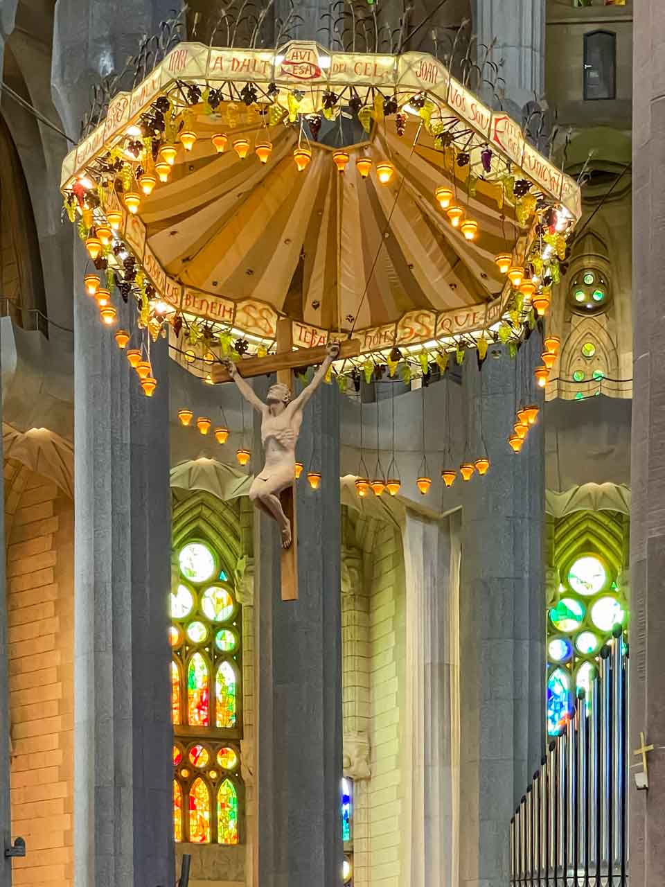
While I failed to see the beauty in the basilica’s exterior, Antoni Gaudi, the Sagrada Familia’s famous architect, has excelled himself with its breathtakingly beautiful interior. See my photo gallery.
The stunned-glass windows create a magical light show inside the basilica.
The Sagrada Familia interior.
The beautiful ceiling inside Sagrada Familia.
Christ on the cross hangs suspended from an umbrella over the main altar.
A note on Antoni Gaudi (because his architecture appears multiple times on this bucket list): Antoni Gaudi is Barcelona’s most famous architect and led the way for the Modernista movement, which is best known for its architectural style. UNESCO recognised Gaudi’s exceptional creativity and contribution to architecture development by placing seven properties he built on the World Heritage List in 1984. UNESCO has collectively listed these seven properties as the “Works of Gaudi”.
In 2003, Gaudi was on the path to sainthood when the Vatican opened the beautification process for him, the first step towards declaring his sainthood. It is now 2023, and Gaudi still needs to become a saint. The Catholic Church does not rush the beautification process. And there is a question mark over what miracle Gaudi caused!
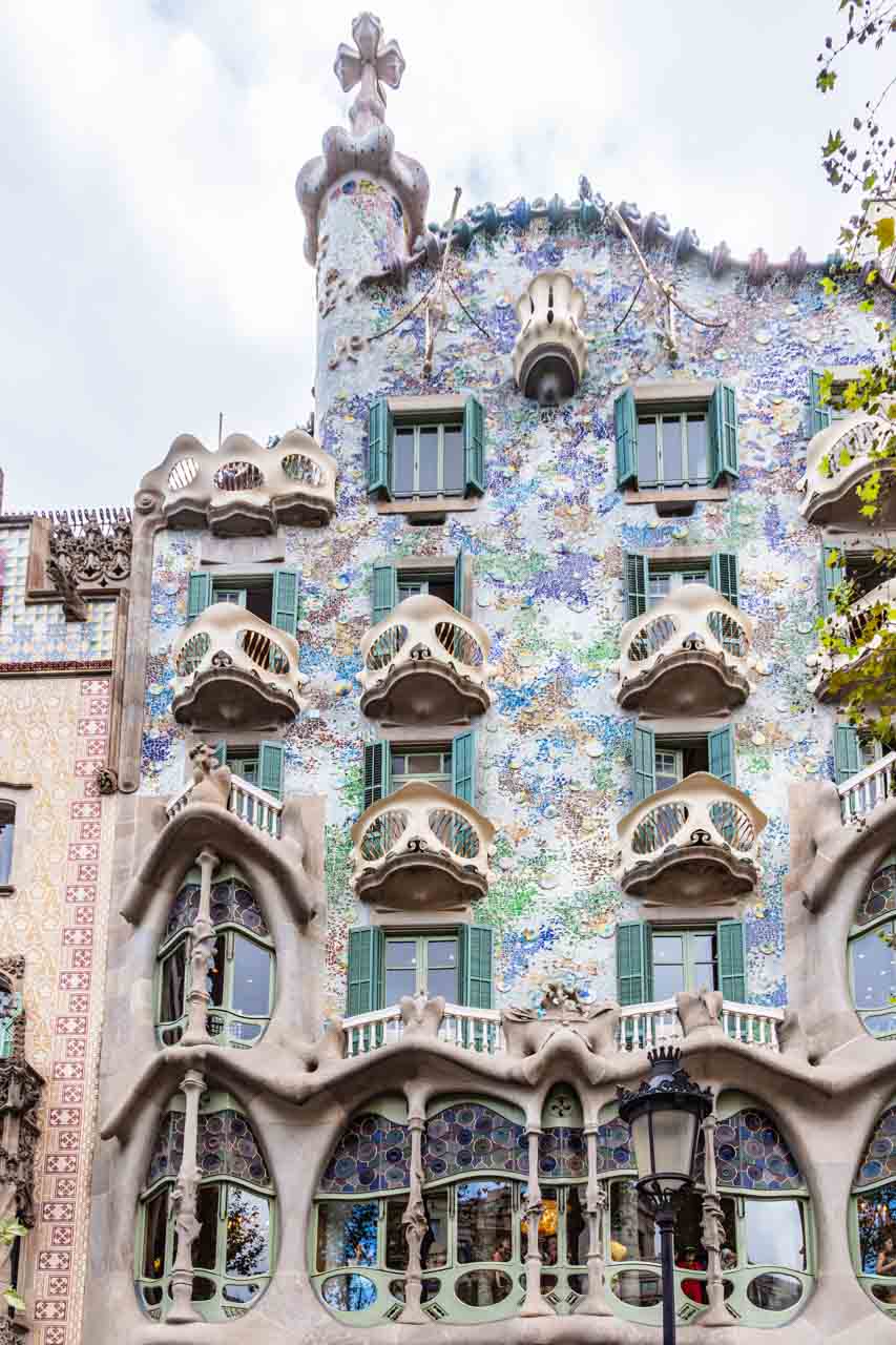
Casa Batllo
The beautiful facade of Casa Batllo.
The building, now known as Casa Batllo, was constructed in 1877. When Joseph Batllo purchased it in 1903, he gave Antoni Gaudi total creative freedom to complete the entire remodelling of the house, which was completed in 1906.
The interior of this UNESCO World Heritage Site is a vision of wrought iron, wood, stained glass, ceramic tiles, and stone ornaments. The building is energy efficient with extensive use of natural light. Casa Batllo’s exterior was given a unique façade by Gaudi, where stone, glass, and ceramics form waves that mirror a calm sea, and the balconies are shell-shaped.
Located at number 43 on Passeig de Gracia, allow at least 1.5 hours to explore the house.
Casa Mila
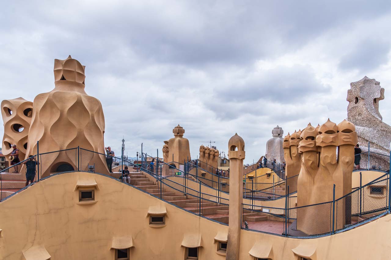
Located at number 92 on Passeig de Gracia, Casa Mila was an apartment block completed in 1912, and Antoni Gaudi was the architect. It is popularly known as La Pedrera, meaning “stone quarry” in Catalan, because stone was the primary building material for the façade and balconies. A visit to Casa Mila includes (at additional cost) the apartment where the Mila family lived, still intact with antique furniture. The rooftop provides excellent views over Barcelona.
Casa Mila has two intriguing features:
There is barely a straight wall in the building, and
The rooftop is a sculpture park of chimneys that looks like something out of Star Wars. The Spanish poet Pere Gimferrer called it The Garden of Warriors.
“Warriors” march across Casa Mila’s rooftop.
Ciutadella Park
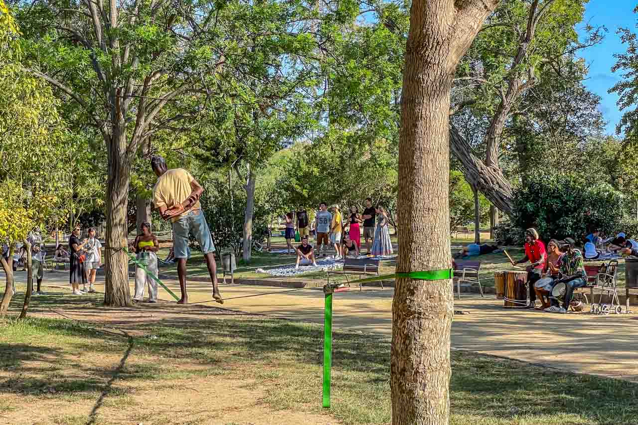
Go people-watching in Ciutadella Park, Barcelona’s largest landscaped park on Passeig de Picasso.
There is much to see and do in Ciutadella Park.
Ciutadella Park is the place to see and be seen, particularly on Sunday afternoons when people gather to play instruments, relax, take a punt on the boating lake, view the extravagant Cascada Monumental, a cascading waterfall fountain topped by a chariot-rider flanked by gryphons which Gaudi helped design, admire the sculptures scattered around the park, or visit the zoo.
Palau de la Musica Catalana
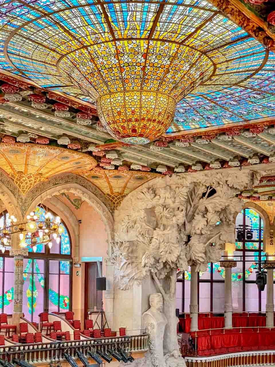
Palau de la Musica Catalana (Palace of Catalan Music) is a concert hall in the Sant Pere district of Barcelona, built between 1905 and 1908. The modernist architect Lluis Domenech i Montaner constructed Musica Catalana as a home for the Catalan Choral Society.
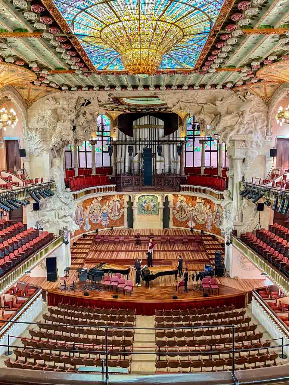
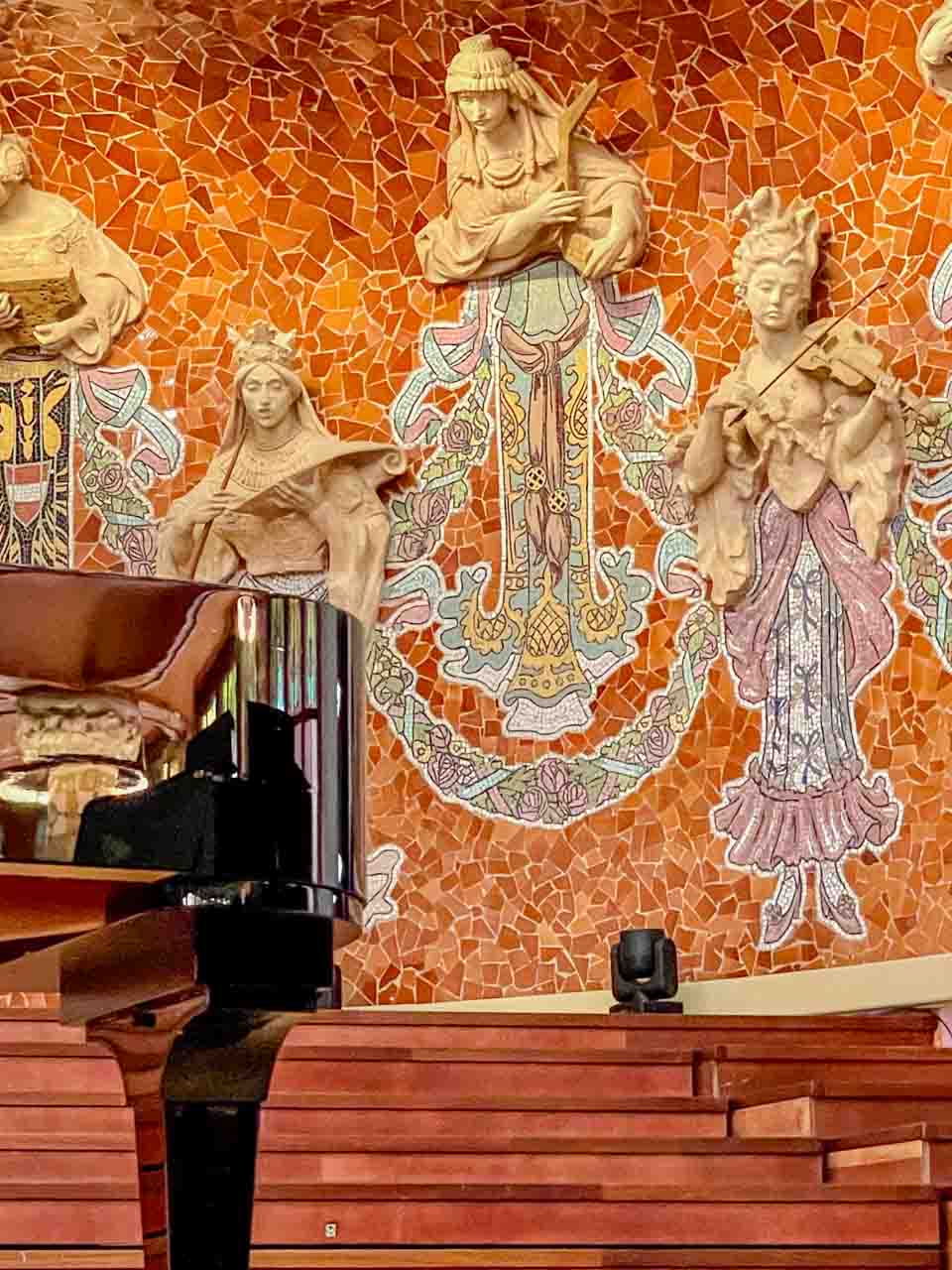
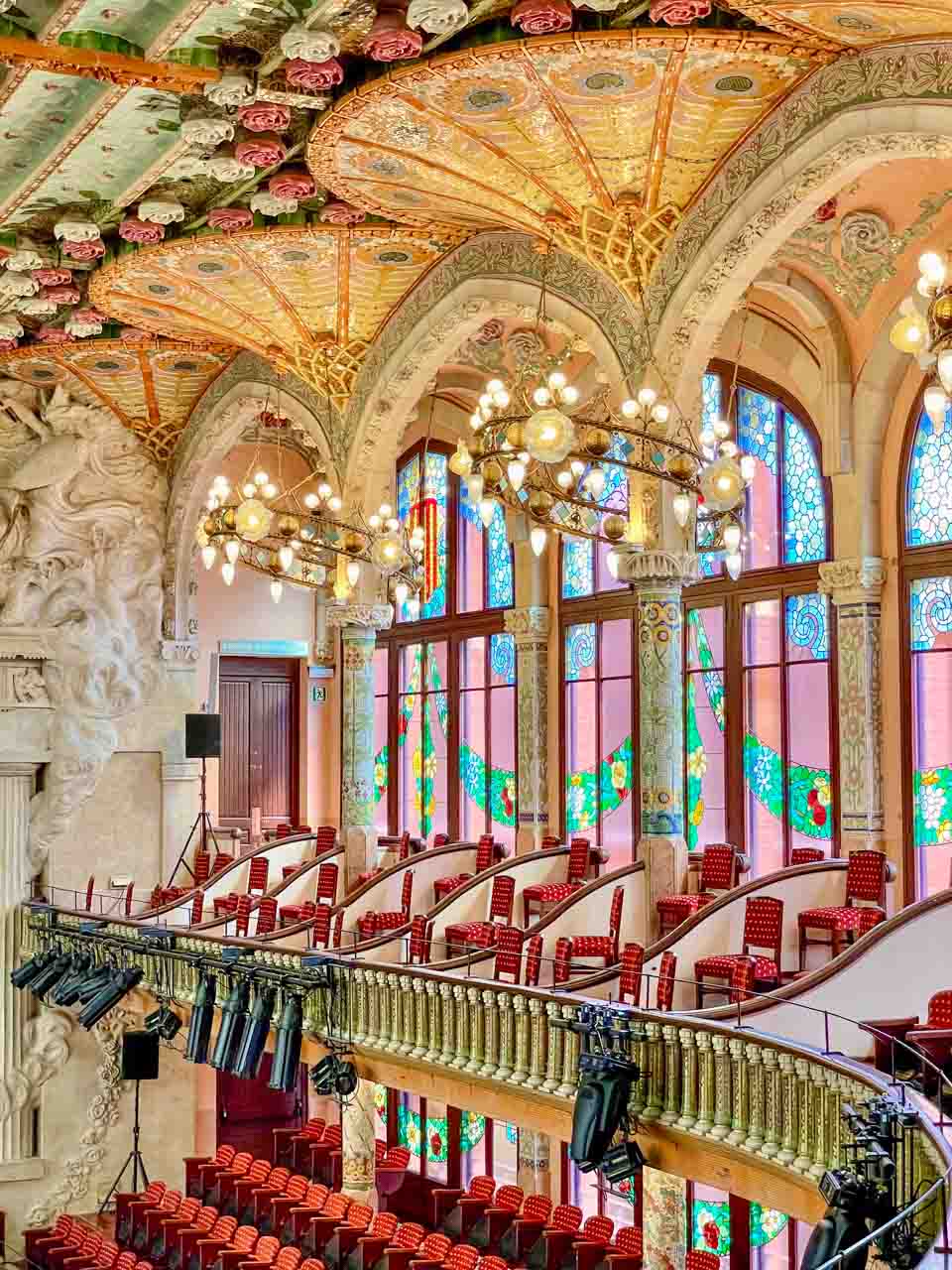
I went to see the Palau de la Musica Catalana because it is a UNESCO World Heritage Site (1997), and I had seen some photos and thought, That’s pretty. “That’s pretty” was an understatement! I was in awe; it was breathtaking! Could there be anything this beautiful? The stained-glass skylight and windows flood the Concert Hall with natural light, the majestic organ has 3,700 pipes, and the 18 muses surrounding the stage, with 18 instruments from different parts of the world, represent music without frontiers.
Palau de la Musica Catalana’s main auditorium seats 1,970, with a further capacity of 600 seats in the Petit Palau (chamber music hall). Discover the secrets of this hidden gem with an in-house guided tour, which includes hearing a short piece played on the organ. Magical!
Check out my photos to see why you should visit this unique Concert Hall.
The interior of Palau de la Musica Catalina.
The iconic stained-glass skylight.
Sculpted muses with musical instruments form a backdrop for the stage.
The stained-glass windows and breathtakingly beautiful ceiling.
The architect was Antoni Gaudi’s teacher. I can see the influence on Gaudi.
There is a good café (Palau Café) in the Palau de la Musica Catalana foyer where you can eat inside or under the umbrellas outside.
Palau Guell (Guell Palace)
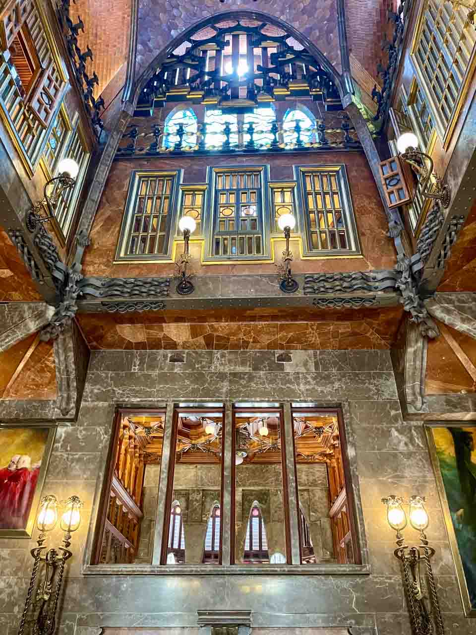
Palau Guell is a luxury mansion on Carrer Nou de la Rambla in the El Raval district of Barcelona. The famous architect Antoni Gaudi designed the palace’s seven floors for the industrial tycoon and Gaudi’s patron, Eusebi Guell, which he completed in 1890. All the palace rooms open onto the spectacular central hall, like an internal courtyard.
The building’s exterior is rather unremarkable, so the interior was a complete surprise. It was spectacular and certainly worth a visit! See for yourself.
Palau Guell was Gaudi’s first actual commission in Barcelona and has been on UNESCO’s World Heritage List since 1984.
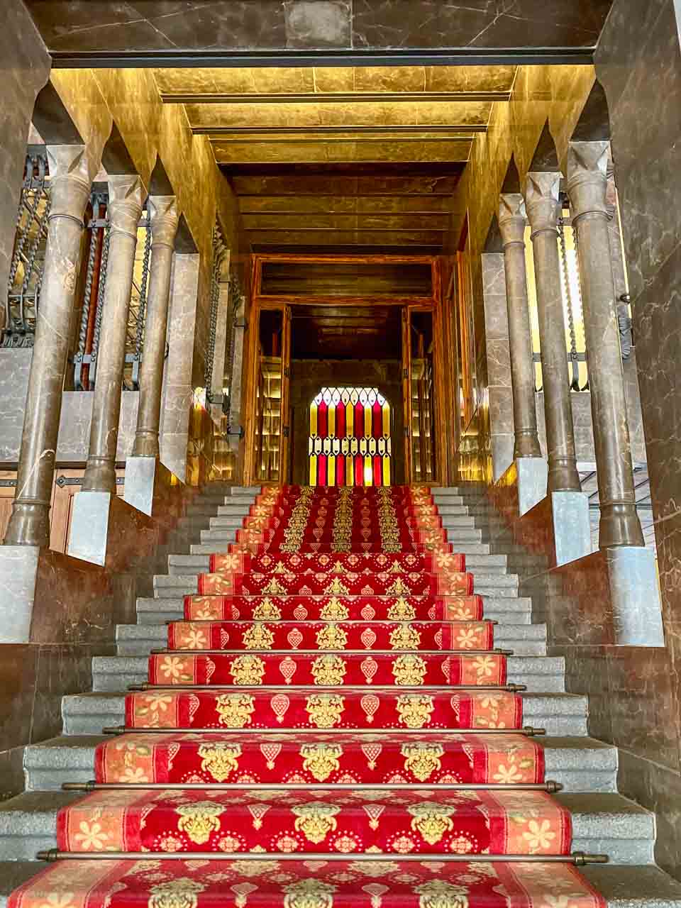
The lobby Palau Guell.
The luxurious central hall.
The lobby’s beautiful staircase with its stained-glass window (also designed by Gaudi) leads up to the luxurious central hall that also serves as a source of light for the rooms leading off it over several floors. Gaudi liked to incorporate wood in his designs, and the wooden ceilings in Palau Guell are works of art.
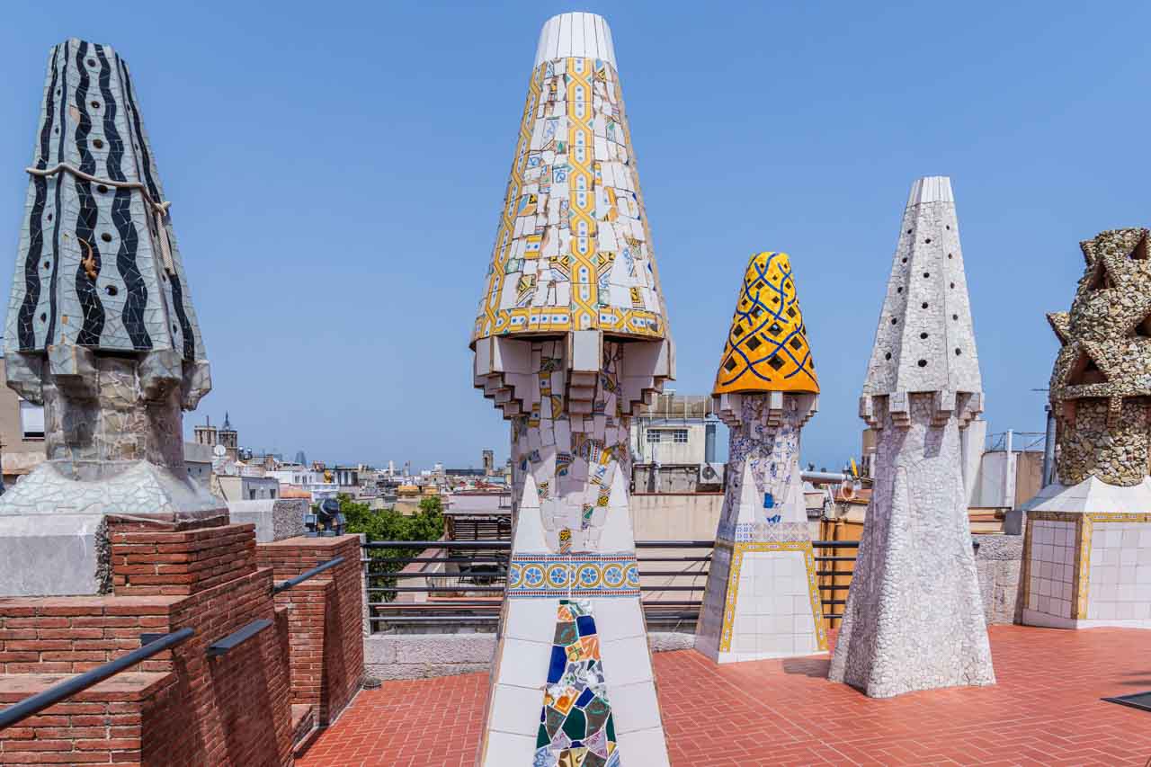
Gaudi installed his signature chimneys on the roof in 1895. There are 20 chimneys in all, which also ventilate the house.
Antoni Gaudi’s signature chimneys on the roof of Palau Guell.
The audio guide was descriptive, informative, and easy to follow.
UNESCO placed Palau Guell on the World Heritage List in 1984. A definite must-see!
Park Guell
A guided tour of Park Guell, designed by the famous Spanish architect Antoni Gaudi, was an optional excursion in Barcelona offered by Insight Vacations on my recent tour with them – and one I couldn’t miss.
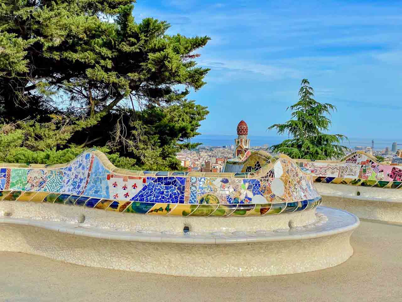
Visiting Park Guell was on my bucket list in Barcelona, and it didn’t disappoint. Gaudi’s distinctive, imaginative, and nonconforming architectural style fascinates me and appeals to my photographic eye. Gaudi decorated most of his structures with mosaics made from broken, colourful ceramic and glass pieces.
The 200-metre undulating tiles snake-like bench circles the terrace.
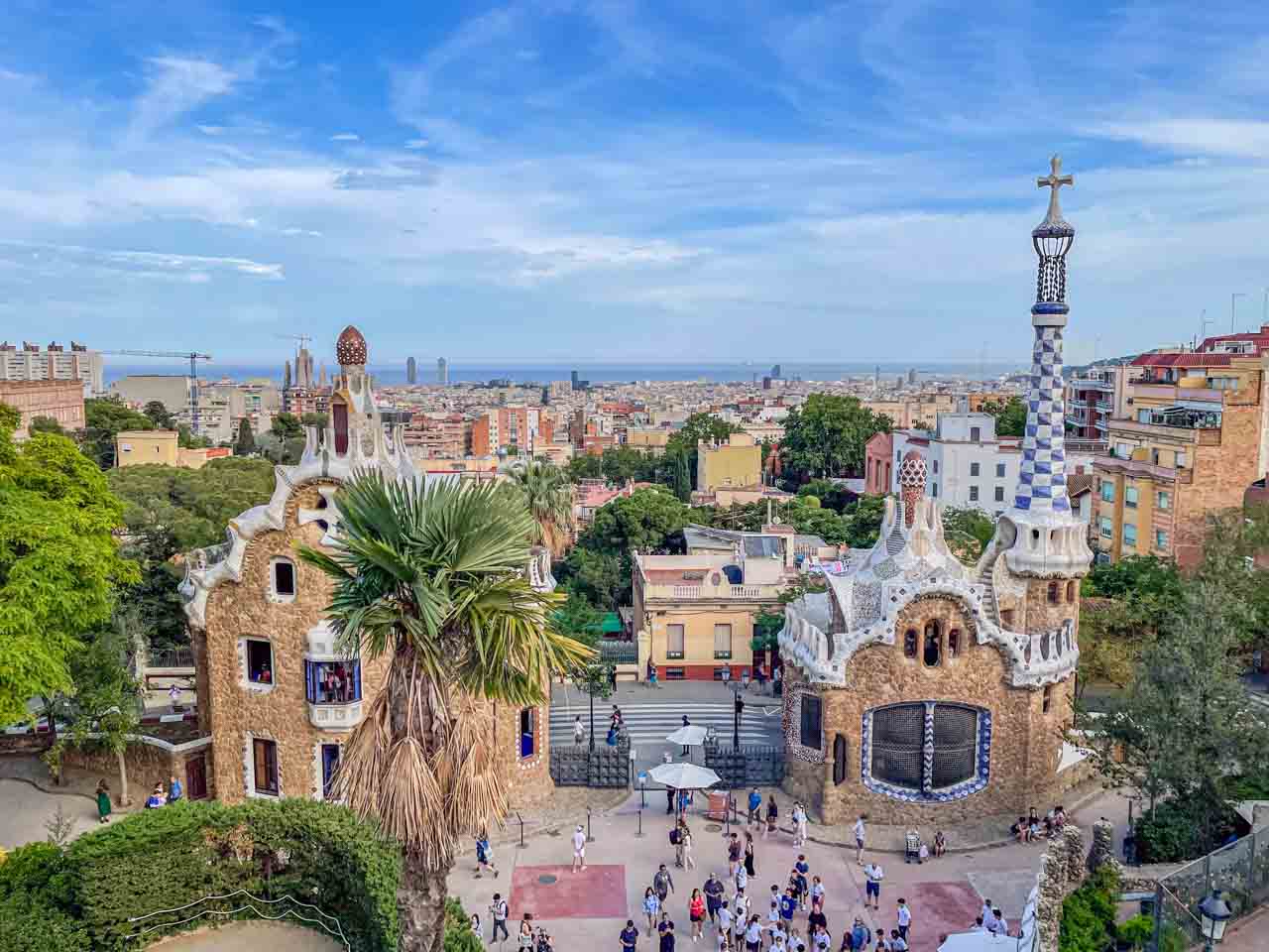
The former guard’s residence (left) and sales office (right) at Park Guell’s Olot Street entrance.
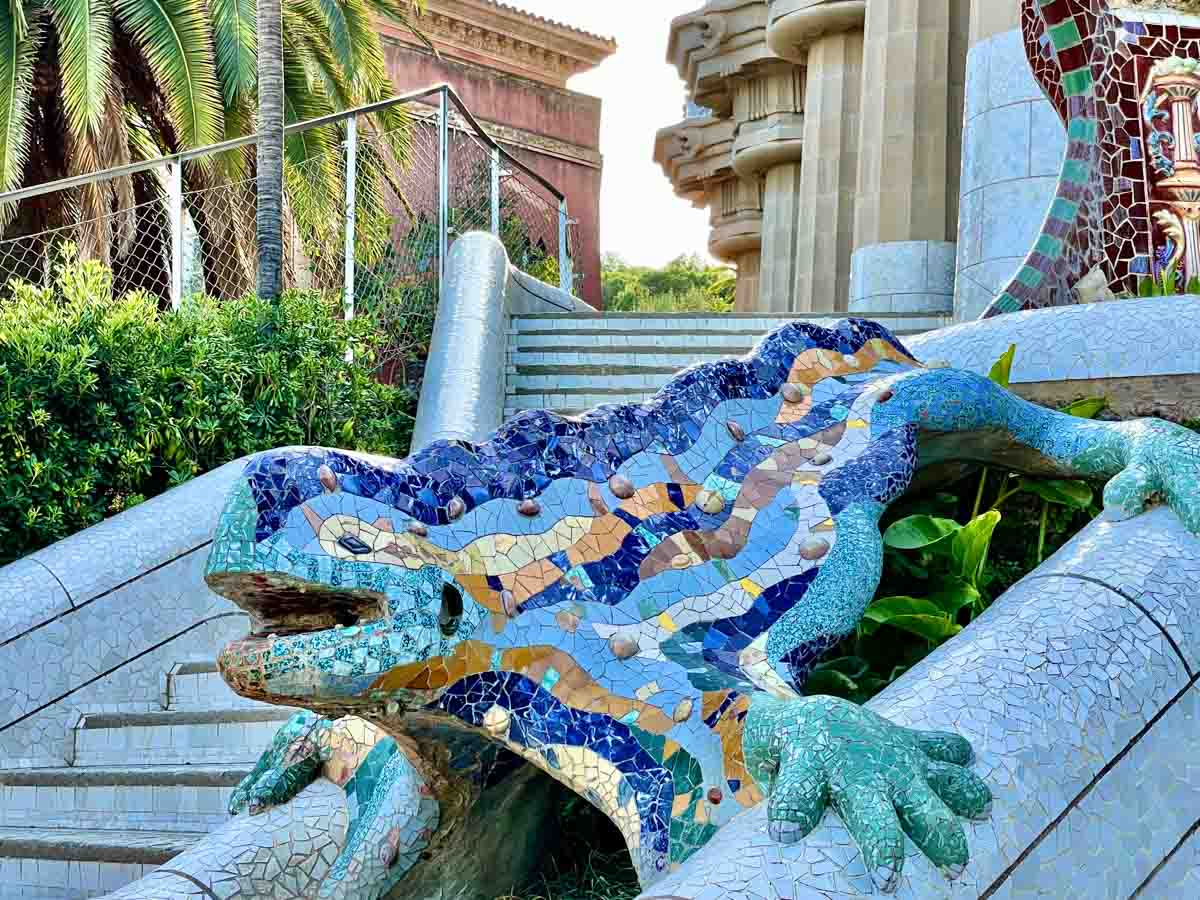
The whimsical multicoloured 2.4-metre-long dragon or salamander has become the symbol of Barcelona.
I didn’t know about Park Guell’s original intention as a luxury residential complex (gated community), but this plan was abandoned in 1914 as it was financially unsuccessful. It was opened to the public as a municipal park in 1926.
At more than 17 hectares, the park is one of the largest green spaces in Barcelona.
The Spanish Government declared Park Guell a Monument of Cultural Interest in 1969 in recognition of its historical, architectural, and artistic uniqueness. It was designated a UNESCO World Heritage Site in 1984 and a Catalan National Cultural Interest site in 1993.
I finally learned how to pronounce ‘Guell’ – ‘Gway’, with the ‘G’ pronounced like the ‘g’ in ‘girl’.
Fun Facts:
Gaudi had a workman drop his pants and sit in the soft plaster for a perfect anatomical curve to ensure the stone bench was comfortable.
The former guard’s residence and sales office have been dubbed the Hansel and Gretel gingerbread houses by the children of Barcelona.
BESALU – Medieval Town on the Fluvia River
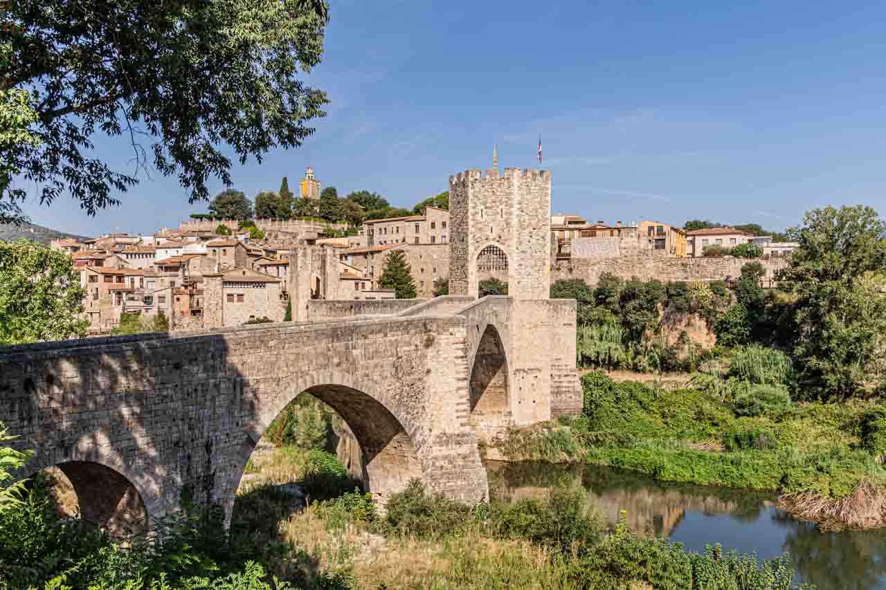
Founded in 878 AD, Besalu is an enchanting medieval town in the southeastern section of the Pyrenees. It is one of Spain’s best-preserved medieval towns and was declared a historic and artistic site of national importance in 1966.
Besalu is home to an 11th-century church and hospital, a 12th-century monastery, the remains of a medieval castle, and an ancient Jewish Quarter, where you will find the ruins of a medieval synagogue and a 12th-century Mikvka (Jewish ritual bathhouse). However, its most significant feature is its 12th-century Romanesque bridge over the Fluvia River with a gateway at its midpoint.
The medieval town of Besalu and its Romanesque bridge.
Keep an eye out for sculptures of chairs scattered around the old town.
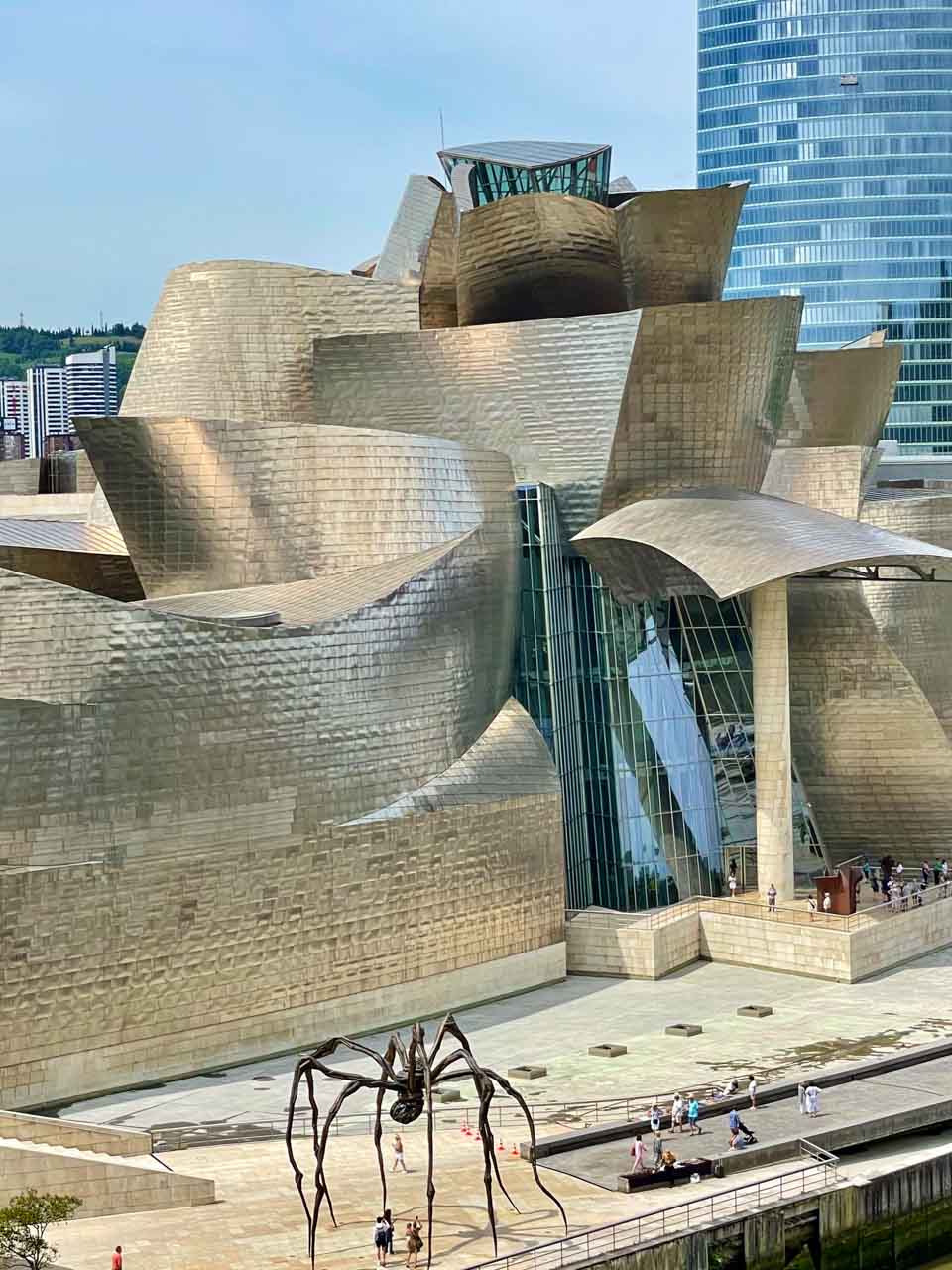
BILBAO – The Many Faces of the Guggenheim Museum
Bilbao is an industrial port city in northern Spain and the biggest city in Basque Country. The opening of the Guggenheim Museum in 1997 saw the revitalisation of Bilbao as it transformed from a nondescript town to one of Spain’s bucket list destinations.
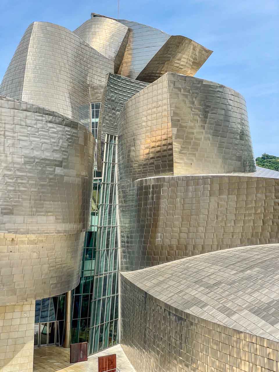
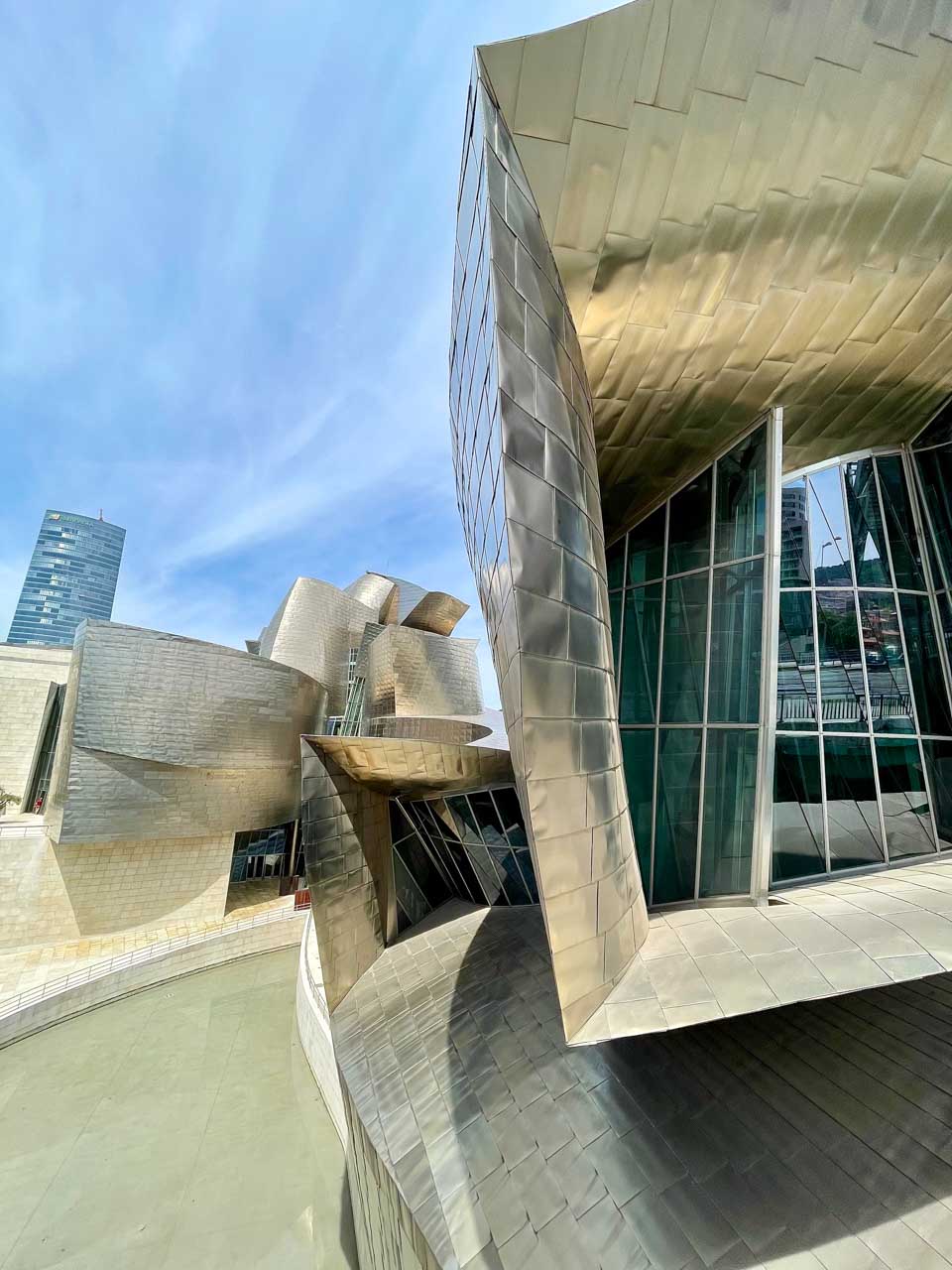
Front facade.
Side facade.
The spider sculpture in front of the Guggenheim Museum.
The Guggenheim Bilbao is a modern and contemporary art museum in Northern Spain’s Basque Country. But before the art, it is, first and foremost, the most fantastic piece of architecture. Wow-factor architecture! Do you agree?
The best views of the Guggenheim are from Salve Bridge, from where I took the above photos. The Salve Bridge is informally known as the Guggenheim Bridge because it merges into the Guggenheim Museum. I particularly liked the spider sculpture in front of the museum.
Take the funicular to the top of Mount Artxanda for great views of Bilbao and the Guggenheim Museum.
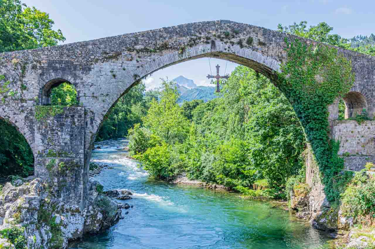
CANGAS DE ONIS – Roman Bridge of Cangas de Onis
Cangas de Onis is a picturesque town in Spain’s northwest province of Asturias.
The five-arched Roman Bridge of Cangas de Onis spanning the Sella River is not Roman. In fact, it is medieval, possibly dating from the late 13th century.
Roman Bridge of Cangas de Onis.
Roman or medieval, it still makes for an interesting bridge in a picturesque landscape. It is a graceful humpback bridge with a large, pointed central arch and is one of the best-known symbols of the Principality of Asturias.
From the centre of the arch hangs a reproduction of the famous Victory Cross – the symbol of the re-conquest of Spain from the Moors. The original Victory Cross is a work of precious metal dating to the start of the 10th century. You will find the Cross in Oviedo Cathedral.
CORDOBA
About 130 kilometres northeast of Seville, Cordoba was an important Roman city and a major Islamic centre in the Middle Ages. In Cordoba, three different cultures peacefully coexisted: Jews, Muslims, and Christians.
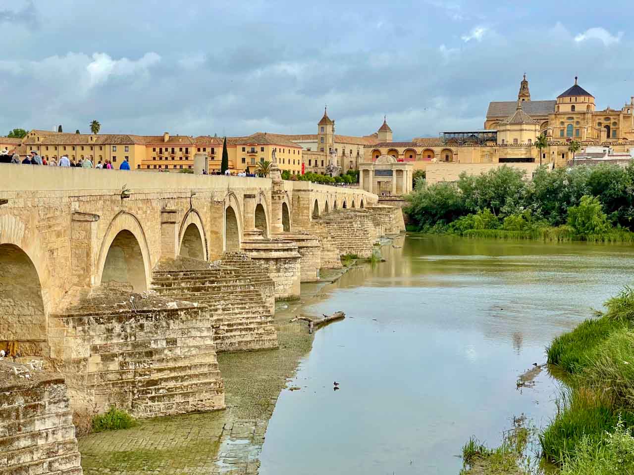
Roman Bridge of Cordoba
Cordoba’s Roman Bridge.
The stunning Roman Bridge of Cordoba was built across the Guadalquivir River in the first century BC. It has 16 arches supported by robust spurs with semi-cylindrical buttresses and is 247 metres long. It has undergone several reconstructions over the centuries, and today, only the 14th and 15th arches at the northern end are originally Roman. However, it remains a beautiful historical bridge. Since 2004, it has been a pedestrian-only bridge.
For those familiar with the TV series “Game of Thrones”, the Roman Bridge of Cordoba doubled as the Long Bridge of Volantis spanning the Rhoyne River in Season 5.
The Roman Bridge is part of the historic centre of Cordoba, which was declared a UNESCO World Heritage Site in 1984.
Mosque-Cathedral of Cordoba (Mezquita-Catedral of Cordoba)
It is also known as the Great Mosque of Cordoba.
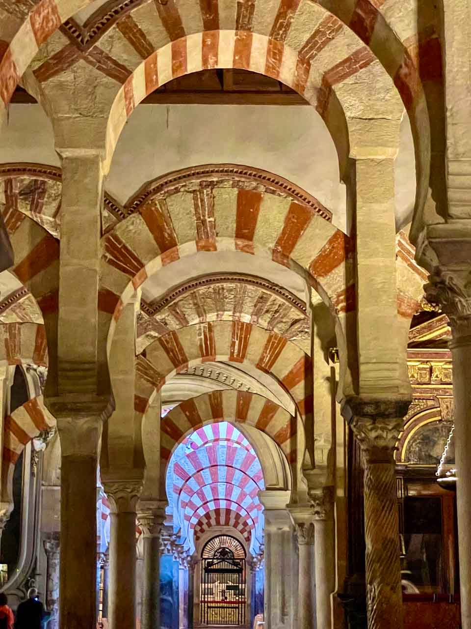
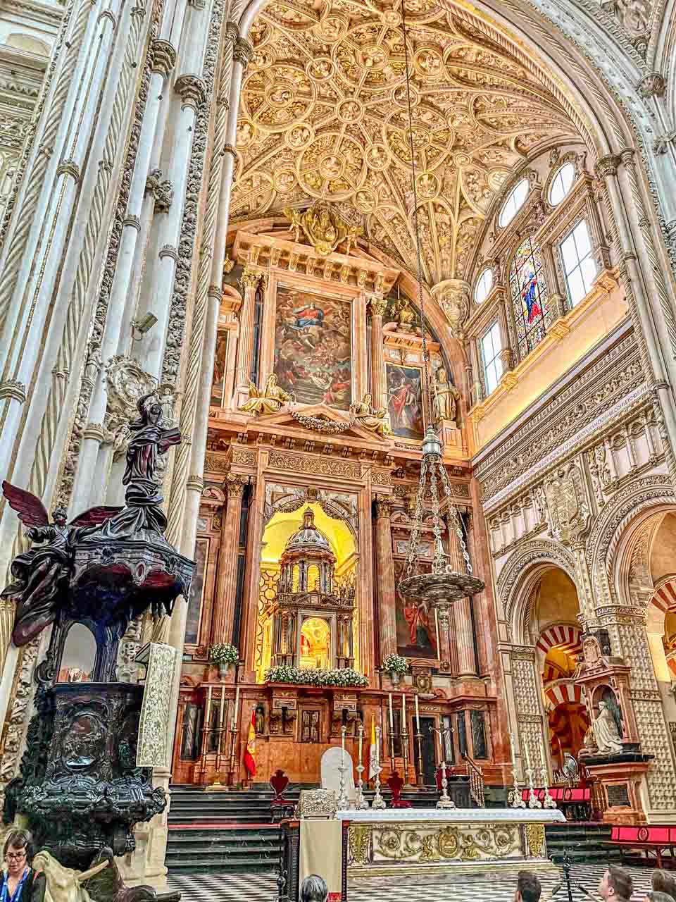
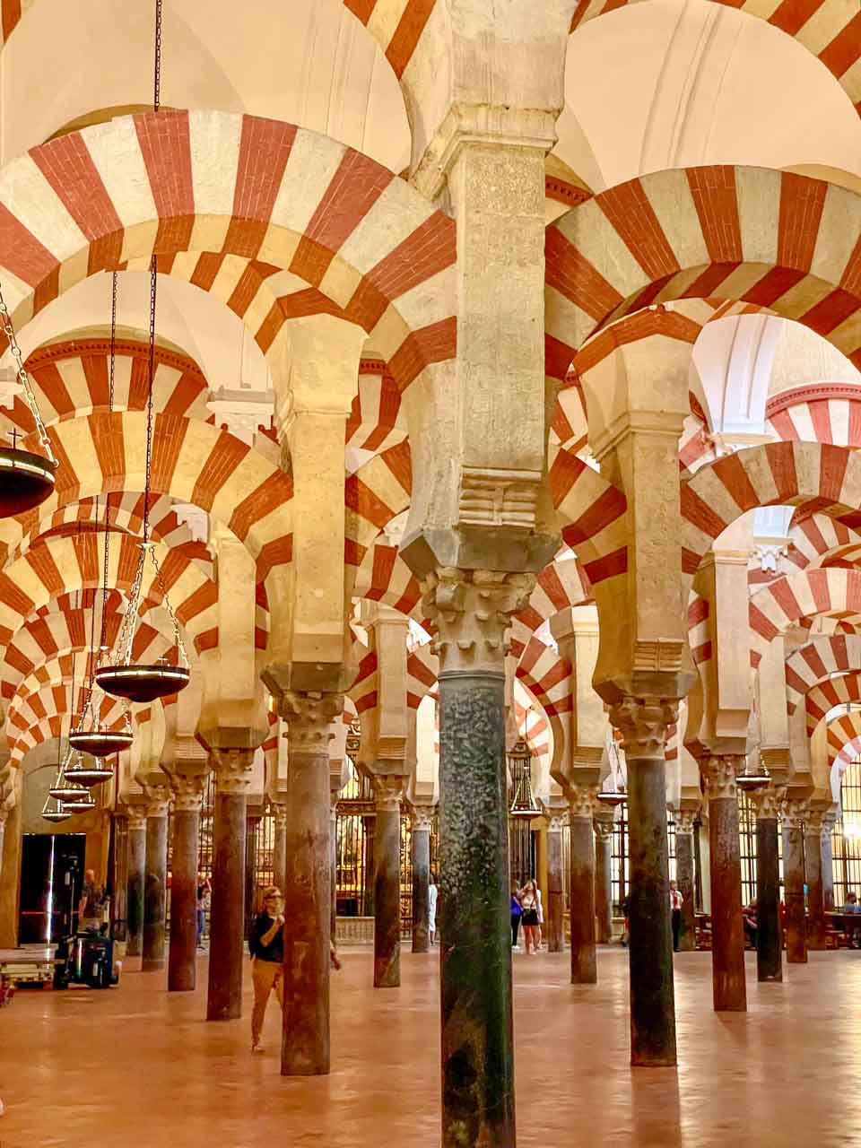
Walking into the mosque stopped me dead in my tracks. It was one of those “Oh my goodness” moments. The main hall is a forest of pillars supporting over 850 double-arched columns – a spectacular sight that is breathtakingly beautiful and unforgettable.
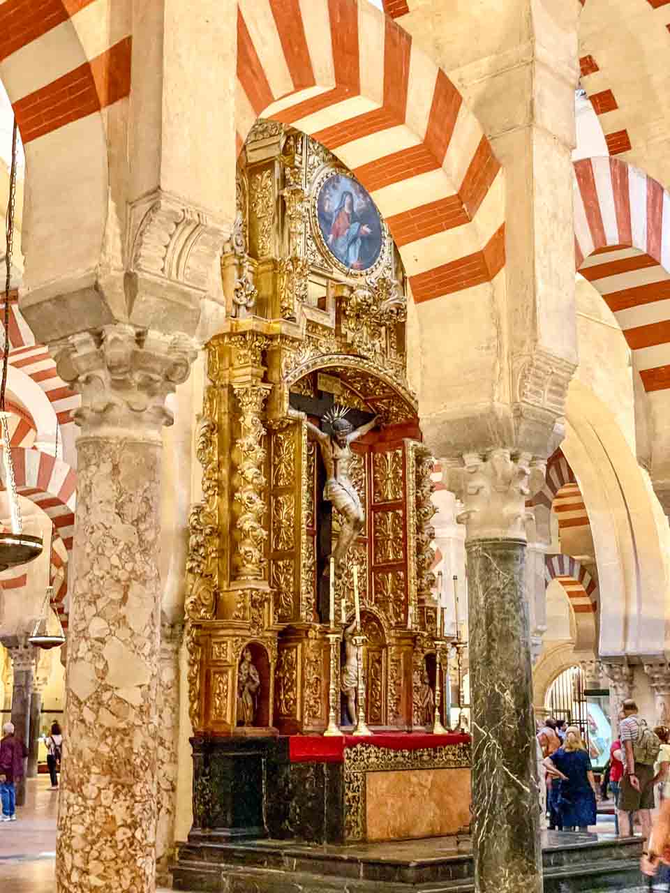
Check out my photo gallery of the eclectic interior of Cordoba’s Mosque-Cathedral:
The mosque leads to a chapel.
A cathedral within a mosque.
The Islamic double-arched columns.
A statue of Christ inside the Mosque-Cathedral.
The Mosque-Cathedral of Cordoba is steeped in history and is a unique blend of cultures and architectural styles – Islam and Christianity.
Building commenced on the mosque in 785 and took over two centuries to complete. It was once one of the most important mosques in the Islamic Kingdom. When the Great Mosque was converted into a Christian Cathedral in 1236 after the conquest of Cordoba by Ferdinand III, he never demolished the mosque. The cathedral was built in the centre of the mosque.
The Mezquita was designated a UNESCO World Heritage Site in 1984.
The Mosque-Cathedral is the Cathedral of Cordoba, and Muslim prayer is prohibited. However, historical beginnings linger. My guide told me that Catholic couples say they are marrying in the mosque, not the cathedral.
The Mosque-Cathedral of Cordoba is one of the most unique buildings in the world, an absolute must-see when in Spain. It is easy to see why the people of Spain voted the Mosque-Cathedral of Cordoba number one in their list of The Twelve Treasures of Spain.
COSTA BRAVA – Catalonia’s Coastline
The Costa Brava is a coastal region of Catalonia in northeastern Spain, stretching from the town of Blanes, 60 kilometres northeast of Barcelona, to the French border.
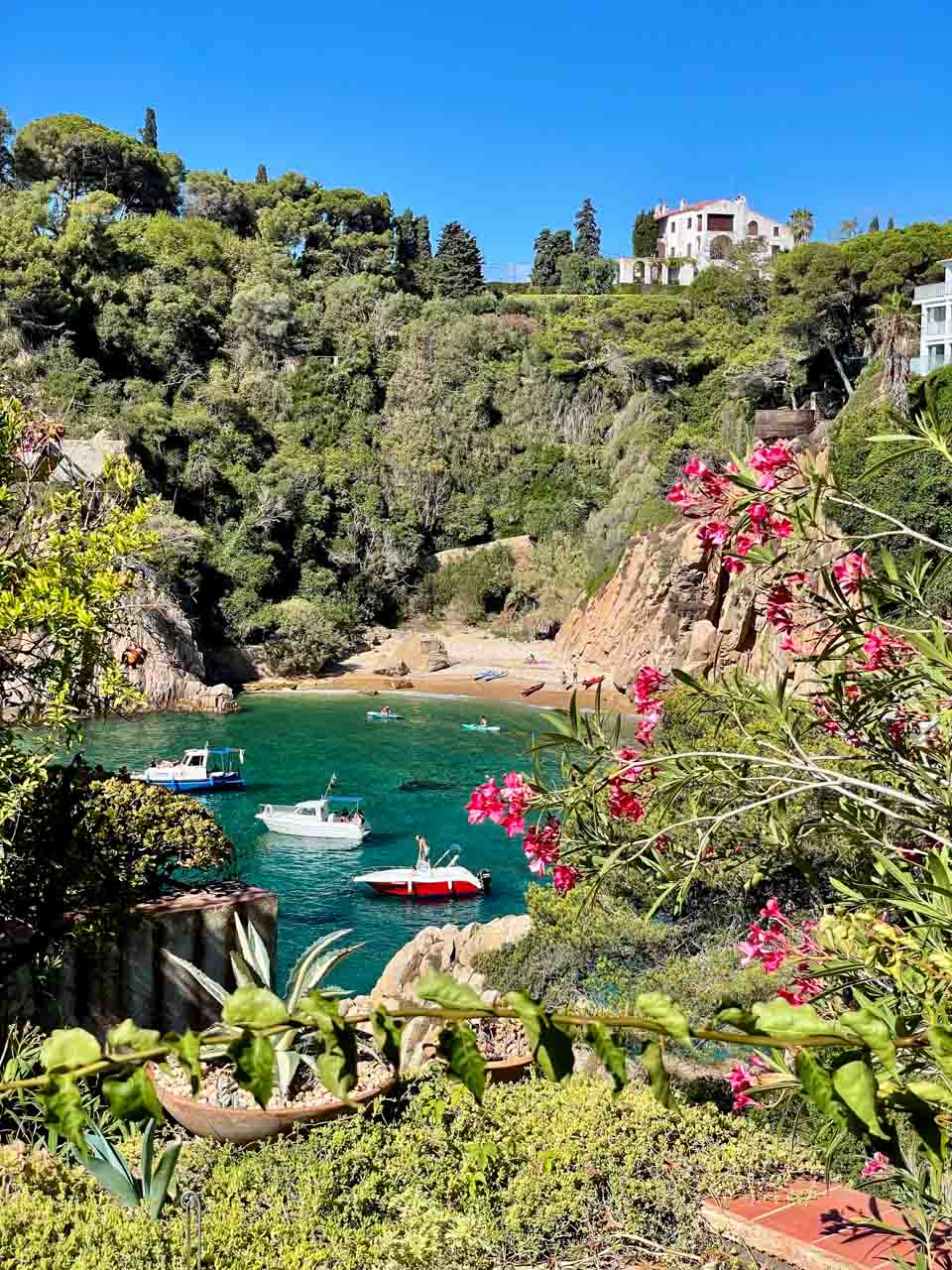
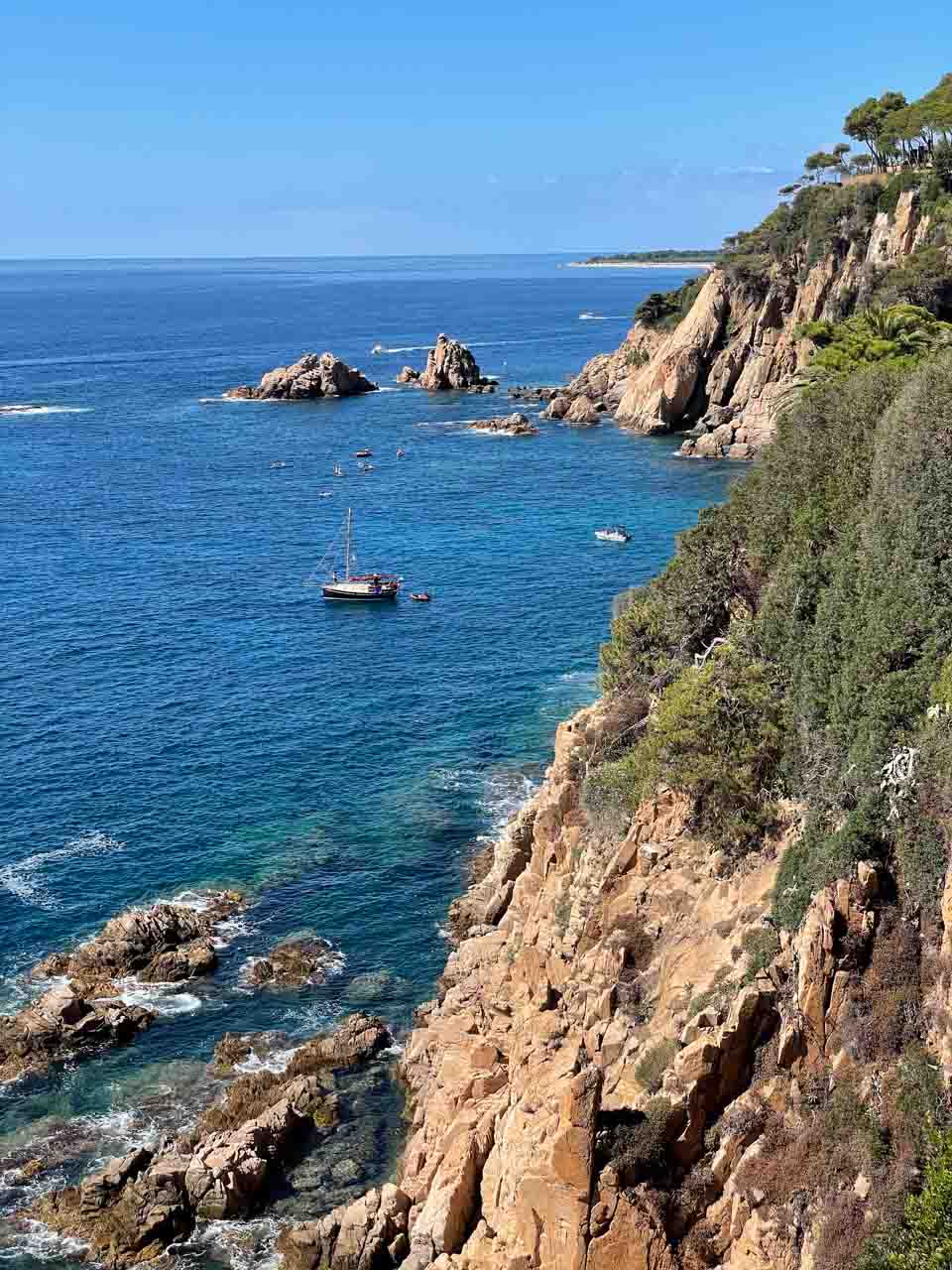
On a day trip from Barcelona, the picturesque Costa Brava was stunningly beautiful with its white sand coves, turquoise waters, and rugged coastline.
Costa Brava viewed from Marimurtra Botanical Garden.
Costa Brava’s coastline.
I took the above photos of the Costa Brava from the cliff-top Marimurtra Botanical Garden near Blanes.
FIGUERES – Dali Theatre-Museum
Near the border with France and about 136 kilometres north of Barcelona, Figueres is famous for being the birthplace of the artist Salvador Dali.
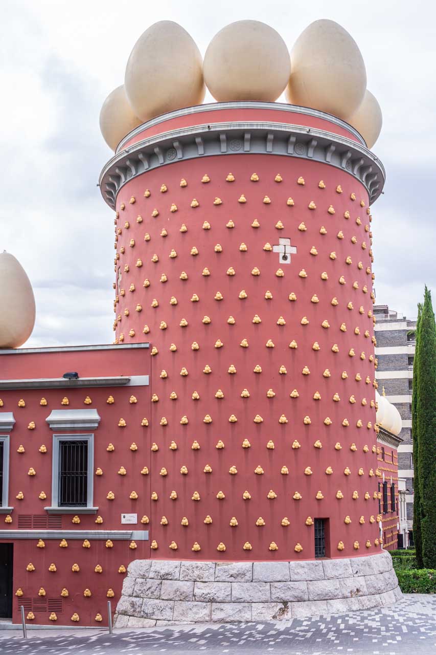
The Dali Theatre-Museum in Figueres built by Salvador Dali.
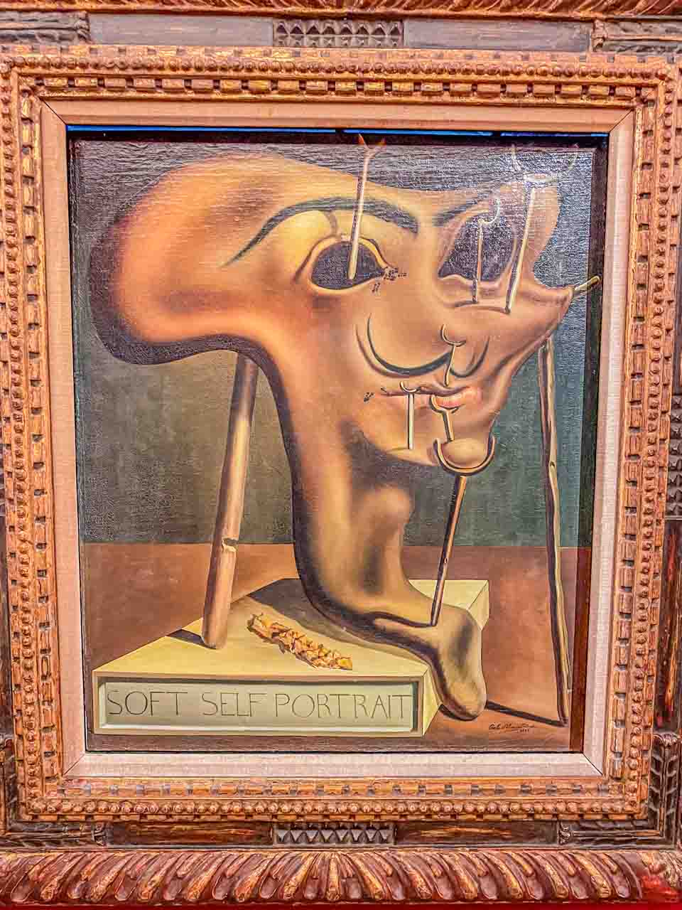
Salvador Dali’s painting “Soft Self-Portrait With Grilled Bacon” 1941 in the Dali Theatre-Museum.
The Dali Theatre-Museum in Figueres, Catalana, is a museum solely dedicated to the Spanish artist Salvador Dali – a genius of Surrealism. The museum, built by Dali, is considered the largest surrealist object in the world and is crowded with his artworks – paintings, sculptures, photographs, and jewellery.
I have been a fan of Salvador Dali for many decades, and visiting his theatre-museum was on my bucket list as soon as I started planning my trip to Spain. And I wasn’t disappointed! Over several hours wandering through the theatre-museum, I got a glimpse into his unique world.
Dali is buried in a crypt beneath the dome of his Figueres Theatre-Museum.
Here’s some trivia for you: Dali designed the Spanish lollipop Chupa Chups logo. I never knew Chupa Chups were Spanish! I may need to attend more trivia nights because who created the Chupa Chups logo is, apparently, a frequently asked trivia question.
GIRONA
Girona is a city located between the Pyrenees and Costa Brava – just a short train ride from Barcelona and about 60 kilometres south of the French border. Girona is famous for preserving the medieval old city, located at the confluence of the Ter, Onyar, Galligants, and Guell rivers.
For Game of Thrones fans, you can take a tour of all the filming locations in Girona.
Jewish Girona
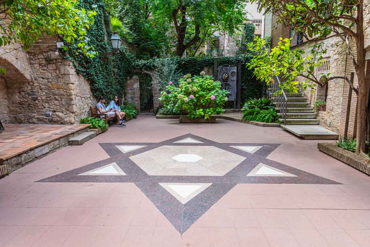
Courtyard with the Star of David in the Museum of Jewish History.
Girona has a long history of Jewish habitation, dating back to at least the 9th century AD and is one of the best-preserved Jewish Quarters in Europe. A guided walking tour of Girona’s Jewish Quarter in the old town, known as El Call, takes you on a fabulous history and architectural trip as you make your way through a labyrinth of narrow streets.
The walking tour I joined concluded with a guided tour through the Museum of Jewish History.
Girona’s last remaining synagogue is home to the Museum of Jewish History. The synagogue was in use until 1492 when the Jews were expelled from Spain. The museum aims to preserve and spread the history of the Jewish life that developed in Spain and Girona.
Medieval Girona
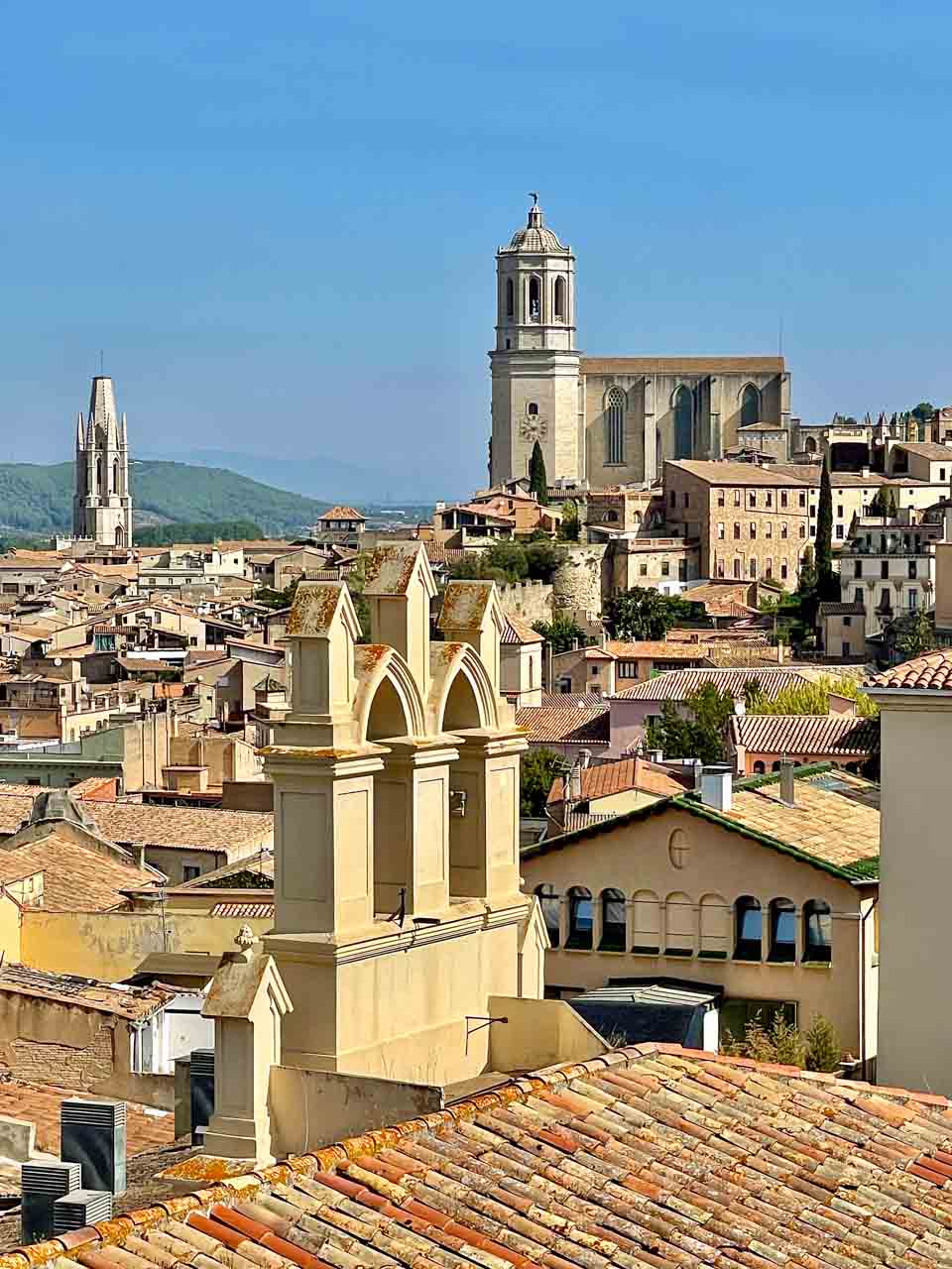
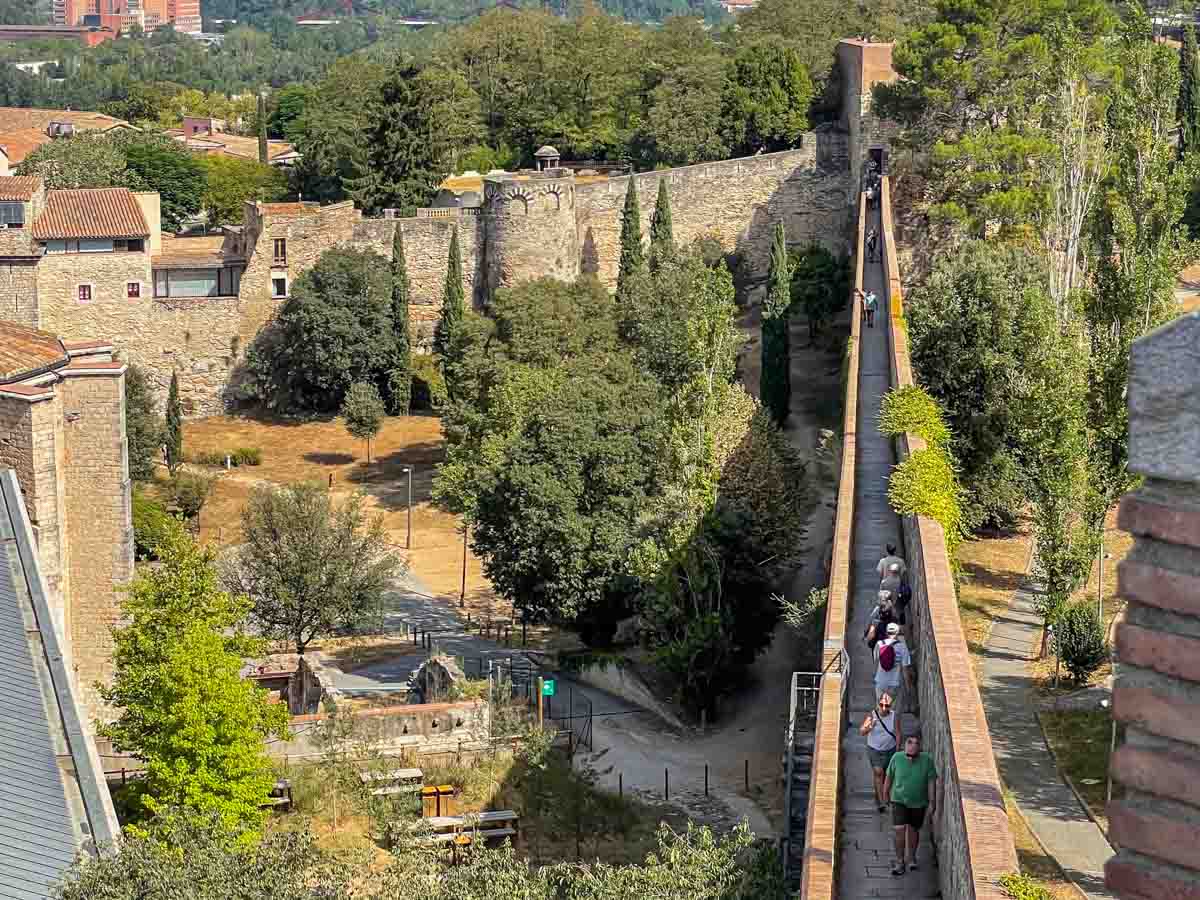
A walk along Girona’s three kilometres of medieval walls is a walk along the path of history and provides fantastic panoramic views of Girona and the Old Town.
View of Girona’s Old Town from the medieval wall.
Initially built by the Romans, Girona’s medieval walls were rebuilt and extended in the Middle Ages. The walls surround the historic city centre and are some of the most complete walls in Spain. There are four access points to the walls, but I recommend waking the entire length for the ever-evolving views of this beautiful city. I accessed the wall at Placa Catalunya (Catalonia Square) and walked its length to the Jardins de la Francesa (French Gardens).
Girona’s medieval walls.
Painted Girona
Girona is a city in Spain’s northeastern Catalonia region, at the confluence of the Onyar, Ter, Galligants, and Guell Rivers. It’s known for its medieval architecture, walled Old Quarter, Barri Vell), Jewish Quarter (Call), and the Roman remains of the Forca Vella fortress.
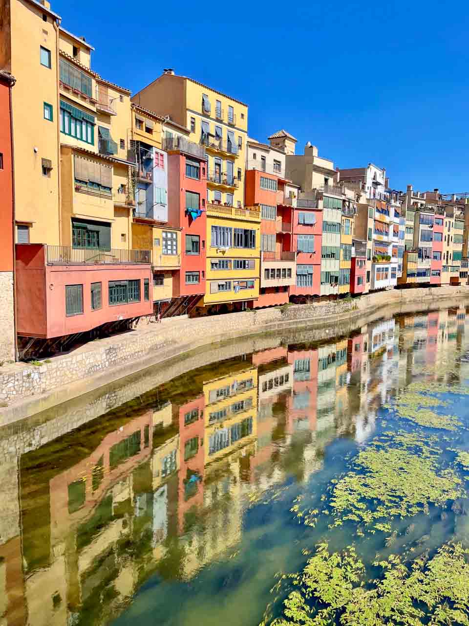
The colourful houses on the banks of the Onyar River are perhaps the most recognised and photographed landmark of Girona.
The coloured houses of Girona reflected in the Onyar River.
In the late 20th century, a small group of artists and architects chose the colour palette for the houses’ facades. The best way to see them is from one of the bridges spanning the Onyar River. I took the photo above from Pont de Sant Agusti, my favourite reflection spot.
Initially built by the Romans, Girona’s medieval walls were rebuilt and extended in the Middle Ages. The walls surround the historic city centre and are some of the most complete walls in Spain. There are four access points to the walls, but I recommend waking the entire length for the ever-evolving views of this beautiful city. I accessed the wall at Placa Catalunya (Catalonia Square) and walked its length to the Jardins de la Francesa (French Gardens).
GRANADA
In the foothills of the Sierra Nevada Mountains in southern Spain’s Andalusia region, Granada is a culturally rich city with 800 years of history as a Muslim Kingdom. Granada’s architecture strongly reflects its Muslim heritage.
The Albaicin
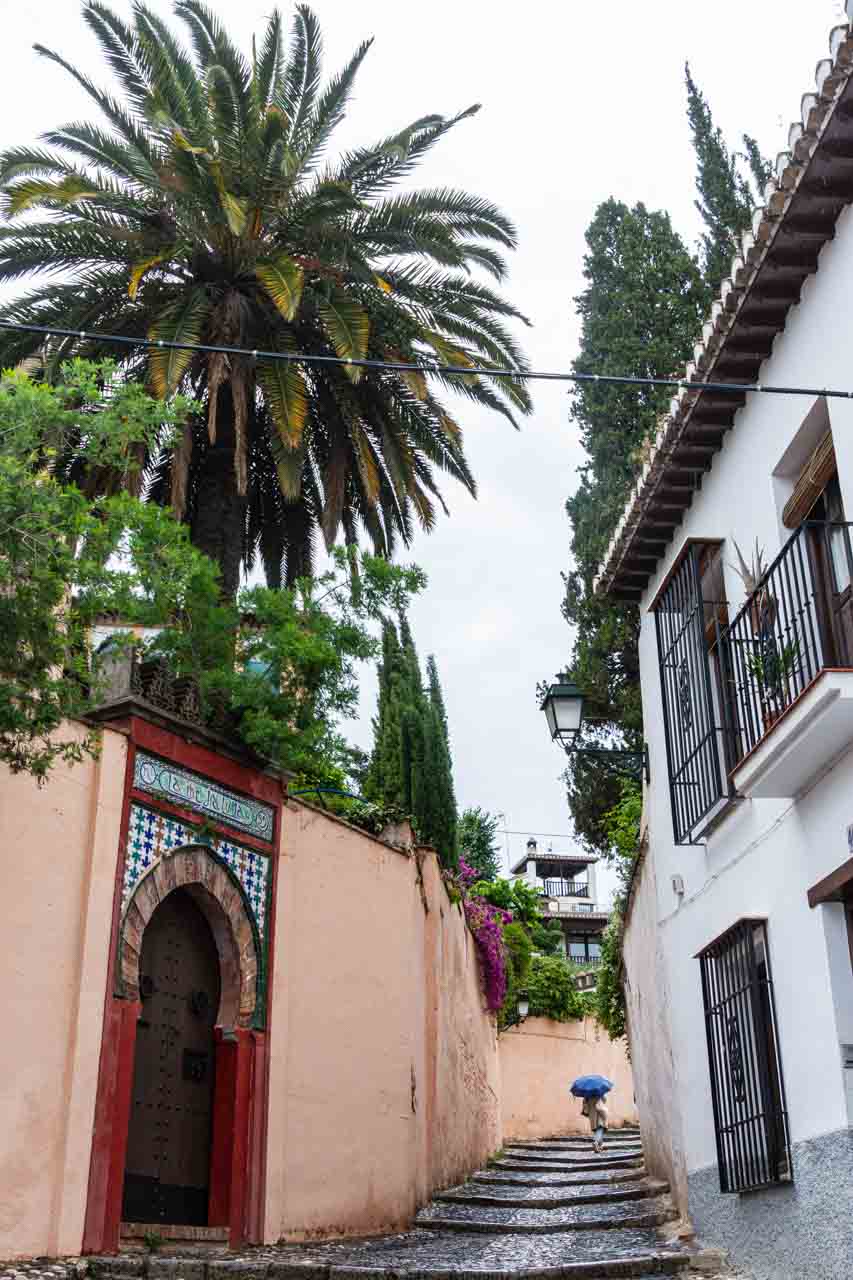
Moorish and Andalusian architecture coexist in World Heritage Albaicin.
Walk through Granada’s ancient Arab Quarter that retains its medieval Moorish origins. Get lost in the Albaicin’s maze of narrow cobbled streets and small squares washed in white. Situated on the hill across from the Alhambra, Granada was founded in the Albaicin and was the capital of the Nasrid Kingdom in the 15th century.
The Albaicin was declared a UNESCO World Heritage Site because of its eclectic but harmonious mix of Moorish and traditional Andalusian architecture.
The Alhambra
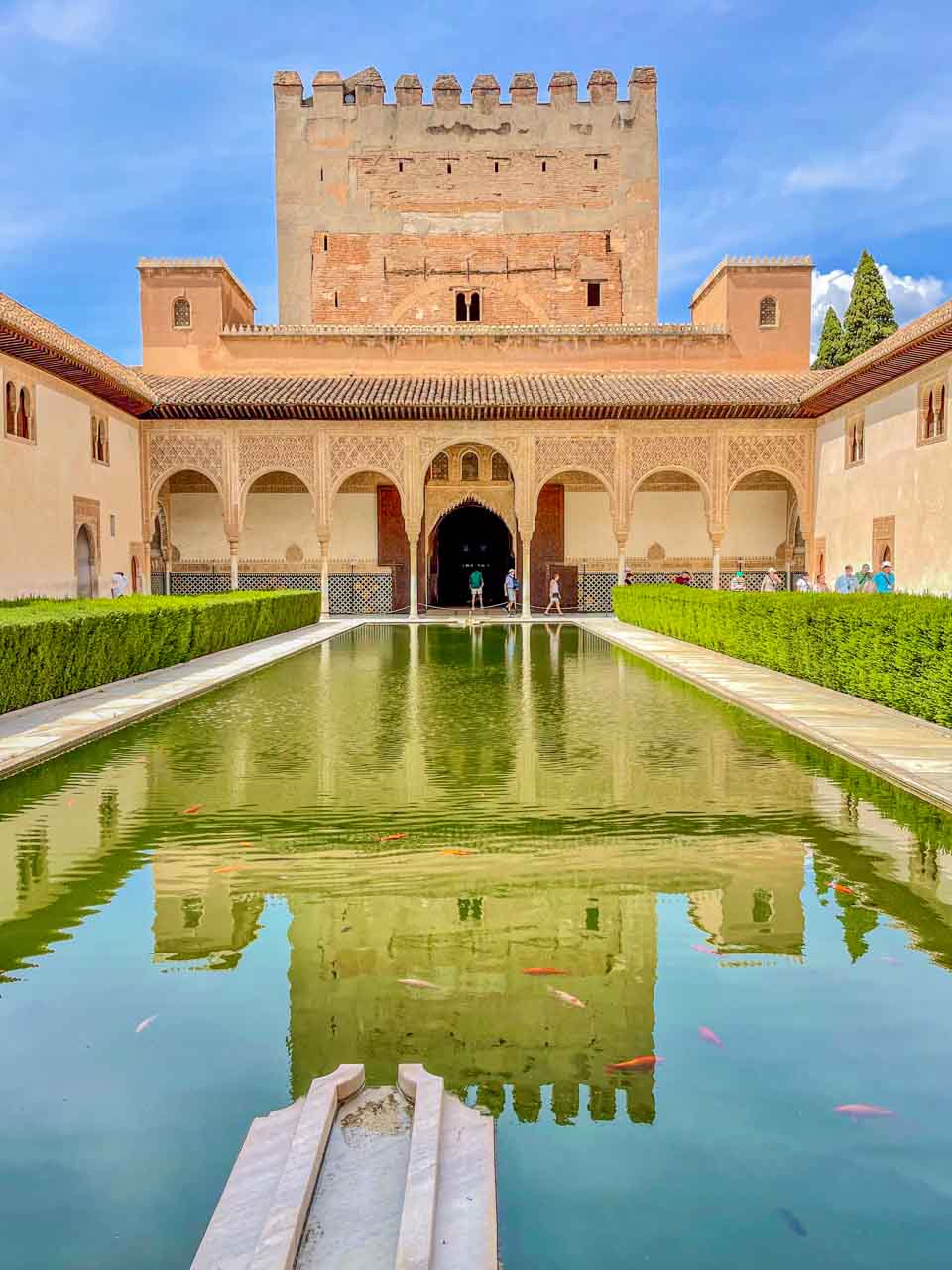
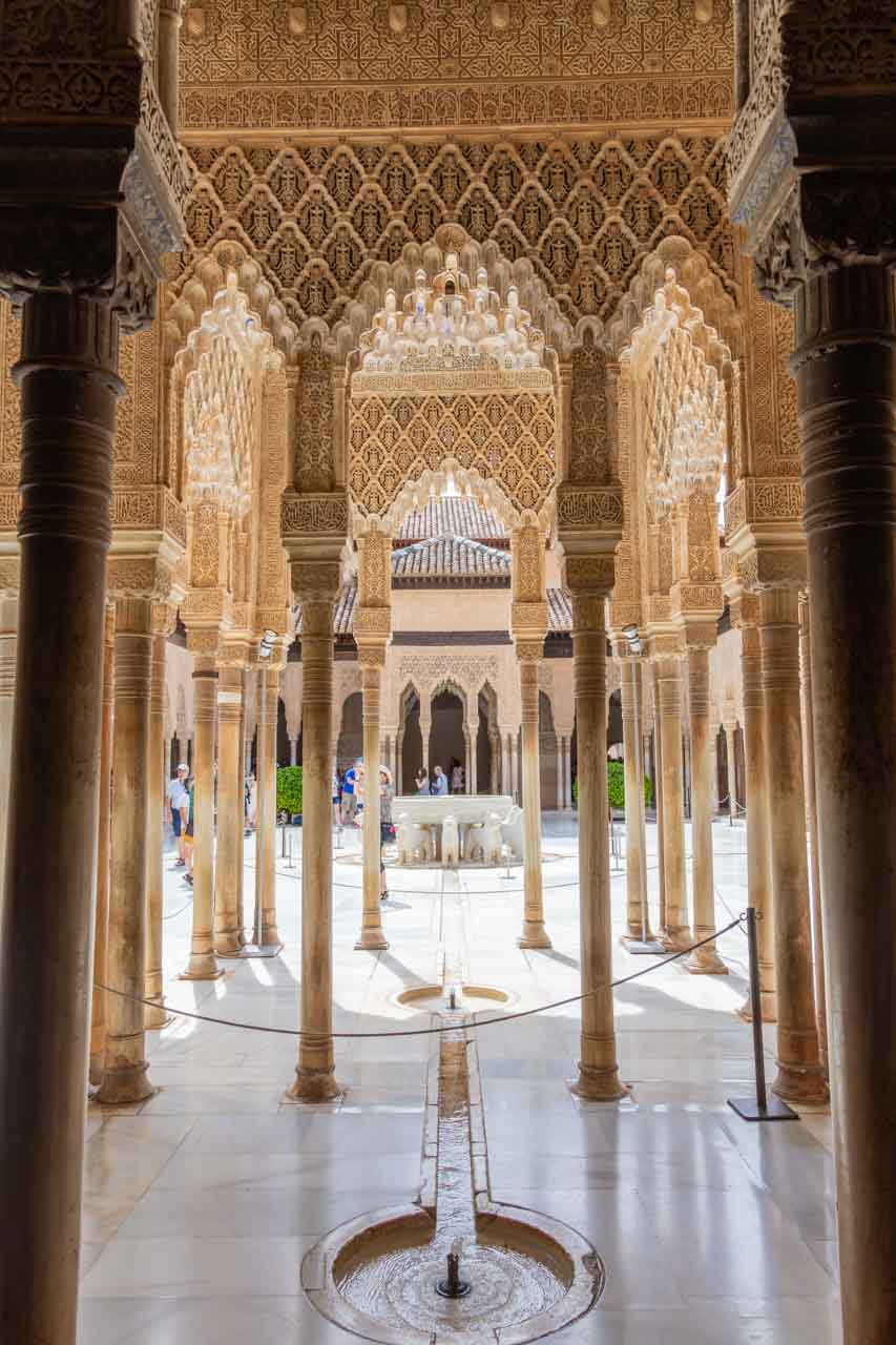
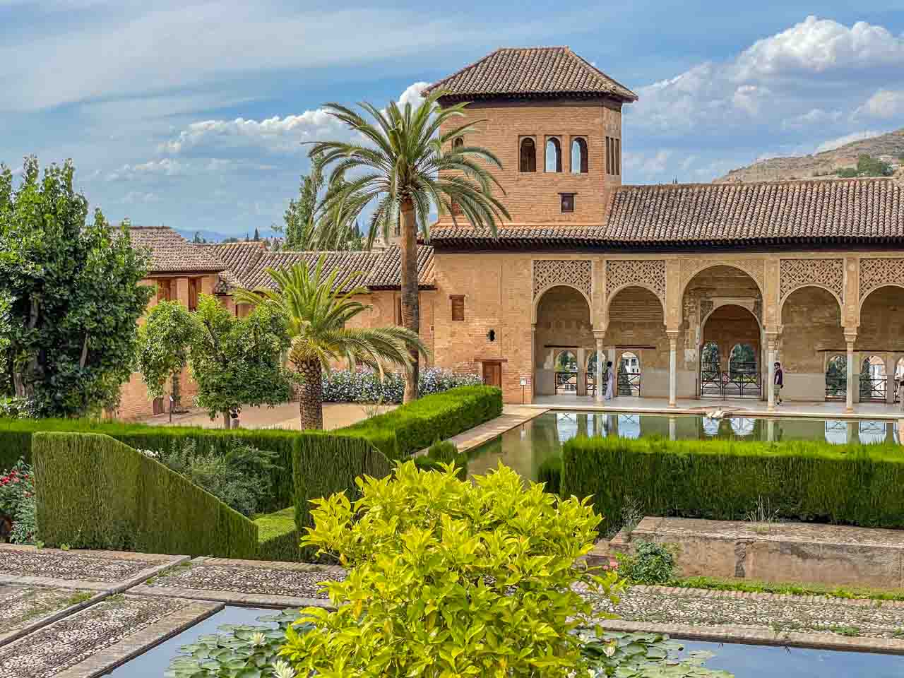
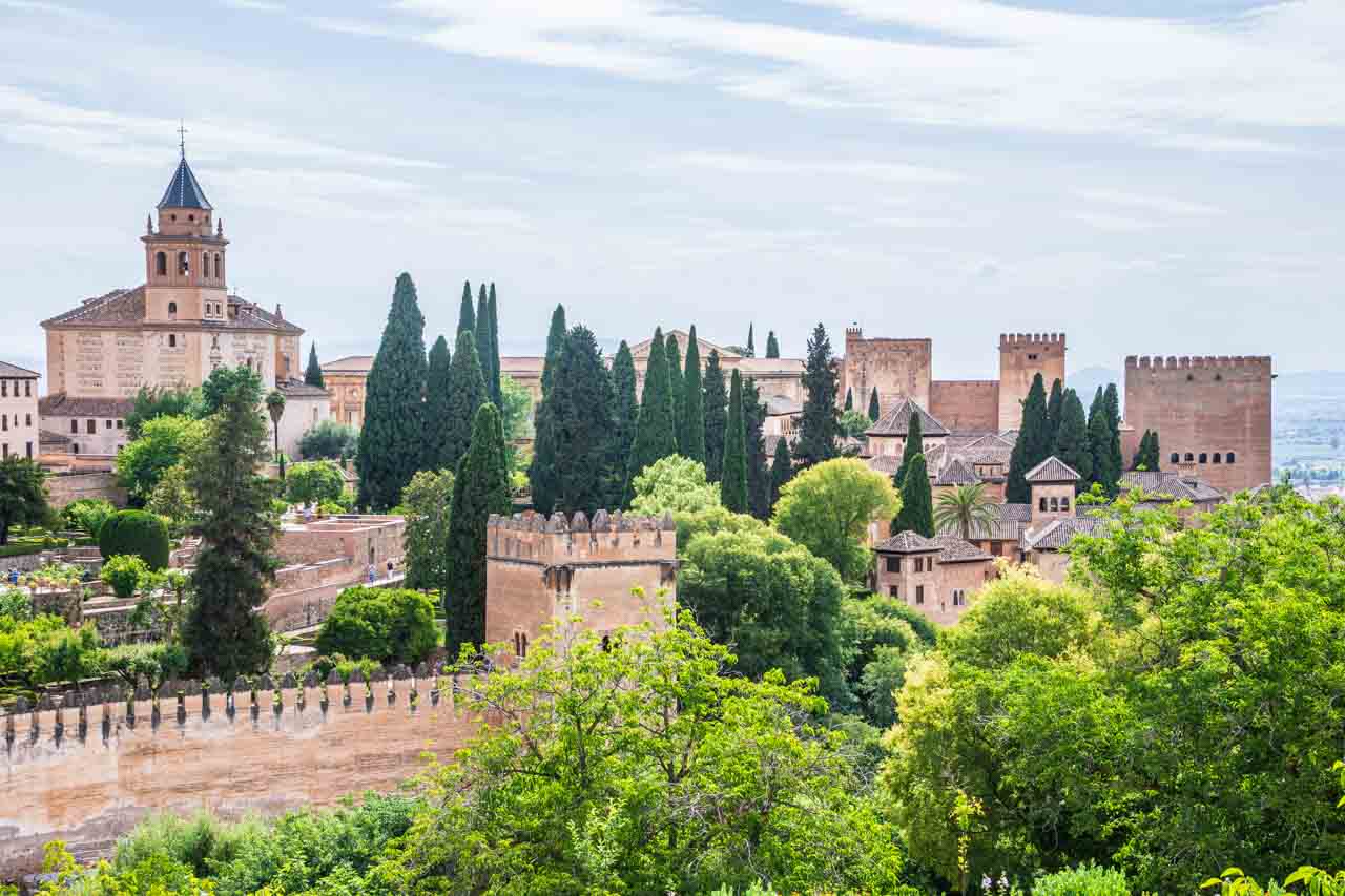
The Alhambra is a massive palace and fortress complex located in Granada. Built by the Nasrid Dynasty – the last Muslims to rule in Spain – and commencing in 1238, the Alhambra is a beautiful testament to Islamic architecture and Moorish culture. The complex includes the Alcazaba, palaces, the Medina, gardens, cemetery, workshops, baths, etc. and is enclosed by a massive, fortified wall with towers.
Myrtle Courtyard in Comares Palace looking towards the Hall of Ambassadors.
Courtyard of the Lions in the sultan’s private dwellings.
Partal Gardens and the Tower of the Ladies.
View of the Alhambra from the Generalise on the Hill of the Sun.
The Alhambra is just one of ten UNESCO World Heritage Sites in Andalusia. However, many believe it to be the most spectacular.
Often referred to as the 8th wonder of the world, the Alhambra was on my must-see list of places to visit in Spain, and I wasn’t disappointed. I had a three-hour guided tour around Alhambra, but you could easily spend all day in the complex.
I crossed this one off my bucket list!
MADRID – Madrid Architecture
Madrid is the capital of Spain and sits almost exactly in the middle of the country. Most famous for the Prado Museum, it was Madrid’s eclectic architectural styles that endeared the city to me.
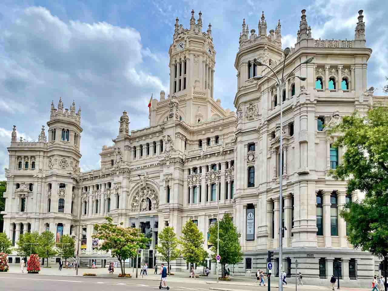
Cibeles Palace (Madrid’s City Hall)
Madrid has some of the most beautiful architecture in Spain, and Cibeles Palace (the former headquarters for the Spanish Post Office) deserves all the photographic and film attention it gets.
Now Madrid’s City Hall, the post office, I discovered when I had to post a parcel to Australia, can still be found in the building through a side entrance.
The best way to appreciate Madrid’s architecture is to walk the city.
MERIDA
A visit to Merida in Spain’s Extremadura region in southwest Spain is like a trip back to the Roman Empire. Founded in 25 BC (Colony of Augusta Emerita), this UNESCO World Heritage City is one of the best-preserved Roman sites in the world. The Roman theatre, amphitheatre, and bridge are unmissable stops along any tour of the ancient Roman city of Merida, and all within an easy walk of each other.
A Modern Play in an Ancient Setting
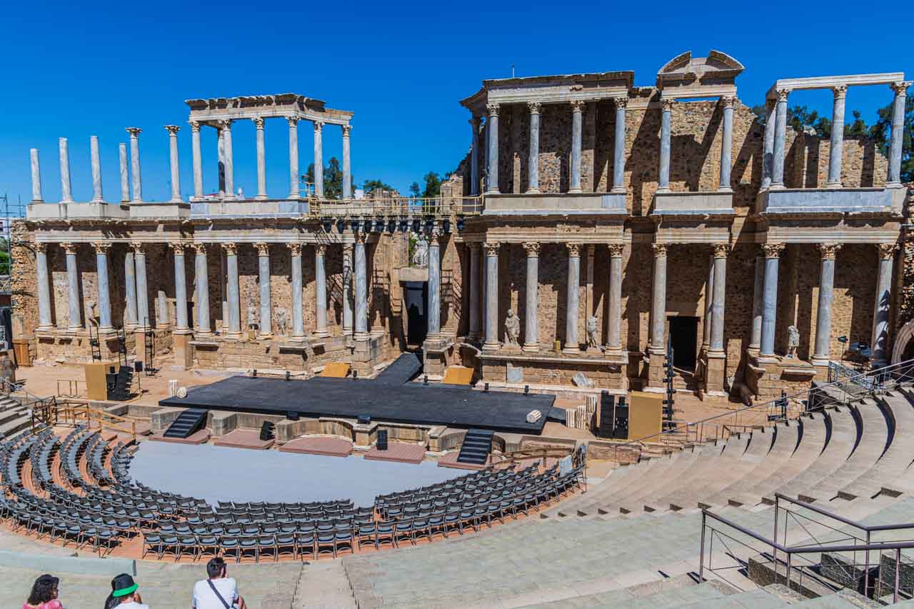
Merida’s Roman Theatre.
The Roman Theatre, with a seating capacity of about 5,000 spectators, was built from 16 to 15 BC and is Merida’s most spectacular Roman monument. I liked that, centuries later, it is still being used for its intended purpose.
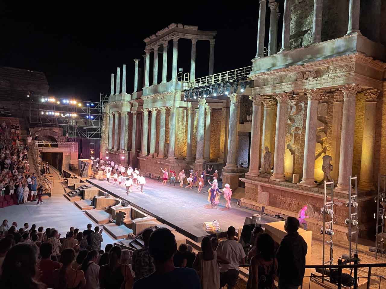
I saw a musical play in the Roman Theatre on my second night in Merida. The play, which didn’t start until 11 pm because of the heat, was entirely in Spanish. I didn’t understand a word, but seeing the play in that ancient setting was one of those once-in-lifetime experiences and was magical.
A standing ovation for the actors of the play in Merida’s Roman Theatre.
Roman Bridge of Merida
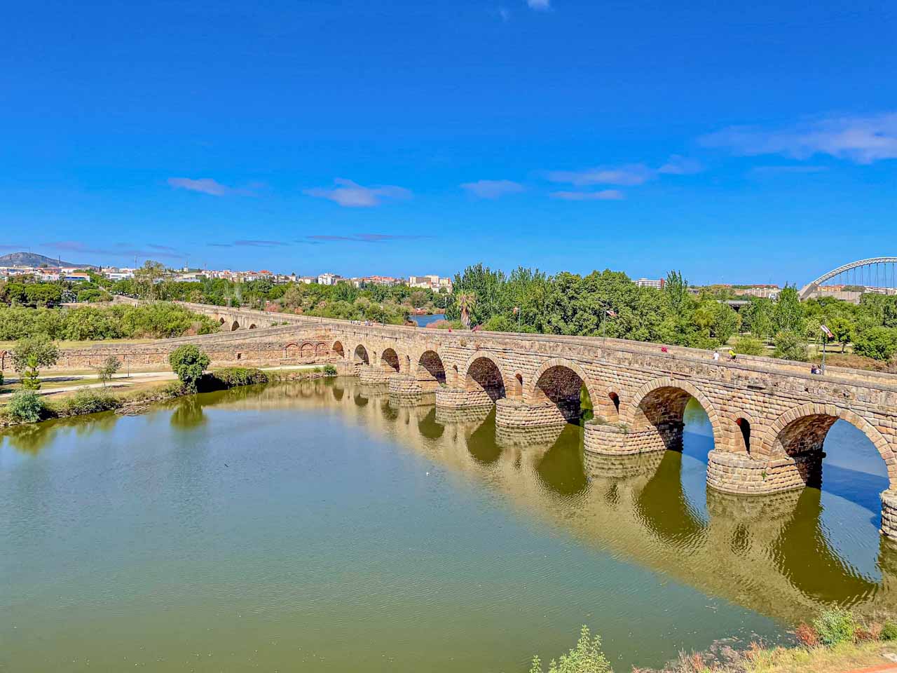
Roman Bridge, Merida
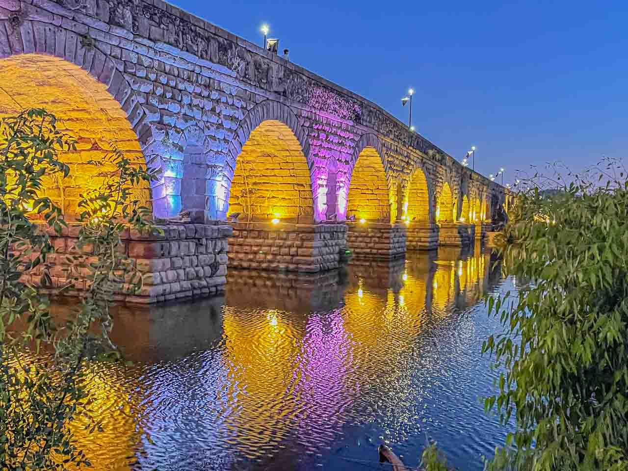
Merida’s Roman Bridge over the Guadiana River was built in the first century BC. At a length of 792 metres and with 60 arches, it is one of the longest bridges in Spain and the longest surviving bridge from ancient times. Carrying road traffic for most of its life, it became a pedestrian-only bridge in 1991.
The Roman Bridge requires two visits – one during the daylight hours and the other at night after sunset. Why? At night, the bridge is lit in multiple colours and is best viewed from the path bordering the Guadiana River.
The Roman bridge lit up at night.
Roman Merida
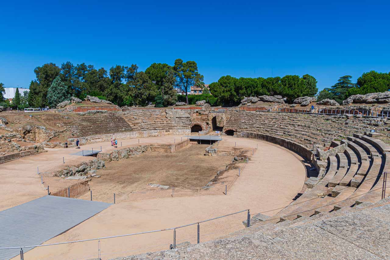
Roman amphitheatre, Merida.
Opened in 8 BC, Merida’s Roman amphitheatre was the setting for popular gladiatorial contests and beast hunts. It has been determined that the arena could seat between 15,000 and 16,000 spectators from all social standings.
Roman Merida is much more than the amphitheatre, bridge, and theatre. Don’t miss the Temple of Diana, Triumphal Arch, Roman Forum, La Cassa del Mitreon, and the Archeological area of Moreria.
MONTSERRAT MONASTERY – Monastery and Hiking Experience
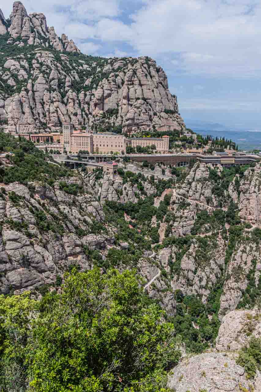
Montserrat Monastery is an 11th-century Benedictine monastery on Montserrat Mountain (meaning ‘serrated mountain’), 60 kilometres northwest of Barcelona. The monastery hangs onto the side of the mountain 725 metres above sea level.
Montserrat Monastery is perched on the side of the mountain.
I took this photo of Montserrat Monastery across the valley at the Cross of St Michael. This lookout was about one and a half hours into my very steep descent down Montserrat Mountain, and I still had about 20 minutes to go before I arrived back at the monastery.
To start my hike from the top of Montserrat Mountain, I rode the Funicular de Sant Joan from the monastery to the summit, about 300 metres above the monastery. I took the path to the left of the Funicular station that wound around and down the mountain, taking in spectacular views.
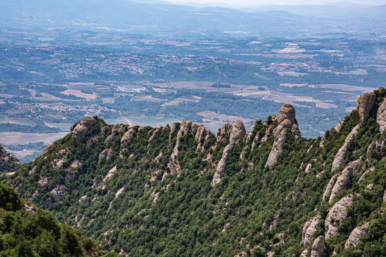
View from Montserrat (‘serrated’) Mountain.
While the hike down the mountain was not technically demanding (it’s a paved path nearly all the way), I did find the steep descent challenging. There were times when the decline was so steep my back was almost vertical to the path. The heat was another challenging factor. I’m sure I was on that mountain on its hottest day ever recorded!
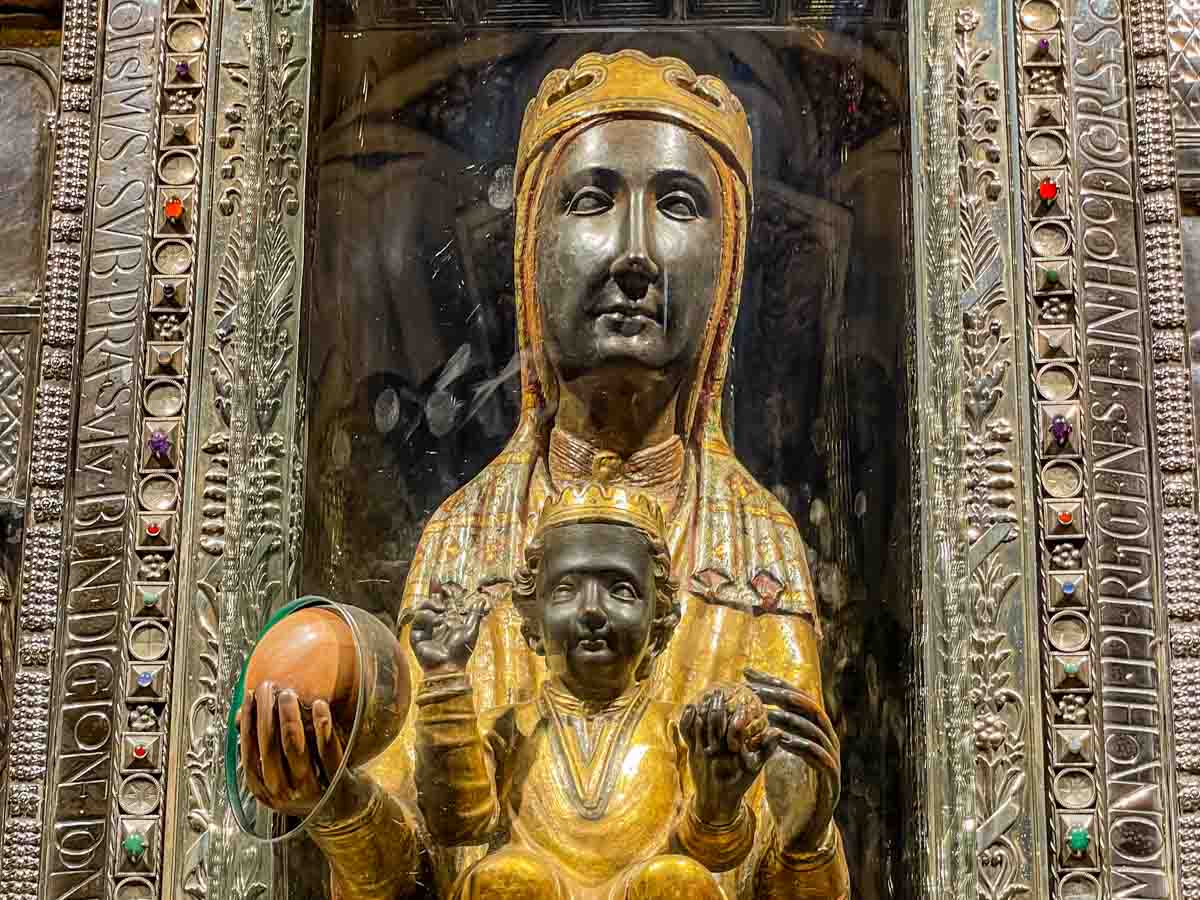
A trip to Montserrat Monastery is about more than just a starting point for hiking around the mountain (and there are several you can do). The monastery is famous for the statue of the Black Madonna housed in the basilica and for one of the oldest boys’ choirs in Europe.
The Black Madonna inside Montserrat Basilica.
The setting alone makes Montserrat Monastery worth a visit. The hike added value!
PAMPLONA
Pamplona is best known for its legendary multiday festival, the Running of the Bulls (Feast of San Femin) in July.
A Monument to Culture
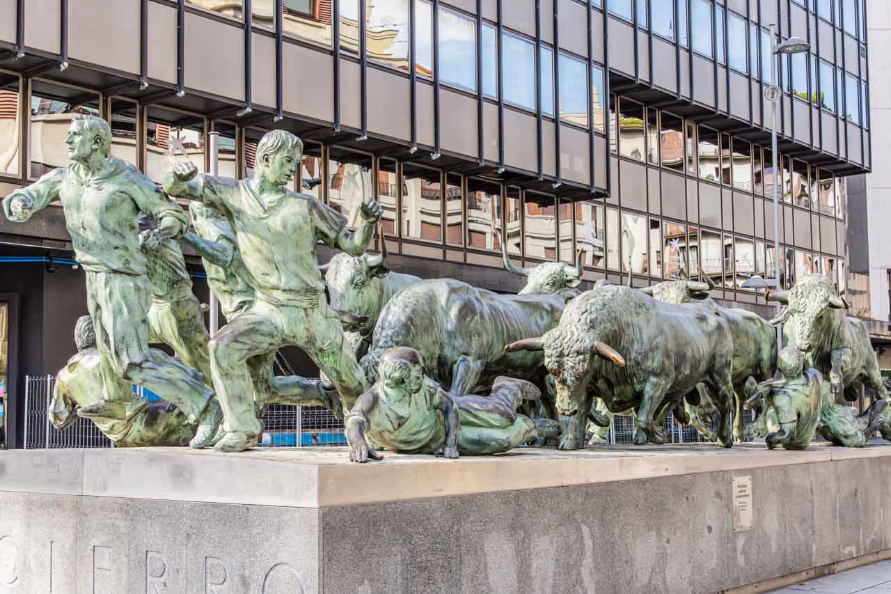
Agree with it or not, the annual running of the bulls is an integral part of Pamplona’s culture. The city even has a monument (Monumento al Encierro) dedicated to the traditional bull-running, freezing a moment in time of the race.
Pamplona’s monument to the running of the bulls.
For those who don’t know, the running of the bulls occurs during the festivities of San Fermin, where thousands of people try to outrun stampeding fighting bulls through the streets of Pamplona.
Ernest Hemingway in Pamplona
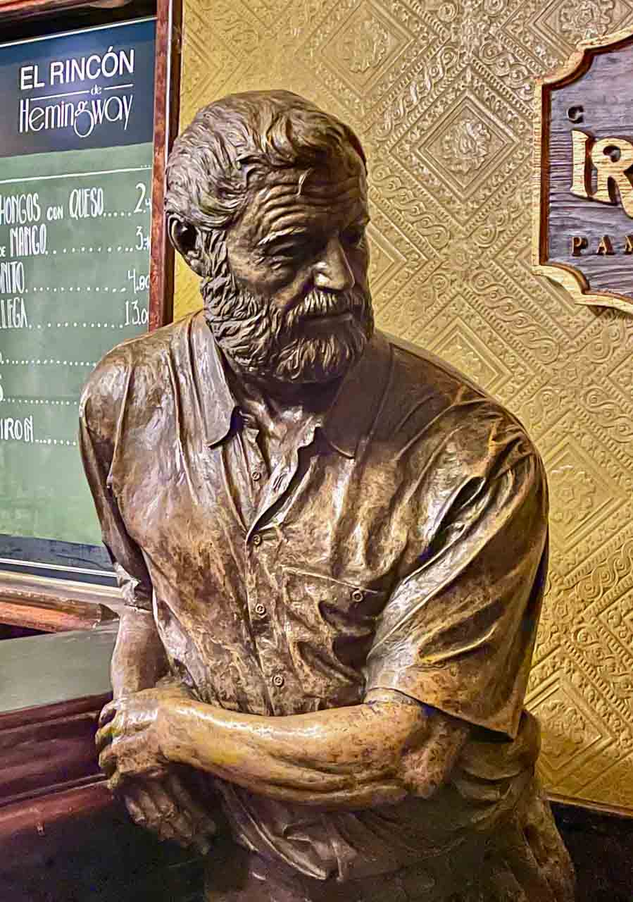
Statue of Ernest Hemingway in Cafe Irina.
Ernest Hemingway props up the bar in his favourite café in Pamplona – Café Iruna on Plaza del Castillo.
Hemingway had a love affair with Pamplona, visiting the city nine times, each time for the Festival of San Fermin and the running of the bulls.
Hemingway’s first novel, “The Sun Also Rises” (1926), is set in Spain, with Pamplona and Café Iruna heavily featured. The novel portrays American and British expats who travel along the Camino de Santiago from Paris to the Festival of San Fermin in Pamplona and watch the running of the bulls and the bullfights.
PUBOL – Gala Dali Castle
Pubol is a small village where Salvador Dali bought a castle for Gala, his wife. Her castle is now a museum. I recommend taking a guided tour.
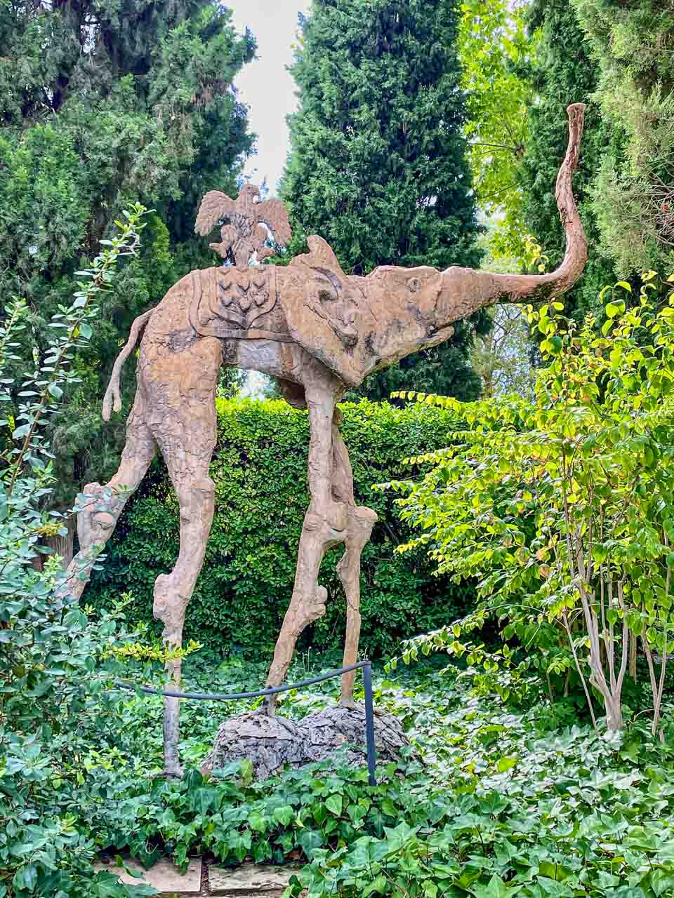
There’s an elephant in the garden.
You will find four elephant sculptures by Salvador Dali in Gala Dali’s castle garden. The castle features other artworks by Salvador Dali, and Gala’s crypt is there.
I knew Dali was a painter but was unaware his artistic talents extended to sculpturing.
Interesting fact: Dali needed Gala’s written permission to visit her at the castle.
QUERALBS – Ancient Village in the Pyrenees
Queralbs is a small village in the Pyrenees with a population of about 80. It sits at an elevation of 1,236 metres above sea level. It is the last vehicle-accessible village on the way up to Vall de Nuria (Nuria’s Valley), a beautiful valley in the eastern Pyrenees. The final six kilometres from Queralbes to Vall de Nuria must be travelled by rack railway – a 20-minute journey to an altitude of 1,964 metres. But first, there was a guided walking tour through Queralbs.
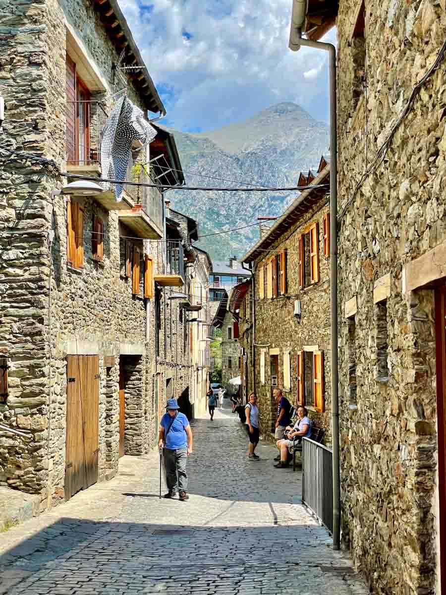
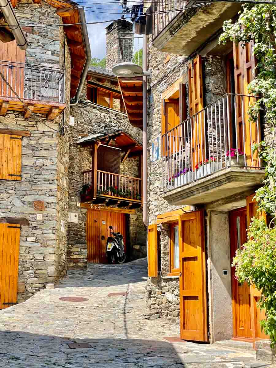
Queralbs is an ancient village dating back to 833 AD. With its traditionally built stone houses perched on the side of the mountain, it is a lovely, picture-perfect village.
The village of Queralbs in the Pyrenees.
The traditional stone houses of Queralbs.
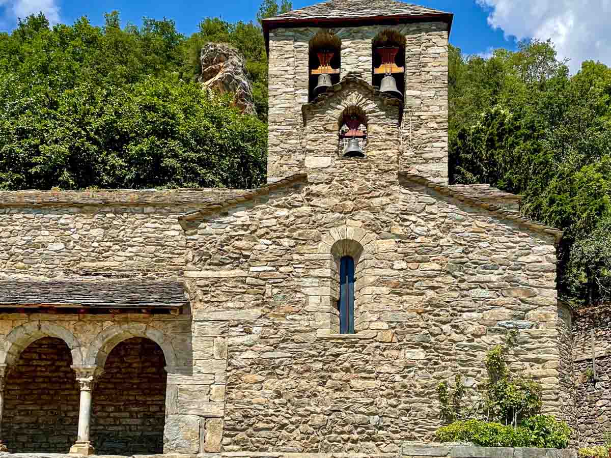
The walking tour ended at the Romanesque Church of Sant Jaume (Saint James).
Queralbs’ Romanesque St James Church.
Time to catch the rack railway train to Vall de Nuria!
RONDA – New Bridge
Ronda is a hilltop city in the Andalusian Province of Malaga. It sits dramatically above a deep gorge that separates the city in two. It is the home of modern bullfighting, but that wasn’t why I was there. I was in Ronda to see the New Bridge.
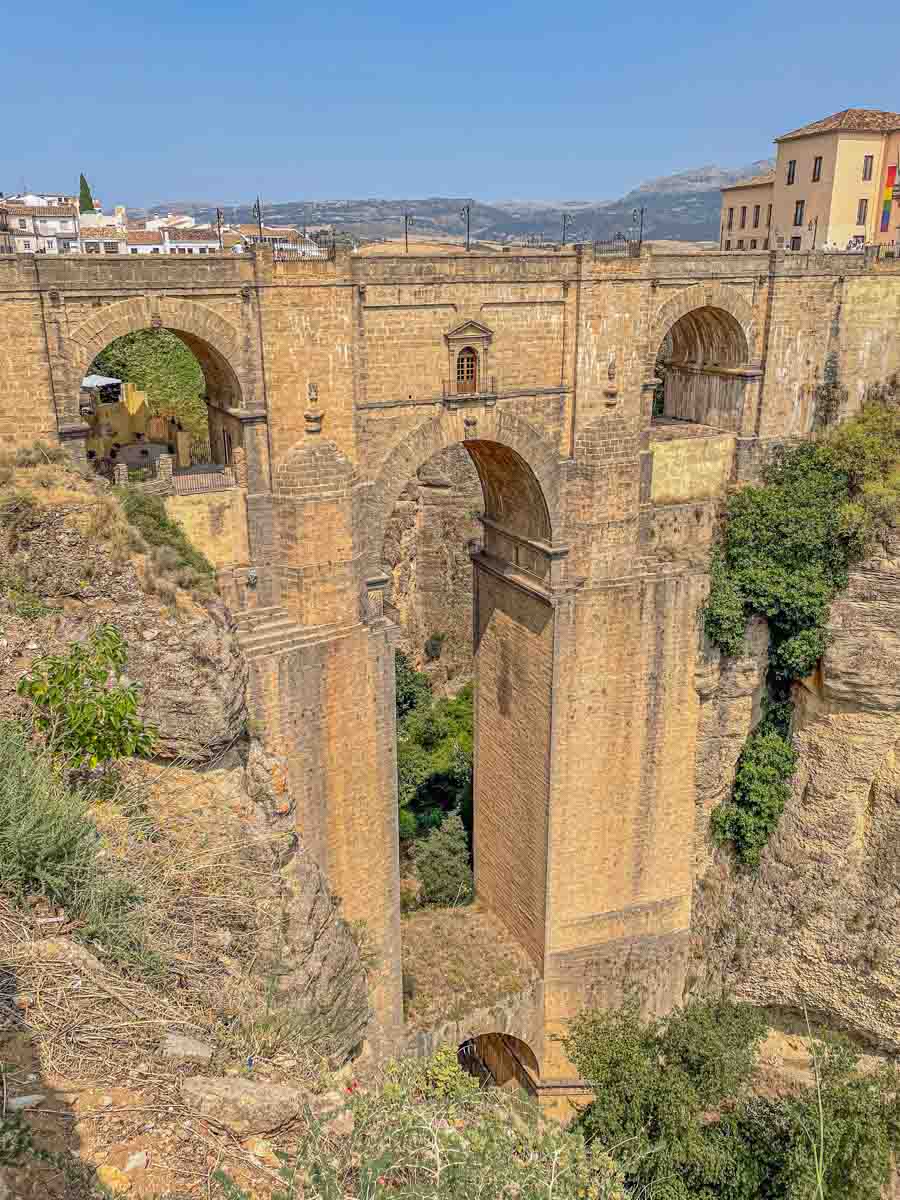
Ronda’s New Bridge spans El Tajo Gorge.
I have seen many photos of Ronda’s New Bridge on Instagram, been amazed, and wanted to see it myself. It was on my bucket list of sites to visit when in Spain.
The New Bridge (Puente Nuevo) spans the 98-metre-deep El Tajo Gorge, separating Ronda’s old town from its new town. The New Bridge is not new; it was completed in 1793 after 40 years of construction and with the loss of 50 lives.
It wasn’t easy to get photos of the bridge from the top. Unfortunately, my visit did not take me to the valley below New Bridge, where I would have been able to view the entire bridge.
SAN SEBASTIAN – Swim, Eat, Repeat
San Sebastian (called Donostia in Basque) is a resort town on the Bay of Biscay in northern Spain’s Basque Country.
There are no Roman ruins or Moorish architecture in San Sebastian, but you will find urban beaches, eclectic architecture, and a food lover’s paradise. San Sebastian has the second most Michelin stars per capita in the world.
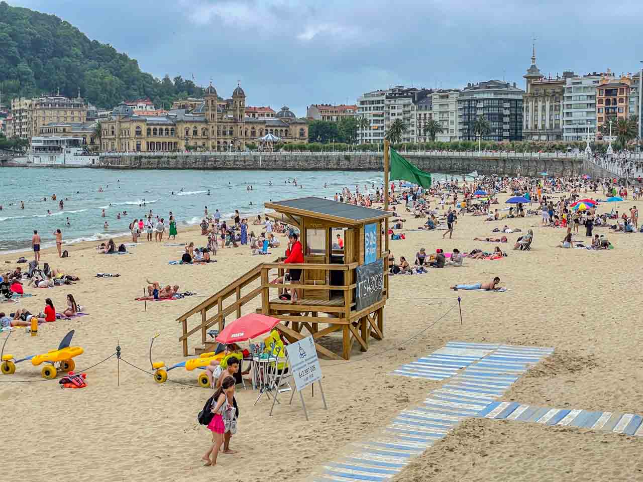
San Sebastian’s famous La Concha Beach is said to be the most beautiful urban beach in Europe. The beach can be busy, but it offers magnificent views of the city and Old Town. Of San Sebastian’s two other main beaches, Ondarreta Beach is a family favourite, while Zurriota Beach is popular with young people and surfers.
San Sebastian’s La Concha Beach with city views.
Strolling along the city’s promenade is a must to admire the beaches and mansions that line this iconic walk.
Conde Nast Traveller’s 2023 Readers’ Choice Award voted San Sebastian the best city to visit in Europe.
SANTIAGO DE COMPOSTELA – Cathedral of Santiago de Compostela
Santiago de Compostela is the capital of Galacia, in the far northwest of Spain.
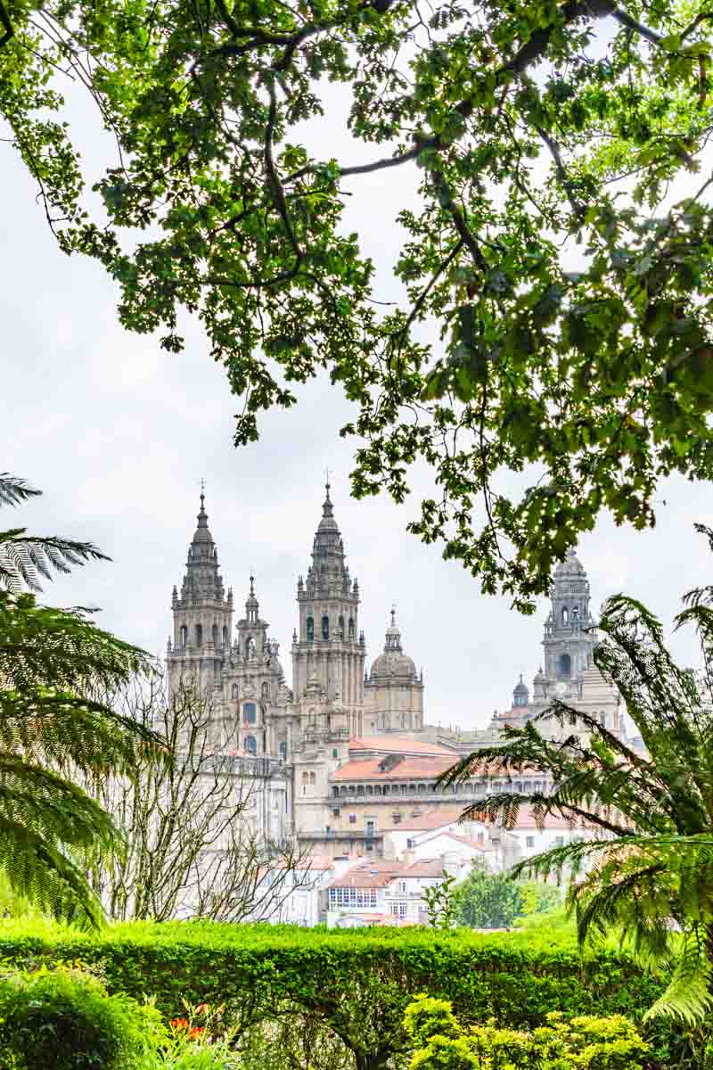
Arriving in Santiago de Compostela with Insight Vacations, I joined a small group on a guided walk through the city’s parks and old town, ending at the cathedral in Plaza del Obradoiro.
View of the Cathedral of Santiago de Compostela from Alameda Park.
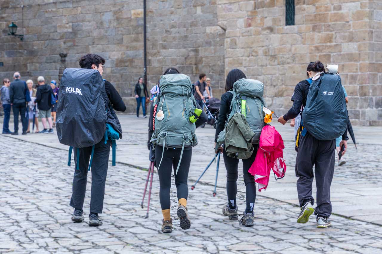
The Cathedral of Santiago de Compostela is the reputed burial place of Saint James the Great, one of the apostles of Jesus Christ. The cathedral fronts Plaza del Obradoiro and is the destination for pilgrims walking or cycling the Camino de Santiago (the Way of St James).
Pilgrims arrive in Plaza del Obradoiro after completing the Camino.
The Cathedral and the Camino are UNESCO World Heritage-listed – 1985 and 1993, respectively.
SEGOVIA
Segovia is in central Spain, about 90 kilometres north of Madrid. It is famous for its historic buildings and a great city to visit.
Alcazar of Segovia
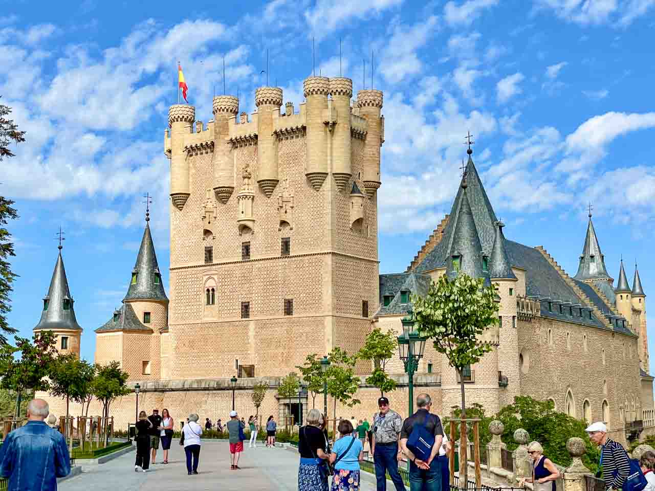
The fairy tale Segovia Alcazar.
Continuing a UNESCO World Heritage theme in Segovia, the Alcazar of Segovia (Fortress of Segovia) is a medieval castle that was home to 22 kings.
Its exterior looks like something out of a fairy story. Some say the castle inspired the design of Cinderella’s Castle at Walt Disney World. Can you see the similarity?
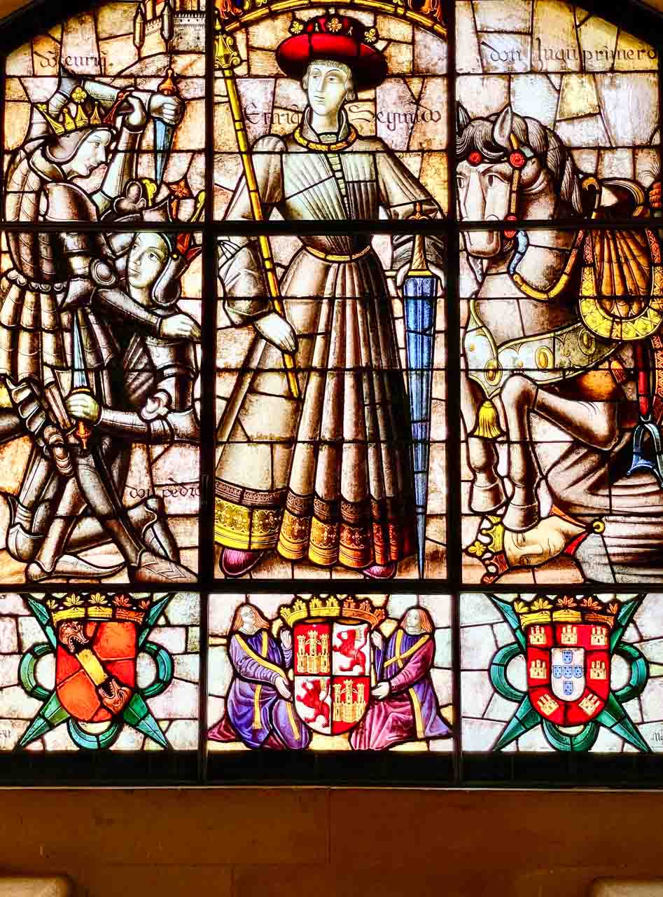
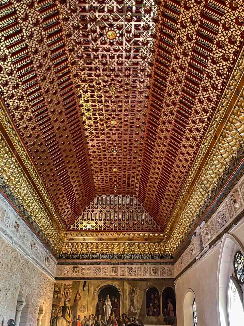
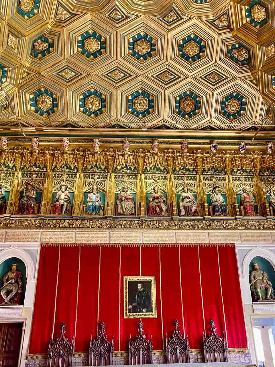
Of all the Alcazars I visited in Spain, the Alcazar of Segovia was my favourite. The decorated ceilings were beautiful, and I loved the stained-glass windows.
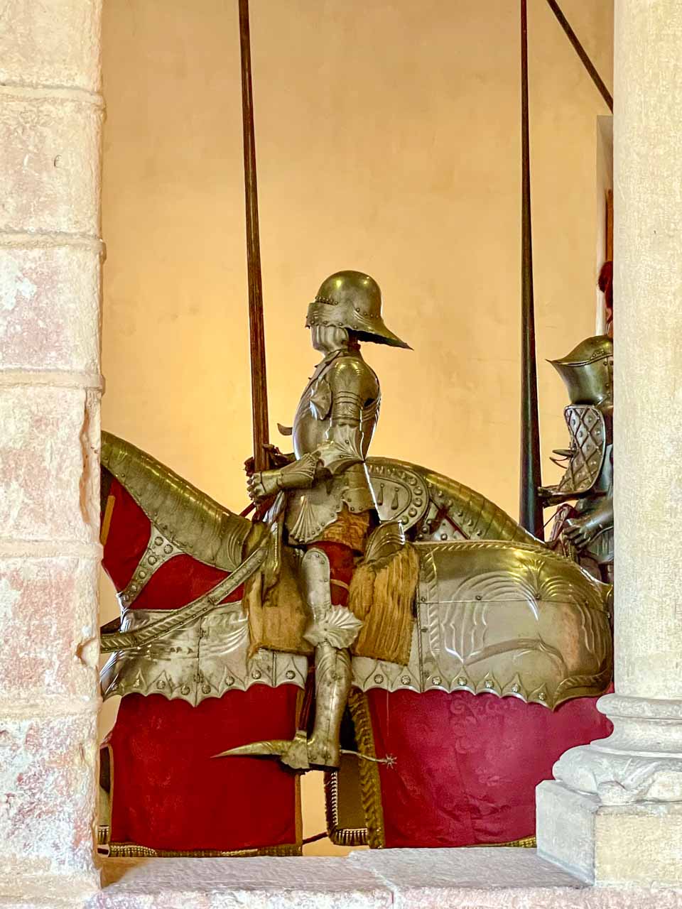
Hall of Horses in the Old Royal Residence.
Stained-glass window in the Throne Room.
The Gallery Room.
The Hall of Monarchs.
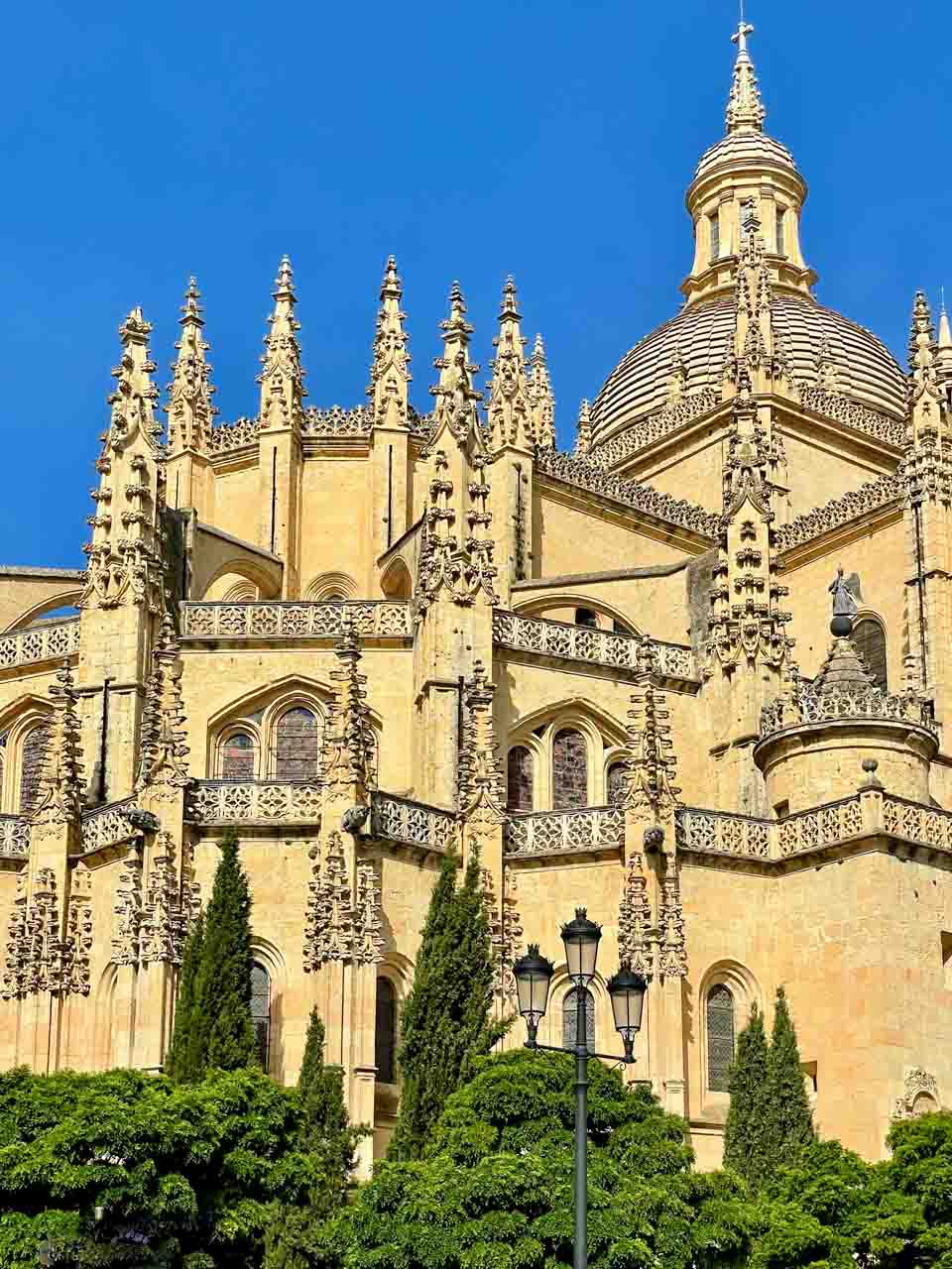
Cathedral of Segovia
Segovia Cathedral.
UNESCO World Heritage-listed in 1985, Segovia Cathedral was the last Gothic cathedral built in Spain.
Construction on the cathedral began in 1525, but it wasn’t consecrated until 1768. Sitting on Segovia’s highest point in Plaza Major (the city’s main square), the Cathedral of Segovia is an imposing building.
I couldn’t enter the cathedral because the Corpus Christi service was underway.
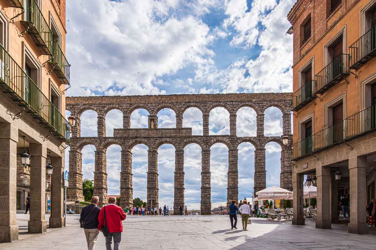
Roman Aqueduct
Segovia Roman Aqueduct.
The Aqueduct of Segovia is a Roman aqueduct built around the first century AD to channel water from springs in the mountains 17 kilometres away to the city’s fountains, public baths, and private houses. Said to be the world’s best-preserved Roman aqueduct, it was in use until 1973.
Twenty thousand four hundred stone blocks were used to construct Segovia’s Aqueduct with no mortar or cement between them. The highest point of the aqueduct is on Plaza del Azoguejo, which stands over 28 metres high, with a total of 167 arches.
This masterpiece of engineering was declared a UNESCO World Heritage Site in 1985.
SEVILLE
Seville is the capital of Andalusia and the former capital of Muslim Spain. It is a charming city that lacks the crowds of Barcelona and Madrid. Seville is a city of large open spaces, beautiful architecture, and Moorish influences. It is home to the biggest Gothic cathedral in the world, has the largest historic centre in Europe, and is famous for its flamenco dancing. It is hard not to fall in love with Seville when its people evidently take so much pride in their city.
Jardines de Murillo
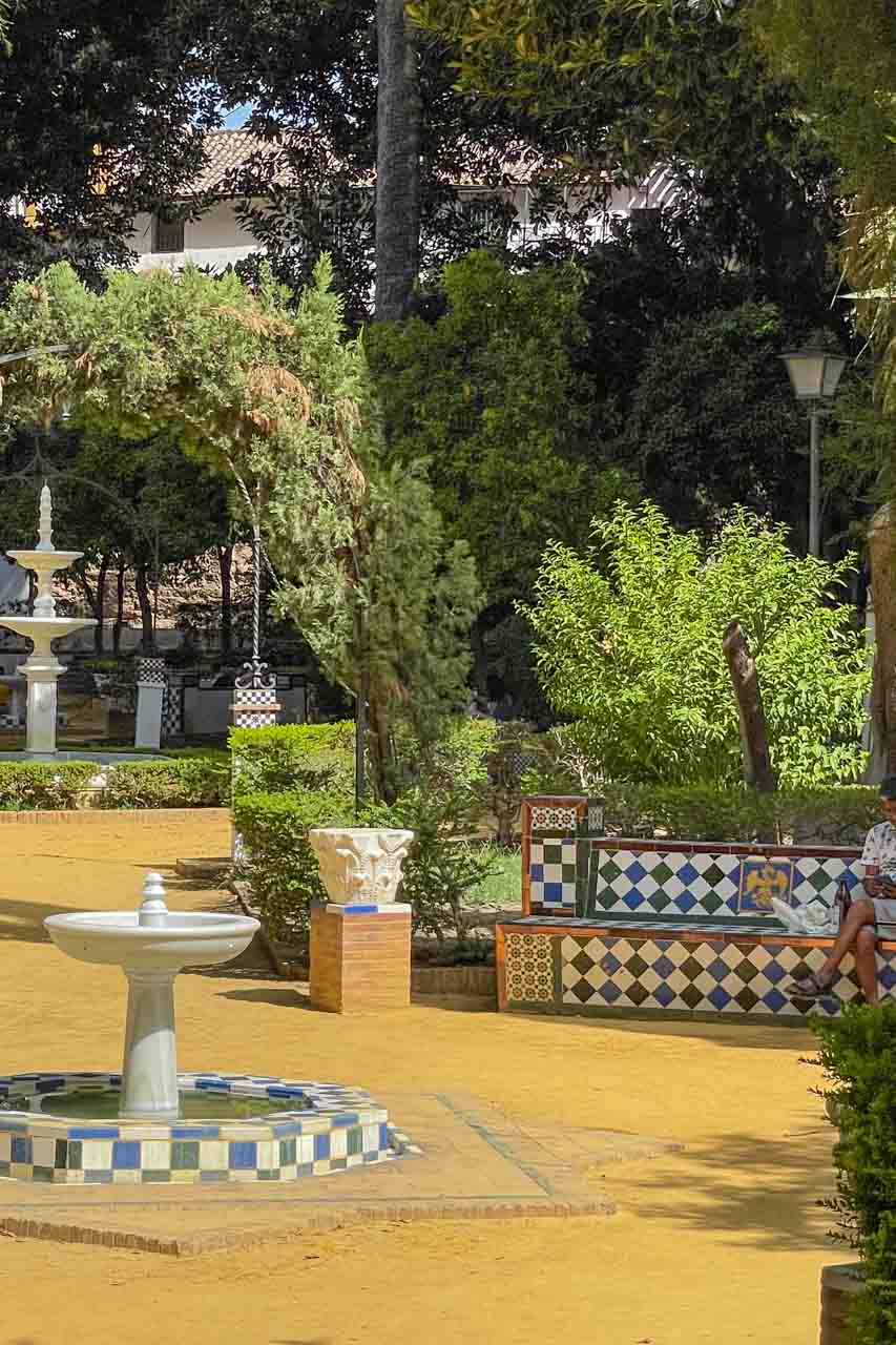
Exploring the old Jewish Quarter on my own in Seville’s Old Town, I came across the pretty, landscaped, well-maintained urban Jardines de Murillo (Murillo Gardens). Its ceramic tile-covered benches provide welcome spots to relax from the heat under the shade of enormous fig trees.
Jardines de Murillo in Seville’s Jewish Quarter.
Jardines de Murillo (Murillo Gardens).
The gardens border the external walls of the Real Alcazar. The gardens are filled with fountains, children’s play equipment, and a monument to Christopher Columbus.
Jardines de Murillo was my favourite garden in Seville. Its intimate atmosphere saw me returning several times. Never crowded, I would take a book to read while eating a sandwich or sit to gather my energy to continue exploring Seville.
Plaza de Espana
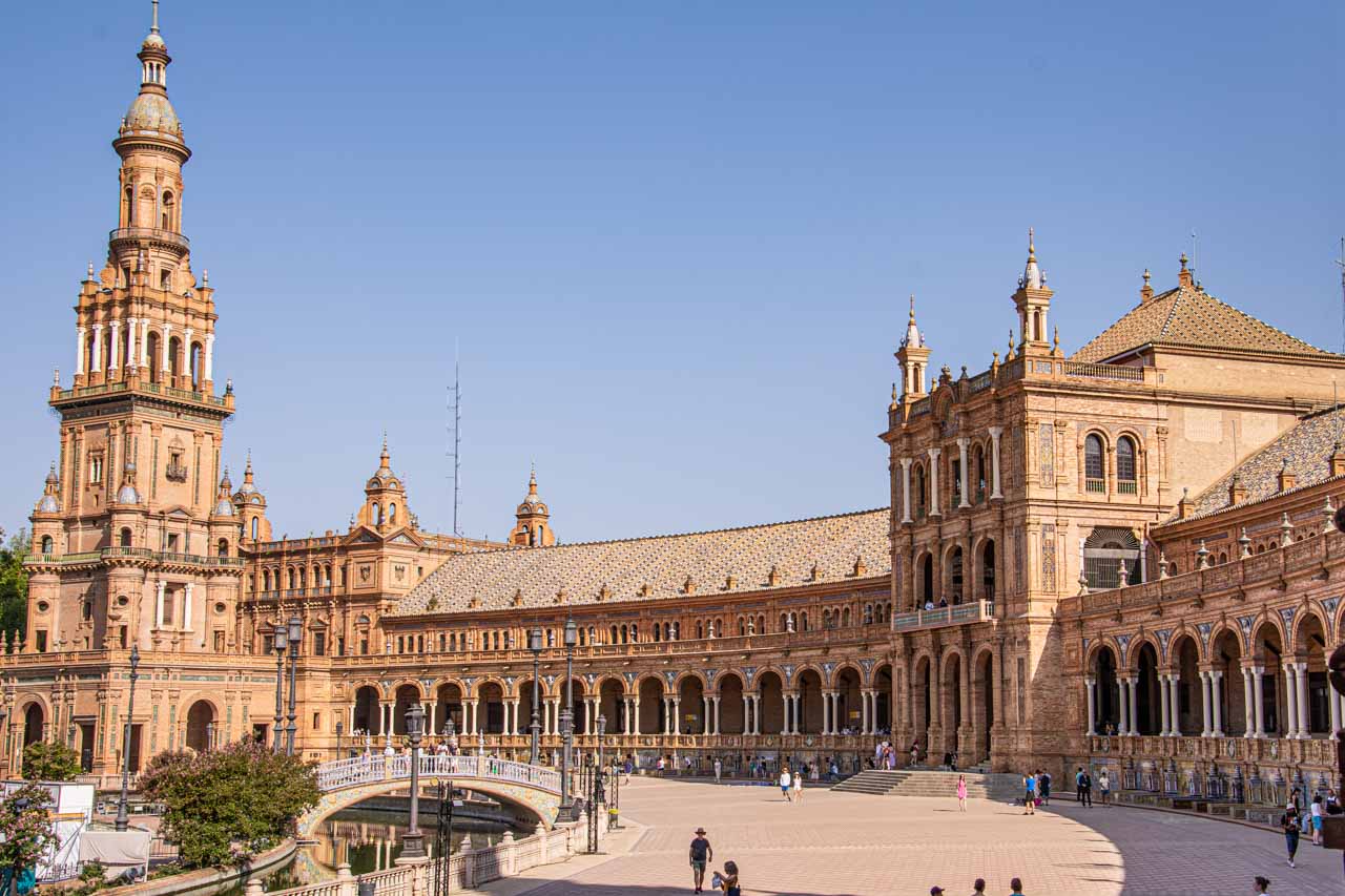
Iconic Plaza de Espana, Seville
The semicircular Plaza de Espana (Spain Square) in Maria Luisa Park blends Renaissance and Moorish-inspired architectural styles. It was built specifically for the 1929 Ibero-American Expo, which aimed to improve Spain’s relations with its former Latin American colonies and make symbolic peace.
Plaza de Espana is a cultural icon, Instagramable, and touted by all the guidebooks as a must-see. So early one morning, on a cooler day in Seville (only 39 degrees Celsius), I played tourist and walked to the plaza.
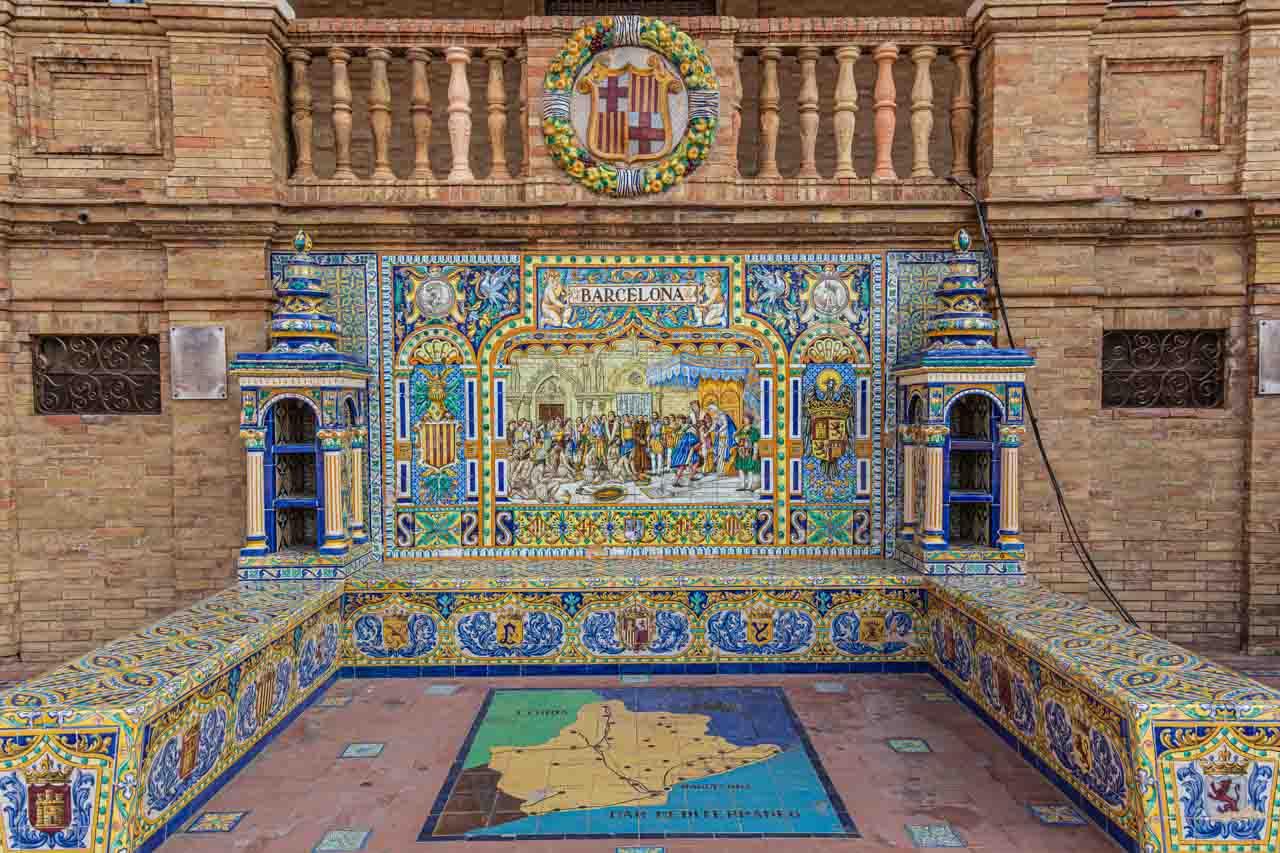
Along the base of the building, there are 48 benches representing each of Spain’s provinces decorated with colourful ceramic tiles depicting significant historical events. Expect to find visitors and nationals alike taking photos of themselves sitting on the bench of their province or the province of their heritage. Not being of Spanish parentage, I took photos of the benches of the places I had visited.
Plaza de Espana – The tiled bench representing Barcelona.
There are four bridges over the mini canal in front of the plaza. These represent the ancient kingdoms of Spain: Castile, Leon, Navarre, and Aragon.
I enjoyed my few hours at Plaza de Espana and even saw an impromptu flamenco show on the building steps.
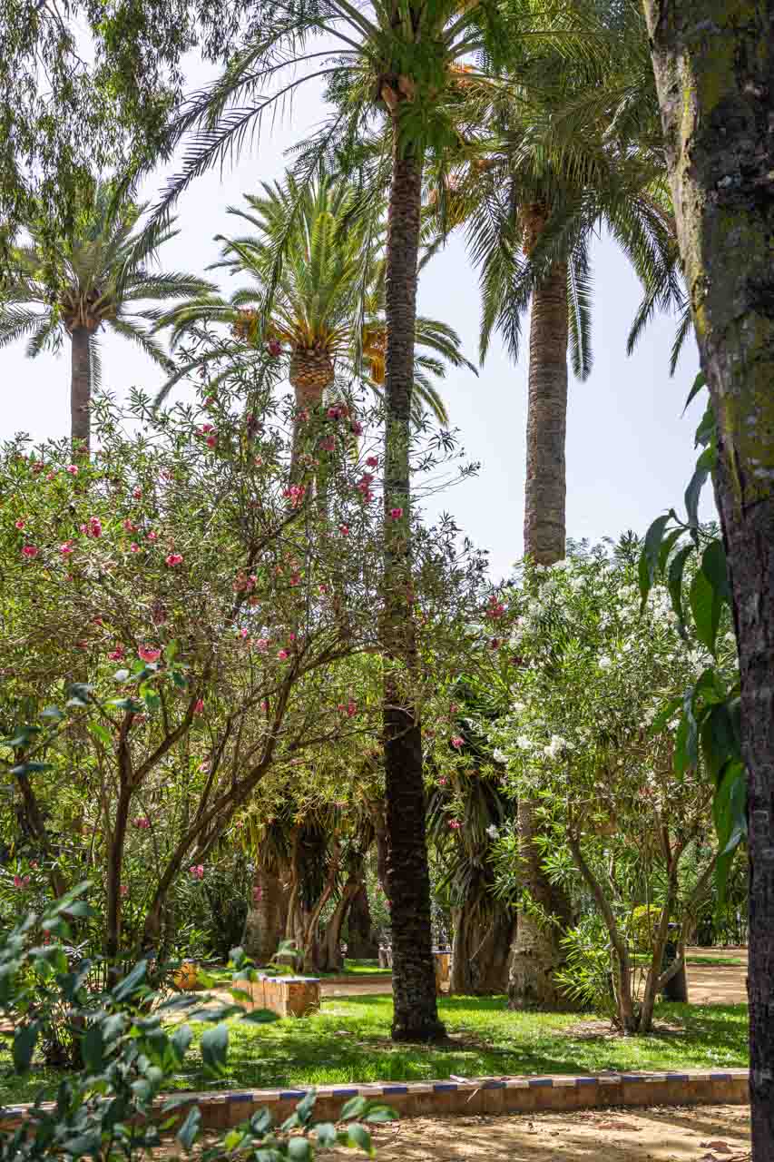
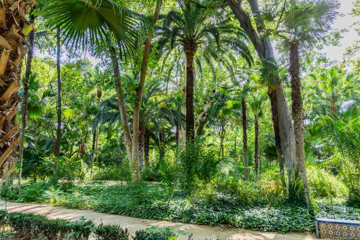
Don’t leave Maria Luisa Park without a stroll through its tropical gardens.
Maria Luisa Park.
Real Alcazar (Royal Alcazar of Seville)
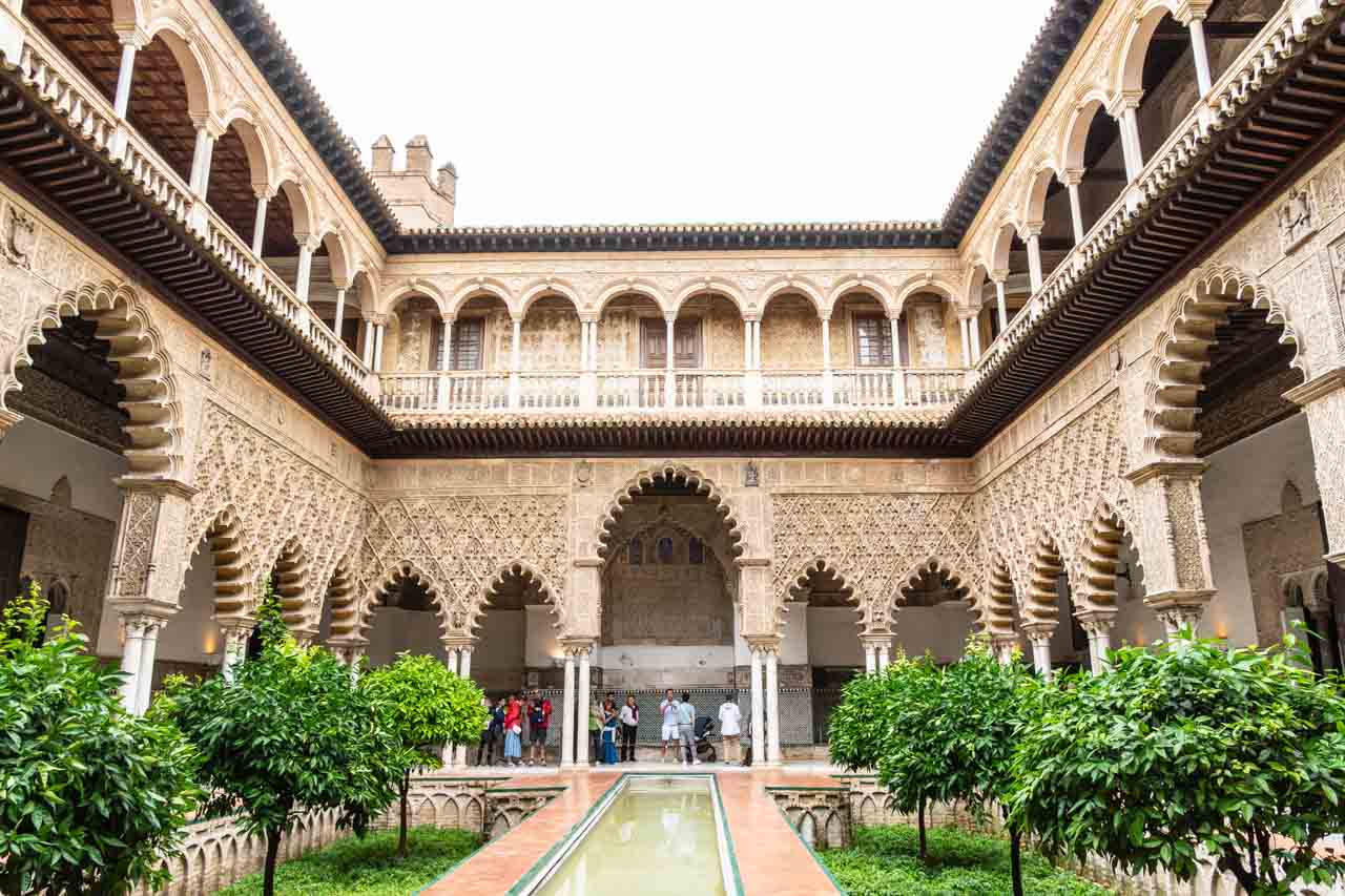
The Alcazar of Seville is a thousand years of art and history, combining five periods: Muslim, Gothic, Mudejar, Renaissance, and Romantic.
The Courtyard of the Maidens in Real Alcazar.
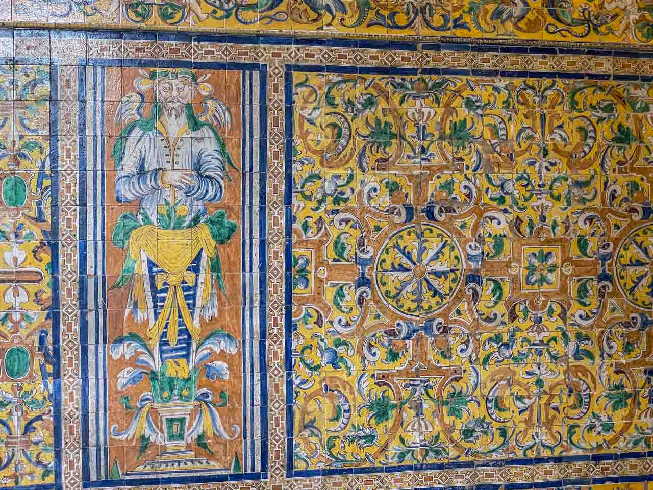
Tilework in the Vault Room.
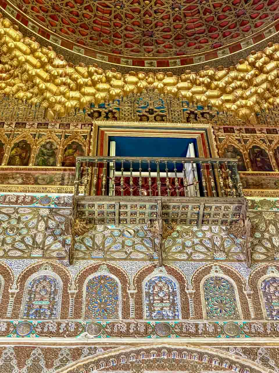
The Ambassador’s Hall.
The Moors greatly influenced southern Spain, and Real Alcazar is another example of beautiful Islamic architecture. Built in the tenth century as government premises, it became a Royal Residence in 1248 when Ferdinand lll moved into it. A UNESCO World Heritage Site, Real Alcazar is the oldest Royal Palace still in use today and is used by the King of Spain and his family when in Seville.
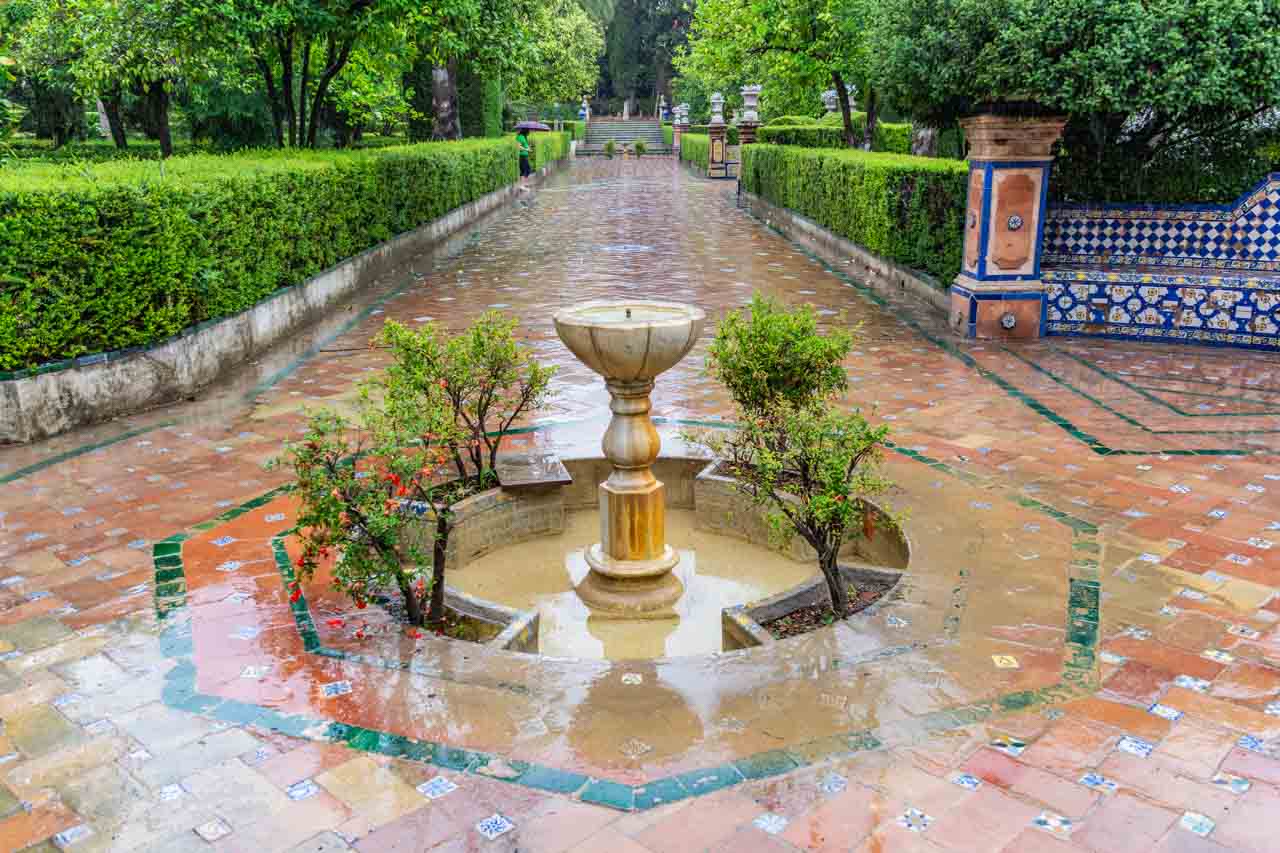
The Alcazar’s formal gardens are worth a wander through but don’t eat at the café (unappetising fast food).
One of the many fountains in the Alcazar’s historic gardens.
Seville’s Real Alcazar featured as a location in the Game of Thrones television series.
Seville Cathedral – The Tomb of the Great Navigator
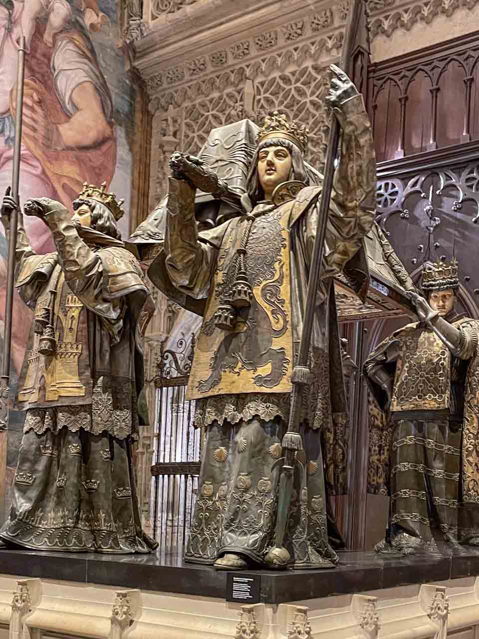
The tomb of Christopher Columbus in Seville Cathedral.
Although probably Italian by birth, Christopher Columbus (known in Spain as Cristobal Colon) completed four voyages across the Atlantic Ocean sponsored by the Spanish monarchy.
His tomb in the Cathedral of Seville is held aloft by four figures representing the four kingdoms of Spain during Columbus’s life: Castile, Aragon, Navarre, and Leon.
Columbus’ body has been moved several times, and the remains in Seville Cathedral are in doubt. DNA testing in 2006 confirmed the body in Seville was either Christopher Columbus or his brother.
Seville Cathedral was designated a UNESCO World Heritage Site in 1987.
Triana
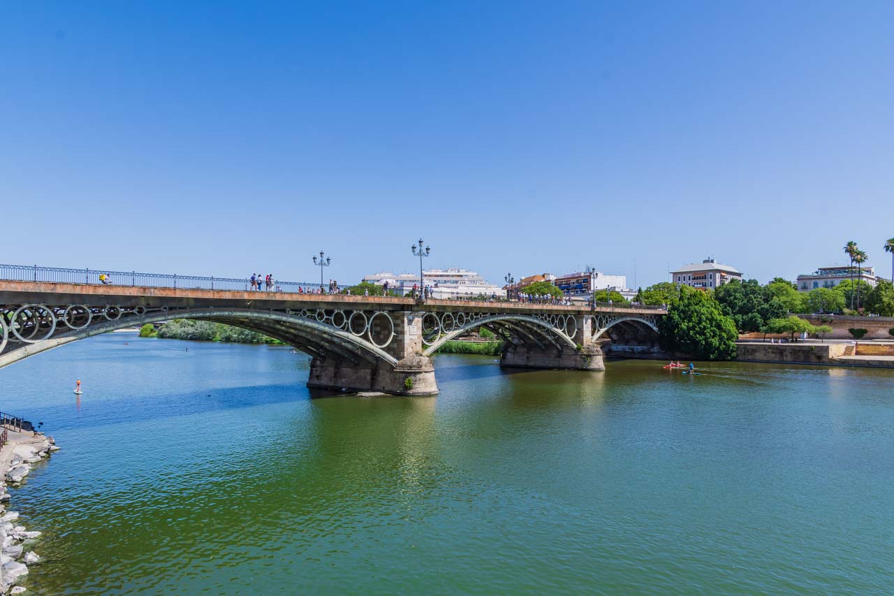
Triana is a charming working-class neighbourhood in Seville on the west bank of the Guadalquivir River. Puente de Isabel ll (often called Triana Bridge) is the gateway to Triana from the city. Don’t expect spectacular sights but an authentic quarter with surprisingly few tourists.
Isabel ll Bridge viewed from Triana.
Traina is especially famous for:
The Azulejo tiles you see throughout Spain.
Being the birthplace of flamenco.
Azulejos are terracotta tiles covered with opaque glazing. They have been used in Spain since around the 13th century. You will see them everywhere, decorating walls (internal and external), fountains, pavements, and much more. Triana has some lovely shops where you can buy good quality Azulejo products to take home.
See an authentic flamenco show at Almoraima (Calle Pages del Corro, 70) – an intimate venue where the passion of the dance is tangible and visible.
Mercado de Triana (on your right as you leave the bridge) is a lively indoor market with fresh fruits, vegetables, meat (especially Iberian ham), herbs, and fish. You can grab lunch while in the Mercado.
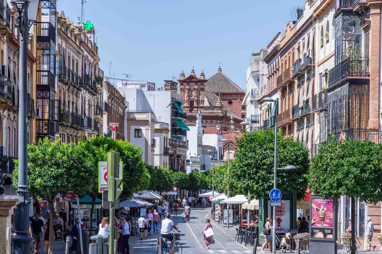
Calle de San Jacinto is Trian’s pedestrian-only street. With its plethora of cafes, bars, and restaurants, you are spoilt for choices of somewhere to eat and people-watch.
Head to Calle de San Jacinto for lunch or dinner.
TOLEDO
While travelling with Insight Vacations through Spain, I opted for a day trip to Toledo, about 70 kilometres south of Madrid, the former capital of Spain.
The Mirador del Valle Lookout
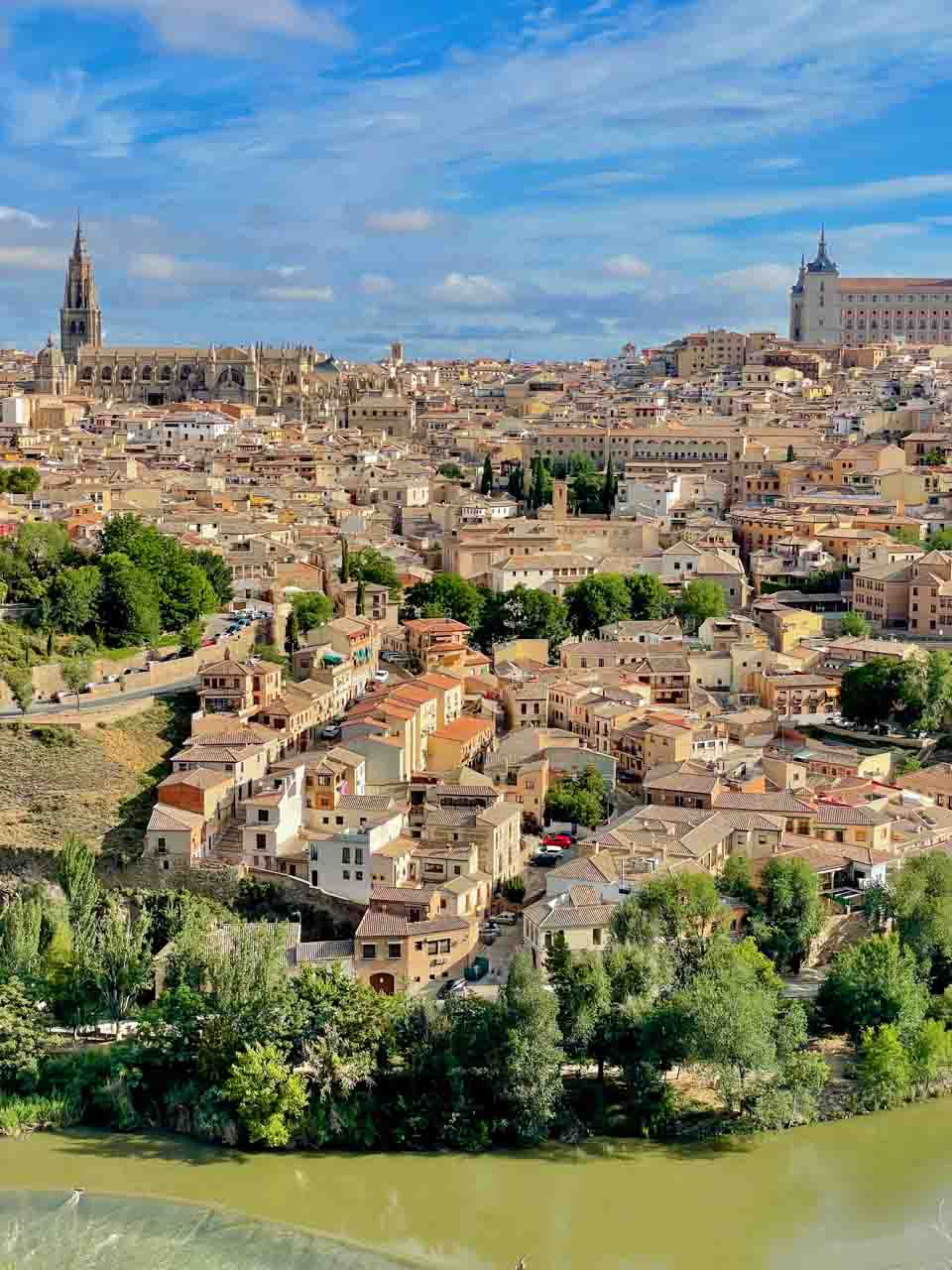
Toledo panorama.
The panoramic view of Toledo from the Mirador del Valle Lookout was breathtaking and a great introduction to this ancient city that owes its rich heritage to the Jews, Muslims, and Christians who lived there in harmony. A city of three cultures, Toledo is a melting pot of Judaism, Christianity, and Islam with impressive monuments. The two large buildings on the city horizon in the photo above are the Cathedral of Toledo on the left and the Alcazar Fortress on the right.
Toledo’s historic centre was designated a UNESCO World Heritage Site in 1986 as an outstanding museum city.
Toledo Cathedral
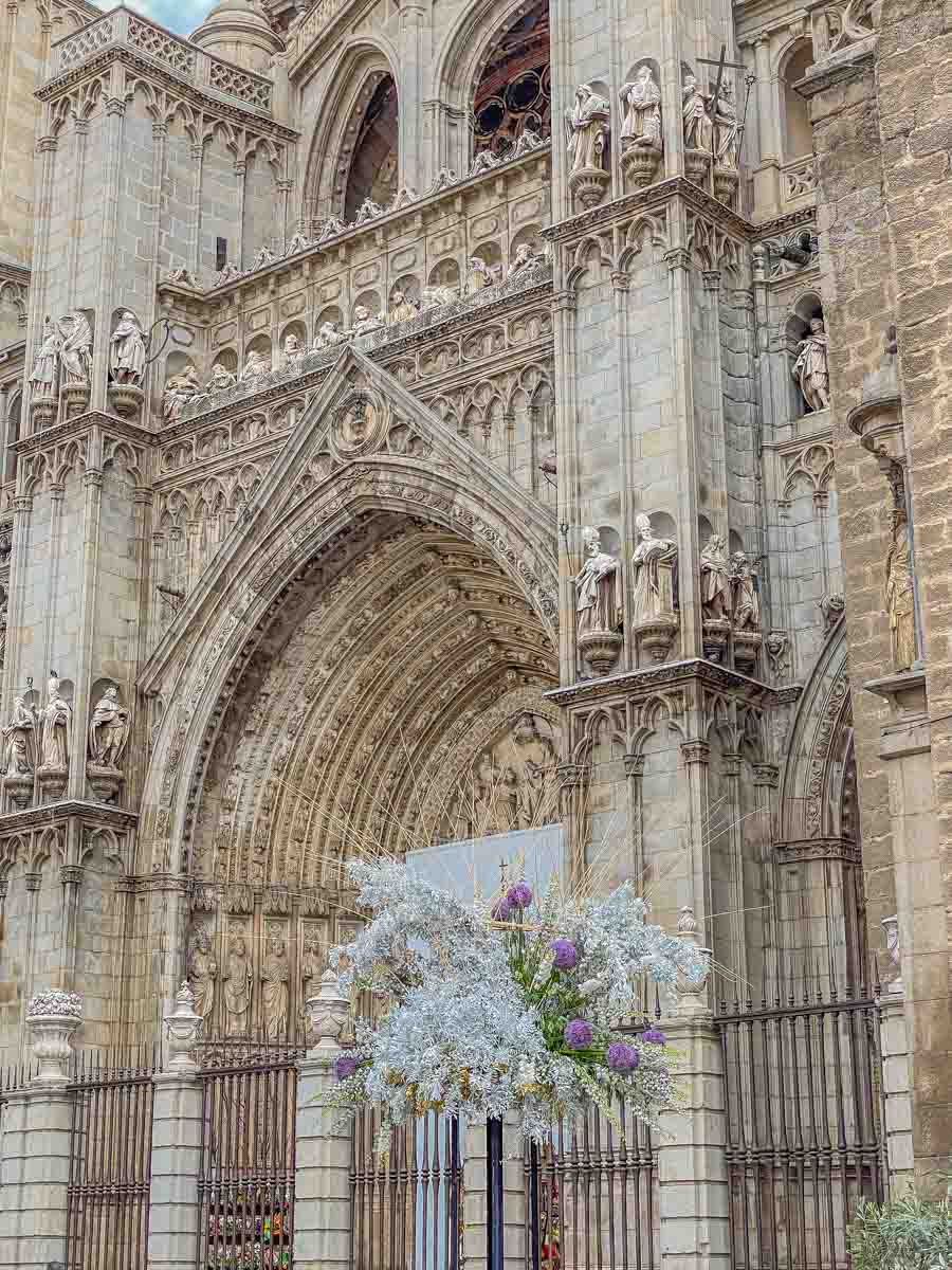
Toledo Cathedral’s main facade from the Plaza del Ayuntamiento.
The magnificent Toledo Cathedral was built on the site of a former mosque and took more than 250 years to complete. It is one of Spain’s most famous and important cathedrals, with several monarchs buried in it. The cathedral is dedicated to Saint Mary and features Mudejar architecture (pointed horseshoe arches and ribbed vaults). It is considered one of Spain’s best examples of High Gothic architecture.
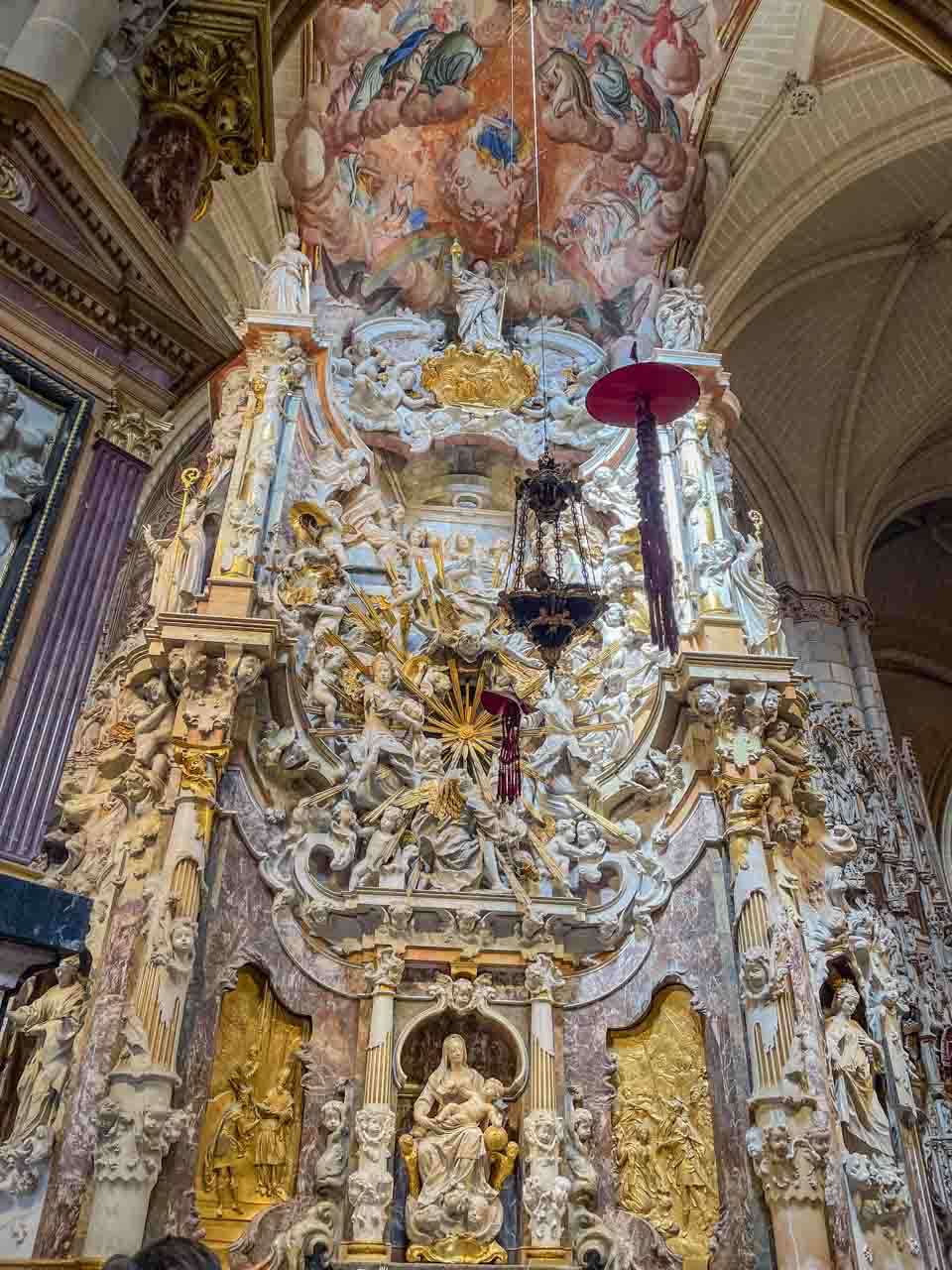
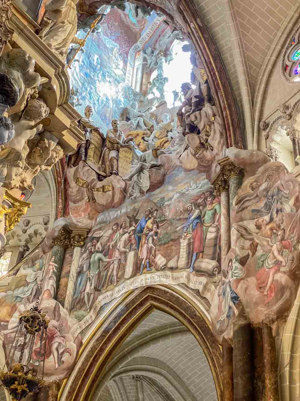
The famous “Transparente”, the cathedral’s altarpiece, is seen by many as Spain’s most important Baroque masterpiece. Created in 1732 by the sculptor Narciso Tome and his four sons, the altarpiece is several stories high, with fantastic figures done in marble, bronze castings, stucco, and painting.
The Transparente – Toledo Cathedral’s altarpiece.
A section of The Transparente – Toledo Cathedral’s altarpiece.
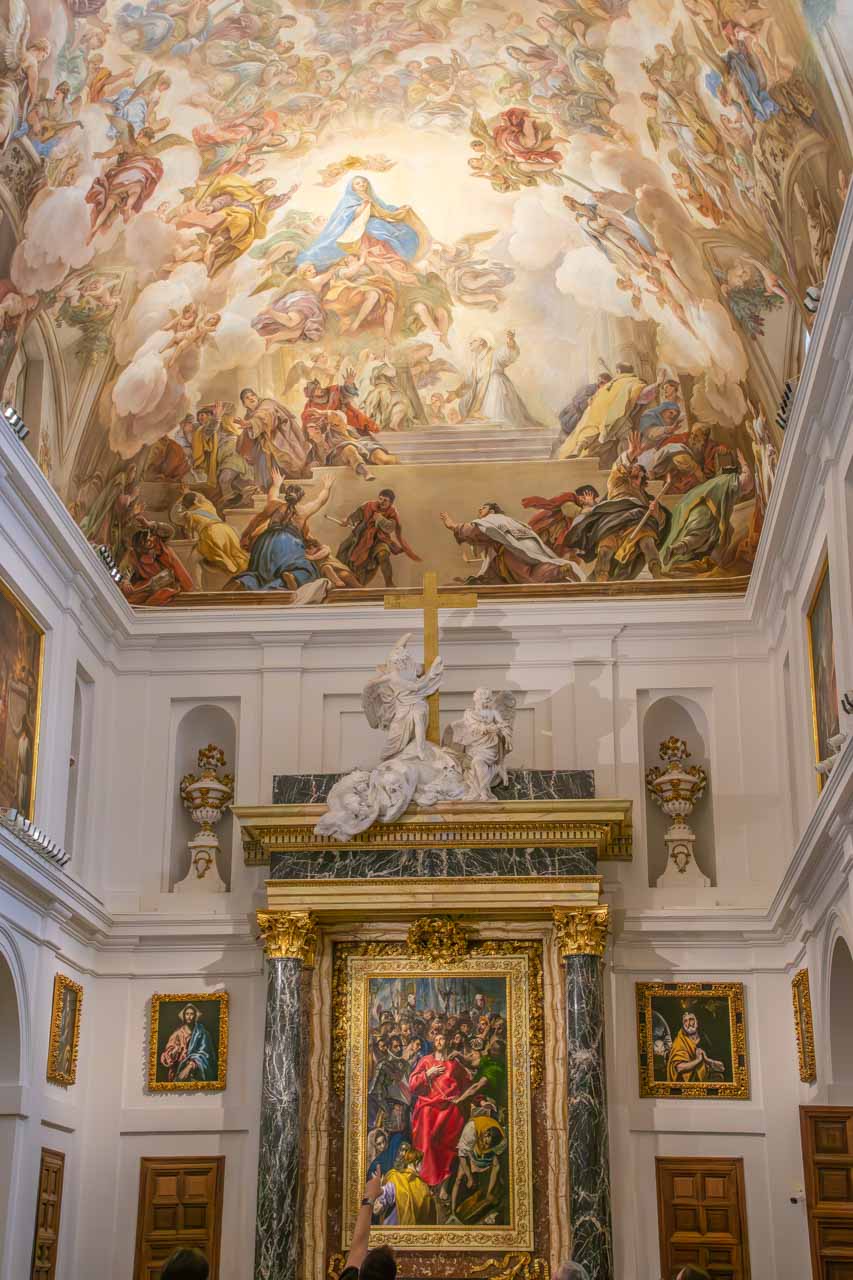
Toledo Cathedral is a veritable art gallery with paintings by notable artists: El Greco, Caravaggio, Van Dick, Goya, and Bellini, to name a few. The Sacristy is a small art gallery with a beautiful ceiling fresco painted by Luca Giordana and El Greco’s “The Disrobing of Christ” (“El Expolio”, 1579), taking centre stage on the high altar. Don’t miss the portraits of the 12 apostles painted by El Greco in the cathedral’s Sacristy.
The beautiful ceiling fresco and El Greco’s painting “The Disrobing of Christ”.
The Cathedral of Toledo is home to more than 100 relics, including fragments of the crown of thorns and the breast milk of the Virgin Mary. None are on public view!
My visit to Toledo was memorable, but the city deserved longer than a day trip.
VALENCIA
Valencia is a hidden gem often overlooked by tourists. It is a city that embraces its past while acknowledging the future. It is also the home of paella (a rice dish originally from Valencia). Contrary to common belief, traditional paella is not made with seafood but is made with chicken or rabbit.
My tour with Insight Vacations included a paella cooking demonstration and tasting at la Cigrona in Valencia’s Old Town.
Futuristic Valencia
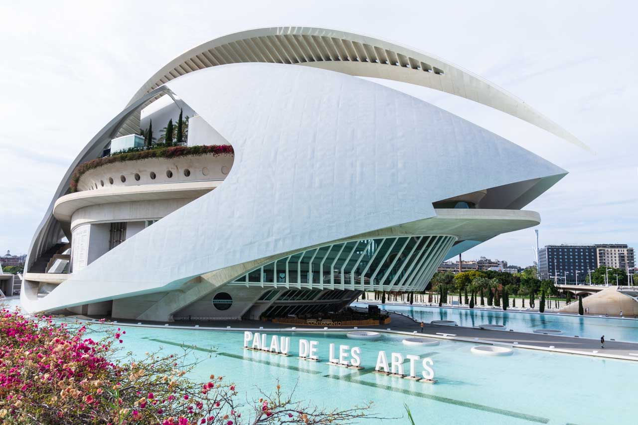
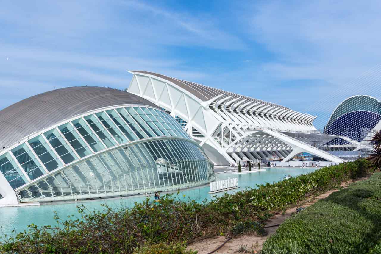
The City of Arts and Sciences (La Ciudad de y las Artes las Ciencias) is a leisure and cultural complex with its architecture taking Valencia into the 21st century. The complex includes the Science Museum, an IMAX Cinema and Planetarium, Europe’s largest aquarium, and the Palace of Arts.
The City of Arts and Sciences’ Palau de les Arts (Opera House)
The Hemisferic and Science Museum at the City of Arts and Sciences.
Valencia’s Old Town
Founded in 130 BC, Valencia has been home to Romans, Visigoths, and Muslims, giving it a rich history. Its Old Town is one of the largest in Europe and the heart of the city.
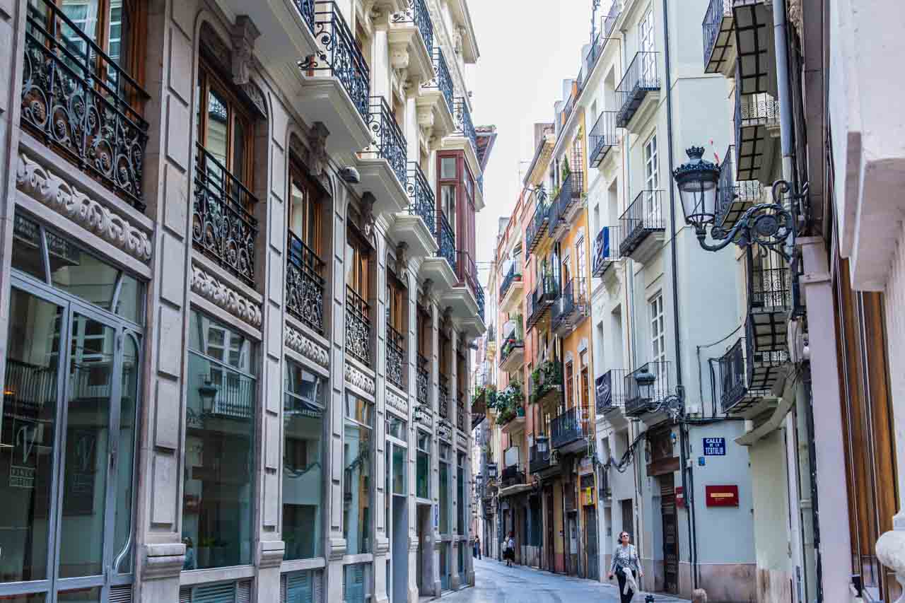
Walking around the Old Town is like travelling back to the Middle Ages. La Plaza del Ayuntamiento is the main square and the hub of activity. It is enclosed by beautiful historic buildings featuring Gothic architecture.
I particularly enjoyed escaping the crowds and walking around the Old Town’s residential streets.
A residential street in Valencia’s Old Town.
A half day exploring Valencia’s Old Town with Insight Vacations was not long enough. I want to explore more! Valencia, I will be back!
VALL DE NURIA – A Beautiful Valley in the Pyrenees Mountains
Taking the rack railway from Queralbs, travel the six kilometres to the resort in Vall de Nuria (Nuria Valley). The journey took 20 minutes, climbing from an altitude of 1,236 metres at Queralbs to 1,964 metres at Vall de Nuria.
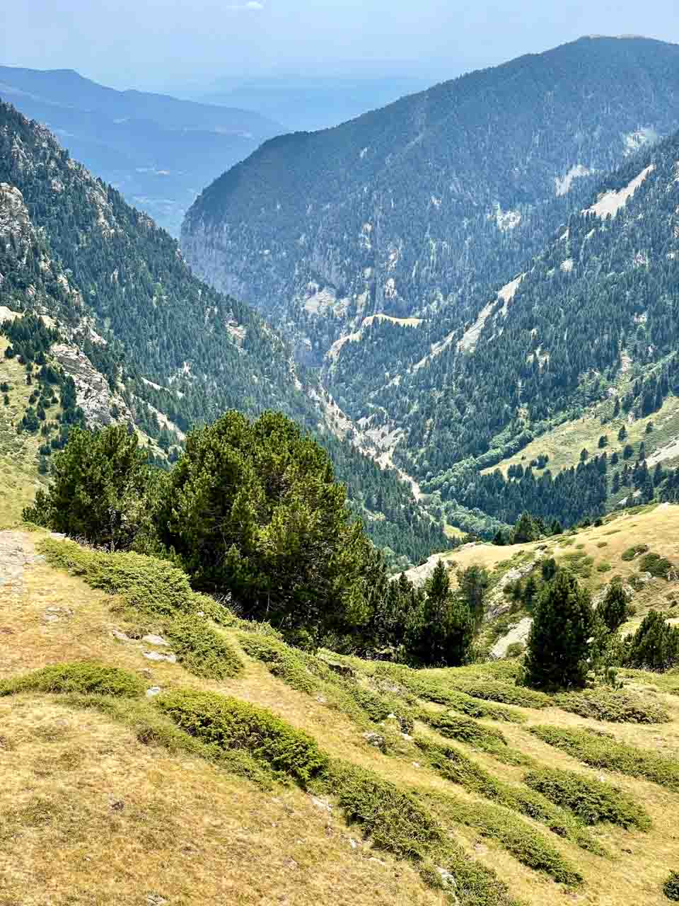
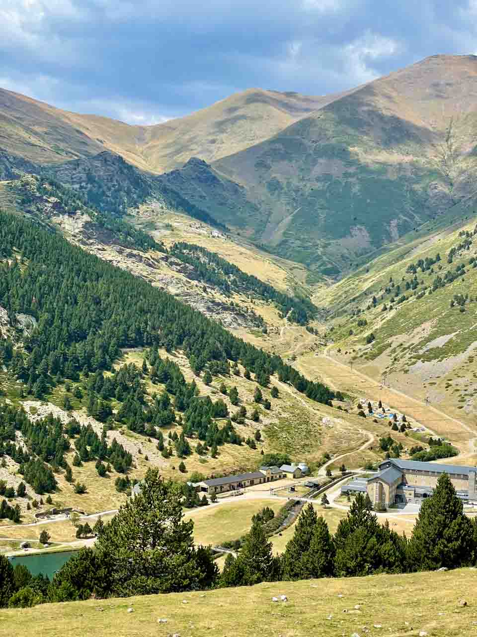
Vall de Nuria is a valley in the eastern Pyrenees offering spectacular mountain landscapes, winter skiing, and summer hiking trails.
Vall de Nuria viewed from the top of the cable car run.
Vall de Nuria landscape with a view of the lake and resort.
With two hours to explore the valley before catching the train back down the mountain, I decided to hike one of the many trails in the hills around the valley. These trails range from easy to challenging.
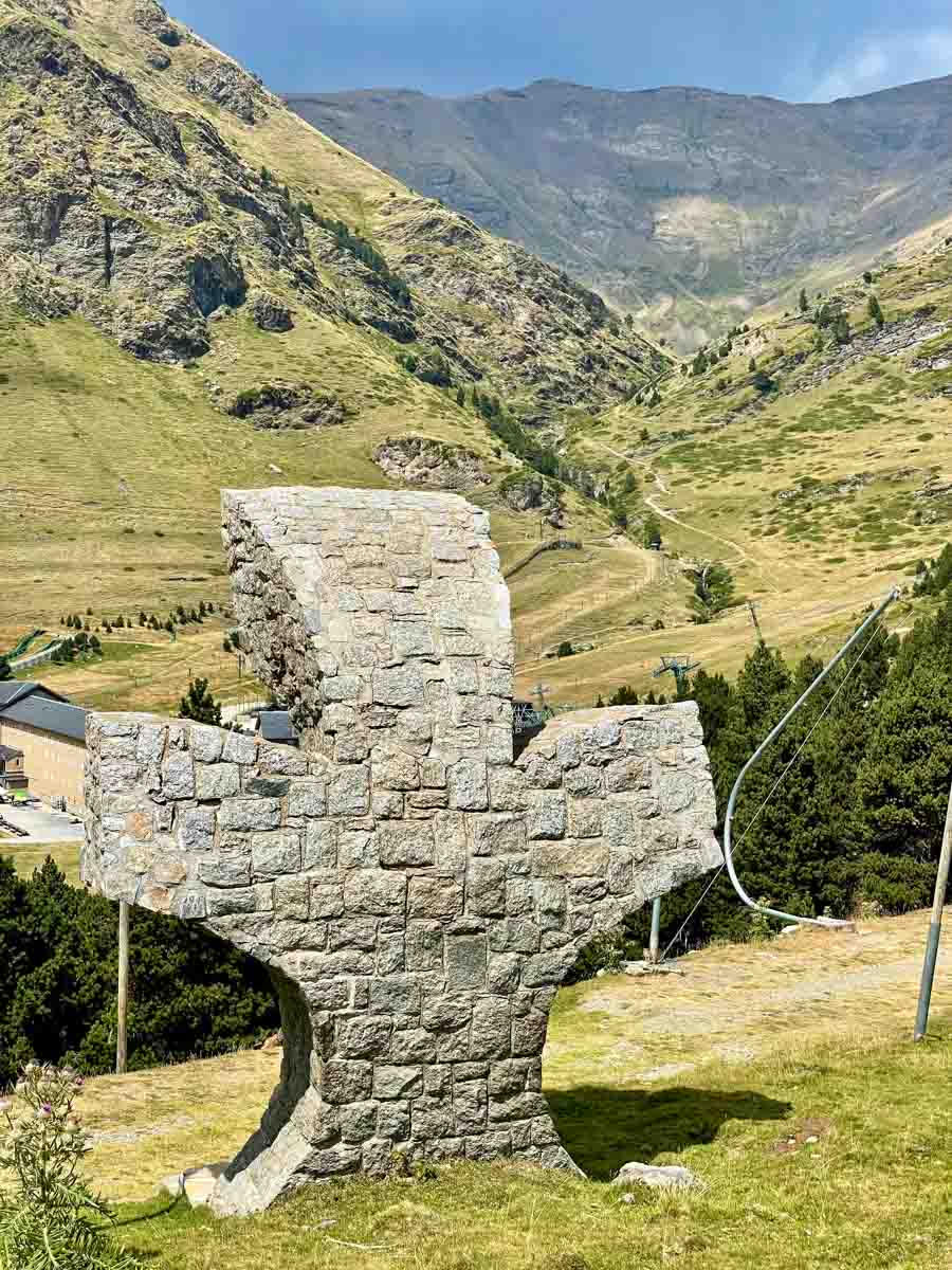
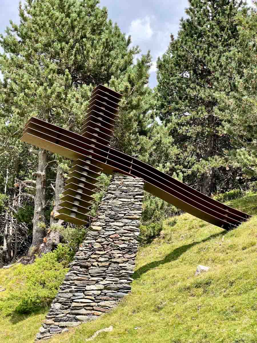
Given my limited time, I chose an easy trail, the Way of the Crosses. I was told it would take 50 minutes to walk, but I knew it would take longer as I would constantly stop to take photos. The trail gets its name from the Christian Way of the Cross tradition, with twelve crosses along the way. I made the hike easier on myself by walking down the mountain rather than up. I did this by taking the cable car to the summit, bringing me to an altitude of 2,170 metres. Consequently, I passed the crosses in reverse – from twelve to one.
Way of the Crosses – Station 6.
Way of the Crosses – Station 5.
I journeyed to Vall De Nuria on a day trip with Explore Catalunya.
VIC – The Old Town
The city of Vic (pronounced Bic) is about 69 kilometres north of Barcelona on the Meder River. It is an ancient city, dating back to the Ausetan Iberians before Roman occupation in the 1st century AD, with an interesting and picturesque Old Town.
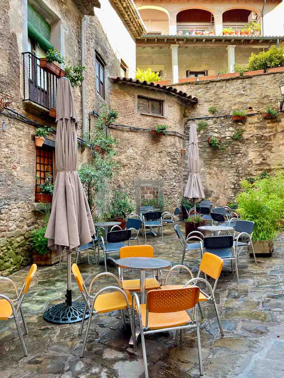
On a guided walking tour around the Old Town, we passed through several small pretty squares with cafes preparing for the day.
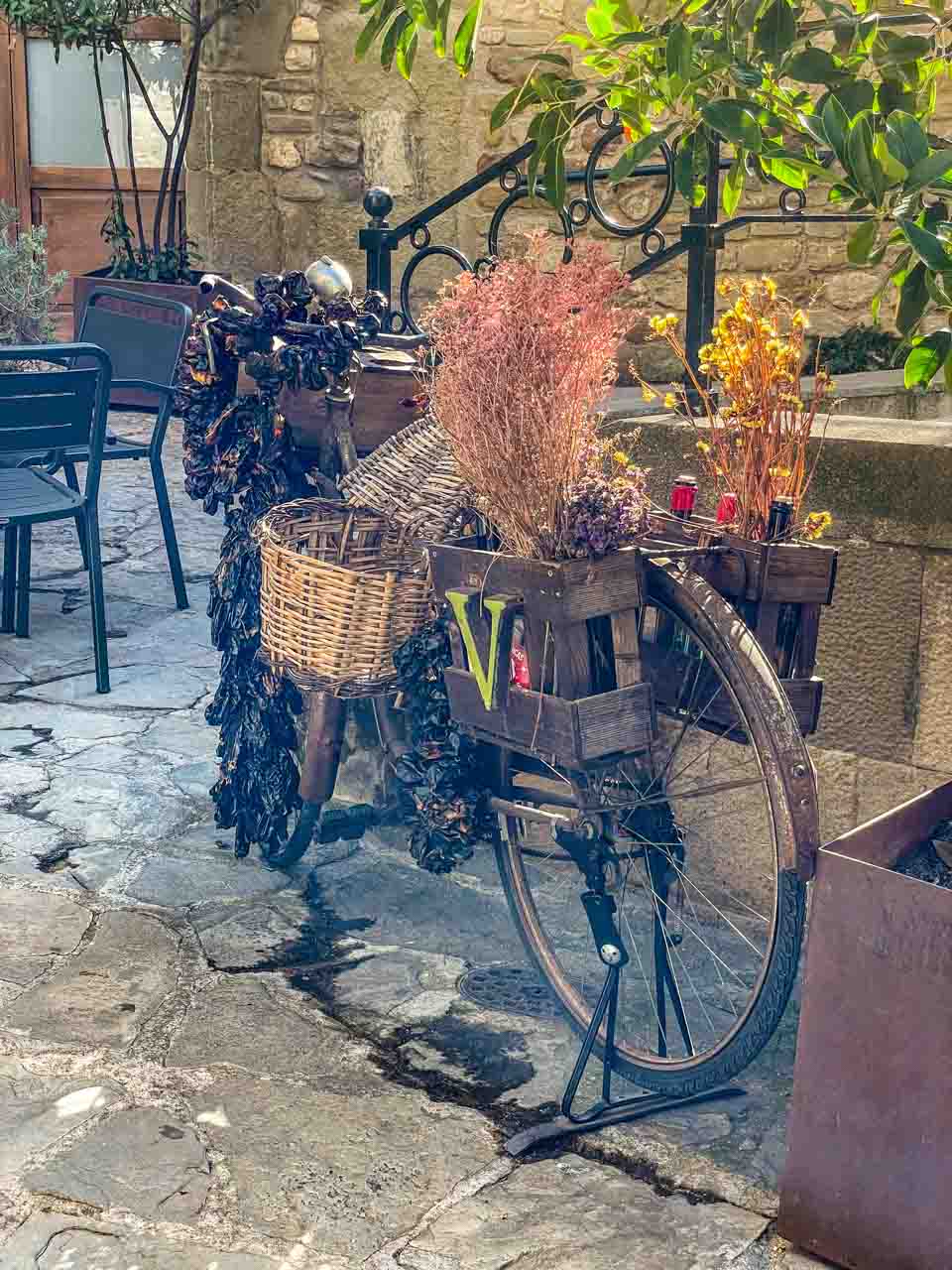
A bicycle adds a touch of romance to a courtyard cafe.
A pretty square makes an ideal spot for a cafe.
I found the interior of Vic’s Sant Pere Cathedral to be unlike anything I had seen previously. Huge, almost monochromatic canvases painted by Joseph Maria Sert cover the walls, making the interior dark and gloomy – an unexpected contrast to the cathedral’s exterior. It wasn’t a place I wanted to linger! However, your reaction may be very different.
Time your visit for market day, which takes place on Tuesdays and Saturdays, with stalls filling the main square.
WHITE VILLAGES OF ANDALUSIA
The name White Village comes from the uniform white colour of the village houses and buildings, covered in lime to keep them cool in the hottest months as the white reflects the sun’s rays.
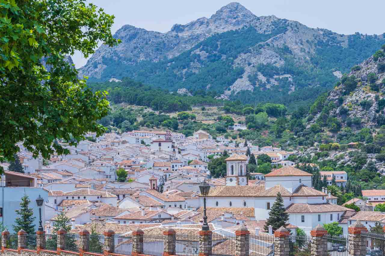
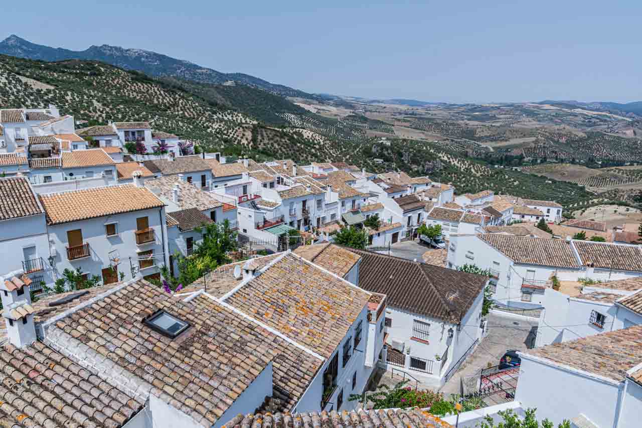
I visited two White Villages in the province of Cadiz – Grazalema and Zahara de la Sierra.
Grazalema
Grazalema, White Village of Andalusia.
Grazalema, located in Sierra de Grazalema National Park, receives the highest rainfall of the entire Iberian Peninsula. However, on the day of my visit, the skies were clear blue. I had a delicious salad for lunch in Grazalema at Restaurant Cadiz el Chico – Ensalada Caprichosa (lettuce, cheese, nuts, mustard and quince jelly, yoghurt, and red berry coulis) (€12 / AU$19.74).
Grazalema is an attractive village with the tiny porches of its whitewashed houses spilling over with potted flowers.
Zahara de la Sierra
Zahara de la Sierra, White Village in Andalusia.
Zahara de la Sierra is also located in Sierra de Grazalema National Park and has been declared a Historic Site. Being situated on the slopes of the Sierra del Jaral forces the streets to be staggered at different levels. Luckily, the guided walking tour through the village started at the top of the village, and we walked down.
Grazalema and Zahara de la Sierra have been chosen by the Association of the Most Beautiful Villages in Spain as two of the four most beautiful villages in Cadiz Province.
Adios Espana.
THE TWELVE TREASURES OF SPAIN
The Twelve Treasures of Spain lists twelve sites of great historical and cultural value to the Kingdom of Spain. The sites were chosen via a poll by two Spanish broadcasting stations, and the results were announced on 31 December 2007.
Mosque-Cathedral of Cordoba
Cave of Altamira (Cantabria)
Seville Cathedral
Alhambra (Granada)
Basilica of Our Lady of the Pillar (Zaragoza)
Teide National Park (Tenerife, Canary Islands)
Roman Theatre (Merida)
Cathedral of Santiago de Compostela
Ciudad de las Artes y las Ciencias (City of Arts and Sciences, Valencia)
Sagrada Familia (Barcelona)
Beach of la Concha (San Sebastian)
Guggenheim Museum Bilbao
Spain is a country that seamlessly weaves together a rich history, vibrant culture, breathtaking landscapes, and unforgettable experiences. In wrapping up this extensive guide to the ultimate Spain bucket list, I hope to have ignited your wanderlust and provided invaluable insights to help you plan an unforgettable trip to Spain.
From the architectural masterpieces of Antoni Gaudi in Barcelona and the ancient wonders of the Alhambra and Mosque-Cathedral of Cordoba to the natural beauty of the Pyrenees and the hidden gems tucked away in charming villages, this bucket list is not just a checklist but intended as a practical guide for planning your itinerary, offering something for every visitor. My 47 memorable postcards spanning the length and breadth of Spain are just a glimpse into the diverse and incredible things not to be missed when visiting the Iberian Peninsula.
Happy planning and even happier travels!
Disclaimer: This post contains no affiliate links. All views and opinions are my own and non-sponsored. All photos are my own and remain the copyright of Just Me Travel.
Sassi di Matera: The Stone City of Italy and a UNESCO World Heritage Site Steeped in History and Charm. Welcome to the mesmerising world of Sassi di Matera, a…
Sassi di Matera: The Stone City of Italy and a UNESCO World Heritage Site Steeped in History and Charm.
Welcome to the mesmerising world of Sassi di Matera, a unique and ancient destination. Matera, a city in Italy’s southern region of Basilicata, is renowned for its extraordinary cave dwellings and rock-cut architecture, collectively known as the Sassi. These ancient settlements, carved into limestone cliffs, have earned the Sassi di Matera a place on UNESCO’s World Heritage List and have captivated visitors with their rich history, unique charm, and breathtaking landscapes.
In this travel blog post, I’ll take you on a visual journey through 15 stunning photos that capture the essence and allure of the Sassi di Matera. Each image tells a story, inviting you into a world where cave dwellings, narrow winding streets and alleyways, and rock-cut architecture create an otherworldly landscape.
Whether you’re a history buff, a culture enthusiast, or simply seeking a destination off the beaten path, Sassi di Matera offers an unforgettable experience. Let these photos inspire you to pack your bags and immerse yourself in the wonders of this timeless Italian gem.
Situated in the “instep” of Italy’s “boot”, Sassi di Matera (literal translation from Italian, “Stones of Matera”) were declared a World Heritage Site by UNESCO in 1993, while Matera was awarded the 2019 European Capital of Culture. However, Matera, particularly the Sassi, did not always deserve these honours. Not so many decades ago, Matera’s Sassi was a place of national humiliation dubbed the “Shame of Italy”.
The Sassi di Matera has two districts – Sasso Caveoso and Sasso Barisano. They are ancient! – prehistoric troglodyte settlements where people have lived in cave dwellings since 7000 BC.
The Sassi have a colourful history that has seen them go from the earliest inhabited city in Italy to a place of national humiliation to Italy’s pride. This history, which is still visible today, makes Sassi di Matera a matchless tourist destination.
A brief history – from shame to honour
In his book Christ Stopped at Eboli (published in 1945), Carlo Levi put Sassi di Matera on the world map when he highlighted the poor living conditions. He painted a picture of abject poverty. Malaria, cholera and typhoid were rampant in the Sassi. Families and their animals were living together under the same roof in dwellings with no natural light or ventilation, no electricity, water or sewers, and there was a high rate of infant mortality.
The Sassi became an embarrassment to the Italian Government. So much so that in 1950, the Prime Minister declared a state of emergency and put plans in place to move the Sassi’s inhabitants out. By 1952, the Sassi were empty – abandoned through forced removal.
After sitting dormant for a few decades, the Sassi began to transform, starting in the 1970s with artists and hippies rediscovering Matera’s Sassi. This urban renewal and a younger generation expressing their desire to bring the caves back to life led the Italian Government to pass a law in 1986 to repopulate the Sassi, connecting water and electricity and subsidising restoration work to encourage the Sassi’s revival.
And the people did come – restoring caves as homes, hotels, restaurants and bars. But many are still uninhabitable.
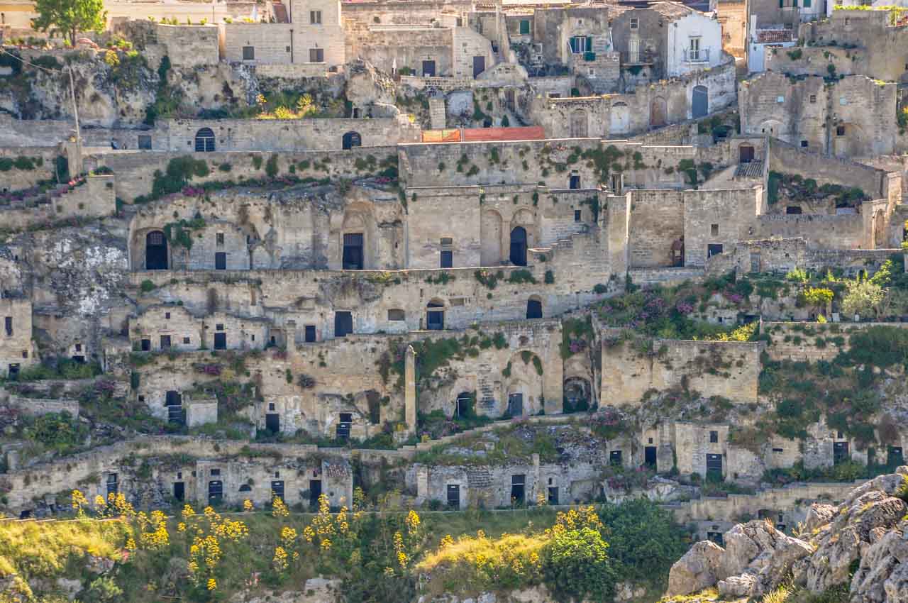
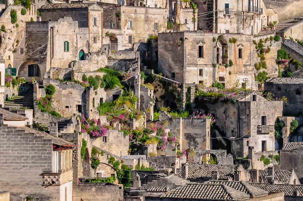
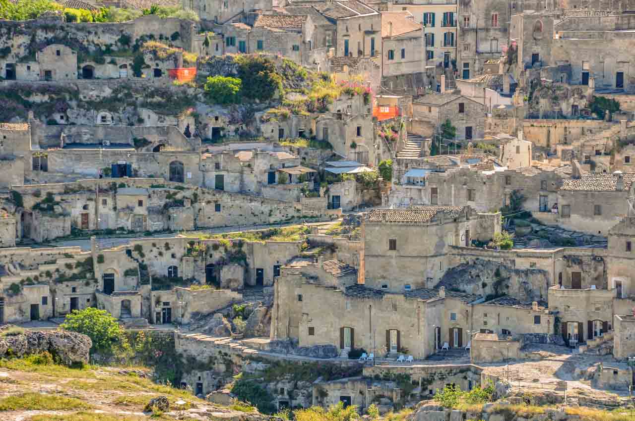
Abandoned cave dwellings in Matera’s Sassi.
Not all the cave dwellings in the Sassi are inhabited.
Sassi di Matera’s revival was further cemented in 1993 when UNESCO listed it as a World Heritage Site for being “the most outstanding, intact example of a troglodyte settlement in the Mediterranean region” and being named 2019 European Capital of Culture.
Matera has reclaimed its dignity and credibility in the eyes of Italy and the world.
Discover Sassi di Matera
I travelled to Matera on a 17-day small group tour with Albatross Tours on their Italy, the Deep South & Sicily tour, staying two nights in the Sassi.
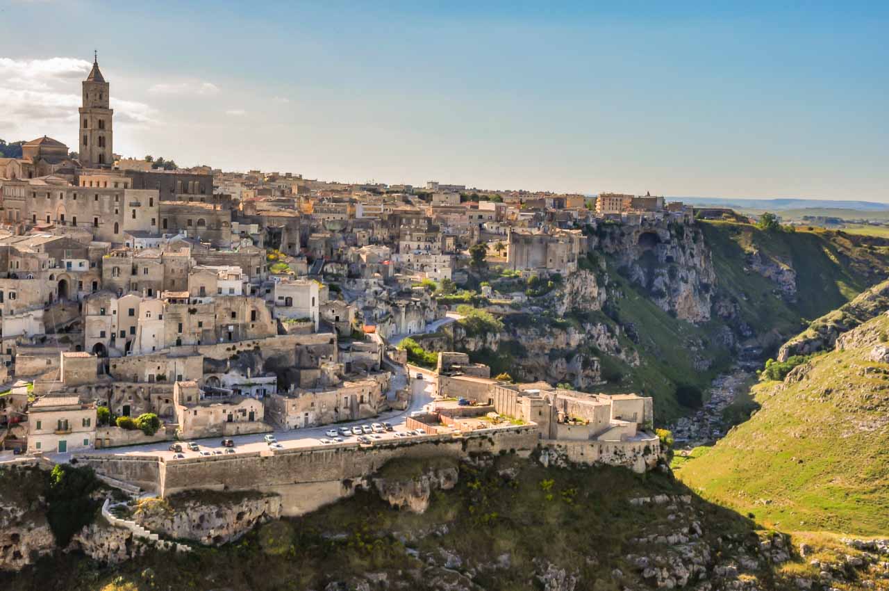
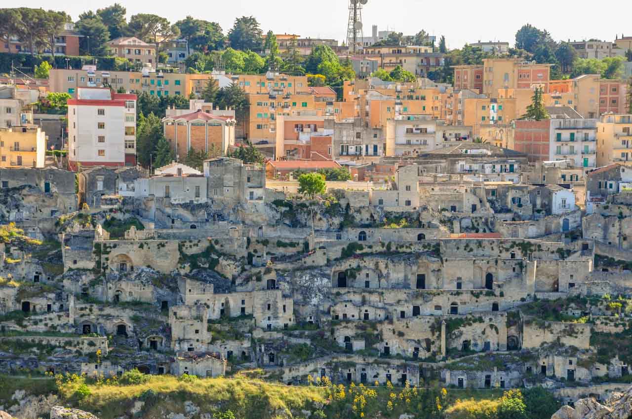
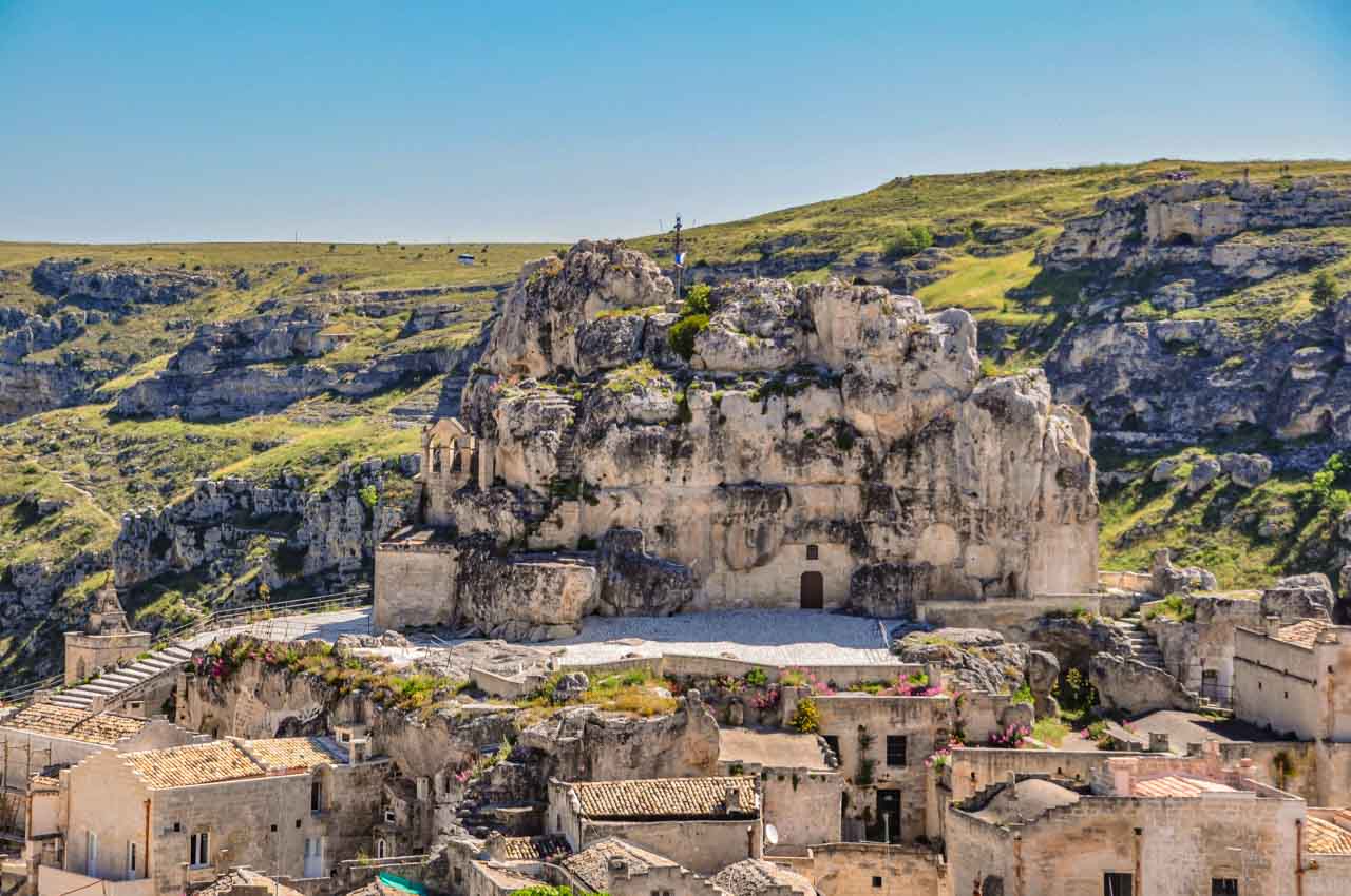
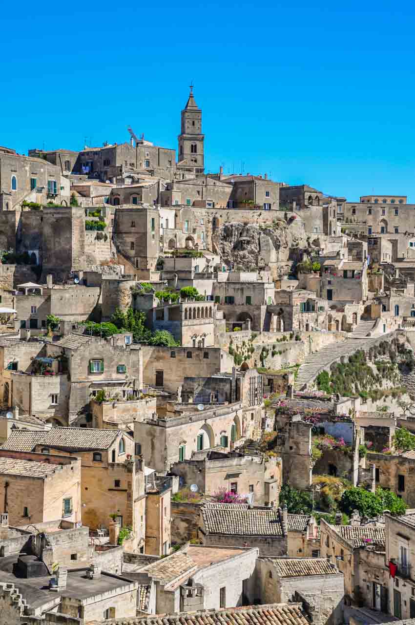
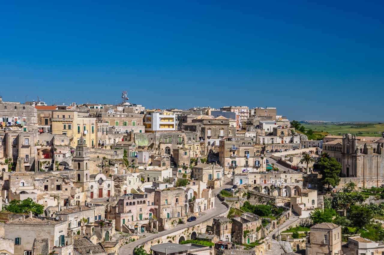
The Sassi are carved into the limestone cliffs of a deep ravine gouged out by the Gravina River. First viewed from across the ravine, the Sassi di Matera were like nothing I had seen before. I have visited Troglodyte caves in France and spent time in Cappadocia in Turkey. But the Sassi di Matera, with caves stacked on each other while clinging to the steep slope, was a stand-alone matchless sight. Then, creating a unique juxtaposition, the modern city of Matera overlooks the Sassi from its height at the top of the hill.
Sassi di Matera viewed from across the ravine.
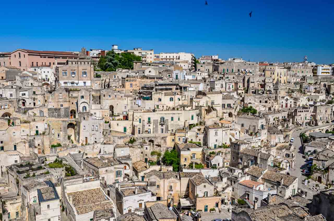
The modern city of Matera sits on top of the ancient Sassi.
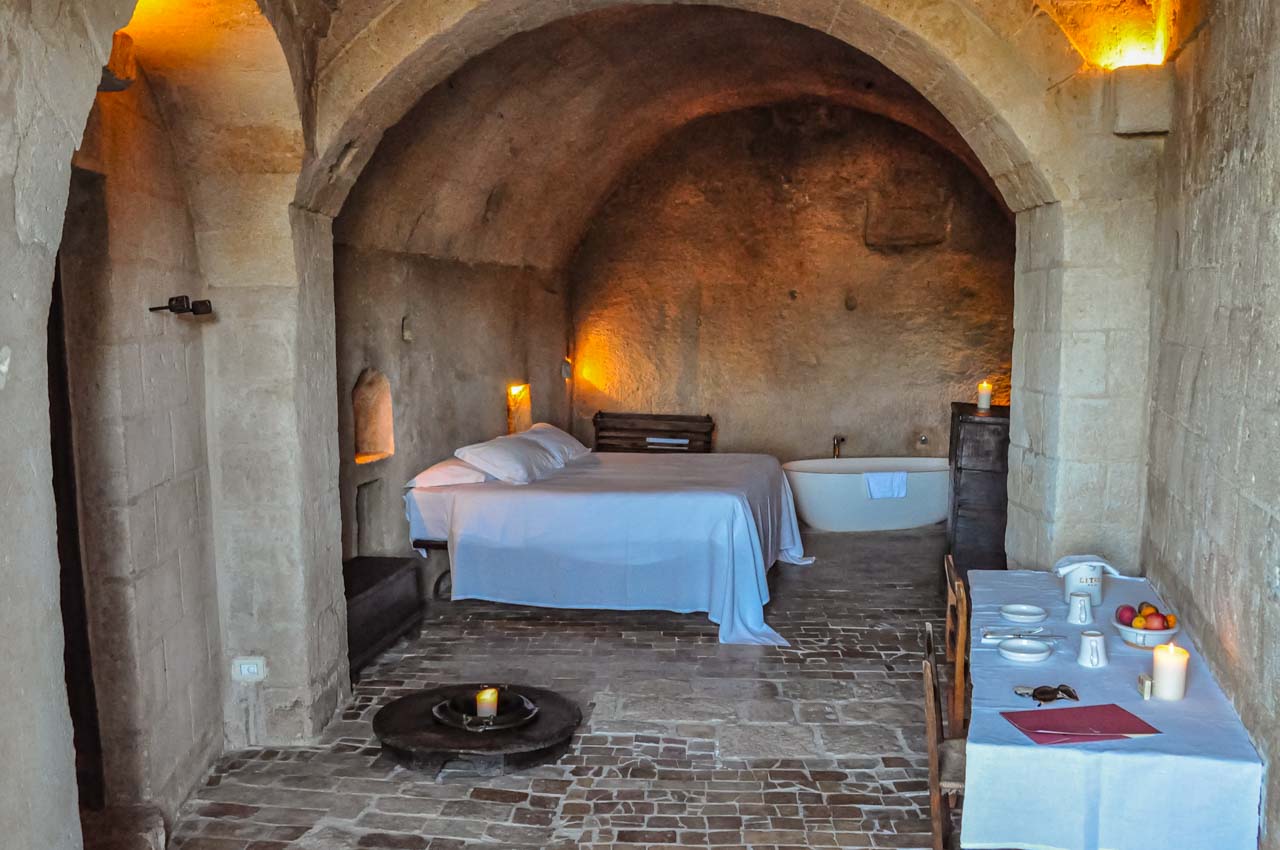
My first ‘taste’ of Sassi di Matera and what it must be like to live in the Sassi was my accommodation for two nights in the luxury Le Grotte della Civita – a cave hotel on the edge of the ravine in the most ancient Sassi area.
My hotel room – a restored cave in Le Grotte della Civita.
Le Grotte della Civita consists of 18 large ‘rooms’ with ensuites. All the rooms are individual caves that have been beautifully restored whilst retaining their original features. The furnishings were simple but tasteful, with much of the lighting provided by candles. The breakfast was served in a reclaimed cave that was once a church and was typical of southern Italy – consisting of various breads, cakes, pastries, meats, jams and cheeses. My stay at Le Grotte della Civita was truly memorable.
After a very comfortable night’s sleep and a delicious breakfast, I joined the walking tour in the morning with a local guide. Walking tours are a great way to get acquainted with a city and learn its history. The walking tour of Sassi di Matera was a fascinating history lesson while being introduced to significant sites. The tour included visiting a cave dwelling to see how families lived in their stone houses and viewing one of the ancient Rupestrian Churches with its biblical frescoes on the cave walls dating back to the Middle Ages.
By the end of the tour, I felt prepared to spend the afternoon and evening on my own, exploring and discovering the labyrinth that is Sassi di Matera. I was in my element, walking around the narrow streets and alleyways, talking to the locals, checking out their cafes, and having all the time I wanted to take photos. A word of advice: you will need comfortable shoes to walk around the Sassi as there are many steep steps to negotiate, given the Sassi are built on the side of a ravine.
There are lots of steps in Sassi di Matera.
Matera has 180 churches, 40 of which are in the Sassi, including the Cathedral and the rock-cut Church of Santa Maria di Idris.
The Church of Santa di Idris.
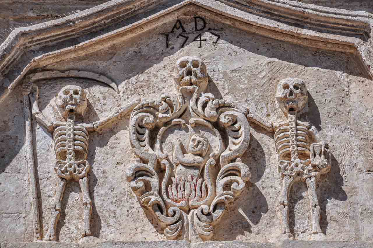
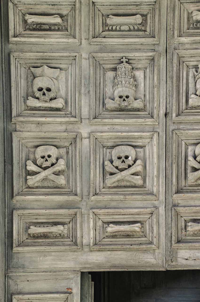
My favourite church was the Church of Purgatory, constructed as a place for people to pray for the souls trapped in limbo between heaven and hell. Completed in 1747, its recurring and only theme is that of death. The baroque façade of the church and its doors are covered with carvings of skulls, skeletons, crossbones, and other death-related decor. While a church focusing on death might seem a bit Grim Reaper-ish, it was fashionable at the time of construction, as death was not seen as the end but as the beginning of a new life.
Skulls and skeletons on the facade of the Church of Purgatory.
The Church go Purgatory’s carved wooden door.
Exploring the Sassi di Matera
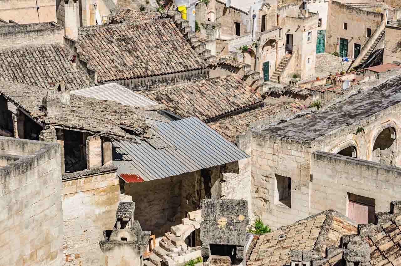
While the Sassi may look like masses of houses, the house-like facades are only that, as the ‘houses’ are dug well into the rock, forming the cave dwellings Matera is famous for.
In the Sassi di Matera, caves look like houses.
Sassi di Matera – a mass of cave dwellings that look like houses.
Houses in the Sassi are built on top of other houses, where many of the streets are built on the roofs of houses, and floors are ceilings of houses below.
Sassi di Matera – roofs are streets, and floors are ceilings.
You would be forgiven for thinking the Sassi are a place of shadow and crampedness. But not so. The squares in the Sassi are sun-drenched open spaces flanked by cafes, shops, churches, and restaurants – great for people-watching.
Wander the Sassi di Matera.
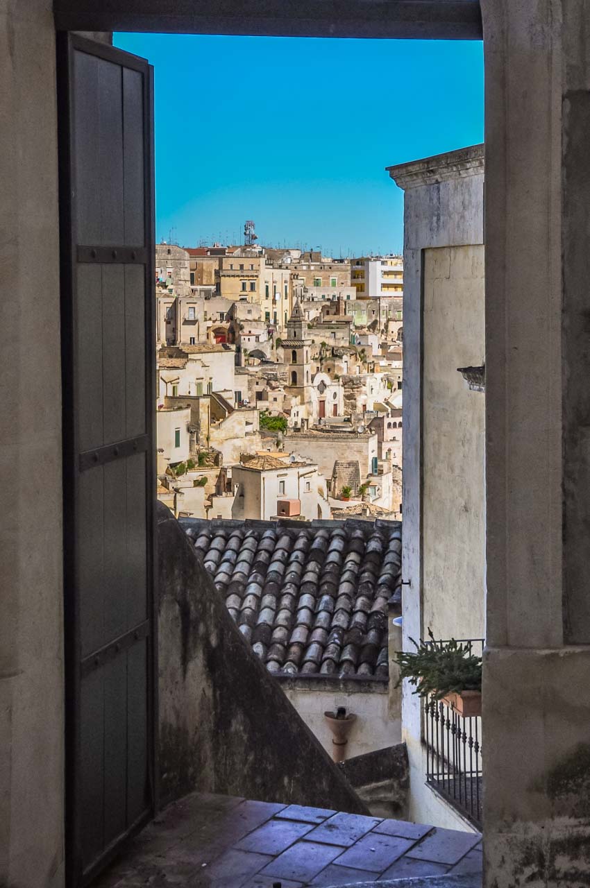
View of the Sassi through a doorway.
World Heritage Listed Sassi di Matera.
Historical and Cultural Timeline:
2019: Matera is the European Capital of Culture.
2014: Tourism starts to take off. This was most likely due to Matera being named the 2019 European Capital of Culture, and Matera began preparations for a year of events highlighting culture and the arts.
1993: UNESCO lists Sassi di Matera as a World Heritage Site.
1986: Italian law changes and people are encouraged to return to the Sassi.
1952: Abandonment of the Sassi through the Italian Government’s forced removal of its inhabitants.
Prehistory: (approximately 9,000 years ago) People first inhabited the Sassi.
Fun facts
Several Directors have used Sassi di Matera as a film location for their movies:
Mel Gibson’s controversial movie, The Passion of the Christ, 2004;
Pier Paolo Pasolini’s The Gospel According to St Matthew, 1964; and
King David was directed by Bruce Beresford and starred Richard Gere in 1985.
It would seem Matera’s Sassi makes for a great ancient Jerusalem.
The 2021 James Bond movie No Time to Die also used Sassi di Matera as a film location.
Sassi di Matera is not just a destination; it’s an immersive journey through time, offering a unique blend of history, culture, and natural beauty that promises to leave a lasting impression on anyone fortunate enough to explore its enchanting streets.
The Sassi beckons, inviting you to witness a living backdrop as you explore a world where tradition meets innovation. The 15 photos you’ve seen here in my blog post are mere snapshots of the unforgettable travel experience that awaits you in person. Dare to wander off the beaten path!
Editor’s Note: I originally published this blog post in March 2019 and have updated it for accuracy and comprehensiveness.
Disclaimer: This post contains no affiliate links. All views and opinions are my own and non-sponsored. All photos are my own and remain the copyright of Just Me Travel.
Have I aroused your curiosity about Sassi di Matera? Are you inspired to visit Italy’s unique Stone City, a valuable UNESCO World Heritage Site? I love hearing from you. Join the conversation and leave a comment below.
Like this post? Save it for Later!
Author’s Note: Please check the latest travel restrictions before planning any trip and follow government advice.
Unlocking the Secrets: Successfully Navigating Mongolian Beliefs, Customs, and Values. A journey to Mongolia is about more than crossing vast landscapes and nomadic lands. It is also a deep…
Unlocking the Secrets: Successfully Navigating Mongolian Beliefs, Customs, and Values.
A journey to Mongolia is about more than crossing vast landscapes and nomadic lands. It is also a deep dive into diverse cultural norms and traditions shaped by Buddhism, Shamanism, and Animism.
Navigating foreign customs can be challenging, especially in a country like Mongolia. In this travel blog post, I’ll guide you through the challenges, providing invaluable tips and practical advice on navigating Mongolia’s cultural environment without stumbling into unintentional faux pas.
Please read the post to make sure your journey to Mongolia is filled with breathtaking landscapes and enriched by a profound understanding of the cultural norms and traditions that make Mongolia uniquely remarkable.
Cultural insensitivity is a sign of profound disrespect. I learned this the hard way in Varanasi (India) when I took a photo of the cremation pyres on the banks of the Ganges River. It took my guide a lot of talking, much apologising, and payment of money to appease the men who supplied wood for the pyres. In my defence (but no excuse), I had not been informed not to take photos of the cremations.
My wrongdoing mortified me. Even though this occurred many years ago, I still beat myself up about it. I have travelled extensively and would describe myself as culturally sensitive. To this day, I cannot explain what made me think it was okay to take such a photo.
So, when our guide in Mongolia advised us about local customs before our two-night stay with a nomadic family, I felt a deep appreciation and relief that I would not commit any social or cultural faux pas through ignorance. I firmly believe that knowledge is power, and I was about to meet this family in a “powerful” (culturally knowledgeable) position.
So, what lessons did I learn from my Mongolian guide?
First, our guide requested we wait to take photos of the family but get to know them a little first. This was a more than reasonable request and one I knew I would have no trouble complying with because I often feel uncomfortable photographing people. However, given this was a photography tour I was on, the family expected photos to be taken of them as they knew this was a part of our learning.
We were advised to ask whatever questions we wanted, with the guide translating for us as the family doesn’t speak English. I suspect this also allowed the guide to ‘censor’ inappropriate questions – a sound filtering system.
Our guide continued her invaluable insights on Mongolian cultural norms and traditions:
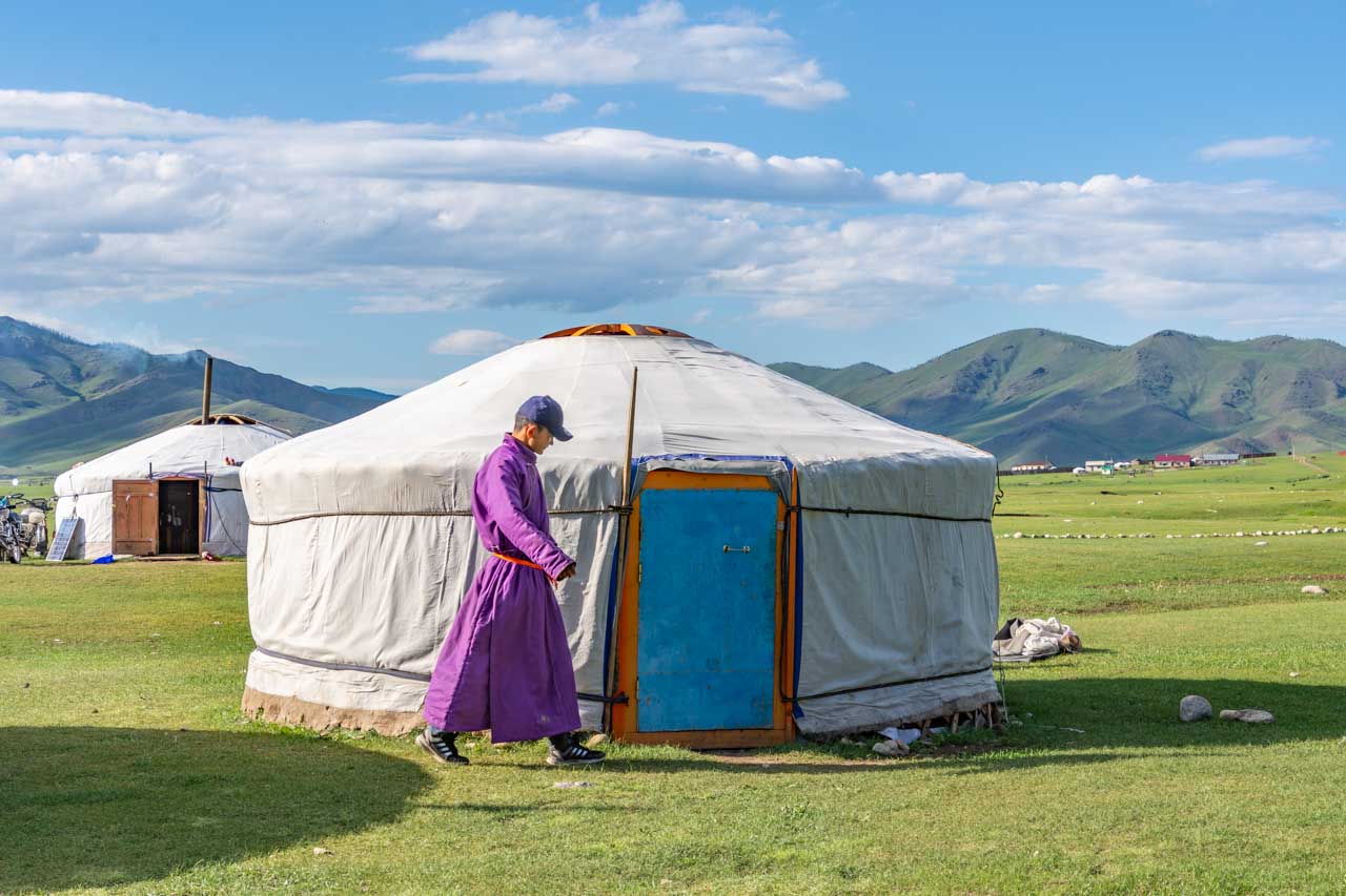
When you enter a ger, you must always go to the left. Don’t circle the interior of the ger. If you need to go to the right once inside the ger, return to the door and then to the right.
Don’t step on the threshold of the ger. You must always step over it.
In a group setting, always say hello to the oldest or most important person first.
Do not touch a person’s head or shoulder; doing so is taking that person’s luck away.
Touching a person’s feet (with your feet) signifies you want to challenge that person to a fight. If you unintentionally touch a person’s feet, shake hands with that person or touch their arm. By doing this, you are saying, “I didn’t mean that” (to challenge to a fight); it removes the challenge.
Do not throw tissues in the fire. The fire is a holy thing, and throwing tissues into the fire is contaminating the fire. It was essential to know this custom as, one by one, we were coming down with colds.
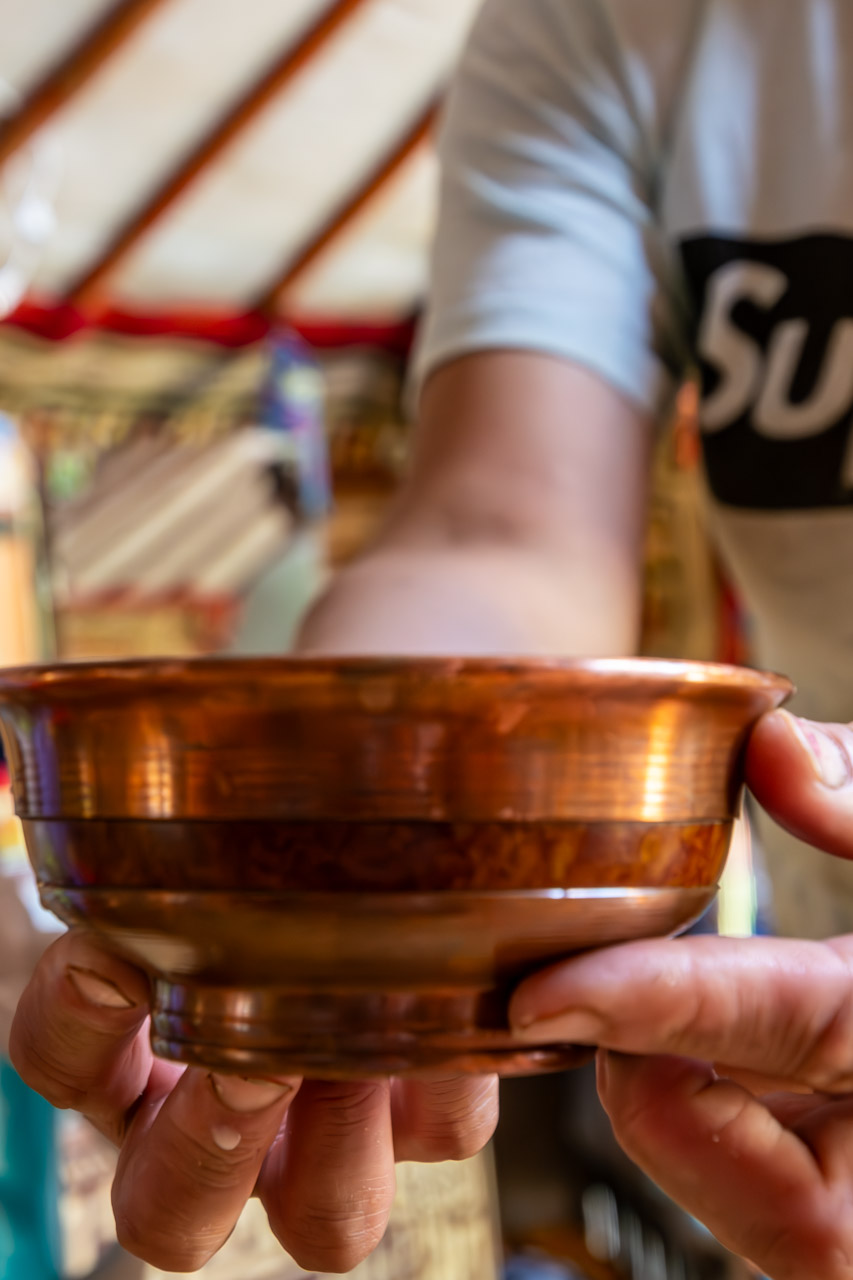
When Mongolians offer you food and drinks, you must accept it with your right hand, and you must taste whatever is offered or, at least, pretend to taste it by putting the food or drink to your lips. There is another alternative if offered a glass of vodka. You can dip your ring finger in the vodka, remove your finger from the vodka and flick your ring finger into the air, thereby flicking drops of vodka in the air.
When offered something, touch it with your right hand before taking it while supporting the elbow with the left hand. This custom is also followed when giving something. The exception to this is when offered a meal or providing a meal.
When exiting religious buildings, e.g. temples, step out backwards so that you do not show your back to the interior. To show your back is to show disrespect to the gods.
Accept and taste all food and drinks that are offered.
Children in Mongolia don’t get their hair cut until they are between 2 and 5 years of age. For girls, this is usually between 2 and 4 years old. Conversely, boys will have their first haircut at 3 to 5 years of age. The reason for leaving the first cutting of children’s hair until this age is because Mongolians believe children are born with their mother’s hair. The cutting (more like shaving) of the hair signifies the child becoming their own person and is celebrated with a hair-cutting ceremony.
The khadag is a long piece of silk cloth (like a scarf). It comes in 5 different colours – blue, white, yellow, green and red – with each colour having its unique significance:
Blue is the most sacred colour in Mongolian culture, representing Mongolia’s eternal blue sky. The blue khadag is the most common and can be given to anyone, regardless of age, to show respect.
White represents milk and is the symbol of purity. It is often given to mothers.
Yellow represents the sun and is the symbol of wisdom. The yellow khadag is given when you greet monks.
Green represents the earth, being in tune with nature. It is the colour of inner peace and is only used in religious rituals.
Red represents fire and blood (as in circulation). It is the colour of life, of prosperity. As with the green khadag, it is not used to greet people but only in religious ceremonies.
To give or offer a khadag to someone or something is to show respect, the ultimate offering. To present a blue khadag to a person or animal is the highest form of respect. Driving through Mongolia, I often saw sheep and horses with blue khadags tied around their neck. Our guide explained that this shows respect for the animal, which can’t be killed/eaten.
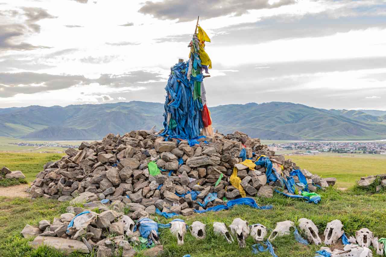
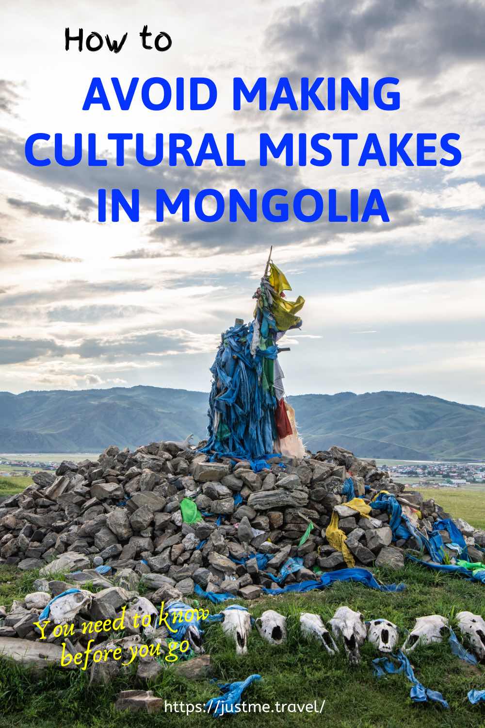
Mongolia’s cairns (shrines) are mounds of rocks and stones for offerings.
Mongolia’s cairns (stone shrines known as ovoos) are adorned with khadags, primarily blue ones. Most Mongolians are Buddhist, but Shamanism is integral to Mongolian life. Locals and travellers erect the cairns to provide offerings to the local spirits, thus showing their respect and honouring the spirits of the surrounding land. When you come across a cairn, you should always stop and show your respect by making an offering. The ritual entails walking around the cairn three times in a clockwise direction. As you do so, you make an offering while making a prayer or wish. This might be for a safe journey, good health, good fortune, or much-needed rain. The offering can be a khadag, food, money, vodka, or a small stone. If you are in a hurry and don’t have time to stop at a cairn, the driver will honk the horn three times. At one cairn, our driver offered a blue khadag. We settled for a small stone each time we stopped at a cairn – and there were many.
Unlocking the secrets of Mongolia’s rich cultural environment requires more than just travelling through its breathtaking landscapes. Understanding and respecting this remarkable country’s cultural norms and traditions is the key to a truly immersive and rewarding travel experience. Avoiding cultural errors is not just about being polite; it’s about creating authentic connections with Mongolia’s warm and hospitable people.
Start your Mongolian adventure with cultural sensitivity, and let the vibrant traditions of this enchanting land enrich your travel story.
And my final piece of practical advice – know before you go!
Editor’s Note: I originally published this blog post in February 2019 and have updated it for accuracy and comprehensiveness.
Disclaimer: This post contains no affiliate links. All views and opinions are my own and non-sponsored. All photos are my own and remain the copyright of Just Me Travel.
Have you travelled to Mongolia? What other cultural insights would you offer readers for Mongolia? I love hearing from you. Join the conversation and leave a comment below.
Like this post? Save it for Later!
Author’s Note: Please check the latest travel restrictions before planning any trip and follow government advice.
Fossick for Dinosaur Bones at Mongolia’s Flaming Cliffs – One of the World’s Greatest Dinosaur Fossil Sites. Dear Pip, Deep in the heart of Mongolia’s Gobi Desert…
Fossick for Dinosaur Bones at Mongolia’s Flaming Cliffs – One of the World’s Greatest Dinosaur Fossil Sites.
Mongolia’s Flaming Cliffs are in the heart of the Gobi Desert.
Dear Pip,
Deep in the heart of Mongolia’s Gobi Desert are the Flaming Cliffs. They are utterly remote at approximately 100 kms northwest of Dalanzadgad and nine hours from Mongolia’s capital, Ulaanbaatar, in the Gobi Gurvan Saikhan National Park.
I don’t know how our driver found his way through the desert because there were no signs or landmarks I could discern to guide the way. When I asked (as translated by our guide) how he knows the way, he shrugged his shoulders, saying (as translated) he just knows. Beats me! However, find the way he did.
The Flaming Cliffs, so named because of their ochre and red-coloured sandstone cliffs and canyons, are an ancient formation of 71 to 75 million years old. They are famous for the first discovery of dinosaur eggs by the American palaeontologist Roy Chapman Andrews in 1923. According to our guide, the eggs were discovered when one of Andrews’ crew fell down the cliff into a nest full of dinosaur eggs.
The Flaming Cliffs are known as one of the world’s greatest dinosaur fossil sites, with more and more bones exposed through erosion. The first dinosaur fossil, a Protoceratops, was discovered in 1922, and in the 1970s, a fossil was unearthed of two dinosaurs locked in a fight. Being a well-known site for dinosaur fossil hunters excited Meg, who scrambled over the cliffs (in thongs!), fossicking for dinosaur bones.
Nearing the end of our cliff walk and exploration, we came across an object sticking out of the cliff face that could be a large bone – possibly a dinosaur thigh bone. Our guide suggested licking the ‘bone’ to test if it is bone or stone. Because bones are more porous than stones, your tongue sticks to it when you lick bone, but it won’t stick to stone. Of course, Meg had to have a lick. Her tongue stuck to it – bone!
A bit of trivia for you:
Roy Chapman Andrews was a bit of a daredevil, a swashbuckler, and he was the inspiration behind the Indiana Jones film character.
Love,
Joanna
Bone or stone? The lick test!
Editor’s Note: I originally published this blog post in February 2019 and have updated it for accuracy and comprehensiveness.
Disclaimer: This post contains no affiliate links. All views and opinions are my own and non-sponsored. All photos are my own and remain the copyright of Just Me Travel.
Experience Fox Glacier and Franz Josef Glacier on a Helicopter Flight – The Most Accessible Rivers of Ice in the World. New Zealand’s Southern Alps are breathtaking and home…
Experience Fox Glacier and Franz Josef Glacier on a Helicopter Flight – The Most Accessible Rivers of Ice in the World.
New Zealand’s Southern Alps are breathtaking and home to several glaciers. Fox Glacier and Franz Josef Glacier are the most accessible. And what better way to experience their natural beauty than with a helicopter flight over the glaciers and landing on the top of one for a walk around?
When touring New Zealand’s South Island, I climbed aboard a helicopter for a scenic flight and snow landing. I have mixed feelings about this flight, which become evident in my review below.
I was so excited about taking a helicopter flight with Glacier Helicopters over New Zealand’s Franz Josef and Fox Glaciers – an optional extra with Grand Pacific Tours and my New Year present to myself. I will always jump at the option of a helicopter or small plane scenic flight and have taken several now around the world. They provide a unique perspective of an area or site you visit, and I feel a sense of adventure with helicopter flights.
Franz Josef and Fox Glaciers are in New Zealand’s Southern Alps on the South Island’s west coast, in Glacier Country. They are temperate maritime glaciers that extend well below the snow line. Franz Josef Glacier’s terminal face is 500 metres above sea level, while Fox Glacier terminates at 250 metres above sea level. Though still flowing, both glaciers, unfortunately, are retreating, with Franz Josef vanishing at a phenomenal rate.
Franz Josef Glacier is 12 kilometres long and lies 20 kilometres south of Fox Glacier. Franz Josef Glacier was named after the Austrian emperor but is better known by its Māori name, Kā Roimata o Hine Hukatere. The glacier is five kilometres from the town of the same name.
At 13 kilometres long, Fox Glacier (Te Moeka o Tuawe) is longer and faster moving than Franz Josef Glacier and is New Zealand’s longest glacier. Fox Glacier is just five kilometres from the village of the same name. I stayed in Fox Glacier village.
View of Fox Glacier taken from State Highway 6 near Fox Glacier village.
Grand Pacific Tours had organised the 40-minute ‘Mountain Scenic Spectacular’ helicopter flight with Helicopter Line in Franz Josef village. However, when we arrived, Helicopter Line advised us to fly the next morning because of the current poor visibility. For some reason I never understood, we booked in the following day with Glacier Helicopters for our scenic flight over Fox and Franz Josef Glaciers, with a snow landing on Franz Josef Glacier and departing from Fox Glacier village. Unfortunately, because of a strong wind, we couldn’t fly around Mount Cook (Aoraki), New Zealand’s highest mountain (3,724 metres), as per the scheduled flight path. Consequently, Glacier Helicopters reduced our helicopter flight plus snow landing to 30 minutes, and we did receive a small discount.
Mount Cook dominates New Zealand’s Southern Alps.
I was disappointed with Glacier Helicopter’s scenic flight. The cabin was cramped inside, and the other passengers obstructed my view. There were three of us in the back, two in the front, and the pilot. Sitting in the middle of the back seat, I found the cramped conditions restricted my arm movements, making taking photos while flying difficult.
I could tolerate being sandwiched between two passengers, but having my views of the landscape we were passing over severely obstructed was upsetting. While flying, the passengers on either side of me continually blocked my sight as they leaned into their respective windows to see the landscape below and take photos. Looking out the front of the helicopter was no better as the heads of the two front passengers were prominent in many of my photos.
These circumstances negatively impacted my overall experience. As a travel blogger and photographer (I rarely disclose my tradecraft), getting good photographs is crucial for my posts. I understand weight distribution is imperative for helicopter flights, but is there no way to guarantee a window seat?
Had I not been seated in the back row’s middle seat, I believe my helicopter flight experience would have been very different – far more positive.
After flying up the ice river that is Franz Josef Glacier, we landed on the top of the glacier to spend 15 wondrous minutes walking on the snow and ice, examining the ice architecture, enjoying the views, and taking photos. The adventure of a lifetime! The landing on Franz Josef Glacier was magical. Who needs a flight around a snow-capped mountain when you can walk on a glacier?
Franz Josef Glacier – climbing the ice river
Landing on Franz Josef Glacier.
While on Franz Josef Glacier, the pilot took photos of the passengers. He had a printer in the helicopter’s tail, and we could purchase a photograph after landing back at Fox Glacier Heliport.
There’s a printer in the helicopter’s tail!
I would have loved more time on Franz Josef Glacier to walk further afield than just the top of the glacier, exploring its features in detail. But that’s what the Heli Hikes entail. Next time!
Being in the middle seat behind the pilot and two other passengers on Glacier Helicopter’s small, five-passenger helicopter was not value for money. I had no choice as to which company I took the helicopter flight with, as Grand Pacific Tours organised it. I recommend exploring other glacier helicopter flight companies to avoid disappointment.
My helicopter flight over New Zealand’s Fox and Franz Josef Glaciers was a mixed experience. The obstruction of my views during the flight by other passengers was undeniably disappointing. However, the magic truly began when we landed on Franz Josef Glacier. The opportunity to step out on this pristine glacier and explore its breathtaking beauty up close gave me a real sense of adventure. While the flight had drawbacks, the glacier landing left an indelible mark on my memory.
Fox Glacier – on top of the mountains.
Disclaimer: This post contains no affiliate links. All views and opinions are my own and non-sponsored. All photos are my own and remain the copyright of Just Me Travel.
My favourite helicopter flights are in small three-passenger helicopters with removed doors. I experienced three such helicopter flights when in The Kimberley, Western Australia. What has been your experience of scenic helicopter flights? I love hearing from you. Please leave a comment below.
Like this post? Save it for later!
Author’s Note: Please check the latest travel restrictions before planning any trip and follow government advice.
HOW TO SEE HORIZONTAL FALLS AND EPIC TIDES, AUSTRALIA. Take an unforgettable scenic flight over northern Western Australia’s Horizontal Falls. Include an incredible sea safari among giant whirlpools and standing tidal waves. See a horizontal waterfall and ride giant tides.
No Trip to Mongolia is Complete Without Having Attended a Local Horse Festival and Witnessed Extraordinary Horseback Skills. Dear Pip, Our trip to Mongolia is turning out to…
No Trip to Mongolia is Complete Without Having Attended a Local Horse Festival and Witnessed Extraordinary Horseback Skills.
Mongolian nomads ready for competition with their uurgas (lasso poles) at a horse festival.
Dear Pip,
Our trip to Mongolia is turning out to be one unique cultural highlight after another. We spent the day sharing the excitement of a local horse festival in the Orkhon Valley, organised by Tsaidam Ger Camp, where we stayed for the night. The festival aims to preserve nomadic tradition and promote the talent and capabilities of Mongolia’s nomadic herders.
The Orkhon Valley is in Central Mongolia, about 360 kilometres southwest of Mongolia’s capital, Ulaanbaatar. The Orkhon Valley, a cultural landscape comprising 1,220 square kilometres, was designated a UNESCO World Heritage Site in 2004.
Mongolia’s history, culture, and people are intimately linked with horses, with children learning to ride almost from the day they can walk. In a country with 13 times more horses than people, I can understand how Mongolia has become known as the land of horses. Throughout the day, I came to appreciate Mongolian nomads’ strong bond with their horses and to understand how Mongolians have long been considered some of the best horse riders in the world.
After Meg shared snuff with some local elders and our guide explained what the horse festival entailed, we found a spot amongst the locals to watch and photograph the men, dressed in traditional costume, compete in several events, including horse lassoing, grabbing a lasso pole from the ground, and riding a wild, bucking horse. These events are designed to show off the Mongolian nomads’ unique horsemanship skills and the strength of their horses.
I wasn’t sure how I felt about the lassoing of stampeding wild horses. However, I learned it is an essential skill as nomadic households have many horses ridden infrequently and need to be re-broken in because they have been left to roam at will, becoming semi-wild. I needed to remind myself that this is their way of life and culture.
Being able to ride a bucking horse is par for the course with breaking-in horses, and this competition elicited shouts of encouragement from the crowd and laughter when horse and rider parted ways. One man who managed to stay on his horse delighted the crowd as he and his horse disappeared into the distance.
I particularly enjoyed watching the men grabbing an uurga (long pole with a lasso on the end) off the ground from a galloping horse. I was left in awe as to how they stayed on their horse because they would be well down the side of the horse, around its fast-moving legs. Their core strength must be remarkable! With all the rider’s weight on one side, how did the horse not topple over?
Some of the younger men had a competition on the side, grabbing a cigarette lighter off the ground from their galloping horse – some more successful than others. The control these young men and all other competitors had over their horses was genuinely impressive.
It was a most enjoyable, exciting day; I will take home unforgettable memories.
Love,
Joanna
Lassoing wild, stampeding horses at the Mongolian Horse Festival.
I bet that hurt! A competitor falls off a bucking wild horse.
Picking up an uurga (lasso on a pole) off the ground from a galloping horse.
A young man picks up a cigarette lighter off the ground from a galloping horse.
Editor’s Note: I originally published this blog post in February 2019 and have updated it for accuracy and comprehensiveness.
Disclaimer: This post contains no affiliate links. All views and opinions are my own and non-sponsored. All photos are my own and remain the copyright of Just Me Travel.
Embark on an Unforgettable Journey on France’s Canal du Midi and Experience Extraordinary Engineering Feats That Are Works of Art. What do you know about the Canal du Midi? …
Embark on an Unforgettable Journey on France’s Canal du Midi and Experience Extraordinary Engineering Feats That Are Works of Art.
What do you know about the Canal du Midi?
Set against the picturesque landscape of southern France, the Canal du Midi is a serene waterway and a testament to human creativity and engineering brilliance. Prepare to be awe-struck by three engineering marvels that have stood the test of time and captivated all who encounter them.
In this travel blog post, I invite you to join me on a journey uncovering the stories behind the three remarkable wonders of human ingenuity I discovered when sailing from Marseillan to Salleles d’Aude on a hotel barge on the historic Canal du Midi: the masterfully constructed Orb Aqueduct that defies gravity, the intricately designed seven-step Fonserannes Locks that challenge navigation skills, and the mystical Malpas Tunnel that channels the canal through a hill.
I am not an engineering expert, but crossing the Orb Aqueduct, climbing the Fonserannes Locks, and traversing the Malpas Tunnel were extraordinary experiences and unforgettable highlights of my barge cruise on the Canal du Midi with European Waterways. They have left a lasting impression on me that I want to share with you, and I hope you get to experience them for yourself.
The Canal du Midi
Cruising the Canal du Midi
The Canal du Midi in southern France was constructed between 1666 and 1681 by the 17th-century canal engineer Pierre-Paul Riquet. It is considered one of the most significant construction works of the 17th century and is one of the oldest canals still in use in Europe. The Canal du Midi was designated a UNESCO World Heritage Site in 1996.
The Canal du Midi runs for 240 kilometres from the Etang de Thau, a sheltered lagoon behind the Mediterranean port of Sete, to Toulouse, where it joins the Canal de Garonne – connecting the Mediterranean Sea to the Atlantic Ocean. The Etang de Thau at Marseillan was the starting point for my barge cruise on the Canal du Midi with European Waterways.
I cruised the Canal du Midi on European Waterway’s first-class, eight-passenger hotel barge, the Adjodi. The section of the Canal du Midi we cruised included three impressive 17th-century engineering feats – the Orb Aqueduct, Fonserannes Locks, and Malpas Tunnel. But you don’t need to be an engineer to appreciate, enjoy, and be thrilled by these wonders of the Canal du Midi.
The sun sets on another day on the Cana du Midi.
Orb Aqueduct
Our barge navigates the Canal du Midi along the Orb Aqueduct at Beziers.
A photo of a barge navigating the Orb Aqueduct (Pont-Canal de l’Orbat) at Beziers in southern France has always been my ‘vision’ of the Canal du Midi and one of the reasons I wanted to do a barge cruise on the canal. No other image of the Canal du Midi was more iconic than the Orb Aqueduct.
The Orb Aqueduct is a one-lane bridge carrying the Canal du Midi over the Orb River. At 240 metres long, 28 metres wide, 12 metres high, and with seven arches, the Orb Aqueduct is one of the largest aqueducts in France and the largest on the Canal du Midi. Prior to the opening of the Orb Aqueduct in 1858, the Canal du Midi traversed a short, treacherous section of the Orb River that would sink boats or leave them stranded for weeks due to its unpredictable flow. Building the aqueduct allowed boats to bypass the dangerous Orb River safely.
The aqueduct carries the canal in a masonry trough sealed with a layer of concrete. The concrete seal was replaced in 1951; otherwise, the original structure still exists. You can walk the length of Orb Aqueduct as there is a towpath on both sides.
The Orb Aqueduct was classified as a National Historical Monument in 1962 and was listed as a World Heritage Site by UNESCO in 1996.
Six of the Orb Aqueduct’s seven arches.
The Orb Aqueduct carries the Canal du Midi over the River Orb.
Fonserannes Locks
The seven-rise lock staircase or Fonserannes.
Locks are an integral part of any barge cruise, and on the Canal du Midi, I got my gratifying fill of them. However, none would raise my excitement or sense of adventure as much as the seven-rise lock staircase of Fonserannes (also known as the Fonserannes Locks or the Fonserannes Staircase) near the town of Beziers.
When the Canal du Midi was constructed in the 17th century, Pierre-Paul Riquet had to overcome the problem of crossing the Orb River, which was 48 metres higher than the natural course of the canal waterway. The answer was the Fonserannes Lock Staircase, a staggering feat of engineering and very impressive, even to my untrained eye. It is one of the features that led to the Canal du Midi being declared a UNESCO World Heritage Site in 1996.
Fonserannes Lock Staircase is a 312-metre-long water staircase, allowing boats and barges to negotiate a 25-metre gradient by passing through seven oval-shaped lock chambers and eight gates. There is an eighth chamber, but it is no longer in use. Boats are raised (or lowered) 21.5 metres over a distance of 300 metres, with the deepest rise (or drop) over six metres.
A boat climbs the Fonserannes Staircase Locks.
We approached the Fonserannes seven-rise lock staircase from the Orb Aqueduct and travelled up the lock staircase. Our barge captain took over 30 minutes to negotiate the boat’s climb through the seven chambers. The force and speed at which the water rushes into the chamber when a gate opens is astounding.
Our barge navigates through Fonserannes Locks.
One lock chamber must have been particularly challenging because going under the bridge that spanned the gate dislodged the height indicator pole (a red flag on a pole on the boat’s bow). As I understand it, the lockkeeper allowed too much water to enter the lock, making the water in the chamber higher than it should have been. Our captain had to duck very low to ensure his head didn’t connect with the bridge.
A low bridge knocked over the red-flagged height indicator pole.
We stopped for the night at the top of Fonserannes Staircase Locks. So, I took the opportunity to walk the towpath back to the Orb Aqueduct, an easy, flat 20-minute walk.
Malpas Tunnel
Our barge approaches the Malpas Tunnel on the Canal du Midi.
The Malpas Tunnel, between Bezier and Capstang on the Canal du Midi, was the first tunnel ever dug for a canal. The tunnel was excavated in 1679 in secret by the canal’s chief engineer, Pierre-Paul Riquet, as the Prime Minister had stopped the plan to dig a canal tunnel through Enserune Hill because initial excavations revealed the tunnel was liable to collapse due to the hill being brittle sandstone. Over 300 years later, the Malpas Tunnel is still navigable! And there is now even a railway tunnel ten metres below the canal tunnel, built nearly 200 years later!
Local folklore has it that after the completion of the Malpas Tunnel, one of the workers built a small nook inside the tunnel’s ceiling and lived there as a hermit. When barges passed through the tunnel, the crew threw bread into the opening for the hermit. Barge crews still sometimes throw a piece of bread into the opening of the nook as a “gift for the hermit”.
Our captain did not throw bread into the opening in the ceiling, but he did play the finale of Tchaikovsky’s 1812 Overture (at least, I think that was what it was). I did not fathom the relevance of this, but the music sounded incredible and very dramatic as it echoed off the tunnel walls.
The hermit nook in the ceiling of Malpas Tunnel.
Canal de Jonction
I want to leave you with my favourite photo I took on the Canal du Midi barge cruise. It is not the Canal du Midi per se but taken when we stopped for the night at Salleles d’Aude on the Canal de Jonction. The Canal de Jonction is a shortcut from the Canal du Midi to the Canal de la Robine. It was early morning, the water was milk-pond still, and the reflections of our barge and the trees lining the canal created an unforgettable image.
The Adjodi reflected in the still waters at Salleles d’Aude on the Canal de Jonction.
Reflecting on my journey along the Canal du Midi, I am in awe of the ingenuity and determination that brought these three remarkable engineering marvels to life. The Orb Aqueduct is a testament to the courage of human vision, carrying the canal over the valley below. The Fonserannes Locks remind us of our ability to conquer and harness the raw forces of nature. And then there is the Malpas Tunnel, a hidden passage shrouded in history and mystery carved through solid rock.
As you traverse the tranquil waters of the Canal du Midi, it’s impossible not to be humbled by the visionaries who conceived these extraordinary structures. Their dedication to crafting a passage that conquered natural obstacles while blending with the landscape continues to inspire admiration centuries later.
Whether you’re a history buff, an engineering enthusiast, or a traveller searching for unique experiences, the Canal du Midi’s engineering marvels promise an unforgettable journey.
Disclaimer: This post contains no affiliate links. All views and opinions are my own and non-sponsored. All photos are my own and remain the copyright of Just Me Travel.
Leave a comment below. I look forward to reading and responding to your comments on the Canal du Midi and its engineering marvels.
Like this post? Save it for later!
Author’s Note: Please check the latest travel restrictions before planning any trip and follow government advice.
You might also like
CARCASSONNE CITADEL – The Best-Preserved Medieval Town in France
Carcassonne Citadel is a medieval treasure in Southern France. It is the most complete medieval town in existence today and is worth two to three days to explore.
Carcassonne Citadel is a Medieval Treasure in Southern France. Dear Ryan, One of the highlights of my Canal du Midi cruise with European Waterways was a morning in the…
Carcassonne Citadel is a Medieval Treasure in Southern France.
Carcassonne Citadel entrance gate
Dear Ryan,
One of the highlights of my Canal du Midi cruise with European Waterways was a morning in the Citadel of Carcassonne. The barge captain was surprised I had not heard of Carcassonne Citadel as it is one of France’s premier tourist attractions. But, as you know, I have only been to France once before, and that was to a different region.
So, here is what I learned about Carcassonne Citadel…
It is the most complete medieval fortified town in existence today and the largest in Europe.
It has about 2,500 years of history and was occupied by the Romans, Visigoths, and Crusaders at different periods.
Three kilometres of double walls interspersed with 52 watchtowers surround the citadel.
It is a lived-in citadel with houses, schools, shops, restaurants, hotels, basilica, and museums.
The citadel is open 24/7 and is free to enter. However, there is an admission fee to visit Carcassonne Castle and its ramparts.
Carcassonne Citadel was declared a UNESCO World Heritage Site in 1997.
European Waterways took us on a two-hour guided walking tour around the walls, through the citadel, and into the Basilica Saint Nazaire. We were given admission tickets for the castle and ramparts, but I didn’t see them. After going to the toilet and watching the visual display at the entrance, I had to leave the castle as it was time to meet our guide to leave Carcassonne.
Basilica Saint Nazaire
Our visit to Carcassonne Citadel was too rushed and deserved so much more time. I could have spent 2-3 days there instead of the few hours allocated to the visit.
I would stay within the citadel. From my view of its exterior, the Hotel de la Cite next to the basilica appealed to me. That it is a 5-star hotel probably added to that appeal, even if it is beyond my budget.
Exploring the castle beyond the toilet block would be a bonus. And I am told the views from the ramparts are stunning. But I would want to walk them to see for myself.
I would like to eat at the many restaurants, buy lots of nougat, and shop until I drop. The clothes and leather goods shops were of particular interest.
Three days would give me time to visit some of the museums within the citadel and Carcassonne city, for example, the School Museum, the Museum of the Inquisition, and the Museum of Fine Arts. Perhaps I need four days!
Did you know there is a Carcassonne board game? Apparently, it is one of the most beloved and well-known board games in the world. I have never heard of it. Just something else to add to my ignorance about Carcassonne!
Next stop, Spain.
Love,
Joanna
Disclaimer: This post contains no affiliate links. All views and opinions are my own and non-sponsored. All photos are my own and remain the copyright of Just Me Travel.
Have you been to Carcassonne Citadel? What would you recommend I include on my next, more in-depth visit? Leave a comment below.
Like this post? Save it for later!
Author’s Note: Please check the latest travel restrictions before planning any trip and follow government advice.
You might also like
SEE 3 ASTOUNDING ENGINEERING MARVELS ON THE CANAL DU MIDI
Prepare to be awe-struck by three extraordinary engineering marvels on the Canal du Midi that are works of art – the Orb Aqueduct, Fonserannes Staircase Locks, and Malpas Tunnel.
Join Me on a Visual Journey Through the Awe-Inspiring Sounds of Fiordland National Park, a Place Where Nature’s Grandeur and Serenity Intertwine. On two recent trips to New Zealand…
Join Me on a Visual Journey Through the Awe-Inspiring Sounds of Fiordland National Park, a Place Where Nature’s Grandeur and Serenity Intertwine.
On two recent trips to New Zealand (Aotearoa), one by land and one by sea, I was fortunate to have cruised three spectacular sounds (fiords) in Fiordland National Park – Dusky Sound, Doubtful Sound, and Milford Sound. New Zealand is one of only a few places where you can see the spectacular sight of glacial-fed fiords.
My land trip involved a convoluted journey to the included overnight, scenic cruise on Doubtful Sound. But my sea trip was a cruise on a large ship, where we sailed in and out of Dusky Sound, Doubtful Sound, and Milford Sound from the Tasman Sea.
In this post, I focus on my photographs of the three sounds because, as the saying goes, a picture paints a thousand words. I feel no amount of words will do justice to the breathtaking natural beauty I experienced of Dusky Sound, Doubtful Sound, and Milford Sound.
Fiordland National Park
The Māori name for Fiordland is Te Rua-o-Te-Moko.
Map of the sounds in New Zealand’s Fiordland National Park (beautifulworld.com)
Fiordland National Park is located in the southwestern corner of New Zealand’s South Island. At over 1.2 million hectares and covering nearly 13,000 square kilometres, it is New Zealand’s largest national park.
Fiordland National Park is a place of extraordinary beauty, and it is home to glaciers, majestic alpine ranges, lakes, rainforests, unique flora and fauna, and 14 sounds (fiords). Dusky Sound, Doubtful Sound, and Milford Sound are three of the park’s most significant fiords.
You will have noticed I jump between ‘sound’ and ‘fiord’, and both terms are correct. However, Dusky Sound, Doubtful Sound, and Milford Sound are actually fiords as they are glacier-carved valleys filled by the sea rather than river valleys flooded by the sea. British explorers misnamed them as sounds, and the name has stuck!
Dusky Sound
The Māori name for Dusky Sound is Tamatea.
Rays of light stream through the clouds over Dusky Sound
Dusky Sound is remote and accessible by air and sea only. It is the largest of Fiordland’s 14 sounds at 40 kilometres long and eight kilometres wide at its widest. Several islands lie in the sound.
Dusky Sound is an area of stunning landscapes, with craggy mountains and hundreds of waterfalls cascading into the sound during winter (June-August) when there are higher rainfalls. It is a wildlife wonderland with seals and dolphins often sighted in the sound.
We sailed into Dusky Sound at 8.30 in the morning, with the clouds still rising above the mountains. Dusky Sound was my favourite of the three sounds as I found it to be the more dramatic. That it revealed itself only slowly added to the drama.
A visual journey through Dusky Sound
Low clouds drape the mountains of Dusky Sound.
Dusky Sound, Fiordland National Park
Dusky Sound – mountains and islands
Doubtful Sound
The Māori name for Doubtful Sound is Patea, meaning “the place of silence”.
Untouched Doubtful Sound, Fiordland National Park
Doubtful Sound is the deepest (421 metres) and one of the longest (40 kilometres) of South Island’s fiords and has three arms. Doubtful Sound is a pretty waterway with its rugged landscape, verdant rainforest, and cascading waterfalls. Wildlife includes fur seals and penguins, and it is home to a permanent pod of about 70 bottlenose dolphins.
Doubtful Sound is remote, and there is no direct road access. Your only way of getting to Doubtful Sound is a bit of a journey but an adventure in itself. Starting at Pearl Harbour wharf in Manapouri, you take a cruise across Lake Manapouri to West Arm (about 50 minutes), then travel by coach over Wilmot Pass (671-metre-high) to Deep Cove in Doubtful Sound, where you board your scenic day or night boat cruise. On the drive over Wilmot Pass, the coach stops at a vantage point for a magnificent view of Doubtful Sound below. The total time travelled from Manapouri to Deep Cove is nearly two hours. There is no settlement at Deep Cove, but it is home to a small fishing fleet.
Looking down on Doubtful Sound from Wilmot Pass
I first experienced the remote wilderness of Doubtful Sound on an overnight cruise on the three-masted Fiordland Navigator, taking the journey described above to get to the ship. On our second day, the ship stopped the engines for 10 minutes of silence to honour Doubtful Sound’s Māori name and listen to nature.
The Fiordland Navigator docked at Deep Cove Wharf in Doubtful Sound.
My second trip along Doubtful Sound was aboard a cruise ship, entering the fiord from the Tasman Sea.
A visual journey through Doubtful Sound
The blue tinge of early morning light on Doubtful Sound
The shadows and light of Doubtful Sound
The ship’s wake creates a path through Doubtful Sound.
Milford Sound
The Māori name for Milford Sound is Piopiotahi.
Milford Sound, Fiordland National Park
Milford Sound is 16 kilometres long, with sheer cliffs and waterfalls to rival some of the world’s tallest. It is the only fiord accessible by road (around 5-6 hours from Queenstown and about three hours from Te Anau) and the most popular. You can stay in Milford Sound, with accommodation options ranging from Airbnb to a public lodge.
Milford Sound is known for the towering Mitre Peak, so called because it resembles a bishop’s mitre. The fiord is home to dolphins, fur seals, and penguins.
The naturalist onboard the Fiordland Navigator commented that Milford Sound is the most touristy of Fiordland National Park’s fiords but the most beautiful. You be the judge! Perhaps the lack of tourists in Dusky Sound and Doubtful Sound appealed to me the most. Somehow, they felt more untouched. But who am I to say? The British writer Rudyard Kipling visited Milford Sound in the 1890s and declared it ‘the eighth wonder of the world’.
A visual journey through Milford Sound
The cliffs of Milford Sound dwarf a boat.
Milford Sound has many waterfalls.
Mitre Peak, Milford Sound
No trip to New Zealand is complete without exploring Fiordland National Park and the spectacular sight of glacial-carved fiords.
I hope these photographs have transported you to a land of untamed beauty, leaving an indelible imprint on your senses with a desire to discover for yourself. Fiordland’s sounds are a testament to the power and harmony of the natural world.
Disclaimer: This post contains no affiliate links. All views and opinions are my own and non-sponsored. All photos are my own and remain the copyright of Just Me Travel.
If you could only visit one of New Zealand’s sounds (fiords) in Fiordland National Park and getting there was no barrier, which sound would you choose and why? Leave a comment below.
Like this post? Save it for later!
Author’s Note: Please check the latest travel restrictions before planning any trip and follow government advice.
You might also like
HOW TO LAND ON A GLACIER IN NEW ZEALAND’S STUNNING SOUTHERN ALPS. Climb aboard a helicopter for a scenic flight over Fox and Franz Josef Glaciers and experience a snow landing on Franz Josef Glacier.

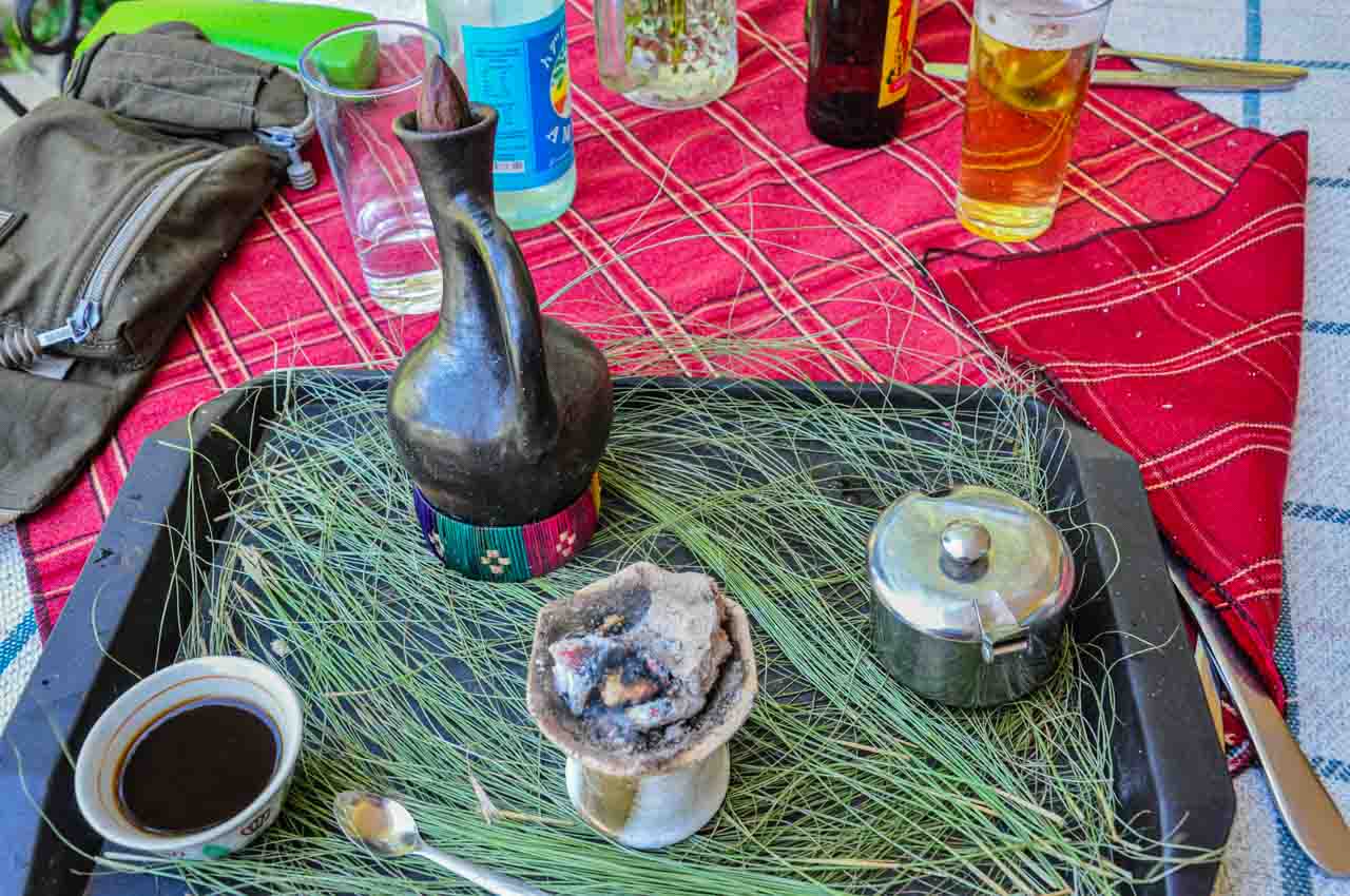
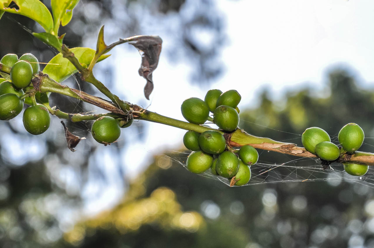
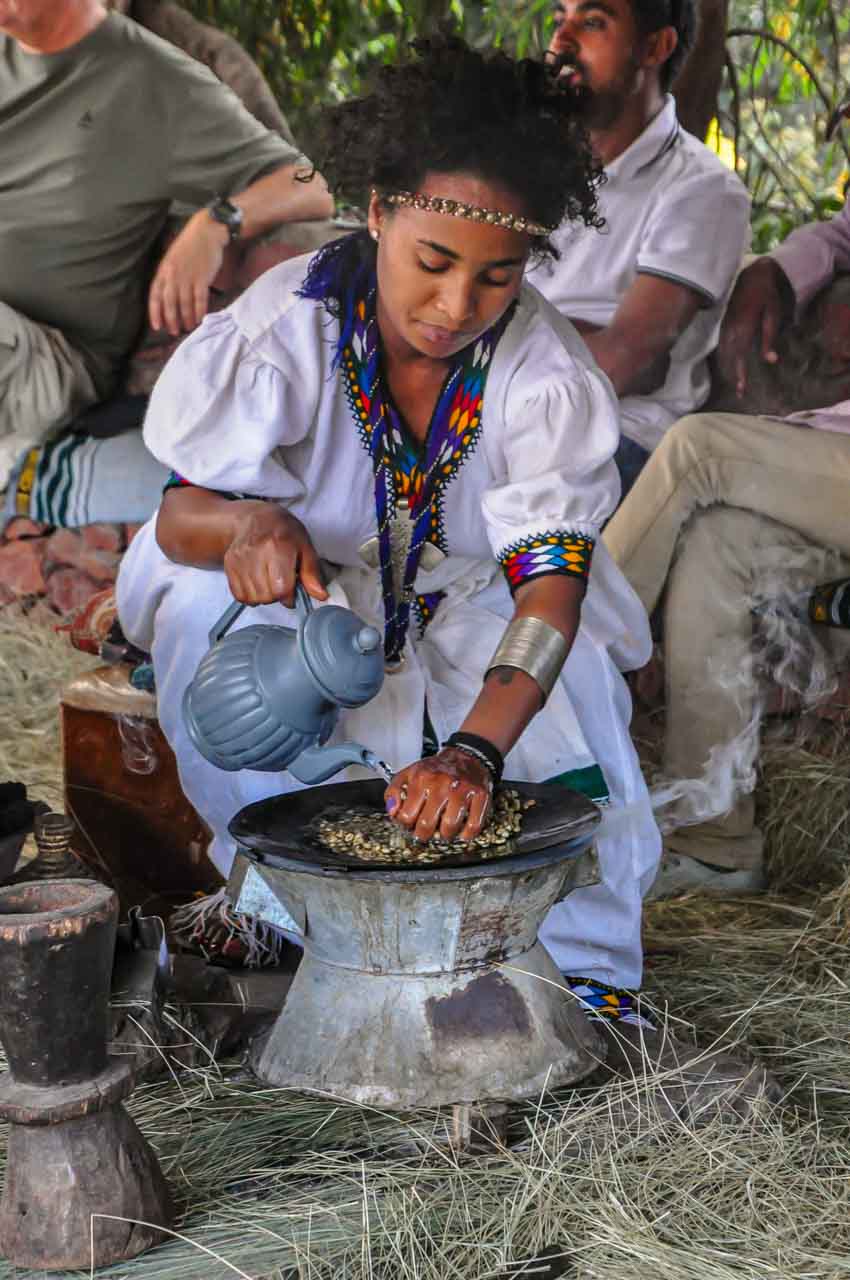
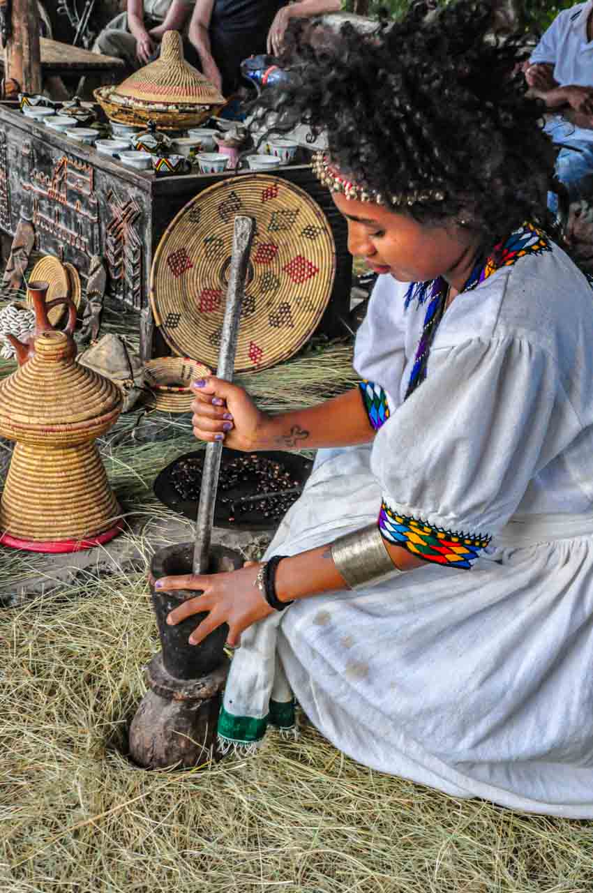
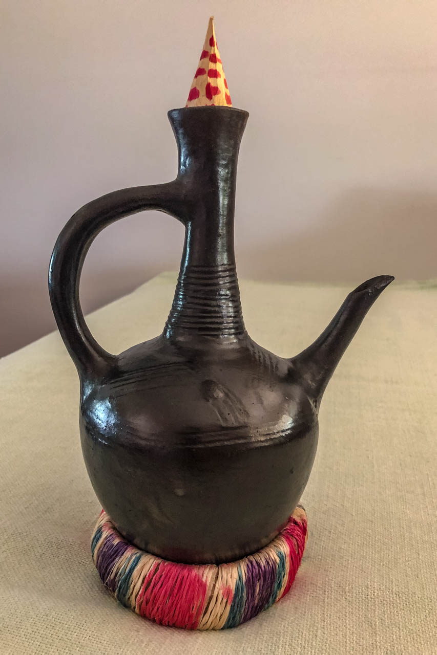
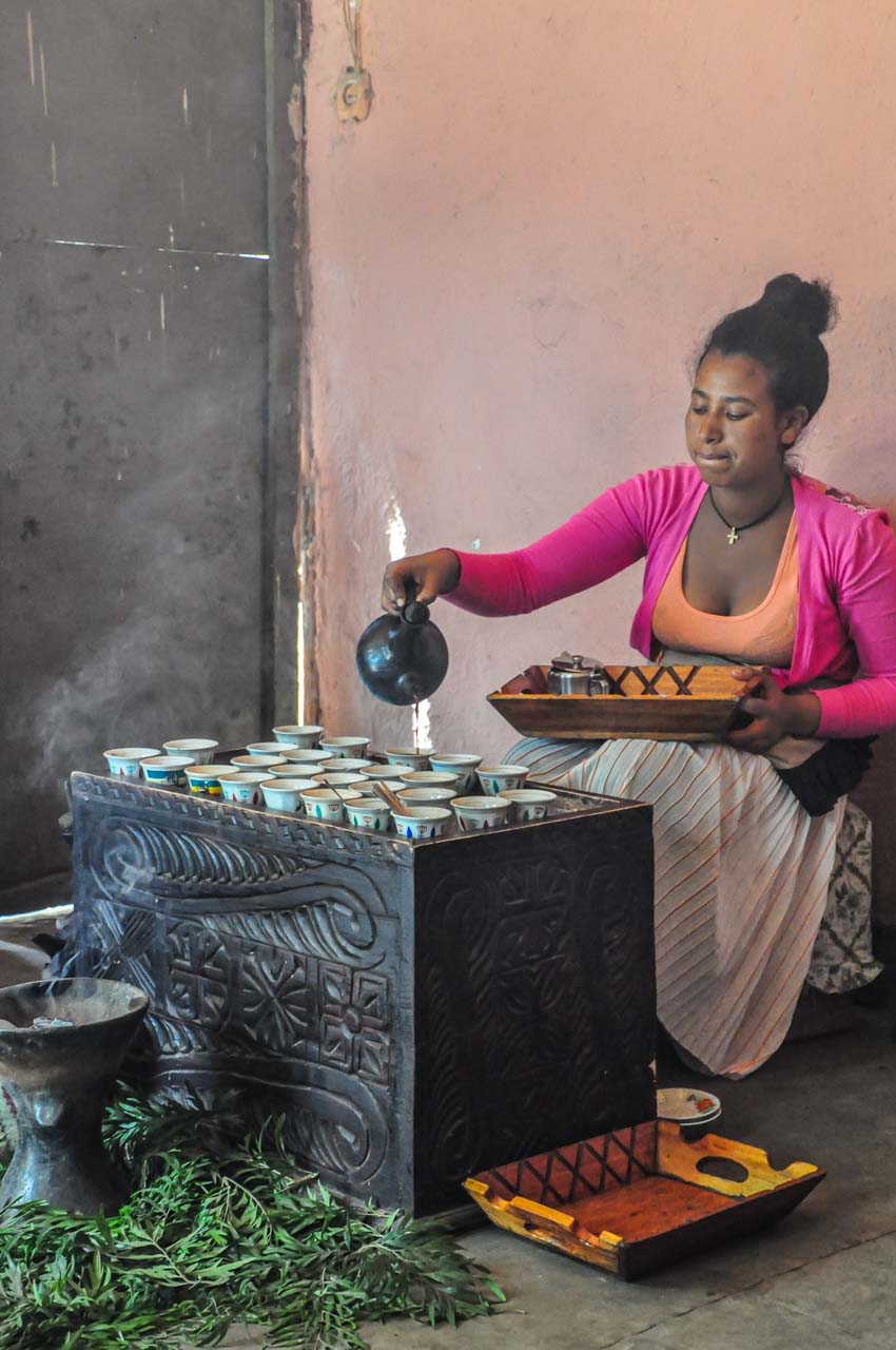
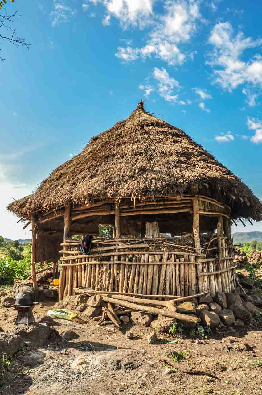
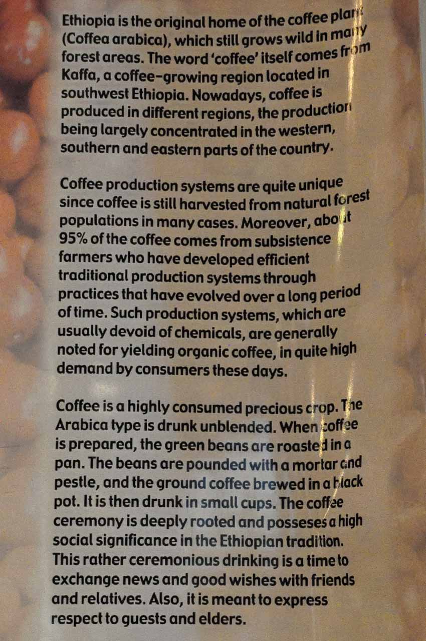
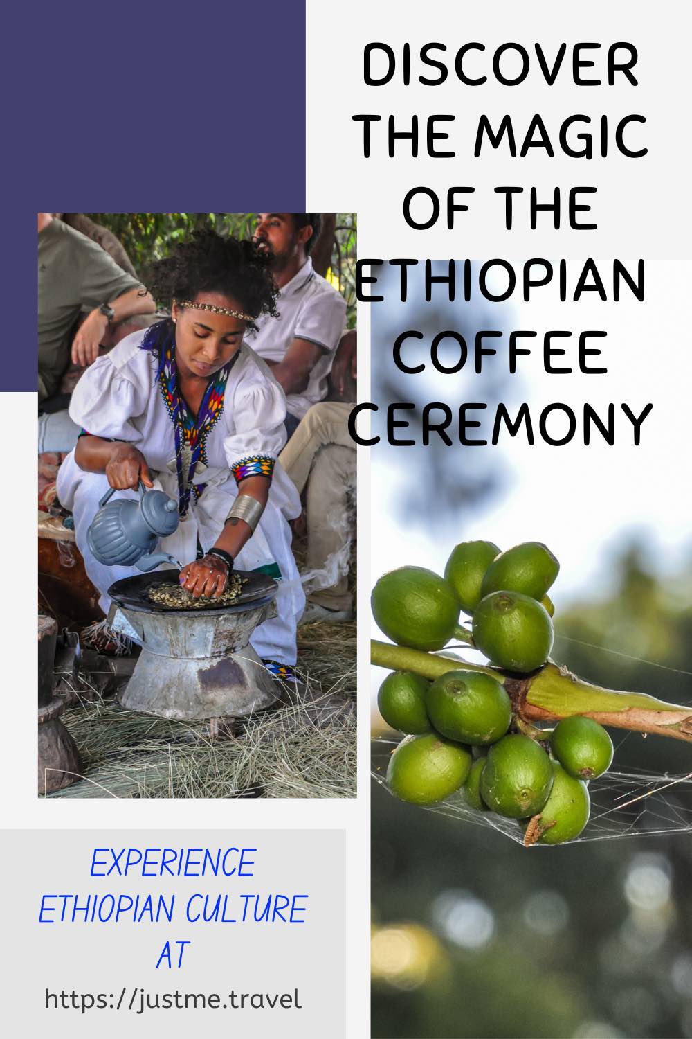

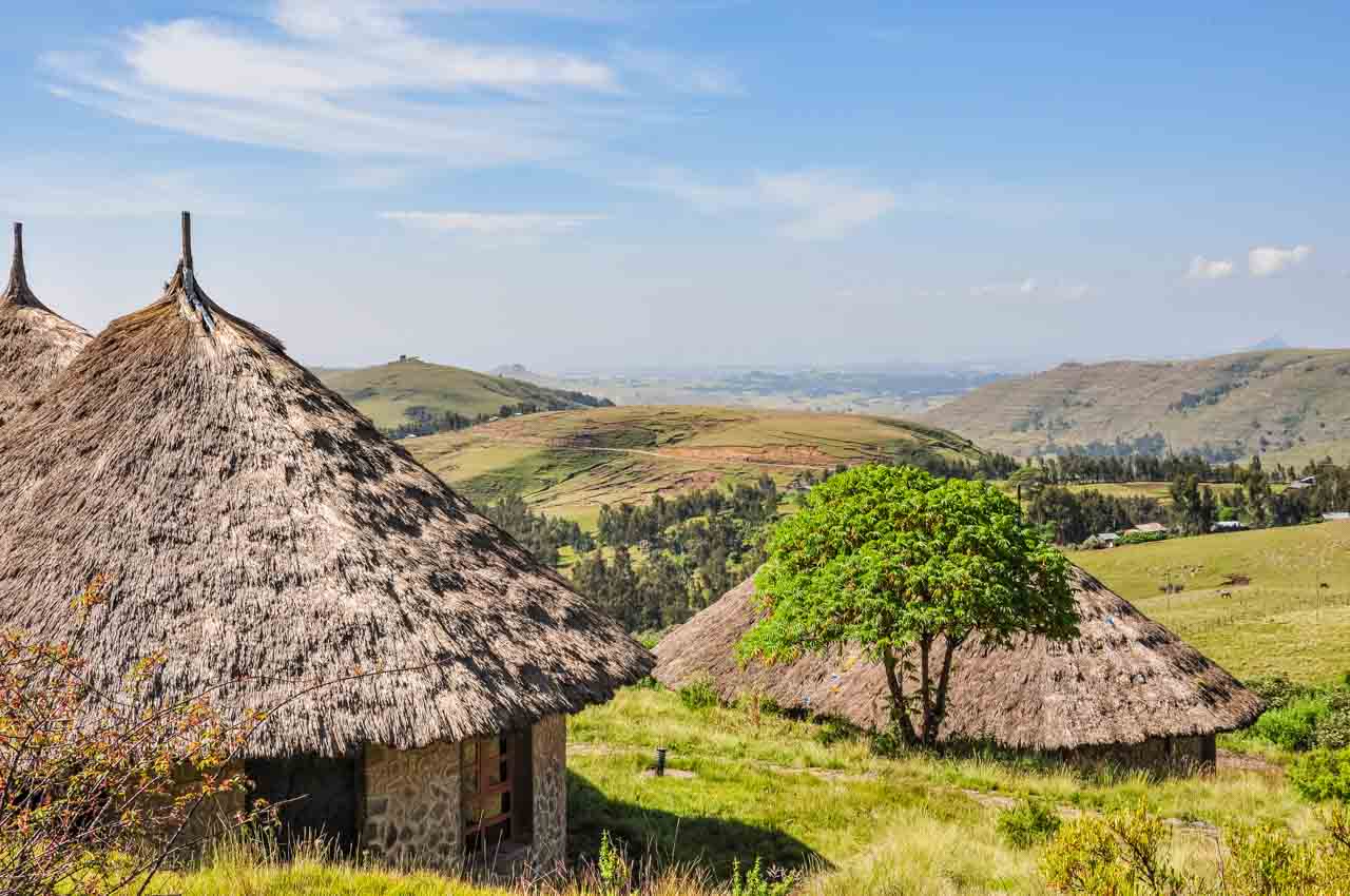 LOST IN TRANSLATION IN ETHIOPIA – Is that the heater?