So, how do you best spend your free time in Rothenburg? The short answer to this question is, WALK. Being relatively flat, Rothenburg’s Old Town is easy to walk around,…
So, how do you best spend your free time in Rothenburg? The short answer to this question is, WALK. Being relatively flat, Rothenburg’s Old Town is easy to walk around, despite the cobblestone streets. If you don’t stop to window shop, it should only take you about 15 minutes to walk from one end of town to the other.
But I am getting ahead of myself here.
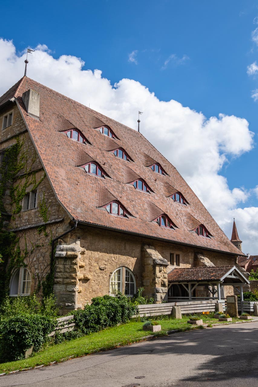
Firstly, Rothenburg is the common abbreviation for this German town’s full name; that being, Rothenburg ob der Tauber. Translated, Rothenburg ob der Tauber means, “Red Fortress above the Tauber”. Red Fortress above the Tauber is an apt name. The town is situated on a plateau above the Tauber River. While ‘Red Fortress’ – translated from rot (red) and burg (burgh, fortified settlement) – is attributed by some to the red roofs of Rothenburg’s houses inside the fortification.

‘Red Fortress’ – the red roofs of the houses behind Rothenburg’s fortifications
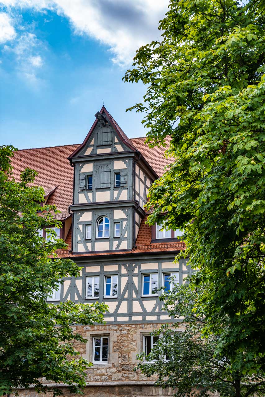
Secondly, why visit Rothenburg ob der Tauber in the first place? With its medieval architecture, narrow cobblestone streets and intact fortification wall, Rothenburg ob der Tauber is considered one of the prettiest towns in Germany. It is a medieval town frozen in time and said to be the most perfectly preserved, medieval walled city in Europe. Rothenburg ob der Tauber is one of Germany’s last remaining walled medieval towns, reached via the ‘Romantic Road’ in the Franconia region of Bavaria in southern Germany. There are photo opportunities everywhere you look.
Rothenburg ob der Tauber is 1000 years of history in the making. It was one of the largest cities in the Holy Roman Empire; survived a siege in 1631 during the Thirty Years’ War between Protestant and Catholic states in the Holy Roman Empire (1618-1648); and stagnated in 1634 due to poverty and plague. It is this latter that preserved Rothenburg in its 17th century state. But this post is not intended to be a history lesson. However, it is worth pointing out that Rothenburg survived WWII substantially intact because its historical significance was recognised and acknowledged by the invading British army. What this post does focus on is a visualisation of Rothenburg ob der Tauber. Through my photographs, I hope to arouse your senses enough to step back in time and visit this beautiful town.
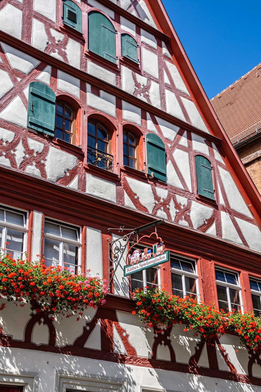
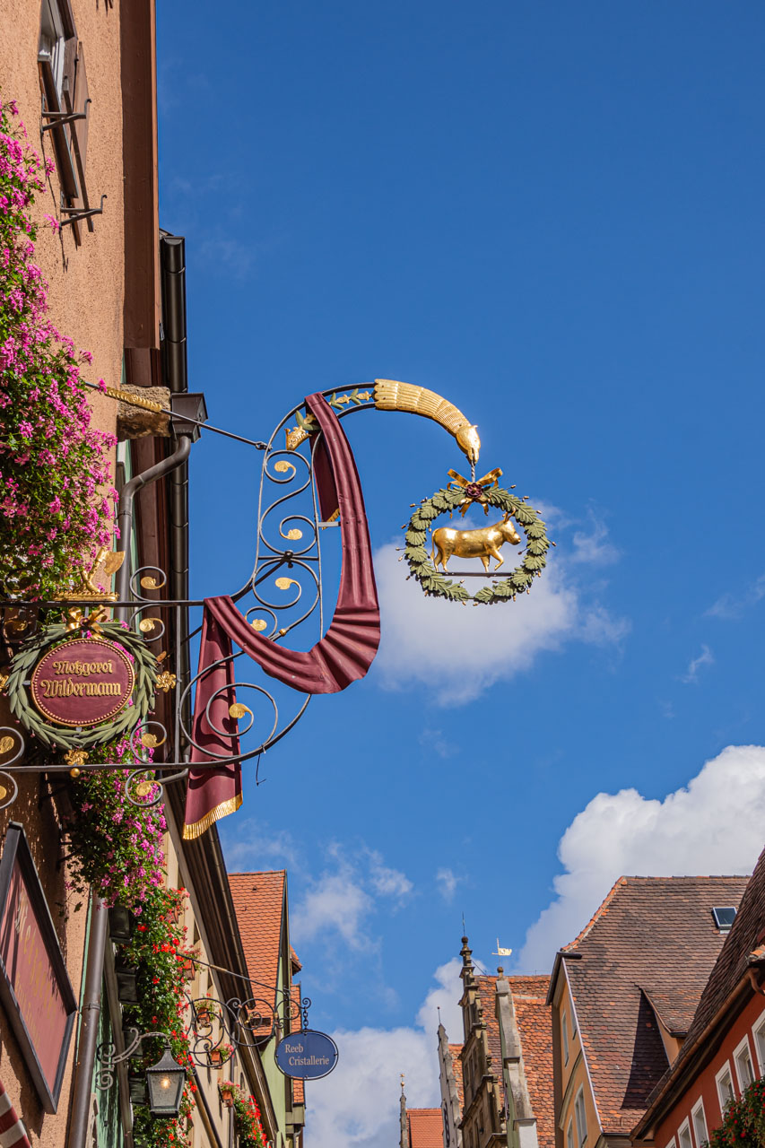
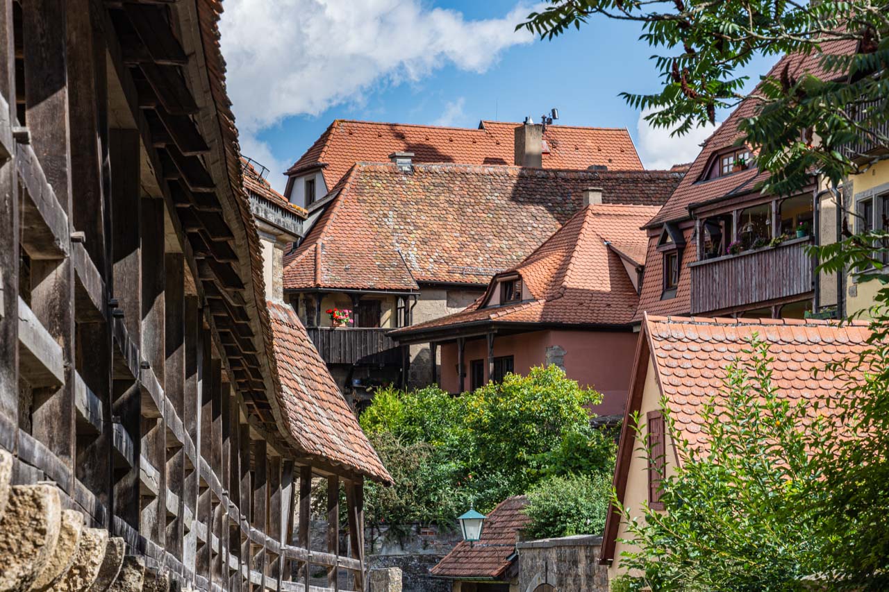
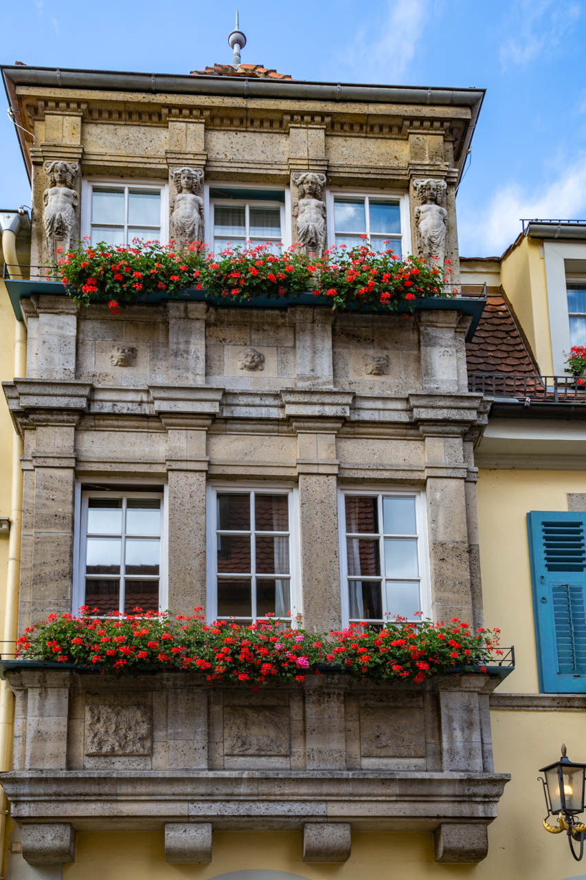
My time in Rothenburg ob der Tauber was on an optional day excursion from my river cruise when we were docked at Wurzburg, Germany. I chose this excursion because I couldn’t resist visiting a place where the Viking Cruise Documents used words like, ‘romantic’, ‘walled’, ‘medieval’, ‘preserved’, ‘inviting’, and ‘picturesque’ to describe it. I was not disappointed, and I immediately fell in love with this picture-perfect, medieval walled town. With its half-timbered houses, elaborate shop signages, and window boxes full of geraniums, every turn was a picture postcard moment.
It was a 1½ hour drive from where the ship was docked at Wurzburg to Rothenburg ob der Tauber. The drive took us along the ‘Romantic Road’. I can’t tell what was romantic about it because I slept most of the way. I believe it has something to do with being a picturesque countryside. I do know that each time I roused from my sleep it was to a view of a vineyard. Shame I slept so much!
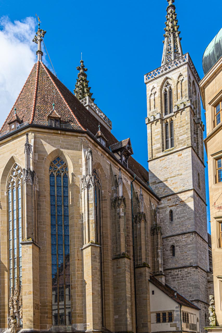
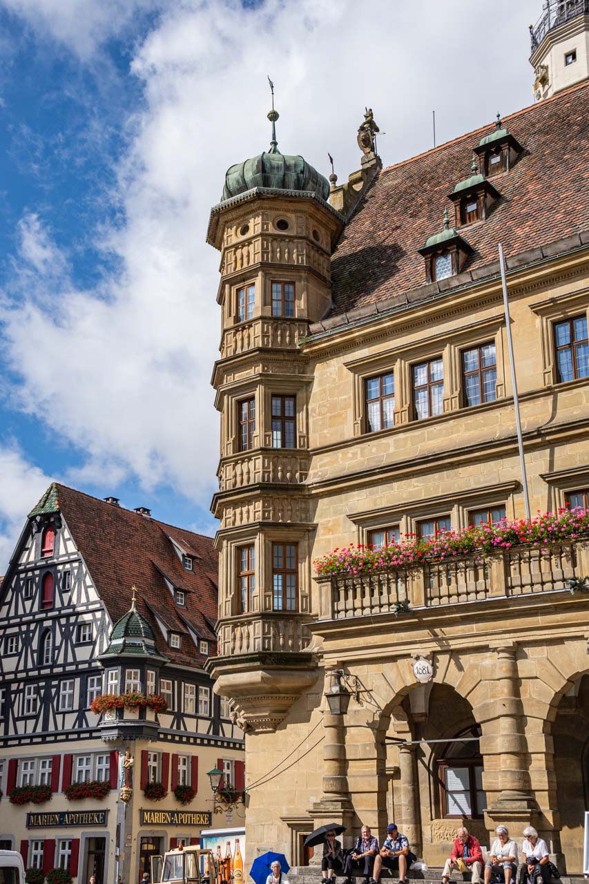
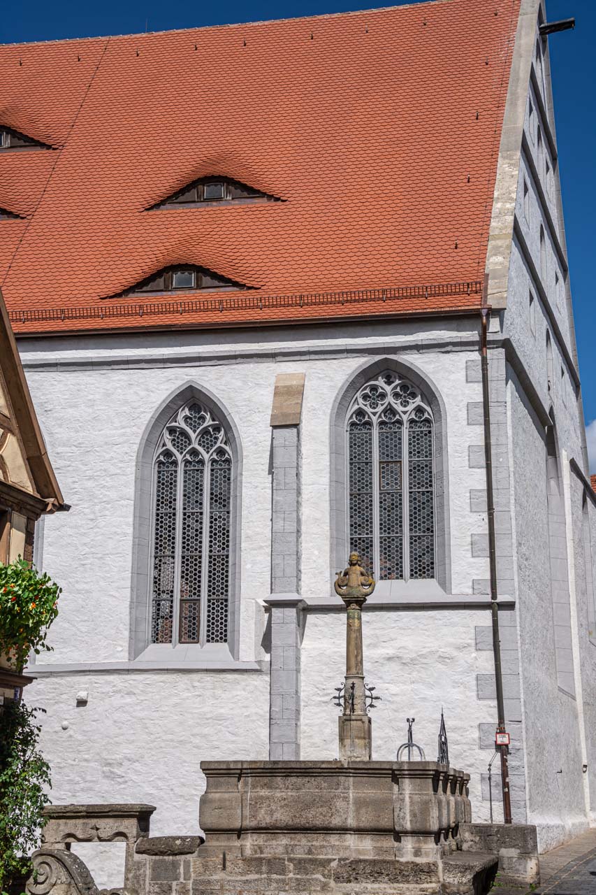
Once in Rothenburg ob der Tauber, our guide gave us an orientation walking tour; taking us past St James Church, through Market Square with its 13th century Gothic/Renaissance Town Hall, past fountains, museums and amazing architecture, explaining the relationship between shops and their signage, and ending at St John’s Church (our meeting point for lunch).
With the orientation completed, we were left to spend our free time as we pleased. I wasn’t interested in the well-known Christmas shop. And I decided to take the guide’s advice and not try the local ‘delicacy’, a Schneeball, which he described as “horrible”. This is deep-fried dough shaped like a snowball and covered in either confectioner’s sugar or chocolate. In our guide’s own words, “you will choke on a Schneeball if you don’t take a drink of water with each and every bite to wash it down”.
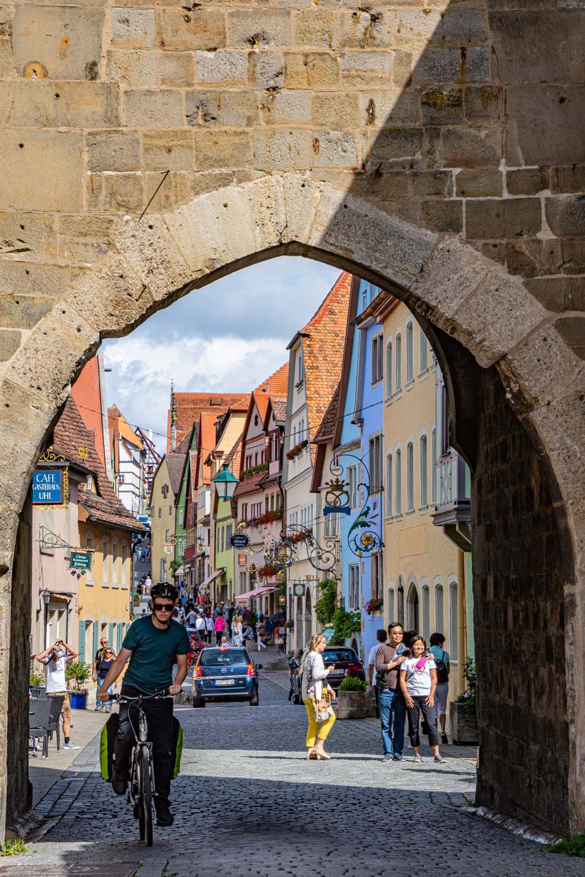
I wanted to explore and photograph my own experience; to follow the direction of my feet. And I only had 1½ hours to do this in. After pointing my feet in the direction of what the guide said is the most instagrammed photo in Rothenburg ob der Tauber, I headed for the town’s fortifications.
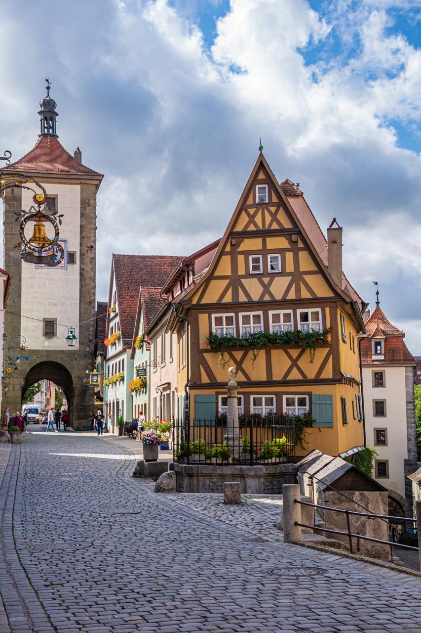
The Plonlein is the most instagrammed image in Rothenburg
I cannot fathom why this crooked, half-timbered house on Plonlein (Little Square) is the most instagrammed image in Rothenburg ob der Tauber; why it should be so photographed. I have read that it has featured in a number of movies and been the inspiration for others, but the town is full of much more interesting, charming architecture. If anyone can enlighten me, that would be appreciated. Or, better still, go check it out for yourself.
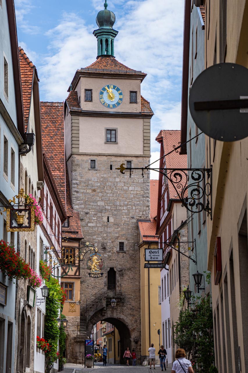
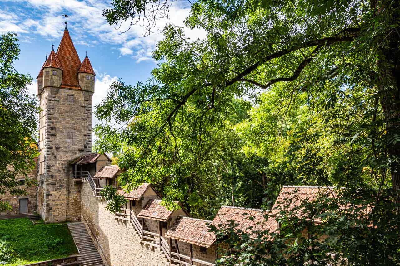
Taking the Kobolzeller Gate (built 1360) to the right as you face the half-timbered house in the ‘most instagrammed photo’, I climbed the few steps to the town’s medieval wall. Rothenburg ob der Tauber’s medieval wall, built in the 13th century, is 4 kilometres long and completely encircles the town’s historical centre. Walking along the wall, there are 6 gates and 42 towers to explore. With my limited time, I only managed 2 gates (up through one gate and down through the next) and a handful of towers. Despite all the tourists in town, I had the wall to myself – a very pleasant experience.
Coming off the wall, I proceeded to walk in a large circle that took me back to Market Square.
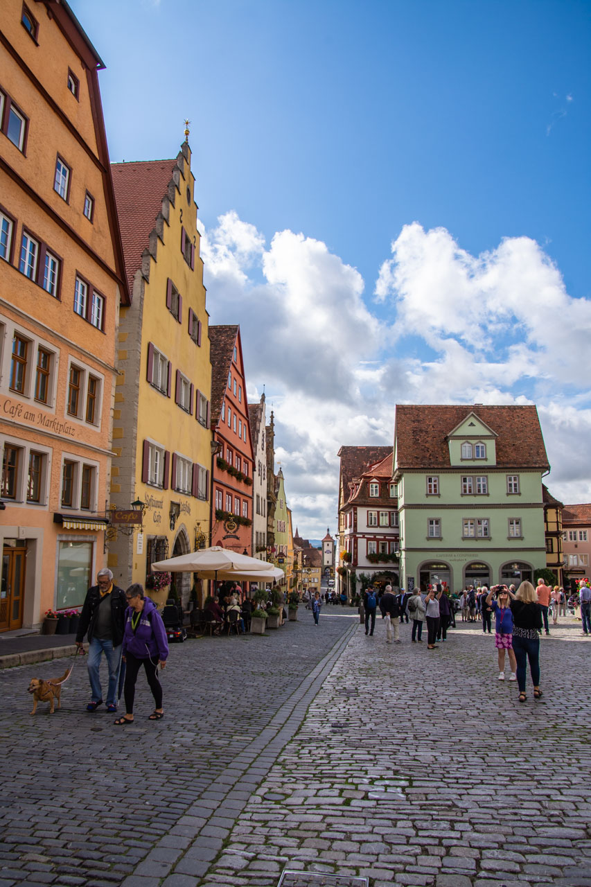
I was back in Market Square in time for when the clock on the 14th century Councillor’s Tavern performs its hourly ritual. Our guide had informed us that on the hour between 10.00am and 10.00pm two doors open on either side of the clock face. Out comes Rothenburg’s former Mayor, Nusch, and the Catholic General, Tilly, who challenged Nusch to drink a gallon tankard of wine in one go without stopping to save the town during the Thirty Years’ War. And save the town he did! It’s not the most interesting mechanical clock I have seen on my travels, but I did like the story behind it – the “Legend of the Master Draught”.
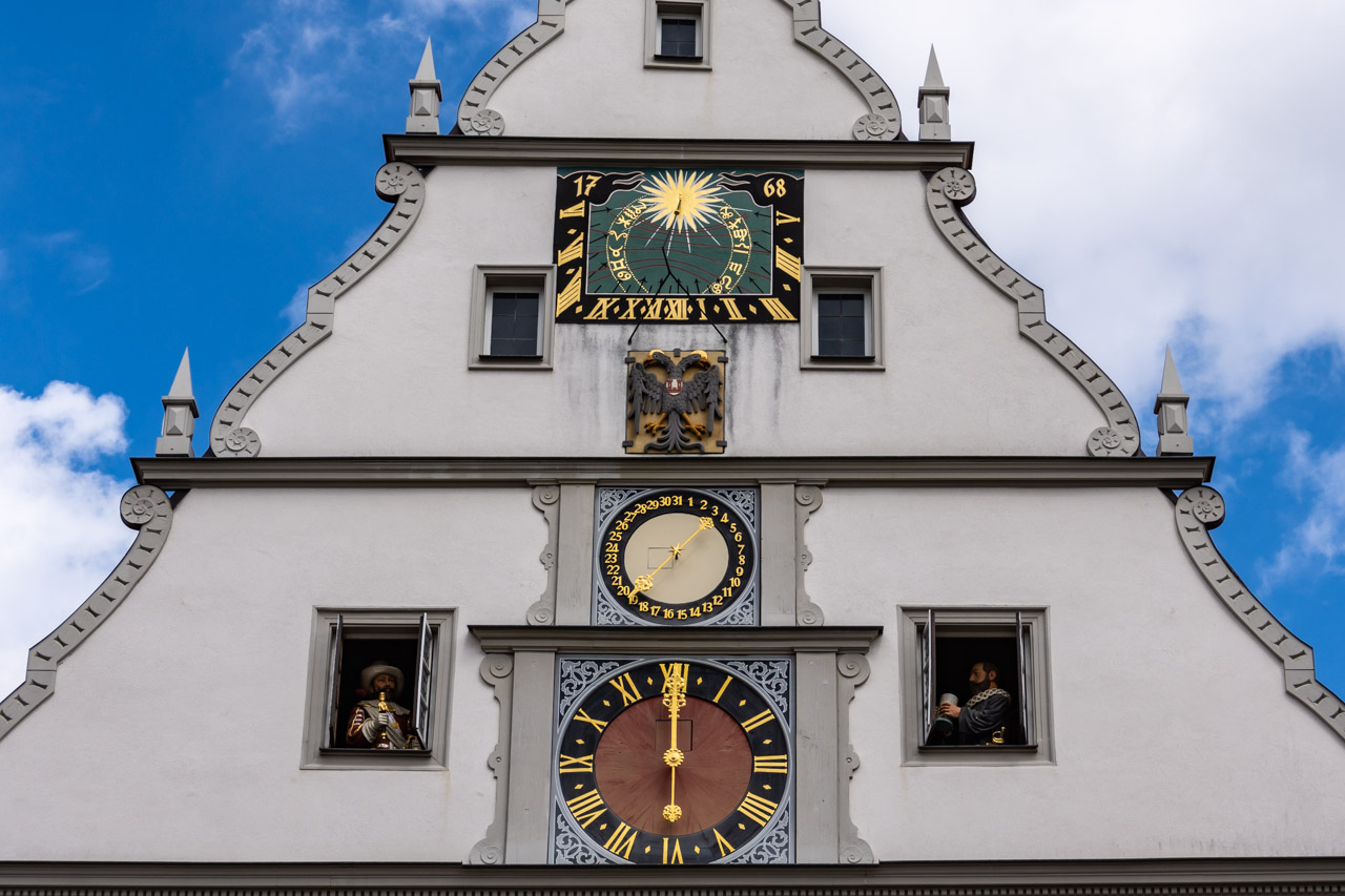
The “Legend of the Master Draught” mechanical clock on the Councillor’s Tavern
I have to go back to Rothenburg ob der Tauber:
- to visit the gardens that replaced Rothenburg Castle which was destroyed in an earthquake in 1356;
- to visit the Medieval Crime and Justice Museum;
- to hike down into the valley;
- to climb the Town Hall Tower to see the views for myself rather than just read about them;
- to check out the interior of St James Church and its famous Holy Blood altarpiece;
- to sit in a cafe in Market Square and people-watch;
- and much more
I reckon this will take me 2 to 3 days (at least).
Rothenburg ob der Tauber, I will see you again.
Disclaimer: This post contains no affiliate links. All views and opinions are my own and non-sponsored. All photos are my own and remain a copyright of Joanna Rath.
No Comments on HOW BEST TO SPEND YOUR FREE TIME IN ROTHENBURG