Mountains, Museums, and Medieval Magic: Catalonia Unveiled Through Unforgettable Day Trips for Every Traveller. Welcome to my travel blog, where I am excited to share with you exceptional day…
Mountains, Museums, and Medieval Magic: Catalonia Unveiled Through Unforgettable Day Trips for Every Traveller.
Welcome to my travel blog, where I am excited to share with you exceptional day trips beyond the streets of Barcelona. Join me as I recount my unforgettable experiences on five diverse and awe-inspiring tours from Barcelona. From towering mountains to rugged coastlines, from quaint medieval villages frozen in time to the birthplace of Surrealism, these five exceptional tours take you to another world of Catalonian beauty and wonder.
Catalonia’s diverse landscapes offer a diversity of experiences. Embarking on day trips from Barcelona opens up a world of exploration, where each destination promises its unique blend of history, culture, and natural beauty. Whether you’re drawn to the spiritual heights of Montserrat, the sun-kissed shores of Costa Brava, the timeless charm of medieval villages, the rugged grandeur of the Pyrenees, or the artistic legacy of Salvador Dali, there’s a world of exploration waiting to be uncovered. Catalonia’s day trips have something for everyone!
The 5 Day Trips
- Day Trip from Barcelona to Montserrat
- Day Trip from Barcelona to Figueres
- Day Trip from Barcelona to Costa Brava
- Day Trip from Barcelona to Medieval Villages
- Day Trip from Barcelona to the Pyrenees
Day Trip from Barcelona to Montserrat
Tour: Montserrat Visit with Ascent by Cogwheel Train
Tour Operator: Julia Travel
Duration: Full day – 11.5 hours
Cost: AUD140.00
I booked this tour from Australia before leaving for Spain.
Julia Travel promotes this small group trip as discovering “one of the most mystic Catalan wonders”.
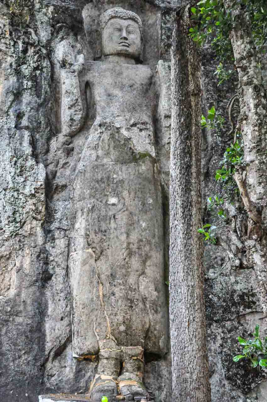
Montserrat Monastery is an 11th-century Benedictine monastery on Montserrat Mountain (meaning ‘serrated mountain’), 60 kilometres northwest of Barcelona. The monastery hangs onto the side of the mountain 725 metres above sea level.
About 80 monks reside at the monastery, which is famous for the Black Madonna statue in the basilica and one of the oldest boys’ choirs in Europe.
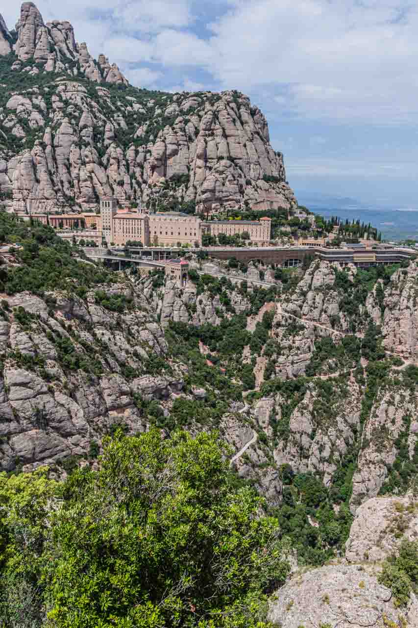
Montserrat Monastery perched on the side of the mountain.
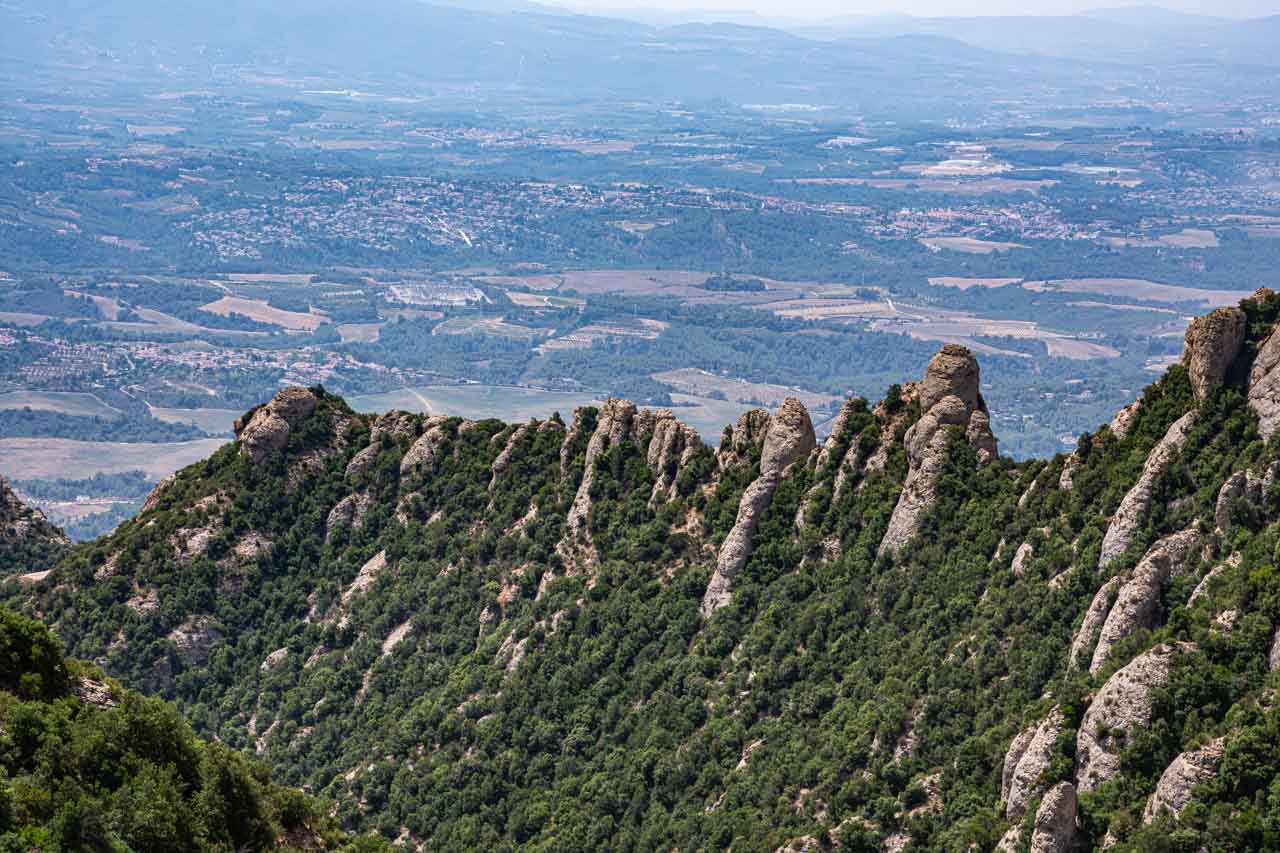
I took this photo of Montserrat Monastery across the valley at the Cross of St Michael.
The tour as I experienced it:
There were five of us on the Montserrat full-day tour, plus the guide. We travelled on the bus from Barcelona to Montserrat with the morning-only tour participants, separating into two groups (morning-only group and full-day group) on arrival at Montserrat Abbey.
An hour after leaving Barcelona, we arrived at the rack railway (also referred to as the Cremallera) at the bottom of Montserrat Mountain in the small town of Monistrol de Montserrat for the cogwheel train ride up the mountain to the centre of the Monserrat Monastery complex. The five-kilometre, 15-minute ride provided fantastic views of this unusual mountain. As you leave the train, pause to take in the views of the mountain that towers above the monastery and basilica and the deep valley below.
The morning was spent with our tour guide, learning about the monastery, visiting the basilica and Black Madonna, and watching a short documentary about the monastery’s world-famous Boys’ Choir (L’Escolania).
We could not see the Boys’ Choir perform in person as the boys were on school holidays.

The Atrium (open courtyard) in front of the Basilica and front facade of the Basilica.
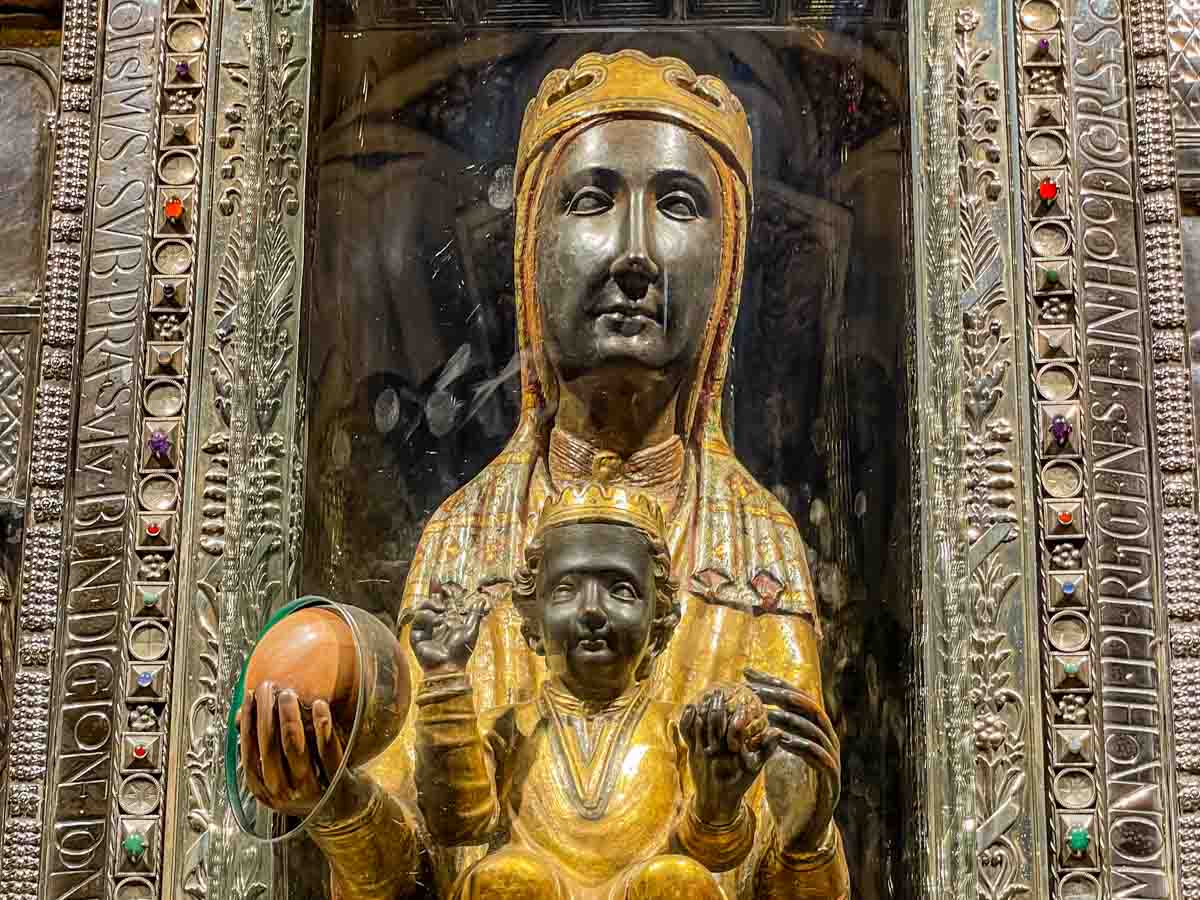
The Black Madonna inside Montserrat Basilica.
The famous Black Madonna wooden statue sits behind glass at the back of the church above the high altar. We joined the queue of pilgrims and tourists to file past the Black Madonna, where many stopped to touch her hand through a cut in the glass.
According to our guide, the Madonna’s face is black due to a botched restoration in about the 12th century when the wrong varnish was used, turning her face black. It was decided to leave her face black, with locals saying that maybe the Madonna wanted a black face. However, historical descriptions of the Madonna say she has simply darkened over time. This latter theory makes more sense, given that the face of the baby Jesus sitting on Madonna’s lap also appears black.
The guided morning tour ended at 12.10 pm, and we were free to spend the rest of the day as we pleased, meeting again at 6.15 pm for the bus trip back to Barcelona.
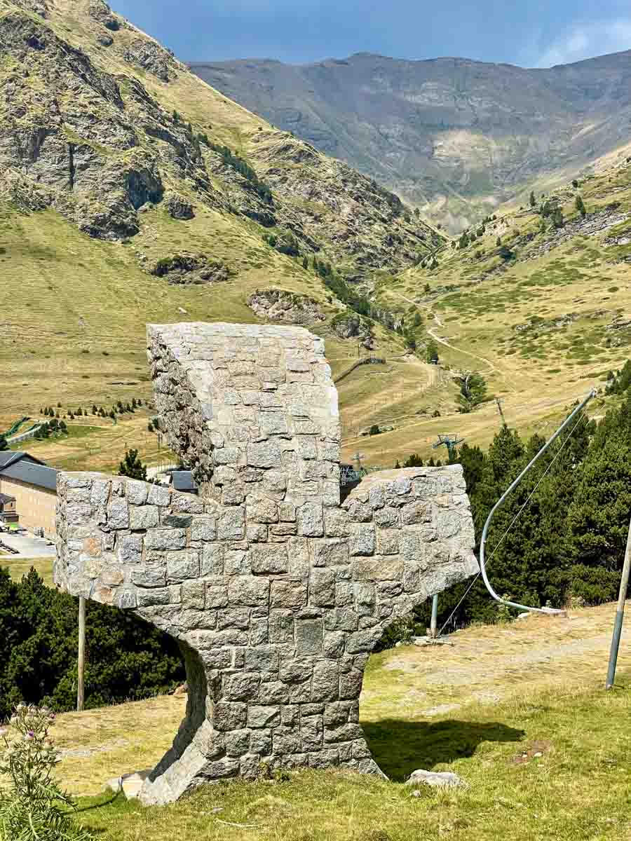
With the afternoon free, I was eager to take a walk on Montserrat Mountain, starting at the top and walking down. To do this, I rode the Funicular de Sant Joan from Montserrat Monastery to the summit of Montserrat Mountain, about 300 metres above the monastery. I took the path to the left of the Funicular station that wound around and down the mountain to the Cross of Saint Michael (Sant Miquel)) and back down to the monastery.
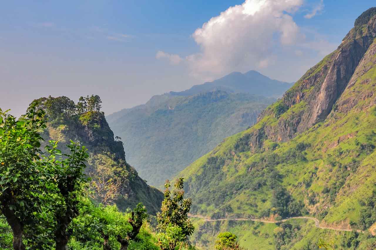
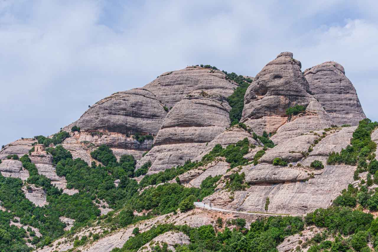
The signpost at the beginning of the path indicated it was a 40-minute walk to the Cross of Saint Michael. The Cross was about one and a half hours into my very steep descent down Montserrat Mountain, and I still had about 20 minutes to go before I arrived back at the monastery. But I was in no hurry as I took in the spectacular views of Montserrat Mountain’s unique geological (‘serrated’) formation and the valleys and river below.
View from Montserrat (‘serrated’) Mountain.
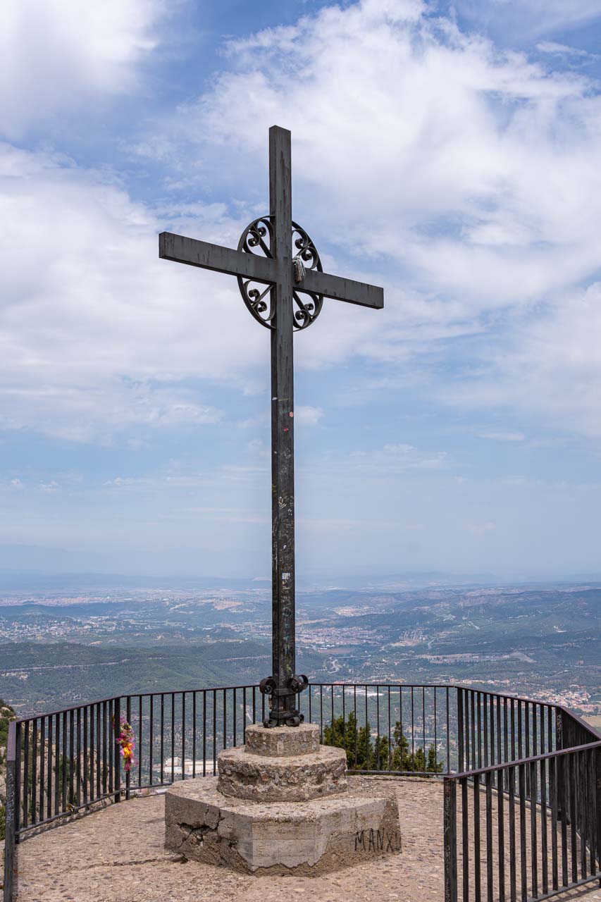
Cross of Saint Michael and the valley below
While the walk down the mountain was not technically demanding (it’s a paved path nearly all the way), I did find the steep descent challenging. There were times when the decline was so steep my back was almost vertical to the path. The heat was another challenging factor. I’m sure I was on that mountain on its hottest day ever recorded!
Back at Montserrat Monastery, I had a late lunch at the cafeteria – a buffet that cost €19,50 and was not worth the money.
My tour review / final thoughts:
According to their website, Julia Travel no longer offers the full-day Montserrat tour from Barcelona that I did. Instead, they offer a morning (5.5 hours) and afternoon (4.5 hours) tour with the cogwheel train at €59 and €51, respectively.
Having done both the morning and full-day tours a few weeks apart, I believe a half-day tour does not allow time to immerse yourself in the beauty of the mountains where the monastery sits. While visiting the abbey and basilica and learning their history was interesting, the highlight for me was the walk on Montserrat Mountain. It would be a shame to miss out on one of the several walks you can take around Montserrat.
The Sant Jeroni walking trail on Montserrat Mountain
There was a communication issue with Julia Travel on this tour. Arriving in Montserrat, the guide sent us to grab a coffee as she was trying to contact Julia Travel to organise our entrance tickets into the basilica and the Black Madonna, delaying the start of the tour by half an hour. Then, when it came to leaving Montserrat, Julia Travel forgot there were five of us doing the full-day tour and supposedly leaving on the same bus as the afternoon tour. However, 50 people were on the afternoon tour, and it was a 50-seater bus. Consequently, we (the five full-day tour group) were taken off the bus and had to wait for another bus from Barcelona to come and get us. So, instead of leaving Montserrat at 6.15 pm, we left an hour later, arriving back in Barcelona at 8.10 pm. Luckily, it wasn’t dark as I had a 35-minute walk back to the hotel, and people were only starting to come out for dinner in restaurants then.
I found Julia Travel’s communication a repetitive problem. I had booked another tour with Julie Travel to Salvador Dali’s Theatre-Museum and Villages – a tour I was particularly keen on taking. However, arriving at 8.00 am at Julia Travel’s office on the day of the tour, I learned it had been cancelled. I received an apology for not being informed and a refund. However, this was not good enough and amounted to unacceptable customer service.
The setting alone makes Montserrat Monastery worth a visit. But it was the mountain walk that made this tour memorable for me.

Llobregat Valley and River taken from Montserrat Mountain
Day Trip from Barcelona to Figueres
Tour: Salvador Dali Museum, Figueres and Cadaques Small Group Trip from Barcelona
Tour Operator: Explore Catalunya
Duration: Full day – 11 hours
Cost: €99,00
Explore Catalunya promotes this small group trip as the “Best tour for Dali enthusiasts, and you’ll see hidden treasures off the beaten path”.
The summer schedule for this day trip (1st July – 14th September) does not include the coastal village of Cadaques, which is included in the winter tour schedule. Instead, the summer schedule takes you to Gala Dali’s Castle in Pubol. I was on the summer schedule day trip.
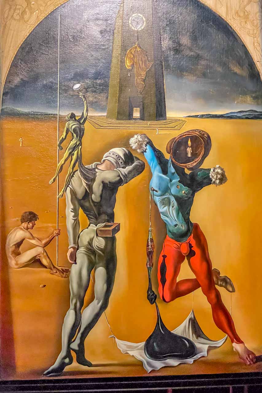
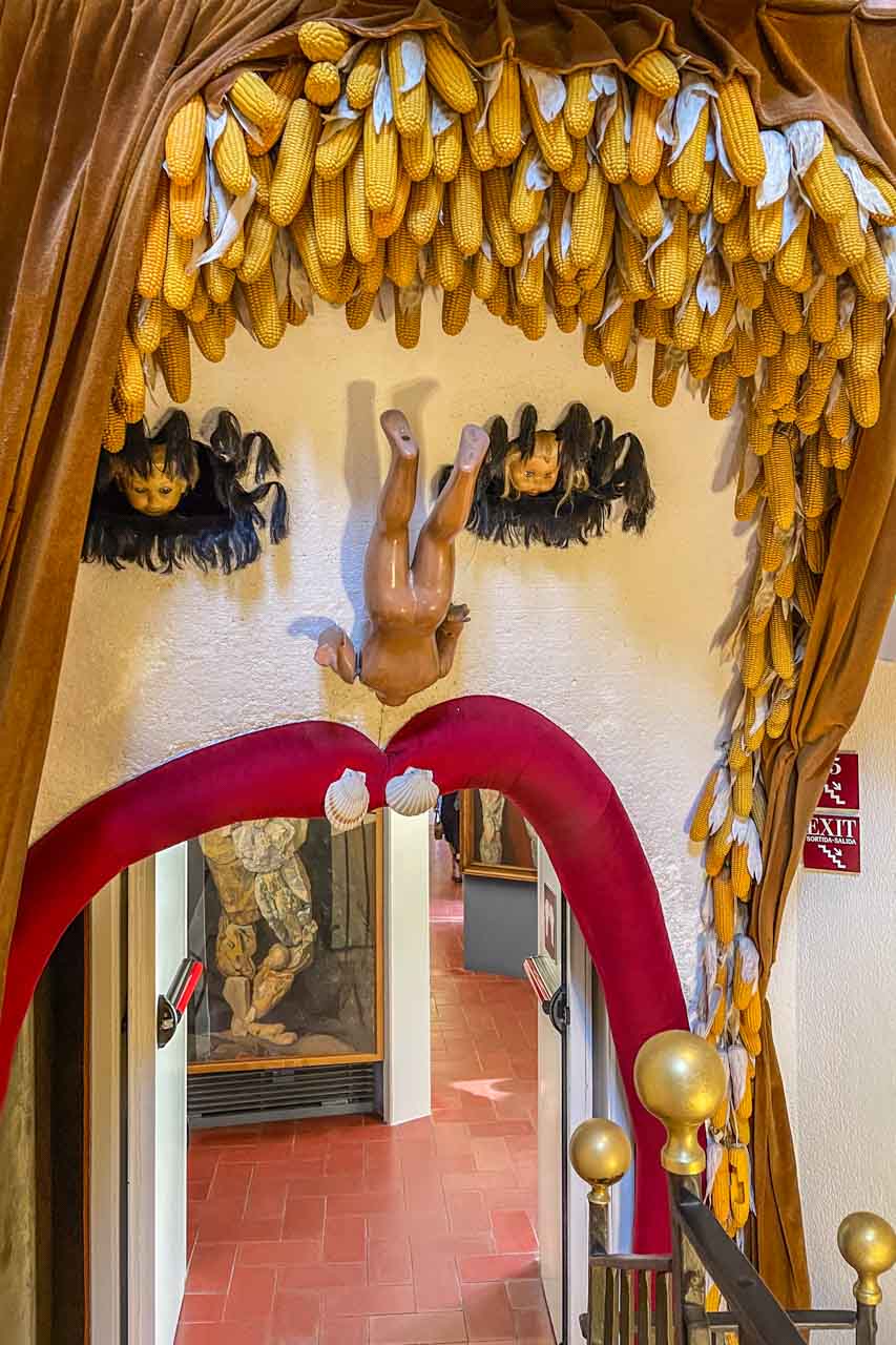
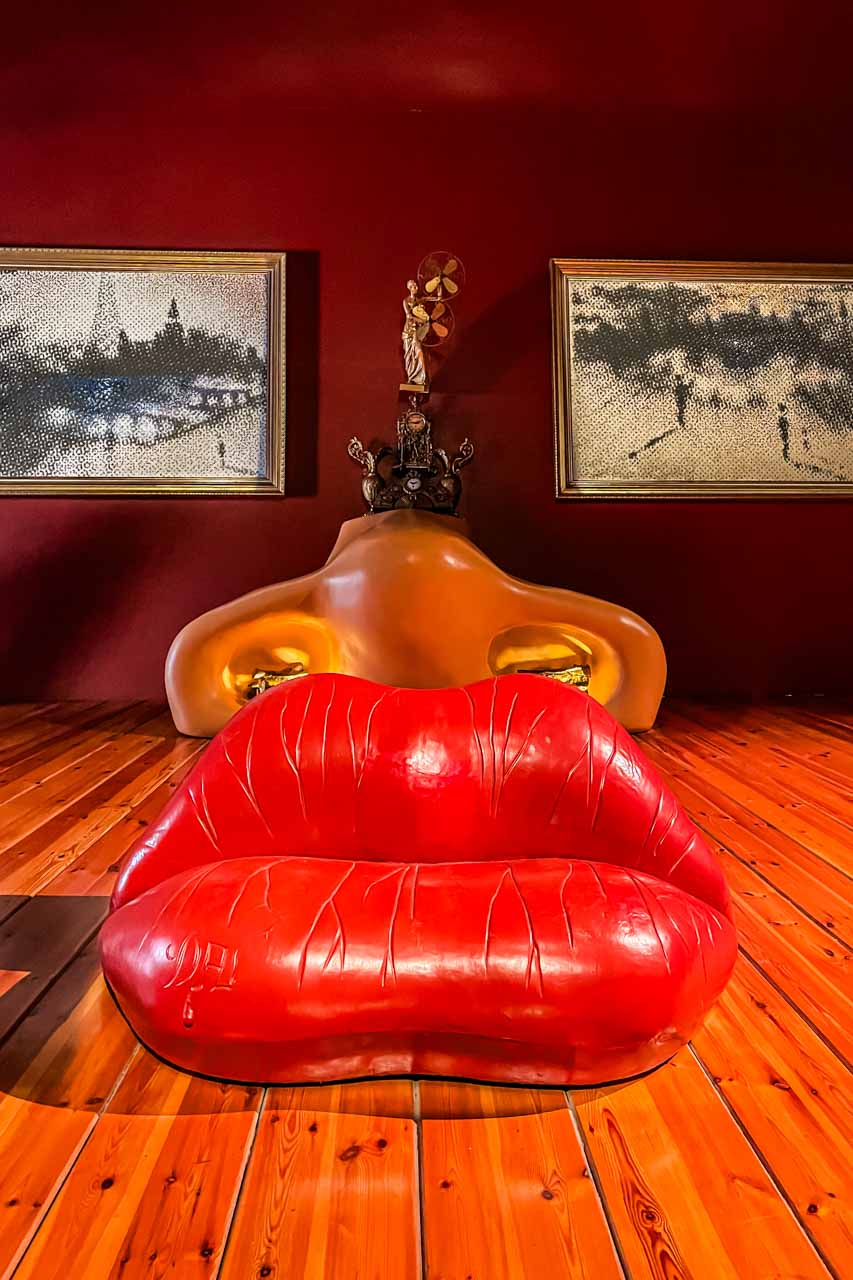
Near the border with France and about 136 kilometres north of Barcelona, Figueres is famous for being the birthplace of the artist Salvador Dali, an artist I have been a fan of for many decades. It is also home to his world-famous Theatre and Museum.
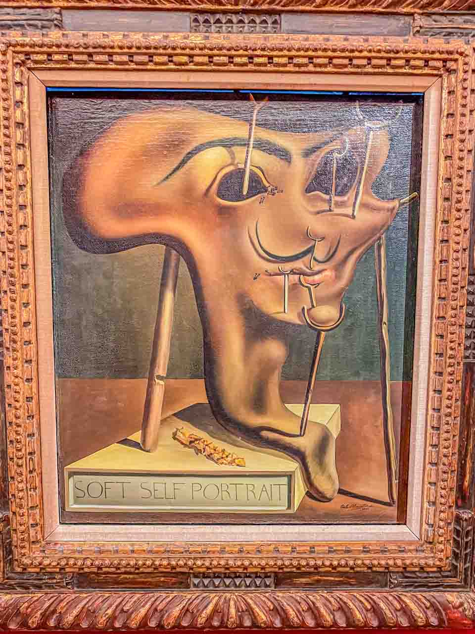
The Dali Theatre-Museum is a museum dedicated solely to the Spanish artist Salvador Dali, a genius of Surrealism. Built by Dali, it is considered the world’s largest surrealist object and is crowded with his artworks – paintings, sculptures, photographs, and jewellery.
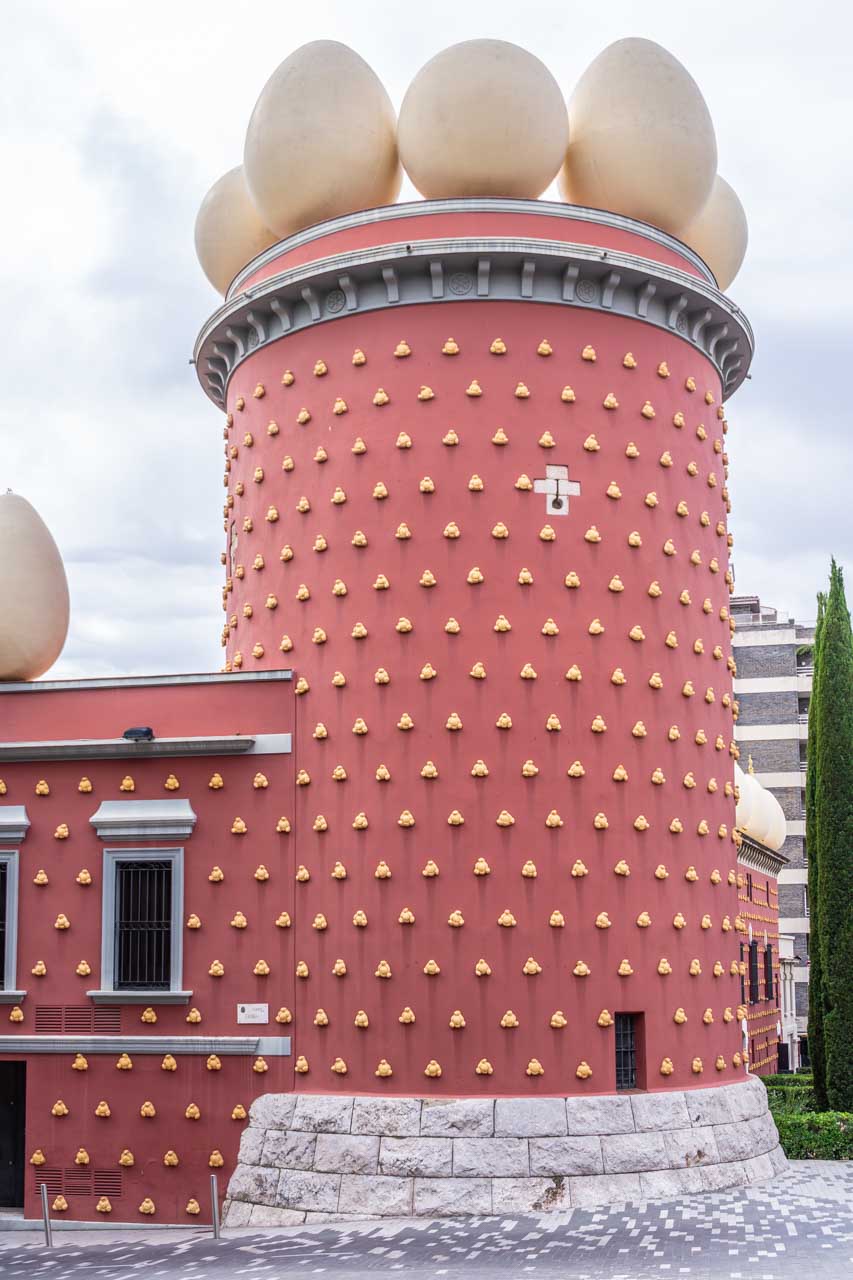
Dali is buried in a crypt beneath the dome of his Theatre-Museum.
The tour as I experienced it:
On arrival in Figueres, we headed to the world-famous Dali Theatre-Museum for a half-hour guided tour with our Explore Catalunya guide. Following the guided tour, we had one and a half hours of free time to explore the three floors of the Theatre-Museum for ourselves.
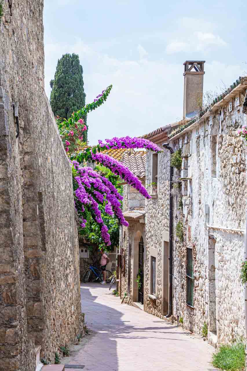
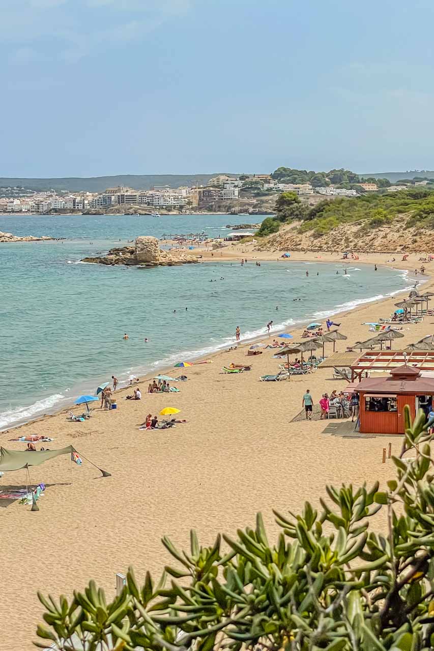
After leaving Figueres at 12.45 pm, we drove a short half-hour to the pretty, seaside medieval village of Sant Marti d’Empuries on the Costa Brava. Here, we were given two hours of free time for lunch, to explore, or to take a dip in the Mediterranean Sea.
I had a delicious salad at L’Escalapi Restaurant and Pizzeria – a Goat’s Cheese Salad with lettuce, tomatoes, goat’s cheese, walnuts, pine nuts, sultanas, and mustard and honey dressing. Spain does salads so well! I followed up my salad with Sugar and Lemon Crepes. The total cost for lunch was €20 (AU$33).
I walked off lunch by wandering around Sant Marti d’Empuries, admiring its medieval buildings and checking out the beach – a lovely spot to stay a while.
Our last stop for the day was Gala Dali’s Castle in the tiny village of Pubol. The castle is the house Salvador Dali bought for his wife. Salvador didn’t live here until after Gala’s death and had to be invited by Gala to visit.
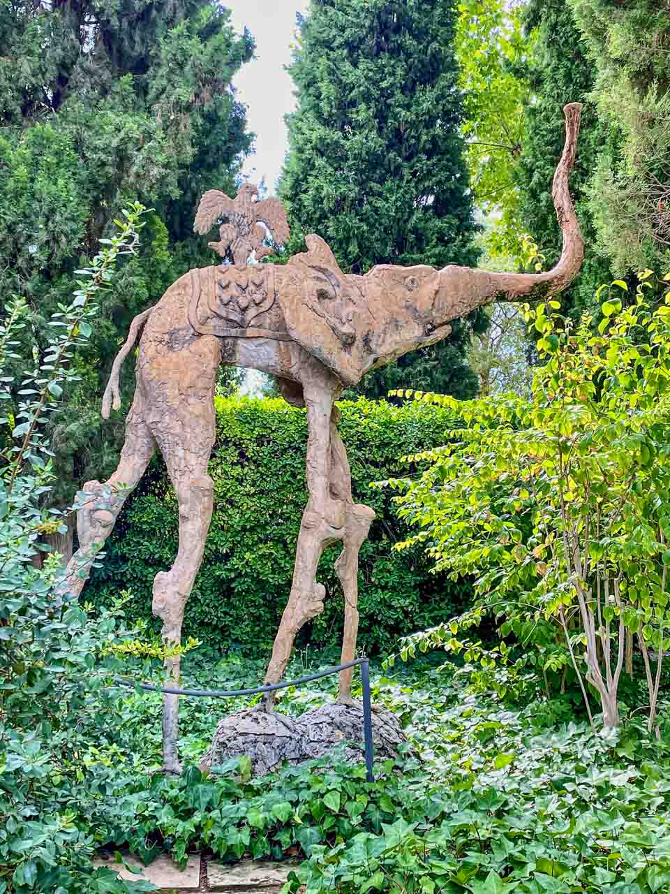
We were given a half-hour guided tour inside the castle and half an hour of free time to explore its gardens. According to our guide, Gala wanted to design the interior herself, but there is substantial Salvador Dali influence (artworks) inside the castle and its grounds. I particularly loved the Dali sculptures of long-legged elephants in the gardens.
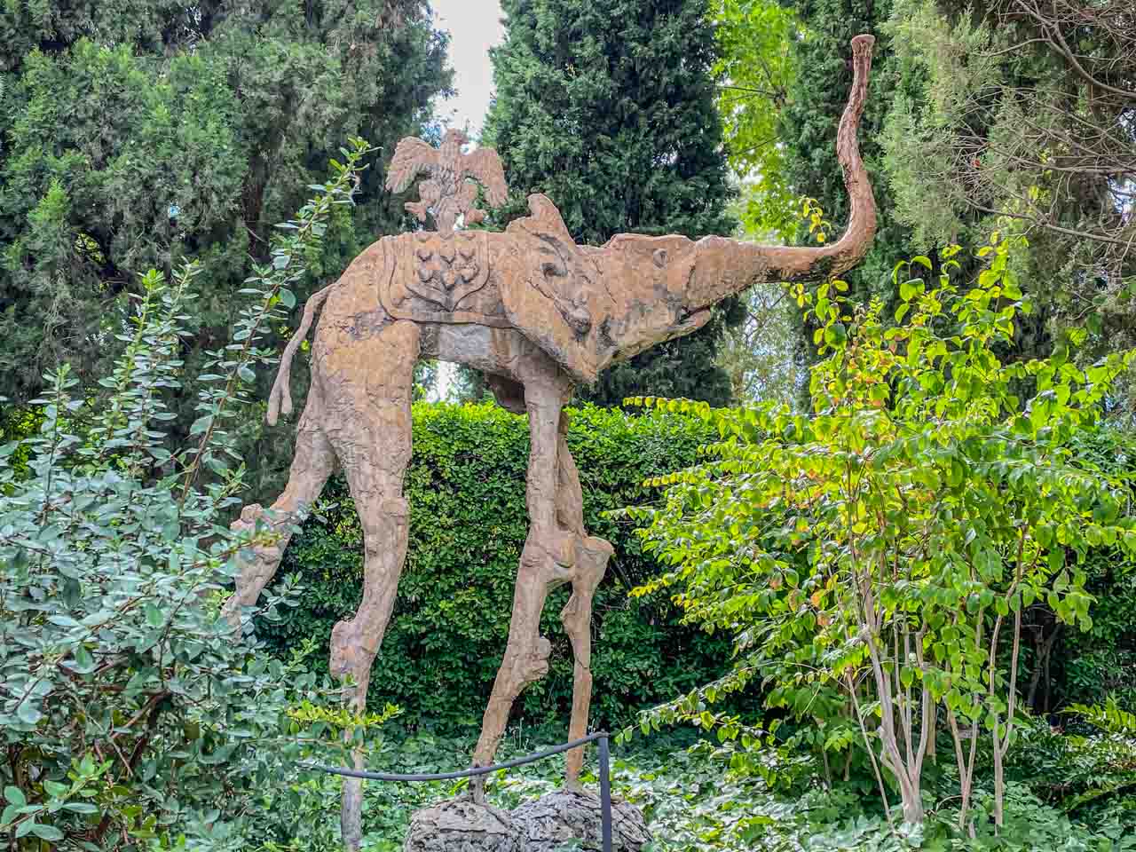
There’s an elephant in the garden!
Gala is buried in the crypt designed by her husband in the castle’s basement.
Leaving Pubol at 5.00 pm, we arrived in Barcelona at 6.45 pm.
My tour review / final thoughts:
I have been a fan of Salvador Dali for many decades, and visiting his Theatre Museum was on my bucket list as soon as I started planning my trip to Spain. And I wasn’t disappointed! As I viewed his works over three floors, I got a glimpse into his unique world and learned so much about the evolution of his artistic styles.
My only criticism of the two hours allocated in the Dali Theatre-Museum is that it wasn’t long enough. Viewing artworks should be a relaxed experience, but I felt rushed as I wanted to take in as much as possible. It also didn’t give me time to view the jewellery Dali designed for his wife or to visit the museum shop, where I had hoped to buy a book on Salvador Dali.
Here’s some trivia: Dali designed the Spanish lollipop Chupa Chups logo. I never knew Chupa Chups were Spanish! Perhaps I need to attend more trivia nights because the question of who created the Chupa Chups logo is, apparently, frequently asked.
Explore Catalunya must ensure the full tour description reflects the actual tour itinerary. Their detailed summer schedule full tour description maintains that Platge de Castell would be our last stop after Gala Dali’s Castle before returning to Barcelona. However, we never visited Platge de Castell, “one of those rare hidden corners you can still find on the Costa Brava”. Instead, we visited Sant Marti d’Empuries on the Mediterranean coast before heading to Gala’s Castle. I can’t say I was disappointed as I knew nothing about Platge de Castell, and Sant Marti d’Empuries was an enchanting village that I thoroughly enjoyed exploring.
I booked this tour because I wanted to see as much as possible about Salvador Dali that was available at the time. As such, I was pleased Explore Catalunya included Gala Dali’s Castle in the tour. I must admit, I found Gala’s home uninteresting but did enjoy wandering through the castle’s grounds. The hour at Gala Dali’s Castle was more than sufficient time to see everything there was.
Day Trip from Barcelona to Costa Brava
Tour: Costa Brava Small Group Tour from Barcelona
Tour Operator: Explore Catalunya
Duration: Full day – 10 hours
Cost: €105,00
Explore Catalunya promotes this small group trip as being transported “to one of the most breathtakingly beautiful stretches of coastline in the whole of Europe – the Costa Brava”.
The Costa Brava is a coastal region of Catalonia on the Mediterranean Sea in northeastern Spain. It stretches from Blanes, a city 60 kilometres northeast of Barcelona, to the French border.
The tour as I experienced it:
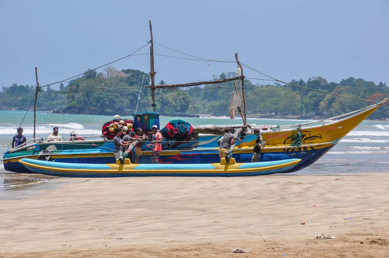
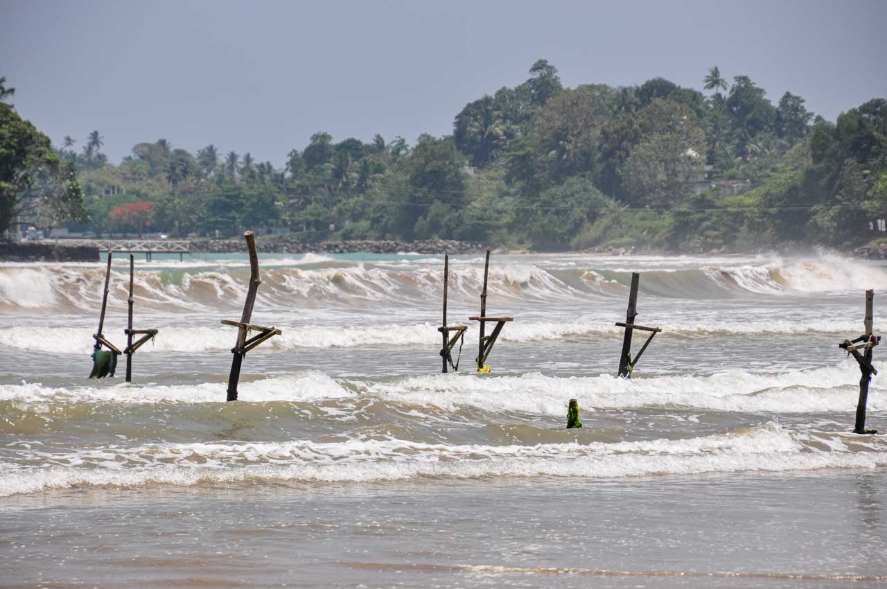
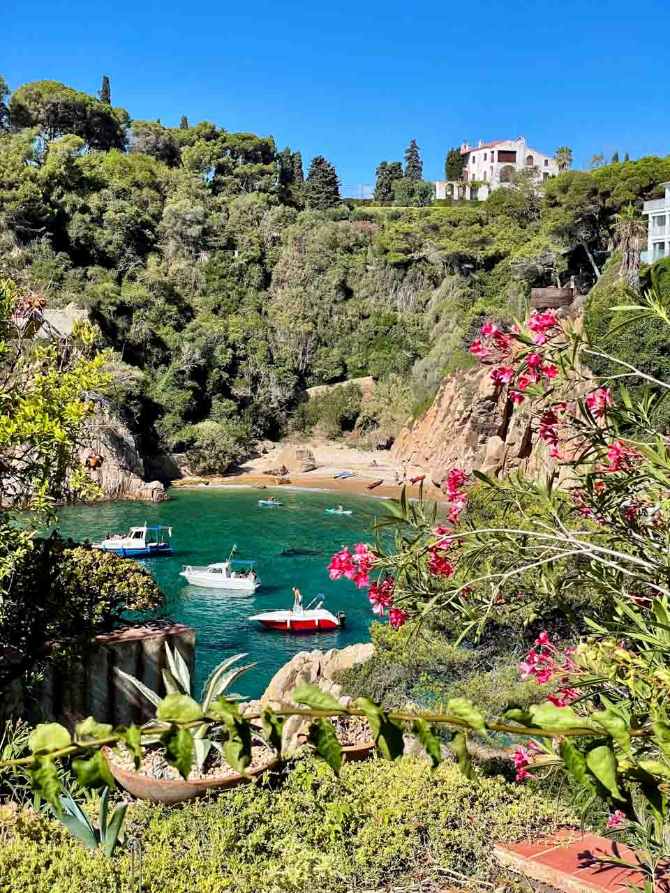
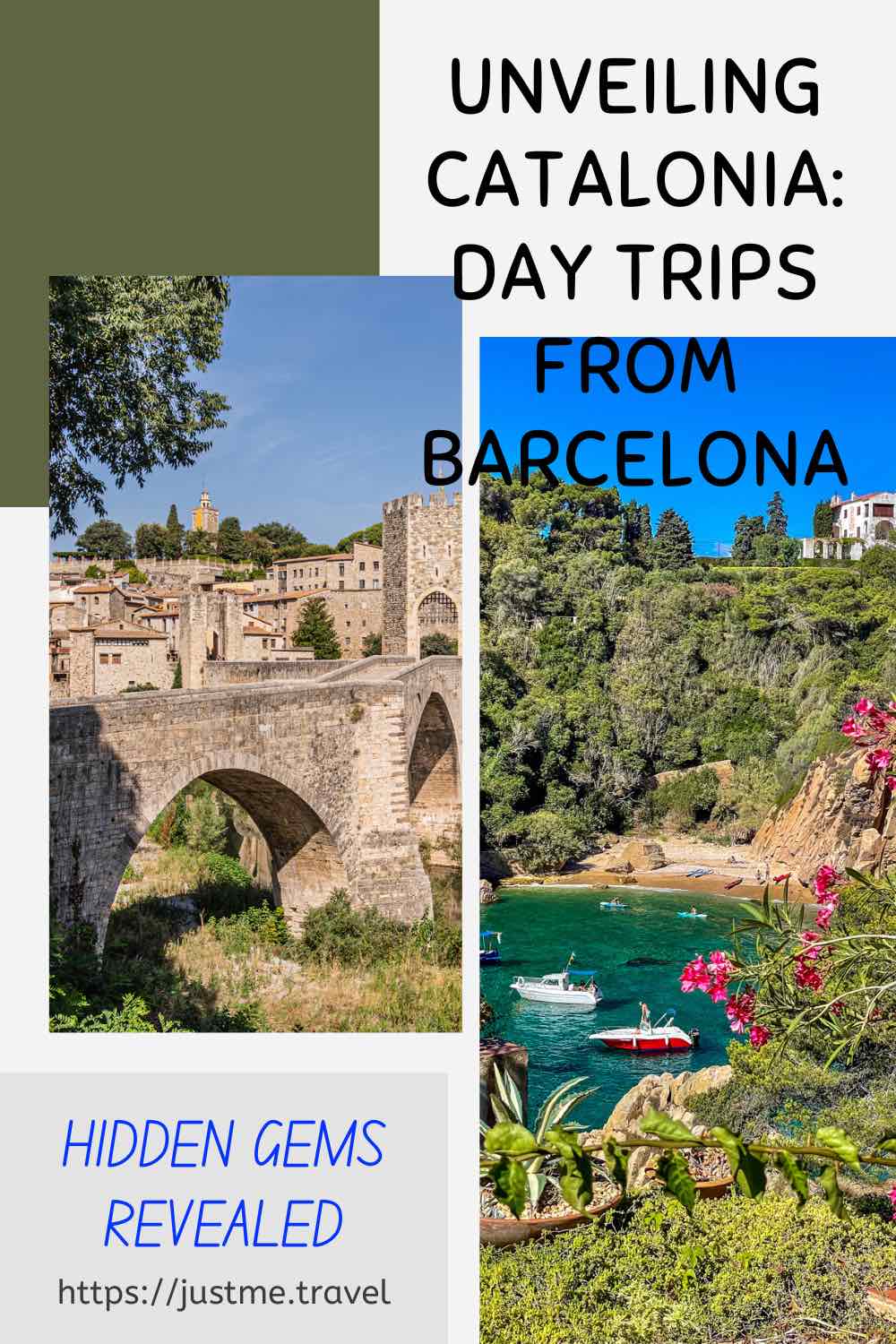
About an hour’s drive from Barcelona, we arrived in Blanes – the gateway to Costa Brava. We didn’t stop in Blanes (a city of nearly 50,000 people) but drove straight to Cala Sant Francesc – a picturesque small cove with yellow sand and turquoise waters.
Alighting from the bus on the hill above Cala Sant Francesc, our guide gave us the option to spend our two hours’ free time at the beach or walking around the nearby Marimurtra Botanical Garden. I chose the Botanical Garden, described as one of the most beautiful gardens on the Mediterranean.

Marimurtra Botanical Garden
Marimurtra Botanical Garden is situated on the top of a cliff, providing stunning views of the picturesque Costa Brava with its white sand coves, crystal clear turquoise and aqua waters, and rugged coastline.
Leaving Cala Sant Francesc at 12.30 pm, we headed for lunch at a family-owned typical Mediterranean restaurant outside of Blanes. Our set menu consisted of a selection of traditional local dishes for starters with a glass of Sangria, a choice of several main courses, and a choice of Mel i Moto (a traditional Catalan dessert) or ice cream.
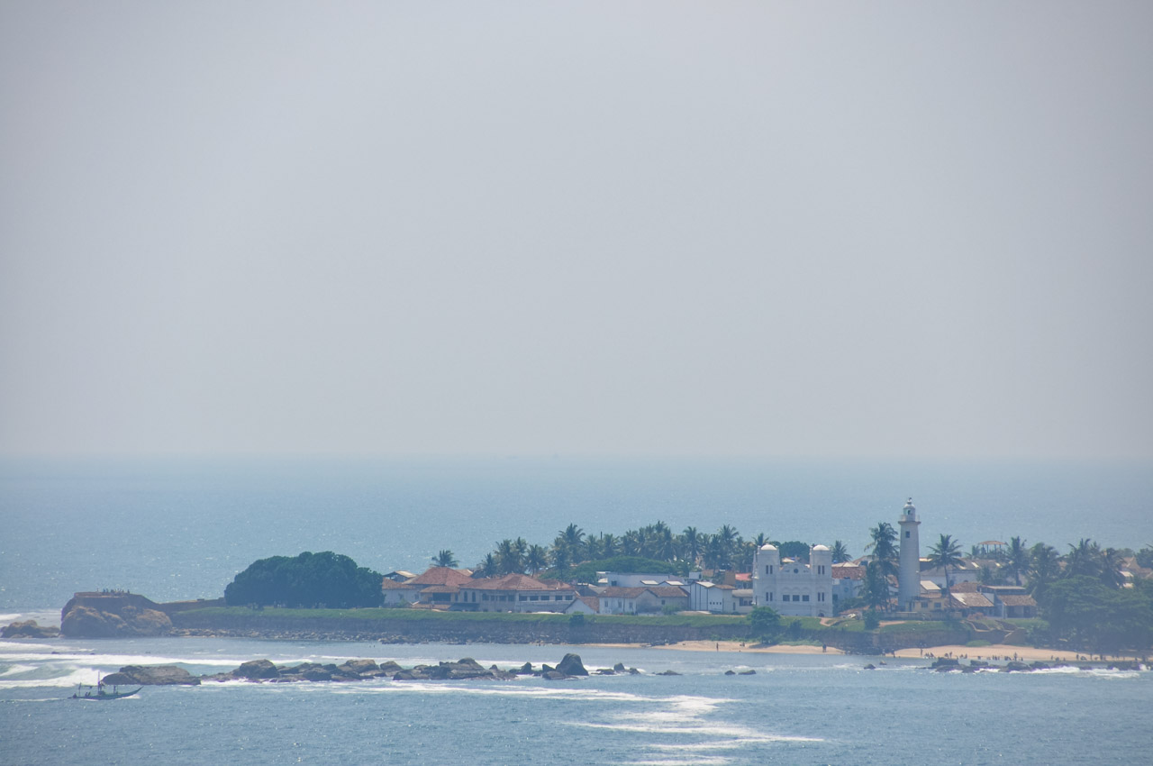
After a leisurely lunch, we drove for about half an hour to Tossa de Mar – a resort town home to the last preserved fortified town on the Costa Brava coast. Upon arrival, our guide took us on an orientation walk through the town and then given over an hour of free time.
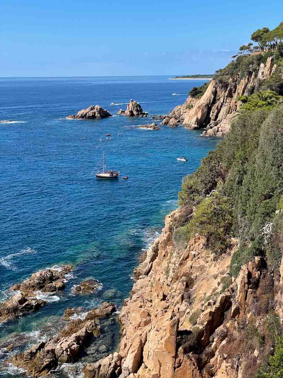
I didn’t go for a swim in the waters of the very crowded beach or seek a coffee in the many cafes and restaurants packed with people. I opted instead to walk up the hill to the lighthouse and fortifications on the town’s highest point.
From the lighthouse and fortifications, I could see over the town, the many boats moored in Tossa de Mar’s bay, and a panoramic view of the Mediterranean Sea with its blue waters and rugged coastline.

Tossa de Mar – town, beach and fortifications
Tossa de Mar was our last stop for the day. An hour and a half drive saw us back in Barcelona.
My tour review / final thoughts:
According to Explore Catalunya, the picturesque Cala Sant Francesc is “one of the few remaining coves on the coast that have avoided the crowds of tourists and big commercial developments and are known only to locals”. All I can say is there must be a lot of locals because the cove’s beach was crowded. Explore Catalunya goes on to say we would have the beach to ourselves. I think they need to rewrite their tour description!

“Uncrowded” Cala Sant Francesc
I enjoyed wandering around the Marimurtra Botanical Garden and admiring its more than four thousand plant species. However, my highlight of the day trip was the hilltop Garden’s coastal views. The Garden provides the most spectacular views of Costa Brava’s beautiful small coves, crystal clear waters, and the rugged coastline of the Mediterranean Sea.

The Mediterranean Sea framed by Marimurtra Botanical Garden
Explore Catalunya’s detailed description for The Costa Brava tour states: “After leaving the beach and gardens, we will continue up to the old castle ruins for another amazing view of the coast.” Unfortunately, this did not occur, leaving me disappointed, as I would have loved to see more of Costa Brava’s coastline.
Lunch was delicious. I had a great salad with lettuce, brie cheese, walnuts, and fruits for my mains. Since I am not fond of ice cream, I had the Mel i Moto – a traditional Catalan dessert of Catalan cheese with honey. It was an interesting dessert but not unpleasant, and I could have had another bowl with more honey. Since arriving home, I have tried making this dessert with ricotta cheese, but it doesn’t taste the same (not as good).
My impression of Tossa de Mar is that of a very crowded tourist town, one I would typically avoid. However, I did enjoy the views from the lighthouse and fortifications of Costa Brava’s dramatic coastline.

Costa Brava’s rugged coastline at Tessa de Mar
Overall, the day trip to Costa Brava was long but enjoyable, and I recommend it.
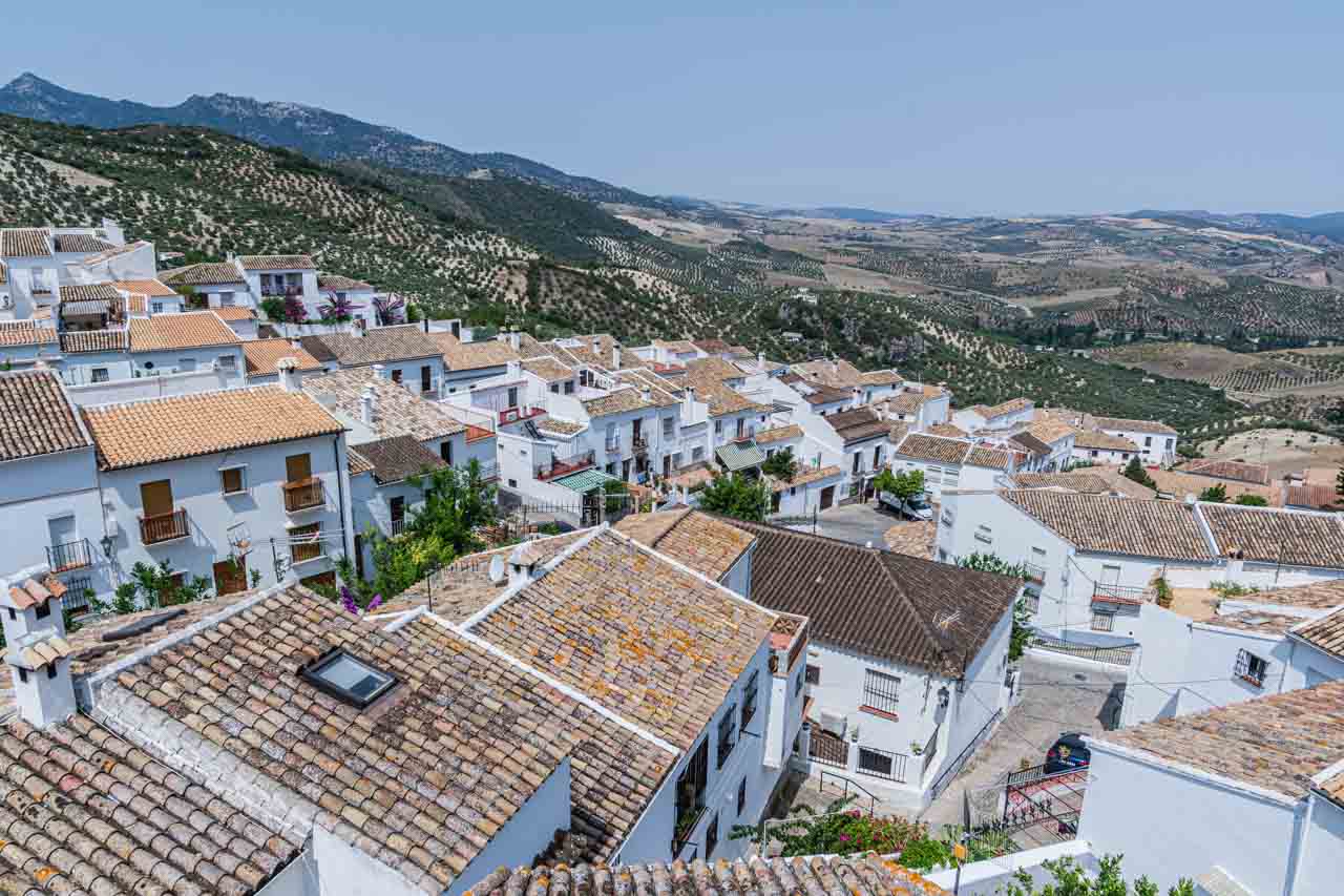
Day Trip from Barcelona to Medieval Villages
Tour: Small Group Medieval Villages Day Trip from Barcelona
Tour Operator: Explore Catalunya
Duration: Full day – 11 hours
Cost: €95,00
Explore Catalunya promotes this day trip as a journey back to the medieval age, visiting the beautifully preserved villages of Besalu and Tavertet and enjoying free time in Rupit village.
The tour as I experienced it:
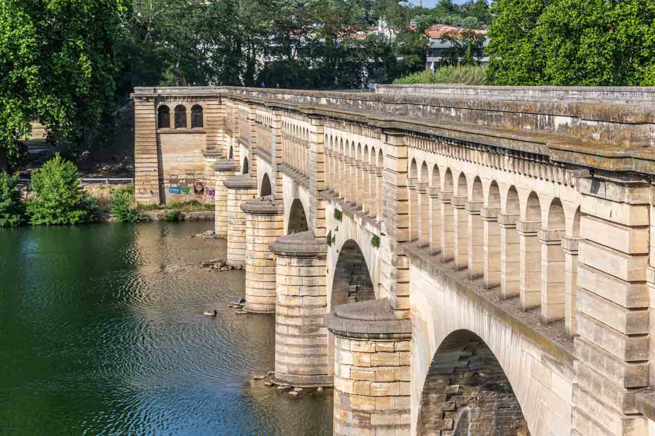
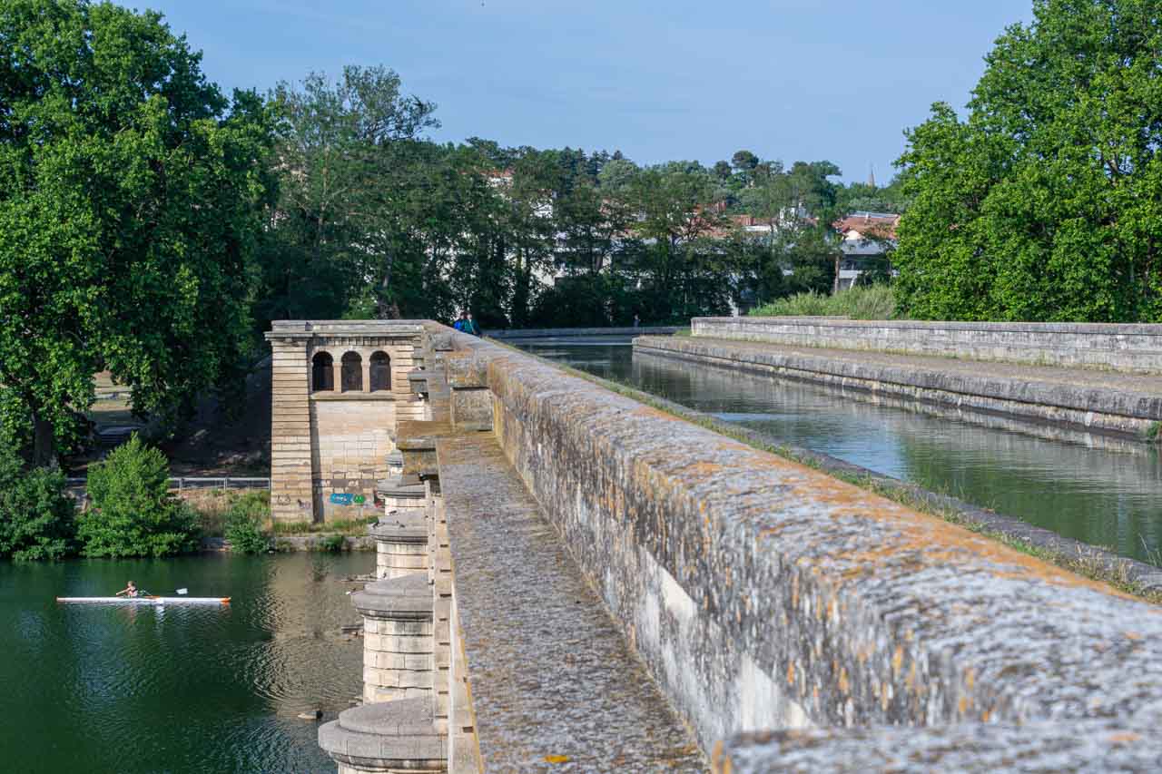
Leaving Barcelona at 8.30 am, we arrived in Besalu, our first medieval village, at about 10.00 am. Upon arrival, we (there were five guests on the tour) were given 20 minutes for a coffee and a bite to eat. We then headed across Besalu’s most significant feature – its 12th-century Romanesque bridge over the Fluvia River with its seven arches and a fortified gateway at its midpoint. Having crossed the bridge, we immediately entered Besalu’s medieval old town, where our Explore Catalunya driver-guide provided a 20-minute guided familiarisation walking tour around the Old Town.
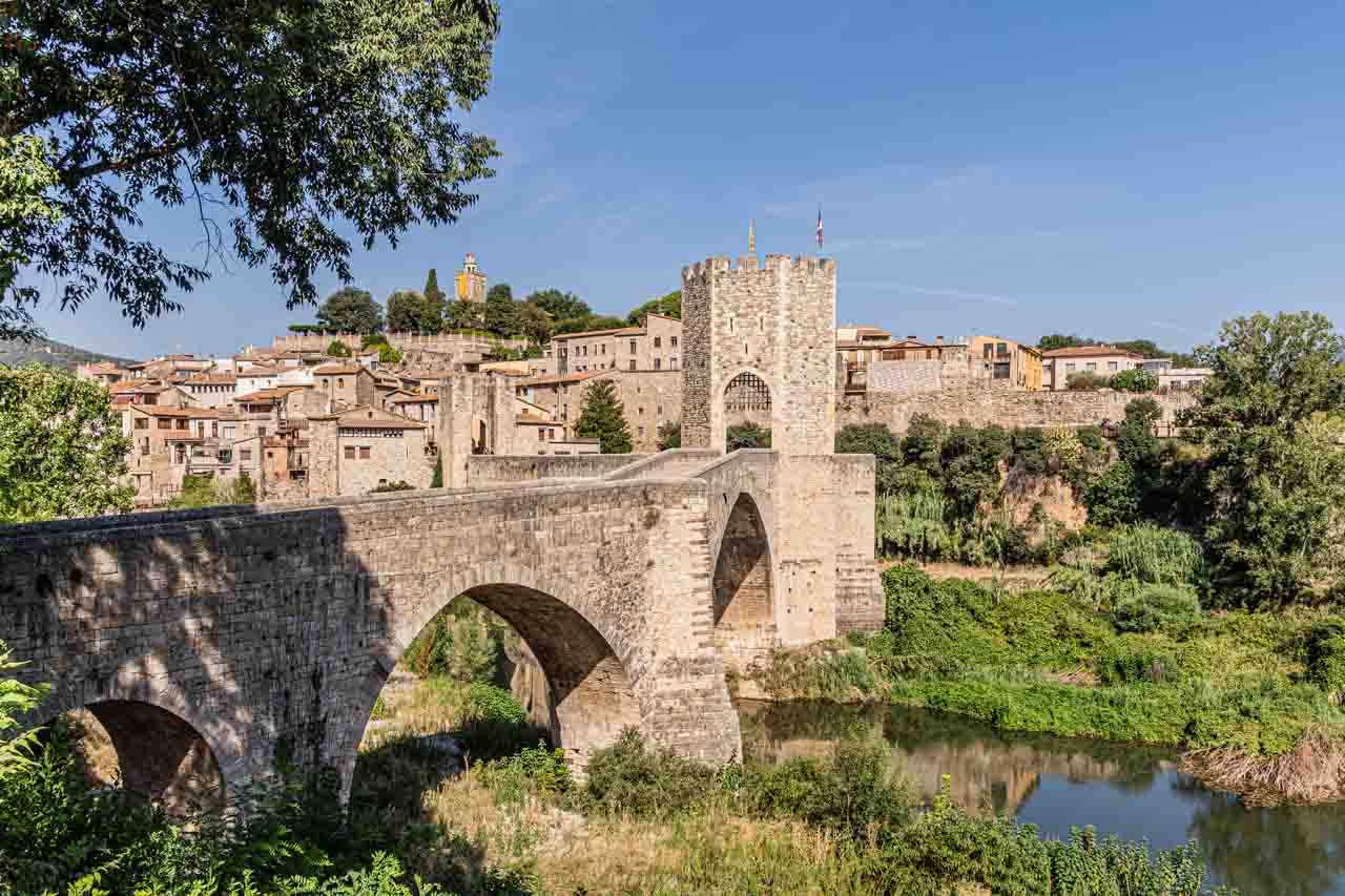
The medieval town of Besalu and its Romanesque bridge.
After the guided walking tour, we had one hour to explore Besalu independently.
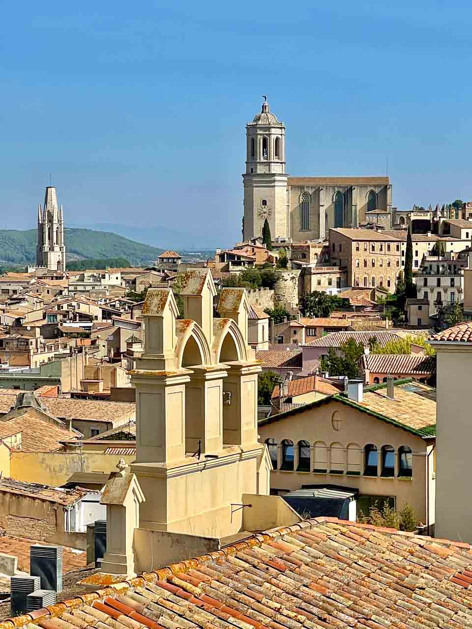
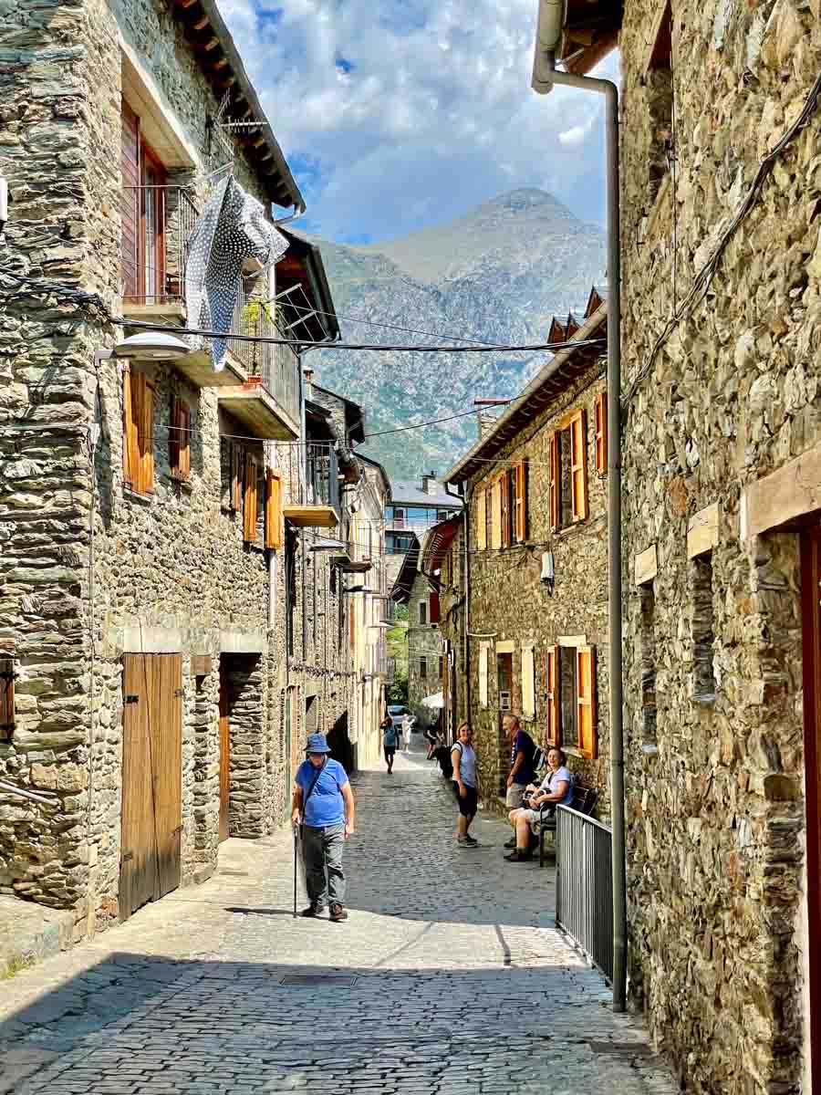
Founded in 878 AD, Besalu is an enchanting medieval town in the foothills of the southeastern section of the Pyrenees. It is one of Spain’s most beautiful and best-preserved medieval towns and was declared a historic and artistic site of national importance in 1966.
Today, Besalu has a population of 2,512 (2023) living there permanently.
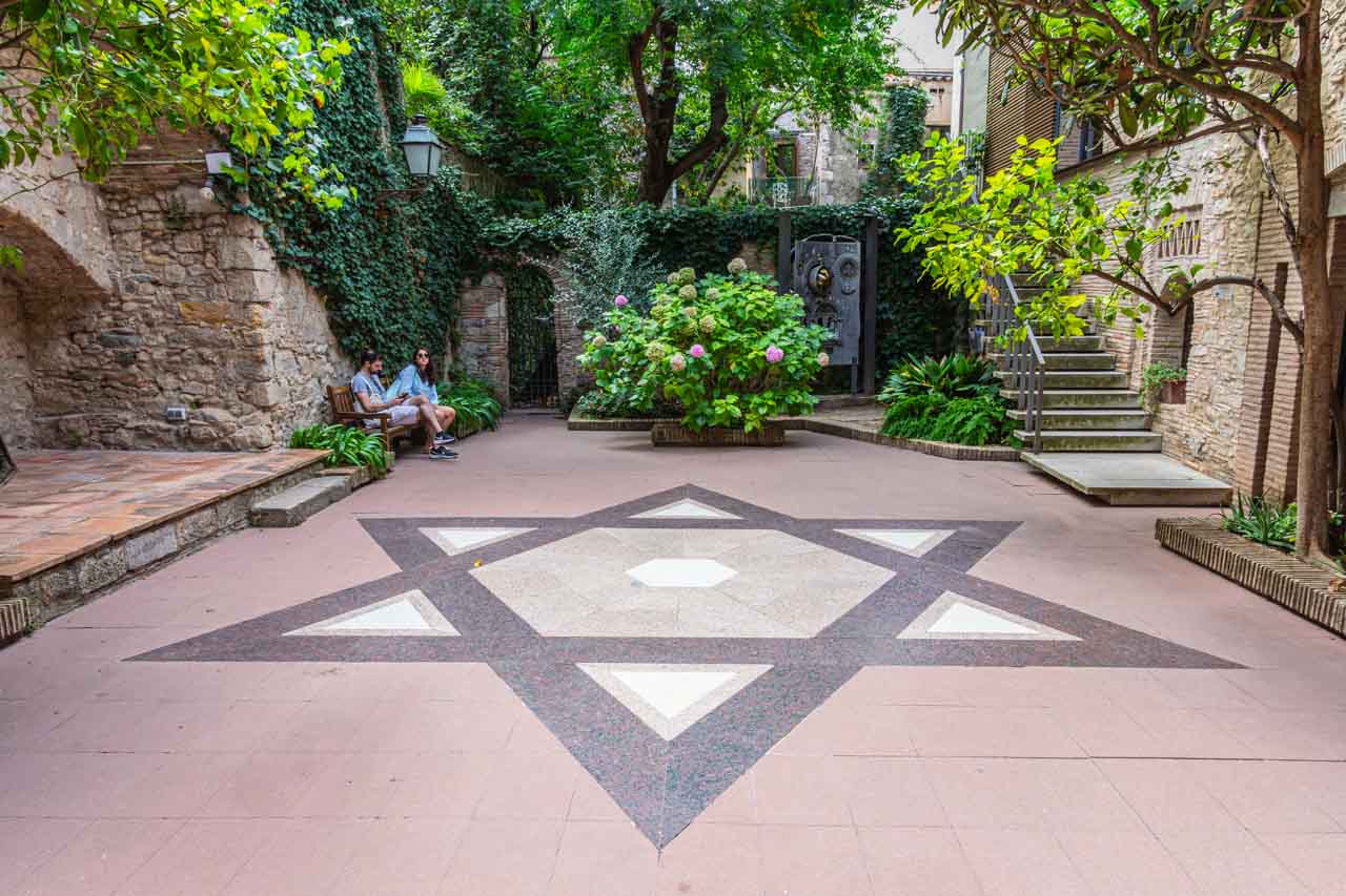
Besalu is home to an 11th-century church and hospital, a 12th-century monastery, the remains of a medieval castle, and an ancient Jewish Quarter, where you will find the ruins of a medieval synagogue and a 12th-century Mikvka (Jewish ritual bathhouse).
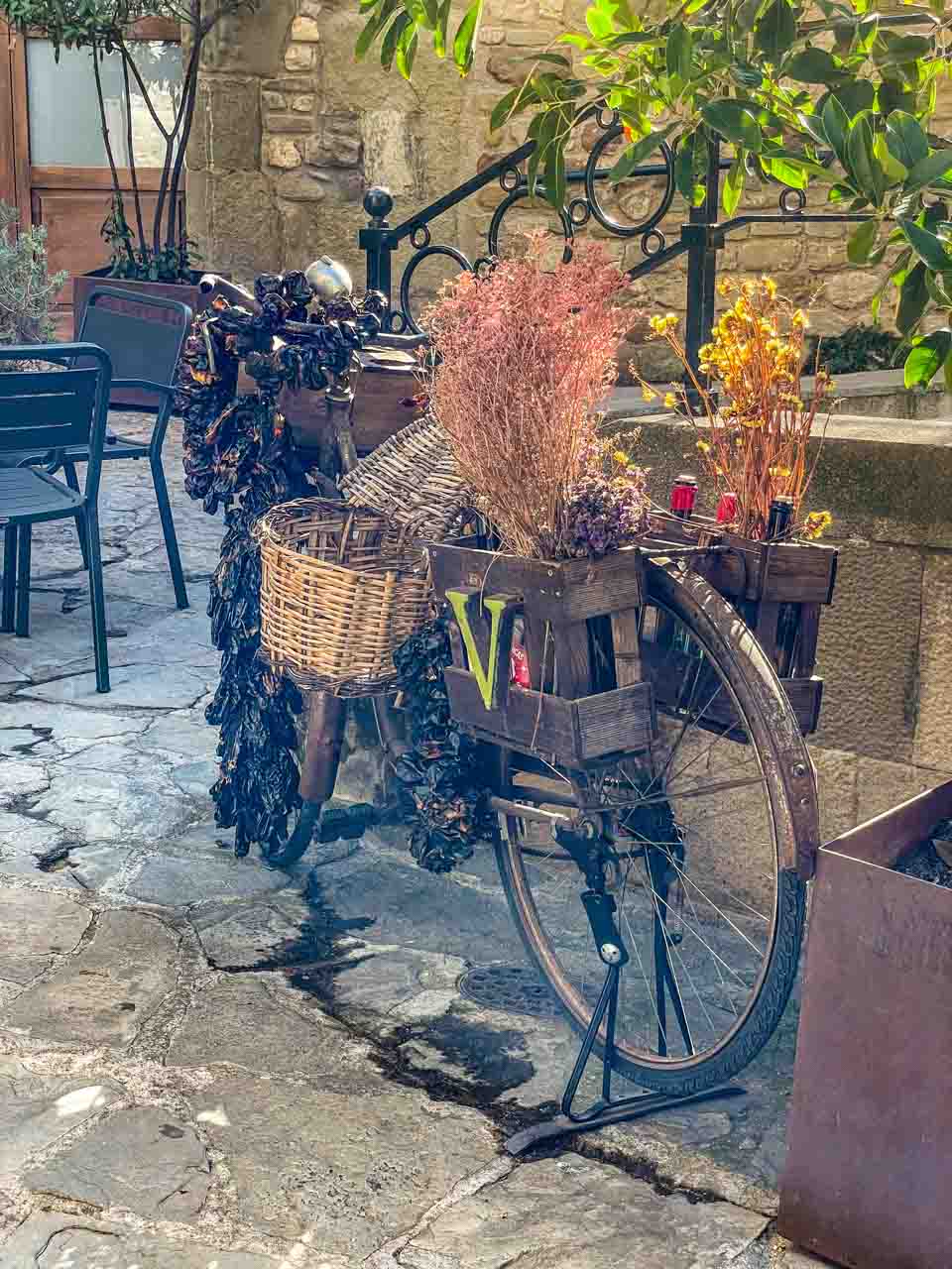
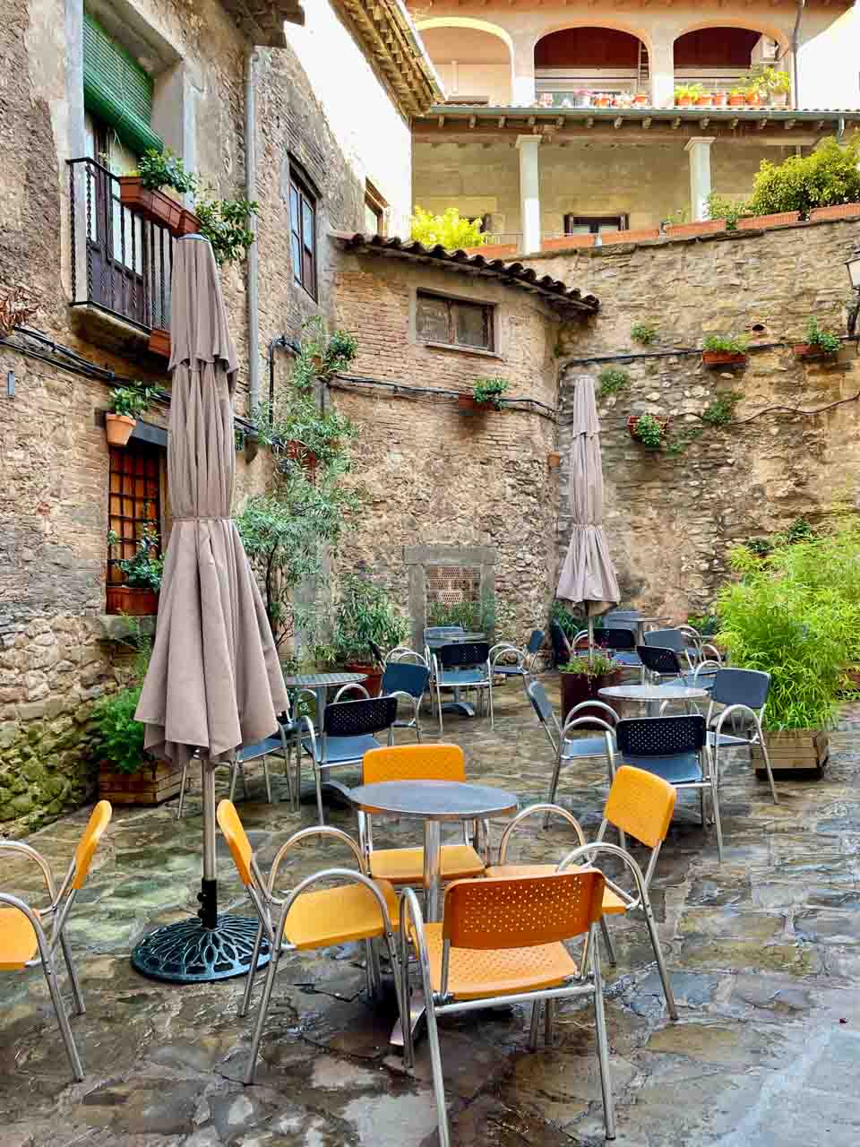
Besalu’s old town is built entirely from sandstone, giving the village a golden, warm hue. Cafes fill the pretty squares, and narrow cobblestone streets wind through the village. As to be expected, souvenir shops line the streets. However, glancing into shops as I walked past them made me think they were of a better quality than most you see.
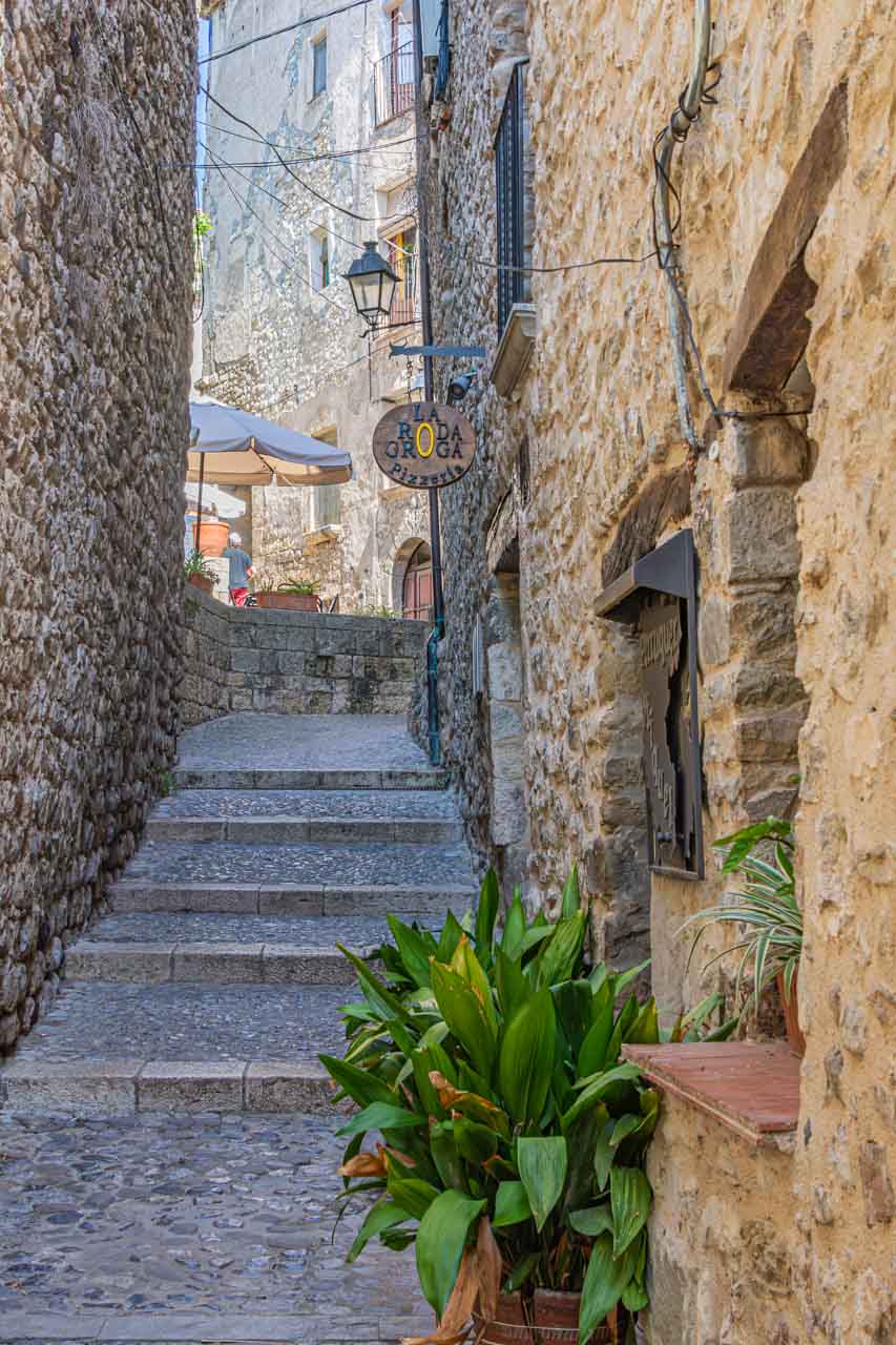
Besalu’s main square, Placa de la Llibertat, is in the centre of the old town and a great place to sit with a drink or ice cream and people-watch.

Cafes and restaurants line Besalu’s main square
I found the wooden chairs attached to the Old Town’s stone walls a thought-provoking addition to Besalu’s medieval architecture. However, I never got an answer about the reason for this art installation.
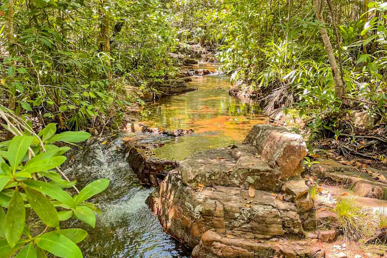
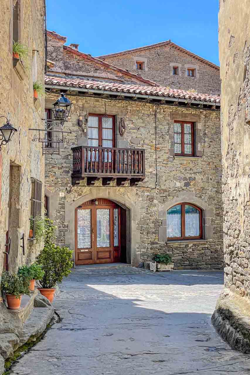
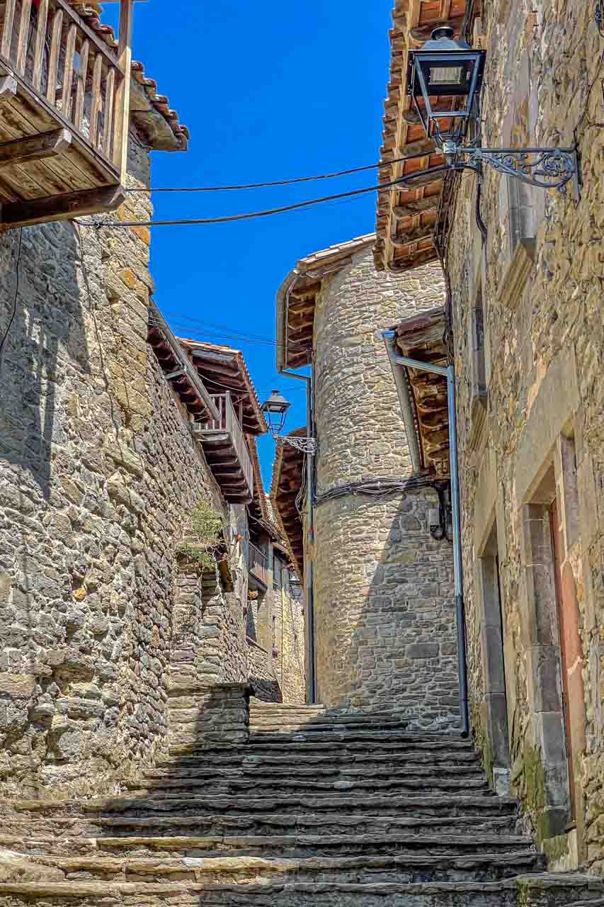
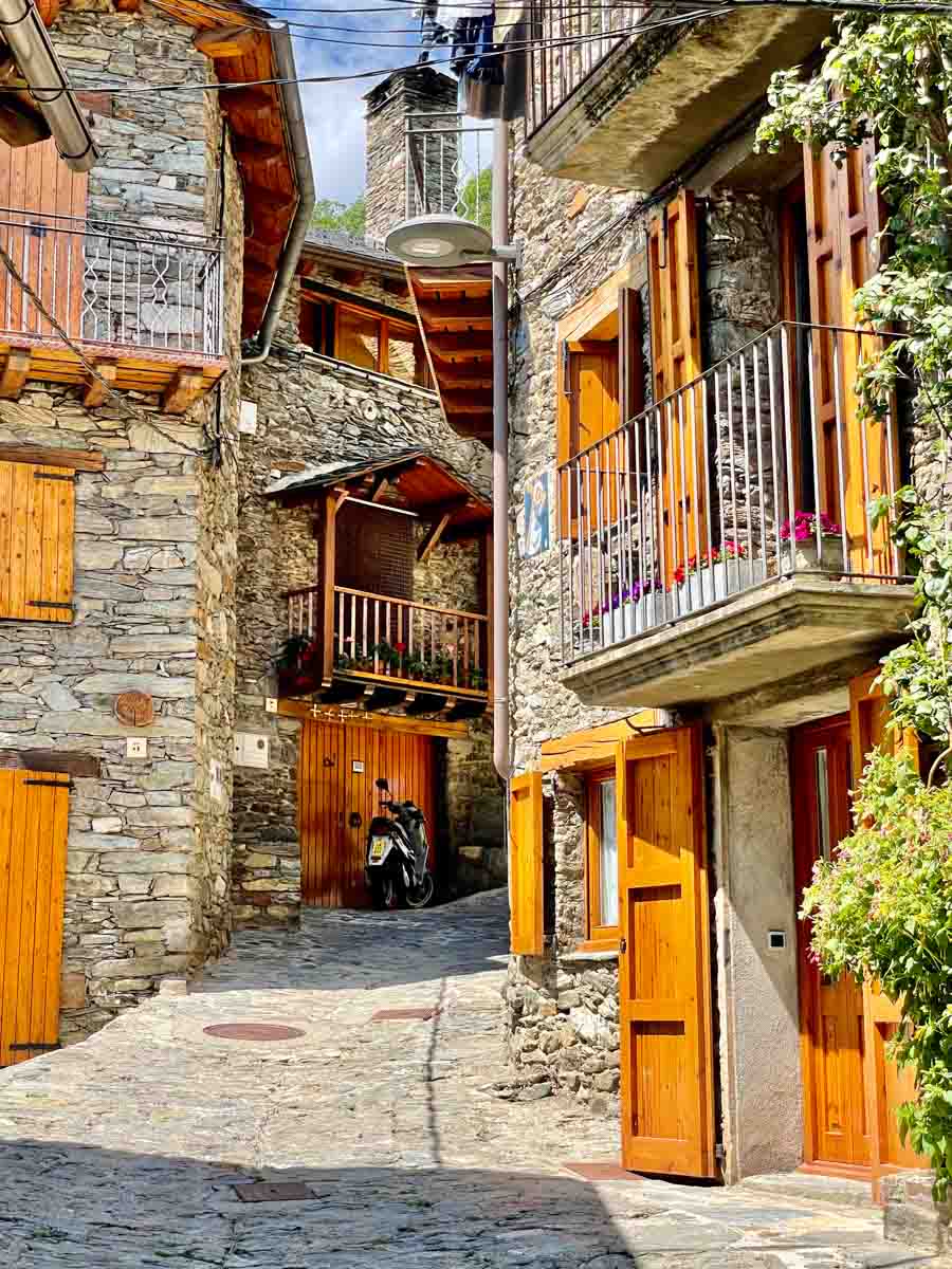
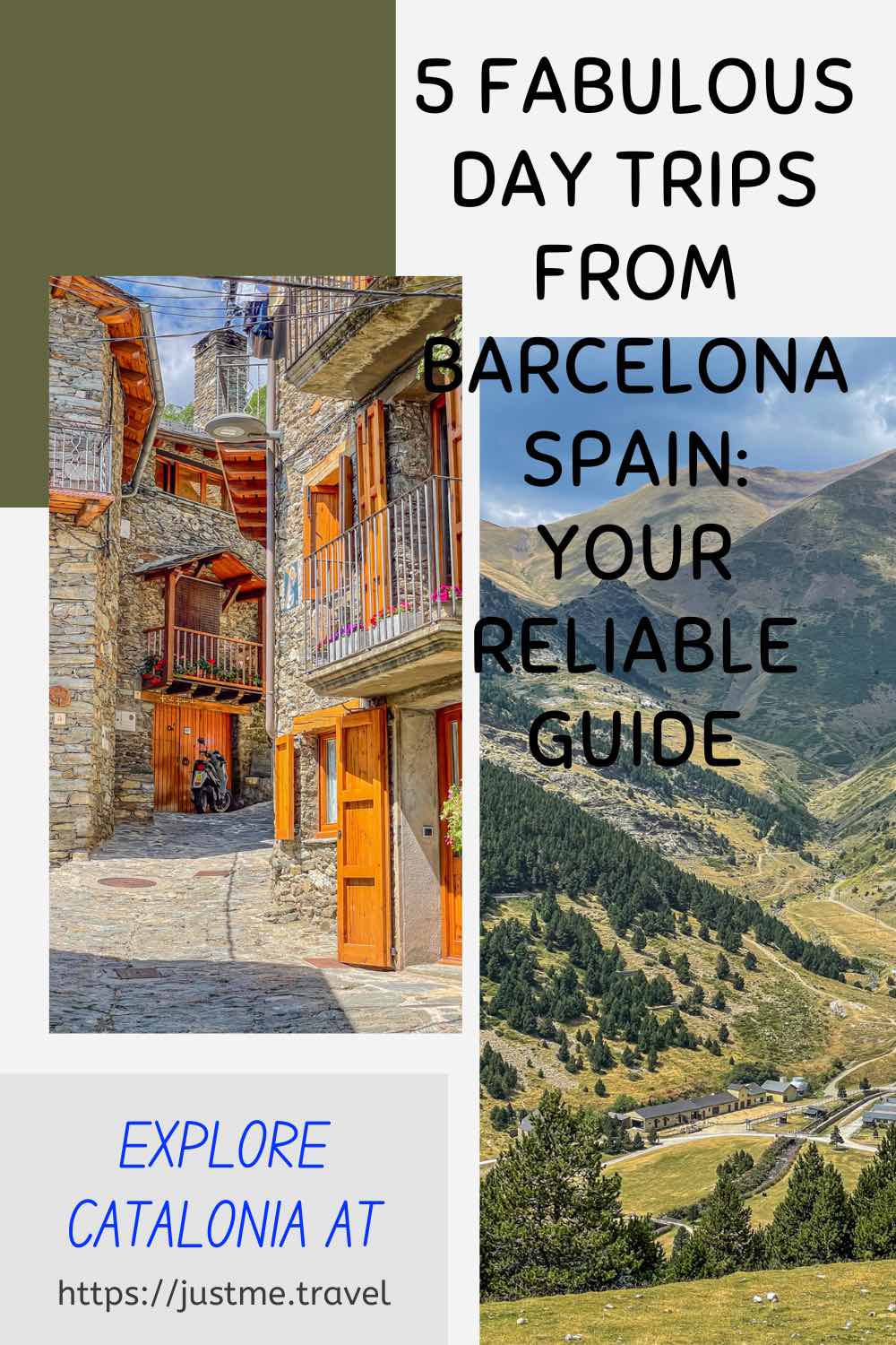
After about an hour’s drive from Besalu and up narrow, winding roads into the Pyrenees, we arrived at the medieval village of Rupit. A river, forest, waterfalls, and caves surround the village, which is 822 metres above sea level in a valley adjacent to the Garrotxa Volcanic Zone Natural Park.
Rupit was in stark contrast to Besalu. Instead of the pale stone buildings that give Besalu an air of warmth, all the houses in Rupit are built with basalt stone, giving the village a dark, forbidding appearance.

The medieval village of Rupert, with houses built in basalt
Rupit is smaller than Besalu, with about 160 permanent residents and just two main streets. The United Nations World Tourism Organisation (UNWTO) has described it as “one of the jewels of Catalonia in Spain.”
Rupit has received two awards in recent years:
- UNWTO named it ‘Best Tourism Villages 2022’ for its “development of sustainable and responsible tourism.”
- It has been awarded ‘European Charming Villages’ by the COSME Initiative of the European Union.
Before arriving in Rupit, our driver-guide gave us the option of free time to explore the village or to join him at a local restaurant for a set menu Catalonian lunch. I opted for lunch with three other guests and our driver-guide – a big mistake! Don’t get me wrong, the three-course lunch was delicious and a leisurely affair, but it took all our allocated two hours of free time in Rupit.
Two hours for lunch in Spain is the norm, but we had no time to explore the village. After several guests voiced their disappointment, our driver-guide gave us ten minutes to explore Rupit.
Our final stop before heading back to Barcelona was at a clifftop lookout in the tiny village of Tavertet, overlooking the valley below and the Guilleries mountain range. From this viewpoint, we could see the large Sau Reservoir, villages, and the odd lone house in the valley below.

View of the valley and mountain range from Tavertet lookout
My tour review / final thoughts:
Besalu:
Grabbing a takeaway coffee instead of sitting down for 20 minutes would have been a better option, allowing more time for the guided walk around Besalu.
I would have liked more time to explore Besalu at a relaxed pace rather than rushing from street to street to see as much as possible and take as many photos as possible.
According to the detailed description on Explore Catalunya’s website, the Medieval Villages tour includes “visit a restored mikveh (an old Jewish bath from the 12th century), and see the remains of a medieval synagogue”. Neither of these happened.
We were discouraged from seeing the old Jewish bath with an explanation that to do so was too hard. We would have to walk back over the bridge (at this point, we were inside the walled town) to the tourist office, get the key for the bath, and then take the key back to the tourist office once having seen the bath. There was also an admission fee involved.
I got the distinct impression that our guide just couldn’t be bothered taking us to visit the restored mikvah and ruins of the medieval synagogue. I found this extremely disappointing as I have a strong interest in Jewish history.
Castellfollit de la Roca:
On the drive to Rupit, our driver-guide pointed to Castellfollit de la Roca village, perched on the edge of a basalt precipice. I have seen several photos of Castellfollit de la Roca on Instagram and have always been in awe of its precarious location. I was okay with not exploring the village but felt incredibly disappointed that we drove straight past and didn’t pull off the road for a photo stop.
Rupit:
Opting to have lunch in a restaurant in Rupit was a missed opportunity to explore the village. It was a shame that our driver-guide failed to advise us that lunch in the restaurant would take up all our free time in Rupit. Had he done so, I would have grabbed something to eat at the bakery and used the two hours to explore the village and walk along the river to discover its pools and waterfalls.
Tavertet:
Explore Catalunya’s detailed description for this tour states that a visit is made to Tavertet village. “With your guide, visit this charming village, which was declared a National Property of Cultural Interest due to its 48 preserved houses from the 17th and 18th centuries. Learn interesting facts about this village as you admire the houses and the 11th-century Romanesque Church of Sant Cristofol.” However, we did not visit Tavertet; we merely drove straight through to the viewpoint on the cliff edge of the village for a panoramic view of the valley below. It was a shame we did not go into Tavertet, as I was looking forward to seeing the houses.
Explore Catalunya advertises that The Small Group Medieval Villages Day Trip from Barcelona lasts 11 hours. However, on this day, it was only ten hours. The additional hour would have allowed the advertised visit to Tavertet village or more time in Besalu.
Final thoughts:
Besalu is a delightful village worth visiting. However, I would have found a full day in Besalu to explore all its nooks and crannies of more value.
Ten minutes to explore Rupit and a short walk along one street to the restaurant was not enough time to make an informed comment on Rupit. However, what I did see had me wanting more.
I cannot comment on Tavertet, as we only drove quickly through the village to the lookout.
I enjoyed the Medieval Villages Day Trip, but I suspect the enjoyment was more about getting out of Barcelona for the day than the trip itself. In truth, I ended the day feeling disappointed and cheated.
Day Trip from Barcelona to the Pyrenees
Tour: Pyrenees Mountains Small Group Day trip from Barcelona
Tour Operator: Explore Catalunya
Duration: Full day – 11 hours
Cost: €109,00
Explore Catalunya promotes this day trip as “The only day tour from Barcelona that takes groups into the Pyrenees Mountains”.
There were five guests on this day trip (including myself) and our driver-guide, Steven. The tour’s destination was Vall de Nuria (Nuria’s Valley) in the Pyrenees via Vic and Queralbs.
The tour as I experienced it:
Our departure from Barcelona at 8.30 am had us arriving in Vic (pronounced Bic) about an hour later.
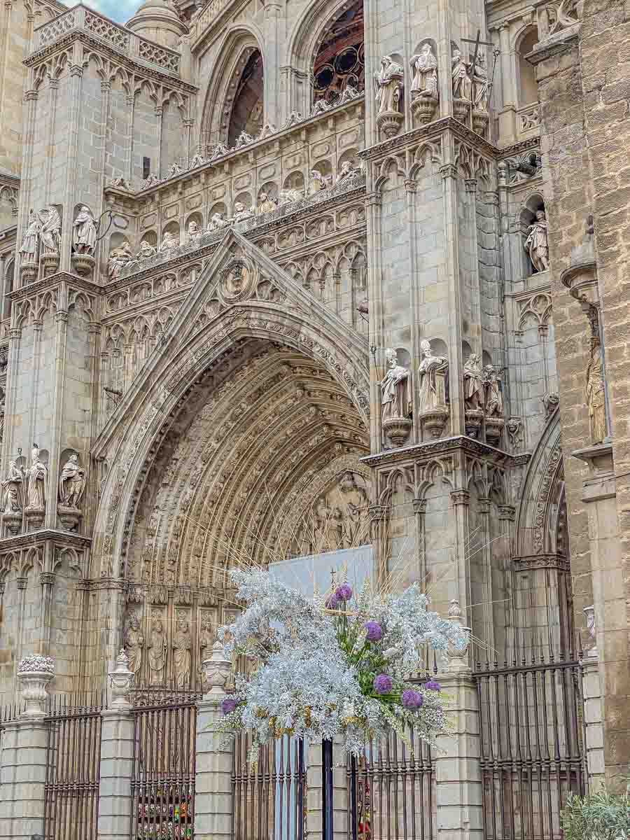
Vic is about 69 kilometres north of Barcelona on the Meder River. It is an ancient city, dating back to the Ausetan Iberians before Roman occupation in the 1st century AD, with an interesting and picturesque medieval Old Town.
On a 20-minute guided walking tour around the Old Town, we passed through several small pretty squares with cafes preparing for the day.
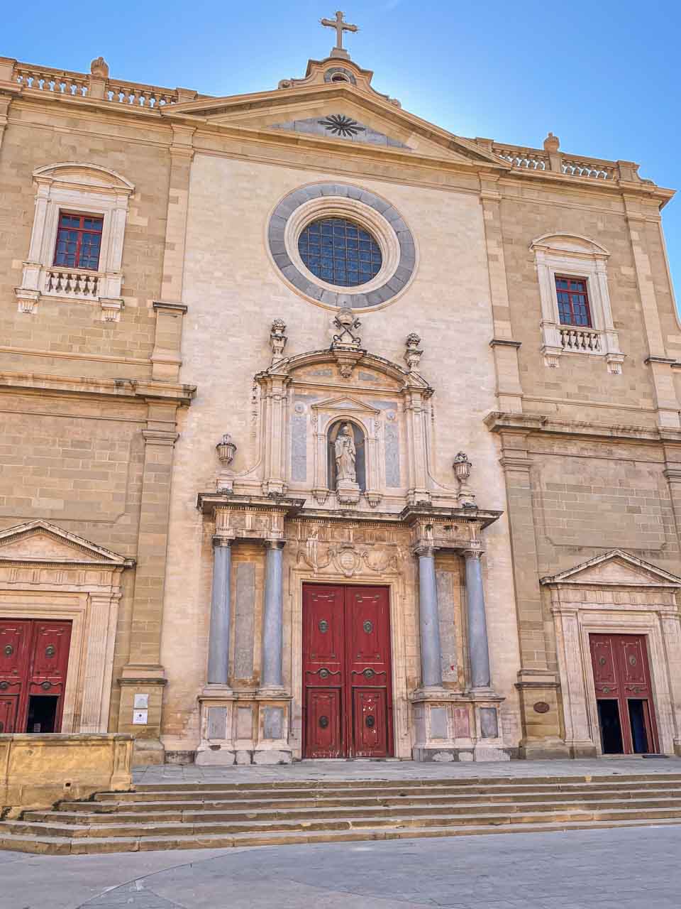
The guided walking tour ended in Cathedral Square at the Roman Catholic cathedral, Catedral de Sant Pere Apostol (Cathedral of Saint Peter the Apostle).
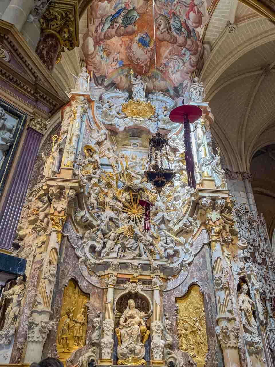
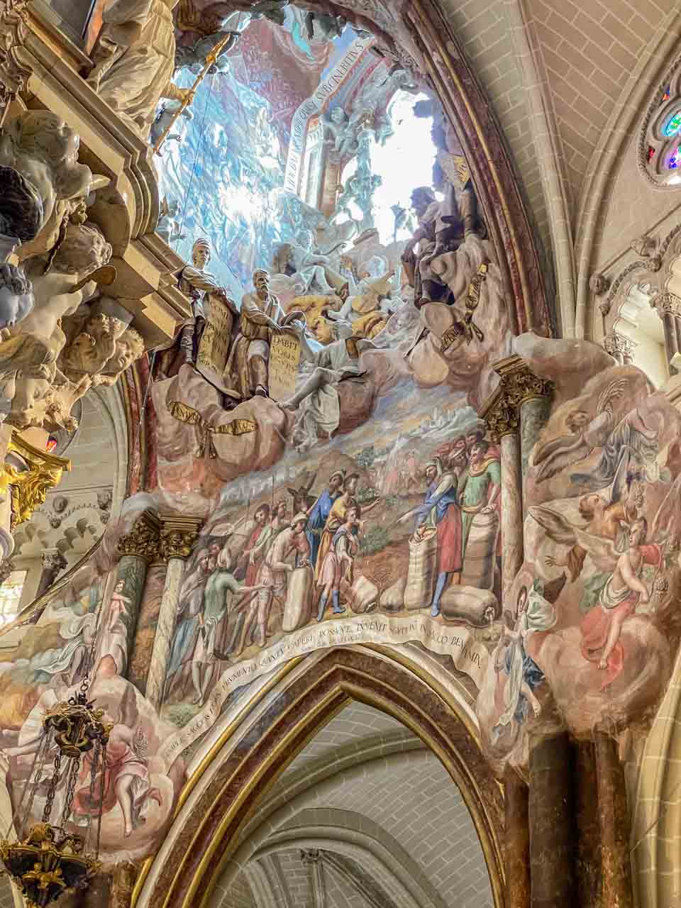
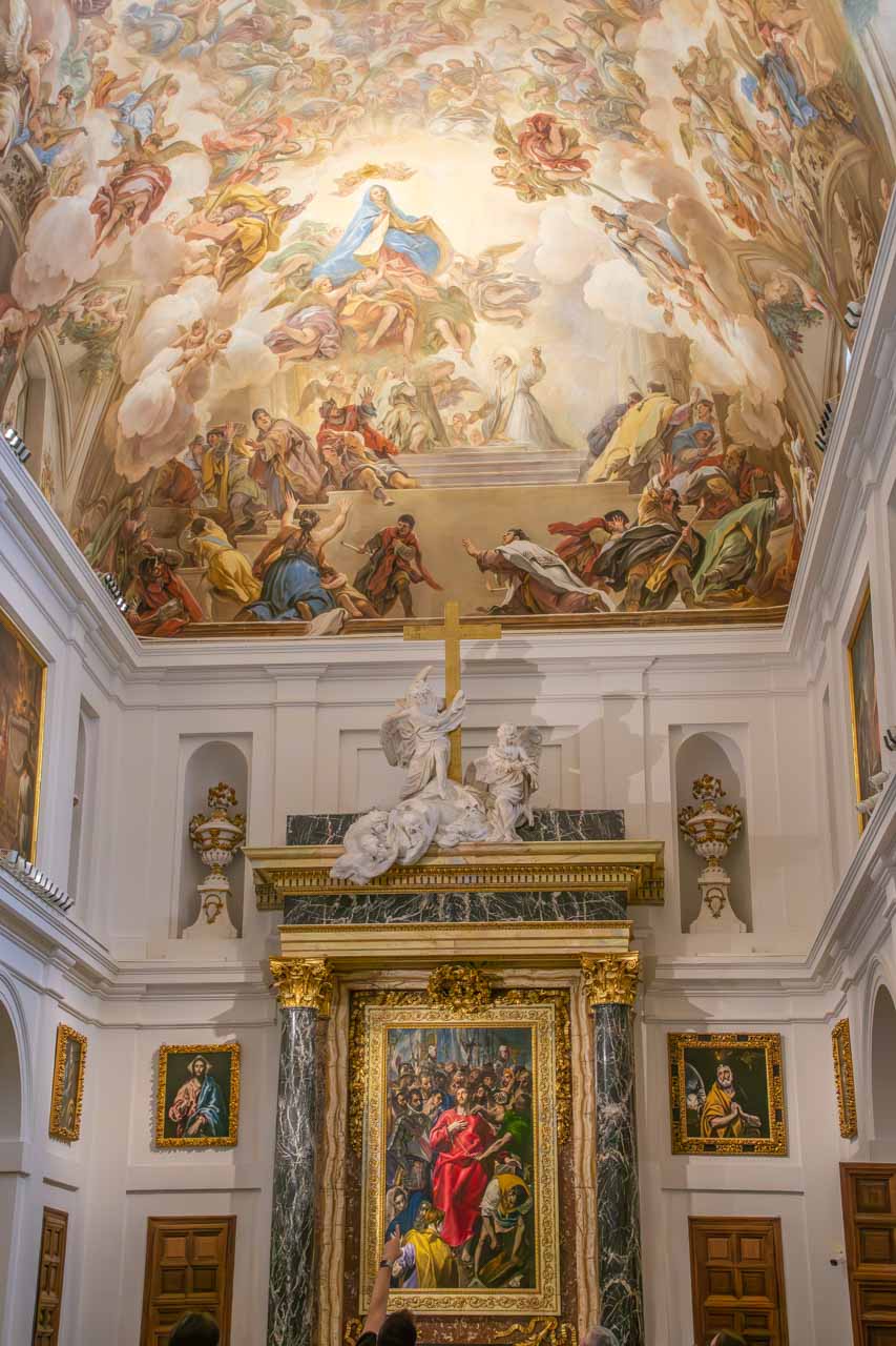
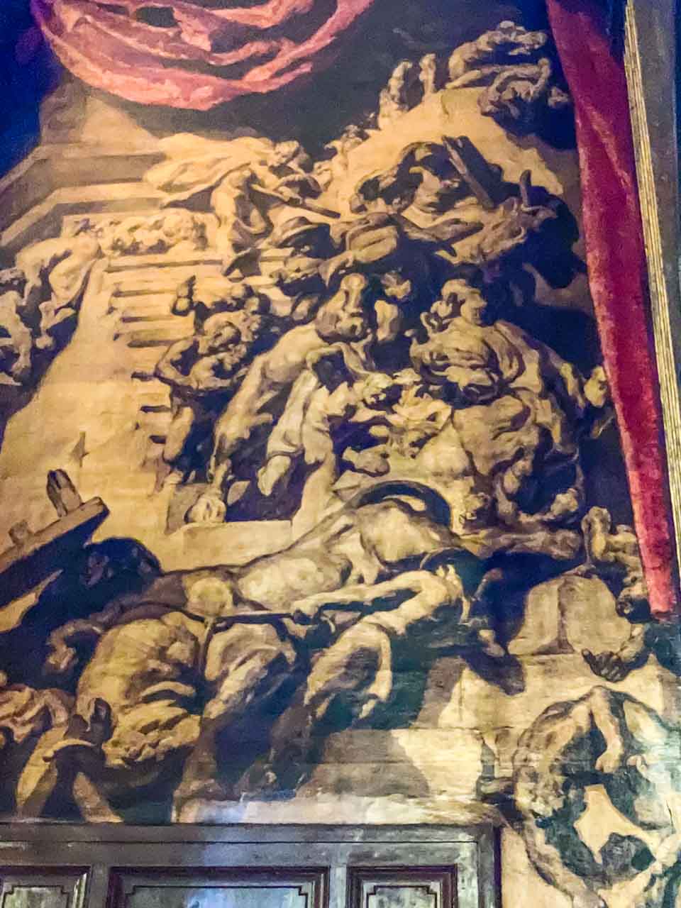
I found the interior of Vic’s Sant Pere Cathedral to be unlike anything I had seen previously. Huge, almost monochromatic canvases painted by Joseph Maria Sert representing the mystery of redemption cover the walls, making the interior dark and gloomy – an unexpected contrast to the cathedral’s light-coloured stone exterior. It wasn’t a place I wanted to linger! However, your reaction may be very different.
Explore Catalunya’s visits to Vic coincide with traditional market days, which take place on Tuesdays and Saturdays in the arched main square (one of the biggest in Spain). Stalls of every sort filled the square.
Our half-hour of free time had me scouring the market stalls and nearby shops for something suitable for a takeaway lunch. Steven advised us that the food at Vall de Nuria’s café was not the best and recommended that we buy lunch in Vic.
From Vic, we drove up into the Pyrenees to the small village of Queralbs, which sits at an altitude of 1,236 metres. It is the last vehicle-accessible village on the way up to Vall de Nuria (Nuria’s Valley), a beautiful valley in the eastern Pyrenees. The final six kilometres from Queralbs to Vall de Nuria must be travelled by rack railway – a 20-minute journey to an altitude of 1,964 metres. But first, there was a guided walking tour through Queralbs.
Queralbs is an ancient village dating back to 833 AD. With its traditionally built stone houses perched on the side of the mountain, “this impossibly quaint, picture postcard beautiful hamlet is one of the most memorable parts of the day” (Explore Catalunya). I couldn’t agree more! The village was picture-perfect.
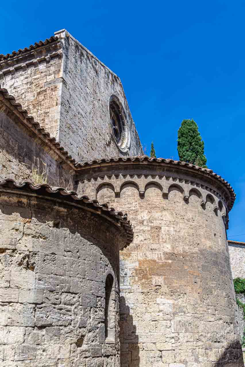
The walking tour ended at the Romanesque Esglesia de Sant Jaume (Church of Saint James) – one of Spain’s oldest surviving Romanesque churches.
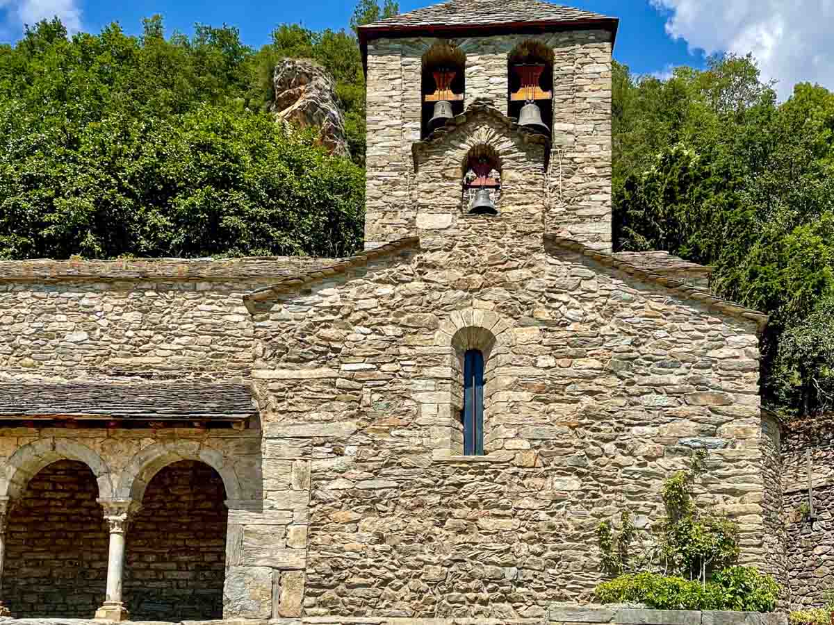
Queralbs’ Romanesque St James Church.
Time to catch the rack railway train to Vall de Nuria!
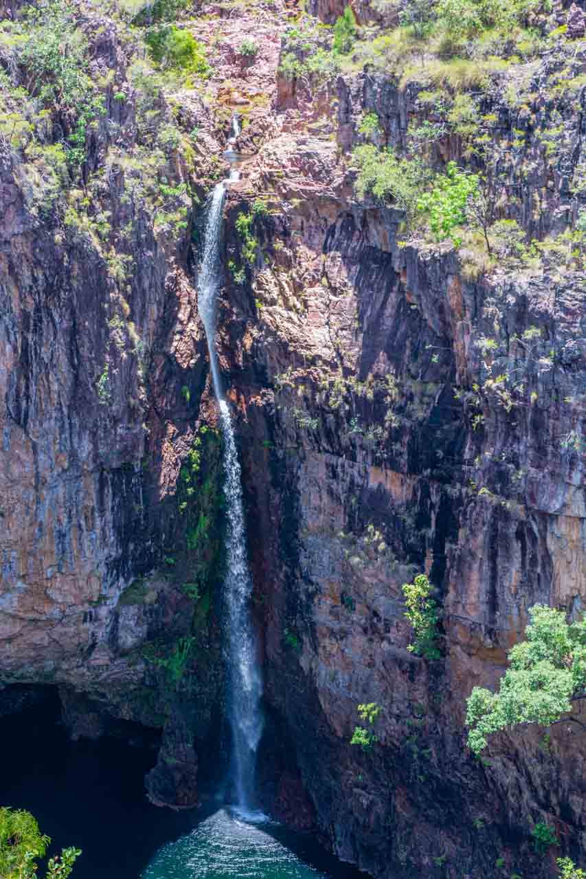
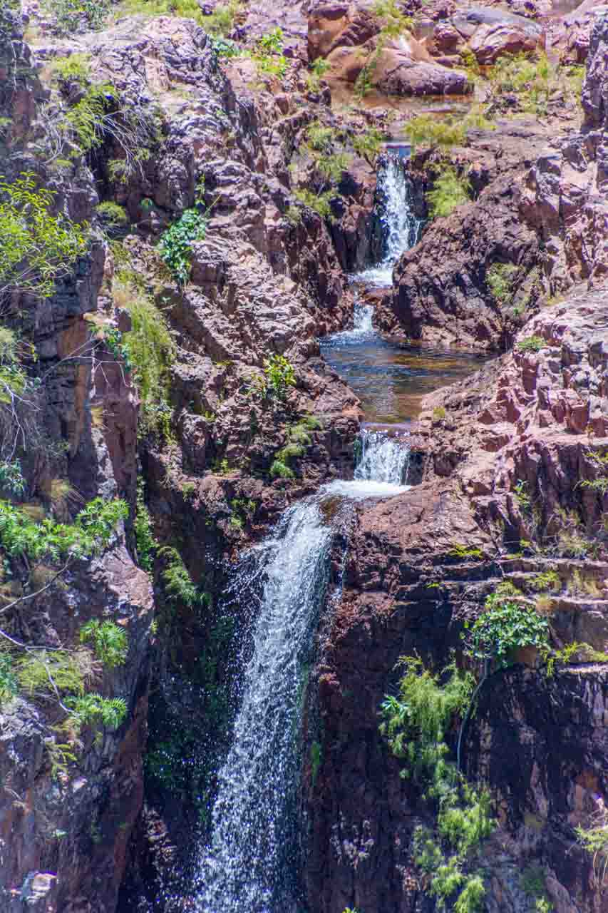
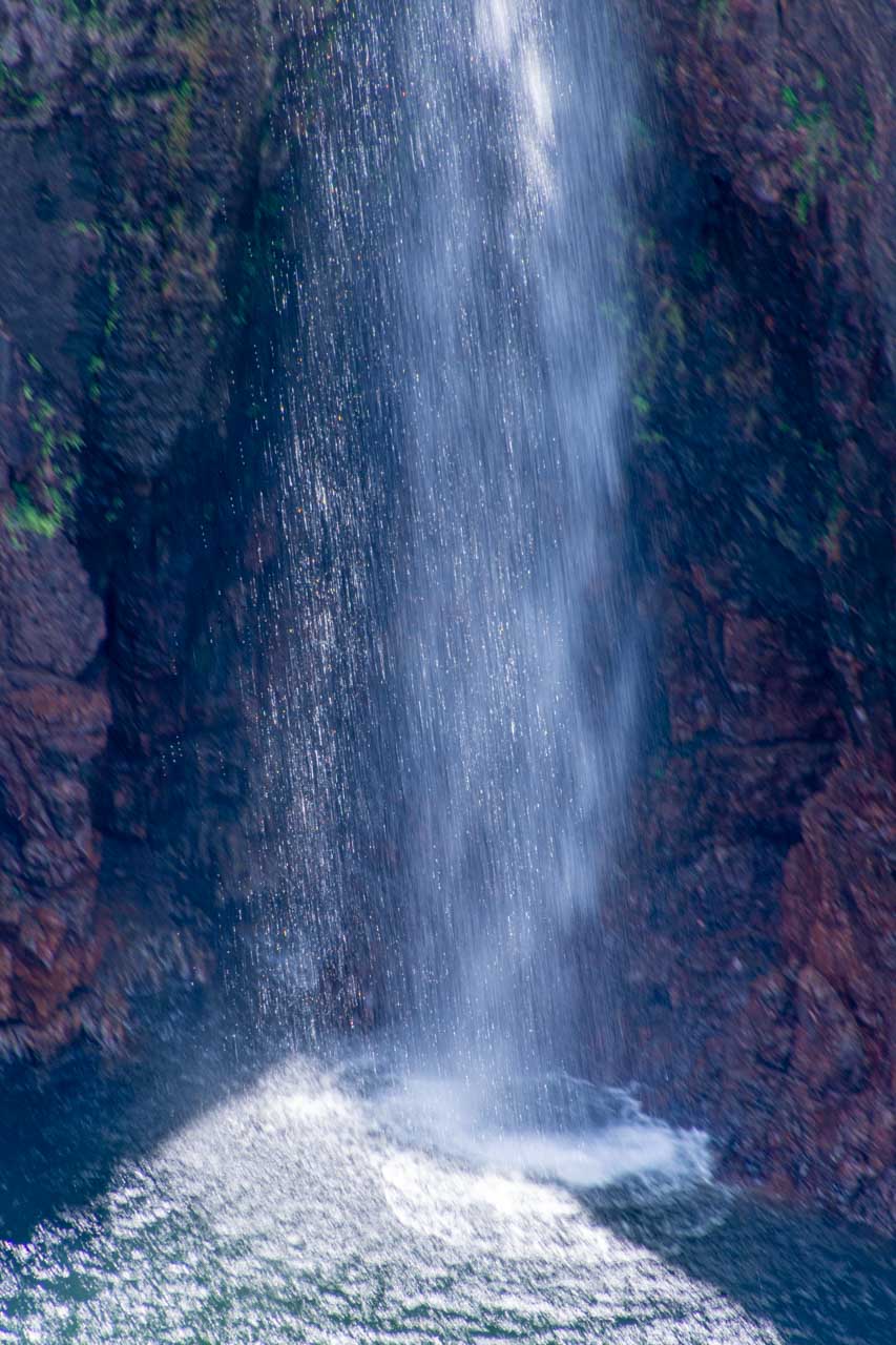
Vall de Nuria is a glacial valley in the eastern Pyrenees, 120 kilometres from Barcelona, 1,964 metres above sea level, and surrounded by mountains nearly 3,000 metres high. It is remote and only accessible by rack railway. The ski resort and Nuria Lake dominate the valley, offering spectacular mountain landscapes, winter skiing, and summer hiking trails.
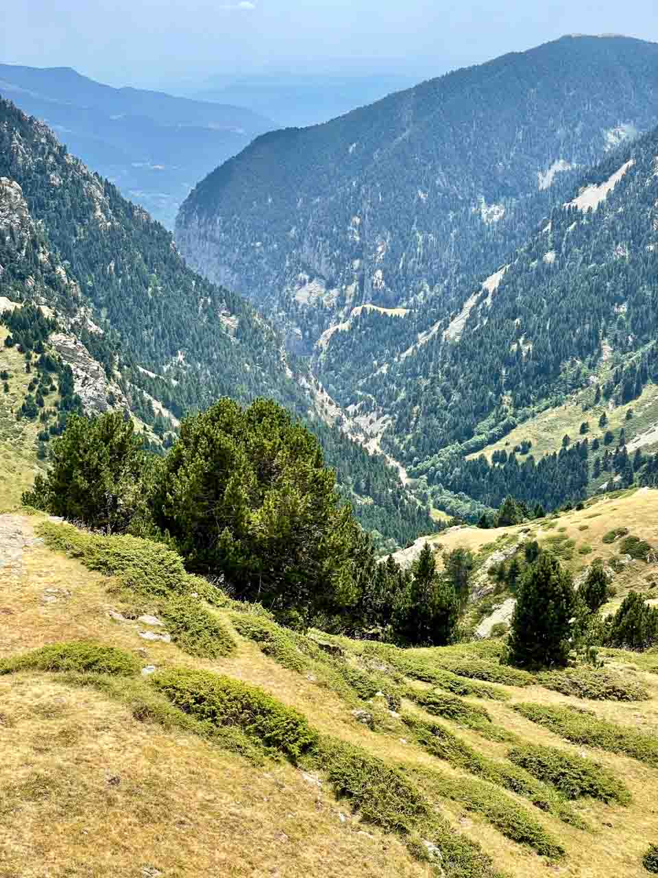
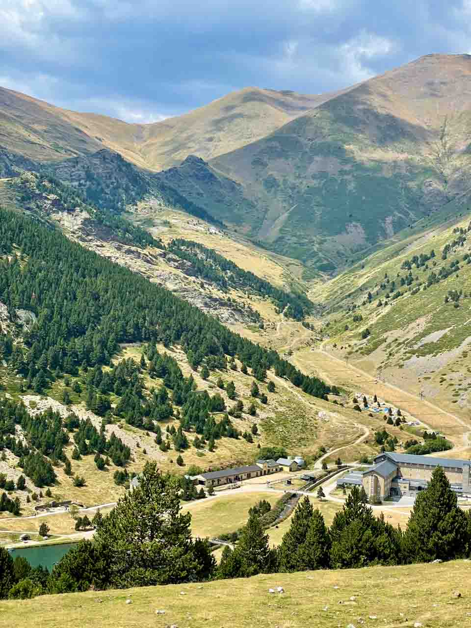
With two hours to explore the valley before catching the train back down the mountain, I decided to hike one of the many trails in the hills around the valley. These trails range from easy to challenging.
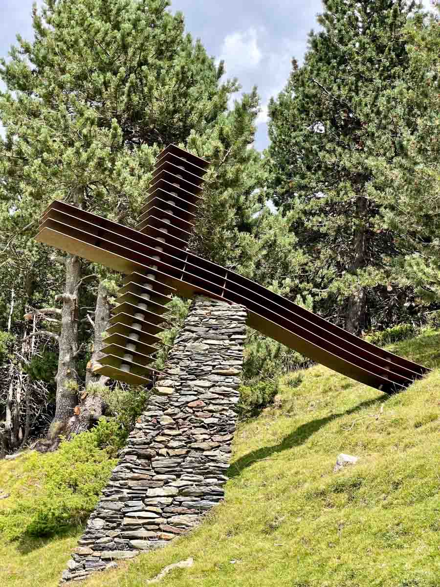
Given my limited time, I chose an easy trail, the Way of the Crosses. I was told it would take 50 minutes to walk, but I knew it would take longer as I would keep stopping to take photos and admire the breathtaking views. The trail gets its name from the Christian Way of the Cross tradition, with twelve crosses along the way. I made the hike easier on myself by walking down the mountain rather than up. I did this by taking the cable car to the summit, bringing me to an altitude of 2,170 metres. Consequently, I passed the crosses in reverse – from twelve to one.
We missed our scheduled train back down the mountain to Queralbs because one couple failed to turn up at the meeting point even though Steven’s instructions were clear. No one knew where they were. I could tell Steven was worried, but he handled it calmly. Eventually, Steven decided we would catch the next train and leave the unreliable couple to fend for themselves. Surprise, surprise! When we arrived back at Queralbs Rack Railway Station (45 minutes late), our errant couple were waiting for us. They had decided to forego the meeting point and catch the train on their own.
From about halfway down the Stations of the Cross trail, the sky was getting blacker and blacker. By the time I reached the bottom, thunder was rolling around the mountains.
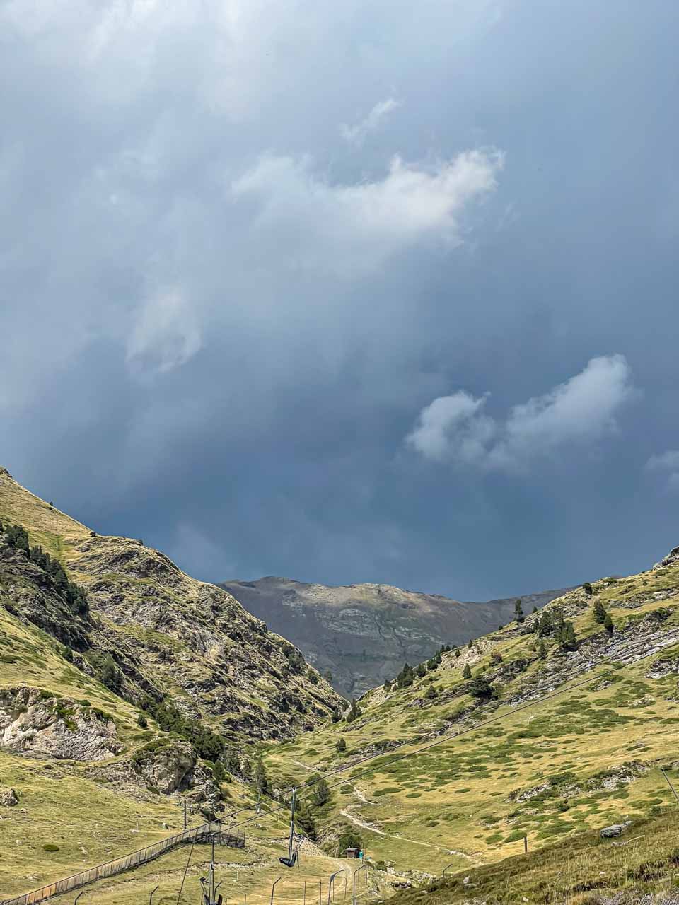
Vall de Nuria – a storm rolls inover the Pyrenees
Just as we were about to board our train back down the mountain, the heavens opened, and heavy rain and hail bucketed down. As we travelled the six kilometres from Vall de Nuria to Queralbs, the rain got heavier and heavier. Running from the train to the station building had us soaked to the skin, and I mean soaked. Water was pouring off me, off my hair and my clothes.
Our misfortunes did not end with a missing couple and soaking rain. Shortly after leaving Queralbs for our drive down the mountain, we came to a grinding halt. Traffic wasn’t going anywhere! The river beside the road was a raging torrent, so I thought maybe the road was flooded. After about 20-30 minutes, the male of our errant couple went to investigate what was happening up ahead – to make up for their “misunderstanding” about the meeting point. He told us there was a mudslide with rocks over the road and water pouring down the mountain. People were staring at this catastrophe, immobile. But our errant male (sorry, I will always think of him as such) started moving the rocks, and others helped. We were moving again! Meanwhile, it was sunny and 30 degrees Celsius in Barcelona!
My tour review / final thoughts:
In Vic, I struggled, wasting a lot of time trying to find suitable food for a takeaway lunch. I couldn’t even find a small supermarket in the streets around the main square. I found a bakery that looked promising, but the queue was too long to wait for service. I was conscious about arriving back at the meeting place on time. Had I known in advance about the recommendation to purchase a takeaway lunch, I would have brought food with me. In hindsight, I am sorry I didn’t risk the cafe at Vall de Nuria because the lentil salad I bought in Vic for lunch was pretty ordinary.
Explore Catalunya advertises the tour as 11 hours in duration. However, the tour was 11 hours only because we were late leaving Vall de Nuria back to Queralbs and encountered a mudslide driving down the mountain. I felt cheated because I would have loved more time on the mountain. The additional hour would have allowed me time to walk around the lake, visit the sanctuary, or have a cup of coffee.
I thoroughly enjoyed this day trip to the Pyrenees Mountains. What an adventure!
Don’t get me wrong; I have enjoyed all my day trips with Explore Catalunya, but this one seemed a bit more special. Perhaps it was the breathtaking landscape of the Pyrenees or just being in the mountains? Perhaps it was the enchanting village of Queralbs or the experience of the Rack Railway? Perhaps it was the adventure of getting soaking wet from a massive storm or driving through a mudslide over the road? Even though all the tours were very different and memorable, this day trip to the Pyrenees was special. It was not your ‘usual’ sightseeing tour and, for the most part, was the more relaxed.
A word on booking tours with Explore Catalunya:
I booked all my tours with Explore Catalunya in person, visiting their office in Barcelona at Carrer Palau de la Musica, 1. When booking in person, I received a €10,00 senior discount on each tour. However, when visiting Explore Catalunya’s website, I found nowhere that a senior discount can be applied when booking a tour.
As we conclude our journey through these five memorable day trips from Barcelona, I hope the experiences I shared have inspired you to venture beyond the city’s boundaries and explore the wonders just a short distance away.
Barcelona is a gateway to extraordinary adventures, allowing you to immerse yourself in captivating landscapes, delve into rich history, and be inspired by world-renowned art. The day trips I took from Barcelona left me with a lifetime of memories.
So, if you find yourself in Barcelona, let these day trips be your guide to exploring the richness that lies beyond the city’s borders, for Catalonia is a region of endless discovery. Allow yourself to be swept away by the allure of Montserrat, the coastal beauty of Costa Brava, the timeless appeal of medieval villages, the majesty of the Pyrenees, and the surreal world of Salvador Dali.
Thank you for joining me on this unforgettable journey through Catalonia’s diverse landscapes and cultural treasures. Until next time, here’s to the endless horizons of discovery and the timeless magic of travel!
Disclaimer: This post contains no affiliate links. All views and opinions are my own and non-sponsored. All photos are my own and remain the copyright of Just Me Travel.
© Just Me Travel 2018-2024. All rights reserved.
Have you found this review of day trip tours from Barcelona a helpful resource? Which would be a day trip not to be missed? I love hearing from you. Please leave a comment below.
I look forward to reading and responding to your comments on which day trips from Barcelona you might include on your next holiday to Spain that this post has inspired.
Like this post? Save it for later!
Author’s Note: Please check the latest travel restrictions before planning any trip and follow government advice.
You might also like
 SPAIN BUCKET LIST: The 47 Incredible Things You Should Not Miss. From historic landmarks to cultural marvels, my Spain Bucket List is your go-to resource for planning the trip of a lifetime. Start planning your Spain itinerary now!
No Comments on 5 FABULOUS DAY TRIPS FROM BARCELONA SPAIN: Your Reliable Guide