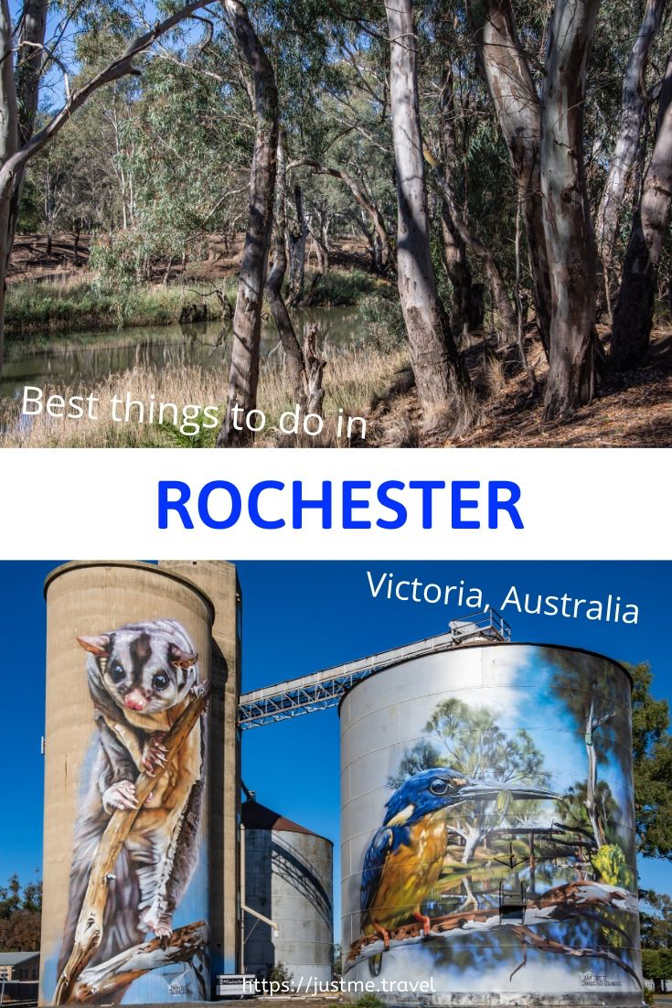
Visit Rochester Victoria – 3 Excellent Reasons to Plan Your Next Great Escape Are you looking for a day trip or overnight stay in rural Victoria? On the Campaspe…
Visit Rochester Victoria – 3 Excellent Reasons to Plan Your Next Great Escape
Are you looking for a day trip or overnight stay in rural Victoria? On the Campaspe River, Rochester is an idyllic spot to see silo art, take an informative walk through the Australian bush, and eat good food. My one-day guide will take you there.
On a 12-day road trip around Victoria, my sister and I stopped over in Bendigo and Ballarat, travelled the silo art trail, photographed our reflections on Lake Tyrrell, explored the Lakes District around Kerang, and walked the Koondrook Barham Redgum Statue Walk.
Rochester was our last stop, arriving late afternoon. The following day, we viewed Rochester’s silo artworks and took the river walk before heading home in the early afternoon. These are two of the best things to see and do in Rochester. The third best thing to do in Rochester was eating – well worth mentioning, given our food experience on this road trip.
Where is Rochester
Situated on the Campaspe River in Victoria (Australia), Rochester is 27 kilometres south of the Murray River Port of Echuca. The Murray River, in New South Wales, forms the border with Victoria and is Australia’s longest river.
Taking the fastest route, according to Google maps, Rochester is 187 kilometres north of Melbourne, 27 kilometres south of Echuca, and 240 kilometres south-west of the twin cities, Albury/Wodonga.
Silo artwork
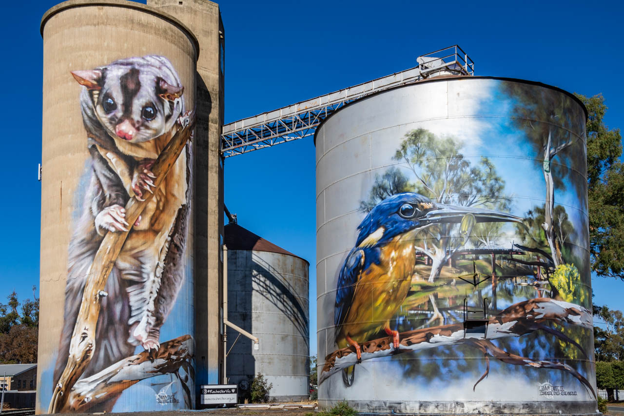
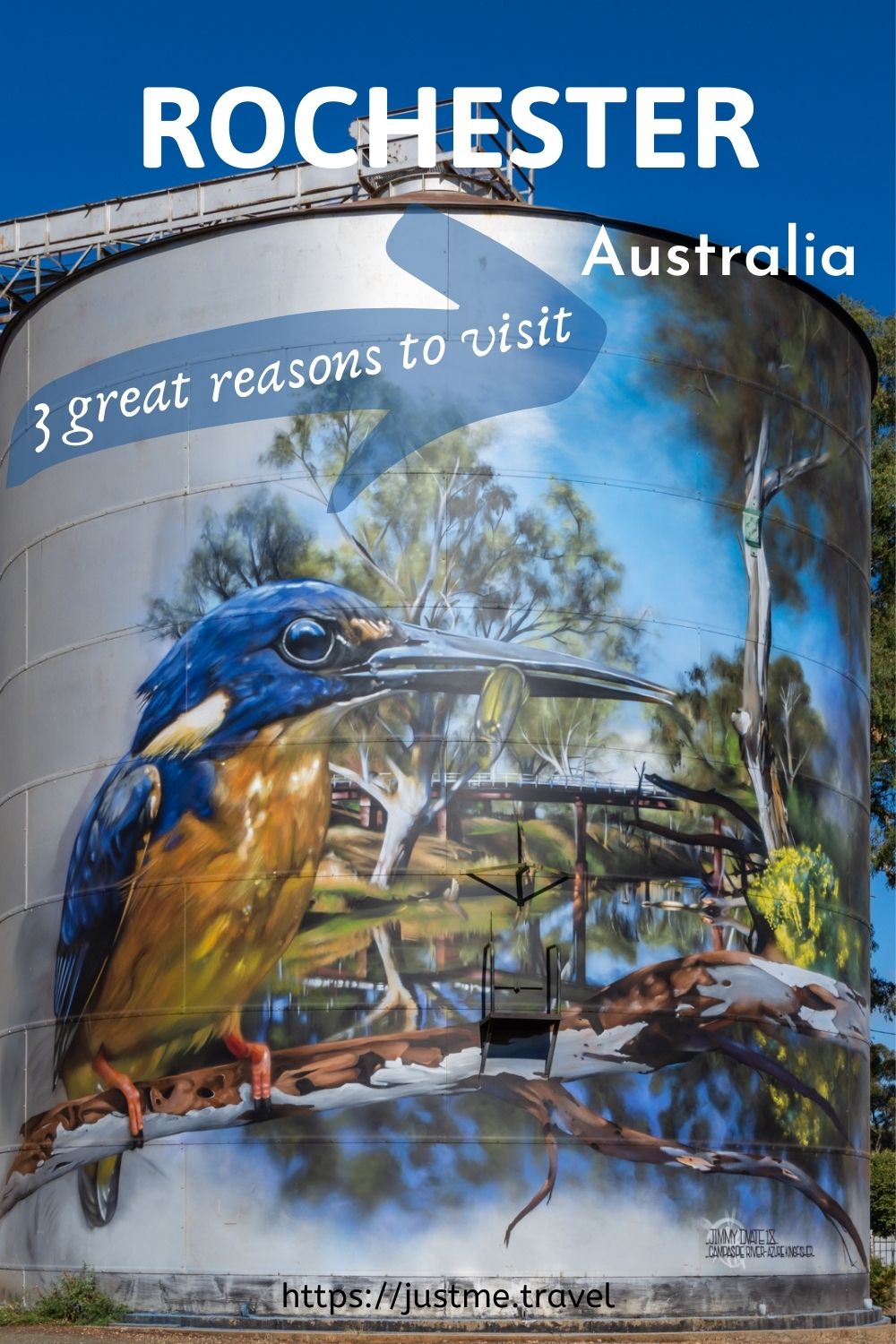
Silo artworks of Squirrel Glider and Azure Kingfisher at Rochester, Victoria.
Rochester’s Silo Art project was the initiative of Rochester Business Network, with support from local businesses and the community. GrainCorp provided the silos as ‘creative’ canvases for artworks on a massive scale. To give you an idea of perspective, the concrete silo is 22 metres high (approximately 72 feet), while the height of the metal silo is 18 metres (about 59 feet).
The painted silos are in the heart of town. They feature the endangered Squirrel Glider on the concrete silo and the Azure Kingfisher on the metal silo. Both are native to Australia.
The painted silos, completed in 2018, is an open-air gallery that never closes and is free to visit. It is street art at its best.
The artist who designed and painted these magnificent murals, Jimmy DVate, is the same artist who painted the silos at Goorambat in North East Victoria.
Jimmy is a Melbourne based artist and graphic designer whose talent is recognised nationally and internationally. He is passionate about conservation and is particularly keen to highlight the plight of endangered species. Painting threatened Australian native fauna is a ‘signature’ of Jimmy’s artwork.
Of all the silo artworks we saw on this road trip around Victoria, which took in the Silo Art Trail, the Rochester painted silos were my sister’s favourite. They rate very highly on my list too. I think I must have an affinity with Jimmy DVate’s artworks as his paintings on the silos at Goorambat are also at the top of my favourites list.

The endangered Squirrel Glider painted on Rochester’s grain silo
River Walk
Walking from the painted silos, we made our way to Rochester’s Red Bridge, a timber rail bridge crossing the Campaspe River at the northern end of Ramsay Street. Built in 1876, the Red Bridge consists of three openings of 14 metres spanning the river and 16 openings of seven metres over the flood plain.
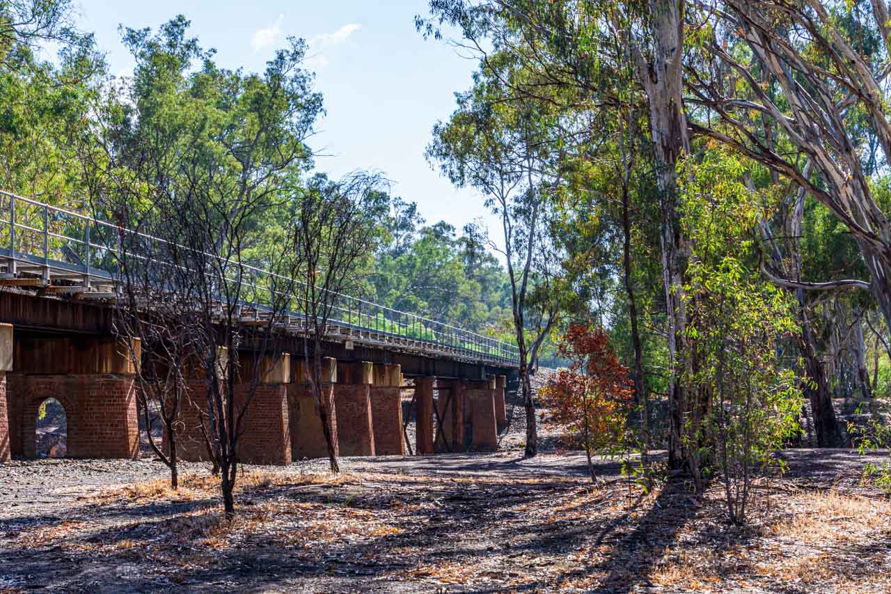
Red Bridge – the rail bridge crossing the Campaspe River at Rochester
The Red Bridge features in the background in the silo artwork of the Kingfisher.
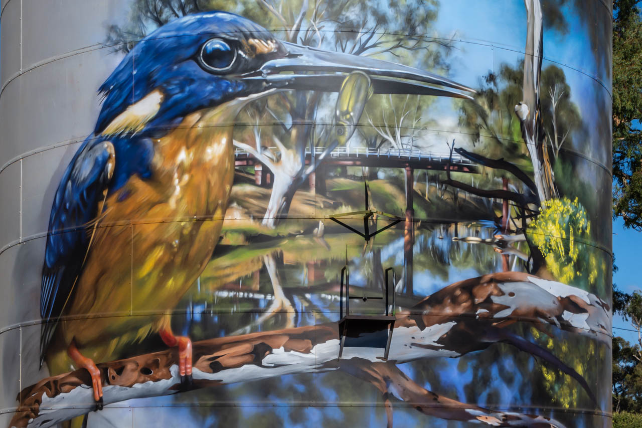
Rochester’s Red Bridge features in the background on the silo artwork of the Kingfisher
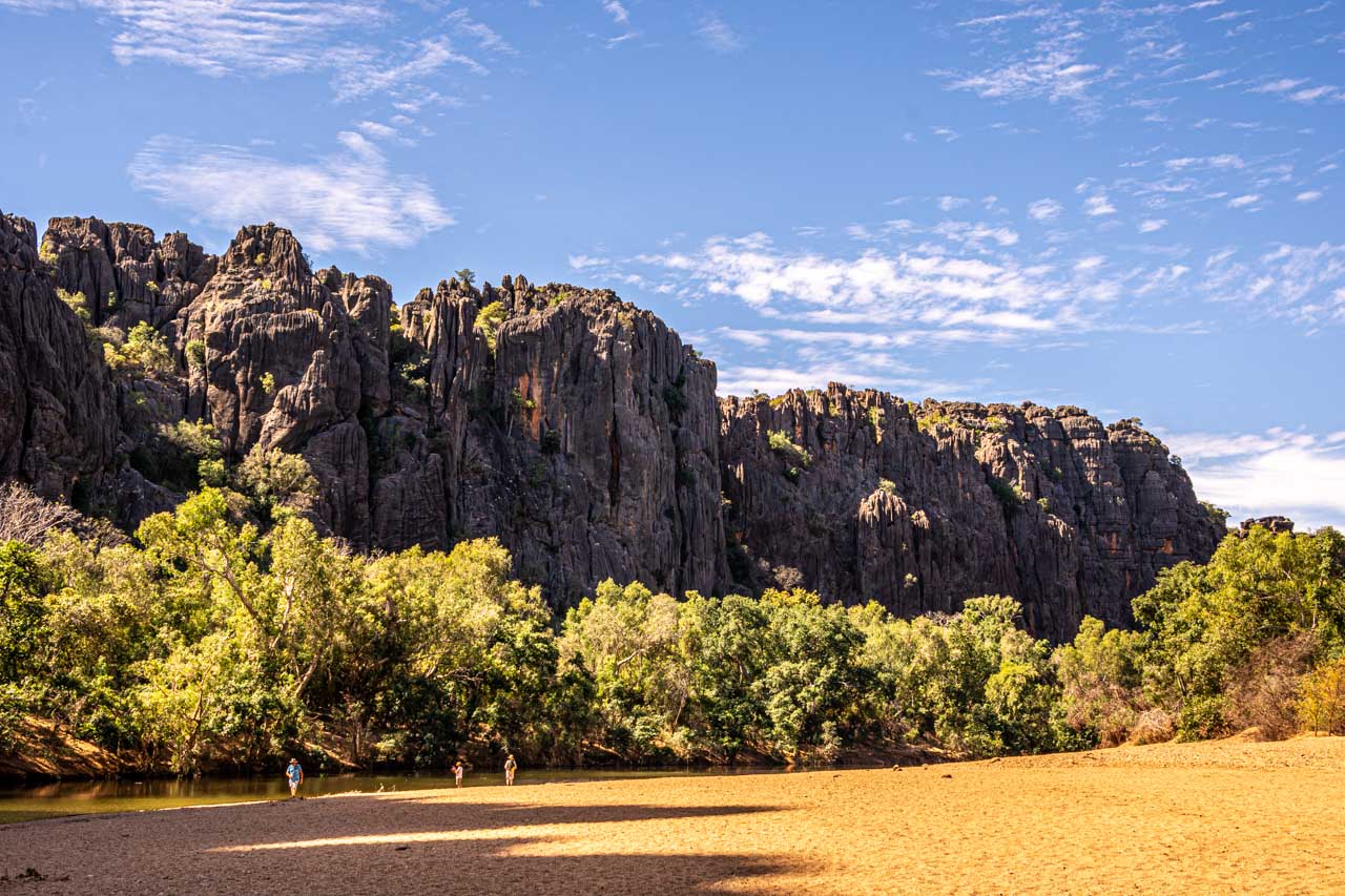
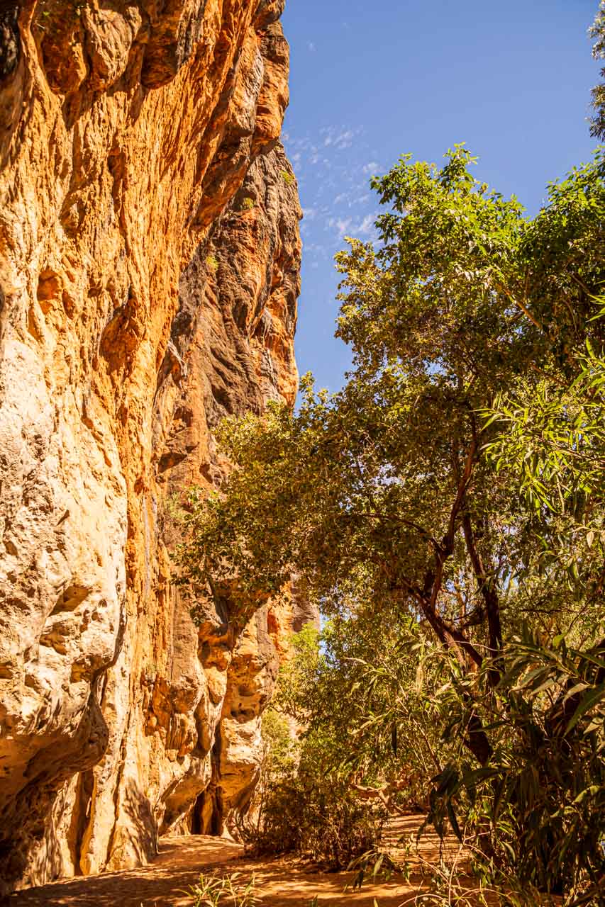
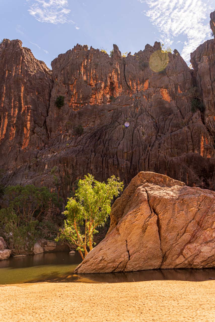
The Red Bridge was our starting point for the 3-kilometre signposted river walk through the urban bushland of the Campaspe River Reserve at Rochester.
The red dotted line indicates the river walk on the map below – taken from the brochure, Experience Rochester, courtesy of Rochester’s Visitor Information Centre.

Map of Rochester, Victoria, showing the river walk route
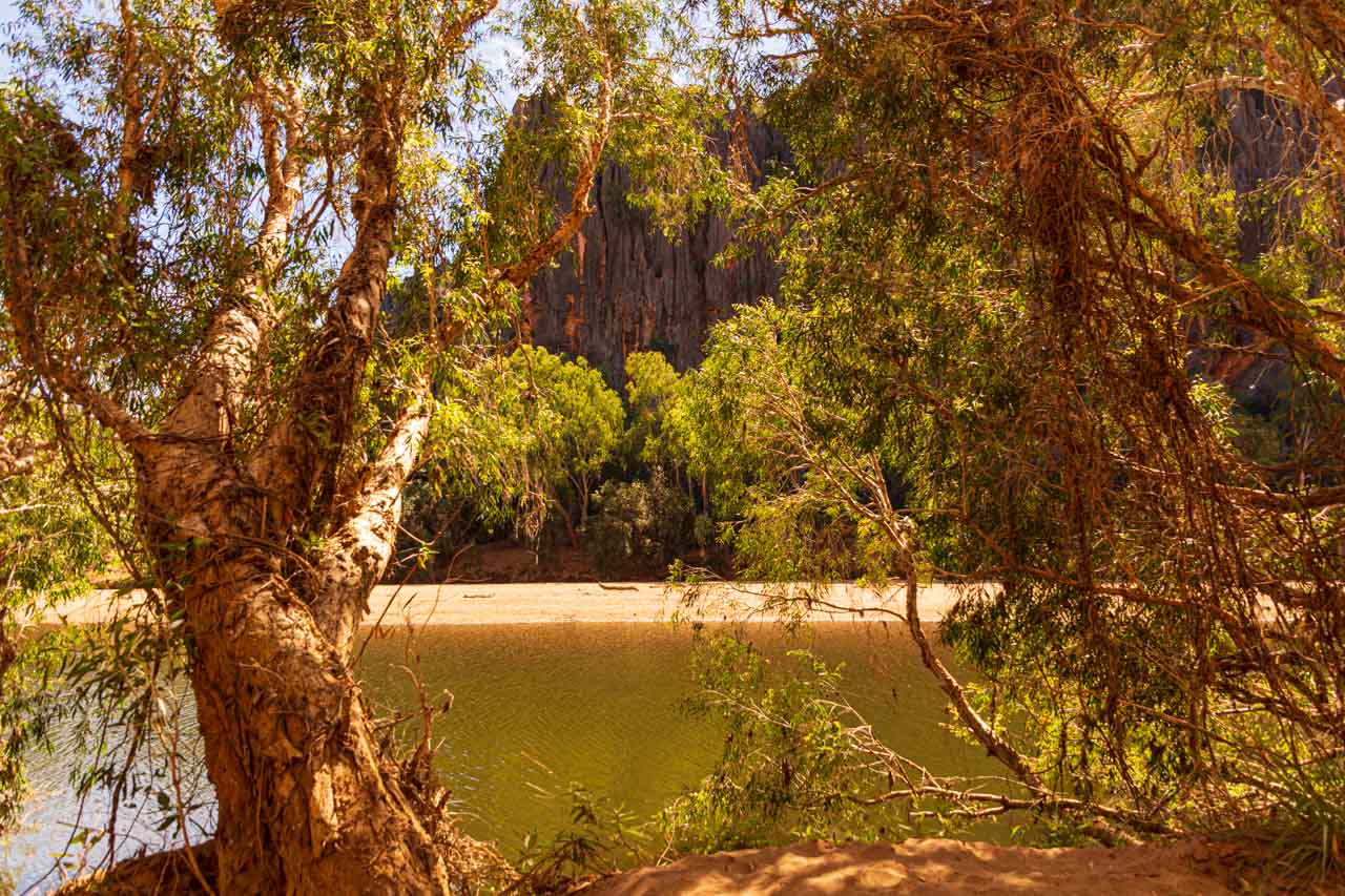
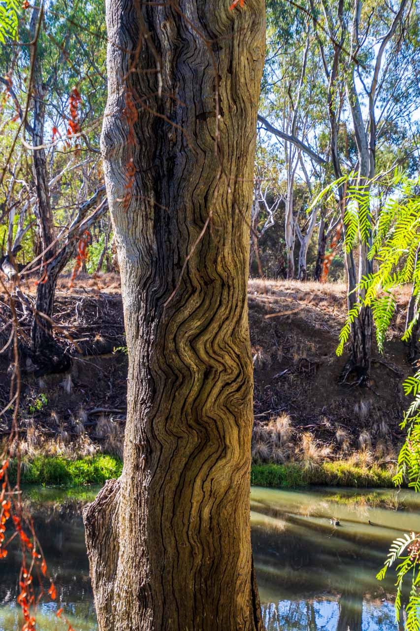
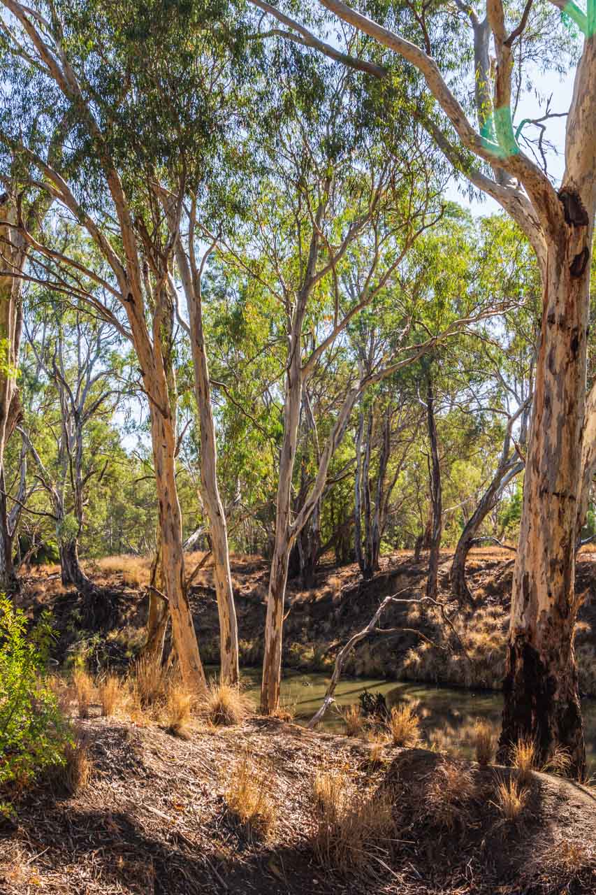
The trail meanders beside the Campaspe River through the iconic Australian bush. The Australian bush always gives me that sense of being home, no matter where I am experiencing it in Australia. And this walk did not disappoint. It was so peaceful. Just us two and birdsong.
The river walk was an easy 3-kilometre walk along the riverbank. Being flat, it was not in the least bit challenging. Benches provided a place to sit for a while and immerse yourself in the stillness and tranquillity.
The trees provide a habitat for local wildlife. My sister enjoyed seeking and identifying the different species of native birds.
Rochester’s river walk through the Campaspe River Reserve is not just a bush walk but a history lesson along the way. Plaques dot the trail at specific points of local historical interest, providing insight into how the local Aboriginal people used the area. For example, pointing out ‘scarred’ trees caused when the Aboriginal people stripped the bark to make canoes, shields, containers, and shelters. And the grooved rocks from grinding their axes.
The Campaspe River is a tributary of the Murray River. It is slow-flowing along the Reserve’s walk – as evidenced in the photos I took of the bush reflected in its waters.
When to go
We visited Rochester in the first week of May, towards the end of Australia’s autumn. In May, the average daytime temperature for Rochester is 17 degrees Celsius, with an average of 5 rain days for the month. The temperature was just right for a bushwalk along the river.
If you are looking at visiting Rochester at another time of year and wondering what the weather will be, you can find the information you need at FarmOnline Weather.
Where to eat
On our 12-day road trip around Victoria, we struggled to find decent food. Food that gives you that feeling of satisfaction. Food that lets you know you have eaten well. We could count on one hand the number of good meals we had on this road trip. But Rochester scored 2 out of 2 – dinner at the Shamrock Hotel and breakfast at Kits Kafe.
Our decision to try the centrally located, historic Shamrock Hotel for dinner was a good one (corner of Gillies and Moore Streets). I had crumbed lamb chops on a bed of mashed potatoes with seasonal steamed vegetables. My sister had the Thai Beef Stir Fry. We both agreed the food was excellent. These were some of the best pub meals we had ever eaten and were thoroughly enjoyed. Had we been staying another night, we would have gone back for seconds as there was much more on the menu we wanted to try.
Breakfast at Kits Kafe (51 Moore Street) was a yummy affair. We both had the pancakes – mine with maple syrup and bacon and my sister’s with fruit cumquat and bacon. The service was excellent, the food was delicious, and the coffee was worth going back for after our river walk.
We could see the silo artworks across the road from the Kits Kafe.
Where to stay
In Rochester, we stayed at the Rochester Motel, but there are other accommodation options available.
Next time I overnight in Rochester, I would like to stay at The Tavern (49 Moore Street) – bed and breakfast accommodation offering boutique queen rooms with ensuite.
Our main reasons for stopping overnight at Rochester were to break the journey between Kerang and Albury and see the silo artworks I had heard much about. The river walk was an enjoyable bonus, as was our food experience. In all, we came away feeling delighted with our visit to Rochester.
Editor’s Note: This blog post was originally published in July 2019 and has been updated for accuracy and comprehensiveness.
Disclaimer: This post contains no affiliate links. All views and opinions are my own and non-sponsored. Unless specifically stated, all photos are my own and remain the copyright © of Just Me Travel.
Comment below to share your thoughts on this blog post. Are amazing silo art, a beautiful river walk, and good food enough to tempt you to visit Rochester? What else would you recommend people see and do in Rochester?
Like this post, PIN it!

Related posts
For more on Victoria, Australia, read:
UNIQUE SILO ART CELEBRATES LOCAL COMMUNITIES AND FAUNA
THE COMPLETE GUIDE TO ROAD TRIPPING VICTORIA’S SILO ART TRAIL
FOOD IS FREE LANEWAY ENGAGES AUTHENTIC COMMUNITY SPIRIT
High Tea on the Yarra River, Melbourne
Author’s Note: Please check the latest travel restrictions before planning any trip, and always follow government advice.
No Comments on 3 OF THE BEST THINGS TO SEE AND DO IN ROCHESTER, VICTORIA [2021 UPDATED]