Just Me Travel

Just Me Travel

Solo Travel Blogger

Category: New Zealand

HOW TO LAND ON A GLACIER IN NEW ZEALAND’S STUNNING SOUTHERN ALPS

Experience Fox Glacier and Franz Josef Glacier on a Helicopter Flight – The Most Accessible Rivers of Ice in the World.   New Zealand’s Southern Alps are breathtaking and home…

Experience Fox Glacier and Franz Josef Glacier on a Helicopter Flight – The Most Accessible Rivers of Ice in the World.


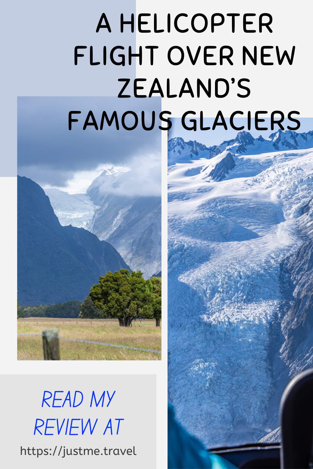
New Zealand’s Southern Alps are breathtaking and home to several glaciers. Fox Glacier and Franz Josef Glacier are the most accessible. And what better way to experience their natural beauty than with a helicopter flight over the glaciers and landing on the top of one for a walk around? 

When touring New Zealand’s South Island, I climbed aboard a helicopter for a scenic flight and snow landing. I have mixed feelings about this flight, which become evident in my review below.


I was so excited about taking a helicopter flight with Glacier Helicopters over New Zealand’s Franz Josef and Fox Glaciers – an optional extra with Grand Pacific Tours and my New Year present to myself. I will always jump at the option of a helicopter or small plane scenic flight and have taken several now around the world. They provide a unique perspective of an area or site you visit, and I feel a sense of adventure with helicopter flights.

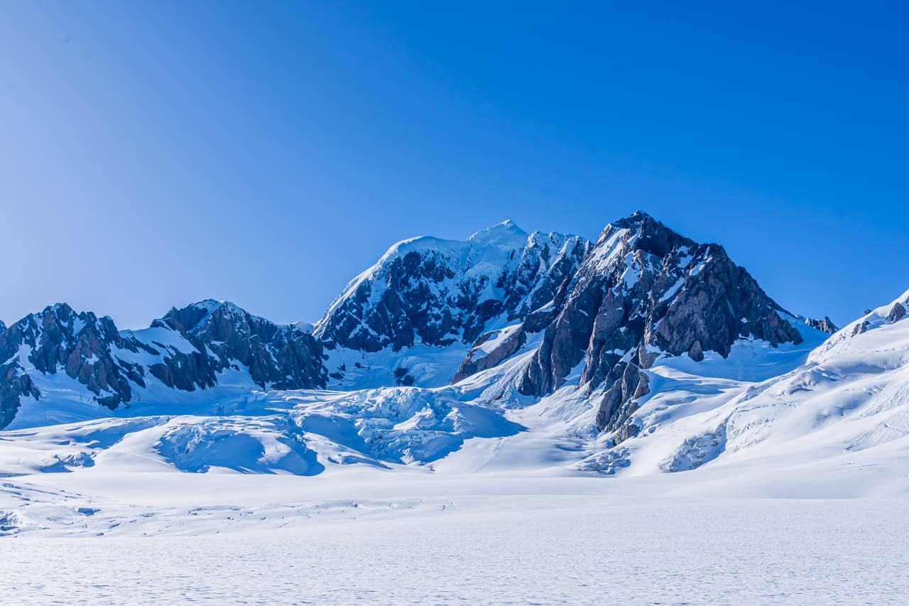
Franz Josef and Fox Glaciers are in New Zealand’s Southern Alps on the South Island’s west coast, in Glacier Country. They are temperate maritime glaciers that extend well below the snow line. Franz Josef Glacier’s terminal face is 500 metres above sea level, while Fox Glacier terminates at 250 metres above sea level. Though still flowing, both glaciers, unfortunately, are retreating, with Franz Josef vanishing at a phenomenal rate.

Franz Josef Glacier is 12 kilometres long and lies 20 kilometres south of Fox Glacier. Franz Josef Glacier was named after the Austrian emperor but is better known by its Māori name, Kā Roimata o Hine Hukatere. The glacier is five kilometres from the town of the same name.

At 13 kilometres long, Fox Glacier (Te Moeka o Tuawe) is longer and faster moving than Franz Josef Glacier and is New Zealand’s longest glacier. Fox Glacier is just five kilometres from the village of the same name. I stayed in Fox Glacier village.

View of a glacier wedged between two mountains. An open plain with several trees is in the foreground of the photo.

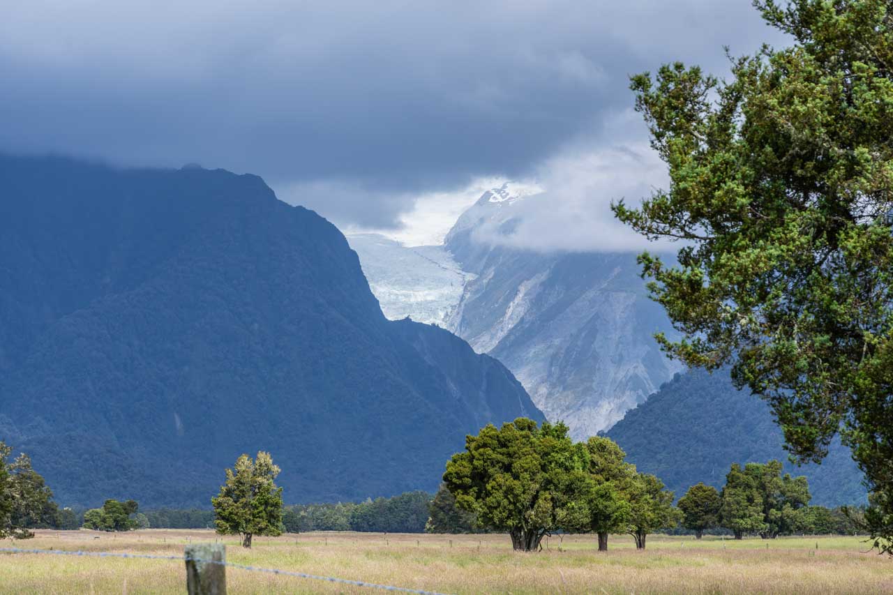
View of Fox Glacier taken from State Highway 6 near Fox Glacier village.


Grand Pacific Tours had organised the 40-minute ‘Mountain Scenic Spectacular’ helicopter flight with Helicopter Line in Franz Josef village. However, when we arrived, Helicopter Line advised us to fly the next morning because of the current poor visibility. For some reason I never understood, we booked in the following day with Glacier Helicopters for our scenic flight over Fox and Franz Josef Glaciers, with a snow landing on Franz Josef Glacier and departing from Fox Glacier village. Unfortunately, because of a strong wind, we couldn’t fly around Mount Cook (Aoraki), New Zealand’s highest mountain (3,724 metres), as per the scheduled flight path. Consequently, Glacier Helicopters reduced our helicopter flight plus snow landing to 30 minutes, and we did receive a small discount.

A snow capped mountain rises above a mountain range devoid of snow.

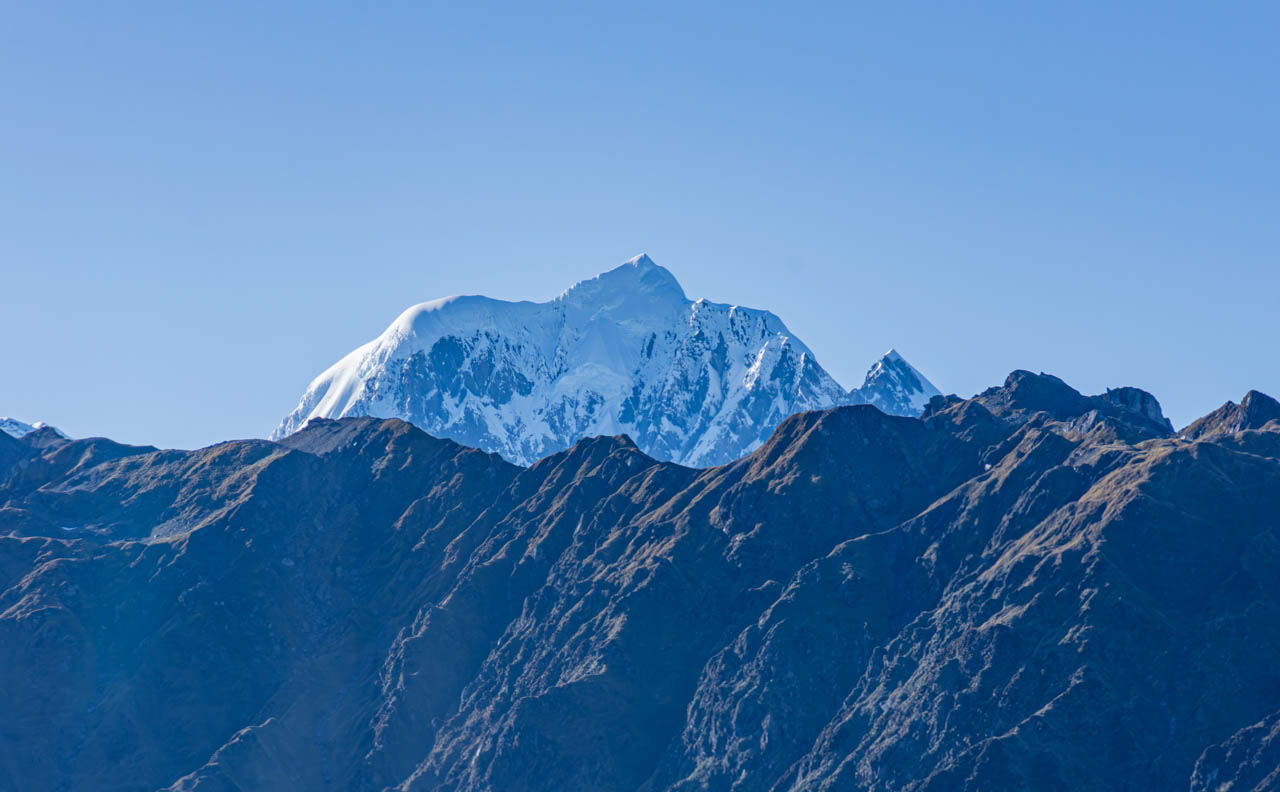
Mount Cook dominates New Zealand’s Southern Alps.


I was disappointed with Glacier Helicopter’s scenic flight. The cabin was cramped inside, and the other passengers obstructed my view. There were three of us in the back, two in the front, and the pilot. Sitting in the middle of the back seat, I found the cramped conditions restricted my arm movements, making taking photos while flying difficult.

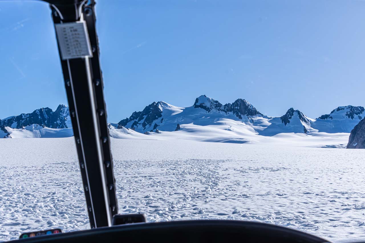
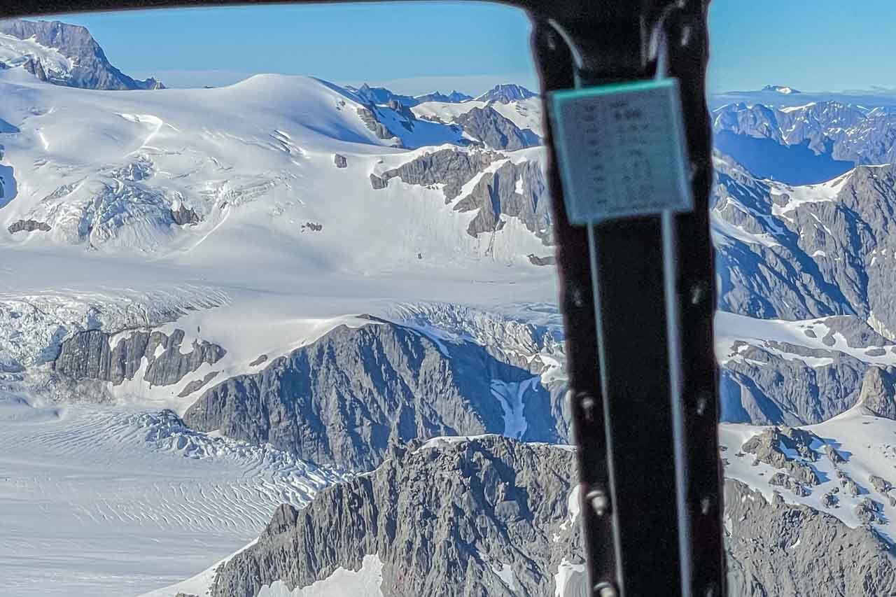
I could tolerate being sandwiched between two passengers, but having my views of the landscape we were passing over severely obstructed was upsetting. While flying, the passengers on either side of me continually blocked my sight as they leaned into their respective windows to see the landscape below and take photos. Looking out the front of the helicopter was no better as the heads of the two front passengers were prominent in many of my photos.

These circumstances negatively impacted my overall experience. As a travel blogger and photographer (I rarely disclose my tradecraft), getting good photographs is crucial for my posts. I understand weight distribution is imperative for helicopter flights, but is there no way to guarantee a window seat?

Had I not been seated in the back row’s middle seat, I believe my helicopter flight experience would have been very different – far more positive.

After flying up the ice river that is Franz Josef Glacier, we landed on the top of the glacier to spend 15 wondrous minutes walking on the snow and ice, examining the ice architecture, enjoying the views, and taking photos. The adventure of a lifetime! The landing on Franz Josef Glacier was magical. Who needs a flight around a snow-capped mountain when you can walk on a glacier?

The ice river of the Franz Josef Glacier is view from a helicopter.

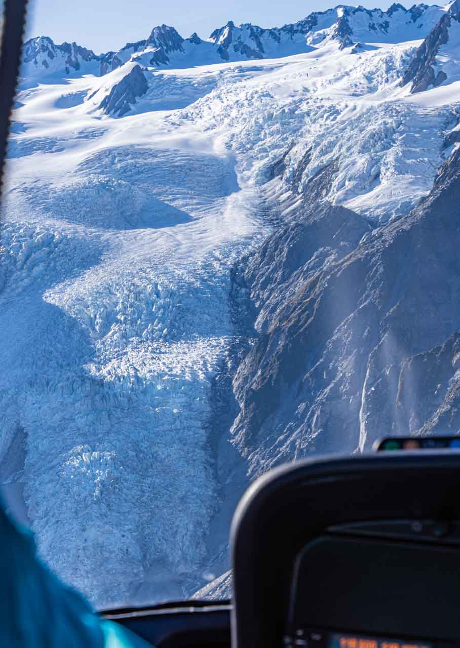
Franz Josef Glacier – climbing the ice river


New Zealand's Southern Alps at the top of Franz Josef Glacier, viewed from inside a helicopter.

Landing on Franz Josef Glacier.


While on Franz Josef Glacier, the pilot took photos of the passengers. He had a printer in the helicopter’s tail, and we could purchase a photograph after landing back at Fox Glacier Heliport.

A red and white helicopter sits on the snow with mountains behind it. The name, Glacier Helicopters is printer on the helicopter's tail. The pilot is looking into the helicopter through an open door in the tail section.

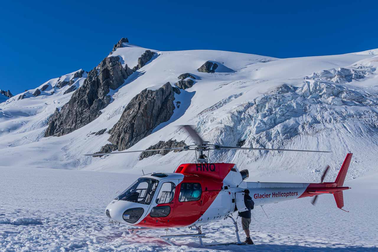
There’s a printer in the helicopter’s tail!


I would have loved more time on Franz Josef Glacier to walk further afield than just the top of the glacier, exploring its features in detail. But that’s what the Heli Hikes entail. Next time!

Being in the middle seat behind the pilot and two other passengers on Glacier Helicopter’s small, five-passenger helicopter was not value for money. I had no choice as to which company I took the helicopter flight with, as Grand Pacific Tours organised it. I recommend exploring other glacier helicopter flight companies to avoid disappointment.


My helicopter flight over New Zealand’s Fox and Franz Josef Glaciers was a mixed experience. The obstruction of my views during the flight by other passengers was undeniably disappointing. However, the magic truly began when we landed on Franz Josef Glacier. The opportunity to step out on this pristine glacier and explore its breathtaking beauty up close gave me a real sense of adventure. While the flight had drawbacks, the glacier landing left an indelible mark on my memory.


Snow covered mountains are viewed from inside a helicopter.

Fox Glacier – on top of the mountains.


Disclaimer: This post contains no affiliate links. All views and opinions are my own and non-sponsored. All photos are my own and remain the copyright of Just Me Travel.

© Just Me Travel 2018-2023.


My favourite helicopter flights are in small three-passenger helicopters with removed doors. I experienced three such helicopter flights when in The Kimberley, Western Australia. What has been your experience of scenic helicopter flights? I love hearing from you. Please leave a comment below.


Like this post? Save it for later!

The image features two photos. One shows a red and white helicopter sitting on snow with mountains behind it. The other photo is a section of a snow covered mountain range.


The image features two photos: a glacier wedged between two mountains with a grass plain in the foreground, and a view of an ice river (glacier) running down a mountain crevice.


Author’s Note: Please check the latest travel restrictions before planning any trip and follow government advice.


Sign up to receive the latest in travel destinations, topics, resources and guides.


You might also like

A collage of three photos of mountains surrounding bodies of water in New Zealand's Fiordland National Park.
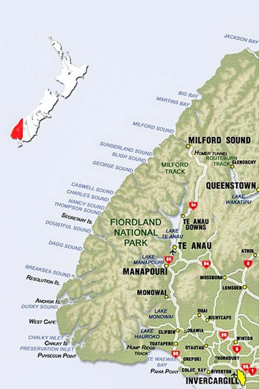
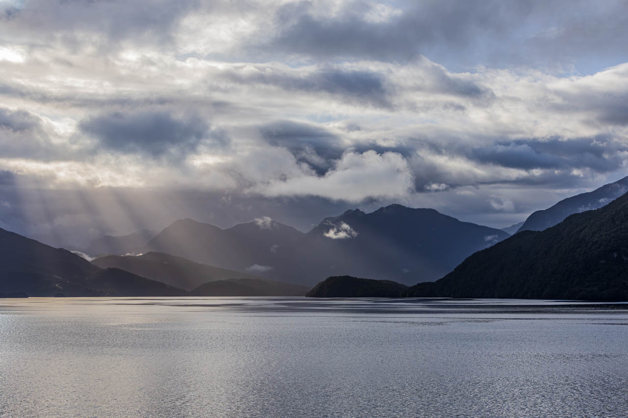
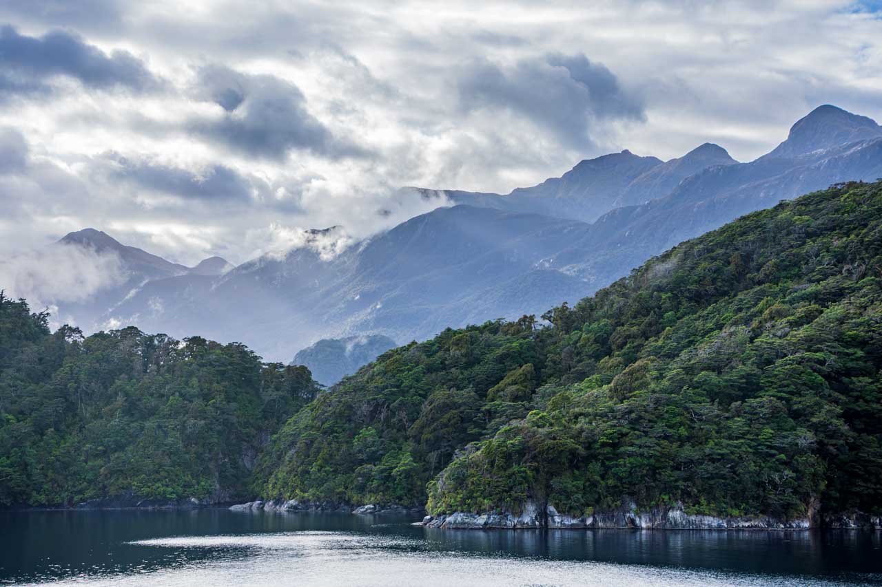
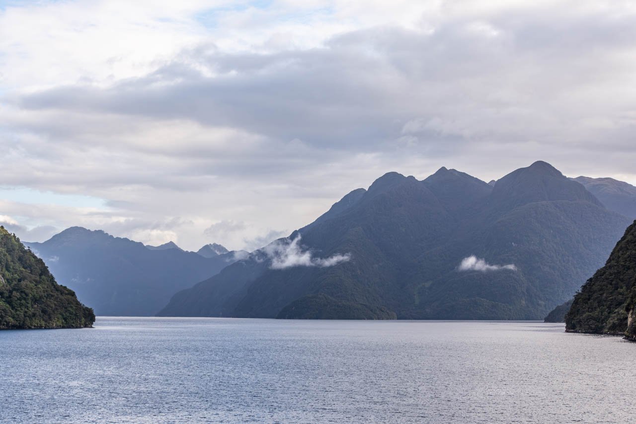
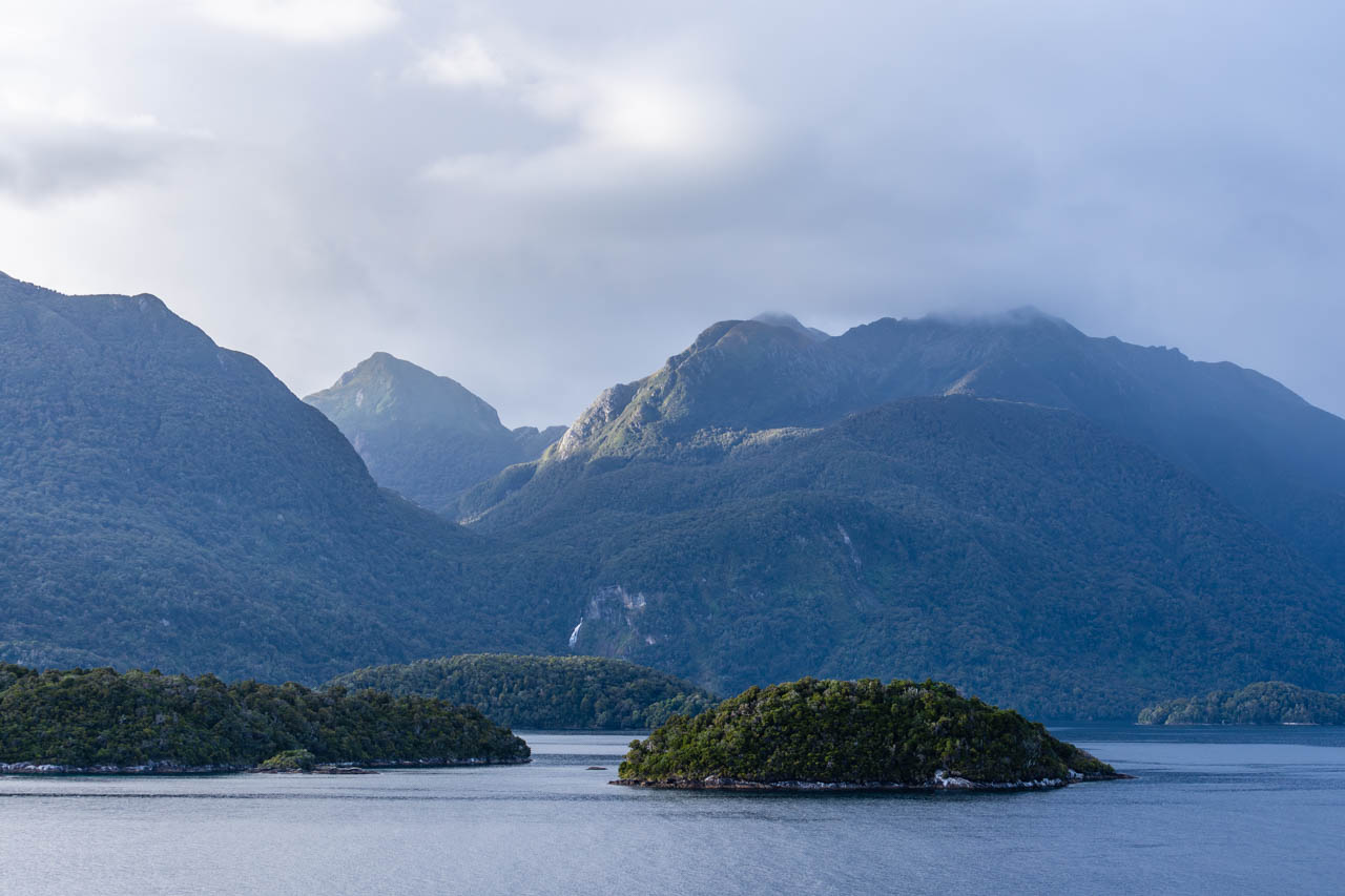
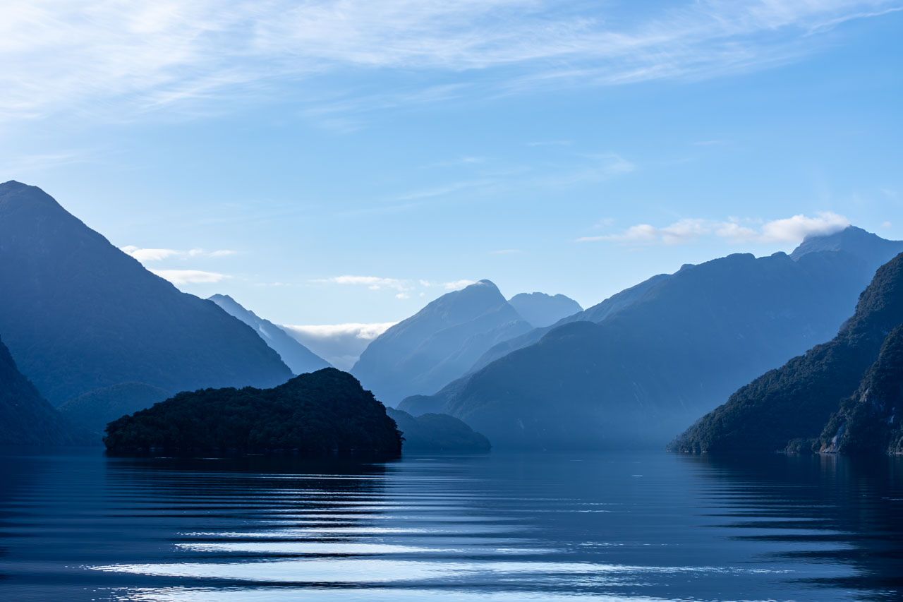
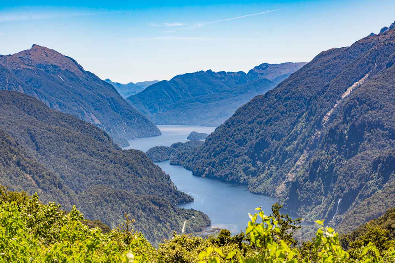
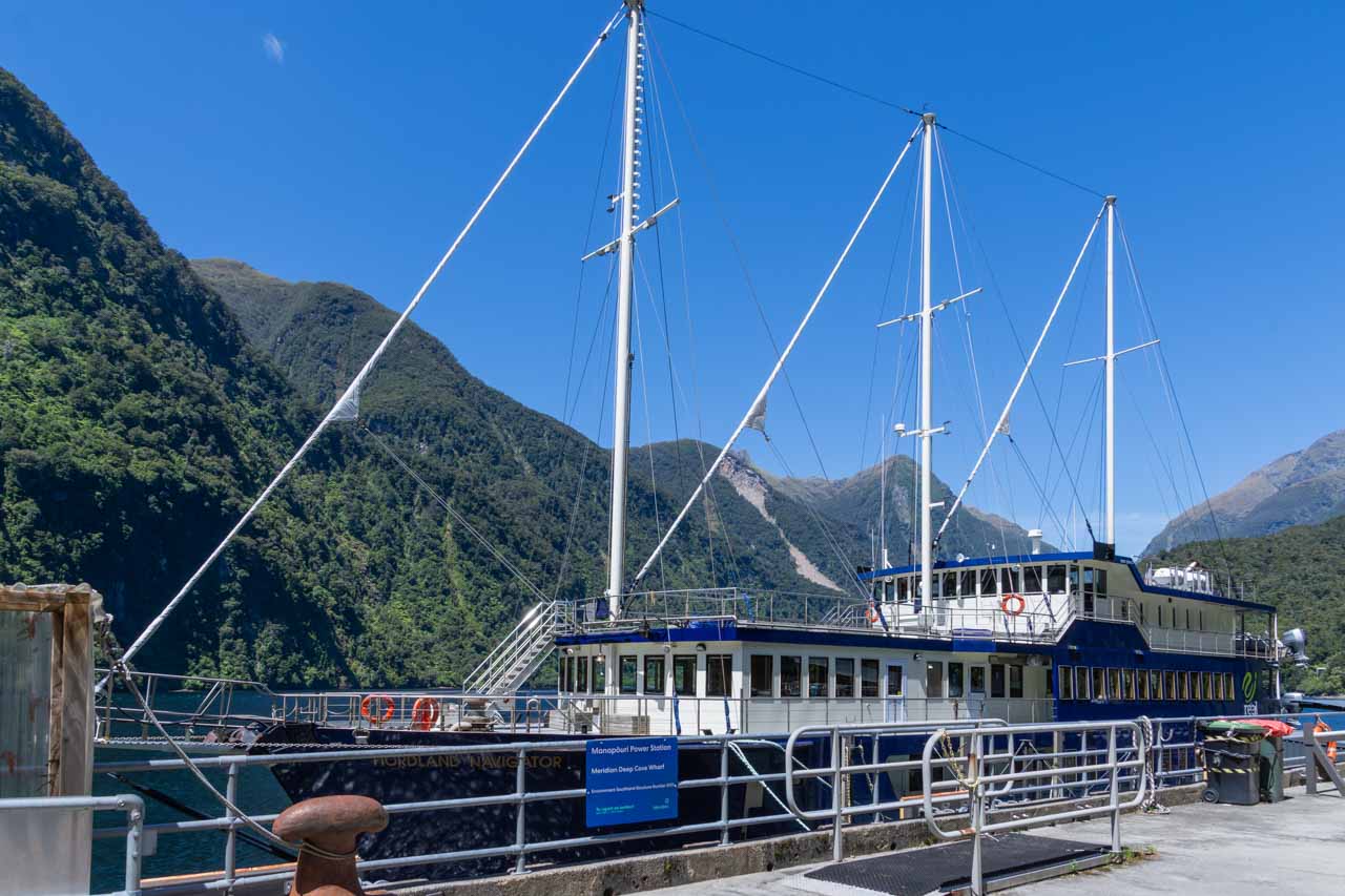
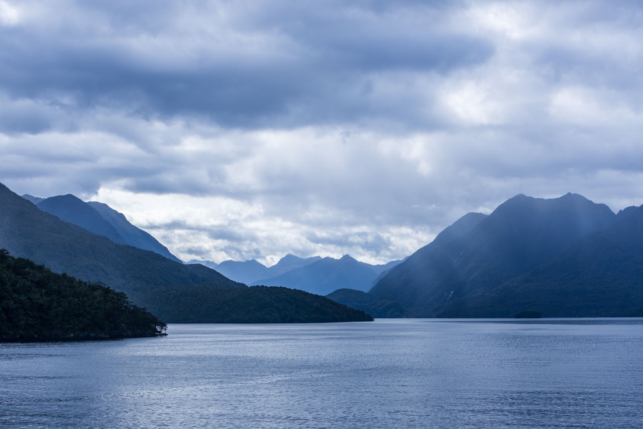
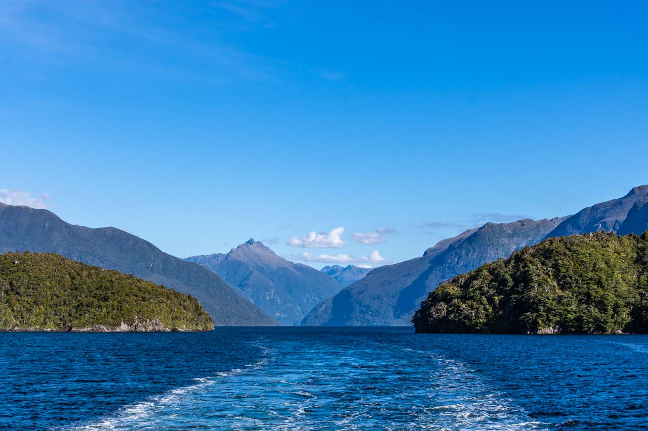
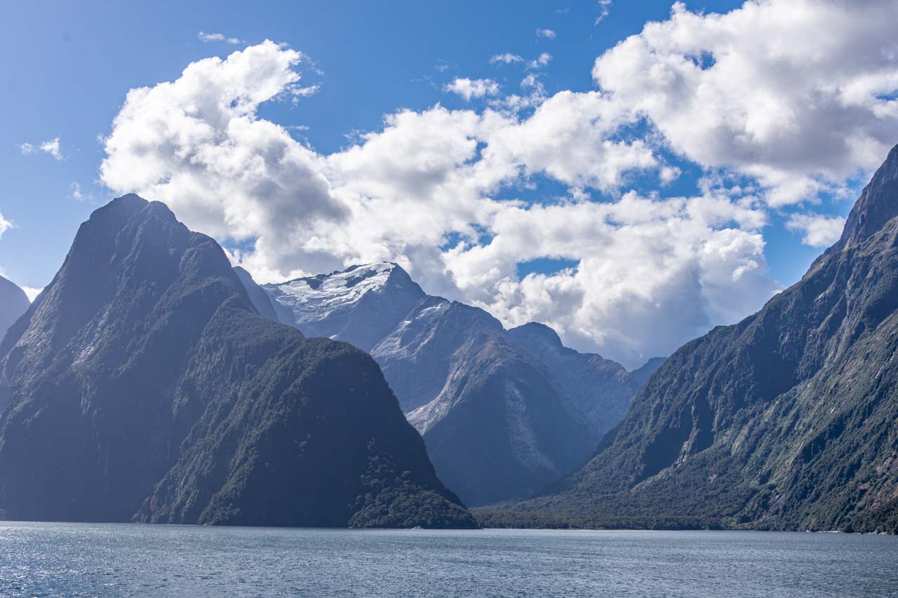
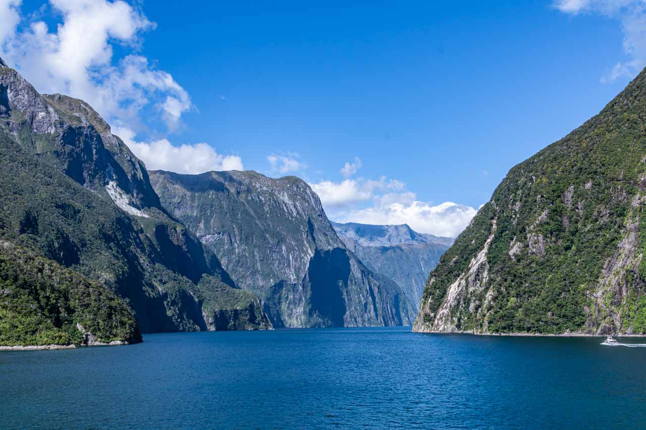
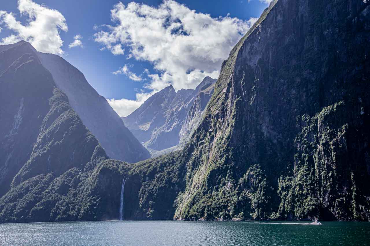
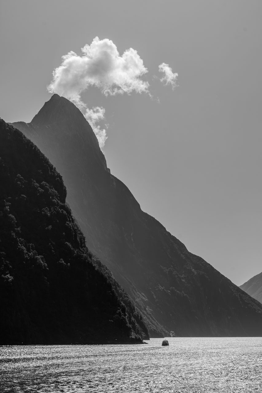
NEW ZEALAND’S FIORDLAND NATIONAL PARK – DISCOVER 3 SPECTACULAR SOUNDS. Journey through the awe-inspiring sounds of Fiordland National Park, where nature’s grandeur & serenity intertwine. Take a cruise to discover the spectacular sight of glacial-fed fiords.


The wing of a plane is seen flying over a landscape of red cliffs, white sand, blue ocean and green forestHOW TO SEE HORIZONTAL FALLS AND EPIC TIDES, AUSTRALIA. Take an unforgettable scenic flight over northern Western Australia’s Horizontal Falls. Include an incredible sea safari among giant whirlpools and standing tidal waves. See a horizontal waterfall and ride giant tides.


No Comments on HOW TO LAND ON A GLACIER IN NEW ZEALAND’S STUNNING SOUTHERN ALPS

NEW ZEALAND’S FIORDLAND NATIONAL PARK – Discover 3 Spectacular Sounds

Join Me on a Visual Journey Through the Awe-Inspiring Sounds of Fiordland National Park, a Place Where Nature’s Grandeur and Serenity Intertwine.   On two recent trips to New Zealand…

Join Me on a Visual Journey Through the Awe-Inspiring Sounds of Fiordland National Park, a Place Where Nature’s Grandeur and Serenity Intertwine.


On two recent trips to New Zealand (Aotearoa), one by land and one by sea, I was fortunate to have cruised three spectacular sounds (fiords) in Fiordland National Park – Dusky Sound, Doubtful Sound, and Milford Sound. New Zealand is one of only a few places where you can see the spectacular sight of glacial-fed fiords.

My land trip involved a convoluted journey to the included overnight, scenic cruise on Doubtful Sound. But my sea trip was a cruise on a large ship, where we sailed in and out of Dusky Sound, Doubtful Sound, and Milford Sound from the Tasman Sea.

In this post, I focus on my photographs of the three sounds because, as the saying goes, a picture paints a thousand words. I feel no amount of words will do justice to the breathtaking natural beauty I experienced of Dusky Sound, Doubtful Sound, and Milford Sound.


Fiordland National Park

The Māori name for Fiordland is Te Rua-o-Te-Moko.

A partial map of New Zealand's South Island showing the fiords in Fiordland National Park

Map of the sounds in New Zealand’s Fiordland National Park (beautifulworld.com)


Fiordland National Park is located in the southwestern corner of New Zealand’s South Island. At over 1.2 million hectares and covering nearly 13,000 square kilometres, it is New Zealand’s largest national park.

Fiordland National Park is a place of extraordinary beauty, and it is home to glaciers, majestic alpine ranges, lakes, rainforests, unique flora and fauna, and 14 sounds (fiords). Dusky Sound, Doubtful Sound, and Milford Sound are three of the park’s most significant fiords.

You will have noticed I jump between ‘sound’ and ‘fiord’, and both terms are correct. However, Dusky Sound, Doubtful Sound, and Milford Sound are actually fiords as they are glacier-carved valleys filled by the sea rather than river valleys flooded by the sea. British explorers misnamed them as sounds, and the name has stuck!

Dusky Sound

The Māori name for Dusky Sound is Tamatea.

A photo of rays of light, clouds, mountains, and a body of water.

Rays of light stream through the clouds over Dusky Sound


Dusky Sound is remote and accessible by air and sea only. It is the largest of Fiordland’s 14 sounds at 40 kilometres long and eight kilometres wide at its widest. Several islands lie in the sound.

Dusky Sound is an area of stunning landscapes, with craggy mountains and hundreds of waterfalls cascading into the sound during winter (June-August) when there are higher rainfalls. It is a wildlife wonderland with seals and dolphins often sighted in the sound.

We sailed into Dusky Sound at 8.30 in the morning, with the clouds still rising above the mountains. Dusky Sound was my favourite of the three sounds as I found it to be the more dramatic. That it revealed itself only slowly added to the drama.

A visual journey through Dusky Sound

Tall peaks with low cloud cover reach a body of water

Low clouds drape the mountains of Dusky Sound.


A body of water surrounded by mountains and low cloud cover.

Dusky Sound, Fiordland National Park


Mountains line a body of water with small islands

Dusky Sound – mountains and islands


Doubtful Sound

The Māori name for Doubtful Sound is Patea, meaning “the place of silence”.

Mountains surround a body of water with small islands in the still morning

Untouched Doubtful Sound, Fiordland National Park


Doubtful Sound is the deepest (421 metres) and one of the longest (40 kilometres) of South Island’s fiords and has three arms. Doubtful Sound is a pretty waterway with its rugged landscape, verdant rainforest, and cascading waterfalls. Wildlife includes fur seals and penguins, and it is home to a permanent pod of about 70 bottlenose dolphins.

Doubtful Sound is remote, and there is no direct road access. Your only way of getting to Doubtful Sound is a bit of a journey but an adventure in itself. Starting at Pearl Harbour wharf in Manapouri, you take a cruise across Lake Manapouri to West Arm (about 50 minutes), then travel by coach over Wilmot Pass (671-metre-high) to Deep Cove in Doubtful Sound, where you board your scenic day or night boat cruise. On the drive over Wilmot Pass, the coach stops at a vantage point for a magnificent view of Doubtful Sound below. The total time travelled from Manapouri to Deep Cove is nearly two hours. There is no settlement at Deep Cove, but it is home to a small fishing fleet.

View from above of a fiord with mountains on both sides.

Looking down on Doubtful Sound from Wilmot Pass


I first experienced the remote wilderness of Doubtful Sound on an overnight cruise on the three-masted Fiordland Navigator, taking the journey described above to get to the ship. On our second day, the ship stopped the engines for 10 minutes of silence to honour Doubtful Sound’s Māori name and listen to nature.

A three-mast passenger ship docked at a wharf, with mountains in the background.

The Fiordland Navigator docked at Deep Cove Wharf in Doubtful Sound.


My second trip along Doubtful Sound was aboard a cruise ship, entering the fiord from the Tasman Sea.

A visual journey through Doubtful Sound

Mountain peaks tinged blue in the early morning light surround a body of water.

The blue tinge of early morning light on Doubtful Sound


Mountain peaks rise above a body of water

The shadows and light of Doubtful Sound


A body of water surrounded by mountains and wake in the water created by an unseen boat.

The ship’s wake creates a path through Doubtful Sound.


Milford Sound

The Māori name for Milford Sound is Piopiotahi.

Tall mountain peaks surround a body of water

Milford Sound, Fiordland National Park


Milford Sound is 16 kilometres long, with sheer cliffs and waterfalls to rival some of the world’s tallest. It is the only fiord accessible by road (around 5-6 hours from Queenstown and about three hours from Te Anau) and the most popular. You can stay in Milford Sound, with accommodation options ranging from Airbnb to a public lodge.

Milford Sound is known for the towering Mitre Peak, so called because it resembles a bishop’s mitre. The fiord is home to dolphins, fur seals, and penguins.

The naturalist onboard the Fiordland Navigator commented that Milford Sound is the most touristy of Fiordland National Park’s fiords but the most beautiful. You be the judge! Perhaps the lack of tourists in Dusky Sound and Doubtful Sound appealed to me the most. Somehow, they felt more untouched. But who am I to say? The British writer Rudyard Kipling visited Milford Sound in the 1890s and declared it ‘the eighth wonder of the world’.

A visual journey through Milford Sound

A small boat cruises through water surrounded by tall cliffs.

The cliffs of Milford Sound dwarf a boat.


Sheer mountains dwarf a waterfall and boat.

Milford Sound has many waterfalls.


A photo of a mountain shaped like a Bishop's mitre

Mitre Peak, Milford Sound


No trip to New Zealand is complete without exploring Fiordland National Park and the spectacular sight of glacial-carved fiords.

I hope these photographs have transported you to a land of untamed beauty, leaving an indelible imprint on your senses with a desire to discover for yourself. Fiordland’s sounds are a testament to the power and harmony of the natural world.


Disclaimer: This post contains no affiliate links. All views and opinions are my own and non-sponsored. All photos are my own and remain the copyright of Just Me Travel.

© Just Me Travel 2018-2022.


If you could only visit one of New Zealand’s sounds (fiords) in Fiordland National Park and getting there was no barrier, which sound would you choose and why? Leave a comment below.


Like this post? Save it for later!

A collage of two photos of mountains reaching down to a body of water. One photo shows a mountain shaped like a Bishop's mitre. The other photo shows the wake of an unseen boat.

A collage of two photos. One photo shows a river-like body of water with mountains on both sides, looking from above. The other photo shows a mountain reflected in the water.


Author’s Note: Please check the latest travel restrictions before planning any trip and follow government advice.


Sign up to receive the latest in travel destinations, topics, resources and guides.


You might also like

A view of New Zealand's snow covered Southern Alps, with Mount Cook in the background.HOW TO LAND ON A GLACIER IN NEW ZEALAND’S STUNNING SOUTHERN ALPS. Climb aboard a helicopter for a scenic flight over Fox and Franz Josef Glaciers and experience a snow landing on Franz Josef Glacier.


No Comments on NEW ZEALAND’S FIORDLAND NATIONAL PARK – Discover 3 Spectacular Sounds

Type on the field below and hit Enter/Return to search