Just Me Travel

Just Me Travel

Solo Travel Blogger

Tag: Day trip destinations

5 FABULOUS DAY TRIPS FROM BARCELONA SPAIN: Your Reliable Guide

Mountains, Museums, and Medieval Magic: Catalonia Unveiled Through Unforgettable Day Trips for Every Traveller.   Welcome to my travel blog, where I am excited to share with you exceptional day…

Mountains, Museums, and Medieval Magic: Catalonia Unveiled Through Unforgettable Day Trips for Every Traveller.


Welcome to my travel blog, where I am excited to share with you exceptional day trips beyond the streets of Barcelona. Join me as I recount my unforgettable experiences on five diverse and awe-inspiring tours from Barcelona. From towering mountains to rugged coastlines, from quaint medieval villages frozen in time to the birthplace of Surrealism, these five exceptional tours take you to another world of Catalonian beauty and wonder.

Catalonia’s diverse landscapes offer a diversity of experiences. Embarking on day trips from Barcelona opens up a world of exploration, where each destination promises its unique blend of history, culture, and natural beauty. Whether you’re drawn to the spiritual heights of Montserrat, the sun-kissed shores of Costa Brava, the timeless charm of medieval villages, the rugged grandeur of the Pyrenees, or the artistic legacy of Salvador Dali, there’s a world of exploration waiting to be uncovered. Catalonia’s day trips have something for everyone!


The 5 Day Trips


Day Trip from Barcelona to Montserrat

Tour: Montserrat Visit with Ascent by Cogwheel Train

Tour Operator: Julia Travel

Duration: Full day – 11.5 hours

Cost: AUD140.00

I booked this tour from Australia before leaving for Spain.

Julia Travel promotes this small group trip as discovering “one of the most mystic Catalan wonders”.

Montserrat Monastery is an 11th-century Benedictine monastery on Montserrat Mountain (meaning ‘serrated mountain’), 60 kilometres northwest of Barcelona. The monastery hangs onto the side of the mountain 725 metres above sea level.

About 80 monks reside at the monastery, which is famous for the Black Madonna statue in the basilica and one of the oldest boys’ choirs in Europe.

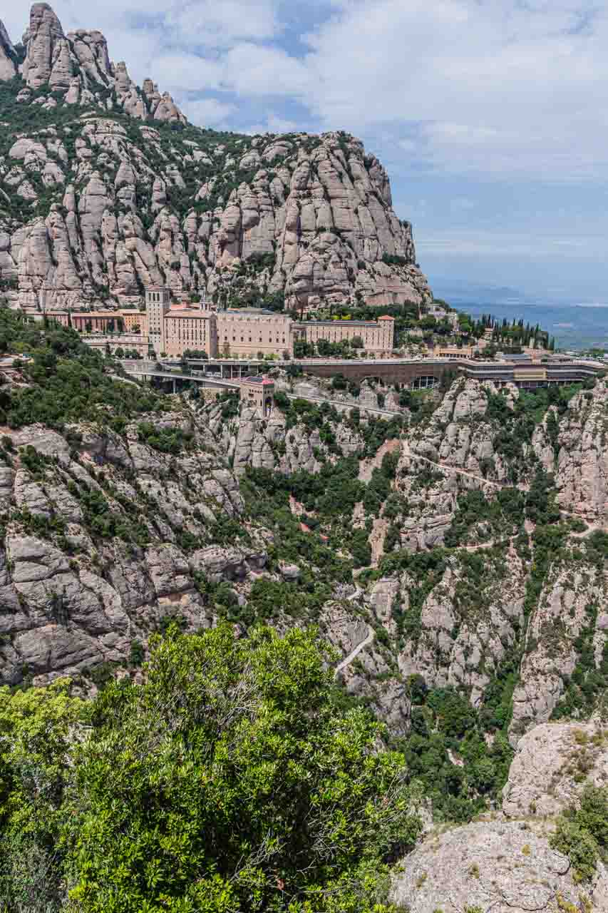
View across the valley of a monastery on the side of a mountain.

Montserrat Monastery perched on the side of the mountain.


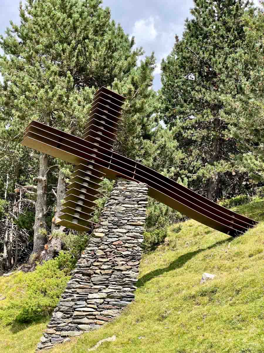
I took this photo of Montserrat Monastery across the valley at the Cross of St Michael.

The tour as I experienced it:

There were five of us on the Montserrat full-day tour, plus the guide. We travelled on the bus from Barcelona to Montserrat with the morning-only tour participants, separating into two groups (morning-only group and full-day group) on arrival at Montserrat Abbey.

An hour after leaving Barcelona, we arrived at the rack railway (also referred to as the Cremallera) at the bottom of Montserrat Mountain in the small town of Monistrol de Montserrat for the cogwheel train ride up the mountain to the centre of the Monserrat Monastery complex. The five-kilometre, 15-minute ride provided fantastic views of this unusual mountain. As you leave the train, pause to take in the views of the mountain that towers above the monastery and basilica and the deep valley below.

The morning was spent with our tour guide, learning about the monastery, visiting the basilica and Black Madonna, and watching a short documentary about the monastery’s world-famous Boys’ Choir (L’Escolania).

We could not see the Boys’ Choir perform in person as the boys were on school holidays.

A tilted courtyard leads to the carved front entrance of a church.

The Atrium (open courtyard) in front of the Basilica and front facade of the Basilica.


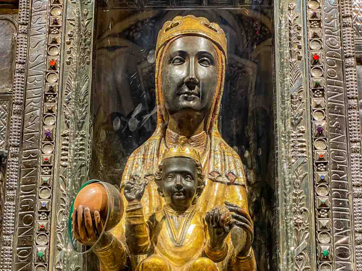
A black madonna with baby Jesus sitting on her lap. She is holding a marble ball that people can rub. The figures are behind glass.

The Black Madonna inside Montserrat Basilica.


The famous Black Madonna wooden statue sits behind glass at the back of the church above the high altar. We joined the queue of pilgrims and tourists to file past the Black Madonna, where many stopped to touch her hand through a cut in the glass.

According to our guide, the Madonna’s face is black due to a botched restoration in about the 12th century when the wrong varnish was used, turning her face black. It was decided to leave her face black, with locals saying that maybe the Madonna wanted a black face. However, historical descriptions of the Madonna say she has simply darkened over time. This latter theory makes more sense, given that the face of the baby Jesus sitting on Madonna’s lap also appears black.

The guided morning tour ended at 12.10 pm, and we were free to spend the rest of the day as we pleased, meeting again at 6.15 pm for the bus trip back to Barcelona.

With the afternoon free, I was eager to take a walk on Montserrat Mountain, starting at the top and walking down. To do this, I rode the Funicular de Sant Joan from Montserrat Monastery to the summit of Montserrat Mountain, about 300 metres above the monastery. I took the path to the left of the Funicular station that wound around and down the mountain to the Cross of Saint Michael (Sant Miquel)) and back down to the monastery.

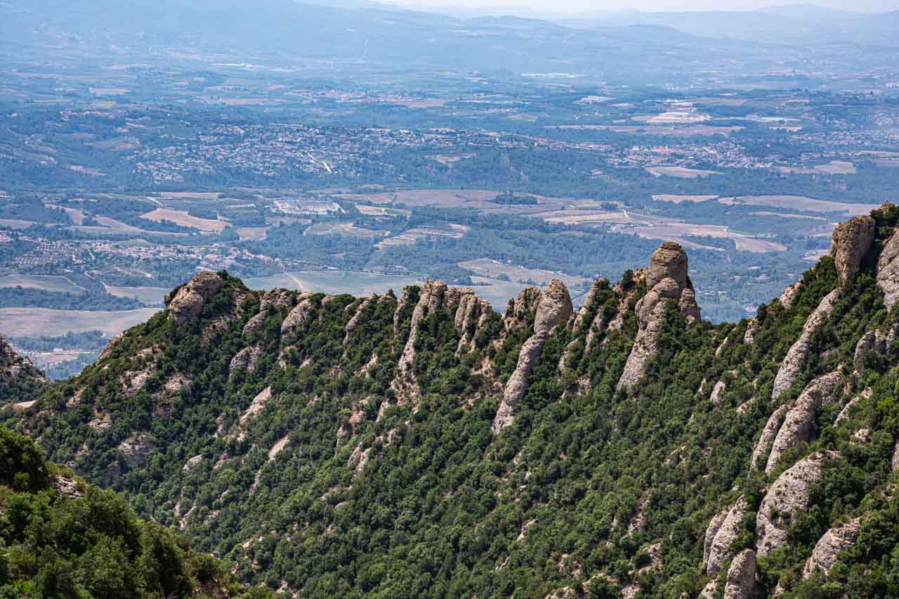
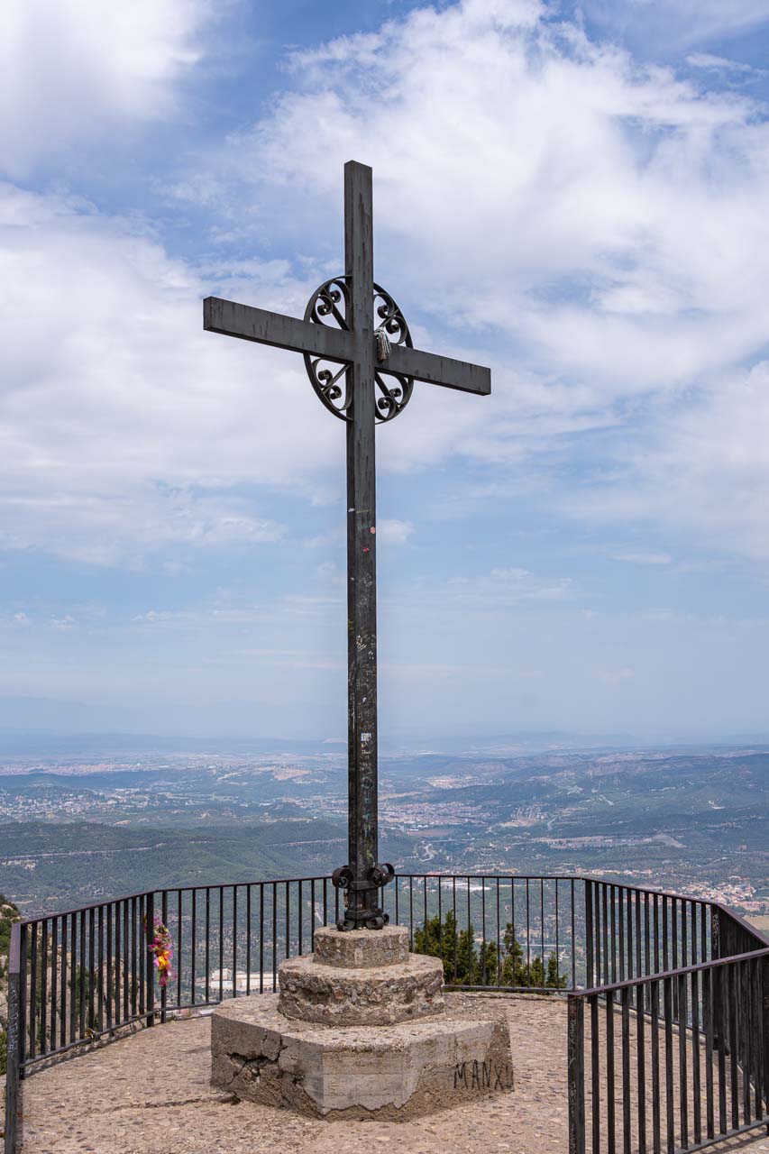
The signpost at the beginning of the path indicated it was a 40-minute walk to the Cross of Saint Michael. The Cross was about one and a half hours into my very steep descent down Montserrat Mountain, and I still had about 20 minutes to go before I arrived back at the monastery. But I was in no hurry as I took in the spectacular views of Montserrat Mountain’s unique geological (‘serrated’) formation and the valleys and river below.

A serrated mountain top with a view of farm lands and towns in the valley below.

View from Montserrat (‘serrated’) Mountain.


A tall cross monument forms a lookout point for the Vally below.

Cross of Saint Michael and the valley below


While the walk down the mountain was not technically demanding (it’s a paved path nearly all the way), I did find the steep descent challenging. There were times when the decline was so steep my back was almost vertical to the path. The heat was another challenging factor. I’m sure I was on that mountain on its hottest day ever recorded!

Back at Montserrat Monastery, I had a late lunch at the cafeteria – a buffet that cost €19,50 and was not worth the money.

My tour review / final thoughts:

According to their website, Julia Travel no longer offers the full-day Montserrat tour from Barcelona that I did. Instead, they offer a morning (5.5 hours) and afternoon (4.5 hours) tour with the cogwheel train at €59 and €51, respectively.

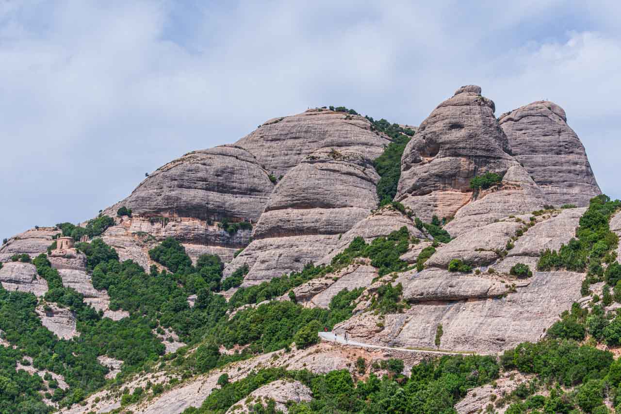
Having done both the morning and full-day tours a few weeks apart, I believe a half-day tour does not allow time to immerse yourself in the beauty of the mountains where the monastery sits. While visiting the abbey and basilica and learning their history was interesting, the highlight for me was the walk on Montserrat Mountain. It would be a shame to miss out on one of the several walks you can take around Montserrat.

People walking on a path around around the top of a mountain.

The Sant Jeroni walking trail on Montserrat Mountain


There was a communication issue with Julia Travel on this tour. Arriving in Montserrat, the guide sent us to grab a coffee as she was trying to contact Julia Travel to organise our entrance tickets into the basilica and the Black Madonna, delaying the start of the tour by half an hour. Then, when it came to leaving Montserrat, Julia Travel forgot there were five of us doing the full-day tour and supposedly leaving on the same bus as the afternoon tour. However, 50 people were on the afternoon tour, and it was a 50-seater bus. Consequently, we (the five full-day tour group) were taken off the bus and had to wait for another bus from Barcelona to come and get us. So, instead of leaving Montserrat at 6.15 pm, we left an hour later, arriving back in Barcelona at 8.10 pm. Luckily, it wasn’t dark as I had a 35-minute walk back to the hotel, and people were only starting to come out for dinner in restaurants then.

I found Julia Travel’s communication a repetitive problem. I had booked another tour with Julie Travel to Salvador Dali’s Theatre-Museum and Villages – a tour I was particularly keen on taking. However, arriving at 8.00 am at Julia Travel’s office on the day of the tour, I learned it had been cancelled. I received an apology for not being informed and a refund. However, this was not good enough and amounted to unacceptable customer service.

The setting alone makes Montserrat Monastery worth a visit. But it was the mountain walk that made this tour memorable for me.

View of a valley below Monterrat Mountain in Spain.

Llobregat Valley and River taken from Montserrat Mountain


Day Trip from Barcelona to Figueres

Tour: Salvador Dali Museum, Figueres and Cadaques Small Group Trip from Barcelona

Tour Operator: Explore Catalunya

Duration: Full day – 11 hours

Cost: €99,00

Explore Catalunya promotes this small group trip as the “Best tour for Dali enthusiasts, and you’ll see hidden treasures off the beaten path”.

The summer schedule for this day trip (1st July – 14th September) does not include the coastal village of Cadaques, which is included in the winter tour schedule. Instead, the summer schedule takes you to Gala Dali’s Castle in Pubol. I was on the summer schedule day trip.

Near the border with France and about 136 kilometres north of Barcelona, Figueres is famous for being the birthplace of the artist Salvador Dali, an artist I have been a fan of for many decades. It is also home to his world-famous Theatre and Museum.

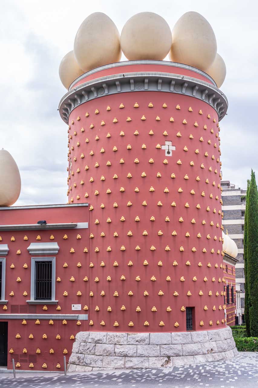
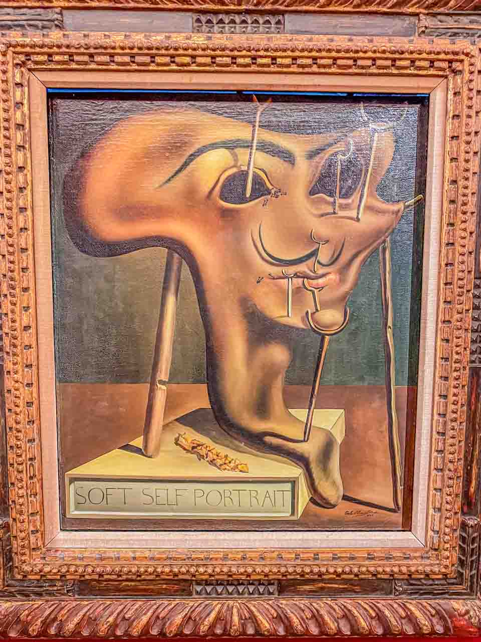
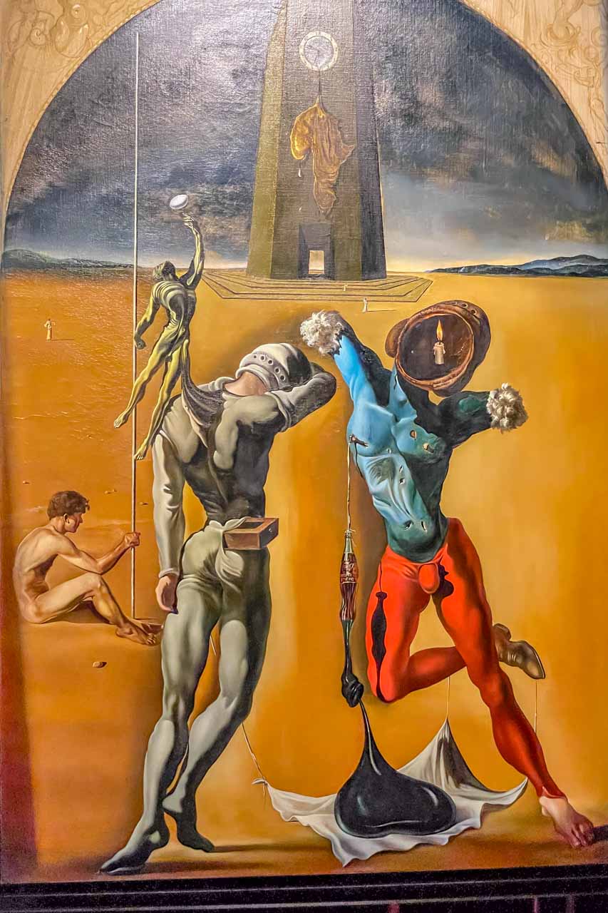
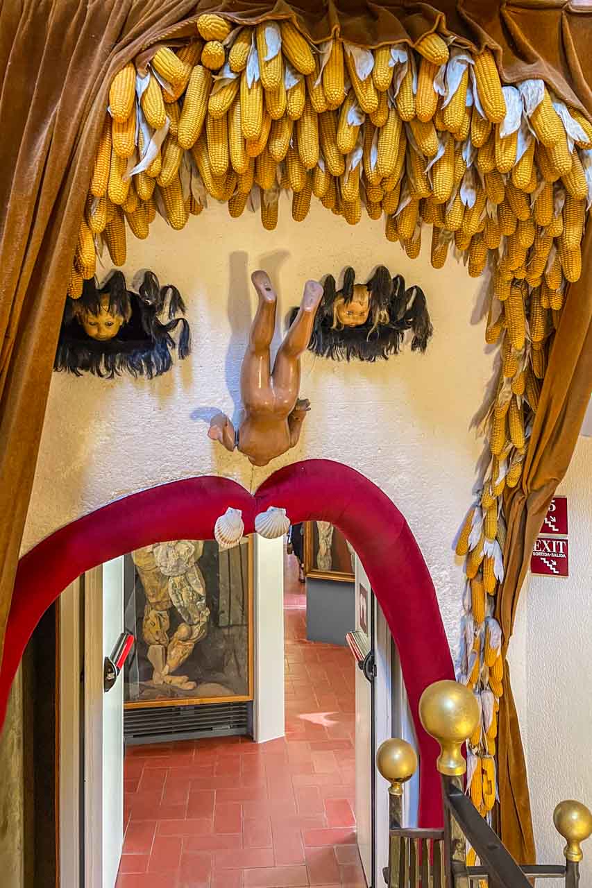
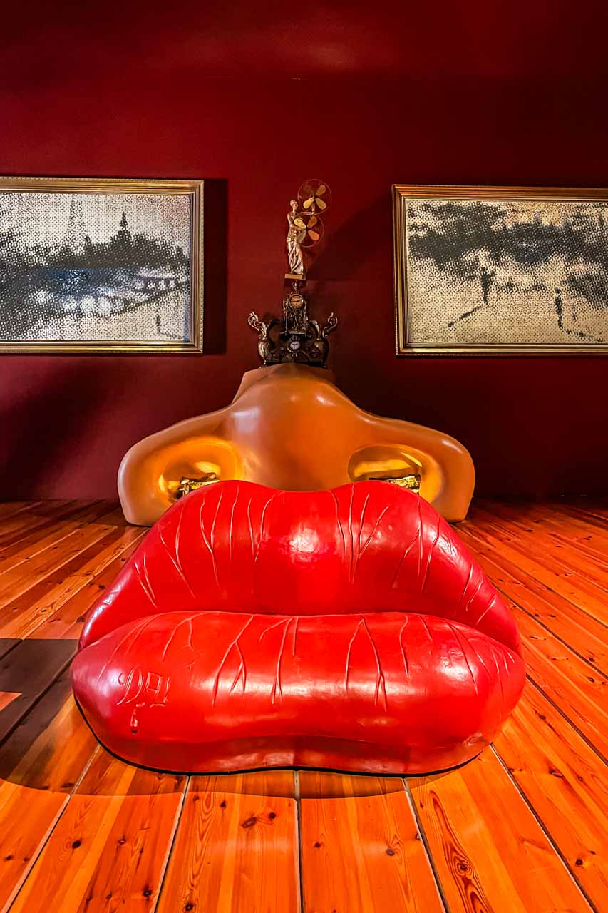
The Dali Theatre-Museum is a museum dedicated solely to the Spanish artist Salvador Dali, a genius of Surrealism. Built by Dali, it is considered the world’s largest surrealist object and is crowded with his artworks – paintings, sculptures, photographs, and jewellery.

Dali is buried in a crypt beneath the dome of his Theatre-Museum.

The tour as I experienced it:

On arrival in Figueres, we headed to the world-famous Dali Theatre-Museum for a half-hour guided tour with our Explore Catalunya guide. Following the guided tour, we had one and a half hours of free time to explore the three floors of the Theatre-Museum for ourselves.

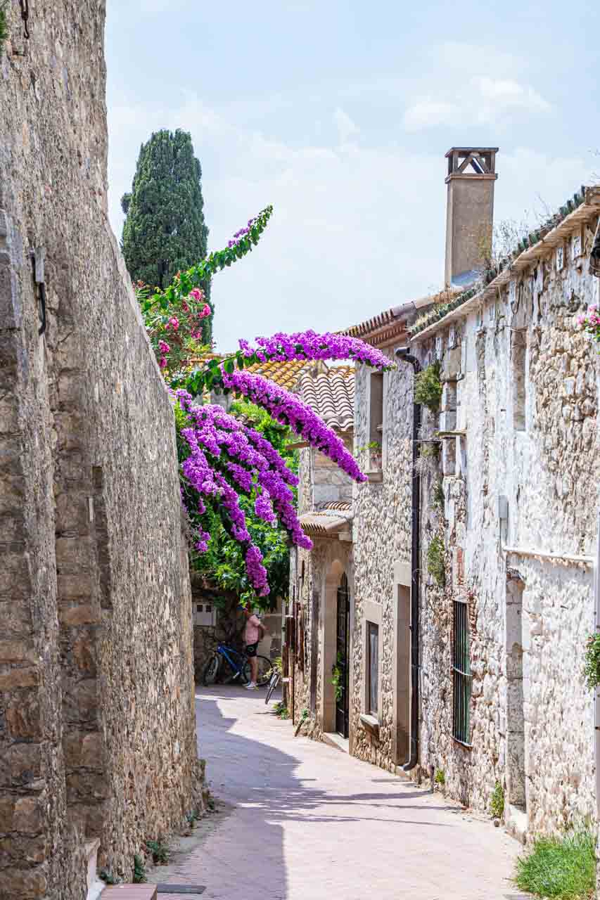
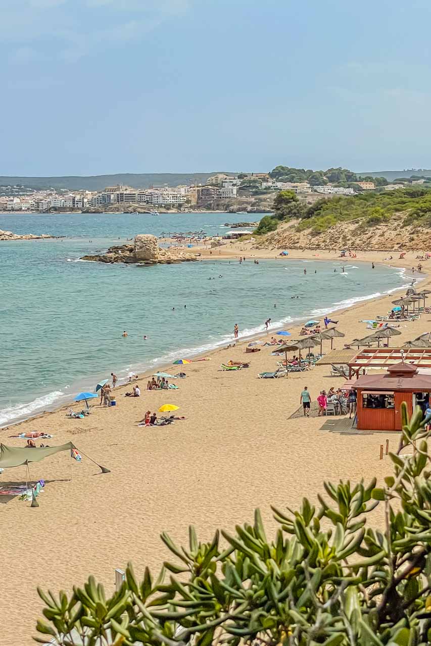
After leaving Figueres at 12.45 pm, we drove a short half-hour to the pretty, seaside medieval village of Sant Marti d’Empuries on the Costa Brava. Here, we were given two hours of free time for lunch, to explore, or to take a dip in the Mediterranean Sea.

I had a delicious salad at L’Escalapi Restaurant and Pizzeria – a Goat’s Cheese Salad with lettuce, tomatoes, goat’s cheese, walnuts, pine nuts, sultanas, and mustard and honey dressing. Spain does salads so well! I followed up my salad with Sugar and Lemon Crepes. The total cost for lunch was €20 (AU$33).

I walked off lunch by wandering around Sant Marti d’Empuries, admiring its medieval buildings and checking out the beach – a lovely spot to stay a while.

Our last stop for the day was Gala Dali’s Castle in the tiny village of Pubol. The castle is the house Salvador Dali bought for his wife. Salvador didn’t live here until after Gala’s death and had to be invited by Gala to visit.

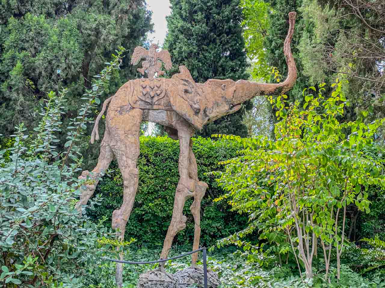
We were given a half-hour guided tour inside the castle and half an hour of free time to explore its gardens. According to our guide, Gala wanted to design the interior herself, but there is substantial Salvador Dali influence (artworks) inside the castle and its grounds. I particularly loved the Dali sculptures of long-legged elephants in the gardens.

A sculpture of an elephant with very long legs and an eagle on top sits in a garden of green plants.

There’s an elephant in the garden!


Gala is buried in the crypt designed by her husband in the castle’s basement.

Leaving Pubol at 5.00 pm, we arrived in Barcelona at 6.45 pm.

My tour review / final thoughts:

I have been a fan of Salvador Dali for many decades, and visiting his Theatre Museum was on my bucket list as soon as I started planning my trip to Spain. And I wasn’t disappointed! As I viewed his works over three floors, I got a glimpse into his unique world and learned so much about the evolution of his artistic styles.

My only criticism of the two hours allocated in the Dali Theatre-Museum is that it wasn’t long enough. Viewing artworks should be a relaxed experience, but I felt rushed as I wanted to take in as much as possible. It also didn’t give me time to view the jewellery Dali designed for his wife or to visit the museum shop, where I had hoped to buy a book on Salvador Dali.

Here’s some trivia: Dali designed the Spanish lollipop Chupa Chups logo. I never knew Chupa Chups were Spanish! Perhaps I need to attend more trivia nights because the question of who created the Chupa Chups logo is, apparently, frequently asked.

Explore Catalunya must ensure the full tour description reflects the actual tour itinerary. Their detailed summer schedule full tour description maintains that Platge de Castell would be our last stop after Gala Dali’s Castle before returning to Barcelona. However, we never visited Platge de Castell, “one of those rare hidden corners you can still find on the Costa Brava”. Instead, we visited Sant Marti d’Empuries on the Mediterranean coast before heading to Gala’s Castle. I can’t say I was disappointed as I knew nothing about Platge de Castell, and Sant Marti d’Empuries was an enchanting village that I thoroughly enjoyed exploring.

I booked this tour because I wanted to see as much as possible about Salvador Dali that was available at the time. As such, I was pleased Explore Catalunya included Gala Dali’s Castle in the tour. I must admit, I found Gala’s home uninteresting but did enjoy wandering through the castle’s grounds. The hour at Gala Dali’s Castle was more than sufficient time to see everything there was.


Day Trip from Barcelona to Costa Brava

Tour: Costa Brava Small Group Tour from Barcelona

Tour Operator: Explore Catalunya

Duration: Full day – 10 hours

Cost: €105,00

Explore Catalunya promotes this small group trip as being transported “to one of the most breathtakingly beautiful stretches of coastline in the whole of Europe – the Costa Brava”.

The Costa Brava is a coastal region of Catalonia on the Mediterranean Sea in northeastern Spain. It stretches from Blanes, a city 60 kilometres northeast of Barcelona, to the French border.

The tour as I experienced it:

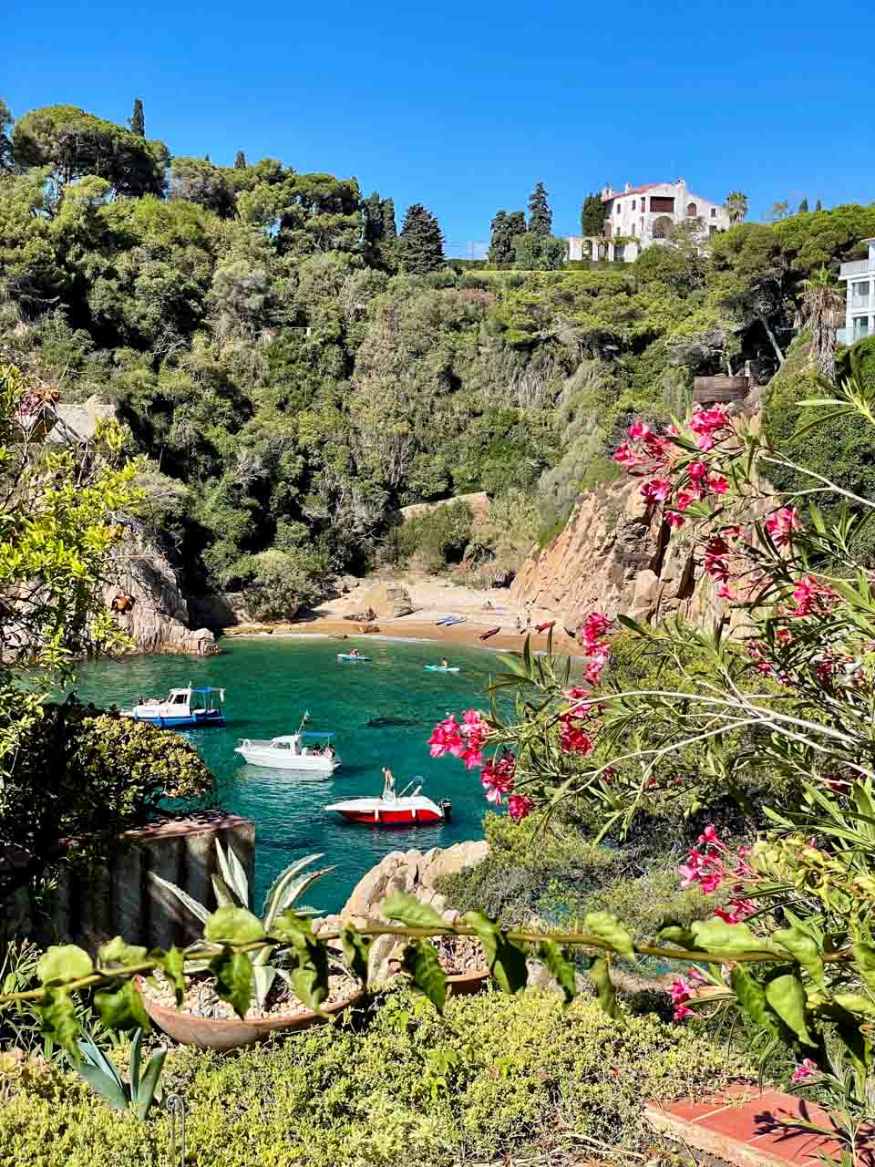
About an hour’s drive from Barcelona, we arrived in Blanes – the gateway to Costa Brava. We didn’t stop in Blanes (a city of nearly 50,000 people) but drove straight to Cala Sant Francesc – a picturesque small cove with yellow sand and turquoise waters.

Alighting from the bus on the hill above Cala Sant Francesc, our guide gave us the option to spend our two hours’ free time at the beach or walking around the nearby Marimurtra Botanical Garden. I chose the Botanical Garden, described as one of the most beautiful gardens on the Mediterranean.

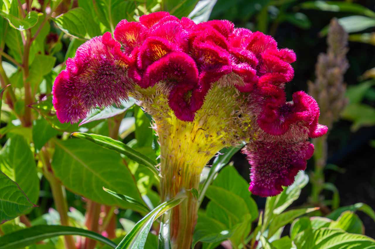
A dark pink flower with irregular petals

Marimurtra Botanical Garden


Marimurtra Botanical Garden is situated on the top of a cliff, providing stunning views of the picturesque Costa Brava with its white sand coves, crystal clear turquoise and aqua waters, and rugged coastline.

Leaving Cala Sant Francesc at 12.30 pm, we headed for lunch at a family-owned typical Mediterranean restaurant outside of Blanes. Our set menu consisted of a selection of traditional local dishes for starters with a glass of Sangria, a choice of several main courses, and a choice of Mel i Moto (a traditional Catalan dessert) or ice cream.

After a leisurely lunch, we drove for about half an hour to Tossa de Mar – a resort town home to the last preserved fortified town on the Costa Brava coast. Upon arrival, our guide took us on an orientation walk through the town and then given over an hour of free time.

I didn’t go for a swim in the waters of the very crowded beach or seek a coffee in the many cafes and restaurants packed with people. I opted instead to walk up the hill to the lighthouse and fortifications on the town’s highest point.

From the lighthouse and fortifications, I could see over the town, the many boats moored in Tossa de Mar’s bay, and a panoramic view of the Mediterranean Sea with its blue waters and rugged coastline.

Medieval fortifications provide a foreground for a crowded beach lined with multistoried hotels.

Tossa de Mar – town, beach and fortifications


Tossa de Mar was our last stop for the day. An hour and a half drive saw us back in Barcelona.

My tour review / final thoughts:

According to Explore Catalunya, the picturesque Cala Sant Francesc is “one of the few remaining coves on the coast that have avoided the crowds of tourists and big commercial developments and are known only to locals”. All I can say is there must be a lot of locals because the cove’s beach was crowded. Explore Catalunya goes on to say we would have the beach to ourselves. I think they need to rewrite their tour description!

A beach of a small cove is crowded with people and beach umbrellas.

“Uncrowded” Cala Sant Francesc


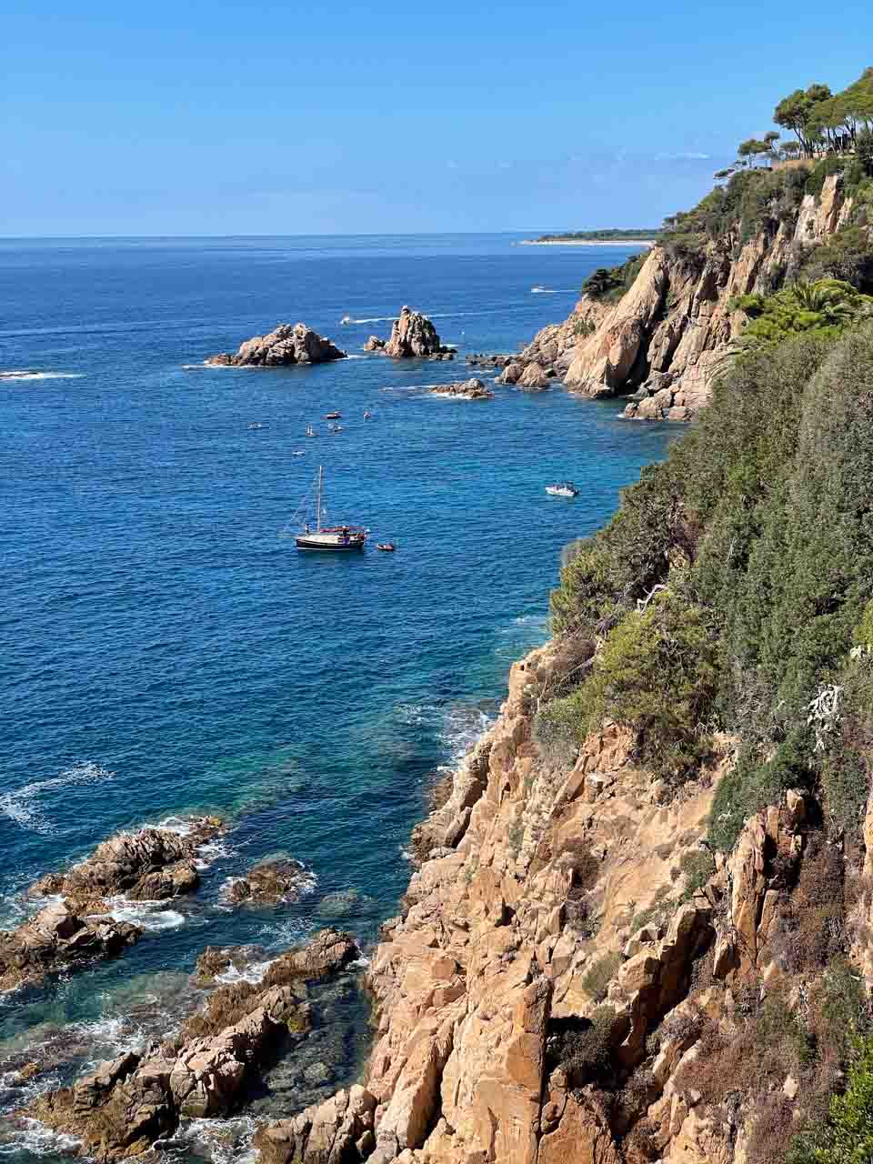
I enjoyed wandering around the Marimurtra Botanical Garden and admiring its more than four thousand plant species. However, my highlight of the day trip was the hilltop Garden’s coastal views. The Garden provides the most spectacular views of Costa Brava’s beautiful small coves, crystal clear waters, and the rugged coastline of the Mediterranean Sea.

Pink flowers, green plants, and trees Fram rocks in the sea.

The Mediterranean Sea framed by Marimurtra Botanical Garden


Explore Catalunya’s detailed description for The Costa Brava tour states: “After leaving the beach and gardens, we will continue up to the old castle ruins for another amazing view of the coast.” Unfortunately, this did not occur, leaving me disappointed, as I would have loved to see more of Costa Brava’s coastline.

Lunch was delicious. I had a great salad with lettuce, brie cheese, walnuts, and fruits for my mains. Since I am not fond of ice cream, I had the Mel i Moto – a traditional Catalan dessert of Catalan cheese with honey. It was an interesting dessert but not unpleasant, and I could have had another bowl with more honey. Since arriving home, I have tried making this dessert with ricotta cheese, but it doesn’t taste the same (not as good).

My impression of Tossa de Mar is that of a very crowded tourist town, one I would typically avoid. However, I did enjoy the views from the lighthouse and fortifications of Costa Brava’s dramatic coastline.

The Mediterranean Sea crashed against the cliffs of Costa Brava's coastline.

Costa Brava’s rugged coastline at Tessa de Mar


Overall, the day trip to Costa Brava was long but enjoyable, and I recommend it.


Day Trip from Barcelona to Medieval Villages

Tour: Small Group Medieval Villages Day Trip from Barcelona

Tour Operator: Explore Catalunya

Duration: Full day – 11 hours

Cost: €95,00

Explore Catalunya promotes this day trip as a journey back to the medieval age, visiting the beautifully preserved villages of Besalu and Tavertet and enjoying free time in Rupit village.

The tour as I experienced it:

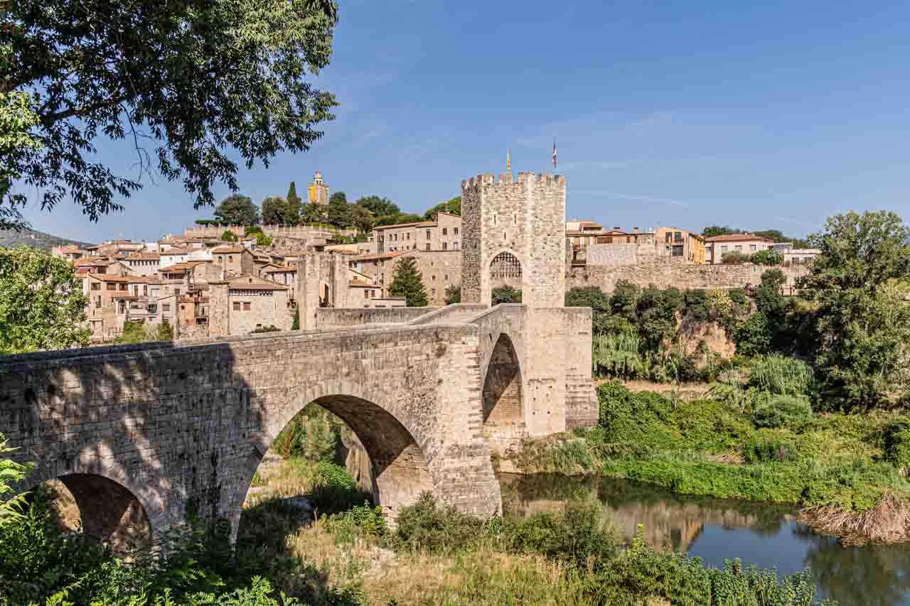
Leaving Barcelona at 8.30 am, we arrived in Besalu, our first medieval village, at about 10.00 am. Upon arrival, we (there were five guests on the tour) were given 20 minutes for a coffee and a bite to eat. We then headed across Besalu’s most significant feature – its 12th-century Romanesque bridge over the Fluvia River with its seven arches and a fortified gateway at its midpoint. Having crossed the bridge, we immediately entered Besalu’s medieval old town, where our Explore Catalunya driver-guide provided a 20-minute guided familiarisation walking tour around the Old Town.

A view of a town made of stone buildings and a stone bridge built in medieval times.

The medieval town of Besalu and its Romanesque bridge.


After the guided walking tour, we had one hour to explore Besalu independently.

Founded in 878 AD, Besalu is an enchanting medieval town in the foothills of the southeastern section of the Pyrenees. It is one of Spain’s most beautiful and best-preserved medieval towns and was declared a historic and artistic site of national importance in 1966.

Today, Besalu has a population of 2,512 (2023) living there permanently.

Besalu is home to an 11th-century church and hospital, a 12th-century monastery, the remains of a medieval castle, and an ancient Jewish Quarter, where you will find the ruins of a medieval synagogue and a 12th-century Mikvka (Jewish ritual bathhouse).

Besalu’s old town is built entirely from sandstone, giving the village a golden, warm hue. Cafes fill the pretty squares, and narrow cobblestone streets wind through the village. As to be expected, souvenir shops line the streets. However, glancing into shops as I walked past them made me think they were of a better quality than most you see.

Besalu’s main square, Placa de la Llibertat, is in the centre of the old town and a great place to sit with a drink or ice cream and people-watch.

A tiled square in a medieval village lined with cafes and restaurants. There are people sitting in the cafes.

Cafes and restaurants line Besalu’s main square


I found the wooden chairs attached to the Old Town’s stone walls a thought-provoking addition to Besalu’s medieval architecture. However, I never got an answer about the reason for this art installation.

After about an hour’s drive from Besalu and up narrow, winding roads into the Pyrenees, we arrived at the medieval village of Rupit. A river, forest, waterfalls, and caves surround the village, which is 822 metres above sea level in a valley adjacent to the Garrotxa Volcanic Zone Natural Park.

Rupit was in stark contrast to Besalu. Instead of the pale stone buildings that give Besalu an air of warmth, all the houses in Rupit are built with basalt stone, giving the village a dark, forbidding appearance.

A cluster of basalt stone houses are surrounded by green shrubs and trees.

The medieval village of Rupert, with houses built in basalt


Rupit is smaller than Besalu, with about 160 permanent residents and just two main streets. The United Nations World Tourism Organisation (UNWTO) has described it as “one of the jewels of Catalonia in Spain.”

Rupit has received two awards in recent years:

  • UNWTO named it ‘Best Tourism Villages 2022’ for its “development of sustainable and responsible tourism.”
  • It has been awarded ‘European Charming Villages’ by the COSME Initiative of the European Union.

Before arriving in Rupit, our driver-guide gave us the option of free time to explore the village or to join him at a local restaurant for a set menu Catalonian lunch. I opted for lunch with three other guests and our driver-guide – a big mistake! Don’t get me wrong, the three-course lunch was delicious and a leisurely affair, but it took all our allocated two hours of free time in Rupit.

Two hours for lunch in Spain is the norm, but we had no time to explore the village. After several guests voiced their disappointment, our driver-guide gave us ten minutes to explore Rupit.

Our final stop before heading back to Barcelona was at a clifftop lookout in the tiny village of Tavertet, overlooking the valley below and the Guilleries mountain range. From this viewpoint, we could see the large Sau Reservoir, villages, and the odd lone house in the valley below.

A valley view in a Spanish mountain range with a large reservoir.

View of the valley and mountain range from Tavertet lookout


My tour review / final thoughts:

Besalu:

Grabbing a takeaway coffee instead of sitting down for 20 minutes would have been a better option, allowing more time for the guided walk around Besalu.

I would have liked more time to explore Besalu at a relaxed pace rather than rushing from street to street to see as much as possible and take as many photos as possible.

According to the detailed description on Explore Catalunya’s website, the Medieval Villages tour includes “visit a restored mikveh (an old Jewish bath from the 12th century), and see the remains of a medieval synagogue”. Neither of these happened.

We were discouraged from seeing the old Jewish bath with an explanation that to do so was too hard. We would have to walk back over the bridge (at this point, we were inside the walled town) to the tourist office, get the key for the bath, and then take the key back to the tourist office once having seen the bath. There was also an admission fee involved.

I got the distinct impression that our guide just couldn’t be bothered taking us to visit the restored mikvah and ruins of the medieval synagogue. I found this extremely disappointing as I have a strong interest in Jewish history.

Castellfollit de la Roca:

On the drive to Rupit, our driver-guide pointed to Castellfollit de la Roca village, perched on the edge of a basalt precipice. I have seen several photos of Castellfollit de la Roca on Instagram and have always been in awe of its precarious location. I was okay with not exploring the village but felt incredibly disappointed that we drove straight past and didn’t pull off the road for a photo stop.

Rupit:

Opting to have lunch in a restaurant in Rupit was a missed opportunity to explore the village. It was a shame that our driver-guide failed to advise us that lunch in the restaurant would take up all our free time in Rupit. Had he done so, I would have grabbed something to eat at the bakery and used the two hours to explore the village and walk along the river to discover its pools and waterfalls.

Tavertet:

Explore Catalunya’s detailed description for this tour states that a visit is made to Tavertet village. “With your guide, visit this charming village, which was declared a National Property of Cultural Interest due to its 48 preserved houses from the 17th and 18th centuries. Learn interesting facts about this village as you admire the houses and the 11th-century Romanesque Church of Sant Cristofol.” However, we did not visit Tavertet; we merely drove straight through to the viewpoint on the cliff edge of the village for a panoramic view of the valley below. It was a shame we did not go into Tavertet, as I was looking forward to seeing the houses.

Explore Catalunya advertises that The Small Group Medieval Villages Day Trip from Barcelona lasts 11 hours. However, on this day, it was only ten hours. The additional hour would have allowed the advertised visit to Tavertet village or more time in Besalu.

Final thoughts:

Besalu is a delightful village worth visiting. However, I would have found a full day in Besalu to explore all its nooks and crannies of more value.

Ten minutes to explore Rupit and a short walk along one street to the restaurant was not enough time to make an informed comment on Rupit. However, what I did see had me wanting more.

I cannot comment on Tavertet, as we only drove quickly through the village to the lookout.

I enjoyed the Medieval Villages Day Trip, but I suspect the enjoyment was more about getting out of Barcelona for the day than the trip itself. In truth, I ended the day feeling disappointed and cheated.


Day Trip from Barcelona to the Pyrenees

Tour: Pyrenees Mountains Small Group Day trip from Barcelona

Tour Operator: Explore Catalunya

Duration: Full day – 11 hours

Cost: €109,00

Explore Catalunya promotes this day trip as “The only day tour from Barcelona that takes groups into the Pyrenees Mountains”.

There were five guests on this day trip (including myself) and our driver-guide, Steven. The tour’s destination was Vall de Nuria (Nuria’s Valley) in the Pyrenees via Vic and Queralbs.

The tour as I experienced it:

Our departure from Barcelona at 8.30 am had us arriving in Vic (pronounced Bic) about an hour later.

Vic is about 69 kilometres north of Barcelona on the Meder River. It is an ancient city, dating back to the Ausetan Iberians before Roman occupation in the 1st century AD, with an interesting and picturesque medieval Old Town.

On a 20-minute guided walking tour around the Old Town, we passed through several small pretty squares with cafes preparing for the day.

The guided walking tour ended in Cathedral Square at the Roman Catholic cathedral, Catedral de Sant Pere Apostol (Cathedral of Saint Peter the Apostle).

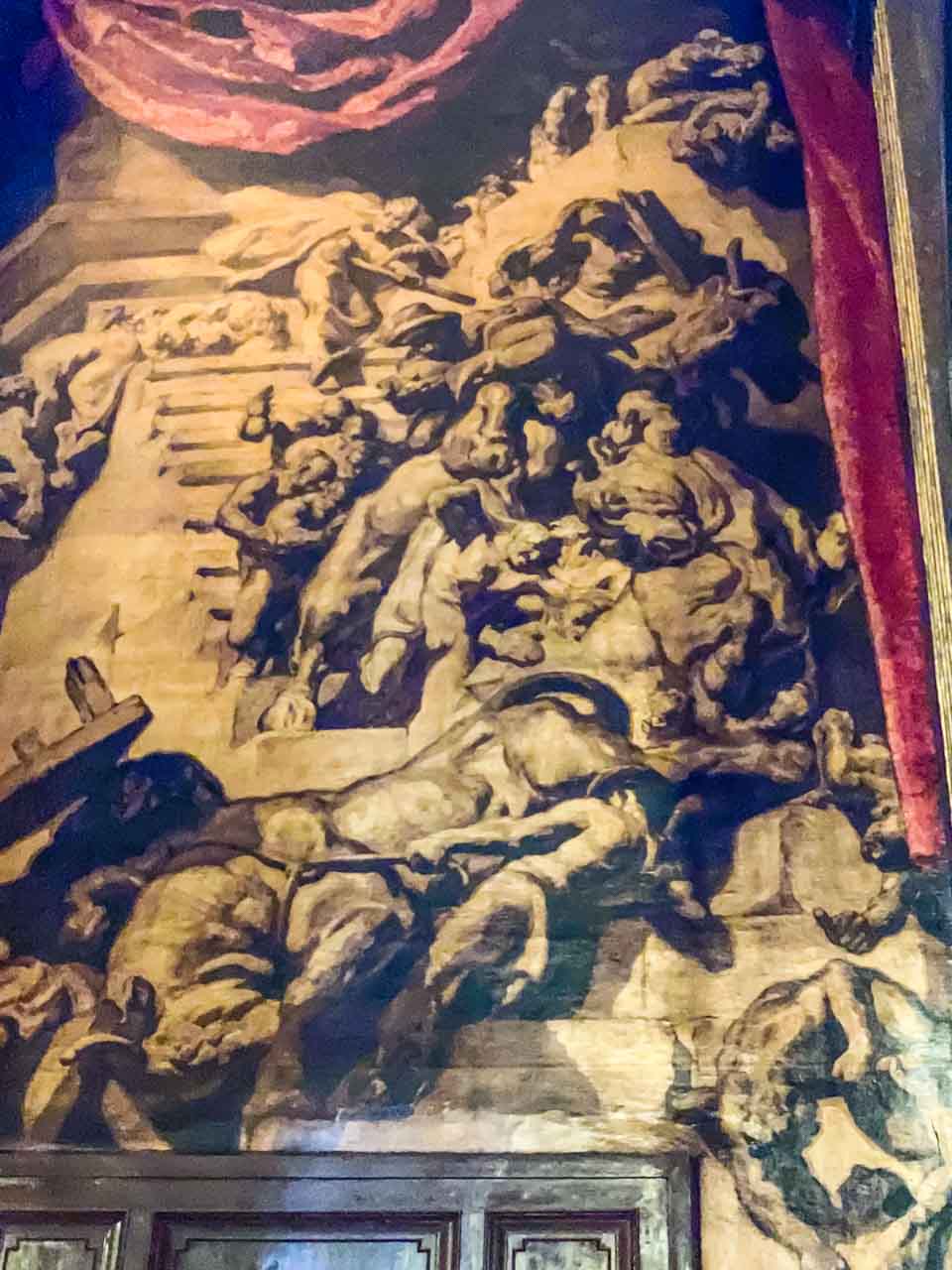
I found the interior of Vic’s Sant Pere Cathedral to be unlike anything I had seen previously. Huge, almost monochromatic canvases painted by Joseph Maria Sert representing the mystery of redemption cover the walls, making the interior dark and gloomy – an unexpected contrast to the cathedral’s light-coloured stone exterior. It wasn’t a place I wanted to linger! However, your reaction may be very different.

Explore Catalunya’s visits to Vic coincide with traditional market days, which take place on Tuesdays and Saturdays in the arched main square (one of the biggest in Spain). Stalls of every sort filled the square.

Our half-hour of free time had me scouring the market stalls and nearby shops for something suitable for a takeaway lunch. Steven advised us that the food at Vall de Nuria’s café was not the best and recommended that we buy lunch in Vic.

From Vic, we drove up into the Pyrenees to the small village of Queralbs, which sits at an altitude of 1,236 metres. It is the last vehicle-accessible village on the way up to Vall de Nuria (Nuria’s Valley), a beautiful valley in the eastern Pyrenees. The final six kilometres from Queralbs to Vall de Nuria must be travelled by rack railway – a 20-minute journey to an altitude of 1,964 metres. But first, there was a guided walking tour through Queralbs.

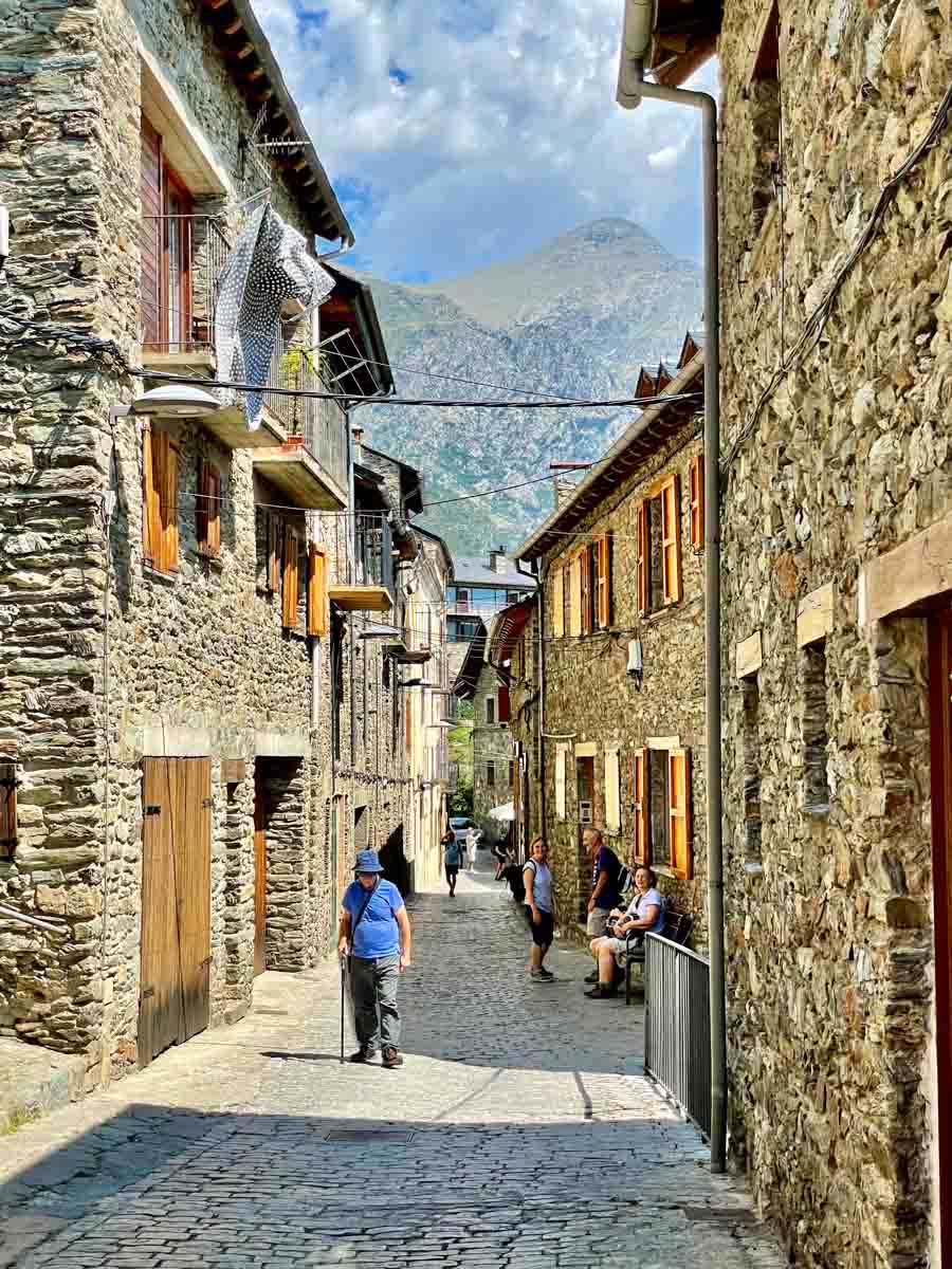
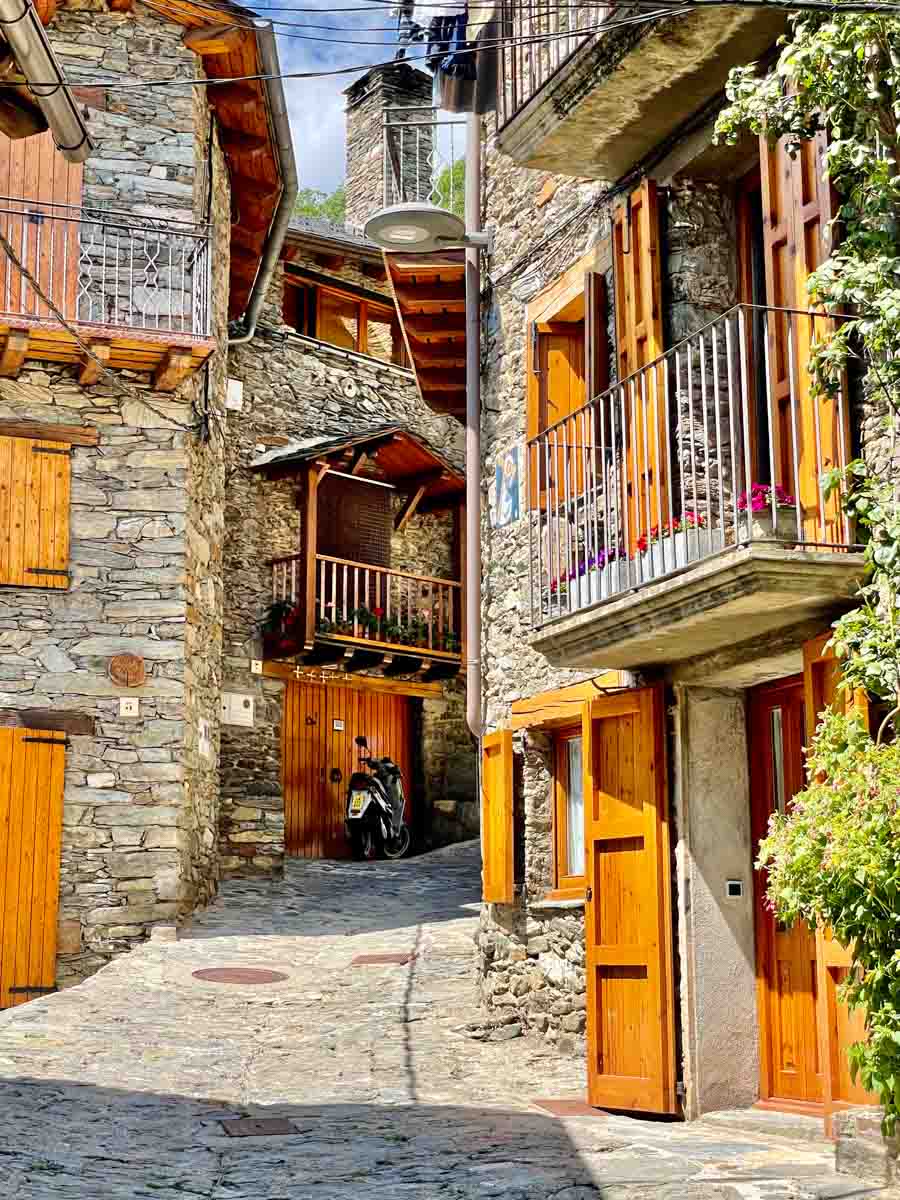
Queralbs is an ancient village dating back to 833 AD. With its traditionally built stone houses perched on the side of the mountain, “this impossibly quaint, picture postcard beautiful hamlet is one of the most memorable parts of the day” (Explore Catalunya). I couldn’t agree more! The village was picture-perfect.

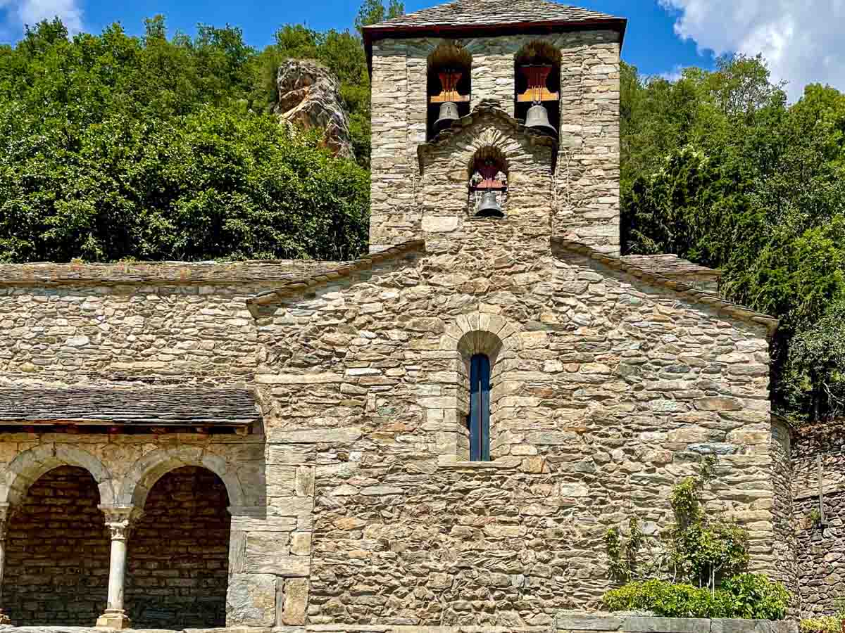
The walking tour ended at the Romanesque Esglesia de Sant Jaume (Church of Saint James) – one of Spain’s oldest surviving Romanesque churches.

A stone church with an arched portico and three bells in the bell tower. Green shrubs are behind the church.

Queralbs’ Romanesque St James Church.


Time to catch the rack railway train to Vall de Nuria!

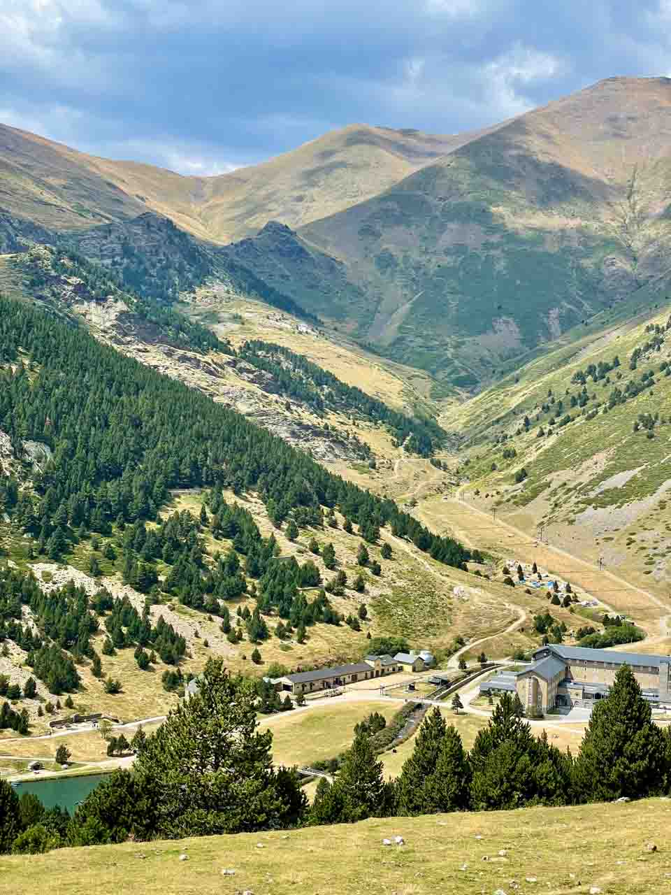
Vall de Nuria is a glacial valley in the eastern Pyrenees, 120 kilometres from Barcelona, 1,964 metres above sea level, and surrounded by mountains nearly 3,000 metres high. It is remote and only accessible by rack railway. The ski resort and Nuria Lake dominate the valley, offering spectacular mountain landscapes, winter skiing, and summer hiking trails.

With two hours to explore the valley before catching the train back down the mountain, I decided to hike one of the many trails in the hills around the valley. These trails range from easy to challenging.

Given my limited time, I chose an easy trail, the Way of the Crosses. I was told it would take 50 minutes to walk, but I knew it would take longer as I would keep stopping to take photos and admire the breathtaking views. The trail gets its name from the Christian Way of the Cross tradition, with twelve crosses along the way. I made the hike easier on myself by walking down the mountain rather than up. I did this by taking the cable car to the summit, bringing me to an altitude of 2,170 metres. Consequently, I passed the crosses in reverse – from twelve to one.

We missed our scheduled train back down the mountain to Queralbs because one couple failed to turn up at the meeting point even though Steven’s instructions were clear. No one knew where they were. I could tell Steven was worried, but he handled it calmly. Eventually, Steven decided we would catch the next train and leave the unreliable couple to fend for themselves. Surprise, surprise! When we arrived back at Queralbs Rack Railway Station (45 minutes late), our errant couple were waiting for us. They had decided to forego the meeting point and catch the train on their own.

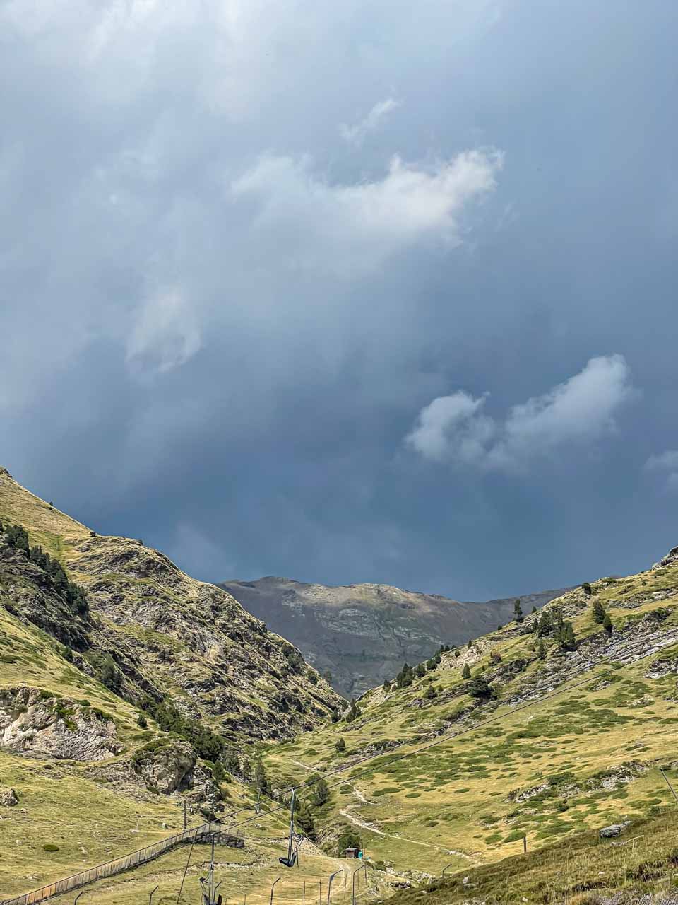
From about halfway down the Stations of the Cross trail, the sky was getting blacker and blacker. By the time I reached the bottom, thunder was rolling around the mountains.

A valley in the Pyrenees is shrouded in black clouds.

Vall de Nuria – a storm rolls inover the Pyrenees


Just as we were about to board our train back down the mountain, the heavens opened, and heavy rain and hail bucketed down. As we travelled the six kilometres from Vall de Nuria to Queralbs, the rain got heavier and heavier. Running from the train to the station building had us soaked to the skin, and I mean soaked. Water was pouring off me, off my hair and my clothes.

Our misfortunes did not end with a missing couple and soaking rain. Shortly after leaving Queralbs for our drive down the mountain, we came to a grinding halt. Traffic wasn’t going anywhere! The river beside the road was a raging torrent, so I thought maybe the road was flooded. After about 20-30 minutes, the male of our errant couple went to investigate what was happening up ahead – to make up for their “misunderstanding” about the meeting point. He told us there was a mudslide with rocks over the road and water pouring down the mountain. People were staring at this catastrophe, immobile. But our errant male (sorry, I will always think of him as such) started moving the rocks, and others helped. We were moving again! Meanwhile, it was sunny and 30 degrees Celsius in Barcelona!

My tour review / final thoughts:

In Vic, I struggled, wasting a lot of time trying to find suitable food for a takeaway lunch. I couldn’t even find a small supermarket in the streets around the main square. I found a bakery that looked promising, but the queue was too long to wait for service. I was conscious about arriving back at the meeting place on time. Had I known in advance about the recommendation to purchase a takeaway lunch, I would have brought food with me. In hindsight, I am sorry I didn’t risk the cafe at Vall de Nuria because the lentil salad I bought in Vic for lunch was pretty ordinary.

Explore Catalunya advertises the tour as 11 hours in duration. However, the tour was 11 hours only because we were late leaving Vall de Nuria back to Queralbs and encountered a mudslide driving down the mountain. I felt cheated because I would have loved more time on the mountain. The additional hour would have allowed me time to walk around the lake, visit the sanctuary, or have a cup of coffee.

I thoroughly enjoyed this day trip to the Pyrenees Mountains. What an adventure!

Don’t get me wrong; I have enjoyed all my day trips with Explore Catalunya, but this one seemed a bit more special. Perhaps it was the breathtaking landscape of the Pyrenees or just being in the mountains? Perhaps it was the enchanting village of Queralbs or the experience of the Rack Railway? Perhaps it was the adventure of getting soaking wet from a massive storm or driving through a mudslide over the road? Even though all the tours were very different and memorable, this day trip to the Pyrenees was special. It was not your ‘usual’ sightseeing tour and, for the most part, was the more relaxed.


A word on booking tours with Explore Catalunya:

I booked all my tours with Explore Catalunya in person, visiting their office in Barcelona at Carrer Palau de la Musica, 1. When booking in person, I received a €10,00 senior discount on each tour. However, when visiting Explore Catalunya’s website, I found nowhere that a senior discount can be applied when booking a tour.


As we conclude our journey through these five memorable day trips from Barcelona, I hope the experiences I shared have inspired you to venture beyond the city’s boundaries and explore the wonders just a short distance away.

Barcelona is a gateway to extraordinary adventures, allowing you to immerse yourself in captivating landscapes, delve into rich history, and be inspired by world-renowned art. The day trips I took from Barcelona left me with a lifetime of memories.

So, if you find yourself in Barcelona, let these day trips be your guide to exploring the richness that lies beyond the city’s borders, for Catalonia is a region of endless discovery. Allow yourself to be swept away by the allure of Montserrat, the coastal beauty of Costa Brava, the timeless appeal of medieval villages, the majesty of the Pyrenees, and the surreal world of Salvador Dali.

Thank you for joining me on this unforgettable journey through Catalonia’s diverse landscapes and cultural treasures. Until next time, here’s to the endless horizons of discovery and the timeless magic of travel!


Disclaimer: This post contains no affiliate links. All views and opinions are my own and non-sponsored. All photos are my own and remain the copyright of Just Me Travel.

© Just Me Travel 2018-2024. All rights reserved.


Have you found this review of day trip tours from Barcelona a helpful resource? Which would be a day trip not to be missed? I love hearing from you. Please leave a comment below.

I look forward to reading and responding to your comments on which day trips from Barcelona you might include on your next holiday to Spain that this post has inspired.


Like this post? Save it for later!

A medieval village with an arched Roman Bridge and a small sandy cove invite you discover the hidden gems of Catalonia, Spain at justme dot travel.

Stone houses in a medieval village and a valley in the Pyrenees invite you to explore Catalonia at justme dot travel.


Author’s Note: Please check the latest travel restrictions before planning any trip and follow government advice.


Sign up to receive the latest in travel destinations, topics, resources and guides.


You might also like

A collage of photos showing Islamic architecture, a beach, an ancient Roman theatre, and a modern glass and silver tiled building.SPAIN BUCKET LIST: The 47 Incredible Things You Should Not Miss. From historic landmarks to cultural marvels, my Spain Bucket List is your go-to resource for planning the trip of a lifetime. Start planning your Spain itinerary now!



No Comments on 5 FABULOUS DAY TRIPS FROM BARCELONA SPAIN: Your Reliable Guide

7 TOP DAY TRIPS AND THINGS TO DO IN AND FROM PERTH, AUSTRALIA

A visit to Perth, Australia, is a Journey of Discovery of Unique Things to Do.   Perth is the most isolated capital city in the world, with Adelaide, the nearest…

A visit to Perth, Australia, is a Journey of Discovery of Unique Things to Do.


Perth is the most isolated capital city in the world, with Adelaide, the nearest city, 2,104 kilometres away. Perhaps its isolation is part of its appeal. It certainly hasn’t limited what Perth has to offer the visitor for things to do in Perth and day trips from Perth – all unique to this beautiful city sitting on the Swan River. Discover, explore, and enjoy the world’s largest city park, the happiest animal on earth, a massive wave-shaped rock in the middle of nowhere, the largest dam mural in the world, one of the world’s biggest musical instruments, and more.


Perth, the capital city of Western Australia, is Australia’s fourth largest city by population. With a population of just over two million, Perth is small enough to feel personal; visiting the city feels like visiting family. I felt I was immersing myself in a community rather than losing myself in an urban jungle. Perth’s ranking as the sixth most liveable city in the world in 2021 was well deserved.

Perth enjoys more hours of sunshine than any other Australian capital city – reason enough to visit. Other reasons why you should visit Perth are:

  • It has a laid-back, relaxed, and welcoming vibe.
  • Being mostly flat, it is easy to walk around.
  • It is a spacious city where you don’t feel hemmed in.
  • As a solo traveller, I always felt safe.
  • Swim in the sapphire blue ocean and lay on beautiful white sand beaches.

My first and lasting impression of Perth is a city of green space, public sculptures, and beautiful architecture.

I stayed ten days in Perth in May 2022. The day trip destinations and things to do suggested in this post are from my own experience as a solo traveller to Perth. Read on to discover seven top day trips and things to do in and from Perth or jump straight to a specific activity.

Take a Perth and Fremantle city tour

When I visit a city I haven’t been to, I like to take an escorted city tour. Whether by foot or bus, a city tour is an excellent way to orientate to the city and check out the places I would like to revisit in more detail.

On my first full day in Perth, I took the Half Day Morning Perth and Fremantle City Explorer with Australian Pinnacle Tours. The drive around the city took us past the famous Western Australian Cricket Ground (WACA) and Optus Stadium. I was particularly taken with the architecture of Matagarup Bridge crossing the Swan River from East Perth to Optus Stadium and knew I would be back to photograph the bridge.

The tour also took in a drive through the more affluent area of Perth known as Millionaire’s Row, past Cottesloe Beach on the Indian Ocean, and the University of Western Australia. However, the highlights for me were the 45-minute stop at Kings Park and the one hour we had to explore Fremantle.

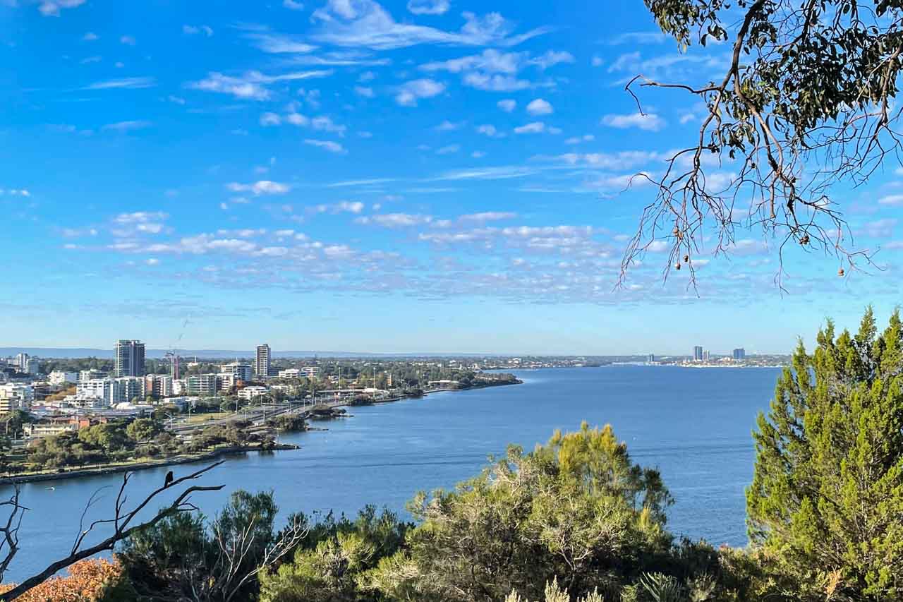
I couldn’t get enough of the spectacular river and city views at Kings Park and knew I would be back for more.

A picture of a view of city buildings on the shore of a river and with shrubs in the foreground

View of Perth City and the Swan River from Kings Park


While there, I found the meeting place for free guided walks in the park, operating daily at 10 am and 1.00 pm. I gathered more information at the Visitor Information Centre in the park and put the walk on my ‘must do’ list for another day.

After leaving Kings Park, we headed to the port city of Fremantle. With an hour to explore, I couldn’t resist the historic Fremantle Markets, especially as, by now, I was hungry. The markets have been operating in this heritage-listed building for over 100 years. Focused on food, I found plenty of culturally diverse options for lunch, but I was drawn to the colourful displays rendered by the fruit and vegetable stalls.

People buying and selling fruit and vegetables laid out in stalls

Fruit and vegetable stalls in Fremantle Markets


I particularly liked this tour because it wasn’t just driving around Perth and Fremantle, but we left the bus for a decent amount of time at strategic points of interest.

While I saw much more of Perth throughout my ten-day stay, I didn’t do Fremantle justice, only visiting again after this tour to catch the ferry to Rottnest Island and to have lunch with friends I met on the APT Kimberley tour last year. I would have liked to explore the port city in more depth, which is only half an hour from Perth by train and take a tour of the prison. With an area known as ‘Cappuccino Street’, it would seem Fremantle has a better coffee culture than Perth – definitely worth discovering.

Photograph a massive mural on a dam wall

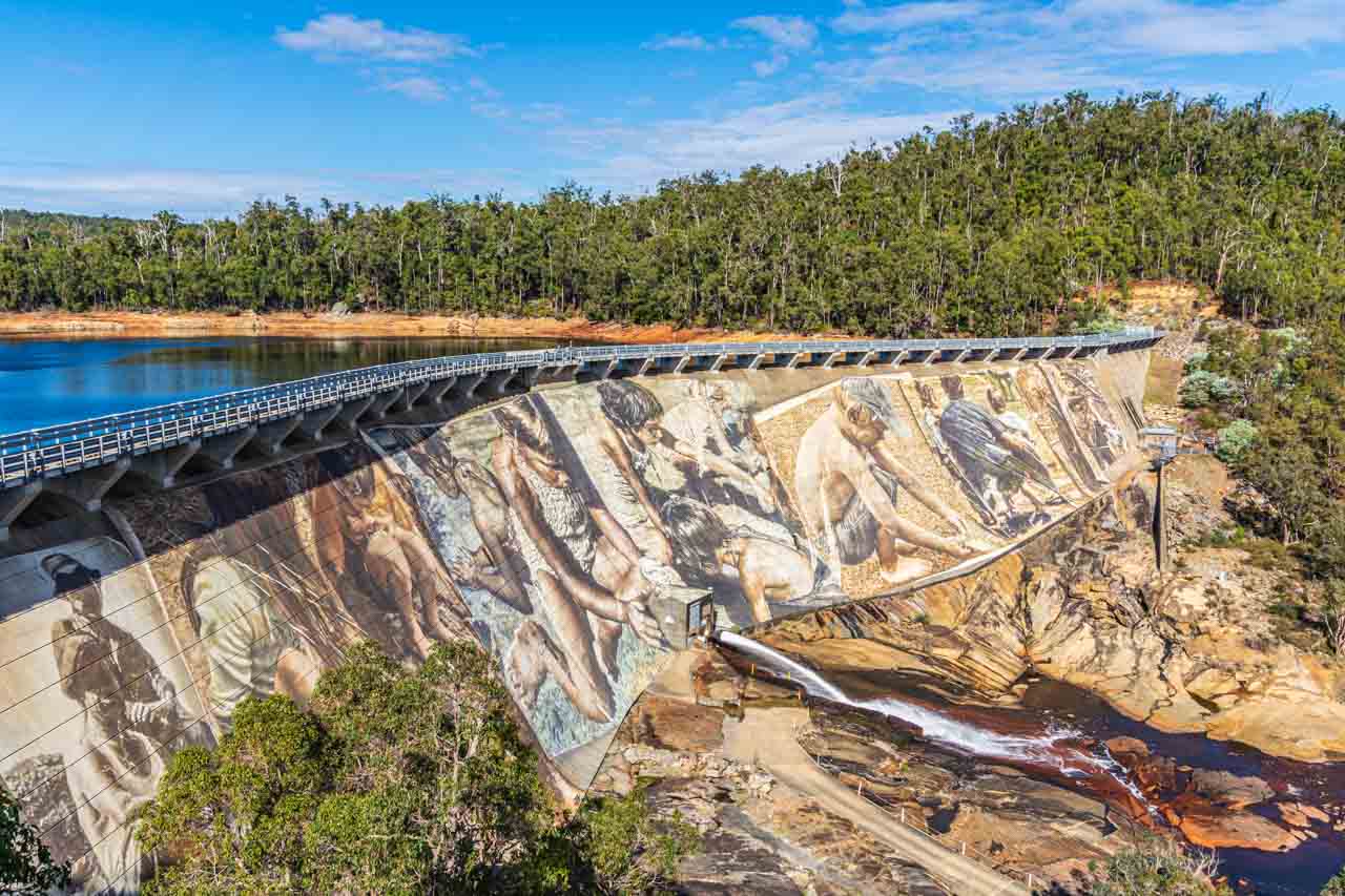
A painting of several people on a dam wall

The magnificent Wellington Dam mural by Guido van Helton


When I first saw photos of Guido van Helton’s mural on Wellington Dam on Facebook over 12 months ago, I knew that if I ever got to Perth, I would have to see it for myself, and I wasn’t disappointed. Magnificent! The artwork is one impressive mural, and Guido is one of my favourite artists. [Check out his painted silos at Brim in Victoria and Portland in New South Wales.]
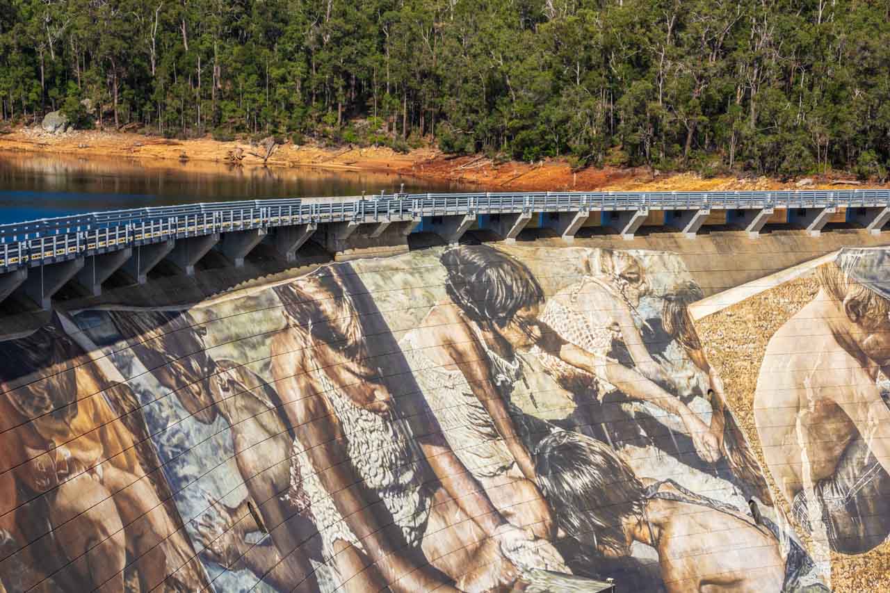
The mural covering 8,000 square metres of the Wellington Dam wall is the largest dam mural in the world. The mural took Guido van Helton, an internationally renowned Australian artist, four months to complete (in February 2021), with Guido camping in the bush for the duration. As with Guido’s silo artworks, local stories, and photographs inspired the Wellington Dam mural. Titled “Reflections”, the mural features images of two migrant workers who worked on the dam build, kids playing in the sand, Aboriginal children playing in the water and a boy with a fish, a dad with two kids, and, finally, an Aboriginal couple.

Wellington Dam is in Wellington National Park, just west of the town of Collie, about two hours from Perth. Rather than hire a car, I took a day trip to Wellington Dam with Australian Pinnacle Tours. The tour included morning tea at Harvey Cheese with a cheese-making demonstration, Wellington Dam, a two-course lunch at Dardanup Tavern (which was delicious), a wine tasting at St. Aidan winery, and a stop at Gnomesville before returning to Perth.

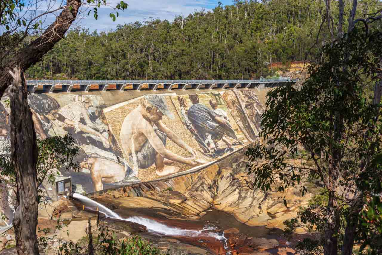
We spent over an hour at Wellington Dam, where I could view and photograph the mural from the specifically installed lookout and walk down to the dam’s base for more photographs.

A painting of children and a man on a dam wall

A section of the Wellington Dam mural by Guido van Helton


A painting of children on a dam wall

A section of the Wellington Dam mural by Guido van Helton


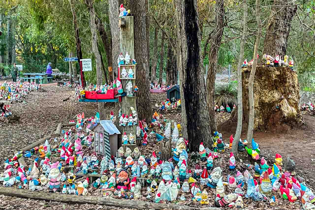
About Gnomesville

A photo of hundreds of garden gnomes on the ground and in the trees

A small section of Gnomesville


Gnomesville has to be seen to be believed. At the roundabout where Wellington Mill Road and Ferguson Road converge (about a 15 minutes drive from Dardanup) and extending along a creek and into the bush, you will find thousands of garden gnomes – over 10,000 at the last count. Legend has it that the first gnome was placed at the site in the 1990s.

Myths surround the creation of Gnomesville – that a single garden gnome appeared at the site and others followed suit or that the workers working on the roundabout created a Gnome Cricket Game and others joined in. The latter seems more fascicle than the former. However, according to the tour bus driver, the story of the creation of Gnomesville goes something like this:

A lady phoned a Perth radio station to say she had many gnomes she wanted to give to a good home, but no one wanted them. Other people then phoned in to say they had the same problem. A farmer, hearing about this, donated land for a home for the gnomes. And people have been leaving gnomes ever since. However Gnomesville started, a tourist attraction was born.

Most of the people on the bus tour had brought a gnome to leave at Gnomesville. I hadn’t, as I knew nothing about Gnomesville and obviously didn’t read the tour itinerary information to be curious enough to learn about it beforehand.

When I told my sister about Gnomesville, she thought it was great fun. Me? I found it bizarre and a bit tacky. Let me know what you think.

Walk over Matagarup Bridge

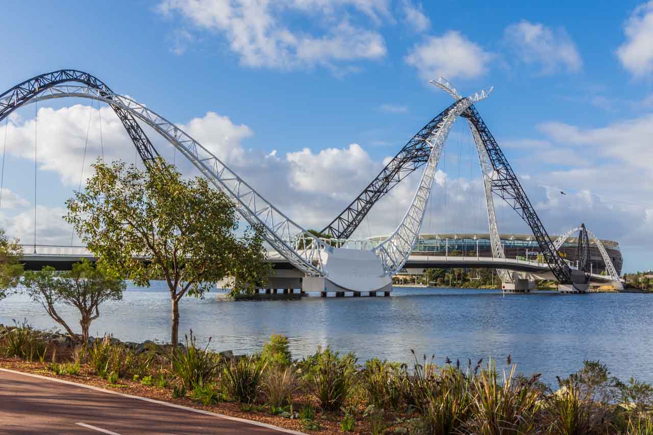
A black and white steel arched suspension bridge with a stadium behind it

Matagarup Bridge with Optus Stadium in the background


On the Perth city tour, I took a liking to the architectural style of Matagarup Bridge and wanted a closer look. So, catching the Blue and then the Red CAT buses (see ‘Getting around Perth’ below for more information), I made my way to Matagarup Bridge on the East Perth side of the Swan River.

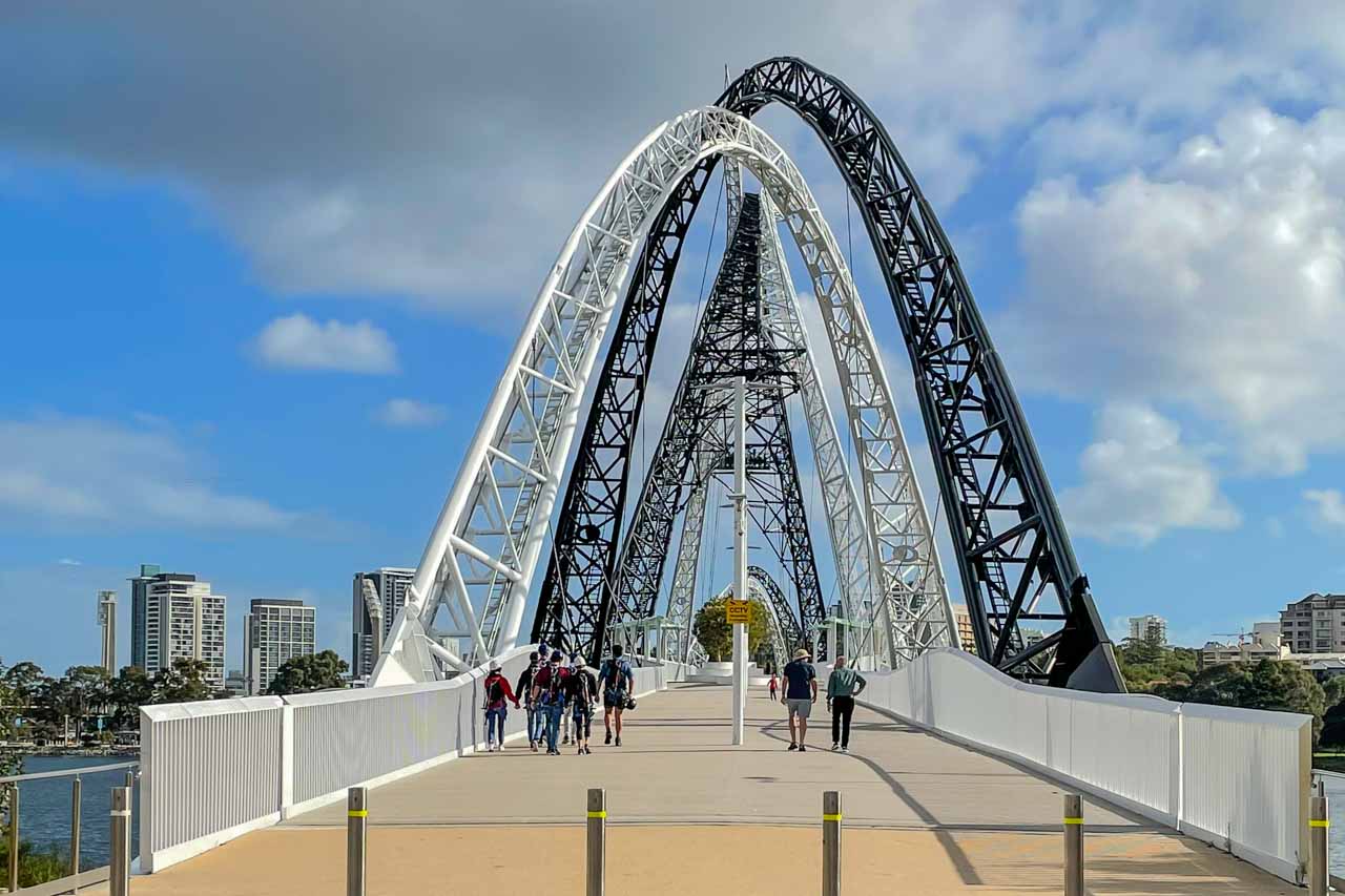
Matagarup Bridge (completed in 2018) is a suspension, pedestrian-only bridge crossing over the Swan River from East Perth to Optus Stadium on the Burswood Peninsula. The arches are said to represent a pair of flying black and white swans, with the bridge arches representing the wishbones, a swimming dolphin, or the Wagyl, a water serpent of significant importance to the local Noongar culture – symbolising a coming together of diverse cultures.

Symbolism aside, Matagarup Bridge is a beautiful piece of architecture. You be the judge.

An information panel in the middle of the bridge provides building statistics and information on the design, name, lighting, and more.

A photo of a black and white arched suspension bridge

Matagarup Bridge


According to the Perth and Fremantle City Tour bus driver, the bridge was built to get people across the Swan River from East Perth to Optus Stadium. Now, there’s a dedication to football for you!
While I had only set out to photograph and walk across Matagarup Bridge, you can climb the bridge to an open-air viewing platform 72 metres above the river. From the viewing platform, you can ride the 400-metre-long zipline to Burswood Peninsula, reaching speeds of 75 kilometres per hour. The zipline looked like fun. If I had been with someone to share the experience with, I would not have hesitated to do it.

People on a zipline over a metal structure

Zipline from Matagarup Bridge


Take a free guided walk in Kings Park and Botanic Garden

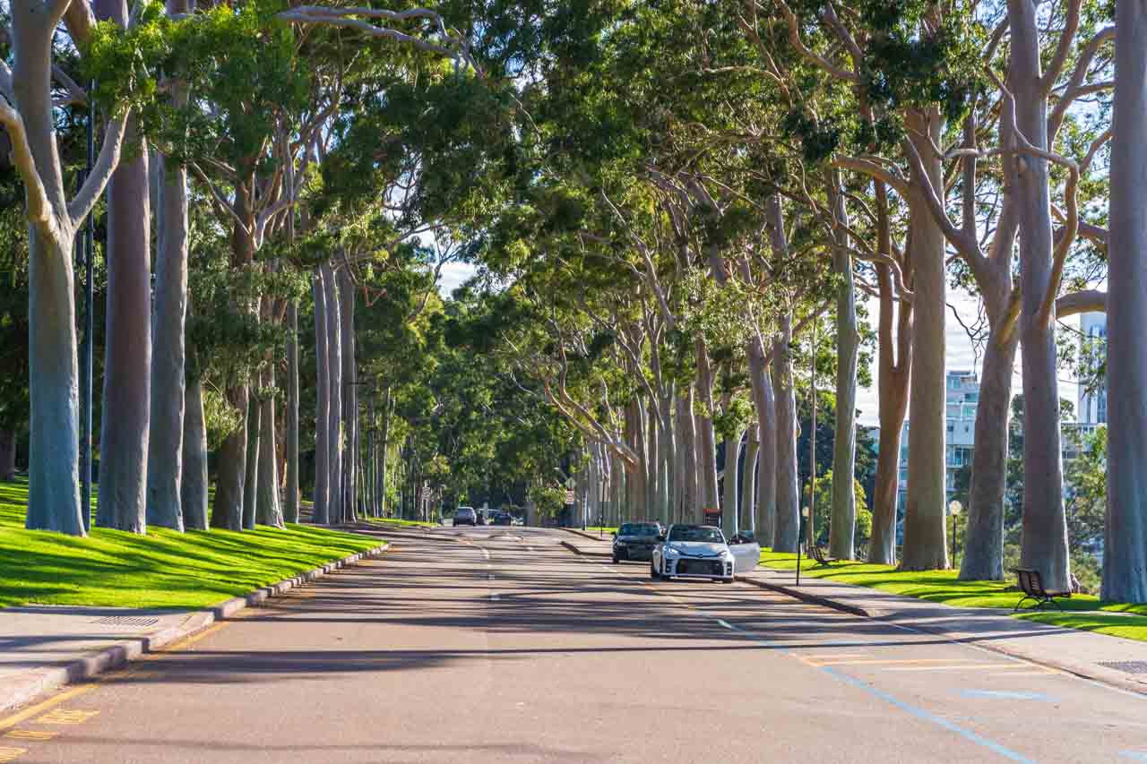
A photo of a tree-lined street

Fraser Avenue, Kings Park


At 400 hectares, Kings Park is the world’s largest inner-city park – larger even than New York’s Central Park, which is 370 hectares. With spectacular views of Perth City and the Swan River, botanic gardens, walking and cycling paths, a tree top walkway, memorials, cafe, picnic and bar-b-que areas, children’s play area, and more, it is easy to understand why Kings Park sees over six million visitors a year.

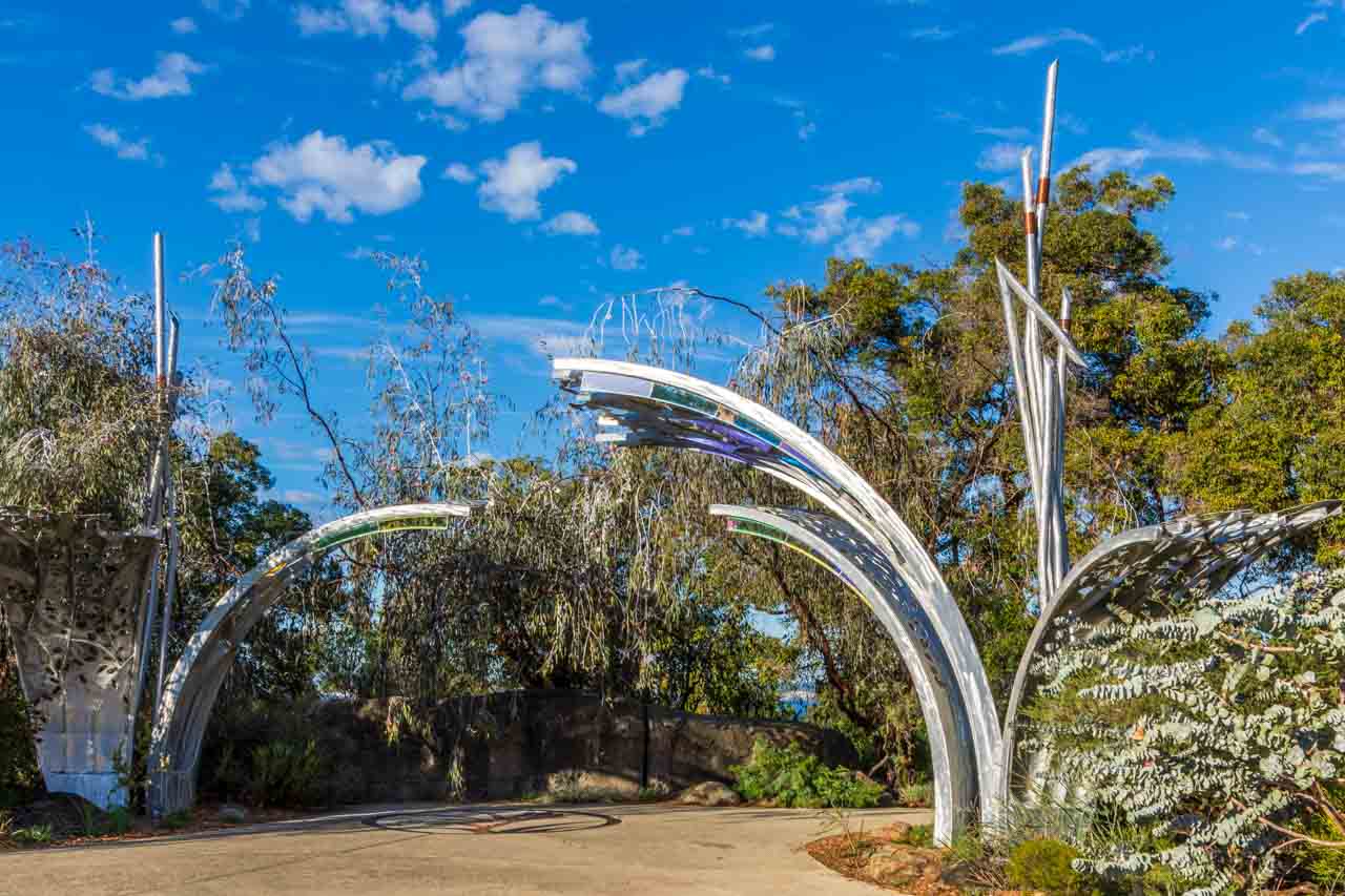
Curved silver metal sculpture overhanging a path and surrounded on two sides by shrubs

Sculpture and mosaic at the entrance to the Western Australia Botanic Garden in Kings Park


The 90-minute free guided walk in the park is run by volunteers twice daily at 10.00 am and 1.00 pm and takes you through several sections of the wonderful 17-hectare Western Australia Botanic Garden, located within Kings Park.

Western Australia is home to half of Australia’s 25,000 plant species, most of which are found nowhere else on earth. The Western Australia Botanic Garden proudly showcases over 3,000 species of Western Australia’s unique flora in stunning garden displays.

While I am a terrible gardener (I can’t keep anything alive), I get a lot of enjoyment out of walking around gardens. There are interpretive signboards throughout the Botanic Garden. But I didn’t need those as my guide was a wealth of information on the numerous gardens we walked past, each dedicated to a specific region of Western Australia, thereby increasing my knowledge of Australian plants and enhancing my enjoyment.

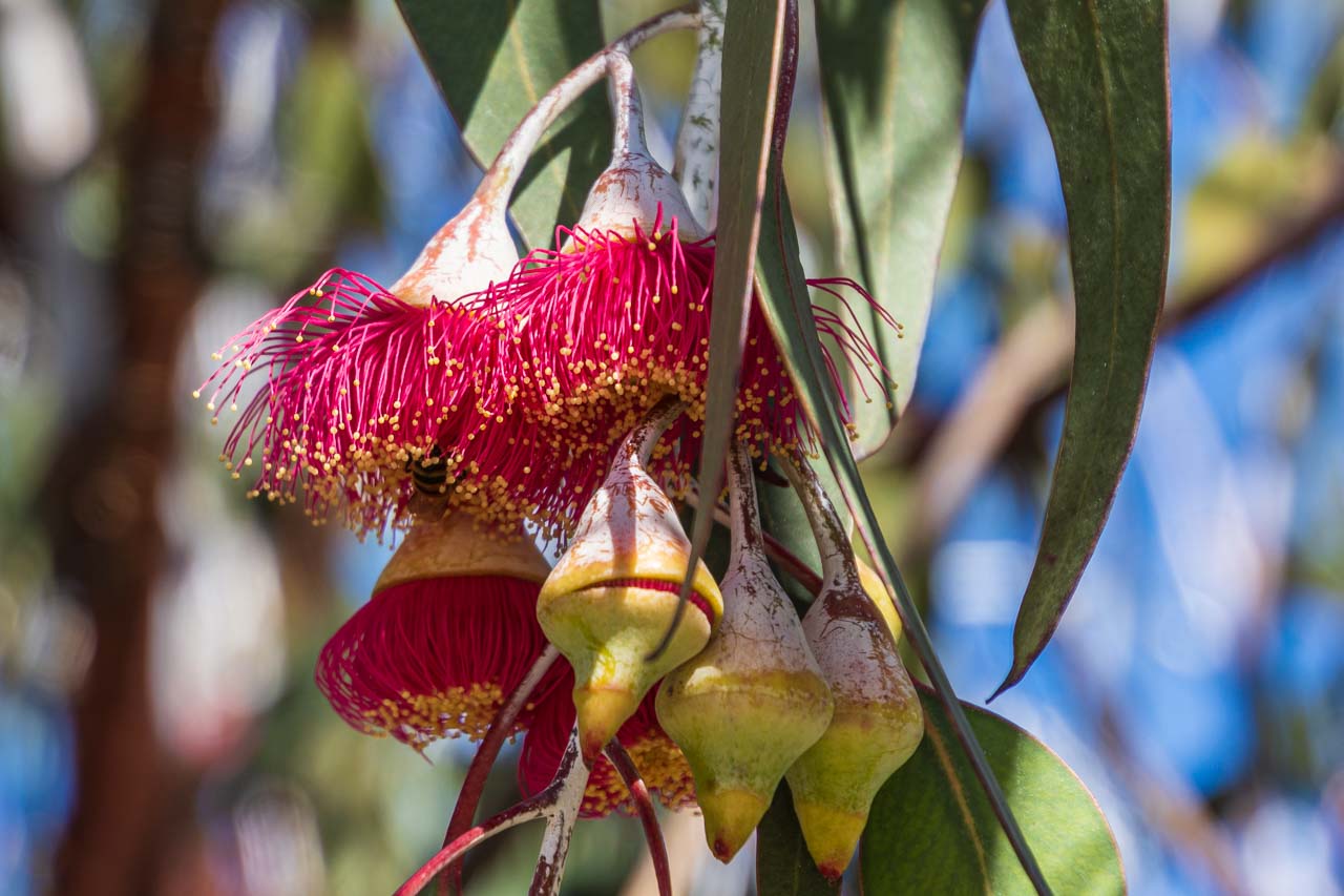
Red flowers and pods on a red flowering gum tree

Red flowering gum endemic to Western Australia


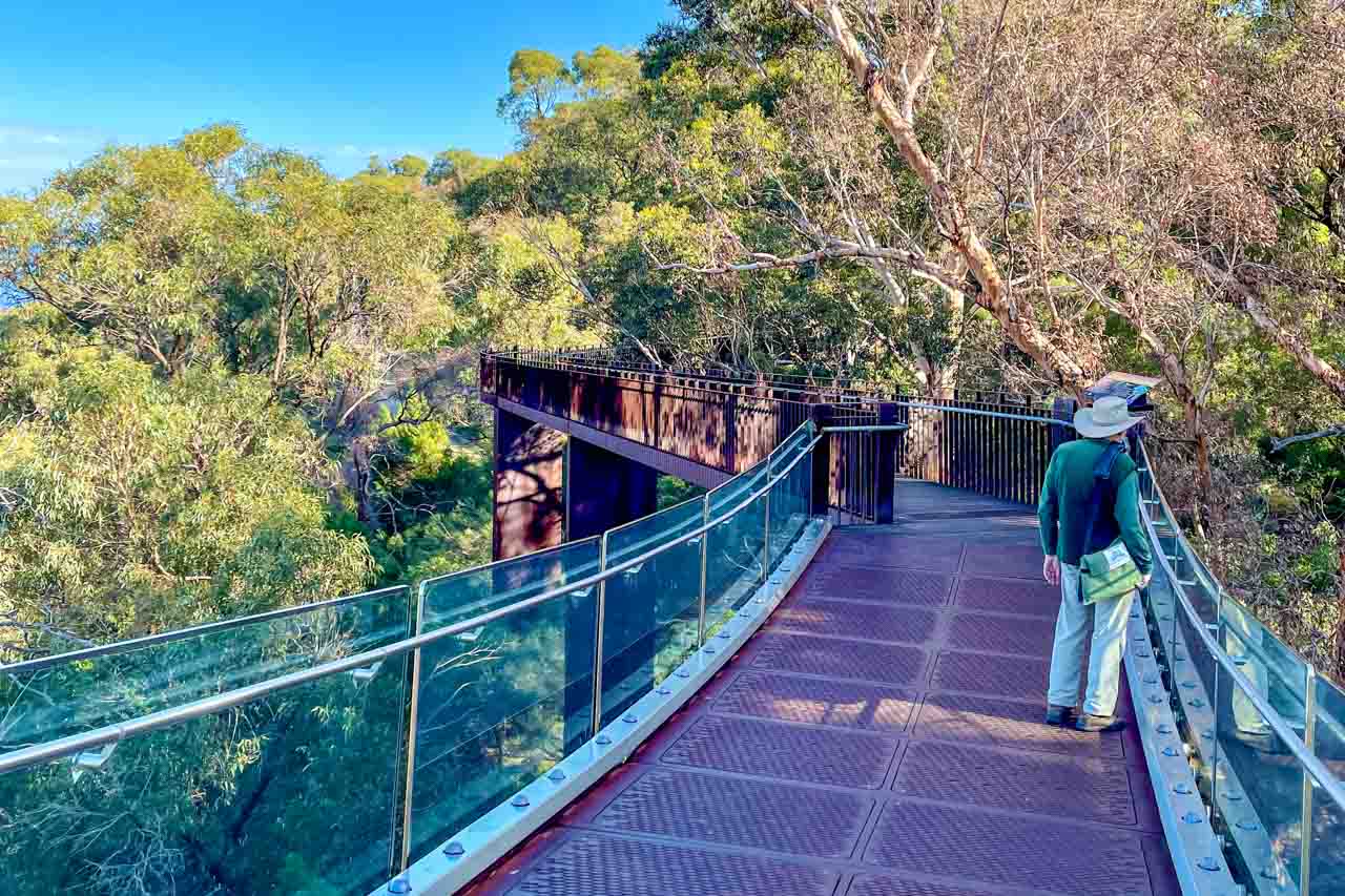
The guided walk in the park included walking the 620-metre long Lotterywest Federation Walkway within the Botanic Garden – a combination of pathways, an elevated walkway in the treetops, and a glass bridge allowing uninterrupted views of the valley floor 16 metres below. The walkway’s highest point is on the glass bridge, providing a panorama of the Swan and Canning Rivers. The elevated section of the Lotterywest Federation Walkway is open daily from 9.00 am to 5.00 pm and is accessible by wheelchair.

A man standing on a metal bridge with glass sides that winds through the treetops

Lotterywest Federation Walkway’s glass bridge in the treetops


Kings Park and Western Australia Botanic Garden are free to enter and open 24 hours a day. A digital visitor map is available on the Botanic Garden and Parks Authority website. Printable versions are also available on the same website but will no longer be updated.

There are several means of getting to Kings Park:

  • Kings Park is an easy 1.5 kilometres from Perth CBD.
  • There are two options here, both free. Option 1 > Transperth Bus #935 travels from St George Terrace (Perth’s CBD) into Kings Park. This service operates every 10 minutes on weekdays and 15 minutes on weekends and is free for passengers travelling from the CBD to Kings Park. Option 2 > The Blue CAT Bus travels between Perth Busport and Kings Park via Perth Station and Elizabeth Quay Bus Station. The service is free and runs every 15 minutes. See ‘Getting around Perth’ below for more information on CAT buses.
  • Free parking is available only for park visitors. You are not allowed to park your vehicle and then leave Kings Park boundaries by any other means (on foot, by bus, or in another vehicle).

View a tsunami of a rock formation

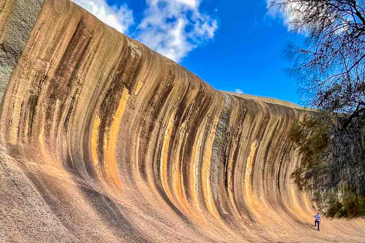
A long rock formation with a man standing at its base that looks like an ocean wave

Wave Rock


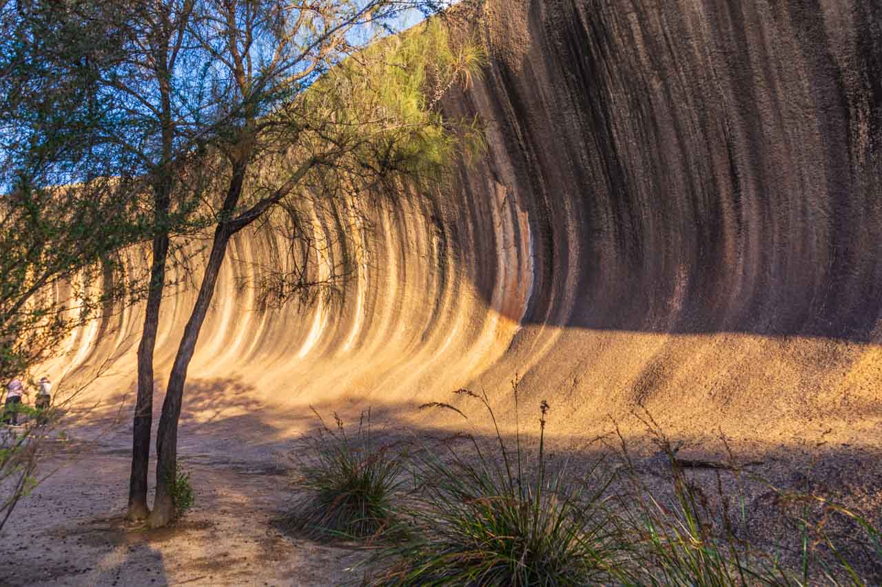
At 15 metres high, Wave Rock towers over you like a tsunami ready to crash on the landscape. This extraordinary natural granite rock formation shaped like an ocean wave (but not in the ocean) was formed more than 2700 million years ago but only ‘discovered’ in the 1960s.

Wave Rock is about four kilometres from the small wheatbelt town of Hyden, but first, you must get to Hyden, which is a four-hour drive from Perth. Rather than drive myself, I decided to travel to Wave Rock in a more relaxed manner and go with Australian Pinnacle Tours on their full day Wave Rock, York, Aboriginal Culture and Seasonal Wildflowers tour.

Note: September is the best month in Western Australia to see wildflowers, and I was there at the end of June and saw no wildflowers.

Our first stop on the way to Wave Rock was in the town of York, where we had enough time for a coffee and a stroll along the main street. Situated on the Avon River and established in 1831, York is the oldest inland town in Western Australia. It is a pretty town renowned for its heritage buildings and colonial architecture lining the main street, and I couldn’t resist the old-fashioned lolly shop.

Having arrived in Hyden, we stopped at Hippos Yawn for a photo stop before lunch.

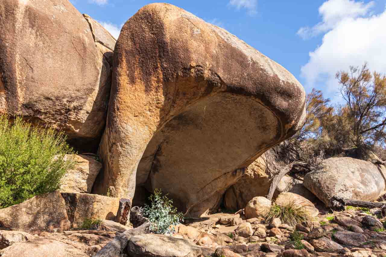
Hippos Yawn is a 12.6-metre-tall rock formation said to resemble a yawning hippopotamus. You can walk to Hippos Yawn from the Wave Rock car park on a flat, easy 1.7-kilometre return path.

A large rock that looks like a hippo yawning

Hippos Yawn


Australian Pinnacle Tours organised lunch at the Wildflower Shoppe Cafe in Hyden. Unfortunately, the buffet chicken and rice were disappointing.

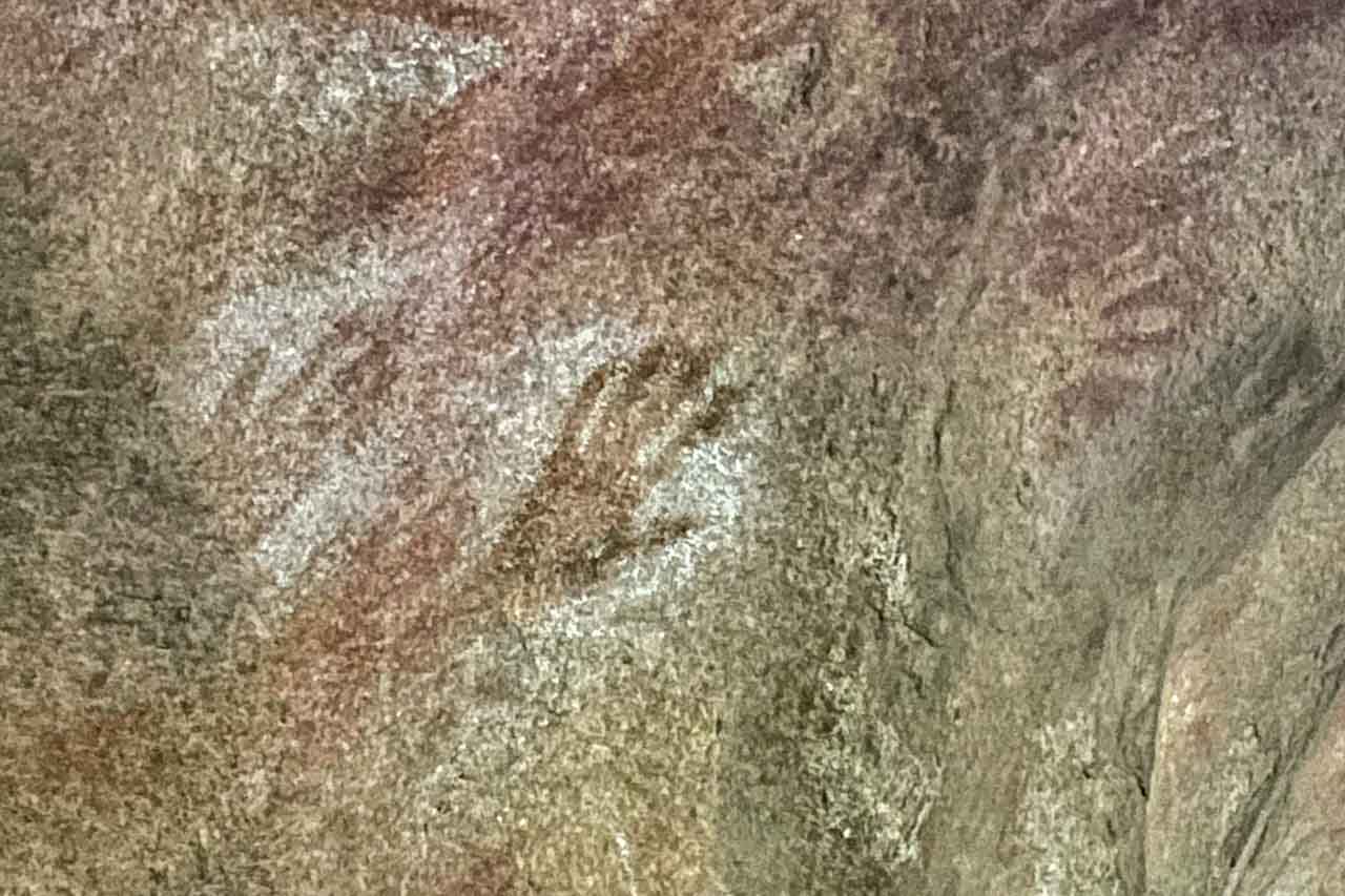
After lunch, we visited Mulka’s Cave to view Aboriginal rock art and handprints significant to the Nyoongar people. In Mulka’s Cave’s three chambers, 452 handprints and paintings have been recorded. Legend has it that the handprints are those of Mulka the Terrible (an Aboriginal evil spirit) who was known as a murderer and cannibal and lived in the Mulka Cave. The tribe eventually killed him after he killed his mother for scolding him for eating children.

Several human handprints on a cave rock face

Aboriginal rock art (handprints) in Mulka’s Cave


Wave Rock is a unique and beautiful rock formation with its wave-like shape caused by the water below ground before the rock was exposed by erosion. The ‘wave’ is even more accentuated by the vertical orange, brown, yellow and grey streaks that stain the surface. The colours in Wave Rock, created by water runoff reacting with the minerals in the rock, are magnificent, and even more so when the sunlight hits the rock.

A low stone wall on top of Wave Rock was built by the Water Authority in 1951 to channel water into the Hyden Reservoir. Initially used as an emergency water supply for livestock, it became the town water supply for Hyden in the early 1960s. It is still used for this purpose but is now supplemented by a larger dam out at The Humps.

We had 60 minutes at Wave Rock which was plenty of time to walk along the 110 metres rock face and the top of the rock and to grab an ice cream at the caravan park store adjacent to Wave Rock before boarding the bus for the drive back to Perth.

A long rock formation with flora in the foreground that looks like an ocean wave

Wave Rock


Explore Rottnest Island

Rottnest Island is a major tourist attraction with over 500,000 visitors a year and is famous for its native quokka population, said to be the happiest animal on earth. So, I thought I better see for myself what all the hype is about.

Dosed up with sea sickness tablets, I caught the train to Fremantle, from where I took the 9.00 am ferry to Rottnest Island – a 30-minute trip across the Indian Ocean.

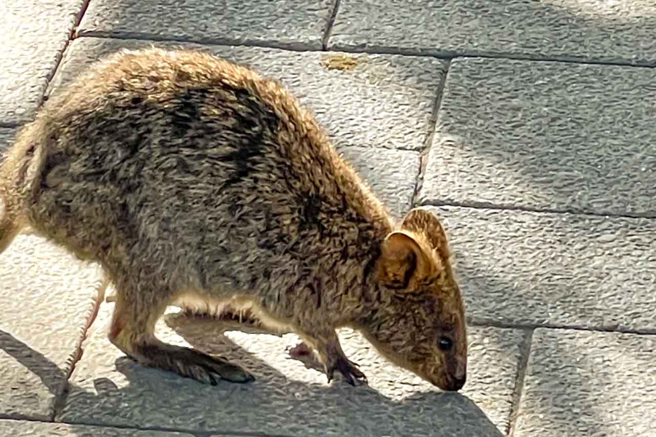
Quokkas are native to Rottnest Island but also, less commonly, found on mainland Western Australia. They are found nowhere else on earth. They are also known as the short-tailed scrub wallaby and are about the size of a domestic cat. In my opinion, they look like a cross between a large rat and a small wallaby. I can understand why the Dutch sailors who first landed on Rottnest Island reported to their captain that the island was infested with large rats and named it Rottenest Island (“Rat’s Nest Island” in English). The ‘e’ was later dropped.

A photo of a quokka

A quokka on Rottnest Island


Quokkas are mainly nocturnal animals, but tourism on Rottnest Island seems to have flipped their internal clock as they were everywhere around the cafes scavenging food. And no, I did not take a selfie with a quokka – apparently, this is THE thing to do on Rottnest Island!

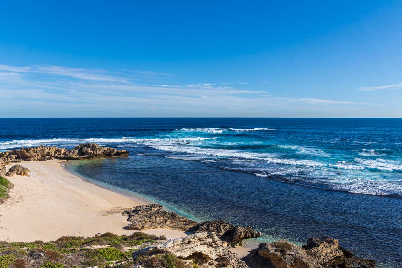
Rottnest Island is 11 kilometres long and 4.5 kilometres wide at its widest point. Locals describe the island as a favourite holiday destination for Western Australians because of its pristine beaches ideal for swimming, beautiful bays to explore, coral reefs and shipwrecks to snorkel around, and cycle paths (cars are not allowed on the island) and walking tracks.

A photo of a sapphire blue ocean and a beach surrounded by rocks on three sides

Fish Hook Bay, Rottnest Island


My visit to Rottnest Island was organised through SeaLink, taking their Rottnest Bayseeker Package. The package included the return ferry with Sealink WA and a 90-minute bus tour of the island, disembarking briefly at a couple of viewpoints around the island. With my bus tour not until 1.45 pm and arriving off the ferry at about 9.45 am, I had several hours to kill. To fill in my time between arrival and the bus tour, I checked out the shops at Thomson Bay, the island’s central hub and referred to as The Settlement, had lunch in one cafe and coffee and cake in another, went for a walk, and visited Wadjemup Museum.

Wadjemup Museum

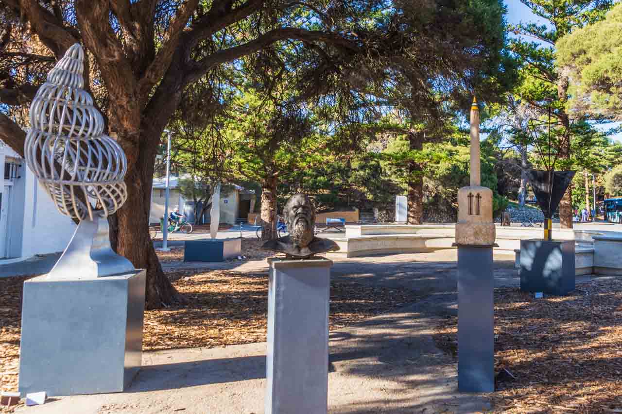
If you want to learn about Rottnest Island’s unique and diverse history, including its dark history as a penal settlement for Aboriginal prisoners, visiting the Wadjemup Museum is a must. The museum is a delight to explore as it is laid out in easy-to-follow themes, including cultural connections, early exploration, Aboriginal incarceration, and milestones such as how the island was used as internment camps in World War l and ll and as a COVID-19 quarantine station in 2020. A theatrette, audio interactions, an interactive touchscreen for kids, and outdoor sculptures complete your museum experience.

A photo of various sculptures outside on plinths

Wadjemup Museum outdoor sculptures


I enjoyed looking through Wadjemup Museum, finding it thought-provoking and engaging. Should you be on Rottnest Island, I recommend visiting the museum.

The museum is in the Old Mill and Hay Store behind the Rottnest Bakery and General Store in Thomson Bay Settlement. Opening hours are 10.00 am to 3.30 pm daily. Entry to the museum is by donation.

While I liked the Wadjemup Museum experience, I was, on the whole, disappointed with my visit to Rottnest Island and, frankly, bored. At one point, I asked myself why I was there. My disappointment stemmed from too much time around Thomson Bay Settlement waiting for the bus tour and a bus tour that made too few stops around the island with minimal time at each of those stops (never a good combination for a keen photographer). In hindsight, I would have been better off taking the Rottnest Express ferry from Barrack Street Wharf over to the island and then using Rottnest Island’s Hop On / Hop Off Bus to explore the island on my own, at my pace.

Chime a massive bell in The Bell Tower

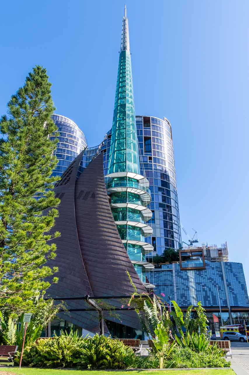
A glass tower with other buildings behind it

The iconic Bell Tower


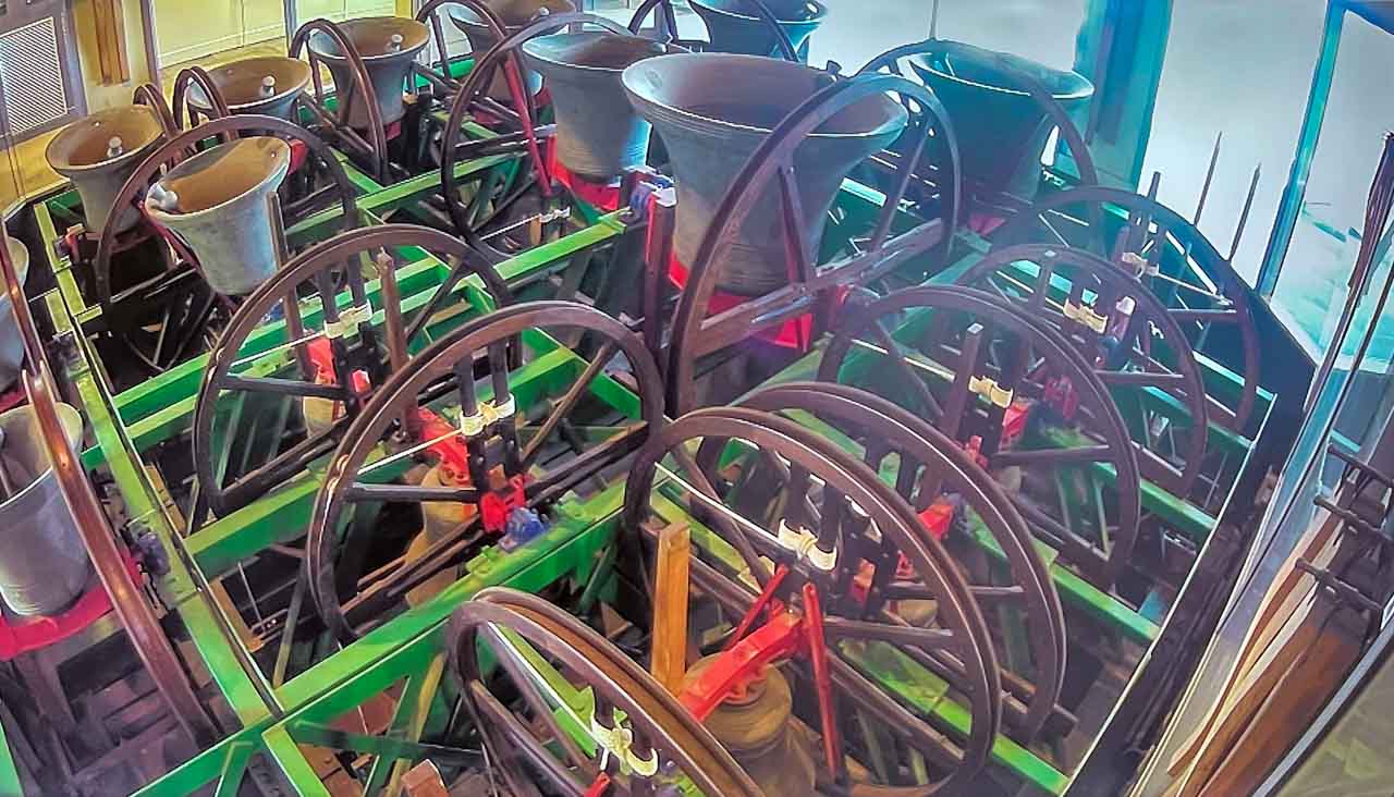
The distinctive design of the towering glass spire of The Bell Tower (resulting from an architectural competition and the world’s only bell tower) has become an icon for Perth and Western Australia. The Bell Tower was custom built to house the twelve historic 18th century Bells of St Martin-in-the-Field (one of London’s most famous churches) and five specially cast bells gifted to the people of Western Australia in 1988 in commemoration of Australia’s bicentenary. The Western Australian Government commissioned a sixth new bell to mark the second millennium, making a total of 18 bells in The Bell Tower.

Eighteen cast bells with rope pull wheels

Bells of St Martin’s


The Bell Tower, located in Barrack Square, is one of the largest musical instruments in the world and a unique, interactive Perth tourist attraction. Open Thursday to Sunday from 10.00 am to 4.00 pm, with the last entry at 3.45 pm. Tickets can be purchased online or directly at the Bell Tower.

A General Entry ticket gives you access to the Bell Tower’s six levels on a self-guided tour, with the opportunity to see the St Martin bells ring by the professional bell ringers if you time your visit between 12.00 pm and 1.00 pm on a Thursday or Sunday. The General Entry ticket does not include chiming the bells yourself.

Level 6 is the open-air Observation Deck, where you get stunning views of the Swan River and Perth City.

I chose the 45-minute ‘Bell Tower Experience’ tour because I wanted more than just to learn about the history of The Bell Tower and the famous royal bells. I wanted to step behind the scenes with access to the Bell Tower ringing chamber to chime the historic bells, and I have the certificate to prove I chimed a bell. I learnt that chiming a bell is not just a matter of pulling the rope, but it is about how the rope is pulled. I also discovered how hard it is to pull the rope to make a sound from the bell.

Don’t be disappointed; buy your ticket ahead of your preferred visit time.

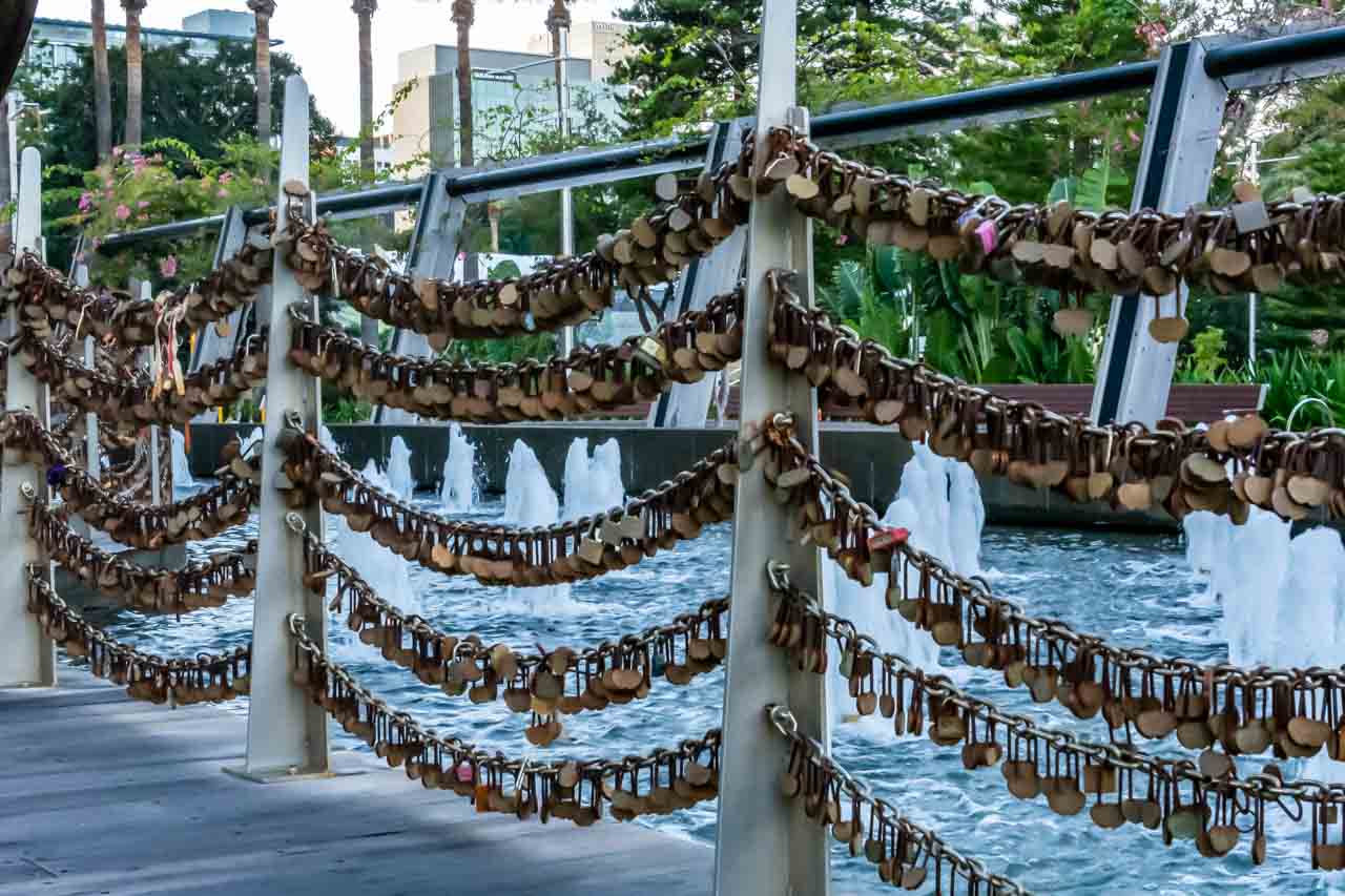
For $35.00, couples can announce their everlasting love to the world with an engraved Love Lock and attach it to the chain fence at the entrance to The Bell Tower.

Five rows of love locks attached to chains

Chain of Love Locks at the Bell Tower


Australian Pinnacle Tours

You will have noticed I used Australian Pinnacle Tours on serval occasions for sightseeing trips in Perth and beyond. Their tours were well organised with appropriate timing at each stop to explore, discover and take heaps of photos, and the drivers a wealth of information. My only suggestion to Australian Pinnacle Tours is to change the lunch venue on the Wave Rock tour.

Australian Pinnacle Tours’ Perth office in Barrack Square was three doors from where I was staying. When I saw a poster in their window for a tour to Wellington Dam (a place I was eager to visit for its massive dam wall mural), which fitted in with the dated I was in Perth, I immediately went in to chat with the staff. I found the staff above and beyond helpful. Perhaps it also helps to have all your tours booked with one company? The staff rearranged my booked tours to enable me to join the Wellington Dam tour, they looked up the weather to ascertain which days would be best for which tours, and they gave me suggestions as to the best spots to take photos of the mural on the dam wall.

When Australian Pinnacle Tours cancelled my Margaret River tour due to not being able to get a driver because of COVID-19 depleting driver numbers, staff explored every possible avenue available to them to get me on the tour another day. Unfortunately, it was not to be, giving me another reason to return to Perth.

I can’t thank the Australian Pinnacle Tours staff enough for their undivided help and attention, friendliness and professionalism. I highly recommend doing business with Australian Pinnacle Tours.

Getting around Perth

In moving around Perth, I walked (Perth is easy to walk around) and used CAT buses. Transperth’s CAT (Central Area Transit) buses operate in the Perth CBD, Fremantle, and Joondalup. They are free and frequent and use a colour-coding system in each area to identify the different routes. You may get off and on them as often as you like without paying a fare.

Click HERE for CAT route maps and timetables, clicking on the PDF symbol next to the relevant timetable.

On two occasions, I needed to get to Fremantle, and I used the train at those times – a 30-minute ride from Perth Railway Station, leaving from Platform 7. Good to know when purchasing a train ticket: Fremantle is in Zone 2 from Perth. A ‘one-way’ ticket is good for one hour, and if returning more than one hour later, you must purchase a Day Pass.

Where I stayed

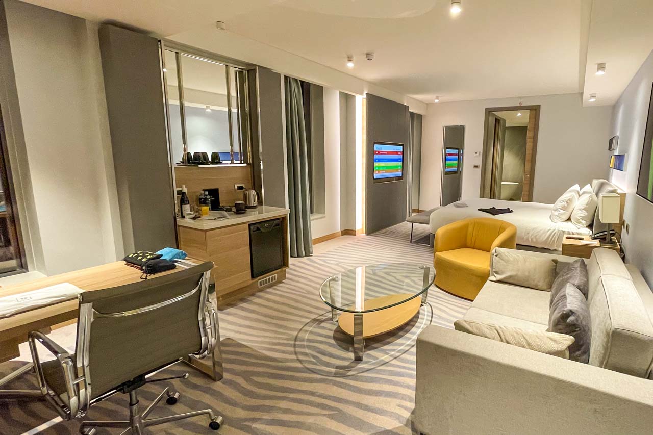
A photo of a large spacious hotel room with floor to ceiling windows, king bed, couch, and desk

My room for 10 days in the Doubletree by Hilton Perth Waterfront


While in Perth, I stayed at Doubletree by Hilton Perth Waterfront at 1 Barrack Square. I had a deluxe room with a king bed and panoramic river view. Being situated on the corner of the building on the 17th floor with large windows all around, I had fabulous views of the Swan River and Perth City.

The room was light, spacious, and comfortable, and I never tired of the views. It had everything I needed for a 9-night stay, except a microwave, and a microwave would have been useful given the length of my stay. When seeking information, I found the hotel reception staff helpful and knowledgeable.

I first visited Perth in 1981 on my way back to Namibia, where I was living at the time. It has taken me 41 years to return, and I certainly will not leave my next visit for so long as Perth has much more for me to discover, explore and enjoy.


Disclaimer: This post contains no affiliate links. All views and opinions are my own and non-sponsored. All photos are my own and remain the copyright of Just Me Travel.

© Just Me Travel 2018-2022.


Please leave a comment below to share your thoughts. Is Perth on your bucket list as my return is on mine?


Like this post? Save it for later!

A photo of a painting of people on a dam wall plus a photo of a city with new and colonial buildings

A photo of a beach plus a photo of a bridge


Are you looking for more ideas on destination Western Australia? Then don’t miss these posts:

HOW TO SEE HORIZONTAL FALLS AND EPIC TIDES, AUSTRALIA

23 GREAT PHOTO SPOTS ON THE ROAD FROM PERTH TO BROOME, AUSTRALIA

15 PHOTOS TO INSPIRE YOU TO VISIT BROOME, WESTERN AUSTRALIA

SEE 7 BEAUTIFUL GORGES IN THE KIMBERLEY – the ultimate guide

THE ULTIMATE GUIDE TO 6 SAFE SWIMMING HOLES IN THE KIMBERLEY, AUSTRALIA


Author’s Note: Please check the latest travel restrictions before planning any trip, and always follow government advice.

No Comments on 7 TOP DAY TRIPS AND THINGS TO DO IN AND FROM PERTH, AUSTRALIA

WYMAH FERRY BORDER CROSSING, LOCAL HISTORY, VALLEY VIEWS – the best day trip guide

Explore Both Sides of the Border on a Day Trip from Albury.   The New South Wales-Victoria border crossing on the Wymah Ferry is a unique experience. Combined with several…

Explore Both Sides of the Border on a Day Trip from Albury.


The New South Wales-Victoria border crossing on the Wymah Ferry is a unique experience. Combined with several lookouts delivering magnificent valley views, learning some local history, and eating the best ice cream in town, you have the perfect day trip from Albury. Use my detailed guide for planning your day trip across the border on a ferry with things to do around Lake Hume. Or save it for future reference when looking for a special day out with friends, family, or just on your own.

A picture of two images. One is of a car on a car ferry crossing a river. The other is views of a lake surrounded by hills.


Albury is a major regional city situated on the mighty Murray River in southern New South Wales. The Murray River is Australia’s longest river (flowing for 2,530 kilometres) and forms the border between the states of New South Wales and Victoria before flowing into South Australia.

Albury is strategically located for some of the best day trips in New South Wales and Victoria. A massive lake and river system, historic towns, mountains, national parks are just some of the adventures waiting for you on Albury’s doorstep.

Getting There

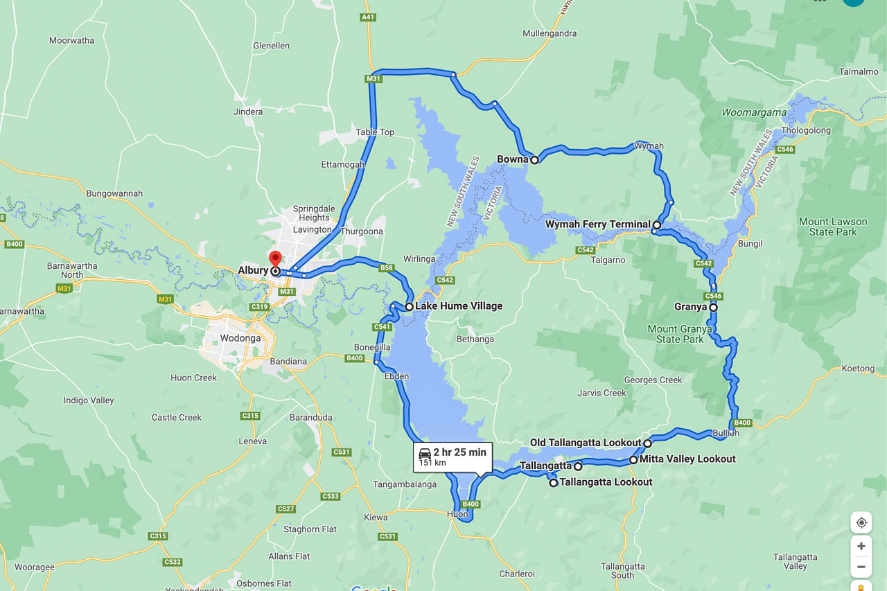
a map of a route from Albury to Bowna to Wymah Ferry Terminal to Old Tallangatta Lookout to Mitta Valley Lookout to Tallangatta to Tallangatta Lookout to Lake Hume Village to Albury

Wymah Ferry day trip route map (Google maps)


The Wymah Ferry day trip is a route driven in a loop and can be travelled in either direction:

  • Albury –> Bowna –> Wymah –> Wymah Ferry Terminal –> Granya –> Old Tallangatta Lookout –> Mitta valley Lookout –> Tallangatta –> Tallangatta Lookout –> Lake Hume Village -> Albury.

OR IN REVERSE

  • Albury –> Lake Hume Village –> Tallangatta Lookout –> Tallangatta, and so forth.

The drive is approximately 2 hours 25 minutes without stopping (151 kilometres). However, this is a day trip because we make several stops at places of interest along the way, take the Wymah Ferry across the Murray River, and stop for the best ice cream in town.

Albury to Wymah Ferry, New South Wales

Albury is the start and endpoint for this day trip. Driving north on the Hume Highway, you leave the highway at the Bowna Road turnoff. With Lake Hume on your right, approximately 5 kilometres along Bowna Road, turn right onto Wymah Road, heading to Wymah Ferry Terminal.

A hidden gem on this section of the route is Wymah School Museum. Make time to visit.

Bowna – the village that was

Bowna was a small village of about 150 people, but the decision to build a dam across the Murray River would foretell its demise. Bowna village was flooded in 1933 by the rising waters of Lake Hume. By 1935, the village had disappeared entirely, with traces only seen when Lake Hume is very low.

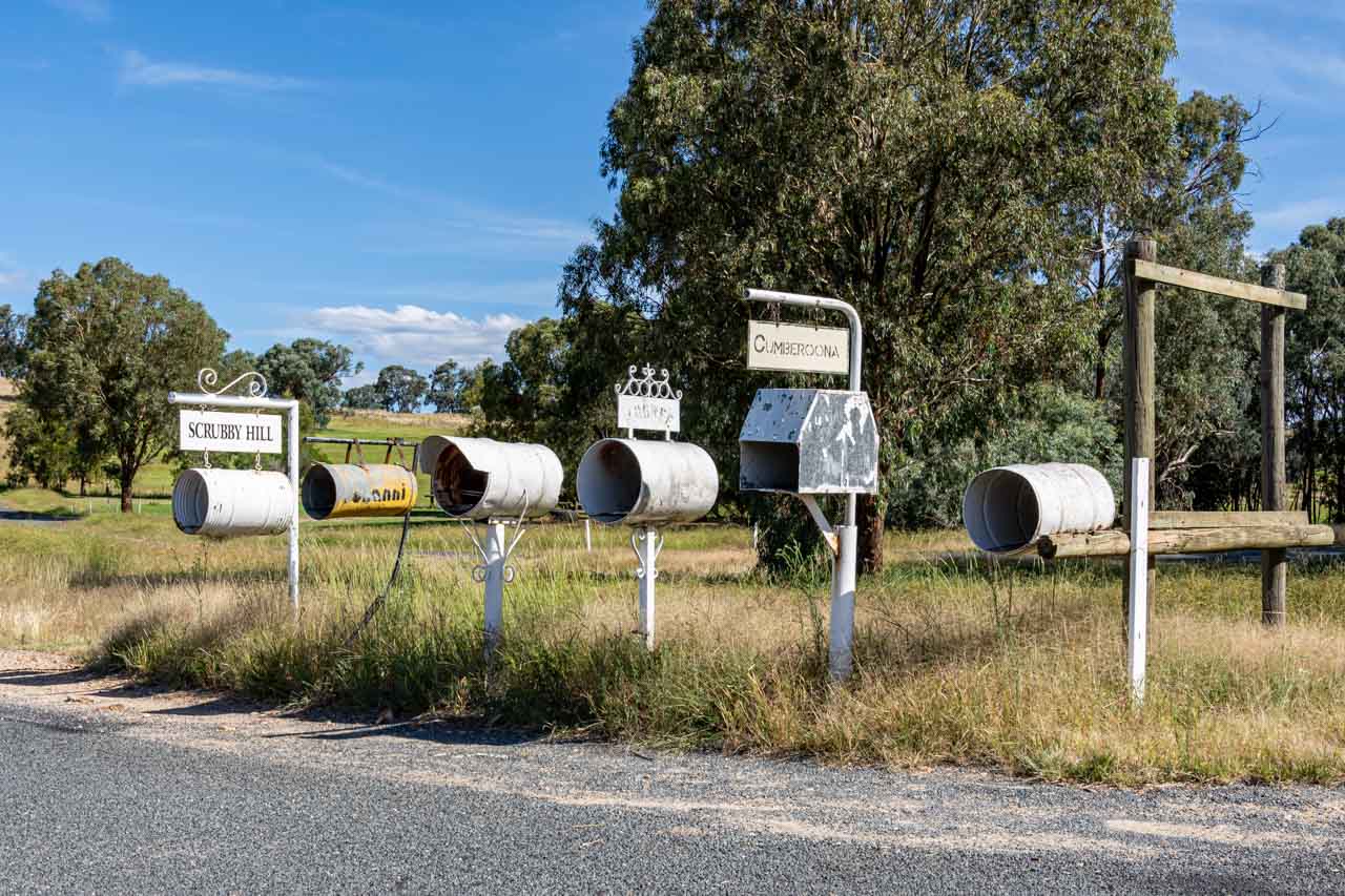
All you will see of Bowna village today on your day trip to or from Wymah Ferry are the letterboxes on Wymah Road in the photo below.

Bowna really is a case of ‘blink-and-you-miss-it’!

A row of six large tin cans on poles used as letterboxes on the side of the road

Wymah School Museum

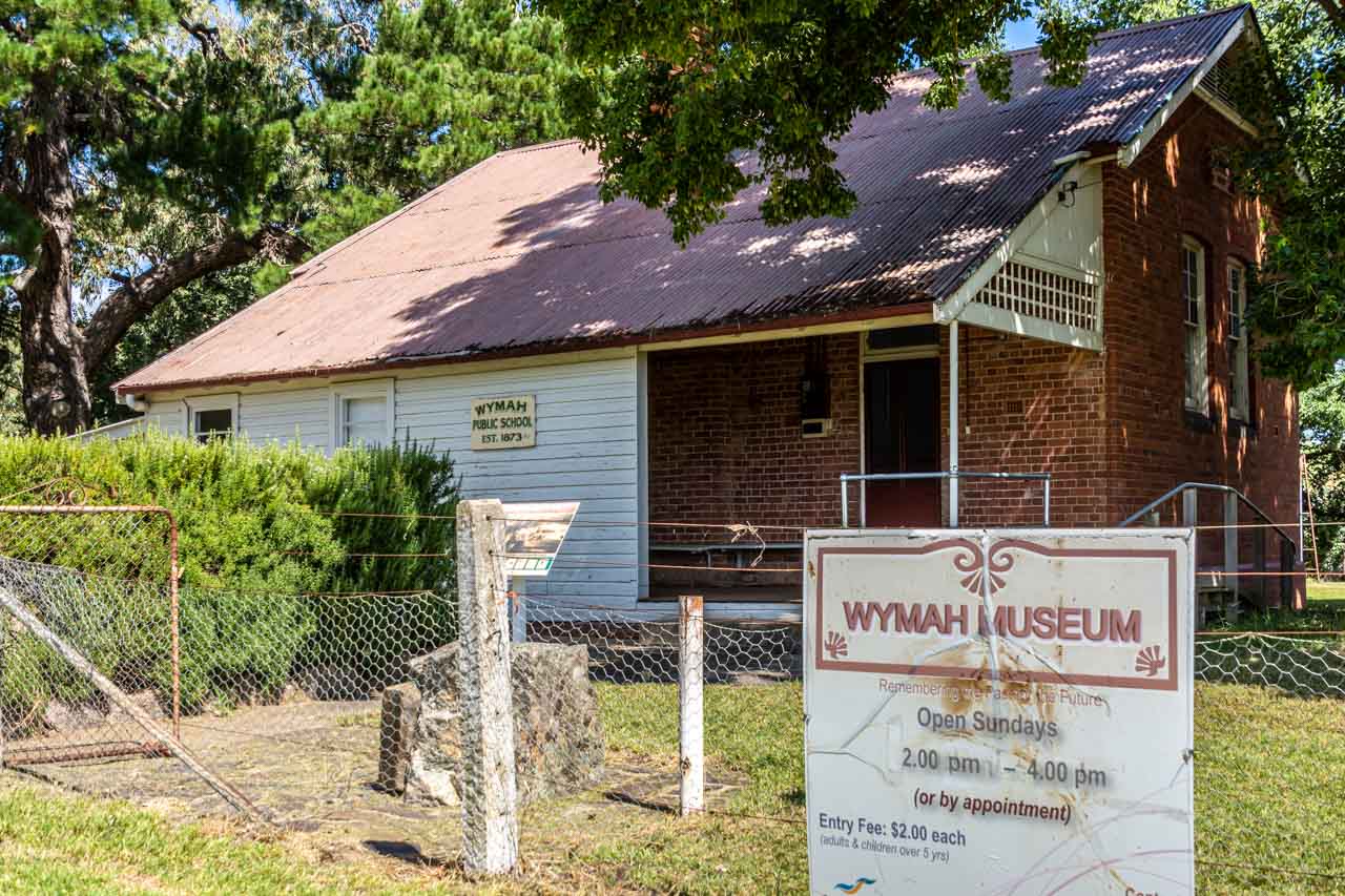
A brick and timber building with a red iron roof. The plaque on the building says, Wymah Public School, Est. 1873. The sign on the fence in from to the building says, Wymah Museum.

Wymah (formerly Wagra) was a pioneer settlement with a small thriving township until the early 20th century. It featured one of the earliest Murray River ferry crossings, transporting people and livestock. Nothing remains today of the original township except Wymah School (closed in 1983), now a museum, the schoolhouse, and Dora Dora Pub at Talmalmo.

The Wymah School Museum (formerly Wymah Museum) was established in 2013. It is a small, delightful museum located in the old Wymah School. When I entered the museum, the first thing I noticed was the beautifully polished original floorboards. Aesthetics aside, the museum presents the opportunity to learn about the history of the original pioneering families, Dora Dora Pub, Wymah Ferry, Wymah School, the local Wiradjuri people, and more.

Wymah School Museum hosts an uncluttered collection, engagingly arranged and focused on local history. Peter was the volunteer on duty the day I visited. He was a wealth of local information, which he willingly shared. His stories were made all the more interesting with his being a local. He was even a pupil at the one-room, single teacher Wymah School.

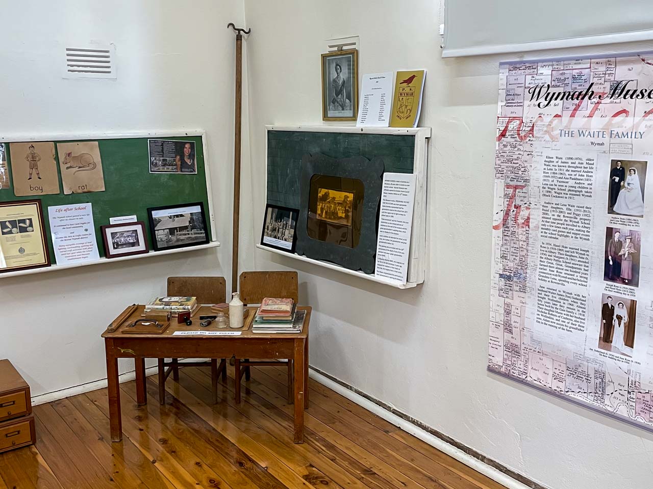
A picture of an old school wooden desk and chairs with books on the desk. There are photos behind the desk and a family history poster hanging on the wall near the desk.

A portion of the collection of artifacts and records in the Wymah Scool Museum


Wymah School Museum, at 2444 Wymah Road, Wymah, is open Sundays, 2.00 pm to 4.00 pm or by appointment. For an appointment, contact June 02 6020 2027 or Maree 02 6020 2005 or Judith 02 6020 2099.

Admission is $2.00 per person over five years.

Wymah School Museum is about a 30-minute drive from Albury. If looking for somewhere to go on a Sunday drive, you can’t go past a visit to this charming museum. Discover this hidden gem for yourself.

Wymah Ferry river crossing

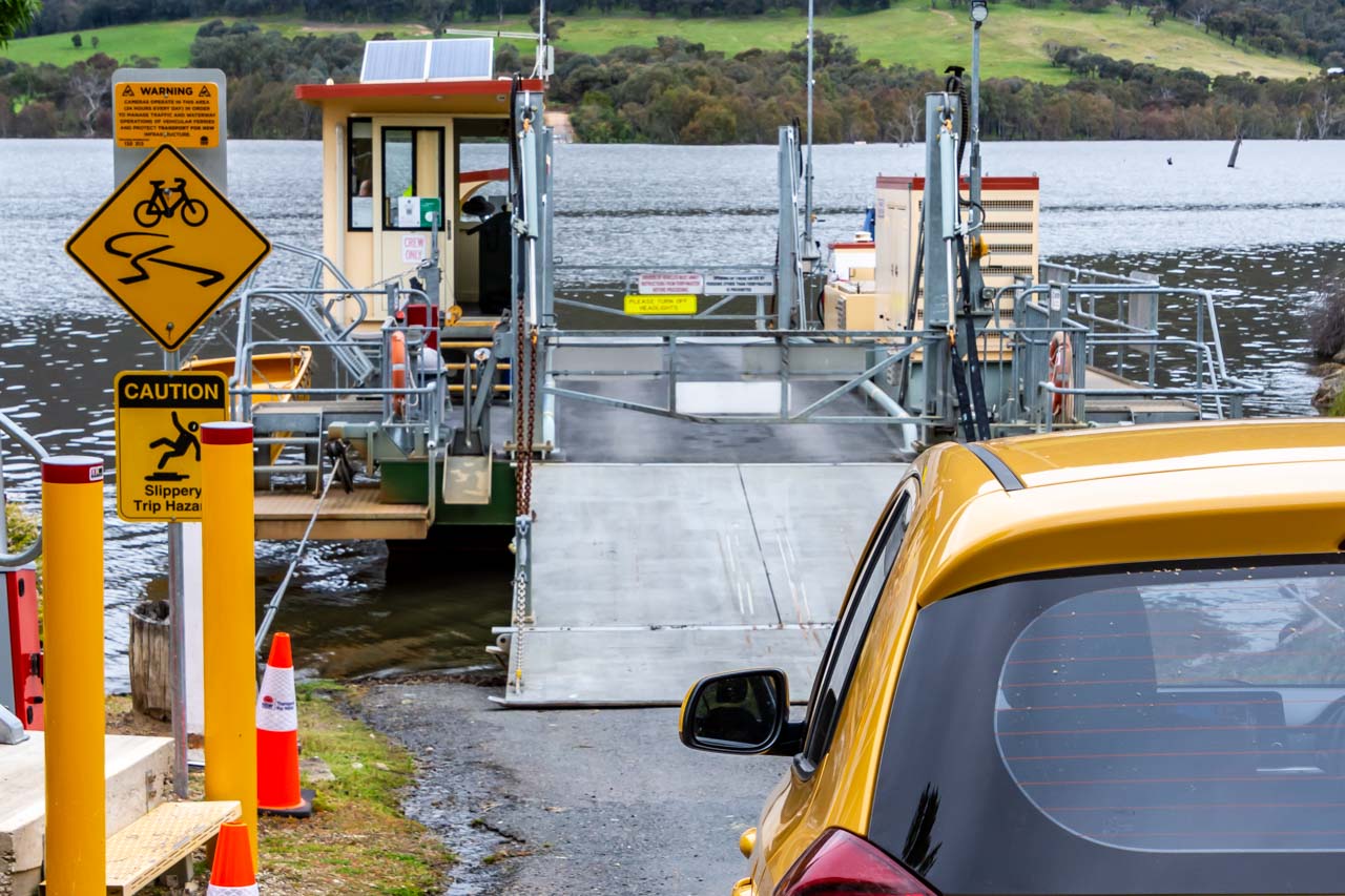
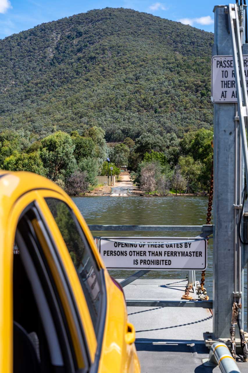
A yellow car waits to drive onto a three-car cable ferry to cross a river.

Waiting to drive my car onto the Wymah Ferry at Wymah


The Wymah Ferry has a long history of service, beginning in the 1860s as a private ferry crossing the Murray River. According to local lore, a pub owner started the first ferry crossing to bring customers over the river to his hotel.

The first public ferry began operating in 1892. The current Wymah Ferry is the fourth public ferry, with two previous ferries sinking (one of which was re-floated) and another dismantled. The third public ferry was a two-car ferry decommissioned in 2013 to make way for the present-day, larger three-car ferry, the “Spirit of Wymah” (picture above).

The Wymah Ferry is a three-car cable ferry crossing the Murray River at Wymah in New South Wales and Granya in Victoria. Its carrying capacity is 35 tonnes – the equivalent of two fully laden fire trucks. Caravans and camper trailers are permitted if vehicle and caravan do not exceed 17 metres.

The Wymah Ferry is unique in several ways:

  • It is the only cable car ferry in the region.
  • It is an unusual and fun way to cross the Murray River between New South Wales and Victoria.
  • It is a heritage-listed cable ferry.

The only other cable ferry crossing the New South Wales-Victorian border is nearly 500 kilometres downstream at Swan Hill.

The Wymah Ferry runs seven days a week and operates 6.00 am to 9.00 pm September to April, and 7.00 am to 8.00 pm May to August, except on the first Wednesday of every month when it is closed between 9 am and 12 pm. The ferry closures for meal breaks are as follows:

  • 10.00 am to 10.20 am,
  • 12.40 pm to 1.00 pm, and
  • 6.00 pm to 6.30 pm.

The trip takes about six minutes and is toll-free.

If the ferry is not at the terminal where you want to cross the Murray River – at Wymah or Granya – there is a button on a post to press to alert the Ferrymaster and call the ferry across.

The ferry service has been suspended on several occasions over the Wymah Ferry’s 150 years of operation due to low water. The service was also stopped in 2020 when the New South Wales-Victorian border was closed due to COVID-19. For up-to-date information on the operation of the Wymah Ferry, contact T: 02 6020 2038.

I have travelled on the Wymah Ferry three times in the last four months and feel a child-like thrill each time. At under 50 kilometres from Albury, enjoy this perfect experience for yourself. Don’t forget to combine the Wymah Ferry crossing with a visit to the Wymah School Museum.

A yellow car on a three-car cable ferry crossing a river.

On the Wymah Ferry leaving Granya


Wymah Ferry Day Trip Through Victoria

On the Victorian section of the Wymah Ferry day trip route, you will discover several lookouts with views over Lake Hume and Mitta River and lunch options in Tallangatta.

Old Tallangatta Lookout

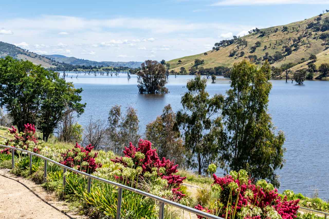
A picture of a body of a lake surrounded by hills. Dead trees sit in the lake and red flowers grow on the lake's foreshore.

View of Lake Hume from Old Tallangatta Lookout


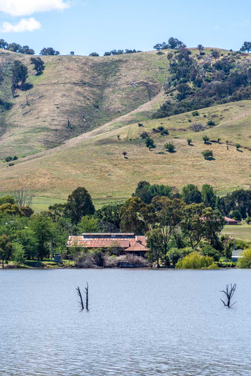
From the Old Tallangatta Lookout, you have stunning views over Lake Hume and across the lake to the prominent ruins of the (old) Tallangatta Butter Factory. The Butter Factory is all that remains of the old Tallangatta township, which was moved in the 1950s due to the expansion of the Hume Dam. Although the old town is now under water, when Lake Hume is very low, the remains of old Tallangatta can be seen above the water.

An image of an old rusty building sitting on the shore of a lake, with hills behind the building.

Old Tallangatta Butter Factory viewed across Lake Hume from Old Tallangatta Lookout


Located on the Murray Valley Highway, Old Tallangatta Lookout is eight kilometres from (new) Tallangatta town centre. There is off-road parking (no shade), information boards, and two picnic tables (one under trees and one undercover). There are no toilet facilities.

You can access the walking-cycle High Country Rail Trail from the lookout should you wish to stretch your legs a bit along the banks of Lake Hume.

Mitta Valley Lookout

Mitta Valley Lookout is a scenic spot on the Mitta Mitta River, just six kilometres from Tallangatta town centre.

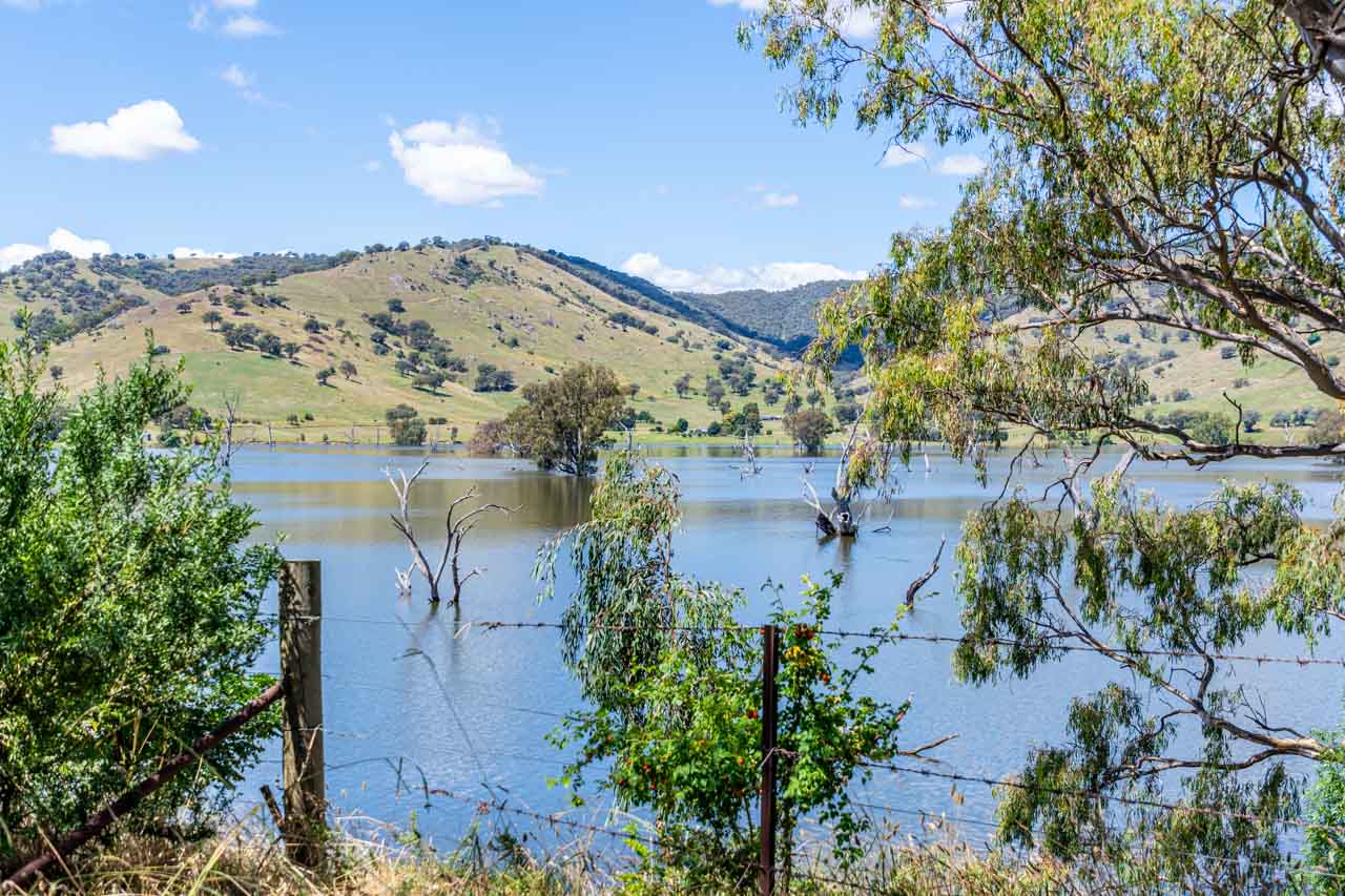
An image of a large body of water with green hills in the background and a barb-wire fence in the foreground

View from Mitta Valley Lookout


Located on the Murray Valley Highway, it is easy to miss the picnic table and signage tucked in amongst the trees on the side of the road. When driving in the direction from the Wymah Ferry towards Tallangatta, Mitta Valley Lookout is on the left at the end of the bridge across the Mitta Mitta River. Driving in the opposite direction (Tallangatta to Wymah Ferry), the lookout is on the right at the approach to the bridge.

A large tree provides good shade for your car should you decide to take a walk across the old railway bridge, now part of the High Country Rail Trail and running parallel to the road bridge.

There are no toilet facilities.

Tallangatta – the town that moved

Tallangatta is known as ‘the town that moved’ for obvious reasons – the town was forced to move 8 kilometres to its new, current location in 1956 when the old Tallangatta township was drowned with the expansion of Lake Hume. It is understandable then why Tallangatta appears stuck in the 1950s.

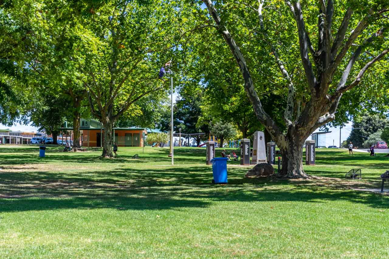
Tallangatta Triangles Park in the centre of town is a large green area shaded by beautiful plane trees moved to the park from old Tallangatta township. The park’s facilities include a children’s playground, barbeques and picnic tables undercover, benches, public toilets, and an information centre.

A picture of a large grassy area (park) with huge, shady trees. A toilet block, war memorial, covered area, and children's playground are located in the park.

Triangles Park


Tallangatta has several options for breakfast, brunch or lunch. I have eaten lunch at Tallangatta Bakery (39 Towong Street) and Tallangatta Hotel (59 Towong Street).  On my next visit to Tallangatta, I want to have brunch at the new cafe in town, Friday at Fika.

Friday at Fika, at 85 Towong Street, is open Friday 7.00 am to 1.00 pm, Saturday 8.00 am to 1.00 pm, and Sunday 8.30 am to 1.00 pm. The kitchen closes at about 12.30 pm.

Other options in Tallangatta for something to eat are Victoria Hotel (2 Banool Road), and Tallangatta Take Away (59 Towong Street). Or take a picnic and make use of the lovely park.

Tallangatta Lookout

Tallangatta Lookout is three kilometres from Tallangatta town centre and is accessed via Tallangatta Lookout Road, off the Murray Valley Highway.

You get stunning views of Lake Hume, Tallangatta township, and Sandy Creek Bridge from the lookout.

A view of a lake, hills and pasture land taken from a lookout.

View of Lake Hume from Tallangatta Lookout

A picture of a town on the shores of a lake and surrounded by hills.

View of (new) Tallangatta township from Tallangatta Lookout


Facilities include a lookout platform, picnic tables and an undercover area. There are no toilets.

Tallangatta Lookout Road is steep, but I managed it effortlessly in my small, automatic two-wheel drive car. The road is sealed near the top of the hill and then gravel for the short distance to the lookout parking area and facilities. I used second gear to come down the hill.

The Homeward Leg – Back in New South Wales

By now, you must be ready for an ice cream, right?

The best ice cream in town and Hume Dam

Lake Vue Cafe at 37 Murray Street, Lake Hume Village on the shores of Lake Hume, has the best ice cream in town. With 24 different flavours, you are spoilt for choice.

Two flavours of ice cream in a waffle cone in a person's hand

At only 12 kilometres (13 minutes) from Albury, an ice cream from Lake Vue Cafe puts the finishing touch on a perfect day out. The cafe is open Wednesday to Monday 9.00 am to 6.00 pm, and closed Tuesdays.

Take a walk down to Hume Dam while eating your ice cream and walk across the dam wall.

Hume Dam is a major dam across the Murray River, 13 kilometres from Albury. The reservoir behind the dam (Lake Hume) holds about six times the amount of water as Sydney Harbour and is an ideal spot for swimming, fishing, and watersports.

A photo of a dam wall with the reservoir behind the wall

Hume Dam


Other activities:

Granya Pioneer Museum

After disembarking the Wymah Ferry in Victoria, the first village you come to is Granya. I have not visited the Granya Pioneer Museum, but if you have time and are interested, you may want to include the museum on your day trip.

Granya Pioneer Museum has a collection of about 500 items with records dating back to 1836, including historical photographs, land records, family histories. A recent extension contains horse-drawn farming equipment, mining and blacksmith tools, and other related artifacts.

Granya Pioneer Museum, at 5 Doubleday Street, is open by appointment only. Phone Lyn on 0457 062097 or Pam on 0407 005503.

Bonegilla Migrant Experience

Leaving Tallangatta Lookout and driving back to Albury on the Murray Valley Highway, you will turn right onto Bonegilla Road at Bonegilla, Victoria. At 1.3 kilometres along Bonegilla Road, you will see the signposted entrance to Bonegilla Migrant Experience, a heritage museum.

Bonegilla became the largest and longest operating migrant reception centre in the post-war era, with more than 300,000 migrants passing through its doors between 1947 and 1971. Today, Block 19 is all that remains of the original 24-block site. Bonegilla Migrant Experience brings to life the stories and experiences of the people who went through the centre.

One in twenty Australians have links to Bonegilla. I remember taking my daughter-in-law to Bonegilla as her father was at the centre as a small child. Do you have a link to Bonegilla?

The museum is open 10.00 am to 4.00 pm Mondays, Wednesdays, Thursdays, and weekends. Take a self-guided tour (site map available at the Welcome Centre) or join a guided tour (adults $5.00).

Day trips are a great way to get out and about while exploring the local area. Crossing the New South Wales-Victoria border on a heritage cable car ferry makes this day trip unique, with an element of fun. Valley views from lookouts along the way and a charming museum ‘alive’ with local history complete your day trip experience. Don’t forget to save this guide.


Disclaimer: This post contains no affiliate links. All views and opinions are my own and non-sponsored. All photos are my own and remain the copyright of Just Me Travel.

© Just Me Travel 2018-2022.


Please leave a comment below to share your thoughts. My purpose in writing this post is to convince you to experience a Murray River crossing on the Wymah Ferry, including a drive through two states around Lake Hume. Have I succeeded? Where have you taken a car ferry across a river?


Like this post? PIN it for later!


Are you looking for day trips in New South Wales? Read my guides…

> ADELONG DAY TRIP GUIDE – the Snowy Valleys’ hidden gem in New South Wales

> LOCKHART DAY TRIP GUIDE – the Riverina’s hidden gem in New South Wales


Author’s Note: Please check the latest travel restrictions before planning any trip, and always follow government advice.


No Comments on WYMAH FERRY BORDER CROSSING, LOCAL HISTORY, VALLEY VIEWS – the best day trip guide

LOCKHART DAY TRIP GUIDE – the Riverina’s hidden gem in New South Wales

Lockhart – where art, history, and metal come together for a great day trip destination from Albury.   Join me on a day trip to Lockhart from Albury, a hidden…

Lockhart – where art, history, and metal come together for a great day trip destination from Albury.


Join me on a day trip to Lockhart from Albury, a hidden gem in regional New South Wales. Lockhart is a town steeped in history and art. Use the day trip guide to discover Lockhart’s award-winning museum, historic architecture, rusty metal sculpture trails, unique wool art, pioneering history, and more. With many things to do in Lockhart, see why this charming town should be a ‘must-visit’ destination.


The Riverina is an agricultural region in south-western New South Wales and home to the Murrumbidgee River (Australia’s second-longest river). The Riverina has an abundance of natural wonders and outdoor experiences. Lockhart is a prime example of all the Riverina has to offer – heritage architecture, a history steeped in its pioneering past, outdoor sculpture galleries, unique wool art portraits, and bush trails.

Lockhart is a true hidden gem. I am amazed by the depth of history and art for visitors to explore and discover in such a small rural town (town population, 818 people; shire population, 3,119)).

I have lived in Albury for nearly 30 years and have not been to Lockhart prior to my initial day trip in October 2020. I was recently telling my daughter about all I have discovered in Lockhart. She wanted to know why we had never been there. I had no answer but promised we would take a day trip to Lockhart next time she’s in Albury.

Getting there

A map of the route to Lockhart from Albury

Albury to Lockhart route and distance. Credit: Google Maps


Albury is situated on the Murray River and a major regional city in New South Wales, Australia. The Murray River is Australia’s longest river and forms the border between New South Wales and Victoria.

The trip from Albury to Lockhart is a drive of 1 hour, 14 minutes (105 kilometres).

Lockhart is 43 minutes (64 kilometres) from Wagga Wagga.

The Big Kangaroo and Big Emu

Sculptures in a paddock of a kangaroo and emu made from old car parts and other scrap metal.

About two kilometres from Lockhart, you will find these two sculptures of Australian icons in a paddock beside the road. Check out the joey in the kangaroo’s pouch.

The impressive Kangaroo and Emu sculptures stand roughly seven metres high. Residents created them over two days in 2011 during a series of community farm art workshops in Lockhart.

The Kangaroo and Emu sculptures have been constructed entirely from scape metal, including old ute and car bodies, 44-gallon drums, galvanised iron, and unused farm materials donated by locals. The sculptures are excellent examples of rural recycling where nothing is thrown away in case it may have a use in the future.

Things to do in Lockhart

The Lockhart Sculpture and Heritage Trail is Lockhart township’s overarching art and history discovery theme and includes all the things to do in this post.

Lockhart Shire has published a detailed brochure on historic Lockhart to assist you on your self-guided sculpture and heritage walk. Download a copy of the two-page Lockhart Sculpture and Heritage Trail brochure – an excellent resource.

Lockhart Verandahs

A picture of a paved sidewalk shaded by verandahs

Lockhart is known as the ‘verandah town’ due to its main street lined with verandahs dating back to the Federation years (around 1890 to 1915). The wide shady verandahs and historic shop fronts were restored in the early 1990s and have earned the town’s architecture classification on the National Trust Australia (NSW) list.

Verandahs line a town's main street and a painted water tower is at the back of the shops

Historic Etched Pavers

Brick pavers etched with a house and the names of the Wright family

The Wright family paver. Jack Wright was a builder, hence the etching of a house.


On the footpath below the verandahs on both sides of Lockhart’s main street are over 400 pavers with images etched on them. The etchings tell the story of the progress and history of the township and represent those families, past and present, who contributed to the district’s growth.

The etchings are a unique, historical legacy of the early life and times, and the families’ businesses in the district, from the illustrious pastoral years, through Federation and the wars, to a more recent past.

Farm Art Sculpture Trail

Lockhart’s Farm Art Sculpture Trail is an easy, flat walk taking you on an artistic journey around the town centre. Be amazed at the talent as you discover over 20 incredible sculptures on permanent display. The sculptures have been created from rusted and recycled farm materials and reflect the land’s natural elements.

Many of the sculptures are award-winning National Farm Art pieces from Lockhart’s annual Spirit of the Land Festival, a celebration of the resilience of those who live and work on the land.

My initial day trip to Lockhart in October 2020 (I have returned on two more occasions) was a suggestion to friends we check out the rusty farm art sculptures of which I had heard so much. We were not disappointed. I love this type of art and the open-air, public galleries in which they exist. I am in awe of the talent to create unique animal sculptures from bits of farm materials that look like the animals they are meant to represent. As we searched for sculptures (no Sculpture and Heritage Trail brochure on this first-day trip), I found myself excited with anticipation as I wondered what we would discover next.

A rusty metal sculpture of a dragon made from recycled farm parts

Sculpture – Australian Rain Dragon by Andrew Whitehead


A rusty metal sculpture of a person driving a wagon pulled by horses

Sculpture – Good Old Days by Keith Simpson


A rusty metal sculpture of a car and people outside a dance hall

Sculpture – Going to the Dance by Stuart Spragg


Greens Gunyah Museum

Corrugated iron building facade with a sculpture hanging on the front and a rusty bicycle near the entrance steps. The building is a museum.

The award-winning Greens Gunyah Museum is a wander through Lockhart’s heritage past. With its impressive collection of historical, traditional, and interactive exhibits, the story of Lockhart unfolds before your eyes.

The museum’s collection of historical artefacts, photography and machinery is extensive. Highlights include a telephone exchange, World War ll memorabilia, shearing memorabilia, an original slab hut, the old blacksmith, old town business histories, and vintage town footage. There is also a room dedicated to Tim Fisher – a former Deputy Prime Minister from the Lockhart region.

You will find Greens Gunyah Museum at 39 Urana Street, at the Narrandera end of Green Street (Lockhart’s main street). Entry to the museum is $5.00.

The artwork on the museum’s façade is “Click go the Shears” by Stuart Spragg and features in Lockhart’s Farm Art Sculpture Trail.

At the time of writing, the museum is closed indefinitely due to low visitor numbers and rising COVID-19 numbers. However, you can arrange a private visit to the museum. Refer to Lockhart’s Greens Gunyah Museum Facebook page for details on arranging a personal visit.

The museum is also home to the renowned Doris Golder Wool Art Gallery.

Doris Golder Wool Art Gallery

Koalas and a lansdscape made from layered natural, undyed sheep's wool

Wool art – Koalas and Australian landscape by Doris Golder


Local artist Doris Golder is one very talented artist. Her layered wool art is truly unique, the only pictures of their type in the world.

By using washed, combed, and undyed sheep’s wool, Doris has been able to create remarkably life-like portraits of well-known identities as well as landscapes. Each portrait took approximately three months to complete. The exception to this was the portrait of Fred Hollows, his wife, and his small children. This portrait took 18 months to complete due to the complexity of capturing the essence of the children.

Over 14 years, Doris created over 30 portraits, 26 of which are hung in Lockhart’s Doris Golder Wool Art Gallery.

I recently returned to the Doris Golder Art Gallery in Lockhart to renew my acquaintance with the artworks. I remain in awe of Doris’ extraordinary creative ability and the patience required to complete her artworks, especially in creating wrinkles.

Do you recognise the famous Australians in these four wool art portraits by Doris Golder? Answers at the end of this post.

The combined Greens Gunyah Museum, Doris Golder Wool Art Gallery, and Visitor Information Centre is staffed by volunteers who willingly share their wealth of local knowledge.

The $5.00 entrance fee to Greens Gunyah Museum includes entry to the Doris Golder Wool Art Gallery.

Pioneers Memorial Gateway

A picture of a memorial with three pillars of replica bales of wool

Pioneers Memorial Gateway is a tribute to Lockhart’s early settlers. It is situated at the entrance to Lockhart’s Showground on Urana Road.

The 22 life-sized replica bales of wool forming the columns of the entrance gates each bear the stencilled wool brand of the original sheep stations of Lockhart district.

Pastoral Shadows of Brookong

A rusty metal sculpture of a man sitting on a wagon drawn by horse. A man on a his rides beside the wagon.

Sculpture – A Drover’s Life by Stuart Spragg


Pastoral Shadows of Brookong is a collection of sculptures and silhouettes created from rusty iron, scapes of metal, and other natural materials. The sculptures are designed to bring history to life, telling the story of Lockhart’s rural life in the 1880s, when Lockhart and the area to the west of the town was a vast sheep station.

Pastoral Shadows of Brookong is situated on the edge of town, on the road to Wagga Wagga, across the road from the Lockhart Motel. The unsealed path taking in the sculptures is an easy, flat 15-minute circular walk – longer, if, like me, you take lots of photos. As you stroll through the sculptures and silhouettes, you will meet settlers, stockmen, drovers, and swaggies, as well as sheep, farm dogs, and kangaroos. Accompanying each sculpture is signage detailing the sculpture’s name and artist.

Brookong was a huge sheep station in the district of 200,000 hectares. In 1888, the Shearer’s Riot at Brookong played a pivotal role in developing Australia’s political history.


A picture of a rusty metal sculpture of three horse pulling a plough with a man sitting on the plough

Sculpture – Stump Jump Plough by Stuart Spragg

Photos from left to right:

  • Raymond the Swaggie – designed and constructed by Craig Lally
  • Settler “Burt” Searching for Land by Myra and Tom Jenkins
  • Swaggie “Fred” Looking for Work by Myra Jenkins, Neil Jeffries, and Des O’Connell

Water Tower Mural

Not silo art, which I am partial to, but the mural on Lockhart’s water tower is a remarkable piece of public art.

The mural features a cascading waterfall surrounded by many of the unique native fauna and flora found in the local landscape. The mural was painted in 2018 by Blue Mountains artists Scott Nagy and James Birkner (Krimsone) using spray cans.

Set close to Lockhart’s historic main street (Green Street) in a pretty, small park, the water tower mural is easily accessible. You will find clean public toilets next to the water tower.

A picture of inside a cafe with table and chairs and pictures on the walls

Interior of Latte Da Cafe, Lockhart

Latte Da Coffee Bar

All this walking will make you thirsty and hungry.

You are not spoiled for choice for cafes in Lockhart. However, Latte Da Coffee Bar is an excellent choice for breakfast, brunch, lunch, or to relax with a cake and coffee in the cafe’s indoor or outdoor setting. Takeaway is also available.

Offering fresh food – gourmet sandwiches, toasted Turkish rolls, pies and sausage rolls, cakes, and slices – Latte Da is located at 133 Green Street (Lockhart’s main street through town). Don’t forget to check out the Specials Board. I recommend the wraps.

The cafe is open 8 am to 4.30 pm Monday to Friday, 8.30 am to 1 pm Saturday, and closed Sunday.


Other activities:


Galore Hill Scenic Reserve

Just 15 kilometres north of Lockhart, off the Sturt Highway between Narrandera and Wagga Wagga, the top of Galore Hill Scenic Reserve is an impressive landmark in a seemingly never-ending flat but changing landscape.

The drive to Galore Hill Scenic Reserve is well signposted, and the gravel road from the Sturt Highway to the top is well maintained. Near the top of the hill, you can continue left to the Summit and right to the Saddle. Travelling with a friend on a second visit to Lockhart, we headed to the Summit, the Lookout Tower and walking tracks.

The views from the top of Galore Hill of the surrounding countryside are stunning.

A view all the way to the horizon of agricultural paddocks

The Summit is well-appointed with toilets, picnic tables undercover and in the open, barbeques, and ample parking.

One walking track in the Reserve takes you to the caves used by the infamous bushranger, ‘Mad Dog’ Morgan, who terrorised the region in the early 1860s. We walked the Saddle Loop Trail – a 45-minute return from the Summit. The trail was a narrow, rocky gravel track through the Australian bush that hugged the side of the hill. We lost the track about halfway along the Saddle Loop Trail and had to return the way we had come.

Considering the state of the trail, I recommend a good level of fitness for the walk, and sturdy walking shoes or hiking boots are a must. A hat, water, sunscreen, and insect repellent are also essential. I got eaten alive by mosquitoes on one section of the Saddle Loop Trail.

On a day trip to Lockhart, you should make time to take a drive to Galore Hill Scenic Reserve to soak in the views. Walking one of the trails will best be left for another time if you want to get back to Albury before dusk to avoid hitting kangaroos. We plan to return to Galore Hill Scenic Reserve to walk the Morgans Caves Loop Trail from the Summit.

Download the Gore Hill Visitor Brochure.

Lockhart is a wonderful town where history, heritage, and art are forever intertwined. There is something for everyone with its Federation verandahs, historic etched pavers, pioneering history, unique wool art and rusty metal sculptures, and water tower mural. Lockhart deserves a visit. Don’t leave it for 30 years as I did! Make Lockhart your next day trip destination, and don’t forget to save this guide.


Disclaimer: This post contains no affiliate links. All views and opinions are my own and non-sponsored. Unless otherwise credited, all photos are my own and remain the copyright © of Just Me Travel 2020-2022.


Please leave a comment below to share your thoughts. My purpose in writing this post is to convince you to take a day trip to Lockhart. Have I succeeded?


Like this post? PIN it for later!


Are you looking for another day trip in New South Wales? Read the guide to Adelong…

> Adelong Day Trip Guide – the Snowy Valleys’ hidden gem in New South Wales

> WYMAH FERRY BORDER CROSSING, LOCAL HISTORY, VALLEY VIEWS – the best day trip guide


Author’s Note: Please check the latest travel restrictions before planning any trip, and always follow government advice.


The famous Australians in the four wool art portraits by Doris Golder are:

Left to Right:

  • Tim Fisher – former Deputy Prime Minister and from the Lockhart region
  • Paul Hogan – comedian and actor
  • John Newcombe – former No. 1 world tennis player
  • Fred Hollows – humanitarian eye surgeon


No Comments on LOCKHART DAY TRIP GUIDE – the Riverina’s hidden gem in New South Wales

ADELONG DAY TRIP GUIDE – the Snowy Valleys’ hidden gem in New South Wales

Drive to Historic Adelong, a Hidden Gem of a Destination in the Snowy Valleys.   Join me on a one-day drive through regional New South Wales, from Albury to picturesque…

Drive to Historic Adelong, a Hidden Gem of a Destination in the Snowy Valleys.


Join me on a one-day drive through regional New South Wales, from Albury to picturesque Adelong. With a history steeped in pioneering and gold, Adelong is a delightful and fascinating day trip destination. It is the town where time stood still. Discover some of the best-preserved remnants of Adelong’s gold mining era, historic buildings, great walks, and more.


I have lost count of the number of times I have driven past the turnoff to Adelong on my way up the Hume Highway to Sydney, always wondering what the town has to offer. So, I jumped at the chance when a friend suggested we take a road trip to Tumut because this meant we could stop in Adelong and visit the famous Adelong Falls Gold Mill Ruins. As it turned out, Adelong is a hidden gem with much more to offer the visitor. Read on to learn why you should take a day trip to Adelong.

Adelong is a picturesque town built along the Adelong Creek, where gold was discovered in 1852. It is the heritage gateway to the Snowy Mountains. The tree-lined main street (Tumut Street), with its beautiful veranda-fronted buildings dating back to the gold rush in the 1800s, and Adelong Falls Gold Mill Ruins are New South Wales National Heritage Trust sites.

Adelong is easy to bypass (I can attest to that), but it is the hidden gem in the Snowy Valleys area. With so much history to discover, scenic walks to meander, friendly locals to chat with, and great food, why would you not want to take a day trip to Adelong?

Getting there

a map showing towns, roads , national parks and the route to take from Albury to Adelong

The Albury to Adelong day trip in New South Wales – courtesy of Google maps


Albury, on the Murray River, is a major regional city in New South Wales, Australia. The Murray River is Australia’s longest river and forms the border between New South Wales and Victoria.

The trip from Albury to Adelong is a drive of 1 hour, 50 minutes. As such, it just falls within my ‘2-hour-drive-from-Albury’ criterion for where to go on a day trip.

Coming from Albury, Adelong is 28 kilometres off the Hume Highway, on the Snowy Mountains Highway.

Adelong is 1 hour, 4 minutes (85 kilometres) from Wagga Wagga and 2 hours, 16 minutes (195 kilometres) from Canberra.

Enroute from Albury to Adelong, we detoured off the Hume Highway for a late breakfast in Holbrook. We cruised the main street seeking out Holbrook’s cafe options. We settled on J & B’s Gourmet Cafe (for no particular reason), where we had an excellent, hearty breakfast.

Our drive from Albury to Adelong took 3 hours 11 minutes:

  • We left Albury at 8.35 am.
  • We arrived in Holbrook at 9.20 am.
  • We did not rush breakfast, leaving Holbrook at 10.20 am.
  • We arrived in Adelong at 11.40 am, having missed the turnoff to the Adelong Falls Gold Mill Ruins – our planned first stop.
  • Turning around, we found the turnoff to the Adelong Falls Gold Mills Ruins 1.5 kilometres back the way we had come.
  • We arrived at the Adelong Falls Gold Mill Ruins at 11.46 am.

A large piece of gold mining machinery on the side of the road. The sign in front of the machinery reads, Adelong Falls Gold Mill Ruins

Driving into Adelong from the Hume Highway along Snowy Mountains Highway, this piece of gold mining machinery and signage (photo above) was only visible in the car’s rear-view mirror. That’s my excuse for missing the turnoff to the Adelong Falls Gold Mill Ruins!

Things to do in Adelong

Adelong might be a small town (population of 943), but there is much to see and do, keeping you occupied for the day and commending it as a worthy place to go for a day trip in New South Wales.

Adelong Falls Gold Mill Ruins

Looking down on Adelong Creek and the stone ruins of the Adelong Falls Gold Mill Ruins. There are two people walking around the ruins.

Gold Mill Ruins – photo taken from the viewing platform


Alluvial gold was discovered in Adelong in 1852 and reef ore in 1856.

The Adelong Falls Gold Mill Ruins is a heritage-listed (New South Wales) industrial site. It features a remarkably preserved collection of stone ruins bearing witness to the 1869 Reefer ore crushing mill and the remains of the ingenious Reefer ore crushing machine. The mill ceased operation in 1914.

Directions to the Adelong Falls Gold Mill Ruins:

From the Hume Highway, take the Snowy Mountains Highway turnoff and continue for 26 kilometres. Turn left onto Quartz Street and continue for 950 metres. At a fork in the road, turn right onto Adelong Falls Road, where the road ends 400 metres at the visitor car park. If you end up in Adelong township, then, like me, you have missed the Quartz Street turnoff.

At the visitor car park, there is ample parking, toilets, and a covered picnic area. Entry to Adelong Falls Gold Mill Ruins is free.

The wheelchair-accessible viewing platform near the visitor’s car park provides an excellent view of the gorge and ruins below.

From the viewing platform, my friend and I took The Ruins Walk down to Adelong Creek and spent a very informative hour walking around the ruins and gaining insight into the history of the Adelong goldfield.

The interpretative signage describing what you see as you walk around the ruins is excellent, making it easy to take yourself on a self-guided walking tour. You can also click here for a pamphlet on a brief history and plan of the Adelong Falls Gold Mill Ruins.

A picture of stone ruins, the remnants of an old wooden water wheel and water flowing over rocks

The lower water wheel at the Adelong Falls Gold Mill Ruins


A sign describing the lower water wheel used to run an ore crushing mill

Adelong Falls Gold Mill Ruins


You don’t have to drive to the Adelong Falls Gold Mill Ruins. You can walk there via the Adelong Falls Walk.

Adelong Falls Walk

Brochure showing the Adelong Falls Walk route beside Adelong Creek that takes the walker from the town centre to the ruins

Map of Adelong Falls Walk – brochure courtesy of Visit Snowy Valleys


The Adelong Falls Walk links the town of Adelong to the Adelong Falls Gold Mill Ruins. The sealed section is an easy, flat walk along the banks of the stunning Adelong Creek.

The Adelong Falls Walk begins at the Adelong Alive Museum on the town centre’s main street (Tumut Street).

The sealed section of the Adelong Falls Walk takes about half an hour, one way. The walk from the sealed path to and around the Adelong Falls Gold Mill Ruins is gravel with steep sections and stairs. Allow approximately 2.5 hours (return) to walk from the museum through to and around the ruins.

A river creek through and over rocks

Adelong Creek


MKS Cafe

MKS Cafe (88 Tumut Street) is situated beside the park and is open for breakfast, brunch and lunch. The cafe owes its old-world charm to its location in one of Adelong’s heritage buildings – The Old Pharmacy, dating from 1877.

We enjoyed good coffee and delicious cake in MKS Cafe’s tree-shaded courtyard.

Adelong Alive Museum

A house with a sign out the front. The sign reads, Adelong Alive Museum. There is also an OPEN sign.

Adelong Alive Museum (86 Tumut Street) tells the stories of Adelong and district, beginning with the gold rush period of 1852 and continuing to the present day. The museum has a scale model of the Reefer ore crushing mill and working models of ore crushing machinery. There is even a room dedicated to the history of the Adelong CWA (Country Women’s Association).

Finding the museum open would seem to be a matter of chance. The Australian Museums and Galleries’ website advises the Adelong Alive Museum is open from 11 am to 3 pm Saturdays and Sundays and by request. Another website I checked informs the reader the museum is open some weekends. The museum’s Facebook page notifies opening hours as Saturdays only, from 11 am to 1 pm. Confused? We were there on a Friday and delighted to find the museum open without prior arrangement. Go figure! Admission is a gold coin donation.

Gary Gately, our friendly and knowledgeable museum volunteer, took the time to show us through the museum, providing detailed information on Adelong’s extensive and colourful history.

A flat metal sculpture in a window of four miners. The base of the sculpture depicts mountains and a river.

A sculpture dominates a window of the Adelong Alive Museum


Adelong Heritage Walks

Take a walk around this historic gold mining town, exploring buildings dating back to the second half of the 19thcentury.

A map showing where to find the heritage buildings in Adelong township

Map of Adelong Heritage Walks – brochure courtesy of The Royal Australian Historical Society


In Adelong, Tumut Street (the town’s tree-lined, veranda-fronted main street) is heritage-listed by the National Trust of Australia (NSW).

The Adelong Heritage Walk takes about an hour and passes most of the town’s noteworthy and National Trust-listed buildings.

If you don’t have time to complete all of Adelong’s Heritage Walk, I suggest you walk along Tumut Street, where most of the town’s heritage buildings are concentrated.

I picked up the Adelong Heritage Walks brochure at the Adelong Alive Museum. However, there is no guarantee the museum will be open. The brochure is available at Tumut Region Visitor Information Centre but driving onto Tumut will add 38 kilometres (30 minutes) return to your day trip drive. I was unable to find the brochure online. However, click here for a description of the walking route and heritage buildings.

Other activities:

  • In the warmer months, take a swim at the Adelong Falls.
  • With gold still to be found in Adelong Creek, try your hand at gold panning.

Adelong deserves a visit. With its pretty main street, vibrant museum, pleasant walk along Adelong Creek, and excellent remnants of its gold mining era, Adelong oozes times past still intact. With so much history in one place, Adelong is a hidden gem where time has stood still, unchanged since the 1940s. Adelong is a must-see day trip destination.


Disclaimer: This post contains no affiliate links. All views and opinions are my own and non-sponsored. Unless expressly stated, all photos are my own and remain the copyright © of Just Me Travel 2021.


Would you visit Adelong? With a population of 943, is it realistic to call Adelong a town or is it better described as a village? Please leave a comment below to share your thoughts.


Like this post? PIN it for later!


Are you looking for another day trip in New South Wales? Read the guide to Lockhart…

LOCKHART DAY TRIP GUIDE – the Riverina’s hidden gem in New South Wales

WYMAH FERRY BORDER CROSSING, LOCAL HISTORY, VALLEY VIEWS – the best day trip guide

Author’s Note: Please check the latest travel restrictions before planning any trip, and always follow government advice.


No Comments on ADELONG DAY TRIP GUIDE – the Snowy Valleys’ hidden gem in New South Wales

Type on the field below and hit Enter/Return to search