Just Me Travel

Just Me Travel

Solo Travel Blogger

Tag: UNESCO World Heritage Sites

HOW TO SPEND ONE PERFECT DAY IN GALLE FORT – Your Ultimate Guide! (2024 Updated)

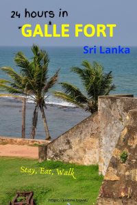
See Sri Lanka’s Colonial Galle Fort – a Must-Visit World Heritage Site Best Explored on Foot.   Welcome to Galle Fort, a UNESCO World Heritage Site and an iconic landmark…

See Sri Lanka’s Colonial Galle Fort – a Must-Visit World Heritage Site Best Explored on Foot.


Welcome to Galle Fort, a UNESCO World Heritage Site and an iconic landmark on Sri Lanka’s southwest coast. Galle Fort is a living testament to the island’s rich history and cultural fusion, offering visitors a unique and immersive e experience. Its cobblestone streets, ancient ramparts, intriguing museums, and vibrant markets make it a must-visit destination for any traveller to Sri Lanka.

This comprehensive guide takes you on a leisurely walk around Galle Fort. You’ll discover its historical sites and hidden gems, including the iconic lighthouse and historic Dutch Reform Church. As an ‘ultimate’ guide, I have included personal suggestions on where to eat, where to stay, and when to go.

From walking atop its well-preserved ramparts with panoramic views of the Indian Ocean to exploring its maze of streets lined with boutique shops, cafes, and museums, Galle Fort captures the essence of Sri Lanka’s diverse cultural heritage.

So, whether you’re a history buff, a culture enthusiast, or just looking for a relaxing walk around a beautiful, quaint city, Galle Fort is perfect for you. Follow my guide and spend one perfect day in Galle Fort, exploring the best of what it has to offer.


Why visit Galle Fort?

Galle Fort is rich in history, with 400 years of Portuguese, Dutch, and British colonialism. Built by the Portuguese in 1589, the Dutch seized the Fort in 1640 and extended its fortifications, which survive to this day. The British modified the Fort after the Dutch handed it to them in 1796. Galle Fort is a UNESCO World Heritage Site and remains the best example in south and southeast Asia of a fortified town built by Europeans.

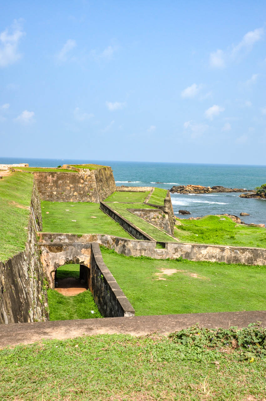
Galle Fort is protected by a wall (ramparts) with 14 bastions that have seen little change since the Portuguese completed it in 1729. The fortifications run for 3 kilometres and are over 1 metre thick. Inside the Fort is a mixture of architecture, with Dutch-colonial buildings, ancient mosques and churches, and grand mansions. Here, you will find cafés, restaurants, boutiques, museums, and hotels. It is also a thriving commercial centre.

With a relatively flat area of only 0.52 square kilometres within the fortifications, Galle Fort is easy to walk around and see everything. It is also a good base for day trips to the southern beaches, gardens, tea factories, rain forests, and nature walks. 

Sri Lanka holds some memorable highlights for me, such as walking the railway line between Ella and Demodara, our visit to Geoffrey Bawa’s garden, and a perfect day exploring Galle Fort.

Galle Fort location and getting there

Galle Fort is a historically fortified town, with the New Town of Galle outside the walls. The Fort is on the southwestern tip of Sri Lanka, 126 kilometres (78 miles) down the west coast from Colombo (Sri Lanka’s capital).

I travelled to Sri Lanka with my sister and brother-in-law for a three-week trip around this teardrop-shaped island. Ours was a private tour with a personal driver, the most comfortable way to get around. However, given its size, travelling around Sri Lanka by taxi, bus, and train is also possible as distances between sights are relatively short.

For a comprehensive guide on getting around Sri Lanka, check out Nerd Nomads’ travel blog post.

We took the coast road to Galle rather than the expressway at our driver’s suggestion. While taking the expressway would have been quicker (approximately 1.5 hours as opposed to approximately 3 hours), the coast road, according to our driver, is more interesting and scenic. And it was! Hugging the coastline, we passed through many small villages that provided a glimpse into local daily life, where farmers and fishermen continue to live and work as they have done for generations.

The drive down to Galle was our first real experience of driving in Sri Lanka. I have been in many countries where I thought the general population were terrible drivers, but Sri Lankan drivers take the prize. Their idea or practice of passing is downright scary.

Picture this: You have a two-lane road barely wide enough for two cars, with one lane for each direction. Suddenly, your lane has three vehicles side-by-side (including your own, with your driver on his mobile phone) as two vehicles want to pass one, and a bus is coming in the opposite direction. No one gives way as all four vehicles come level with each other, and all you can do is close your eyes and hold your breath. And yet, I never saw an accident!

I learned a valuable lesson on this drive – don’t ever think of doing a self-drive holiday in Sri Lanka, as you may never survive the experience. Their driving and use of the roads are, for these foreigners, positively frightening. My brother-in-law was never able to relax when we were driving. For some reason, he always managed to get the seat with a clear view out of the front windscreen, causing him to remain transfixed on the traffic and in a perpetual state of anxiety.

Galle Fort walking guide

We decided on an early start for our walk around Galle Fort, its bastions, ramparts (walls), and landmarks so that we would be finished before the day got too hot. In hindsight, it makes no difference in April, heat-wise, what time of day you venture out, as it is always very hot and wet (humidity, not rain).

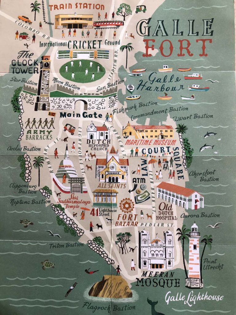
After a leisurely breakfast at the Fort Bazaar (our hotel) of fresh fruit, bacon and eggs, and freshly ground coffee, we set off on our self-guided tour (walk) of Galle Fort. Following our route, you will visit all the major attractions and more.

A colourful tourist map of Galle Fort showing the rampart bastions and major attractions.

Gall Fort tourist map (Courtesy of Fort Bazaar)


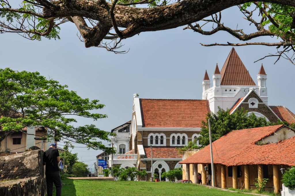
Walking up Church Street (Galle Fort’s main thoroughfare) towards the main gate and the Clock Tower, we passed All Saints Anglican Church with its distinctive stumpy steeple and the Maritime Archaeological Museum.

Two people view colonia buildings, including a brick church with a short steeple.

All Saints Anglican Church with its distinctive stumpy steeple.


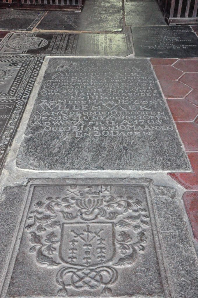
Our first stop on Church Street was at the Dutch Reform Church (corner of Church and Middle Streets). Originally built in 1640 and completed by the Dutch in 1755, the church is still in use. Tombstones removed from Dutch cemeteries are laid on the floor of the Dutch Reform Church – the oldest date from 1662. There are more tombstones in the church’s grounds.

Street view of the front of a white church next to another low-lying building.

Street view of the Dutch Reform Church next to Galle Fort’s library.


Tombstones are inlaid in the floor of a church.

Tombstones on the floor of the Dutch Reform Church.


Leaving the Dutch Reform Church, we continued up Church Street, making our way to the Clock Tower, our starting point for our walk along the Fort’s ramparts.

Heading east and past the Main Gate, we walked up onto the ramparts at the Moon Bastion, with its large Clock Tower built by the British in 1882.

Moon Bastion has an unhindered view of the ocean and is considered one of the main bastions of the Fort. It was built by the Portuguese in 1620 and strengthened by the Dutch in 1667 with a strong firepower base, including 16 canons. Sri Lanka’s Ministry of National Heritage has converted Moon Bastion into an art gallery with statues, sculptures, and art that depict people and events that mattered in the past.

From here, you can see the length of the northern ramparts (east to west) to the Star Bastion and Sun Bastion.

The northern ramparts are the most heavily fortified section of the ramparts as they protect the most vulnerable side of the Fort – the landward side. The Indian Ocean surrounds Galle Fort on three sides.

For those cricket fans: These northern ramparts, especially at the Sun Bastion, provide a good view of the Galle International Cricket Stadium outside the Fort. This massive, 30,000-seater stadium has hosted more than 100 one-day international matches. Australian bowler Shane Warne claimed his 500th Test wicket at the stadium in 2004. In 2010, Sri Lanka’s legendary cricket player, Muttiah Muralitharan, played his last match at this venue. However, as of July 2018, Galle International Cricket Stadium was at risk of losing its UNESCO World Heritage status due to the unauthorised construction of a 500-seat pavilion.

Turning south at the Sun Bastion, we came to the Fishmark Bastion, built to protect the local fishing boats.

Two fishermen are cutting up fish on the beach with a boat behind them and one man buying fish.

Fishermen sell their catch of the day below Fishmark Bastion.


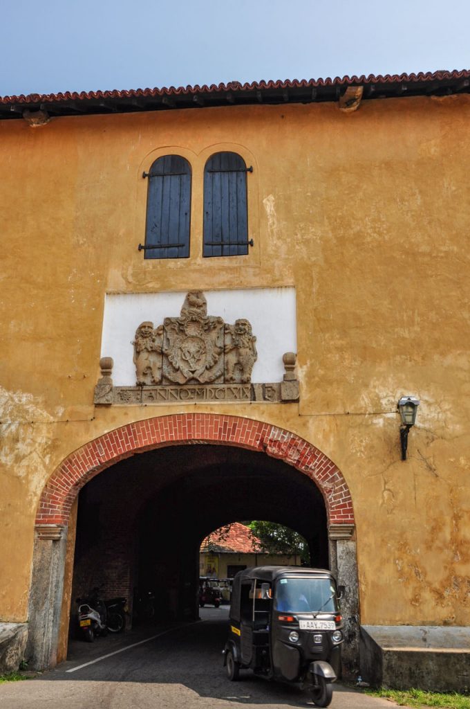
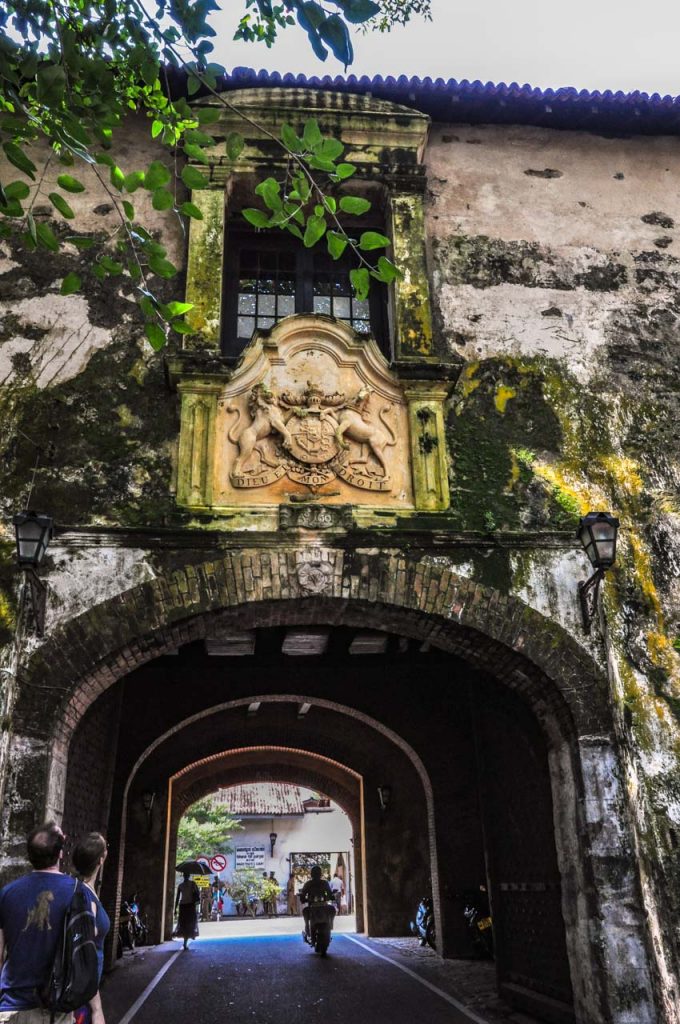
We left the ramparts at Fishmark Bastion to walk through Court Square, where we stopped at the Old Gate. This gate was the original entrance to the Fort and the only section of the Portuguese fortification that remains. The Fort side of the Old Gate is inscribed with the Dutch East India Company’s coat of arms, while the port side of the gate is adorned with a British coat of arms (which replaced the original Dutch crest).

Court Square is shaded by magnificent, massive banyan trees with branches that seem to spread forever. The Square houses the law courts (with the lawyers standing around in their black suits) and the Old Dutch Hospital (the white, two-story building on the left in the photo below). The Old Dutch Hospital is now home to shops and cafes.

Colonial buildings surround a large square with massive banyan trees. Two people on a motor bike and three people walking are in the Square.

Court Square with its massive banyan trees.


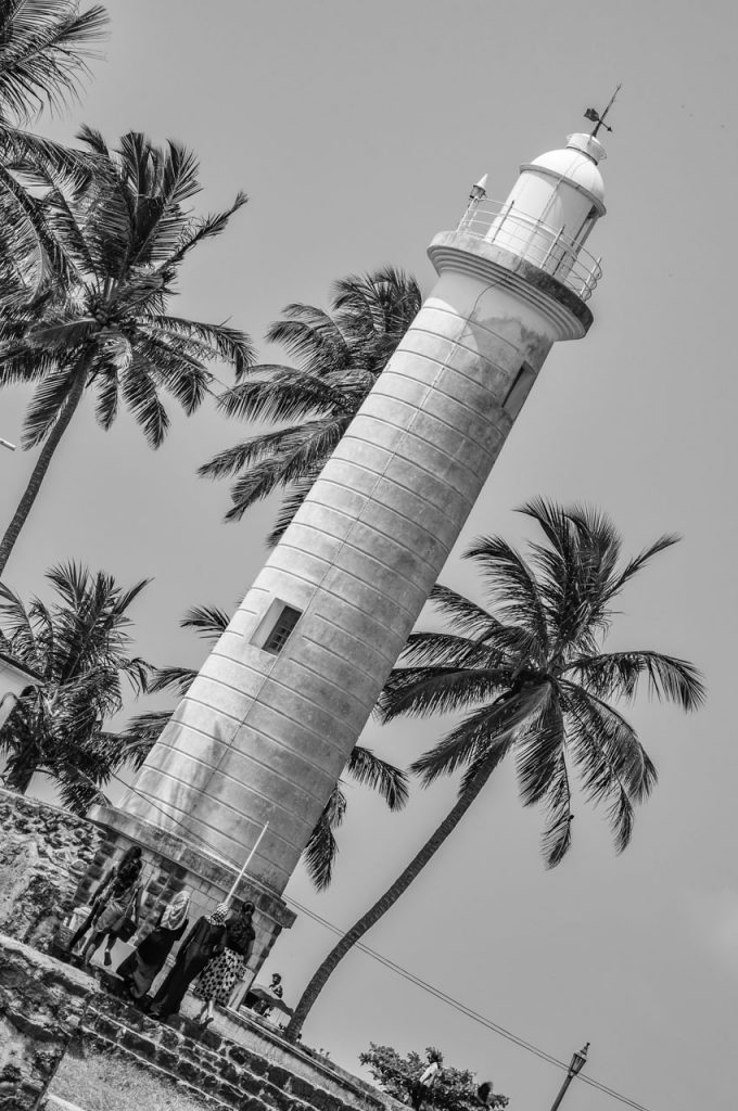
Heading south down Hospital Street, we found ourselves at the Point Utrecht Bastion, which is dominated by Galle Lighthouse. The British built the current lighthouse in 1939 after the original was destroyed by fire. With the lighthouse standing 26.5 metres high (87 feet), the light has a range of 47 nautical miles (87 kilometres / 54 miles) and is still in use. Galle Lighthouse is Sri Lanka’s oldest light station.

A group of people stand in front of a stone and cement lighthouse. The photo is in black and white.

Galle Lighthouse on Point Utrecht Bastion.


We climbed back onto the wall at the lighthouse and walked along the southern rampart towards Flag Rock. Along this south section of the wall, families gathered on the shaded grass, picnicking and playing cricket.

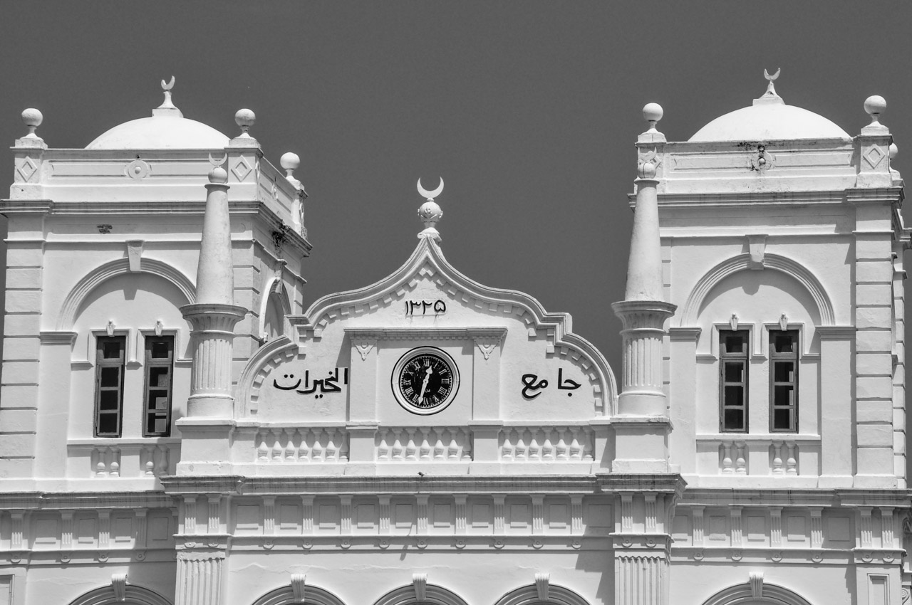
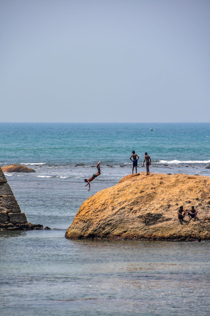
Walking past the Meeran Jumma Mosque, which looks very much like a European Baroque church, we came to Flag Rock, located on the southernmost end of the Fort. People dive from Flag Rock into the ocean – described as daring free-style divers. I saw a young man run along the top of the rock and dive from it. “Idiot” might be a better description than “daring”. “Clearly potty” is how one guidebook describes these jumpers. Perhaps they have insider knowledge of exactly where the submerged rocks are.

The top of a white mosque

Meeran Jumma Mosque


A boy dives off a rock into the ocean while other boys look on.

Local boys dive off Flag Rock.


We finally headed north as the ramparts hugged the west coast. We ended our ramble along Galle Fort’s ramparts near the army barracks, just before the Clock Tower where we had begun. Here, we cut across the village green past the Army Barracks, as I had thrown a hissy fit, being upset that we were still walking in the heat. This was a shortcut back to our hotel and a welcomed decision.

The guidebooks and tourist brochures inform you that the walk along the ramparts will take 90 minutes. We took almost twice that length of time due to the heat and constant stopping to take photos. It’s surprising how hard it is to lift your feet when weighed down by heat and humidity!

We made a couple more stops before returning to our hotel for a well-earned rest in our air-conditioned rooms.

We felt a long, cool drink on the wide veranda of the luxury Amangalla Hotel was warranted before visiting the Historical Mansion Museum (at 31-39 Leyn Baan Street – entrance is free). This museum has an extensive private collection of antiques and miscellaneous objects (described by one guidebook as “outright junk”). The collection belongs to Abdul Gaffar, a local gem merchant, and is displayed in an old Dutch mansion. In my opinion, Gaffar has a serious hoarding problem, with rooms and cabinets stuffed full of old typewriters, cameras, telephones, crockery, spectacles, jewellery and old Chinese memorabilia. To describe this collection as bizarre is to be very kind and generous. It was just downright weird! For that reason alone, it is worth the visit. The museum does provide insight into some traditional crafts with presentations of lace embroidery, gem cutting and jewellery making. However, be cautious if you have asthma because the museum is very, very dusty.

Where to eat

Lunch on our walk was at the Serendipity Arts Café (65 Leyn Baan Street), which one guidebook recommended. The food was good. I had a delicious chicken club sandwich, which was not very imaginative of me.

Our first night’s dinner was in the restaurant at the Galle Fort Hotel (at 28 Church Street), which was recommended by guidebooks.

The Galle Fort Hotel was a former gem merchant’s mansion. The restaurant’s setting was picture-perfect, with the tables on the wide veranda overlooking the pool and garden.

We had dinner at The Fort Printers (39 Pedlar Street) on our second night in Galle Fort. This elegant, small private hotel (a restored 18th-century mansion) was a printing facility in its former life. The original printing press is on display in the hotel lobby. We discovered this hotel on our morning walk. I found the menu limiting as I am allergic to seafood, which was the restaurant’s specialty. My sister and brother-in-law have no such allergy and loved the menu choices. However, the menu included chicken, lamb, and vegetarian dishes. The restaurant is in a lovely setting in a courtyard around a small pool. We were tucked into an alcove at the side of the courtyard that afforded a good level of privacy, which was just as well as our conversation became quite lively and animated. Even so, our waiter did not forget us. The staff were friendly, attentive, knowledgeable about their menu, and ready to answer any questions. The food was so good we went back a second night.

Where to stay

We stayed three nights at Fort Bazaar inside Galle Fort’s fortified walls.

Fort Bazaar (at 26 Church Street, Galle Fort) was formerly a 17th-century merchant’s townhouse. Opening in 2016, Fort Bazaar is a small, luxury boutique spa hotel. Its 18 rooms are spacious, cool, and contemporarily furnished with comfortable four-poster beds. It is in a central location within the Fort, and complimentary tea and cakes are served daily between 3.00 and 4.00 pm on the terrace. My kind of hotel! I could not fault the staff, who were friendly, attentive and helpful. It was Sri Lankan hospitality at its best!

When to go

The weather can significantly affect your travel experience and will probably be one of the most important factors in your decision when to visit Sri Lanka. Sri Lanka has a tropical climate with a dry season and two wet (or monsoon) seasons.

With its rich history and stunning colonial architecture, Galle Fort offers a unique blend of culture and natural beauty throughout the year. However, certain seasons may be more suitable depending on your preferences and travel goals.

Galle, and subsequently Galle Fort, experiences the following seasonal patterns:

  • Dry Season: December to March – lowest rainfall and most days of sunshine
  • First Inter-Monsoon Season: April – a transition in weather patterns with relatively dry days and occasional rain
  • Southwest Monsoon (Yala Monsoon): May to September – more frequent rainfall, particularly in June and July
  • Second Inter-Monsoon Season: October to November – more rain than the dry season but less than during the Southwest Monsoon

I recommend you refer to the World Weather site for Galle for a comprehensive list of daily average minimum and maximum temperatures per month, average total rainfall per month, and average number of rain days per month.

On a personal note, the humidity was 80% during our walk around Galle Fort, which caused havoc with our DSLR cameras – fogged-up lenses and constant error messages that prevented photos from being taken. While I have never conclusively found out if these problems were due to the humidity, it is certainly something to be aware of.

The humidity also impacted my clothing. I wasn’t just perspiring; I was completely wet! I was wearing a dark pink T-shirt that I had washed several times before this trip. However, the pink dye was coming out of my T-shirt. It stained my body, camera strap, and camera where they touched the T-shirt. To top it off, the colour was bleached entirely out of the T-shirt where my backpack was touching it – to the point where my T-shirt looked as though it had been tie-dyed.


As your day draws to a close, you’ll find that this historic town has offered more than just a walk through time. From the majestic views atop the ramparts to the charming streets lined with Dutch colonial buildings, every moment spent in Galle Fort is a reminder of the rich tapestry of cultures that have shaped this unique destination. Whether you’ve indulged in the local cuisine, explored iconic landmarks and hidden gems, or simply soaked in the laidback atmosphere, Galle Fort leaves an unforgettable memory on every traveller.

But Galle Fort is not just a destination; it’s a journey through history, culture, and beauty, all within a day’s walk. So, if you’re planning a trip to Sri Lanka, make sure you add Galle Fort to your itinerary. You won’t regret it.


Editor’s Note: I originally published this blog post in April 2019 and have updated it for accuracy, relevance, and comprehensiveness.


Disclaimer: This post contains no affiliate links. All views and opinions are my own and unsponsored. Unless expressly stated, all photos are my own and remain the copyright of Joanna Rath/Just Me Travel.

© Just Me Travel 2018-2024.


Have you been to Galle Fort? What other tips, information, and resources might you suggest for my readers?

I love hearing from you and look forward to reading and responding to your comments. Please join the conversation by leaving a comment below.


Like this post? Save it for Later!

a Pinterest pin with two photos - one of a stone wall a palm trees on the ocean foreshore and the other of a white dutch-colonial church.

A Pinterest pin with two photos - one of statues of soldiers with firearms between bastions and the other of a boy diving off a rock into the ocean with other boys looking on.


Author’s Note: Please check the latest travel restrictions before planning any trip and follow government advice.


Sign up to receive the latest in travel destinations, topics, resources and guides.


You might also like

Learn where to find the best wildlife encounters, discover the natural beauty of the Hill Country, explore six World Heritage sites, wander through untamed gardens, and so much more.

Escape the crowds and visit Geoffrey Bawa’s garden. It is largely undiscovered by tourists, being something different from the ‘usual’ tourist attraction. Organise to have lunch while you are there.

Do as a local and walk the 6.5 kilometres along the railway line from Ella, across the iconic Nine Arch Bridge, and onto Demodara Railway Station. Catch the train back to Ella to complete your experience.

Read my review of my stay at Wallawwa in Sri Lanka – luxury accommodation in an 18th-century colonial manor house.

Who said climbing Little Adam’s Peak was easy? The guidebooks don’t always get it right. Know before you climb!


3 Comments on HOW TO SPEND ONE PERFECT DAY IN GALLE FORT – Your Ultimate Guide! (2024 Updated)

15 PHOTOS TO INSPIRE YOU TO VISIT THE UNIQUE SASSI MATERA, ITALY (2024 Updated)

Sassi di Matera: The Stone City of Italy and a UNESCO World Heritage Site Steeped in History and Charm.   Welcome to the mesmerising world of Sassi di Matera, a…

Sassi di Matera: The Stone City of Italy and a UNESCO World Heritage Site Steeped in History and Charm.


Welcome to the mesmerising world of Sassi di Matera, a unique and ancient destination. Matera, a city in Italy’s southern region of Basilicata, is renowned for its extraordinary cave dwellings and rock-cut architecture, collectively known as the Sassi. These ancient settlements, carved into limestone cliffs, have earned the Sassi di Matera a place on UNESCO’s World Heritage List and have captivated visitors with their rich history, unique charm, and breathtaking landscapes.

In this travel blog post, I’ll take you on a visual journey through 15 stunning photos that capture the essence and allure of the Sassi di Matera. Each image tells a story, inviting you into a world where cave dwellings, narrow winding streets and alleyways, and rock-cut architecture create an otherworldly landscape.

Whether you’re a history buff, a culture enthusiast, or simply seeking a destination off the beaten path, Sassi di Matera offers an unforgettable experience. Let these photos inspire you to pack your bags and immerse yourself in the wonders of this timeless Italian gem.


Situated in the “instep” of Italy’s “boot”, Sassi di Matera (literal translation from Italian, “Stones of Matera”) were declared a World Heritage Site by UNESCO in 1993, while Matera was awarded the 2019 European Capital of Culture. However, Matera, particularly the Sassi, did not always deserve these honours. Not so many decades ago, Matera’s Sassi was a place of national humiliation dubbed the “Shame of Italy”.

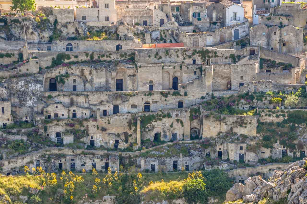
The Sassi di Matera has two districts – Sasso Caveoso and Sasso Barisano. They are ancient! – prehistoric troglodyte settlements where people have lived in cave dwellings since 7000 BC.

The Sassi have a colourful history that has seen them go from the earliest inhabited city in Italy to a place of national humiliation to Italy’s pride. This history, which is still visible today, makes Sassi di Matera a matchless tourist destination.


A brief history – from shame to honour

In his book Christ Stopped at Eboli (published in 1945), Carlo Levi put Sassi di Matera on the world map when he highlighted the poor living conditions. He painted a picture of abject poverty. Malaria, cholera and typhoid were rampant in the Sassi. Families and their animals were living together under the same roof in dwellings with no natural light or ventilation, no electricity, water or sewers, and there was a high rate of infant mortality.

The Sassi became an embarrassment to the Italian Government. So much so that in 1950, the Prime Minister declared a state of emergency and put plans in place to move the Sassi’s inhabitants out. By 1952, the Sassi were empty – abandoned through forced removal.

After sitting dormant for a few decades, the Sassi began to transform, starting in the 1970s with artists and hippies rediscovering Matera’s Sassi. This urban renewal and a younger generation expressing their desire to bring the caves back to life led the Italian Government to pass a law in 1986 to repopulate the Sassi, connecting water and electricity and subsidising restoration work to encourage the Sassi’s revival.

And the people did come – restoring caves as homes, hotels, restaurants and bars. But many are still uninhabitable.

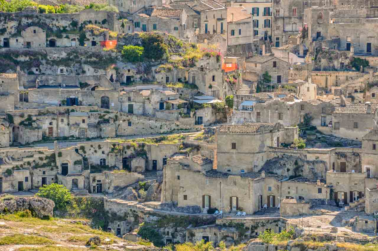
Cave houses, many of which are abandoned, in a troglodyte settlement in Italy.

Abandoned cave dwellings in Matera’s Sassi.


Cave houses in a troglodyte settlement. Some are obviously uninhabited.

Not all the cave dwellings in the Sassi are inhabited.


Sassi di Matera’s revival was further cemented in 1993 when UNESCO listed it as a World Heritage Site for being “the most outstanding, intact example of a troglodyte settlement in the Mediterranean region” and being named 2019 European Capital of Culture.

Matera has reclaimed its dignity and credibility in the eyes of Italy and the world.


Discover Sassi di Matera

I travelled to Matera on a 17-day small group tour with Albatross Tours on their Italy, the Deep South & Sicily tour, staying two nights in the Sassi.

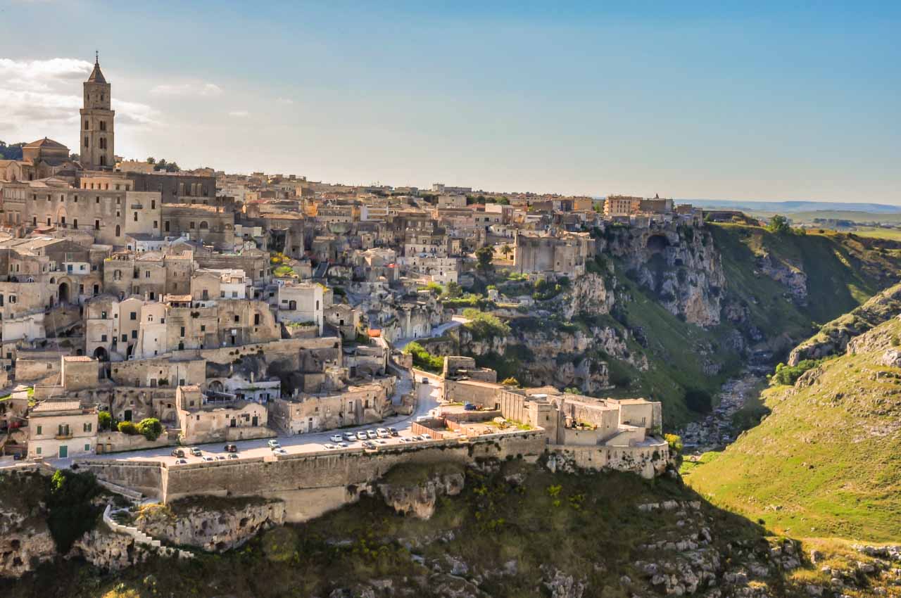
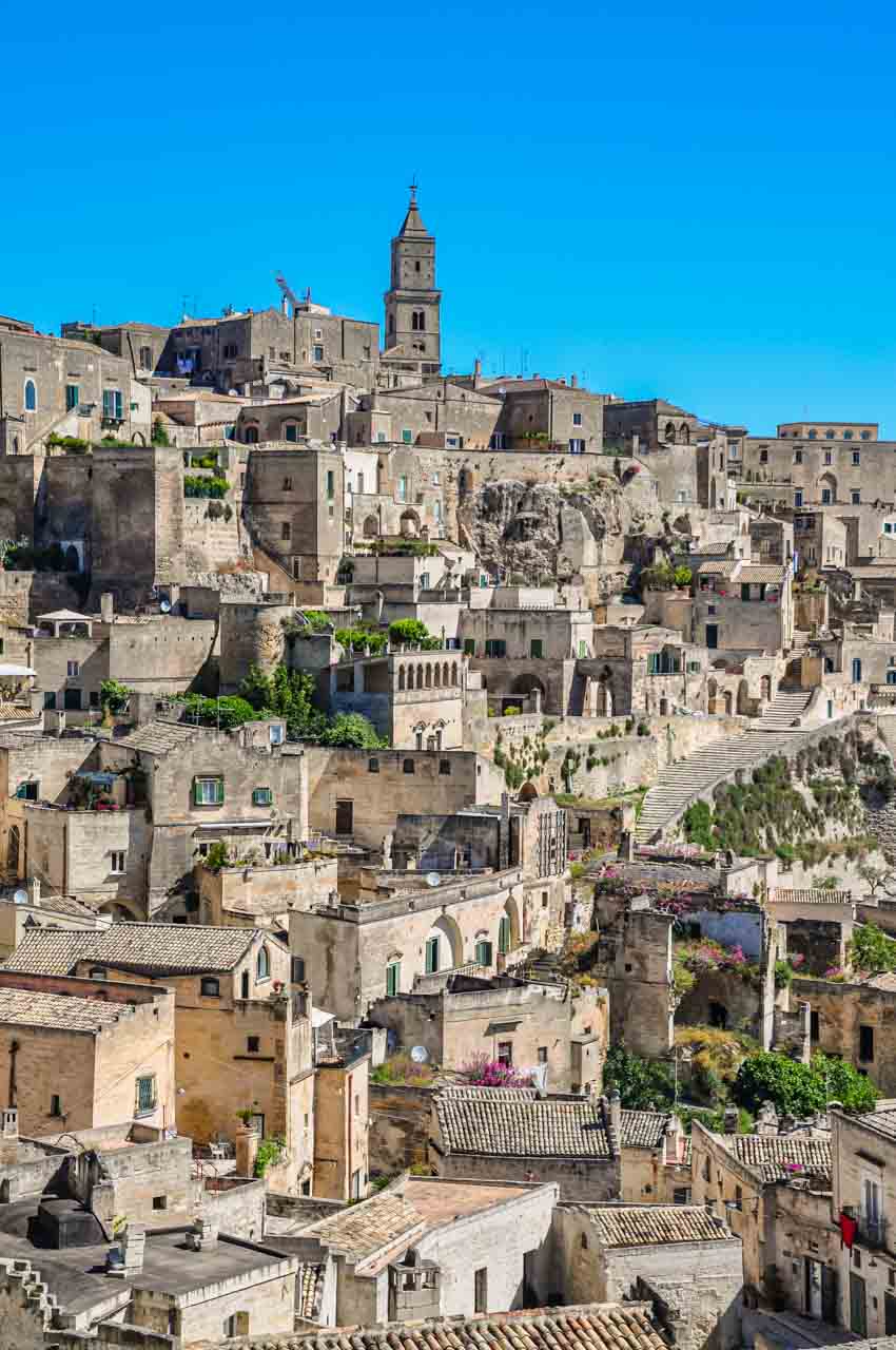
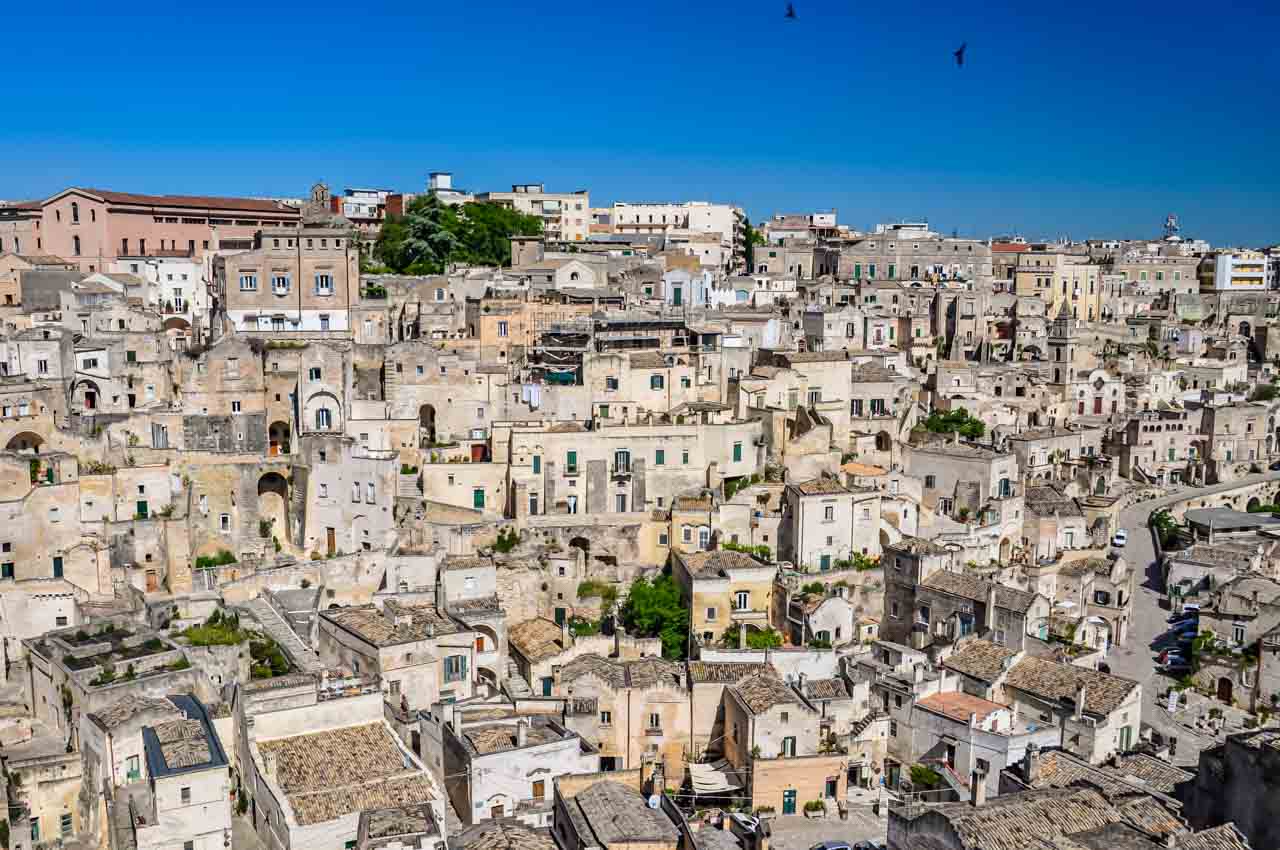
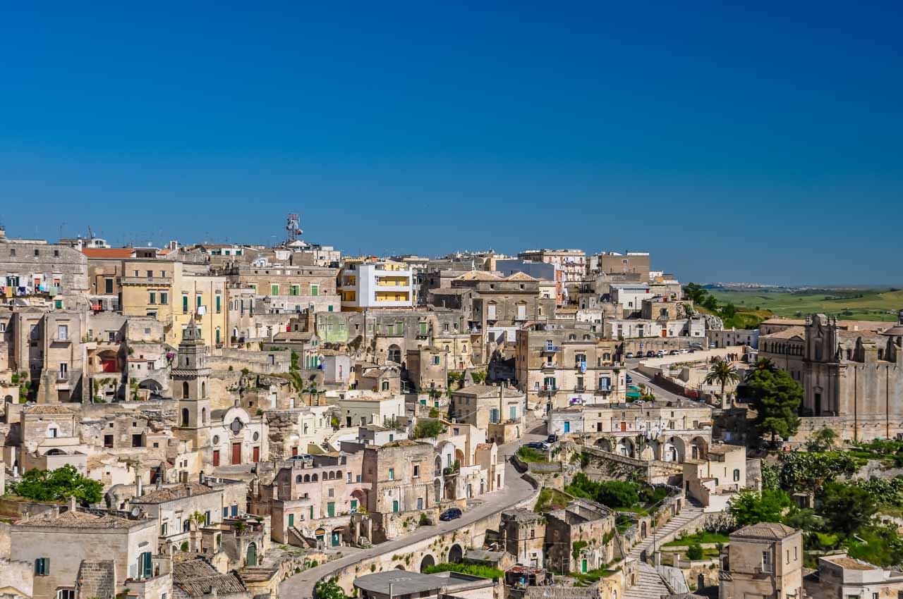
The Sassi are carved into the limestone cliffs of a deep ravine gouged out by the Gravina River. First viewed from across the ravine, the Sassi di Matera were like nothing I had seen before. I have visited Troglodyte caves in France and spent time in Cappadocia in Turkey. But the Sassi di Matera, with caves stacked on each other while clinging to the steep slope, was a stand-alone matchless sight. Then, creating a unique juxtaposition, the modern city of Matera overlooks the Sassi from its height at the top of the hill.

A mass of cave houses on a hill are viewed from across a ravine. There is a stone church bell tower on top of the hill.

Sassi di Matera viewed from across the ravine.


An abandoned troglodyte settlement (cave dwellings) sits below a modern city on the side of a hill.

The modern city of Matera sits on top of the ancient Sassi.


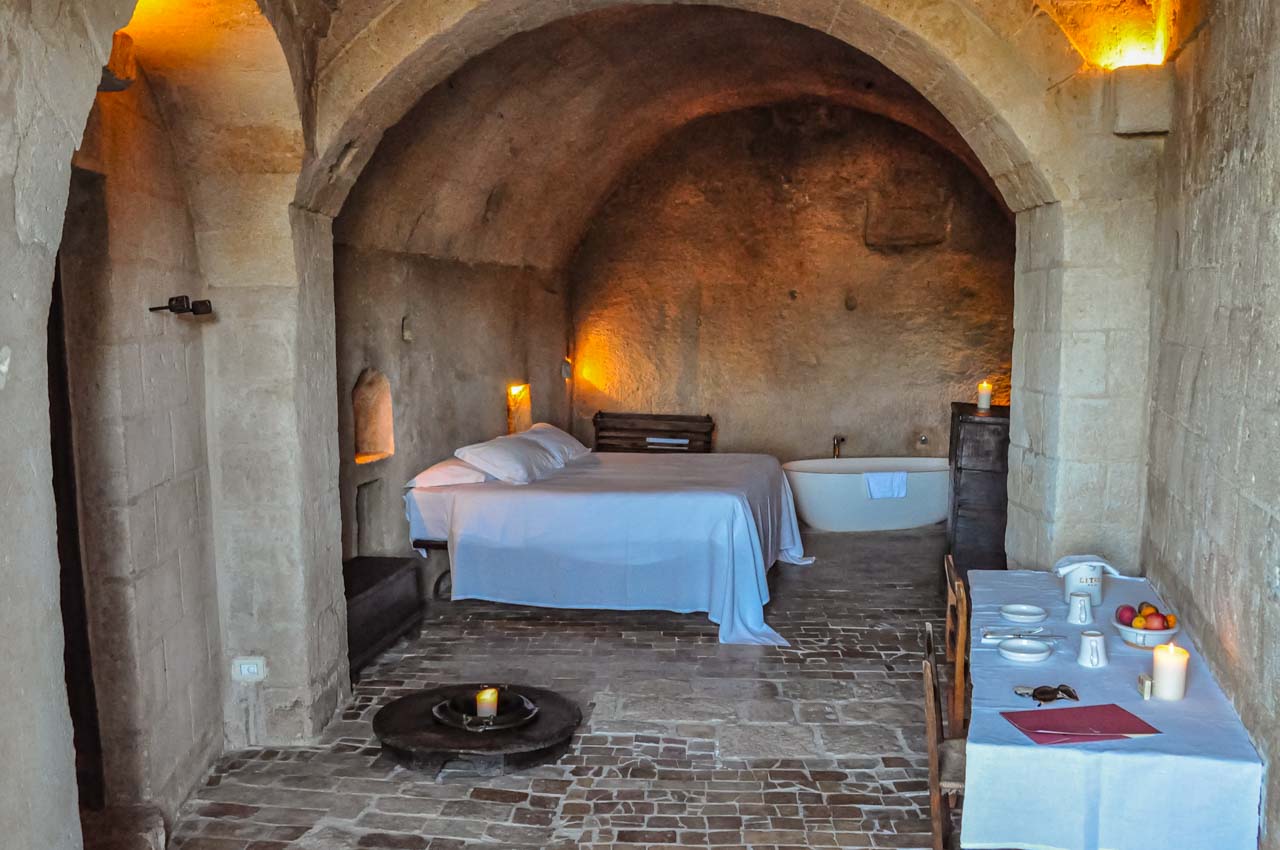
My first ‘taste’ of Sassi di Matera and what it must be like to live in the Sassi was my accommodation for two nights in the luxury Le Grotte della Civita – a cave hotel on the edge of the ravine in the most ancient Sassi area.

A hotel room in a cave, with a double bed, bath, and table and chairs. the cave room is lit by candles.

My hotel room – a restored cave in Le Grotte della Civita.


Le Grotte della Civita consists of 18 large ‘rooms’ with ensuites. All the rooms are individual caves that have been beautifully restored whilst retaining their original features. The furnishings were simple but tasteful, with much of the lighting provided by candles. The breakfast was served in a reclaimed cave that was once a church and was typical of southern Italy – consisting of various breads, cakes, pastries, meats, jams and cheeses. My stay at Le Grotte della Civita was truly memorable.

After a very comfortable night’s sleep and a delicious breakfast, I joined the walking tour in the morning with a local guide. Walking tours are a great way to get acquainted with a city and learn its history. The walking tour of Sassi di Matera was a fascinating history lesson while being introduced to significant sites. The tour included visiting a cave dwelling to see how families lived in their stone houses and viewing one of the ancient Rupestrian Churches with its biblical frescoes on the cave walls dating back to the Middle Ages.

By the end of the tour, I felt prepared to spend the afternoon and evening on my own, exploring and discovering the labyrinth that is Sassi di Matera. I was in my element, walking around the narrow streets and alleyways, talking to the locals, checking out their cafes, and having all the time I wanted to take photos. A word of advice: you will need comfortable shoes to walk around the Sassi as there are many steep steps to negotiate, given the Sassi are built on the side of a ravine.

An elderly lady dressed in black walks up stone steps that are under a stone arch.

There are lots of steps in Sassi di Matera.


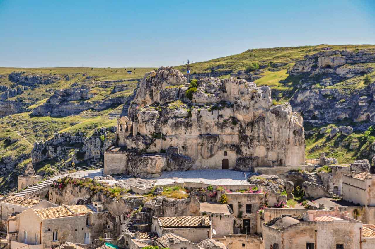
Matera has 180 churches, 40 of which are in the Sassi, including the Cathedral and the rock-cut Church of Santa Maria di Idris.

A rock-cut church on top of a green hill with cave dwellings below it.

The Church of Santa di Idris.


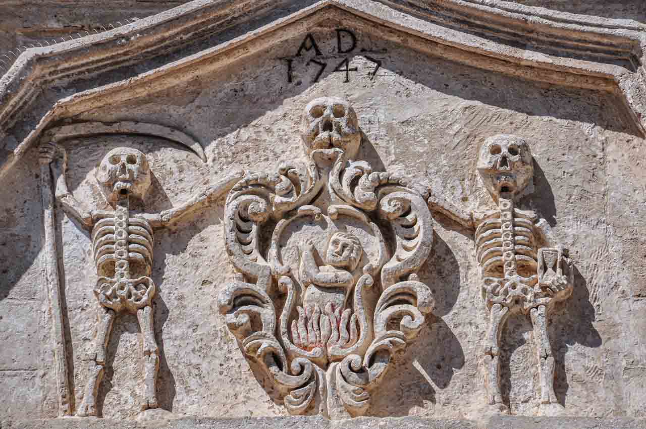
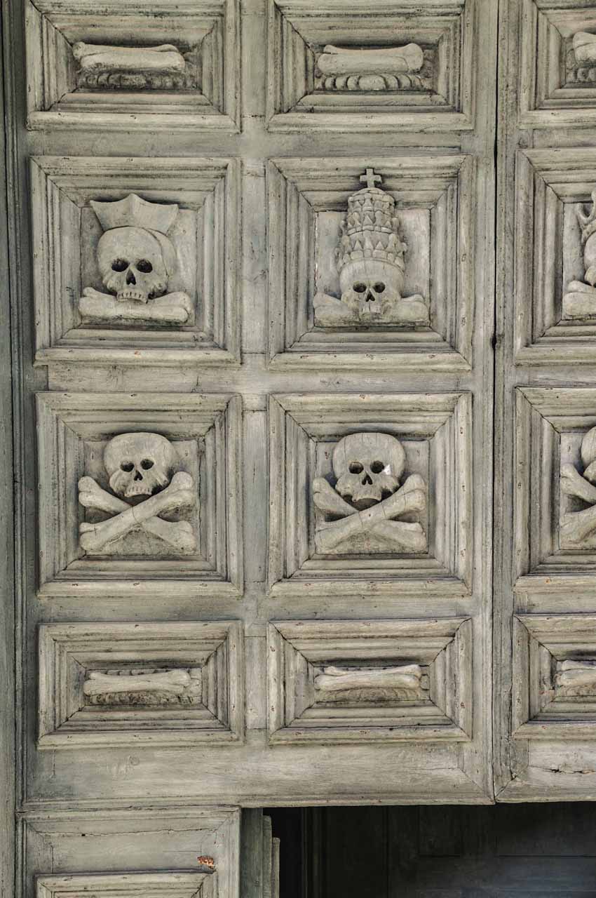
My favourite church was the Church of Purgatory, constructed as a place for people to pray for the souls trapped in limbo between heaven and hell. Completed in 1747, its recurring and only theme is that of death. The baroque façade of the church and its doors are covered with carvings of skulls, skeletons, crossbones, and other death-related decor. While a church focusing on death might seem a bit Grim Reaper-ish, it was fashionable at the time of construction, as death was not seen as the end but as the beginning of a new life.

A skull and two skeletons carved into stone. One skeleton is holding an hourglass, and the other skeleton is holding a scythe.

Skulls and skeletons on the facade of the Church of Purgatory.


A wooden door carved with square panels of skulls and cross bones.

The Church go Purgatory’s carved wooden door.


Exploring the Sassi di Matera

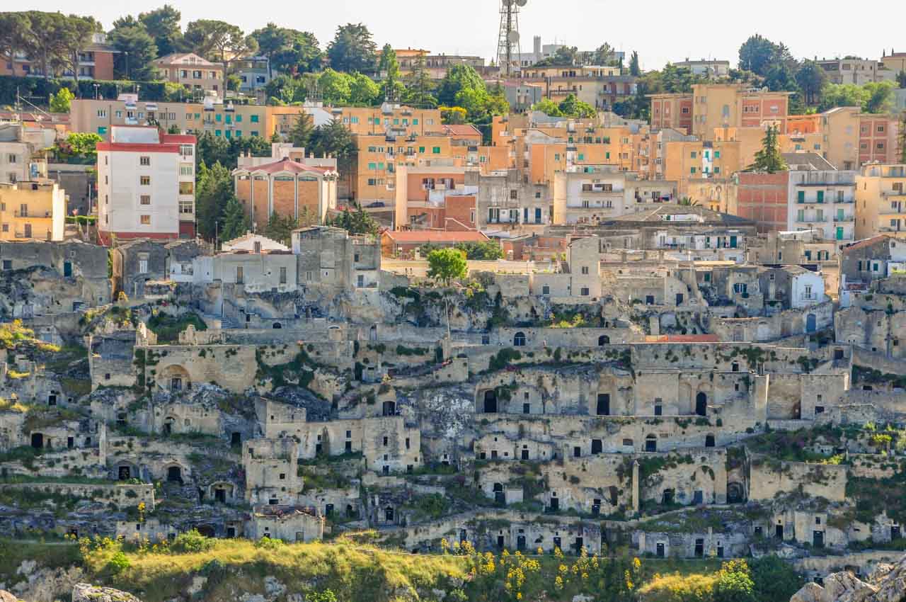
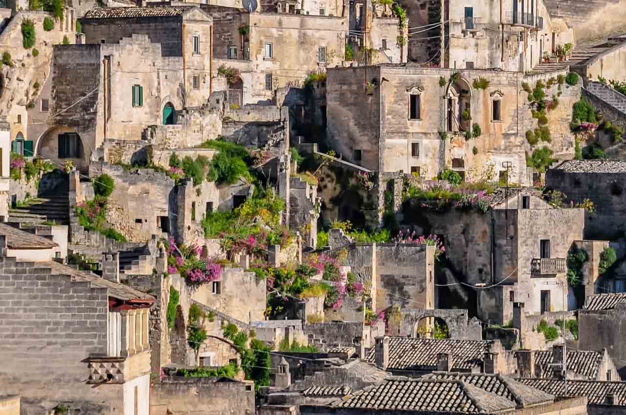
While the Sassi may look like masses of houses, the house-like facades are only that, as the ‘houses’ are dug well into the rock, forming the cave dwellings Matera is famous for.

A photo of stone houses that are actually caves.

In the Sassi di Matera, caves look like houses.


A settlement of cave houses surrounded by purple flowers and green shrubs.

Sassi di Matera – a mass of cave dwellings that look like houses.


Houses in the Sassi are built on top of other houses, where many of the streets are built on the roofs of houses, and floors are ceilings of houses below.

Cave homes sit on top of each other, where you have roads forming roofs and floors, and the ceiling of the house below.

Sassi di Matera – roofs are streets, and floors are ceilings.


You would be forgiven for thinking the Sassi are a place of shadow and crampedness. But not so. The squares in the Sassi are sun-drenched open spaces flanked by cafes, shops, churches, and restaurants – great for people-watching.

A troglodyte settlement of cave houses built into the side of a hill.

Wander the Sassi di Matera.


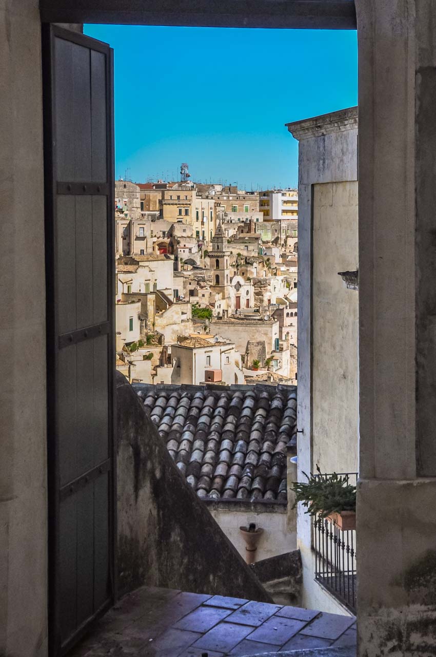
Cave houses are viewed through a doorway.

View of the Sassi through a doorway.


Cave houses are built on top of each other on the side of a hill.

World Heritage Listed Sassi di Matera.

Historical and Cultural Timeline:

2019: Matera is the European Capital of Culture.

2014: Tourism starts to take off. This was most likely due to Matera being named the 2019 European Capital of Culture, and Matera began preparations for a year of events highlighting culture and the arts.

1993: UNESCO lists Sassi di Matera as a World Heritage Site.

1986: Italian law changes and people are encouraged to return to the Sassi.

1952: Abandonment of the Sassi through the Italian Government’s forced removal of its inhabitants.

Prehistory: (approximately 9,000 years ago) People first inhabited the Sassi.

Fun facts

Several Directors have used Sassi di Matera as a film location for their movies:

  • Mel Gibson’s controversial movie, The Passion of the Christ, 2004;
  • Pier Paolo Pasolini’s The Gospel According to St Matthew, 1964; and
  • King David was directed by Bruce Beresford and starred Richard Gere in 1985.

It would seem Matera’s Sassi makes for a great ancient Jerusalem.

The 2021 James Bond movie No Time to Die also used Sassi di Matera as a film location.


Sassi di Matera is not just a destination; it’s an immersive journey through time, offering a unique blend of history, culture, and natural beauty that promises to leave a lasting impression on anyone fortunate enough to explore its enchanting streets.

The Sassi beckons, inviting you to witness a living backdrop as you explore a world where tradition meets innovation. The 15 photos you’ve seen here in my blog post are mere snapshots of the unforgettable travel experience that awaits you in person. Dare to wander off the beaten path!


Editor’s Note: I originally published this blog post in March 2019 and have updated it for accuracy and comprehensiveness.


Disclaimer: This post contains no affiliate links. All views and opinions are my own and non-sponsored. All photos are my own and remain the copyright of Just Me Travel.

© Just Me Travel 2018-2024.


Have I aroused your curiosity about Sassi di Matera? Are you inspired to visit Italy’s unique Stone City, a valuable UNESCO World Heritage Site? I love hearing from you. Join the conversation and leave a comment below.


Like this post? Save it for Later!

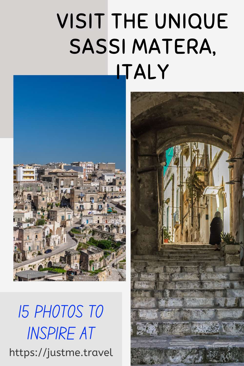
The image has two photos. One photo is of an old lady walking up a flight of stone steps. The second photo shows a settlement of stone houses.


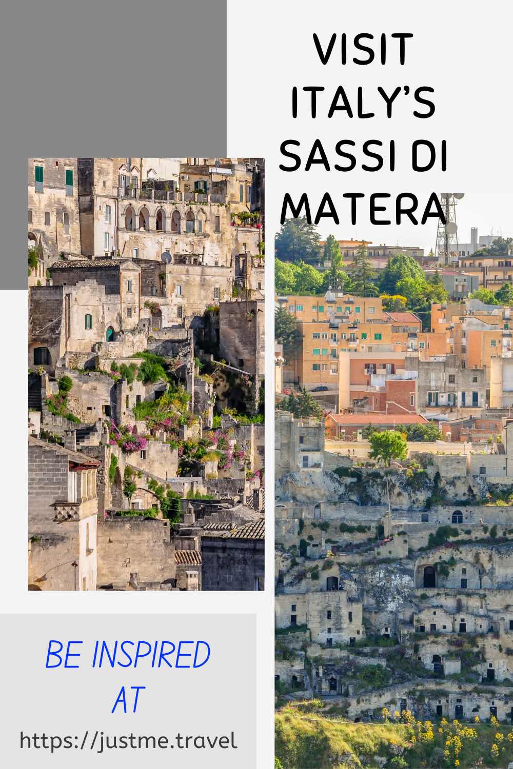
The image has two photos that show a troglodyte settlement. One photo is bathed in sunlight with purple flowers and green shrubs. The second photo shows abandoned cave homes below a modern city. The image invites you to visit Italy's Sassi di Matera.


Author’s Note: Please check the latest travel restrictions before planning any trip and follow government advice.


Sign up to receive the latest in travel destinations, topics, resources and guides.


You might also like

A VENETIAN WALKABOUT – how to spend 5 perfect days in Venice, Italy [2020 UPDATED]

My self-guided walking itinerary will lead you to incredible experiences as you explore 5 of Central Venice’s 6 districts and then go island hopping.

 

5 Comments on 15 PHOTOS TO INSPIRE YOU TO VISIT THE UNIQUE SASSI MATERA, ITALY (2024 Updated)

A UNIQUE MONGOLIA HORSE FESTIVAL SHOWCASES IMPRESSIVE HORSE-RIDING TALENT (2023 Updated)

  No Trip to Mongolia is Complete Without Having Attended a Local Horse Festival and Witnessed Extraordinary Horseback Skills.   Dear Pip, Our trip to Mongolia is turning out to…


No Trip to Mongolia is Complete Without Having Attended a Local Horse Festival and Witnessed Extraordinary Horseback Skills.

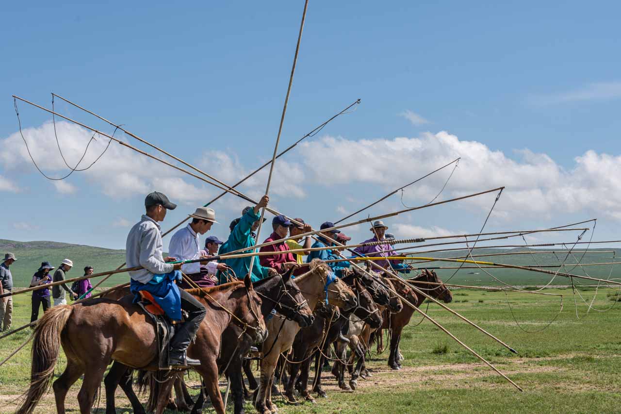
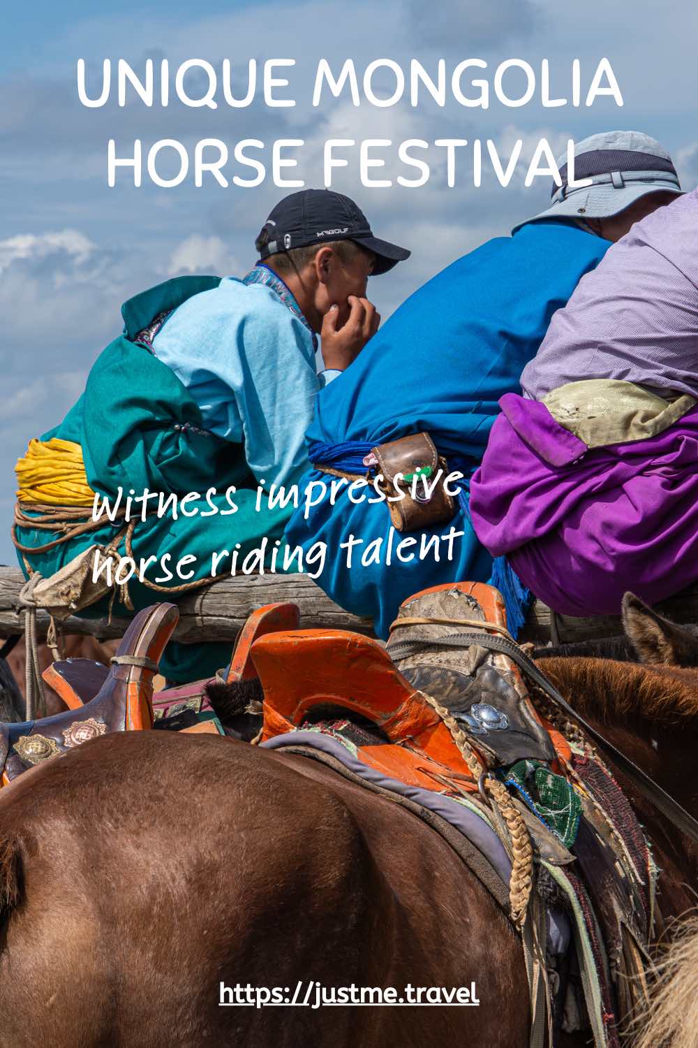
Several me in colourful robes line up on their horses for the start of competition. They are carrying long poles with lassos on the end.

Mongolian nomads ready for competition with their uurgas (lasso poles) at a horse festival.


Dear Pip,

Our trip to Mongolia is turning out to be one unique cultural highlight after another. We spent the day sharing the excitement of a local horse festival in the Orkhon Valley, organised by Tsaidam Ger Camp, where we stayed for the night. The festival aims to preserve nomadic tradition and promote the talent and capabilities of Mongolia’s nomadic herders.

The Orkhon Valley is in Central Mongolia, about 360 kilometres southwest of Mongolia’s capital, Ulaanbaatar. The Orkhon Valley, a cultural landscape comprising 1,220 square kilometres, was designated a UNESCO World Heritage Site in 2004.

Mongolia’s history, culture, and people are intimately linked with horses, with children learning to ride almost from the day they can walk. In a country with 13 times more horses than people, I can understand how Mongolia has become known as the land of horses. Throughout the day, I came to appreciate Mongolian nomads’ strong bond with their horses and to understand how Mongolians have long been considered some of the best horse riders in the world.

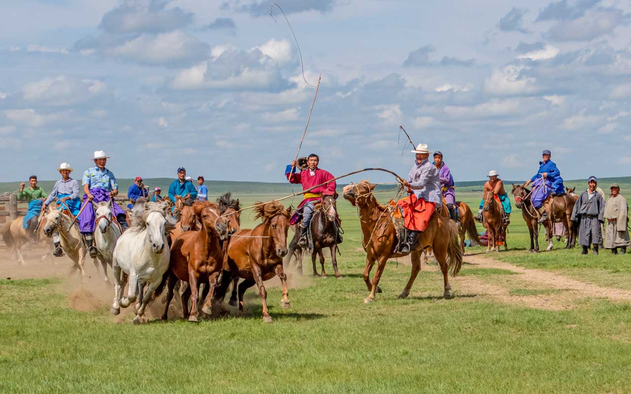
After Meg shared snuff with some local elders and our guide explained what the horse festival entailed, we found a spot amongst the locals to watch and photograph the men, dressed in traditional costume, compete in several events, including horse lassoing, grabbing a lasso pole from the ground, and riding a wild, bucking horse. These events are designed to show off the Mongolian nomads’ unique horsemanship skills and the strength of their horses.

I wasn’t sure how I felt about the lassoing of stampeding wild horses. However, I learned it is an essential skill as nomadic households have many horses ridden infrequently and need to be re-broken in because they have been left to roam at will, becoming semi-wild. I needed to remind myself that this is their way of life and culture.

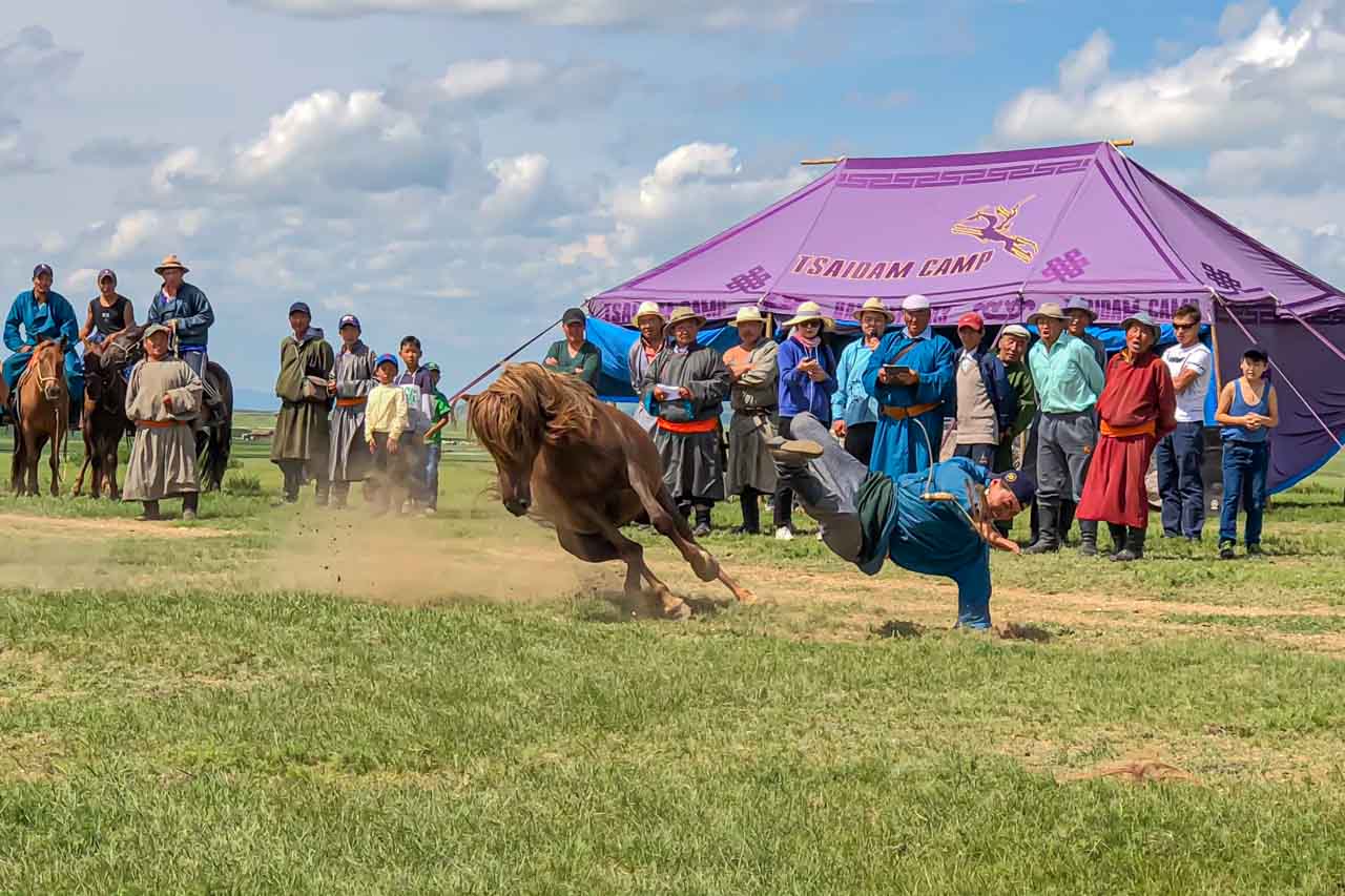
Being able to ride a bucking horse is par for the course with breaking-in horses, and this competition elicited shouts of encouragement from the crowd and laughter when horse and rider parted ways. One man who managed to stay on his horse delighted the crowd as he and his horse disappeared into the distance.

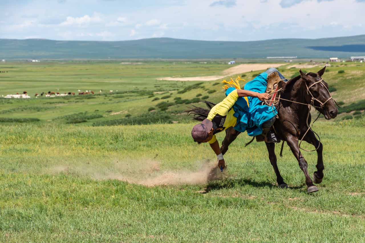
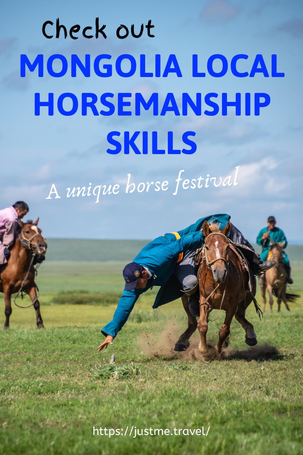
I particularly enjoyed watching the men grabbing an uurga (long pole with a lasso on the end) off the ground from a galloping horse. I was left in awe as to how they stayed on their horse because they would be well down the side of the horse, around its fast-moving legs. Their core strength must be remarkable! With all the rider’s weight on one side, how did the horse not topple over?

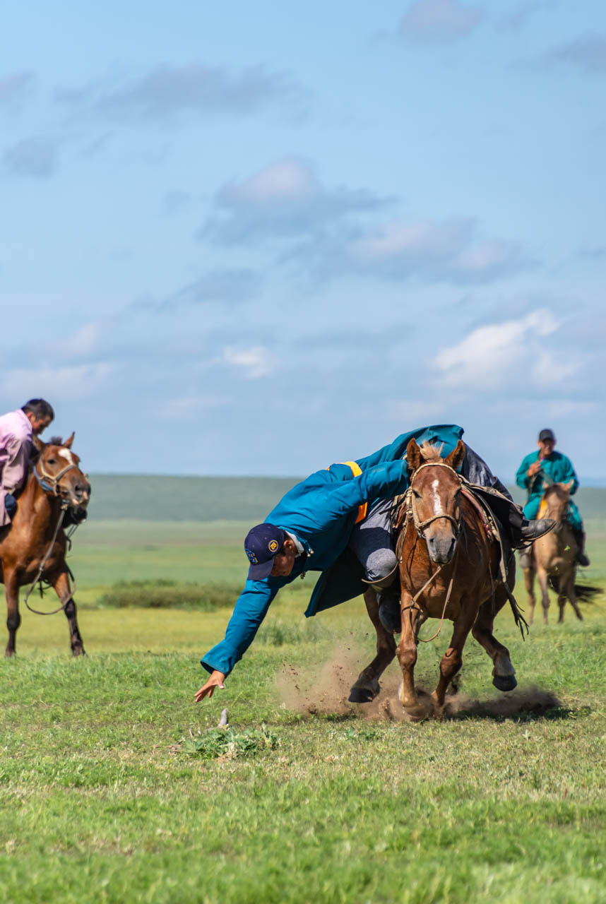
Some of the younger men had a competition on the side, grabbing a cigarette lighter off the ground from their galloping horse – some more successful than others. The control these young men and all other competitors had over their horses was genuinely impressive.

It was a most enjoyable, exciting day; I will take home unforgettable memories.

Love,

Joanna

Riders on horses with lassos on long poles rope stampeding horses.

Lassoing wild, stampeding horses at the Mongolian Horse Festival.


People stand around in front of a tent while watching a man fall to the ground off a bucking horse.

I bet that hurt! A competitor falls off a bucking wild horse.


A man in a colourful robe hangs on the side of his galloping horse as he picks up a stick off the ground.

Picking up an uurga (lasso on a pole) off the ground from a galloping horse.


A young man hangs on the side of his galloping horse as he picks up a cigarette lighter off the ground.

A young man picks up a cigarette lighter off the ground from a galloping horse.


Editor’s Note: I originally published this blog post in February 2019 and have updated it for accuracy and comprehensiveness.


Disclaimer: This post contains no affiliate links. All views and opinions are my own and non-sponsored. All photos are my own and remain the copyright of Just Me Travel.

© Just Me Travel 2018-2023.


Would you seek out this type of experience when travelling? I love hearing from you. Leave a comment below.


Like this post? Save it for later!

Men in colourful robes sit on a fence railing with their saddled horses behind them.


A man dressed in a colourful robe hangs on the side of his galloping horse as he picks up a pole off the ground.


Author’s Note: Please check the latest travel restrictions before planning any trip and follow government advice.


Sign up to receive the latest in travel destinations, topics, resources and guides.


You might also like


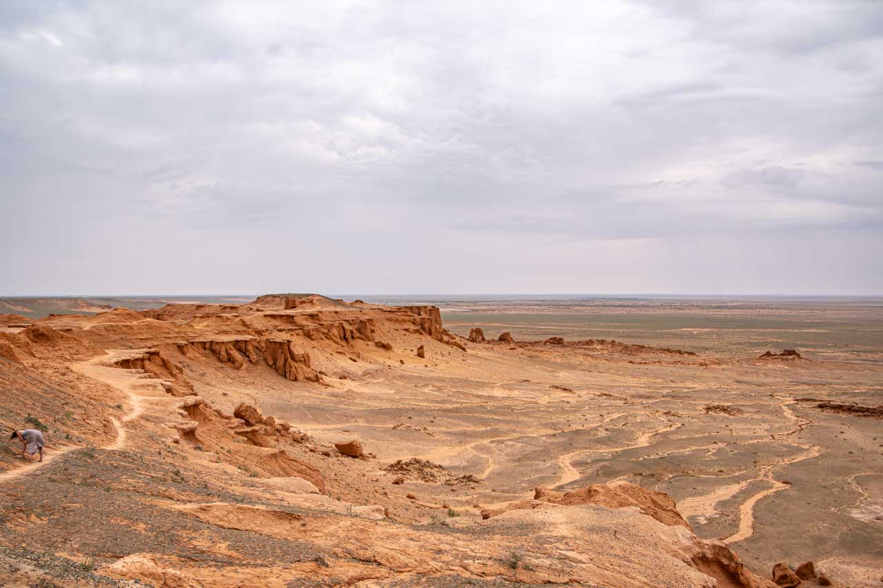
A person is fossicking for dinosaur fossils along an escarpment of the Flaming Cliffs in Mongolia's Gobi Desert.DINOSAUR FOSSIL HUNTING IN MONGOLIA’S GOBI DESERT AT THE FLAMING CLIFFS (2023 Updated)

The Flaming Cliffs are famous for the discovery of dinosaur eggs in 1923 and is one of the world’s greatest dinosaur fossil sites. Go fossicking!


A nomad and his ger

MONGOLIAN CULTURAL NORMS AND TRADITIONS – HOW TO PREVENT CULTURAL ERRORS

Cultural sensitivity when travelling is a sign of deep respect. Prevent social and cultural faux pas through ignorance. Know before you go!


8 Comments on A UNIQUE MONGOLIA HORSE FESTIVAL SHOWCASES IMPRESSIVE HORSE-RIDING TALENT (2023 Updated)

SEE 3 ASTOUNDING ENGINEERING MARVELS ON THE CANAL DU MIDI

Embark on an Unforgettable Journey on France’s Canal du Midi and Experience Extraordinary Engineering Feats That Are Works of Art.   What do you know about the Canal du Midi? …

Embark on an Unforgettable Journey on France’s Canal du Midi and Experience Extraordinary Engineering Feats That Are Works of Art.


What do you know about the Canal du Midi? 

Set against the picturesque landscape of southern France, the Canal du Midi is a serene waterway and a testament to human creativity and engineering brilliance. Prepare to be awe-struck by three engineering marvels that have stood the test of time and captivated all who encounter them.

In this travel blog post, I invite you to join me on a journey uncovering the stories behind the three remarkable wonders of human ingenuity I discovered when sailing from Marseillan to Salleles d’Aude on a hotel barge on the historic Canal du Midi: the masterfully constructed Orb Aqueduct that defies gravity, the intricately designed seven-step Fonserannes Locks that challenge navigation skills, and the mystical Malpas Tunnel that channels the canal through a hill.

I am not an engineering expert, but crossing the Orb Aqueduct, climbing the Fonserannes Locks, and traversing the Malpas Tunnel were extraordinary experiences and unforgettable highlights of my barge cruise on the Canal du Midi with European Waterways. They have left a lasting impression on me that I want to share with you, and I hope you get to experience them for yourself.


The Canal du Midi

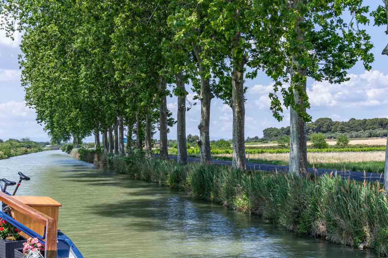
A boat sails along a tree-lined canal.

Cruising the Canal du Midi


The Canal du Midi in southern France was constructed between 1666 and 1681 by the 17th-century canal engineer Pierre-Paul Riquet. It is considered one of the most significant construction works of the 17th century and is one of the oldest canals still in use in Europe. The Canal du Midi was designated a UNESCO World Heritage Site in 1996.

The Canal du Midi runs for 240 kilometres from the Etang de Thau, a sheltered lagoon behind the Mediterranean port of Sete, to Toulouse, where it joins the Canal de Garonne – connecting the Mediterranean Sea to the Atlantic Ocean. The Etang de Thau at Marseillan was the starting point for my barge cruise on the Canal du Midi with European Waterways.

I cruised the Canal du Midi on European Waterway’s first-class, eight-passenger hotel barge, the Adjodi. The section of the Canal du Midi we cruised included three impressive 17th-century engineering feats – the Orb Aqueduct, Fonserannes Locks, and Malpas Tunnel. But you don’t need to be an engineer to appreciate, enjoy, and be thrilled by these wonders of the Canal du Midi.

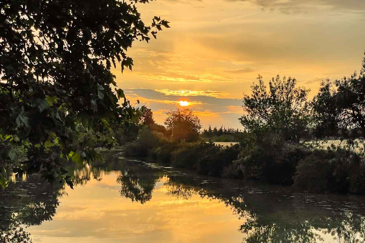
A sunset is reflected in the waters of a tree-lined canal.

The sun sets on another day on the Cana du Midi.


Orb Aqueduct

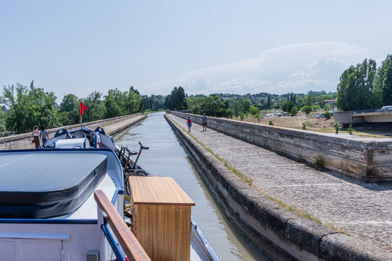
A boat sails through aqueduct - a water bridge.

Our barge navigates the Canal du Midi along the Orb Aqueduct at Beziers.


A photo of a barge navigating the Orb Aqueduct (Pont-Canal de l’Orbat) at Beziers in southern France has always been my ‘vision’ of the Canal du Midi and one of the reasons I wanted to do a barge cruise on the canal. No other image of the Canal du Midi was more iconic than the Orb Aqueduct.

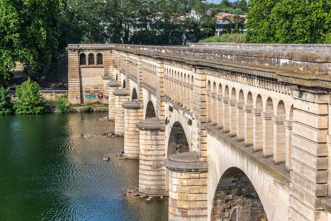
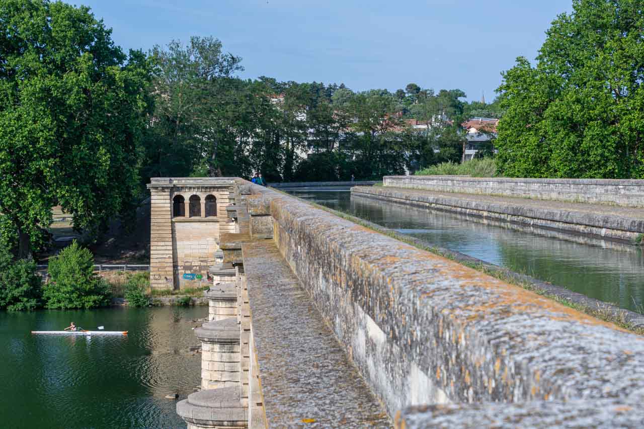
The Orb Aqueduct is a one-lane bridge carrying the Canal du Midi over the Orb River. At 240 metres long, 28 metres wide, 12 metres high, and with seven arches, the Orb Aqueduct is one of the largest aqueducts in France and the largest on the Canal du Midi. Prior to the opening of the Orb Aqueduct in 1858, the Canal du Midi traversed a short, treacherous section of the Orb River that would sink boats or leave them stranded for weeks due to its unpredictable flow. Building the aqueduct allowed boats to bypass the dangerous Orb River safely.

The aqueduct carries the canal in a masonry trough sealed with a layer of concrete. The concrete seal was replaced in 1951; otherwise, the original structure still exists. You can walk the length of Orb Aqueduct as there is a towpath on both sides.

The Orb Aqueduct was classified as a National Historical Monument in 1962 and was listed as a World Heritage Site by UNESCO in 1996.

A water bridge carrying the Canal du Midi over the river below.

Six of the Orb Aqueduct’s seven arches.


A bridge carrying water over a river below.

The Orb Aqueduct carries the Canal du Midi over the River Orb.


Fonserannes Locks

The image shows the mechanisms on top of seven lock gates that climb up a hill.

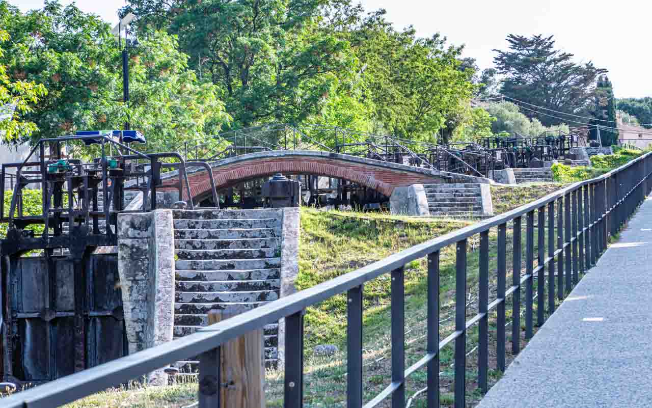
The seven-rise lock staircase or Fonserannes.


Locks are an integral part of any barge cruise, and on the Canal du Midi, I got my gratifying fill of them. However, none would raise my excitement or sense of adventure as much as the seven-rise lock staircase of Fonserannes (also known as the Fonserannes Locks or the Fonserannes Staircase) near the town of Beziers.

When the Canal du Midi was constructed in the 17th century, Pierre-Paul Riquet had to overcome the problem of crossing the Orb River, which was 48 metres higher than the natural course of the canal waterway. The answer was the Fonserannes Lock Staircase, a staggering feat of engineering and very impressive, even to my untrained eye. It is one of the features that led to the Canal du Midi being declared a UNESCO World Heritage Site in 1996.

Fonserannes Lock Staircase is a 312-metre-long water staircase, allowing boats and barges to negotiate a 25-metre gradient by passing through seven oval-shaped lock chambers and eight gates. There is an eighth chamber, but it is no longer in use. Boats are raised (or lowered) 21.5 metres over a distance of 300 metres, with the deepest rise (or drop) over six metres.

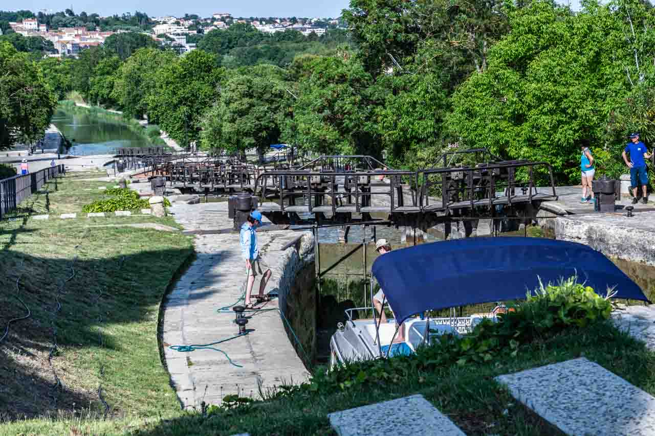
A boat is in a lock chamber on the Canal du Midi. This is a staircase lock system of which there are seven ovoid chambers and eight gates.

A boat climbs the Fonserannes Staircase Locks.


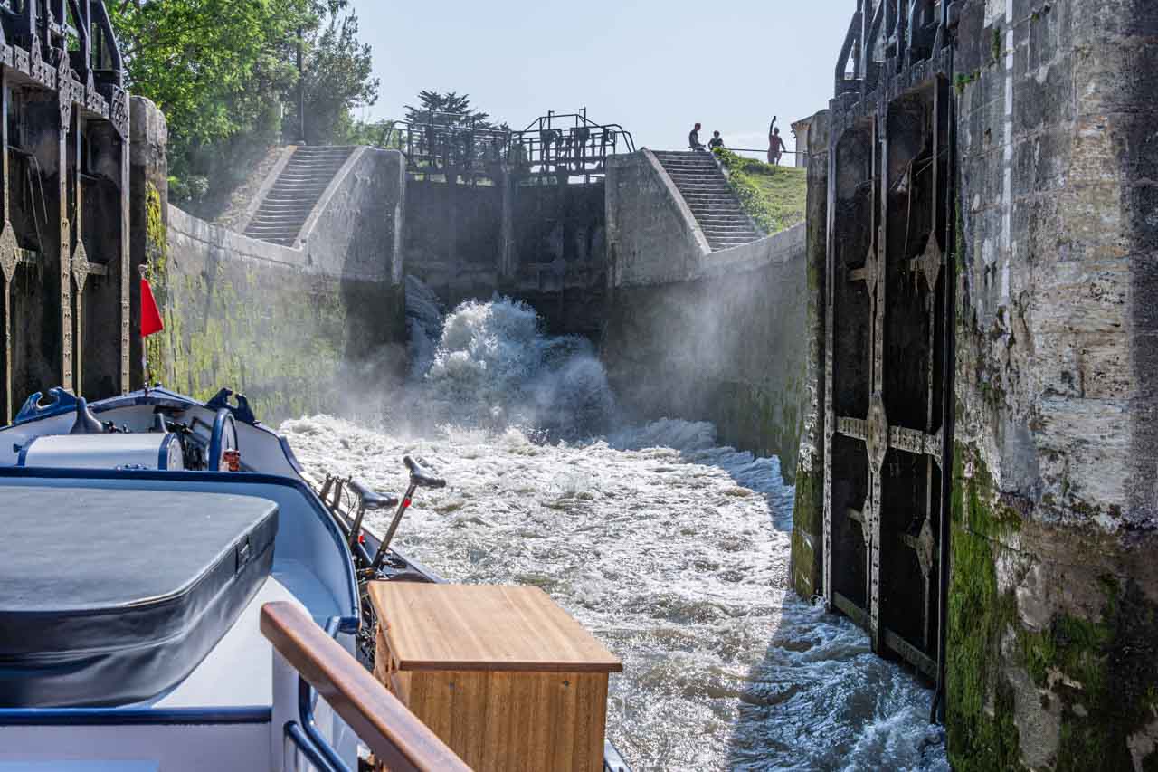
We approached the Fonserannes seven-rise lock staircase from the Orb Aqueduct and travelled up the lock staircase. Our barge captain took over 30 minutes to negotiate the boat’s climb through the seven chambers. The force and speed at which the water rushes into the chamber when a gate opens is astounding.
A boat moves into the rushing waters of a filling lock chamber.

Our barge navigates through Fonserannes Locks.


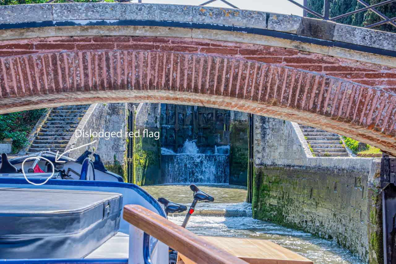
One lock chamber must have been particularly challenging because going under the bridge that spanned the gate dislodged the height indicator pole (a red flag on a pole on the boat’s bow). As I understand it, the lockkeeper allowed too much water to enter the lock, making the water in the chamber higher than it should have been. Our captain had to duck very low to ensure his head didn’t connect with the bridge.

A boat travels under a low bridge as it enters a lock chamber with water starting to rush through the opening gate into the next lock chamber.

A low bridge knocked over the red-flagged height indicator pole.


We stopped for the night at the top of Fonserannes Staircase Locks. So, I took the opportunity to walk the towpath back to the Orb Aqueduct, an easy, flat 20-minute walk.

Malpas Tunnel

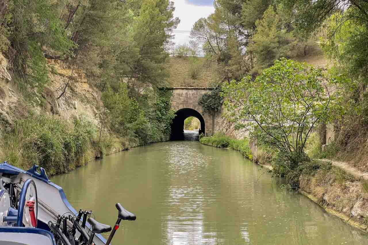
A boat approaches a tunnel in a hill with the canal passing through the tunnel.

Our barge approaches the Malpas Tunnel on the Canal du Midi.


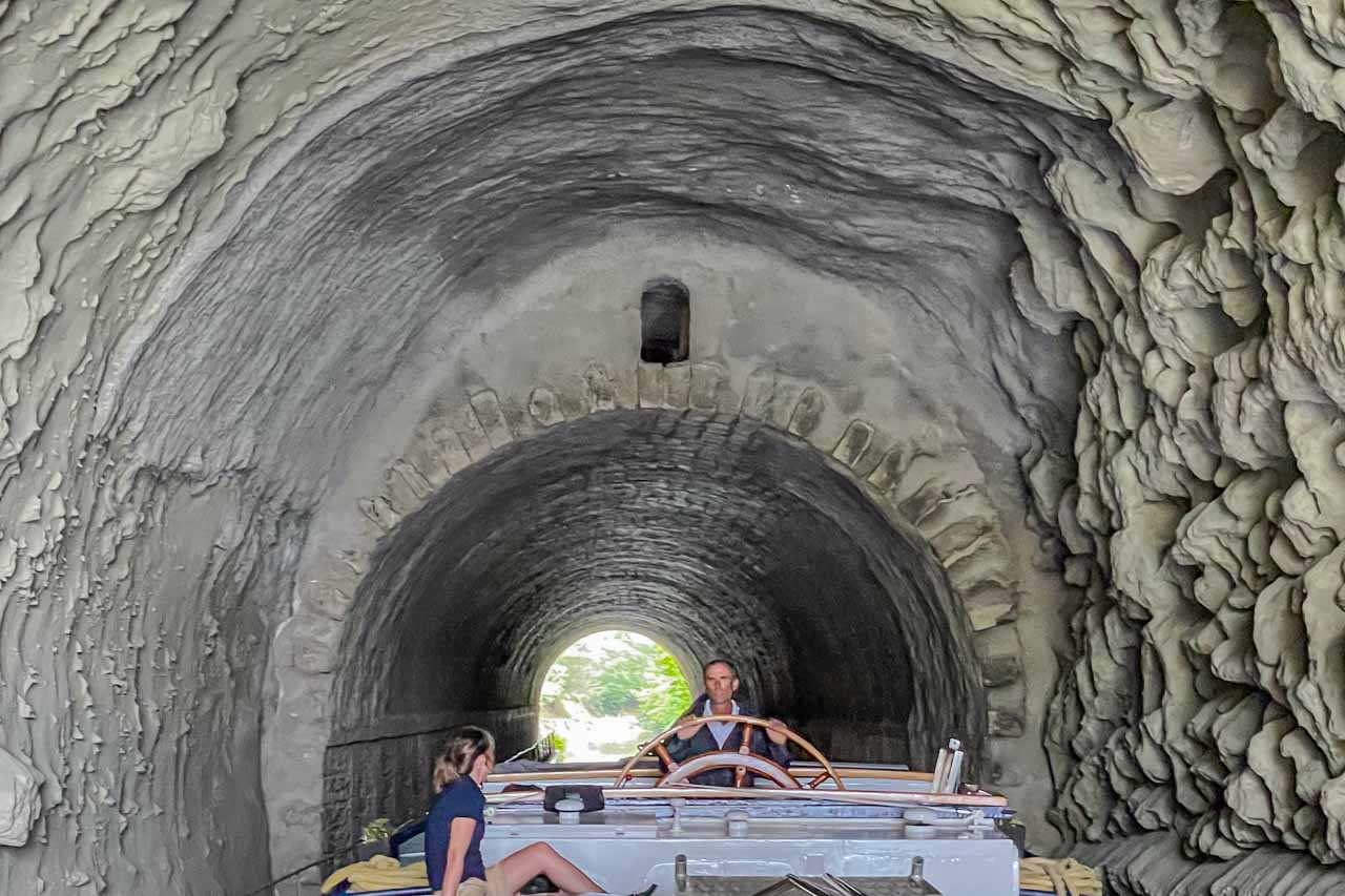
The Malpas Tunnel, between Bezier and Capstang on the Canal du Midi, was the first tunnel ever dug for a canal. The tunnel was excavated in 1679 in secret by the canal’s chief engineer, Pierre-Paul Riquet, as the Prime Minister had stopped the plan to dig a canal tunnel through Enserune Hill because initial excavations revealed the tunnel was liable to collapse due to the hill being brittle sandstone. Over 300 years later, the Malpas Tunnel is still navigable! And there is now even a railway tunnel ten metres below the canal tunnel, built nearly 200 years later!

Local folklore has it that after the completion of the Malpas Tunnel, one of the workers built a small nook inside the tunnel’s ceiling and lived there as a hermit. When barges passed through the tunnel, the crew threw bread into the opening for the hermit. Barge crews still sometimes throw a piece of bread into the opening of the nook as a “gift for the hermit”.

Our captain did not throw bread into the opening in the ceiling, but he did play the finale of Tchaikovsky’s 1812 Overture (at least, I think that was what it was). I did not fathom the relevance of this, but the music sounded incredible and very dramatic as it echoed off the tunnel walls.

A boat exits a tunnel that carries the Canal du Midi through the hill. A man is steering the boat.

The hermit nook in the ceiling of Malpas Tunnel.


Canal de Jonction

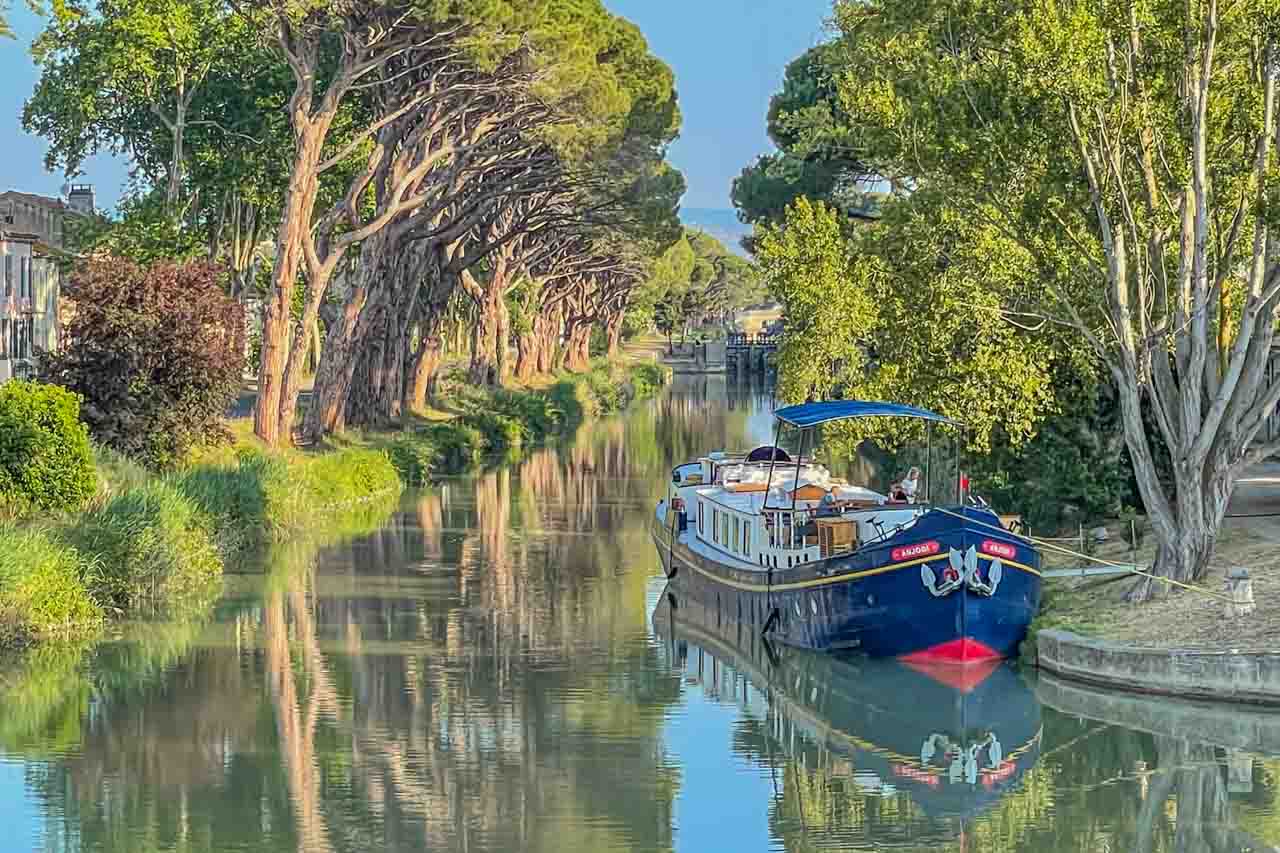
I want to leave you with my favourite photo I took on the Canal du Midi barge cruise. It is not the Canal du Midi per se but taken when we stopped for the night at Salleles d’Aude on the Canal de Jonction. The Canal de Jonction is a shortcut from the Canal du Midi to the Canal de la Robine. It was early morning, the water was milk-pond still, and the reflections of our barge and the trees lining the canal created an unforgettable image.

A blue and white barge is tied up to the bank of a tree-lined canal. The barge and trees are reflected in the still waters of the canal. A lock can be seen in the distance.

The Adjodi reflected in the still waters at Salleles d’Aude on the Canal de Jonction.


Reflecting on my journey along the Canal du Midi, I am in awe of the ingenuity and determination that brought these three remarkable engineering marvels to life. The Orb Aqueduct is a testament to the courage of human vision, carrying the canal over the valley below. The Fonserannes Locks remind us of our ability to conquer and harness the raw forces of nature. And then there is the Malpas Tunnel, a hidden passage shrouded in history and mystery carved through solid rock.

As you traverse the tranquil waters of the Canal du Midi, it’s impossible not to be humbled by the visionaries who conceived these extraordinary structures. Their dedication to crafting a passage that conquered natural obstacles while blending with the landscape continues to inspire admiration centuries later.

Whether you’re a history buff, an engineering enthusiast, or a traveller searching for unique experiences, the Canal du Midi’s engineering marvels promise an unforgettable journey.


Disclaimer: This post contains no affiliate links. All views and opinions are my own and non-sponsored. All photos are my own and remain the copyright of Just Me Travel.

© Just Me Travel 2018-2023.


Leave a comment below. I look forward to reading and responding to your comments on the Canal du Midi and its engineering marvels.


Like this post? Save it for later!

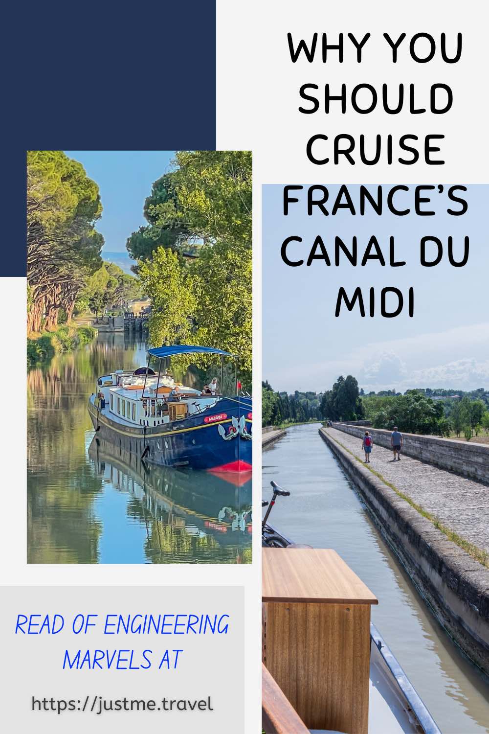
The image shows two photos. One photo is of a boat reflected in the waters of a tree-lined canal. The other photo is a boat sailing on an aqueduct (a water bridge). These are engineering marvels on the Canal du Midi.

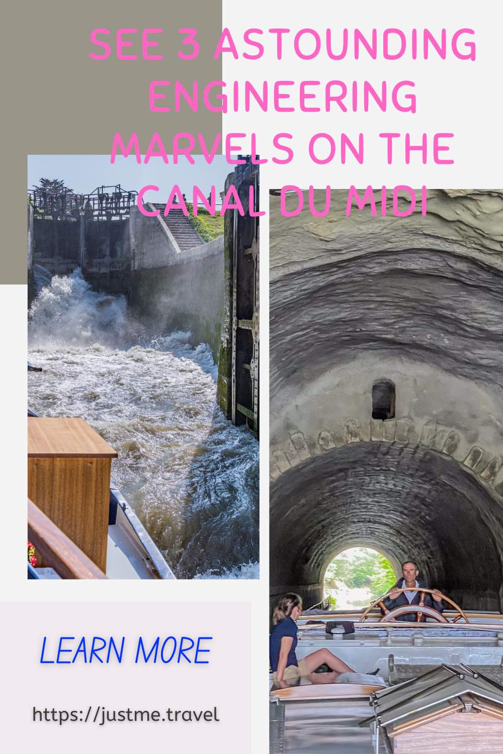
The image is two photos - a boat entering the swirling waters of a lock chamber and the other is a boat, steered by a man, exiting a tunnel.


Author’s Note: Please check the latest travel restrictions before planning any trip and follow government advice.


Sign up to receive the latest in travel destinations, topics, resources and guides.


You might also like

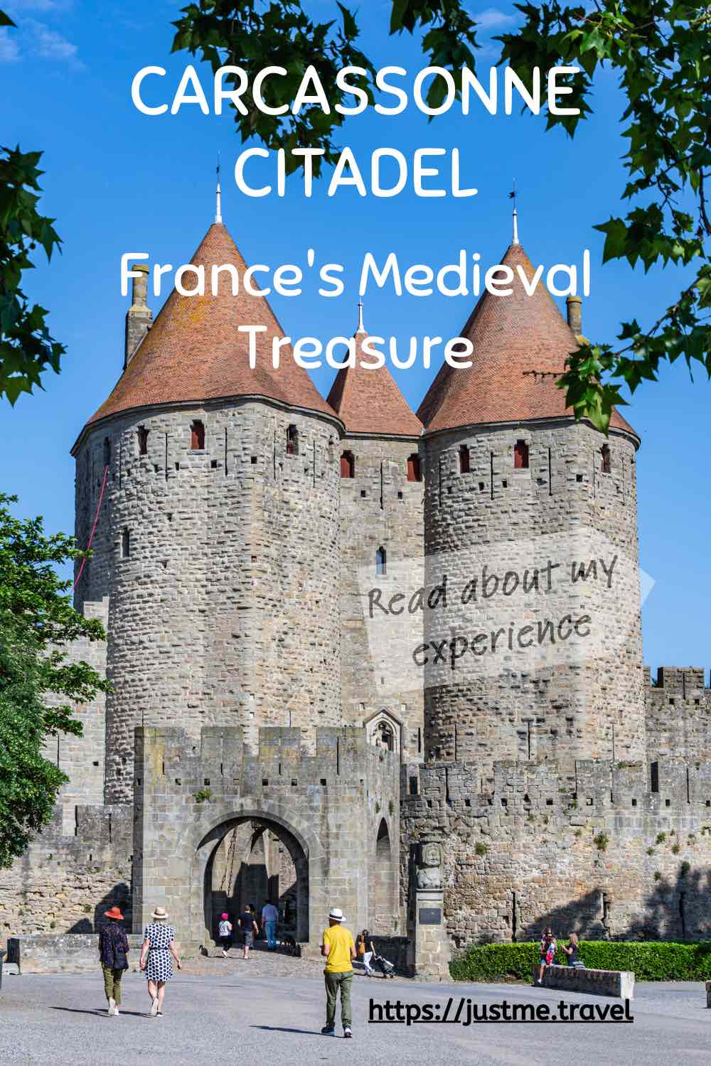
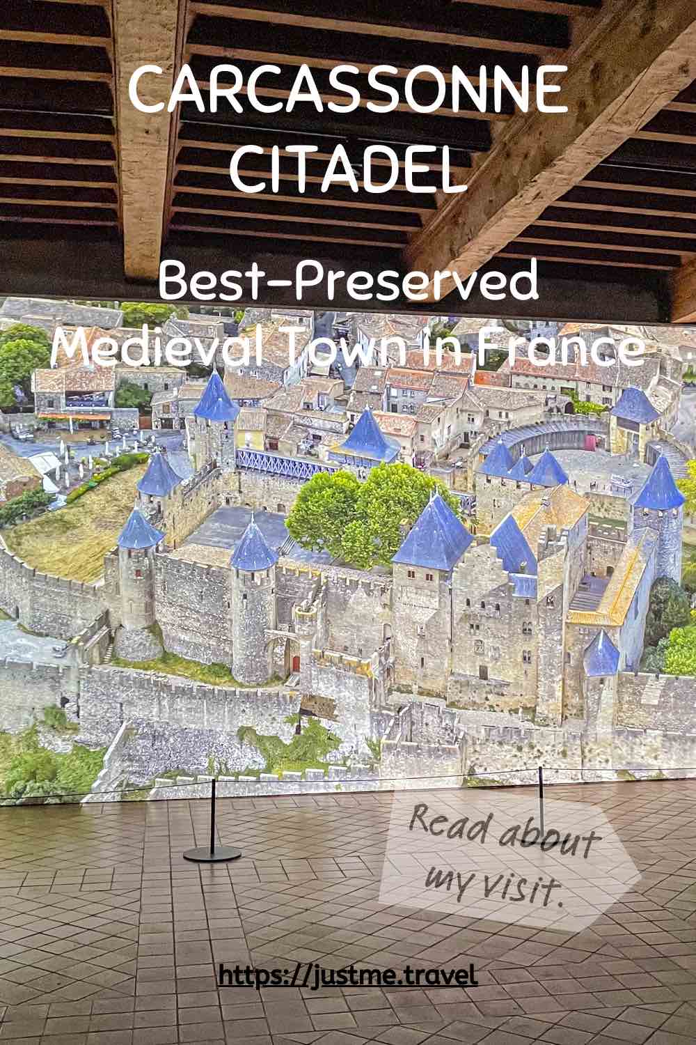
An image of a castle within a medieval citadel.
Carcassonne Citadel is a medieval treasure in Southern France. It is the most complete medieval town in existence today and is worth two to three days to explore.


A collage of three French castels in the Loire Valley - Chateaux Chenonceau, Villandry, and Chambord.SEE 7 UNIQUE FRENCH CHATEAUX IN THE BEAUTIFUL LOIRE VALLEY.   In this blog post, I invite you on a majestic journey through time and architecture, unveiling 7 magnificent castles that have helped shape the Loire Valley’s iconic landscape.


No Comments on SEE 3 ASTOUNDING ENGINEERING MARVELS ON THE CANAL DU MIDI

CARCASSONNE CITADEL – The Best-Preserved Medieval Town in France

Carcassonne Citadel is a Medieval Treasure in Southern France.   Dear Ryan, One of the highlights of my Canal du Midi cruise with European Waterways was a morning in the…

Carcassonne Citadel is a Medieval Treasure in Southern France.

A medieval fortified town

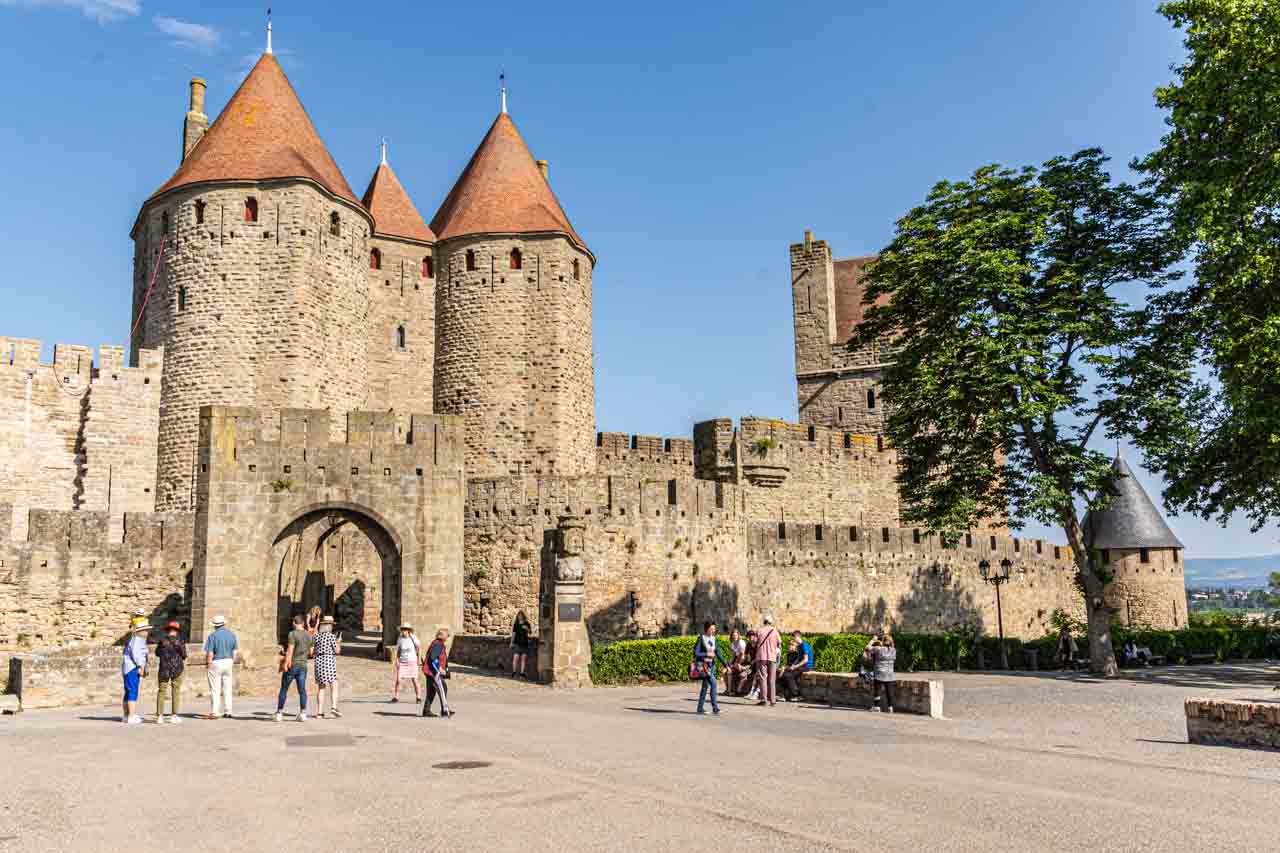
Carcassonne Citadel entrance gate


Dear Ryan,

One of the highlights of my Canal du Midi cruise with European Waterways was a morning in the Citadel of Carcassonne. The barge captain was surprised I had not heard of Carcassonne Citadel as it is one of France’s premier tourist attractions. But, as you know, I have only been to France once before, and that was to a different region.

So, here is what I learned about Carcassonne Citadel…

  • It is the most complete medieval fortified town in existence today and the largest in Europe.
  • It has about 2,500 years of history and was occupied by the Romans, Visigoths, and Crusaders at different periods.
  • Three kilometres of double walls interspersed with 52 watchtowers surround the citadel.
  • It is a lived-in citadel with houses, schools, shops, restaurants, hotels, basilica, and museums.
  • The citadel is open 24/7 and is free to enter. However, there is an admission fee to visit Carcassonne Castle and its ramparts.
  • Carcassonne Citadel was declared a UNESCO World Heritage Site in 1997.

European Waterways took us on a two-hour guided walking tour around the walls, through the citadel, and into the Basilica Saint Nazaire. We were given admission tickets for the castle and ramparts, but I didn’t see them. After going to the toilet and watching the visual display at the entrance, I had to leave the castle as it was time to meet our guide to leave Carcassonne.

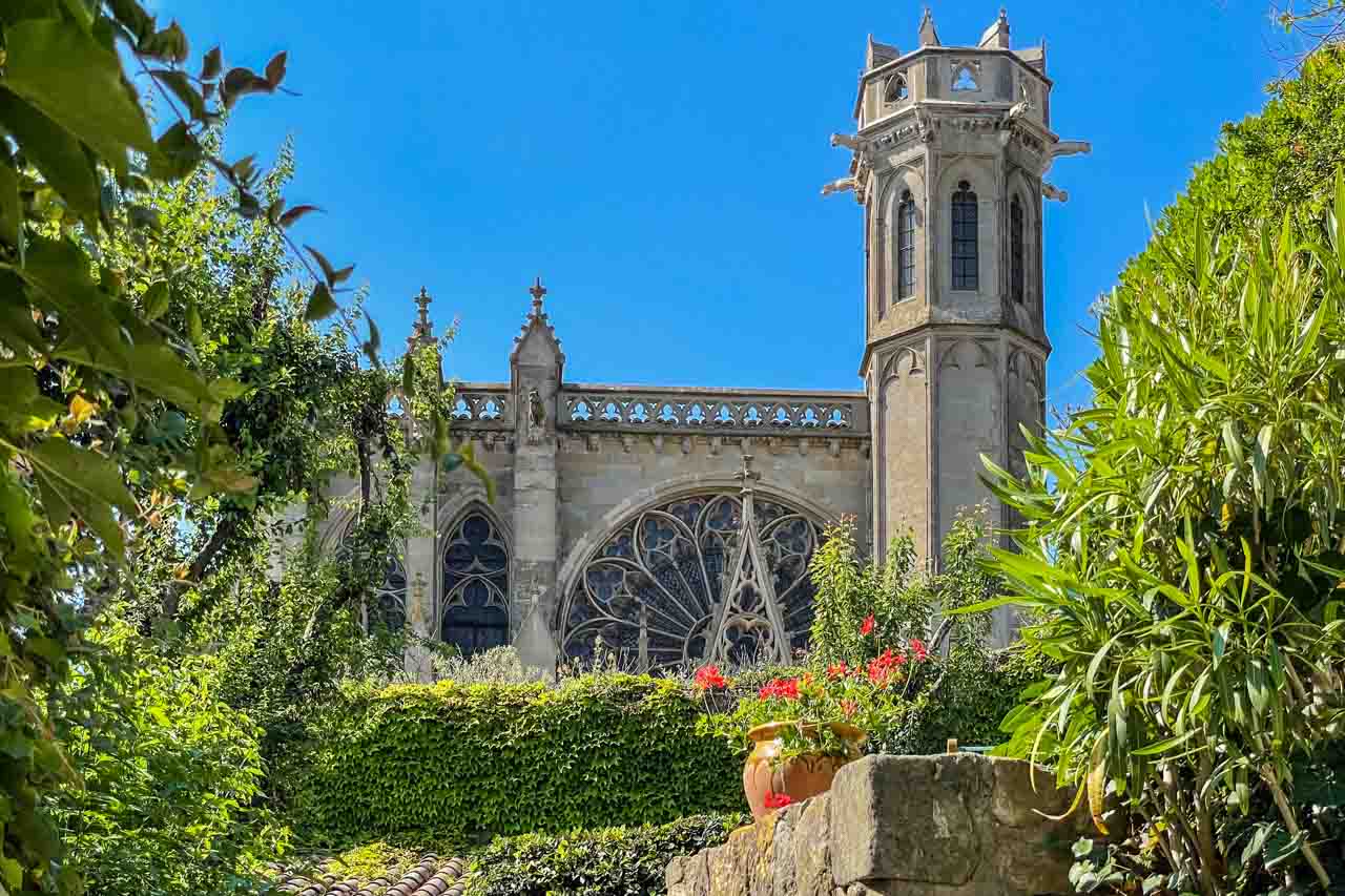
A gothic church facade with shrubs and flowers in front of it.

Basilica Saint Nazaire


Our visit to Carcassonne Citadel was too rushed and deserved so much more time. I could have spent 2-3 days there instead of the few hours allocated to the visit.

  • I would stay within the citadel. From my view of its exterior, the Hotel de la Cite next to the basilica appealed to me. That it is a 5-star hotel probably added to that appeal, even if it is beyond my budget.
  • Exploring the castle beyond the toilet block would be a bonus. And I am told the views from the ramparts are stunning. But I would want to walk them to see for myself.
  • I would like to eat at the many restaurants, buy lots of nougat, and shop until I drop. The clothes and leather goods shops were of particular interest.
  • Three days would give me time to visit some of the museums within the citadel and Carcassonne city, for example, the School Museum, the Museum of the Inquisition, and the Museum of Fine Arts. Perhaps I need four days!

Did you know there is a Carcassonne board game? Apparently, it is one of the most beloved and well-known board games in the world. I have never heard of it. Just something else to add to my ignorance about Carcassonne!

Next stop, Spain.

Love,

Joanna


Disclaimer: This post contains no affiliate links. All views and opinions are my own and non-sponsored. All photos are my own and remain the copyright of Just Me Travel.

© Just Me Travel 2018-2023.


Have you been to Carcassonne Citadel? What would you recommend I include on my next, more in-depth visit? Leave a comment below.


Like this post? Save it for later!

A photo of an entrance gate to a medieval fortified citadel.

An image of a medieval castle in a fortified citadel.


Author’s Note: Please check the latest travel restrictions before planning any trip and follow government advice.


Sign up to receive the latest in travel destinations, topics, resources and guides.


You might also like

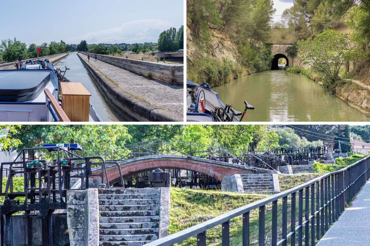
The image shows three photos of engineering marvels on the Canal du Midi - a boat crossing the Orb Aqueduct, a boat approaching a canal tunnel, and a seven-rise lock staircase.

SEE 3 ASTOUNDING ENGINEERING MARVELS ON THE CANAL DU MIDI

Prepare to be awe-struck by three extraordinary engineering marvels on the Canal du Midi that are works of art – the Orb Aqueduct, Fonserannes Staircase Locks, and Malpas Tunnel.


A collage of three French castels in the Loire Valley - Chateaux Chenonceau, Villandry, and Chambord.SEE 7 UNIQUE FRENCH CHATEAUX IN THE BEAUTIFUL LOIRE VALLEY. 

In this blog post, I take you on a majestic journey to seven magnificent chateaux in the Loire Valley. Each offers a unique window into France’s rich history and architectural splendour, which has helped shape the Loire Valley’s iconic landscape.


No Comments on CARCASSONNE CITADEL – The Best-Preserved Medieval Town in France

EXPLORING BEAUTIFUL MELK ABBEY IS GUARANTEED TO BE SPECIAL

There are not enough adjectives to describe Melk Abbey. My first sighting of Melk Abbey, a Benedictine monastery, took my breath away and it took a while before I could…

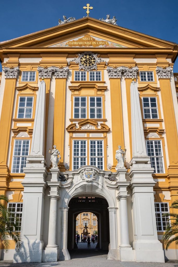
There are not enough adjectives to describe Melk Abbey. My first sighting of Melk Abbey, a Benedictine monastery, took my breath away and it took a while before I could pick my jaw up off the ground. This beautiful, beautiful monastery (duplication not a typo) in Lower Austria should be on everyone’s European itinerary.

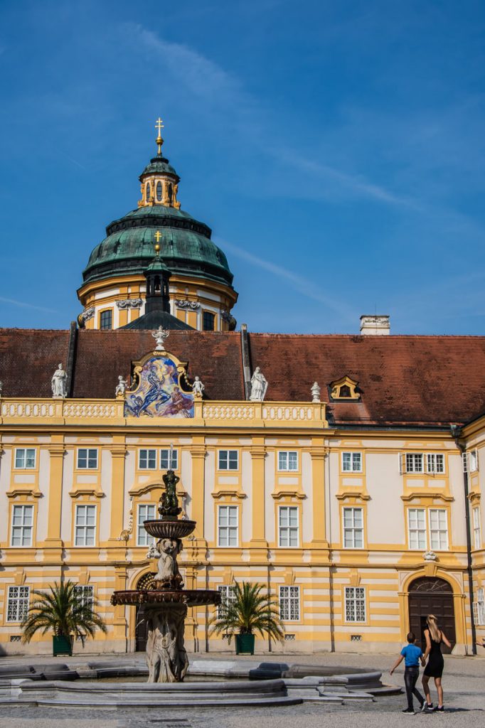
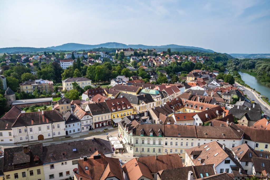
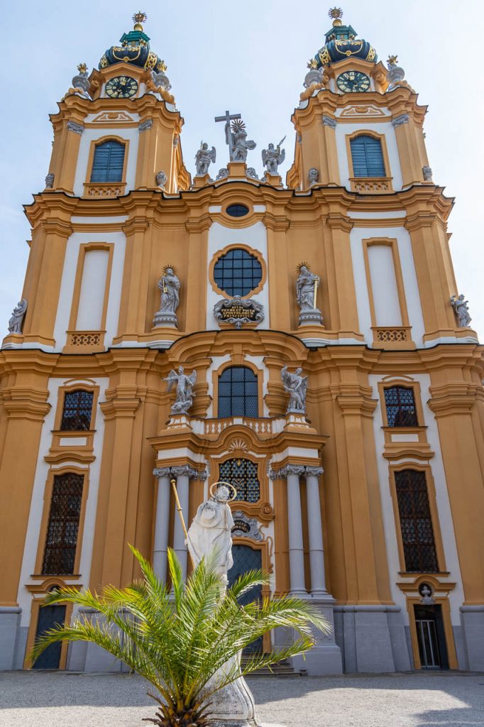
Melk Abbey is a masterpiece of Baroque architecture. It is Austria’s largest Baroque structure. Perched high on a cliff overlooking the old town of Melk and the Danube and Melk rivers, it sits within the Wachau Valley, a UNESCO World Heritage Site.

The abbey you see today was built between 1702 and 1736. But Melk Abbey is 900 years of history – all evidently told in the abbey’s museum. Originally a palace, Melk Abbey was gifted to the Benedictine monks in 1089 and has remained an active abbey ever since. Today, Melk Abbey has 30 monks (ranging in age from 21 to 96 years); a co-educational secondary school with 900 pupils; and extremely well presented, minimalist museum; and a church that I can only describe as ostentatious.

From every angle, Melk Abbey is impressive. I lost count of the number of times I said, “Oh my goodness”. Swathed in ochre-coloured paint, Melk Abbey is just the most beautiful building to behold. You might have gathered by now that I fell in love with Melk Abbey. And the guided tour cemented my love.

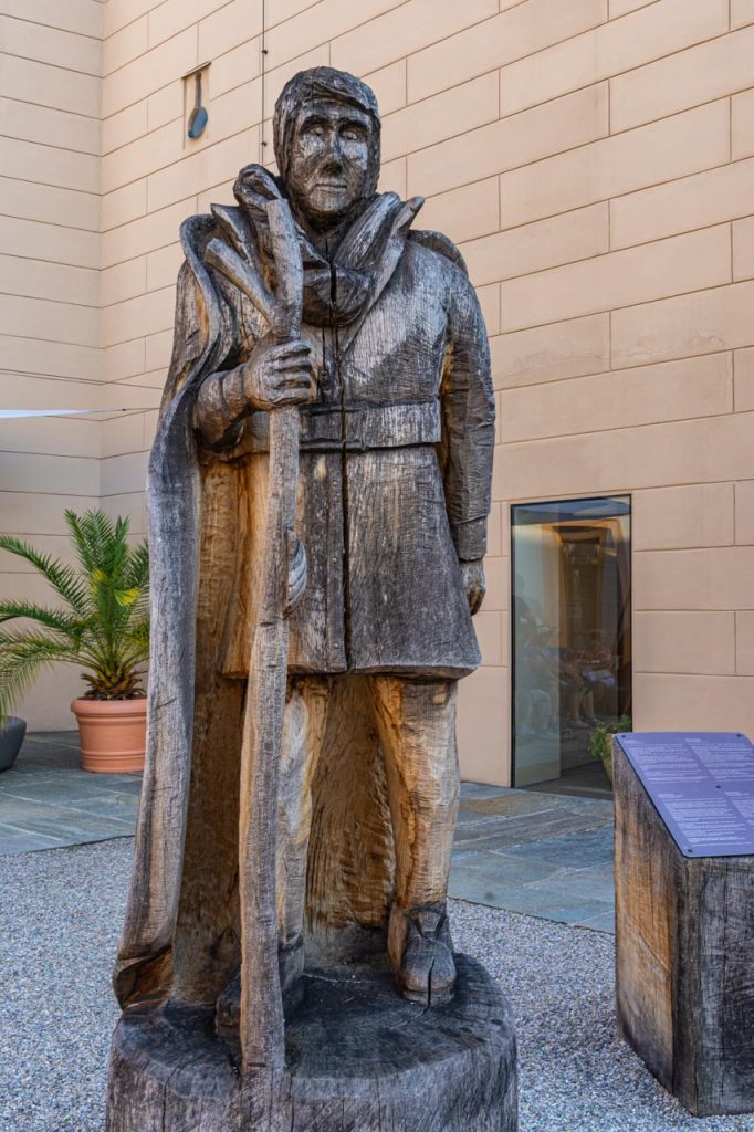
The guided tour through Melk Abbey commenced with a meet and greet in the large outer courtyard, the Gatekeeper’s Courtyard. In this courtyard, you will find the oak wooden statue of Saint Coloman. The statue is 150 years old and the oak was sourced from the abbey’s forests. Saint Coloman was Austria’s first patron saint until 1663. He is still the patron saint of Melk Abbey and the town of Melk.

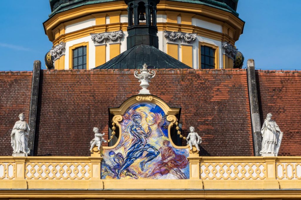
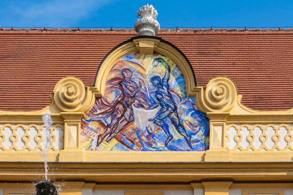
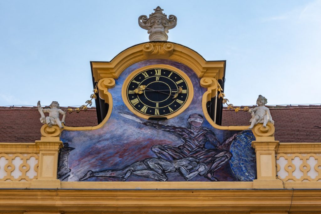
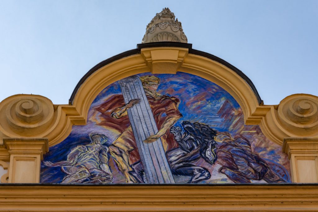
From the Gatekeeper’s Courtyard, it was through the Benedict Hall and into the Prelate’s Courtyard. In this latter courtyard were four vivid, contemporary frescos; replacing the Baroque frescos that were unable to be restored. These frescos represent the four cardinal virtues – Prudence, Temperance, Justice and Fortitude. The modernist style of the frescos caused some controversy as people tried to adjust to the move away from the original, and expected, Baroque style.

The fountain in the Prelate’s Courtyard is a copy of the Coloman fountain. The original, removed from Melk Abbey in 1722, now stands in Melk’s Town Hall Square.

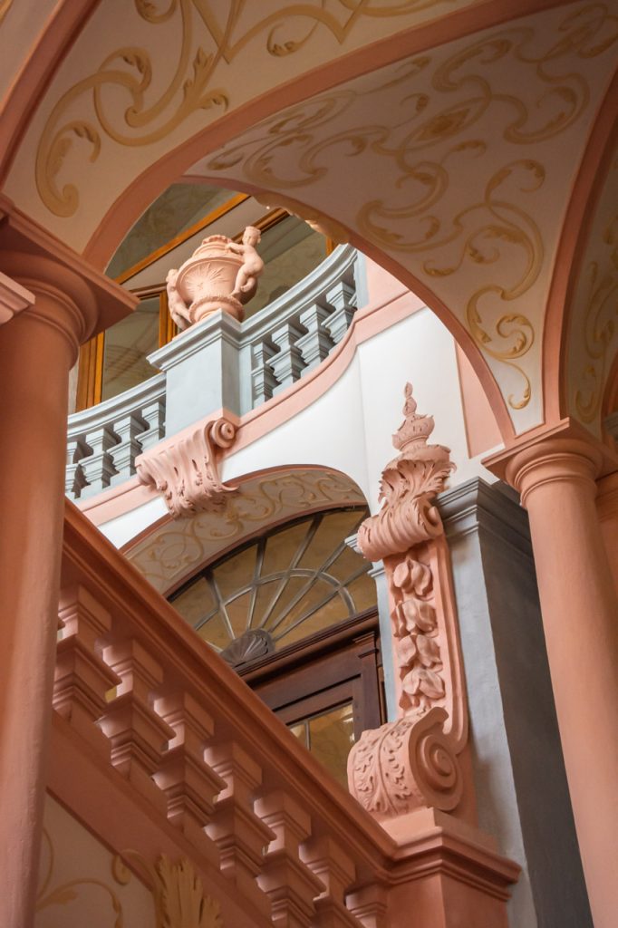
Leaving the Prelate’s Courtyard through a narrow passageway, the Imperial Staircase leads up to the Imperial Wing.
The Imperial Wing was originally designed for the imperial court. Here, we find the Imperial Corridor and the imperial rooms (now housing Melk Abbey’s museum). A lot of ‘imperials’ happening here!
The Imperial Corridor, at 200 metres long, is impressive. The Corridor is hung with portraits of Austria’s rulers – from the first Babenberg Emperor, Leopold l, to the last Habsburg Emperor, Karl l. There are more portraits of Habsburgs because they ruled for longer.

The Melk Abbey museum, in the imperial rooms to the left of the Imperial Staircase, is extremely well set up and informative. It is minimalist in a positive way. That is, you get a good overview of the history (past and present) of the abbey, of its cultural, political and economic functions, but you are not left feeling overwhelmed; feeling as though there was too much to take in and, therefore, coming away none the wiser. No information overload here.

The museum comprises of 11 small rooms. The overriding theme of the museum is, “The Path from Yesterday to Today: Melk Abbey in its Past and Present”, with each room having its own individual theme. What follows are snippets of, in my opinion, interesting information taken from the guide’s explanations throughout the museum tour and my impressions.

Room 3 (“The Ups and Downs of History”) has a wavy floor, representing the ups and downs of life. The flooring is not the original Baroque because Napoleon was an unfortunate guest who burned documents on the floor.

Rooms 5 and 6 are a tribute to Melk Abbey’s contribution to the Baroque period. The Baroque period was a time in history of excess and all that glitters (gold, and more gold). “Heaven on Earth” seems to me an appropriate theme for this period. However, Room 7, with its, “In the Name of Reason” theme, represents new times and a sensible, frugal monarch. Joseph ll said the Baroque style was too expensive. But perhaps he was a little too frugal. Taking the Baroque style to the opposite extreme, he only allowed one coffin per church. The coffin designed to meet this requirement had a bottom that would open, allowing the corpse to drop through. Thus, the coffin could be used again.

Room 10 (“To Glorify God in Everything”) contains a 17th century iron chest used for secure storage and transporting the abbey’s most important documents and treasures. The chest has a convoluted locking mechanism, comprising of 14 locks that are still working.

The detailed model of Melk Abbey housed in Room 11 (“Motion is a sign of Life”) turns so you can see all sides unobstructed. There is a mirror on the ceiling to enable a view into the courtyards of the model.

The Marble Hall was a place to receive guests and dining hall for the imperial family. The name ‘Marble’ Hall is somewhat misleading as only the door frames are true marble. The ‘marble’ on the walls is faux marble. However, this is easily forgiven by the magnificent ceiling fresco that is complemented and framed by stunning architectural painting.

Magnificent views of the town of Melk, and the Danube and Melk rivers are to be had from the Terrace that connects the Marble Hall with the library. The Terrace also provides a great view of Melk Abbey church.

The library is the second most important room in any Benedictine monastery; second only to the church.

My favourite library to date has been Coimbra University library in Portugal. However, the competition between that library and Melk Abbey’s library would be a close contest. Both are stunningly beautiful. There is something uniquely special about the mix of dark wood and old books.

Melk Abbey library houses approximately 10,000 volumes, with manuscripts dating back to the 9th century. The uniformity of the books in the inlaid bookshelves is due to them all being bound to match. With internal balconies, wooden sculptures, a huge free-standing world globe, figurines and frescoed ceilings, the library is an entrancing vision. It also exudes peace and tranquillity; a place where I could easily spend hours just sitting and soaking in the atmosphere. I know I am waxing lyrical here, but I can’t help it. Melk Abbey library does that to me. No wonder Umberto Eco conducted his research on his book, The Name of the Rose in Melk Abbey’s library. But more on that later.

The upper floor of the library, reached by a spiral staircase, is not open to the public.

The guided tour ended in the library. I lingered to absorb the library’s ambiance before heading to the church on the recommendation of the guide.

My visit to Melk Abbey’s church, not part of the guided tour, was very brief as I am over what I can only describe as ostentatious, Baroque churches. Of note, however, is the Altar of St. Coloman. Here you will find a sarcophagus with, we are told, the remains of St. Coloman, the patron saint of Melk Abbey.

Photography was not permitted inside Melk Abbey’s museum, the Marble Hall, the library, or the church.

You don’t have to take the one-hour guided tour of Melk Abbey (except in the winter months). However, it is my opinion this would be false economy as the explanations provided by the guide throughout the tour were invaluable. The guide’s story telling brought Melk Abbey alive; revealing all its traits.


Melk Abbey’s literary connection is not just confined to the books in its historical library.

The Name of the Rose, written by Umberto Eco (1980), is a historical murder mystery (a medieval whodunit) set in an Italian Cistercian monastery in 1327.

But what does a story about murders in a Cistercian monastery in Italy have to do with a Benedictine monastery in Austria? The connection is Melk Abbey’s magnificent library. You see, the focal point in The Name of the Rose is the library where all the murders take place. Melk Abbey’s library is said to be Eco’s inspiration for the library in The Name of the Rose.

But the connection goes further than that. One of Eco’s main characters in The Name of the Rose is Adso of Melk, a Benedictine novice from Melk Abbey. The Name of the Rose is Adso of Melk’s story as he is the narrator. As way of introduction, Adso of Melk informs us he is writing his narrative, now an old man, at Melk Abbey. On the last page of The Name of the Rose, Adso of Melk tells the reader he is leaving his manuscript in the library of Melk Abbey.


In summary, make the effort to visit Melk Abbey. You won’t be disappointed. I guarantee it is something special.

If you like this post, PIN it for keeps

Melk Abbey blog post PIN for Pinterest


Disclaimer: This post contains no affiliate links. All views and opinions are my own and non-sponsored. All photos are my own and remain a copyright of Joanna Rath.


No Comments on EXPLORING BEAUTIFUL MELK ABBEY IS GUARANTEED TO BE SPECIAL

Type on the field below and hit Enter/Return to search