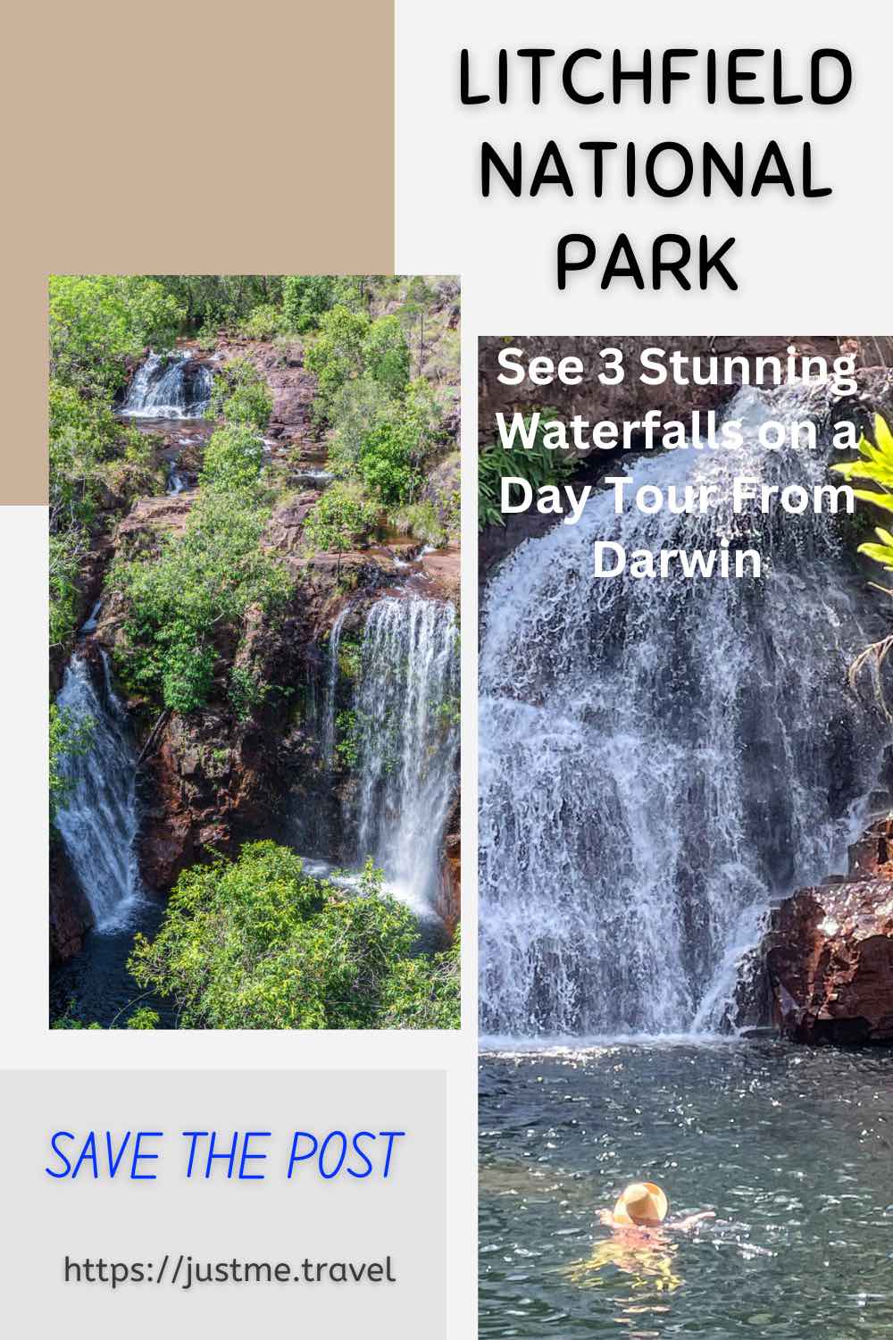
Breathtaking Waterfalls, Idyllic Plunge Pools, Iconic Magnetic Termite Mounds, and the Australian bush, Litchfield National Park Will Not Disappoint. Litchfield National Park is one of the Northern Territory’s best-kept…
Breathtaking Waterfalls, Idyllic Plunge Pools, Iconic Magnetic Termite Mounds, and the Australian bush, Litchfield National Park Will Not Disappoint.
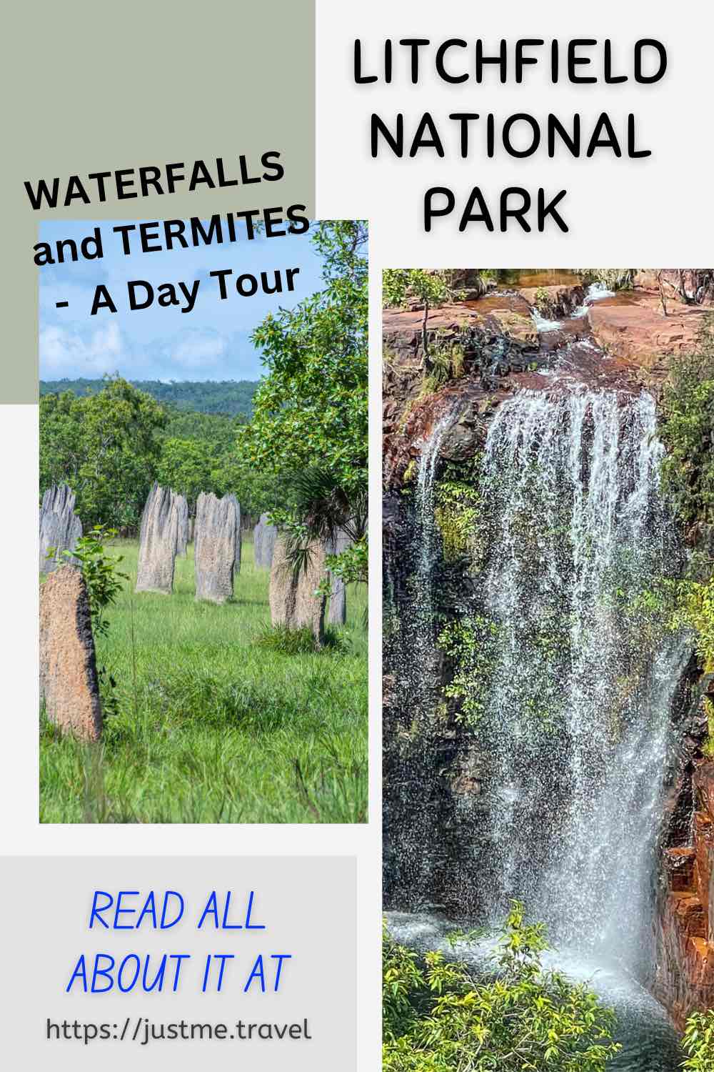
Litchfield National Park is one of the Northern Territory’s best-kept secrets and a must-see in Australia’s ‘Top End’. Home to spectacular waterfalls that plunge into crystal clear pools perfect for a swim and iconic magnetic termite mounds unique to northern Australia, visiting Litchfield National Park on a day tour at the end of 2022 was the highlight of my six days in Darwin.
Read on to learn why Litchfield is my new favourite national park and why I recommend the day tour I did with AAT Kings. Hint: I love waterfalls, landscapes, the bush, and the unusual.
About Litchfield National Park
Litchfield National Park in the Northern Territory (Australia) is near the town of Batchelor, about 100 kilometres southwest of Darwin. The Park was named after Frederick Henry Litchfield, a Territory pioneer who explored areas of the Northern Territory in 1864. Litchfield National Park covers an area of approximately 1,500 square kilometres and was proclaimed a national park in 1986.
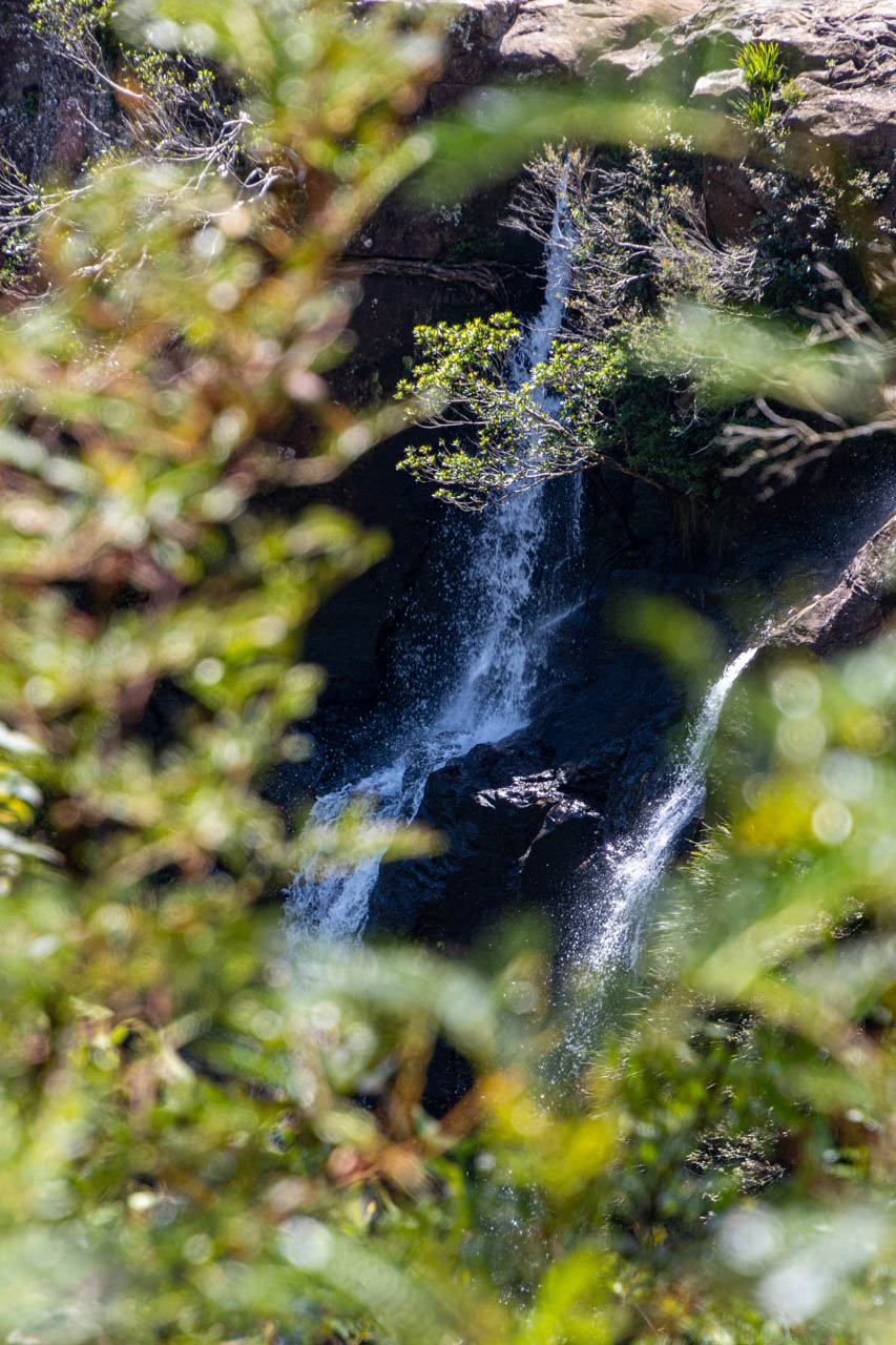
Litchfield National Park is an ancient landscape carved by water and is home to 15 waterfalls. The falls flow year-round but are particularly spectacular in the wet and early dry seasons.
As well as an abundance of waterfalls, Litchfield National Park is famous for its magnetic termite mounds and found only in Australia’s Northern Territory.
The Marranuggu, Koongurrukun, Werat, and Warray Aboriginal people consider Litchfield National Park an important cultural site.
A day tour from Darwin
I explored Litchfield National Park with AAT Kings on their Litchfield National Park Waterfalls day tour from Darwin.
I am drawn to waterfalls and the stunning landscapes in which they are located. Any tour that takes me to waterfalls will always grab my attention. So, with AAT Kings advertising a day tour visiting three waterfalls, I quickly grabbed my place.
The three waterfalls included in the tour were Florence Falls, Tolmer Falls, and Wangi Falls. As a bonus, we also saw the unusual magnetic termite mounds.
On a day tour, three waterfalls were an ideal number to visit as it allowed for a leisurely pace to see and swim at the falls. AAT Kings’ Litchfield National Park Waterfalls tour was well-planned, well-timed, and well-executed.
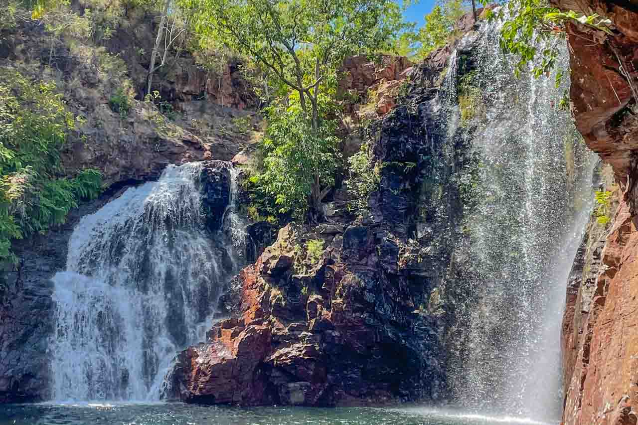
Florence Falls

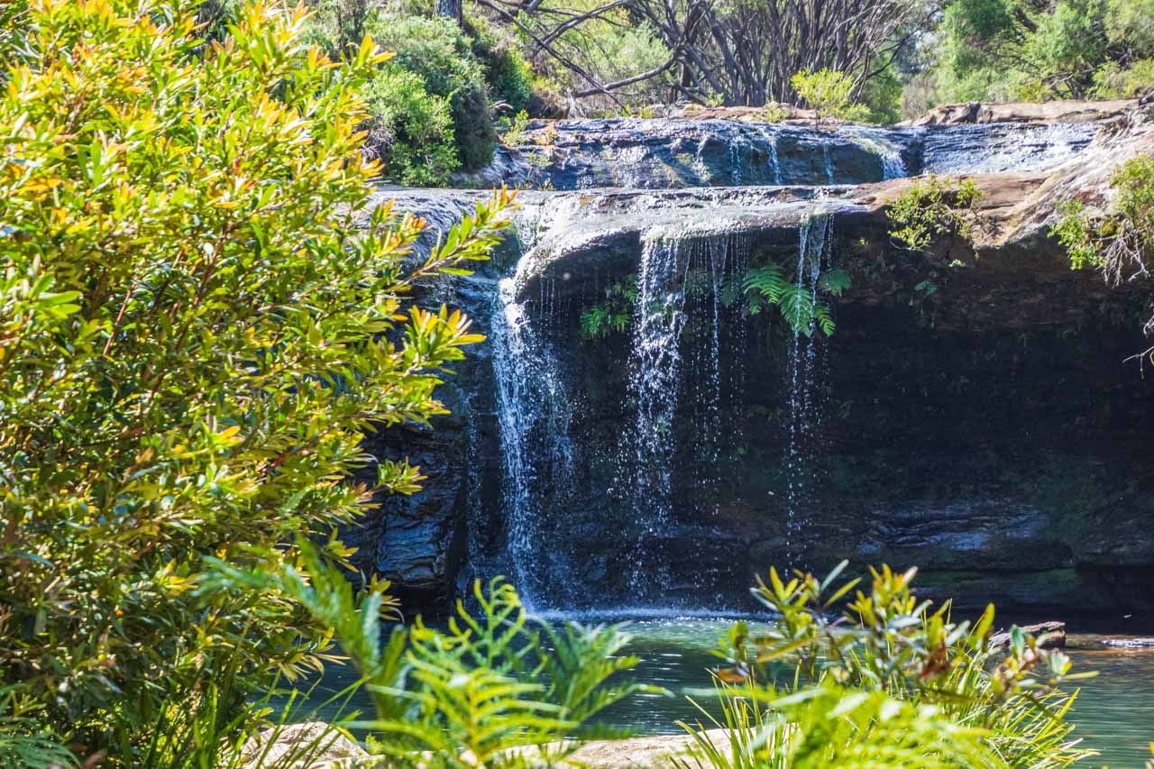
Florence Falls photographed from the viewing platform.
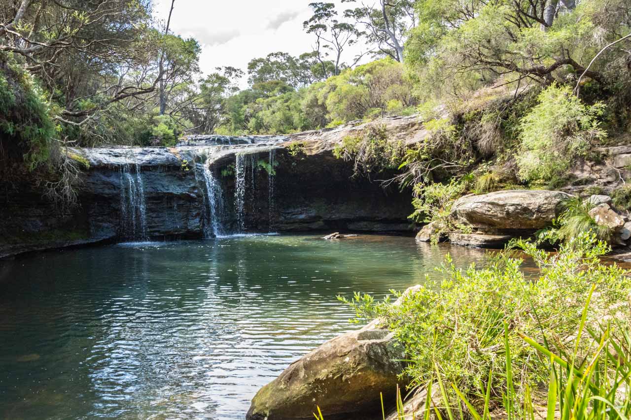
Florence Falls was my favourite of the three waterfalls we visited. It is a cascade waterfall that becomes segmented before it plunges over the cliff into a crystal-clear plunge pool perfect for a swim and set in a pocket of monsoon forest (a tropical dry forest).
Take the 3-minute walk from the car park to the viewing platform to see Florence Falls in all its splendour.
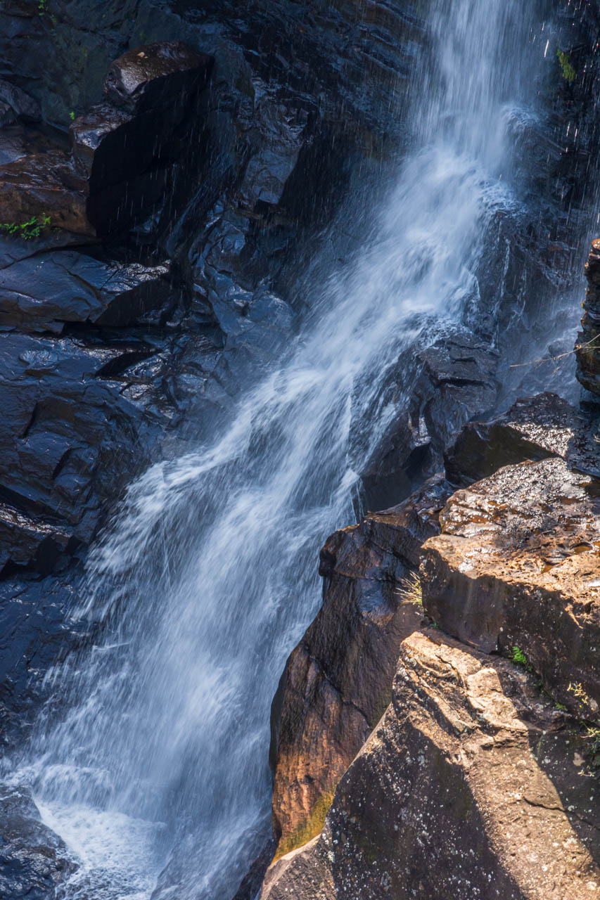
From the viewing platform, take the 170 steps (135 steel steps, with the rest being stone steps) down to the picturesque plunge pool, where a swim is a must. Here Florence Falls plunges into the pool from a height of about 15 metres before the creek continues over rocks and through the ancient landscape.
Florence Falls drops into the plunge pool.
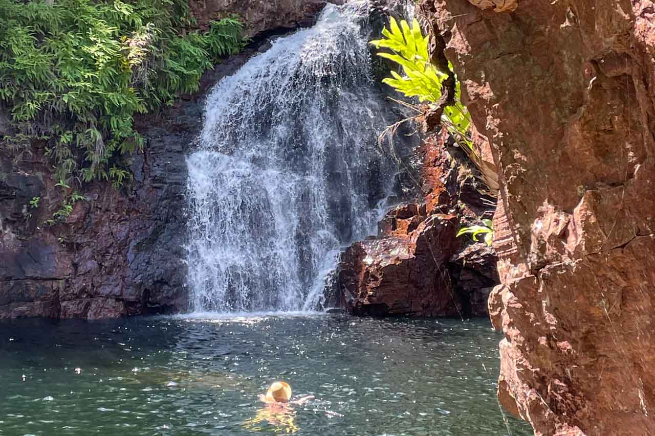
Florence Falls Plunge Pool
I was pleasantly surprised by the pool’s water temperature. Coming from a town that sits on a river that originates in the Snowy Mountains, I expected the water to be freezing. However, the water was warm, but not so warm that you didn’t feel refreshed from a swim in the pool.
I recommend you walk down the steps to the plunge pool at the bottom of Florence Falls and take the Shady Creek Walk back up to the car park.
Shady Creek Walk
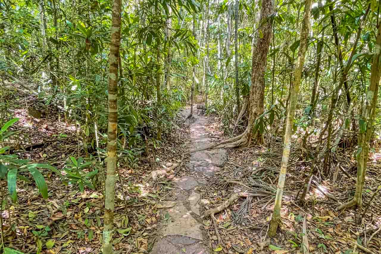
Shady Creek Walk meanders through Monsoon Forest
From the plunge pool at the bottom of Florence Falls, walk back to the car park via Shady Creek Walk – a Grade 3 (moderate) walk of one kilometre one way. The well-defined path meanders through the monsoon forest at a steady incline. There are some rock steps to negotiate, which are not particularly challenging and at various points along the way, the path crosses Shady Creek.
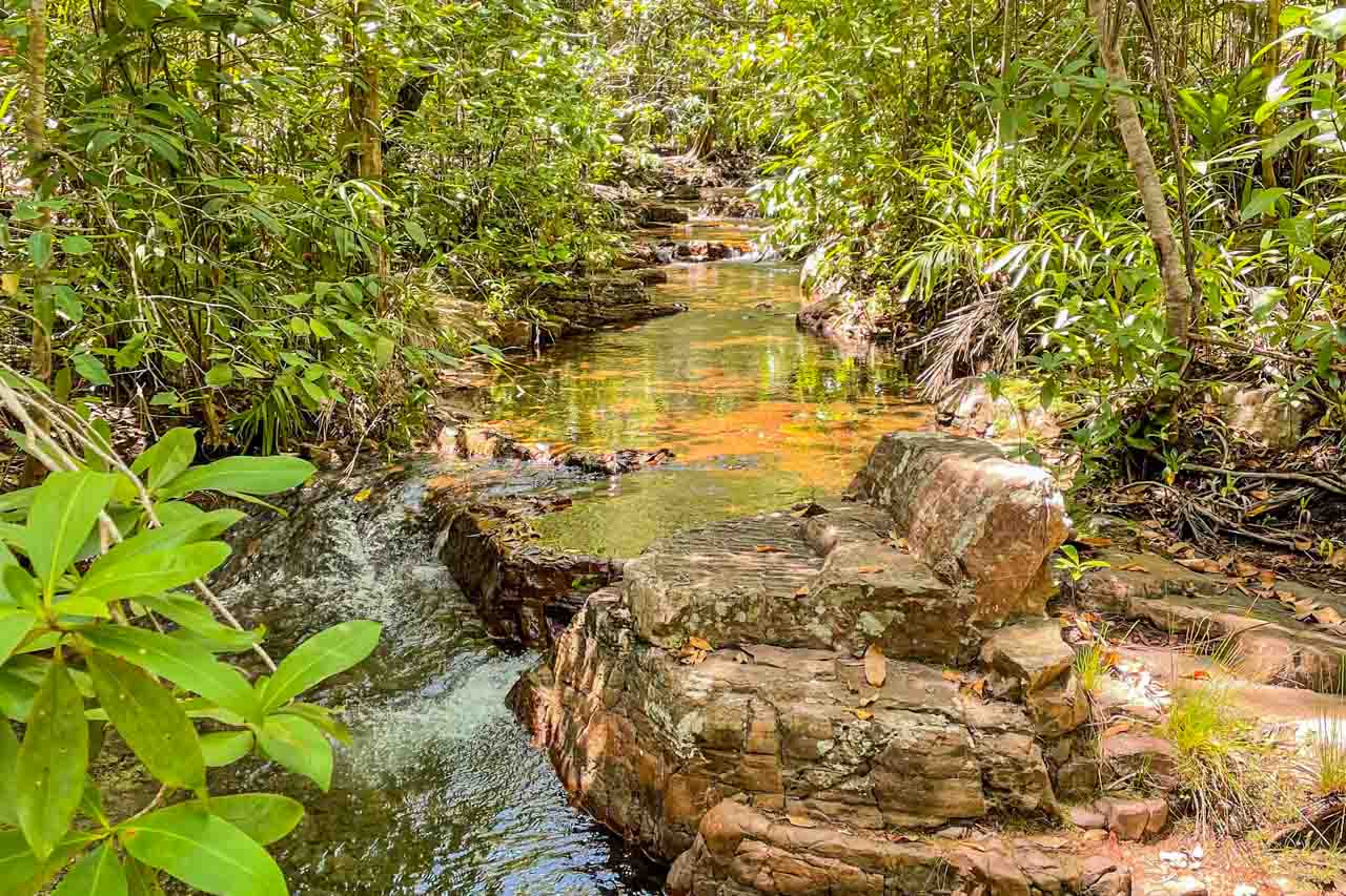
Shady Creek Walk crosses Shady Creek at various points.
A small plunge pool on Shady Creek is 50 metres from the car park. Take a final welcome dip before getting back on the bus.
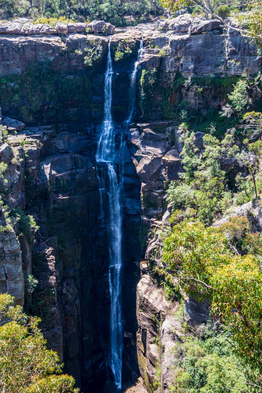
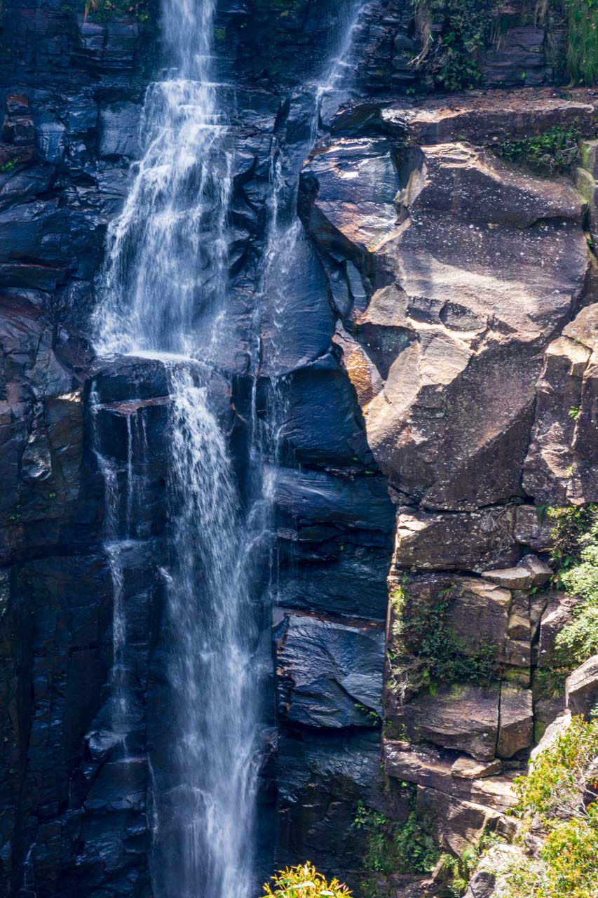
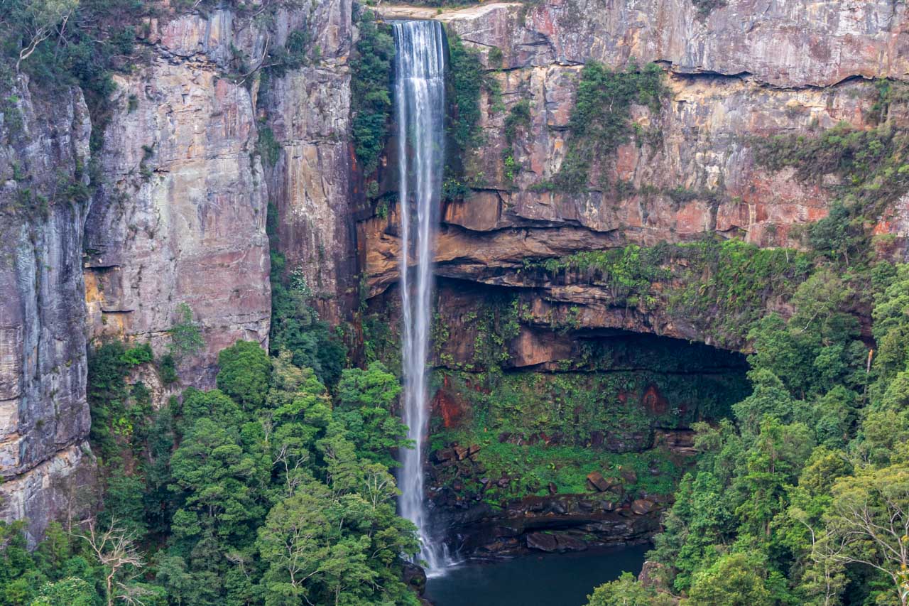
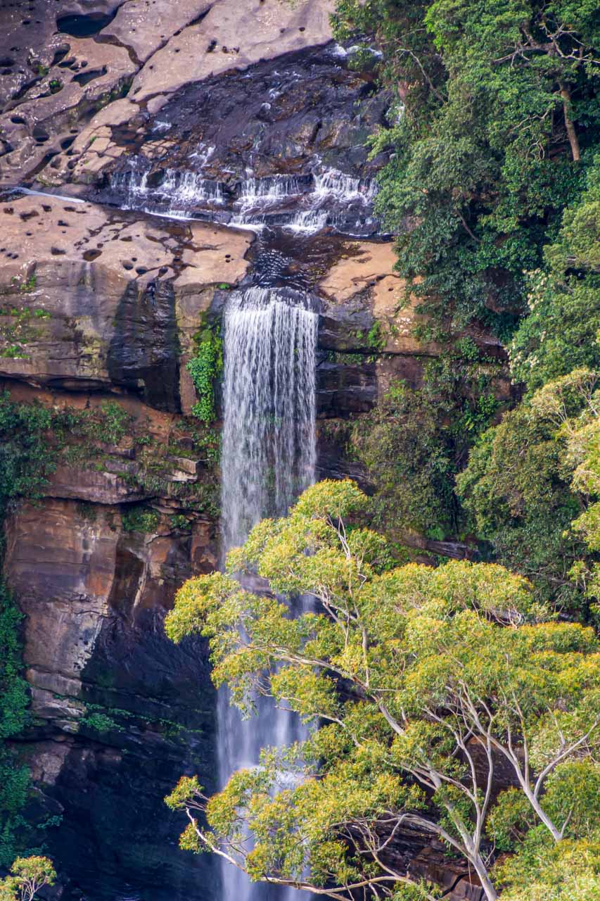
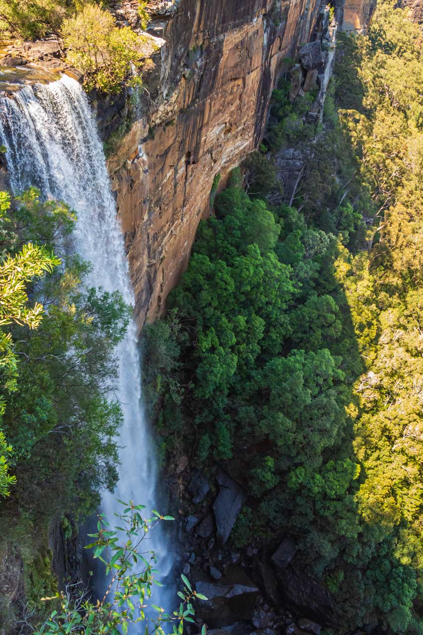
Tolmer Falls
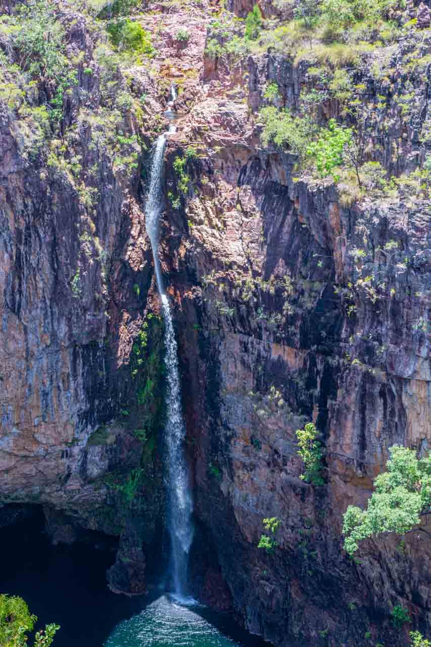
Tolmer Falls
Tolmer Falls is an impressive plunge waterfall with two drops at a total height of about 40 metres into the pool below. Swimming is prohibited at Tolmer Falls.
It is a 400-metre walk on a steep, sealed path from Tolmer Falls car park to the viewing platforms. The first platform provides magnificent views over the gorge, while the lower platform is the one you want for the best view of Tolmer Falls.
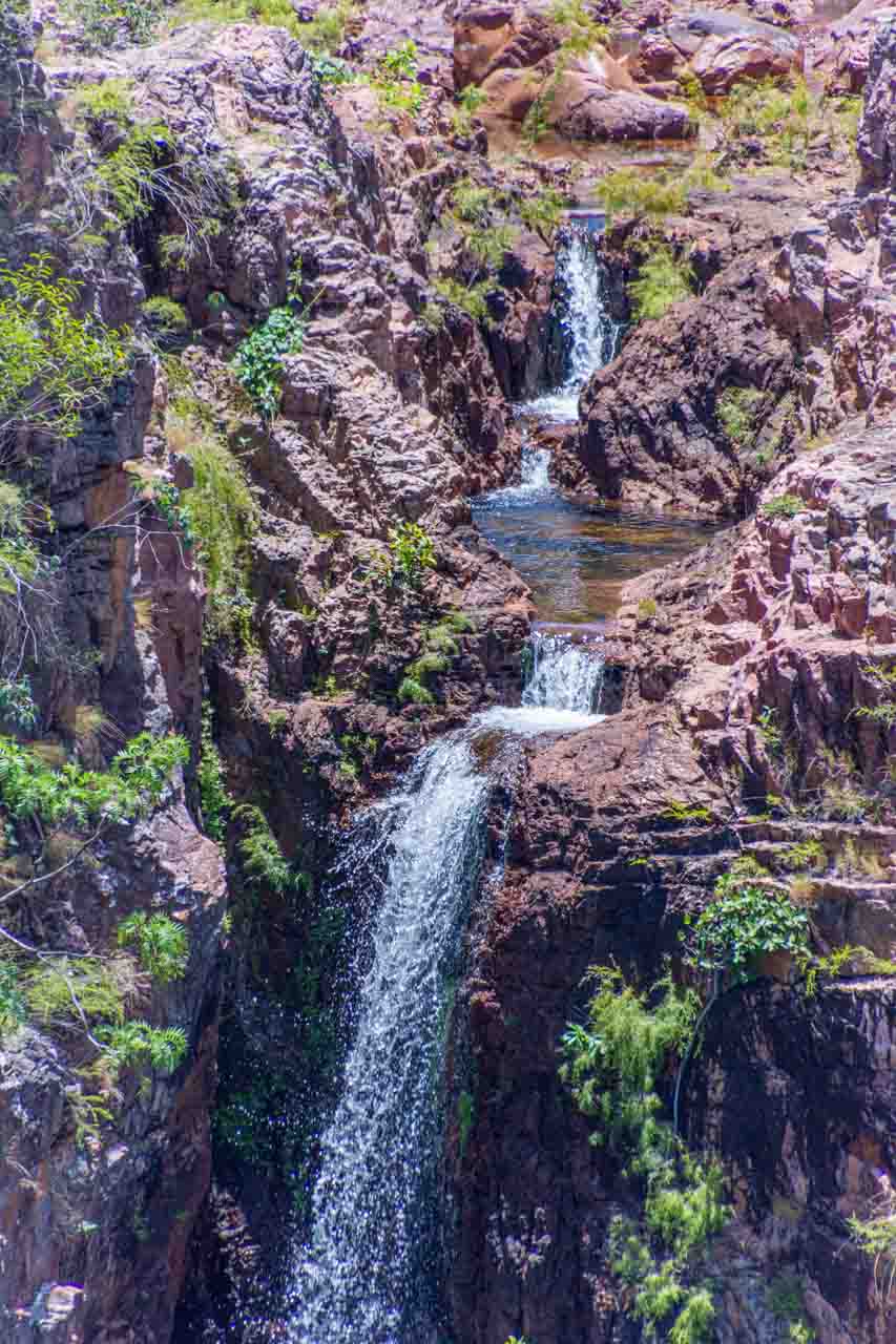
The top section of Tolmer Falls
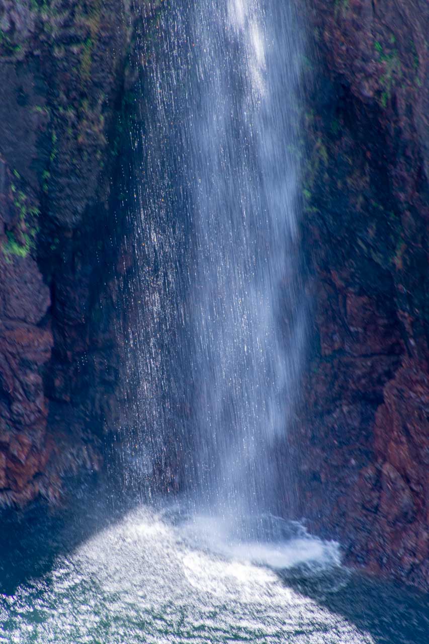
Tolmer Falls crashes into the pool below.
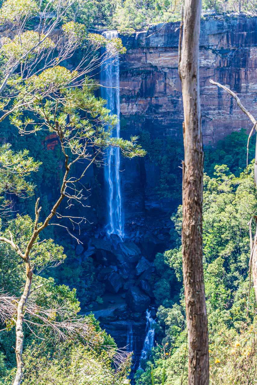
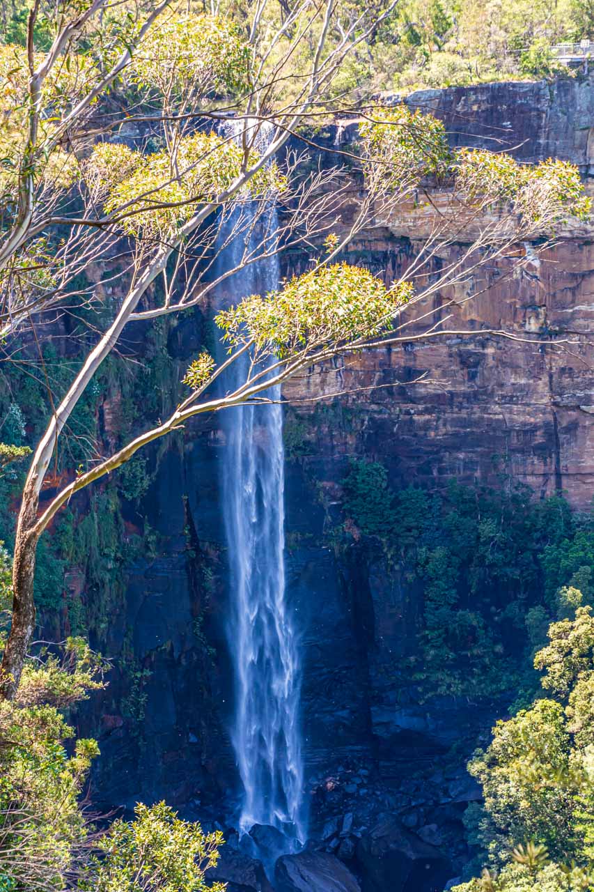
Wangi Falls
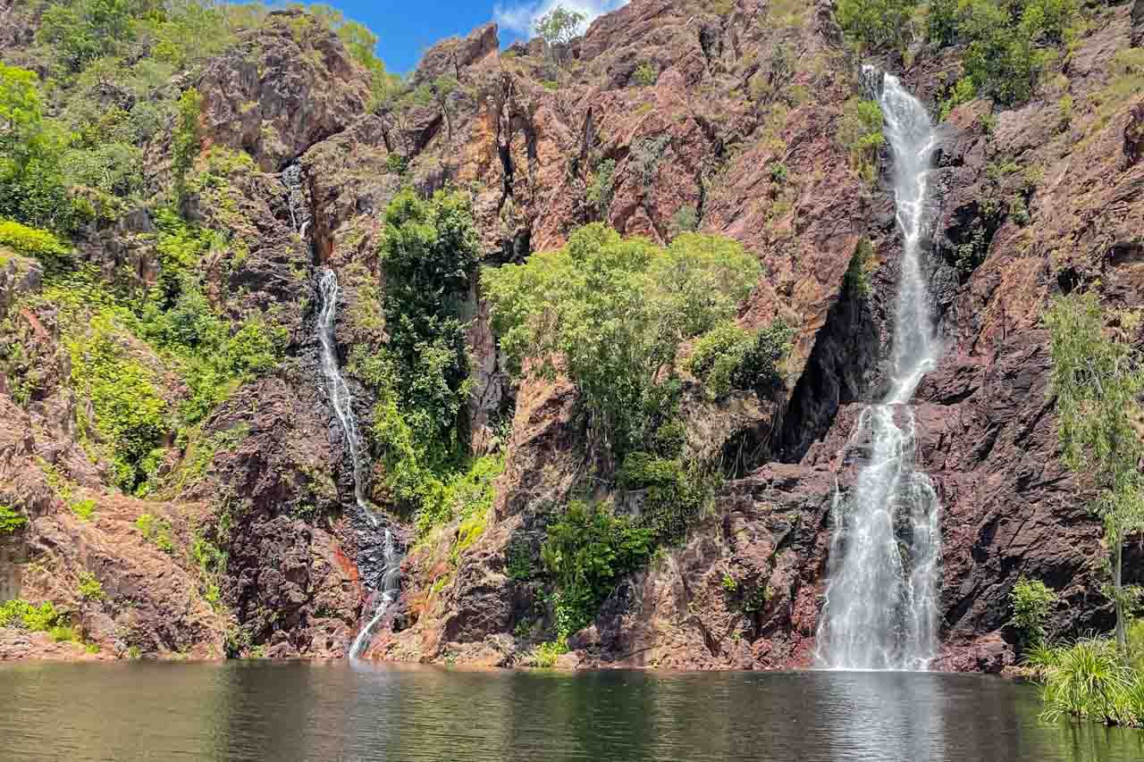
Wangi Falls
Wangi Falls is a segmented waterfall with a drop of about 50 metres. It is the most popular in Litchfield National Park as its large plunge pool is the most accessible.
Walking 125 metres along an easy, flat path will take you to the viewing platform, where the falls and plunge pool create a stunning panorama.
There was no swimming for us at Wangi Falls as it had been closed for the season for safety reasons after recent rains. The water had risen over the rocks that form a natural barrier against saltwater crocodiles entering the plunge pool. As such, the Park Rangers could not guarantee there were no crocs in the pool. Therefore, they closed the falls. Good Plan!
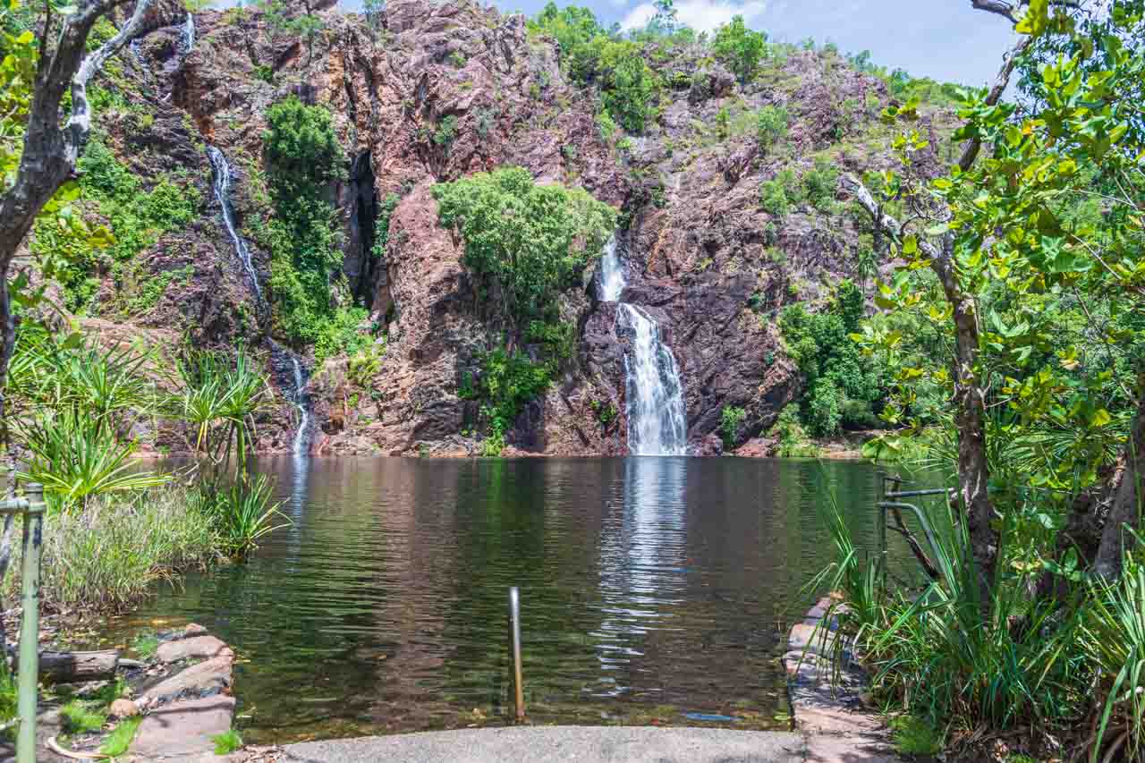
The large plunge pool at Wangi Falls
Our included lunch at Wangi Falls Café consisted of cold meats and salads, with fresh fruit to follow.
Magnetic termite mounds
Termite mounds are found throughout Australia, but magnetic termite mounds are found only in the Northern Territory. And Litchfield National Park has a most impressive sight of hundreds of magnetic termite mounds standing up to two metres high on a vast flat plain. They look like tombstones spread over a large cemetery, all facing in the same direction.

Tombstone-like magnetic termite mounds
Around 100 years old, these peculiar mounds are mysteriously aligned to the earth’s magnetic field. Their thin edges point north-south, and their broad backs face east-west. Thereby, according to current theory, magnetic termites keep their homes comfortable.
“Northern Australia gets extremely hot during the day and cool at night, and researchers believe termites have somehow harnessed the power of the earth’s magnetism to strategically climate-control their homes.”
https://www.amusingplanet.com/2014/01/magnetic-termite-mounds.html
An accessible boardwalk skirts the plain of magnetic termite mounds, giving uninterrupted views.
When to visit
The northern part of the Territory, including Darwin and Litchfield National Park, has a tropical monsoonal climate with two seasons – a dry season and a wet season.
The dry season runs from May to October, with sunny days and cool evenings. The humidity is low, and the average daily temperature is around 32 degrees Celsius.
The wet season runs from November to April. It is a time of spectacular thunderstorms and cyclones. The humidity can rise as high as 98%, and the average daily temperature inland can hover around 39 degrees Celsius. However, balmy evenings provide some relief.
I visited Darwin in late October, at the very end of the Top End’s dry season. As the photos attest, the waterfalls were still flowing strongly.
Litchfield National Park is best known for its waterfalls, and a day tour must be on any traveller’s itinerary to the Top End. This is where I recommend AAT Kings’ Litchfield National Parks Waterfalls day tour from Darwin. Their tour was well-organised and conducted at a leisurely, relaxed pace. For once, on an escorted tour, I didn’t find myself rushed to take my photos. However, the tour has whet my appetite to see more of what Litchfield National Park has to offer. After all, I still have 12 waterfalls to explore!
Disclaimer: This post contains no affiliate links. All views and opinions are my own and non-sponsored. All photos are my own and remain the copyright of Just Me Travel.
© Just Me Travel 2018-2023.
While Wangi Falls is the most popular attraction in Litchfield National Park, Florence Falls was my favourite of the three waterfalls the tour included. If you could only visit one of the waterfalls I have described and shown in this post, which would it be? Leave a comment.
Like this post? Save it for later!
Are you looking for more waterfall destinations in Australia? Then don’t miss these posts:
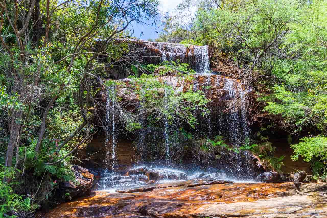
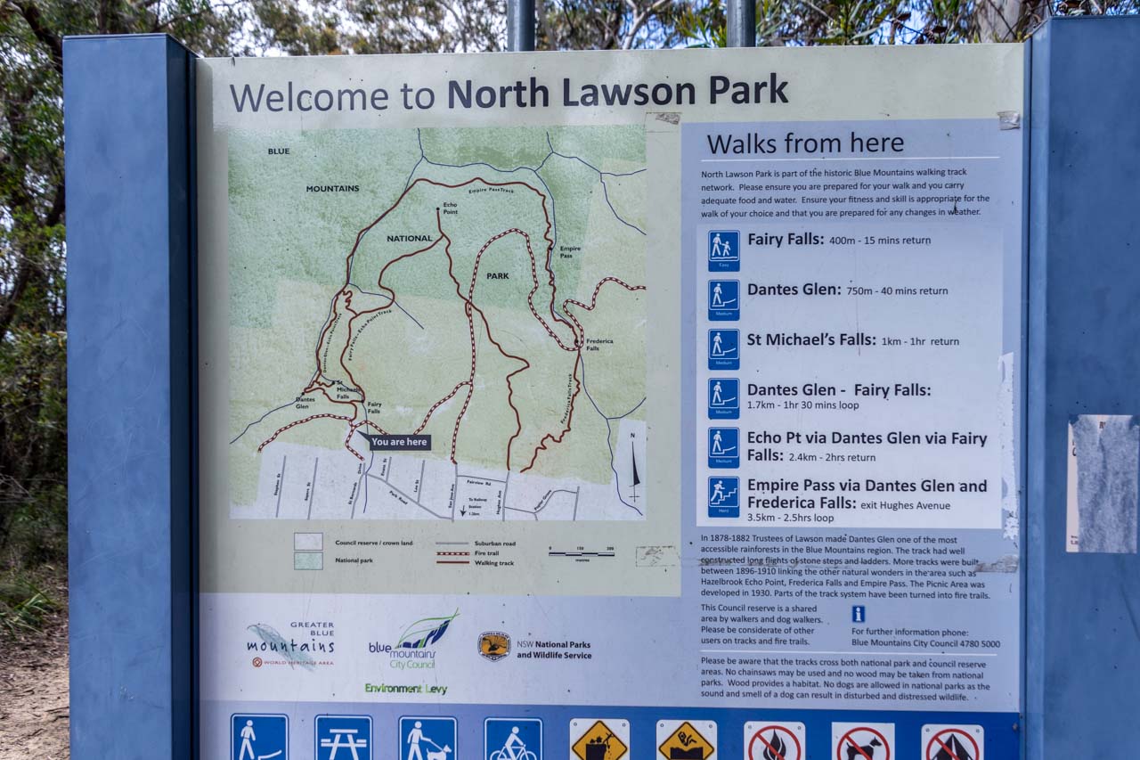
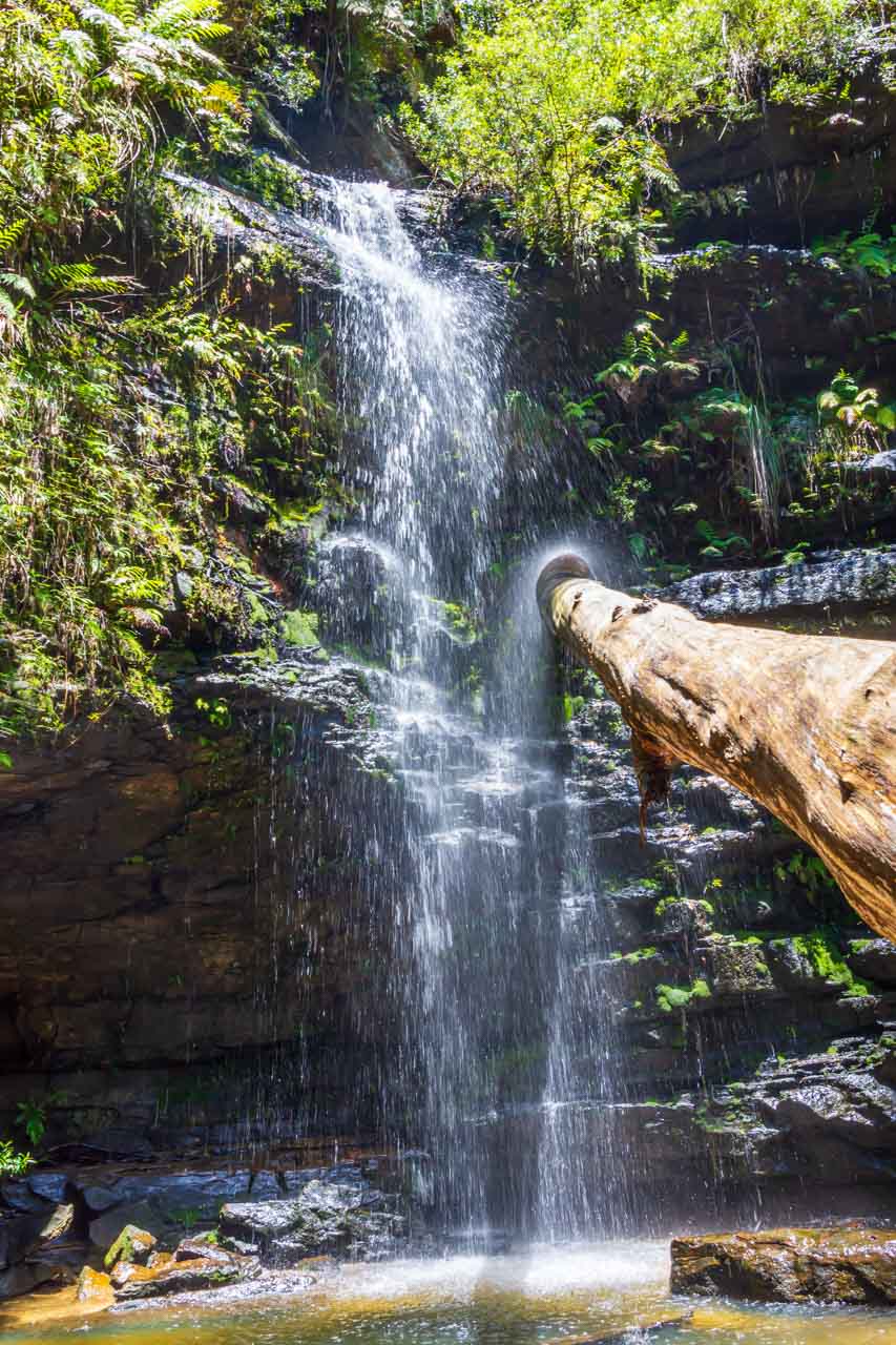
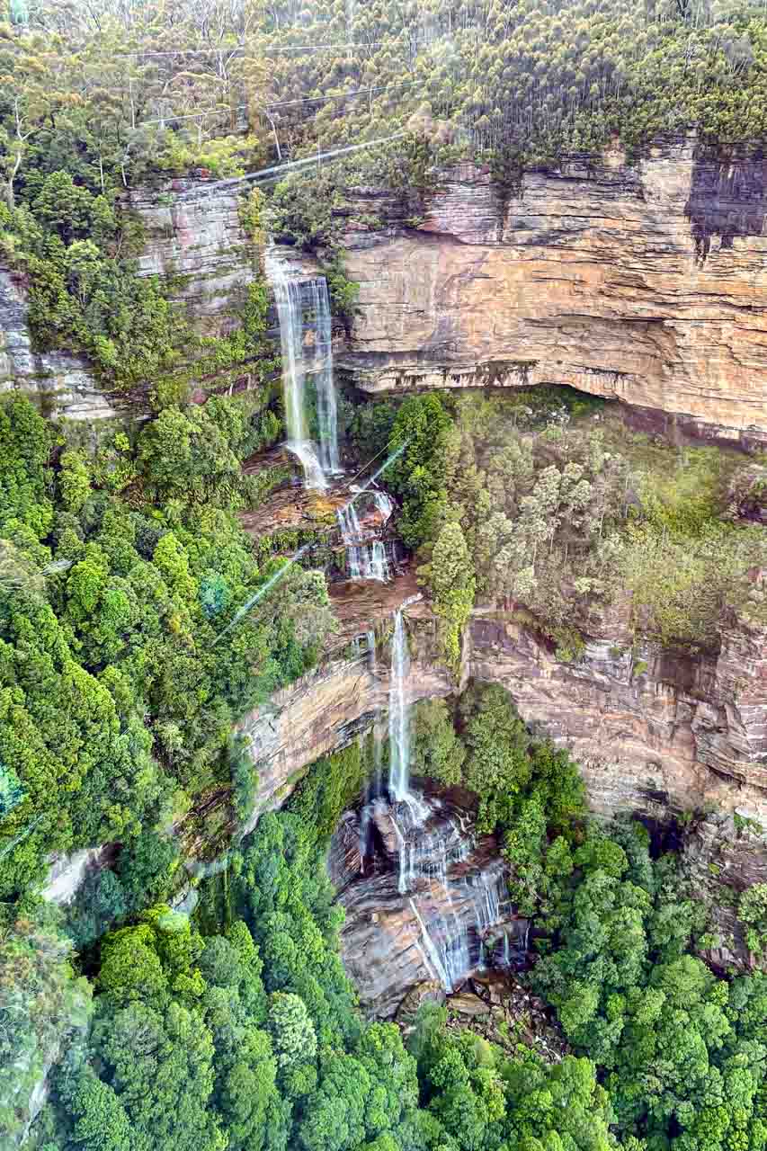
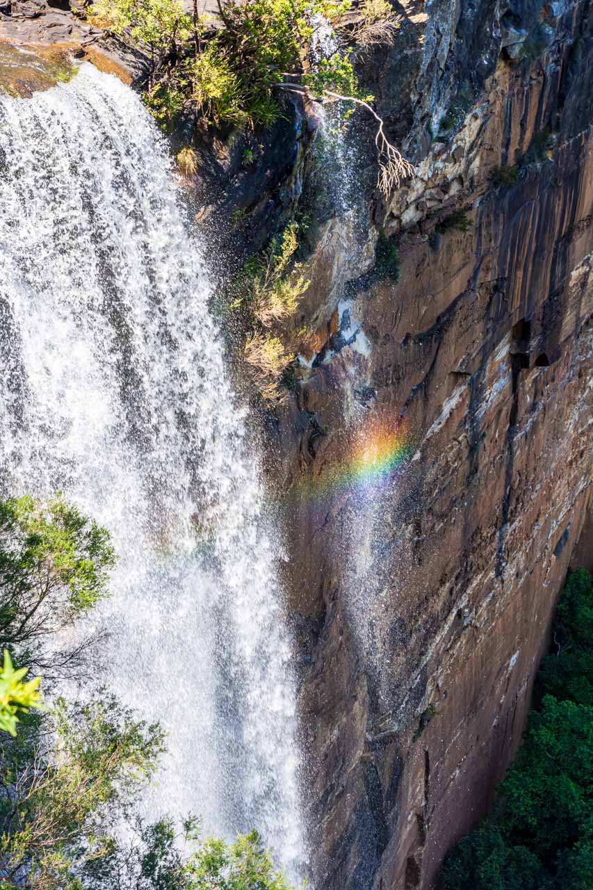
SEE 3 OF THE BEST WATERFALLS IN THE SOUTHERN HIGHLANDS, NEW SOUTH WALES
9 BEAUTIFUL BLUE MOUNTAINS WATERFALLS + PHOTOS
Author’s Note: Please check the latest travel restrictions before planning any trip and follow government advice.
No Comments on LITCHFIELD NATIONAL PARK – See 3 Stunning Waterfalls on a Day Tour From Darwin