So, how do you best spend your free time in Rothenburg? The short answer to this question is, WALK. Being relatively flat, Rothenburg’s Old Town is easy to walk around,…
So, how do you best spend your free time in Rothenburg? The short answer to this question is, WALK. Being relatively flat, Rothenburg’s Old Town is easy to walk around, despite the cobblestone streets. If you don’t stop to window shop, it should only take you about 15 minutes to walk from one end of town to the other.
But I am getting ahead of myself here.
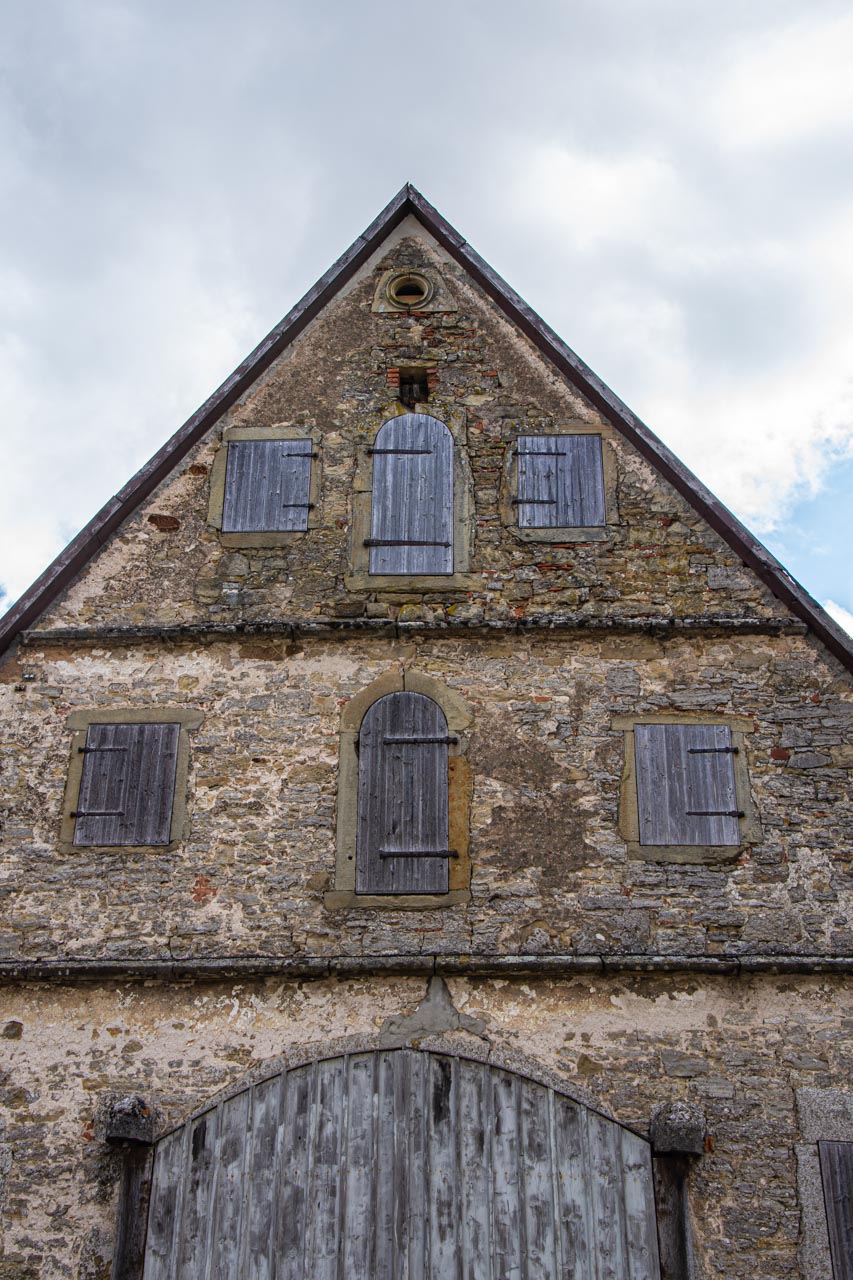
Firstly, Rothenburg is the common abbreviation for this German town’s full name; that being, Rothenburg ob der Tauber. Translated, Rothenburg ob der Tauber means, “Red Fortress above the Tauber”. Red Fortress above the Tauber is an apt name. The town is situated on a plateau above the Tauber River. While ‘Red Fortress’ – translated from rot (red) and burg (burgh, fortified settlement) – is attributed by some to the red roofs of Rothenburg’s houses inside the fortification.
‘Red Fortress’ – the red roofs of the houses behind Rothenburg’s fortifications
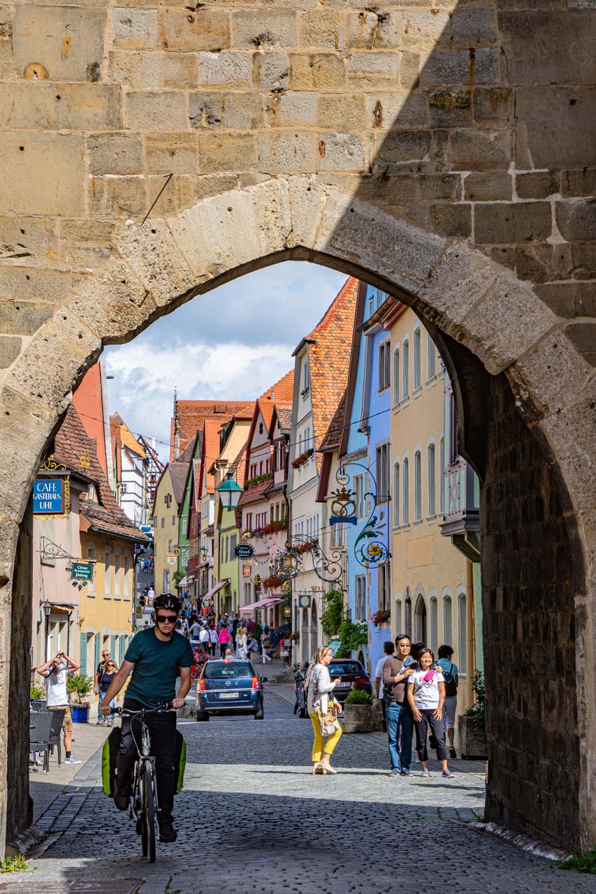
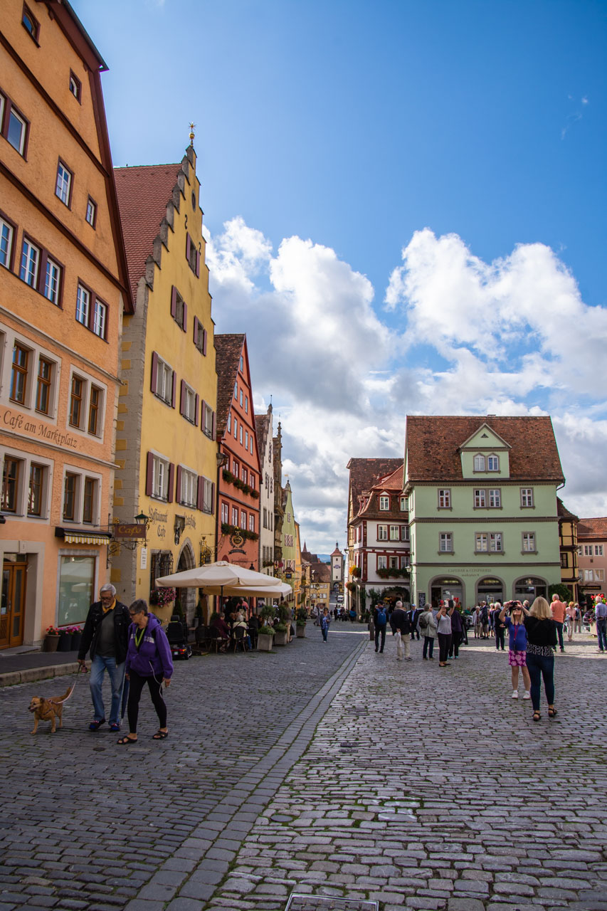
Secondly, why visit Rothenburg ob der Tauber in the first place? With its medieval architecture, narrow cobblestone streets and intact fortification wall, Rothenburg ob der Tauber is considered one of the prettiest towns in Germany. It is a medieval town frozen in time and said to be the most perfectly preserved, medieval walled city in Europe. Rothenburg ob der Tauber is one of Germany’s last remaining walled medieval towns, reached via the ‘Romantic Road’ in the Franconia region of Bavaria in southern Germany. There are photo opportunities everywhere you look.
Rothenburg ob der Tauber is 1000 years of history in the making. It was one of the largest cities in the Holy Roman Empire; survived a siege in 1631 during the Thirty Years’ War between Protestant and Catholic states in the Holy Roman Empire (1618-1648); and stagnated in 1634 due to poverty and plague. It is this latter that preserved Rothenburg in its 17th century state. But this post is not intended to be a history lesson. However, it is worth pointing out that Rothenburg survived WWII substantially intact because its historical significance was recognised and acknowledged by the invading British army. What this post does focus on is a visualisation of Rothenburg ob der Tauber. Through my photographs, I hope to arouse your senses enough to step back in time and visit this beautiful town.
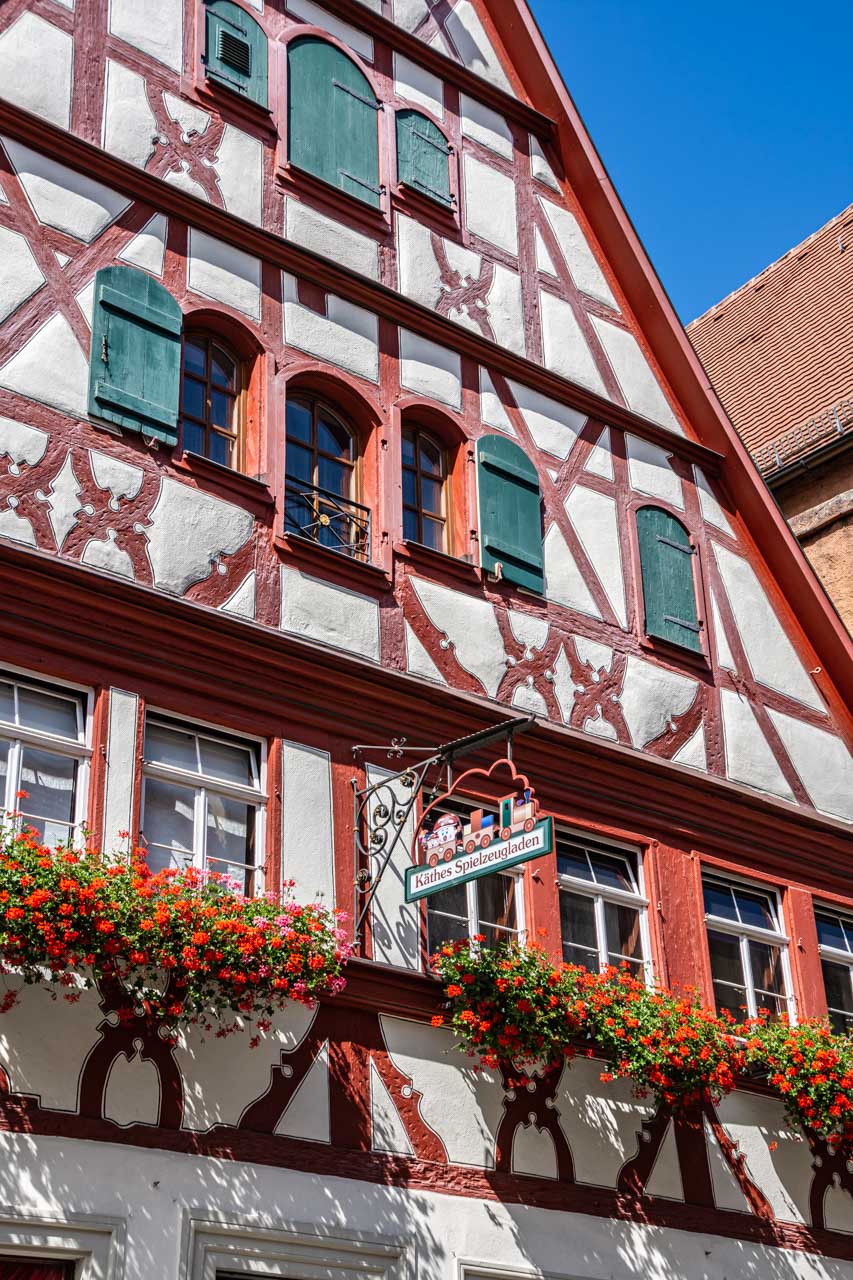
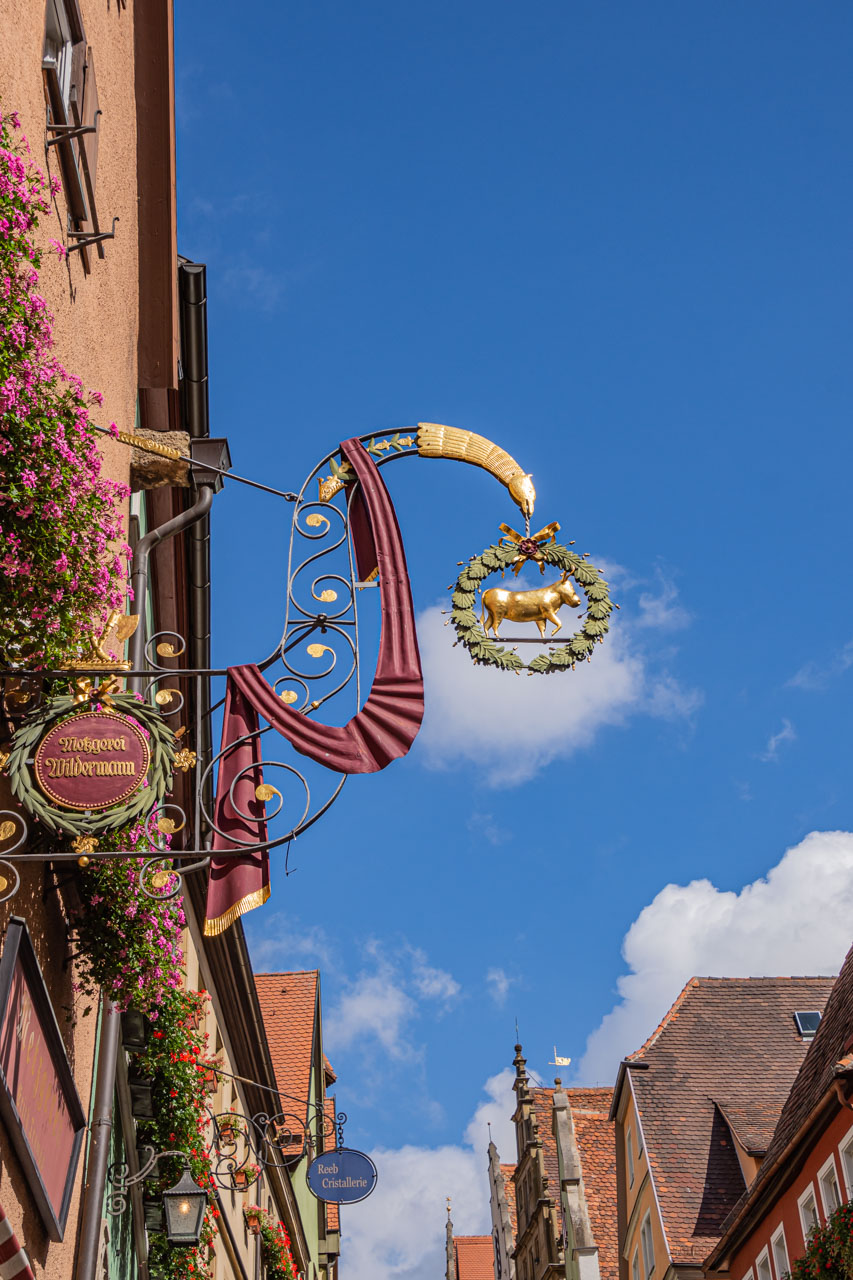
My time in Rothenburg ob der Tauber was on an optional day excursion from my river cruise when we were docked at Wurzburg, Germany. I chose this excursion because I couldn’t resist visiting a place where the Viking Cruise Documents used words like, ‘romantic’, ‘walled’, ‘medieval’, ‘preserved’, ‘inviting’, and ‘picturesque’ to describe it. I was not disappointed, and I immediately fell in love with this picture-perfect, medieval walled town. With its half-timbered houses, elaborate shop signages, and window boxes full of geraniums, every turn was a picture postcard moment.
A half-timbered house makes a great location for a toy shop
The ‘cow’ butcher shop ornate sign, geraniums and rooftops
It was a 1½ hour drive from where the ship was docked at Wurzburg to Rothenburg ob der Tauber. The drive took us along the ‘Romantic Road’. I can’t tell what was romantic about it because I slept most of the way. I believe it has something to do with being a picturesque countryside. I do know that each time I roused from my sleep it was to a view of a vineyard. Shame I slept so much!
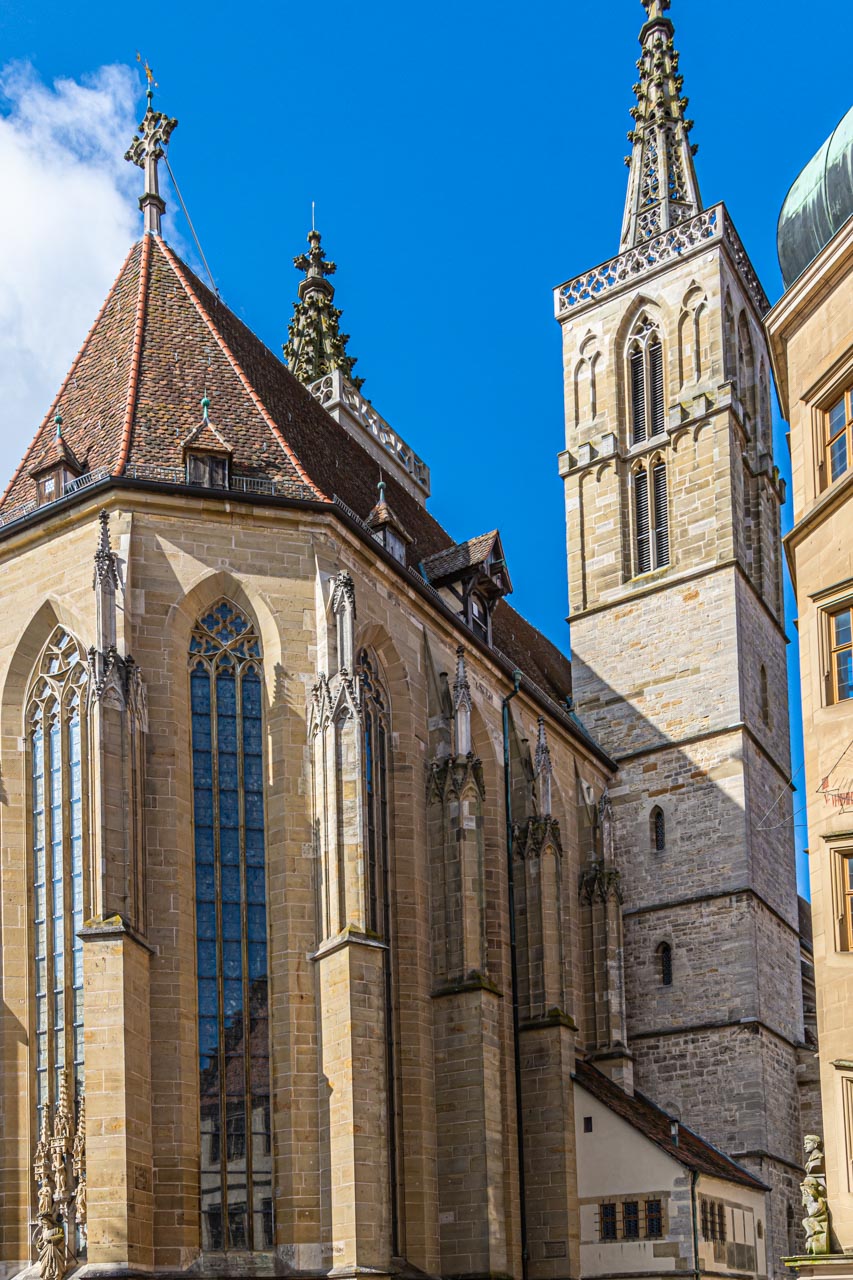
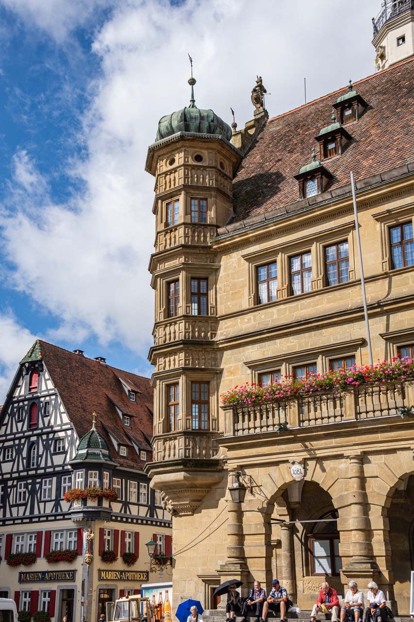
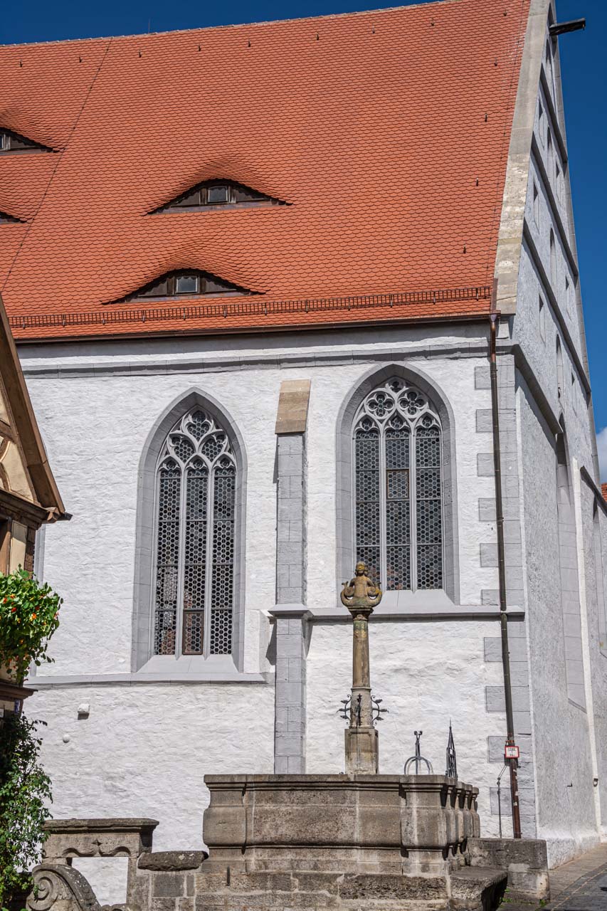
Once in Rothenburg ob der Tauber, our guide gave us an orientation walking tour; taking us past St James Church, through Market Square with its 13th century Gothic/Renaissance Town Hall, past fountains, museums and amazing architecture, explaining the relationship between shops and their signage, and ending at St John’s Church (our meeting point for lunch).
St James (Lutheran) Church
The Town Hall and half-timbered house in Market Square
A picturesque narrow street with signage and tower
St John’s (Catholic) Church and locust fountain
With the orientation completed, we were left to spend our free time as we pleased. I wasn’t interested in the well-known Christmas shop. And I decided to take the guide’s advice and not try the local ‘delicacy’, a Schneeball, which he described as “horrible”. This is deep-fried dough shaped like a snowball and covered in either confectioner’s sugar or chocolate. In our guide’s own words, “you will choke on a Schneeball if you don’t take a drink of water with each and every bite to wash it down”.
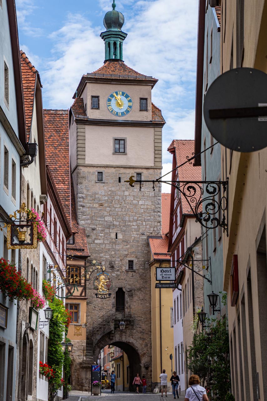
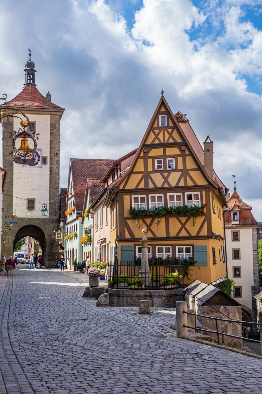
I wanted to explore and photograph my own experience; to follow the direction of my feet. And I only had 1½ hours to do this in. After pointing my feet in the direction of what the guide said is the most instagrammed photo in Rothenburg ob der Tauber, I headed for the town’s fortifications.
The Plonlein is the most instagrammed image in Rothenburg
I cannot fathom why this crooked, half-timbered house on Plonlein (Little Square) is the most instagrammed image in Rothenburg ob der Tauber; why it should be so photographed. I have read that it has featured in a number of movies and been the inspiration for others, but the town is full of much more interesting, charming architecture. If anyone can enlighten me, that would be appreciated. Or, better still, go check it out for yourself.
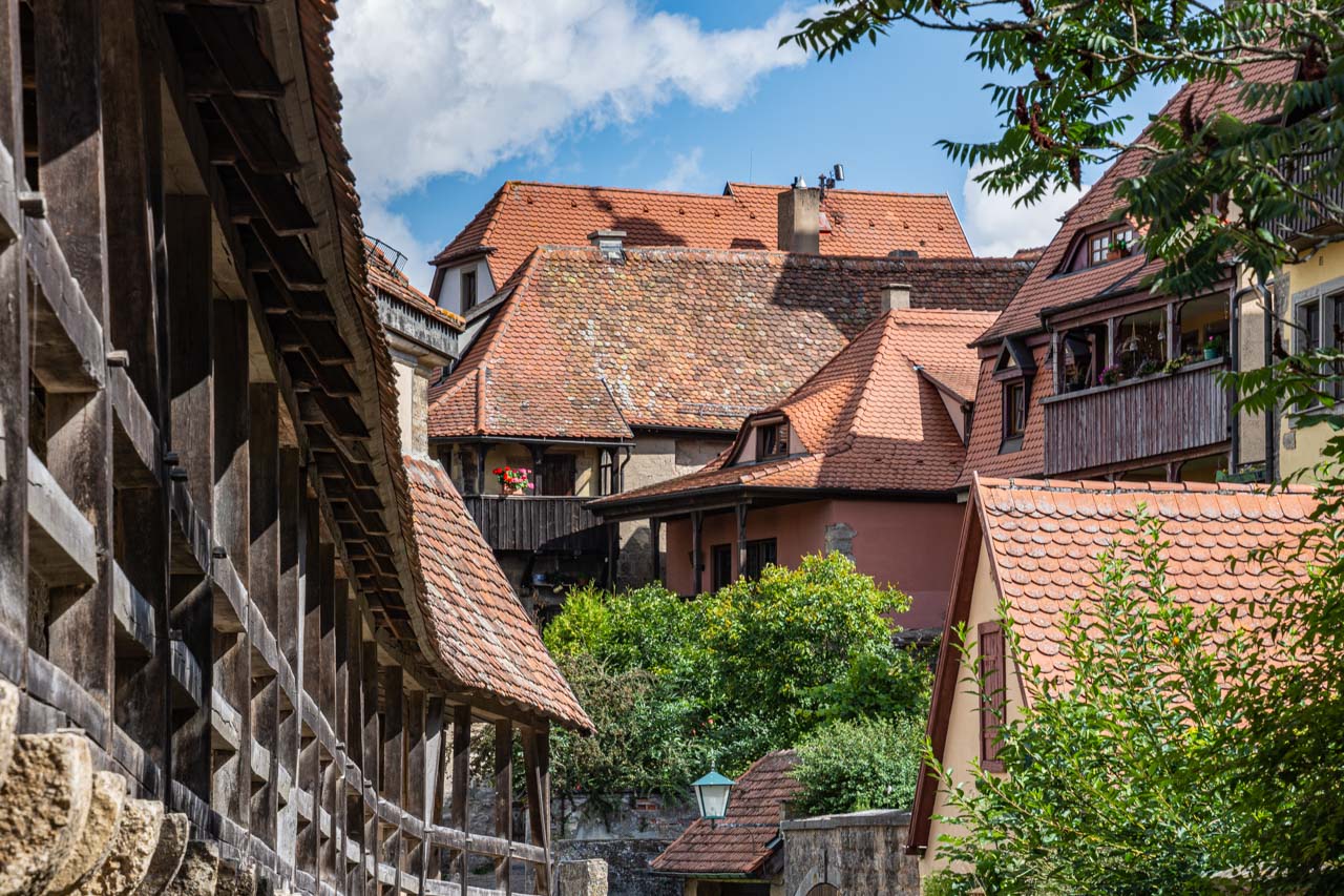
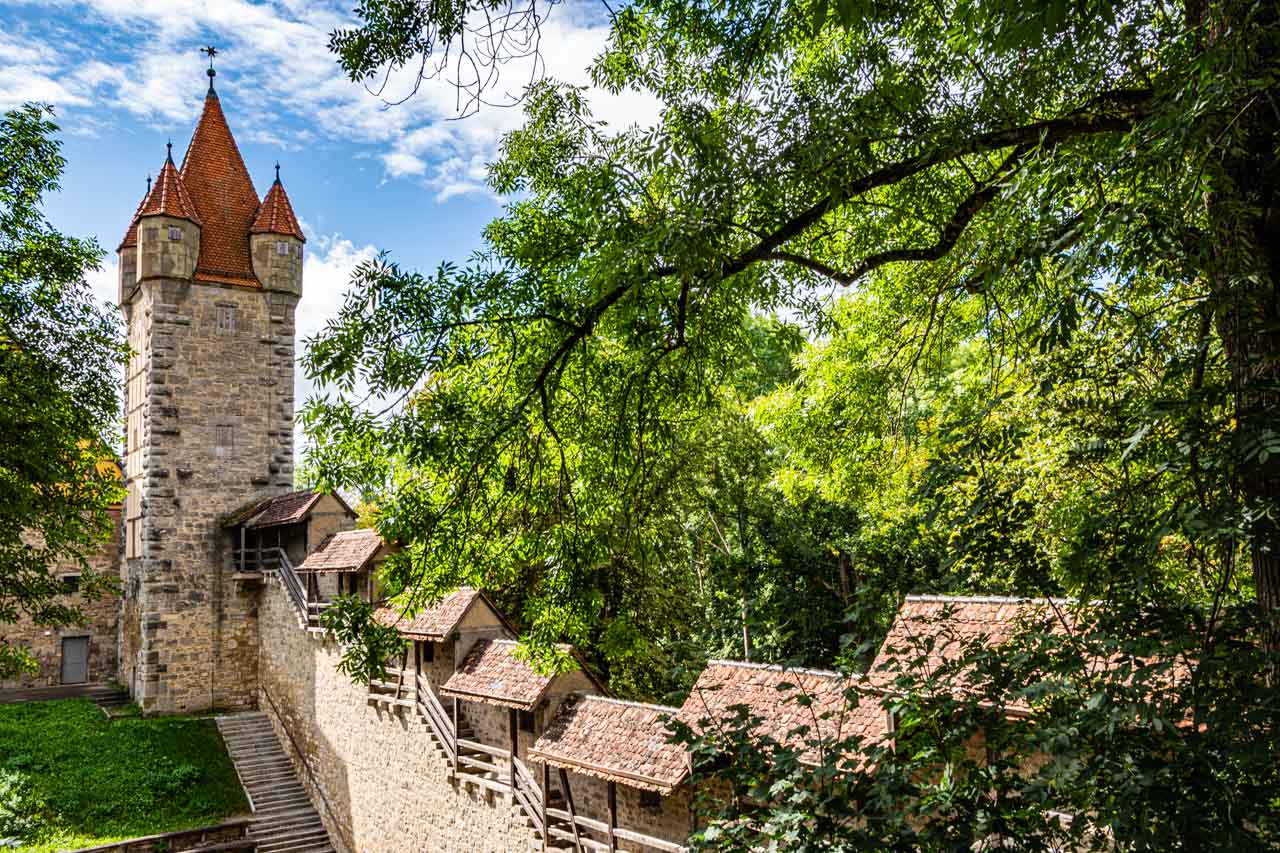
Taking the Kobolzeller Gate (built 1360) to the right as you face the half-timbered house in the ‘most instagrammed photo’, I climbed the few steps to the town’s medieval wall. Rothenburg ob der Tauber’s medieval wall, built in the 13th century, is 4 kilometres long and completely encircles the town’s historical centre. Walking along the wall, there are 6 gates and 42 towers to explore. With my limited time, I only managed 2 gates (up through one gate and down through the next) and a handful of towers. Despite all the tourists in town, I had the wall to myself – a very pleasant experience.
The medieval wall encloses Rothenburg’s houses
A section of the medieval wall with one of the 42 towers
Coming off the wall, I proceeded to walk in a large circle that took me back to Market Square.
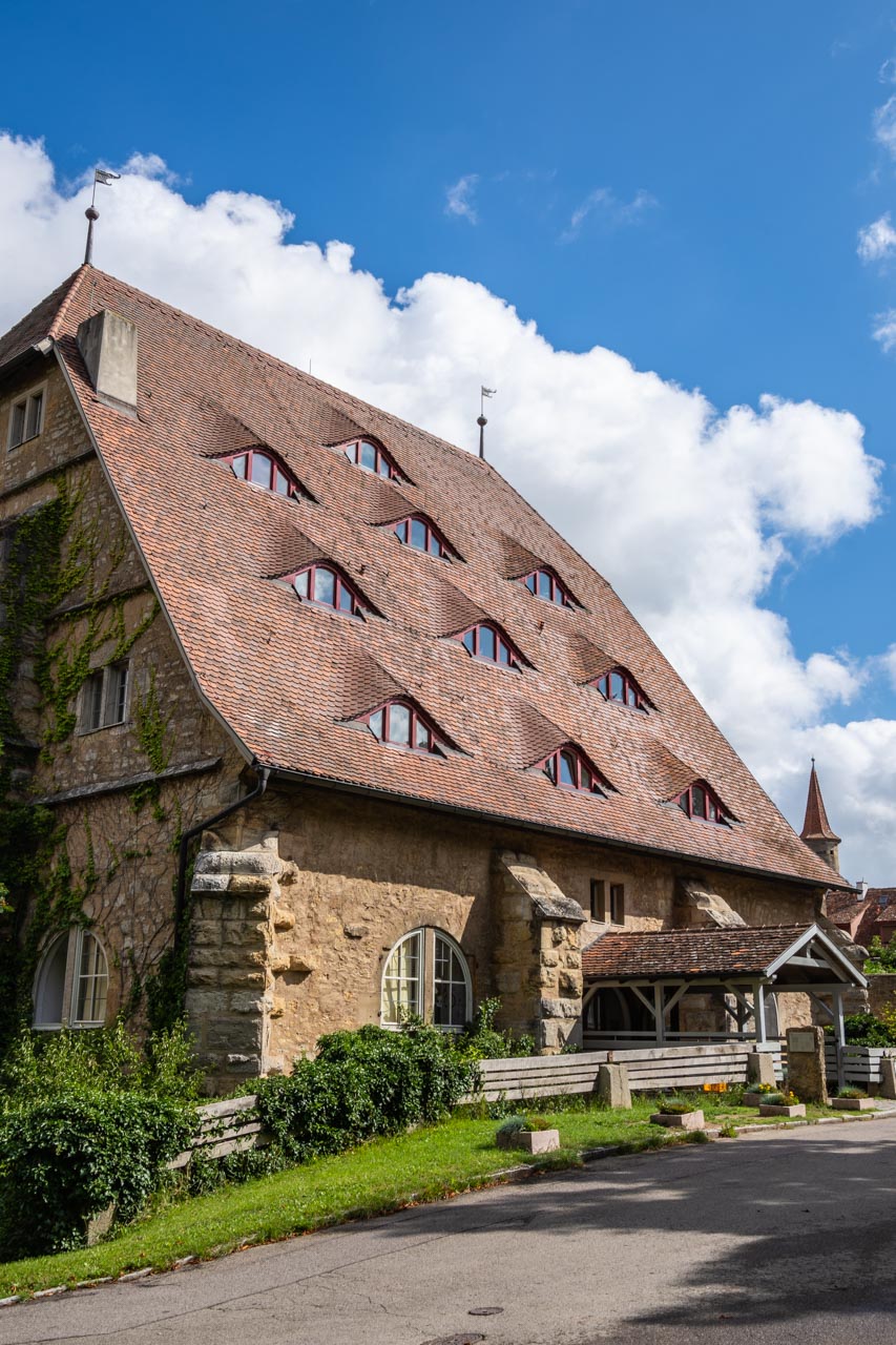
The former Horse Mill (built 1516) is now Rothenburg’s youth hostel
Medieval architecture. This half-timbered house is locked in time
The Master Builder’s House (built 1596) presents a different architectural style
I loved the textures of this old warehouse
Street view of shops, their ornate signs and tourists through a tower
Cafes line Market Square
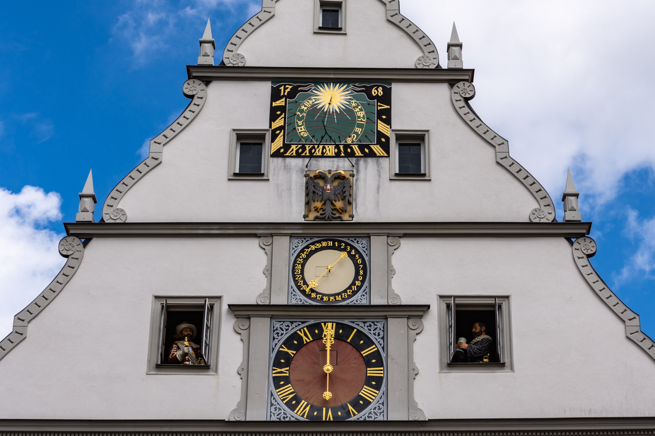
I was back in Market Square in time for when the clock on the 14th century Councillor’s Tavern performs its hourly ritual. Our guide had informed us that on the hour between 10.00am and 10.00pm two doors open on either side of the clock face. Out comes Rothenburg’s former Mayor, Nusch, and the Catholic General, Tilly, who challenged Nusch to drink a gallon tankard of wine in one go without stopping to save the town during the Thirty Years’ War. And save the town he did! It’s not the most interesting mechanical clock I have seen on my travels, but I did like the story behind it – the “Legend of the Master Draught”.
The “Legend of the Master Draught” mechanical clock on the Councillor’s Tavern
I have to go back to Rothenburg ob der Tauber:
to visit the gardens that replaced Rothenburg Castle which was destroyed in an earthquake in 1356;
to visit the Medieval Crime and Justice Museum;
to hike down into the valley;
to climb the Town Hall Tower to see the views for myself rather than just read about them;
to check out the interior of St James Church and its famous Holy Blood altarpiece;
to sit in a cafe in Market Square and people-watch;
and much more
I reckon this will take me 2 to 3 days (at least).
Rothenburg ob der Tauber, I will see you again.
Disclaimer: This post contains no affiliate links. All views and opinions are my own and non-sponsored. All photos are my own and remain a copyright of Joanna Rath.
Dear Pip, It is from a cold, dark place that I write you this postcard. A place that reminds me of a horrific time in history – a time…
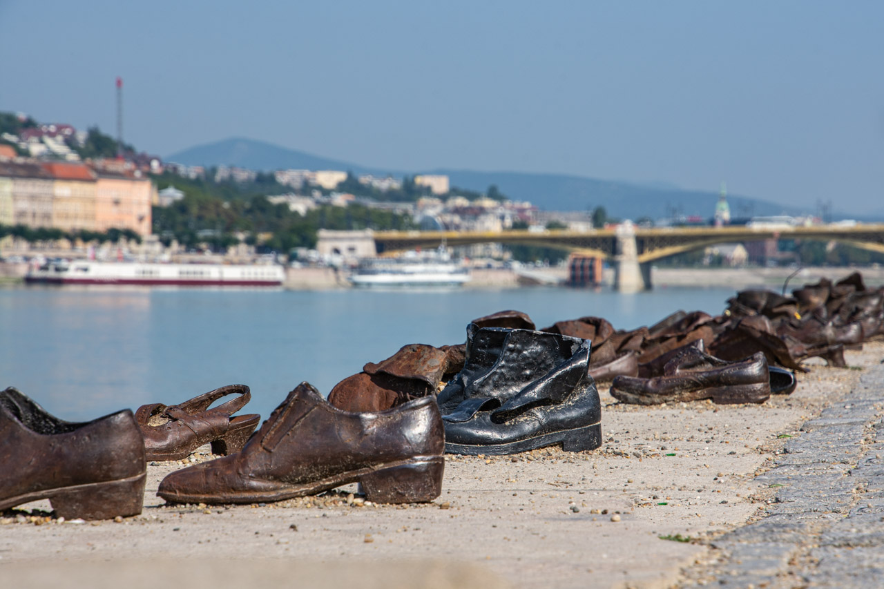
Budapest’s holocaust memorial, Shoes on the Danube Promenade
Dear Pip,
It is from a cold, dark place that I write you this postcard. A place that reminds me of a horrific time in history – a time that should never be forgotten.
I refer to the holocaust memorial, “Shoes on the Danube Promenade” in Budapest, Hungary.
“Shoes on the Danube Promenade” was created in 2005. The memorial comprises of 60 pairs of life size, iron shoes stretching along a section of the Danube’s riverbank. Caste in the style of the 1940s, the shoes are in different sizes; representing the men, women and children this memorial is a tribute to.
“Shoes on the Danube Promenade” holocaust memorial is dedicated to the thousands of Jews (approximately 20,000) who were executed along the Danube riverbank during 1944-1945. They were shot by members of the Hungarian fascist and anti-Semitic organisation, the Arrow Cross Party. The victims were forced to remove their shoes, face their executioner, and were shot so that they tumbled into the river. The river would then carry their bodies away. This saved the Arrow Cross Party having the hard labour of digging graves. The victims were forced to remove their shoes because shoes were a valuable commodity and could be sold by the executioners.
‘60’ was not just a random number of shoes to include in the holocaust memorial. It reflects the 600,000 Hungarian Jews who died during World War 2, and the memorial was created 60 years after the war.
“Shoes on the Danube Promenade” is located on the banks of the Danube River on the Pest side of Budapest between two well-known landmarks, the Chain Bridge and the Parliament Building.
I deliberately set out to walk to this holocaust memorial after our tour guide pointed it out from the bus on the way back to our ship from our walking tour of Budapest’s Jewish Quarter. The memorial is unique; unlike anything I have ever seen. Even with all the tourists, I found the memorial poignant and haunting; a place for reflection and contemplation.
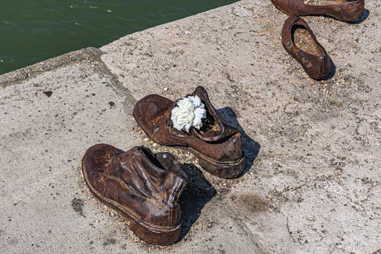
On my way back from the Parliament Building, I passed the “Shoes on the Danube Promenade” holocaust memorial again. Someone had put a white carnation in two of the shoes. I like to think it was the wedding couple who were being photographed nearby. That, on a day that was so memorable for them, they have taken the time to remember and honour those who so tragically had their memories taken from them. Perhaps they were remembering a family member.
I was profoundly moved by this holocaust memorial (more so than any other I have been to on this trip), and thankful for how fortunate I am.
Love,
Joanna
A carnation is placed in one of the memorial shoes as a sign of remembrance
Some of the holocaust memorial’s 60 pairs of shoes on the Danube Promenade
Disclaimer: This post contains no affiliate links. All views and opinions are my own and non-sponsored. All photos are my own and remain a copyright of Joanna Rath.
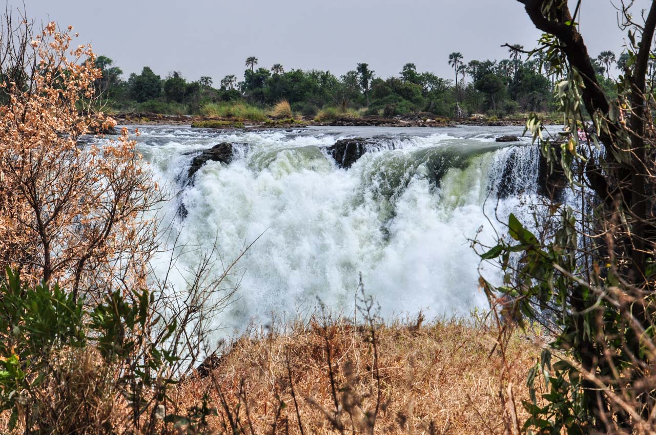
Mosi-oa-Tunya, “the smoke that thunders” is an apt name given to Victoria Falls by the Kalolo-Lozi people. The spray that rises above Victoria Falls truly does look like smoke. And…
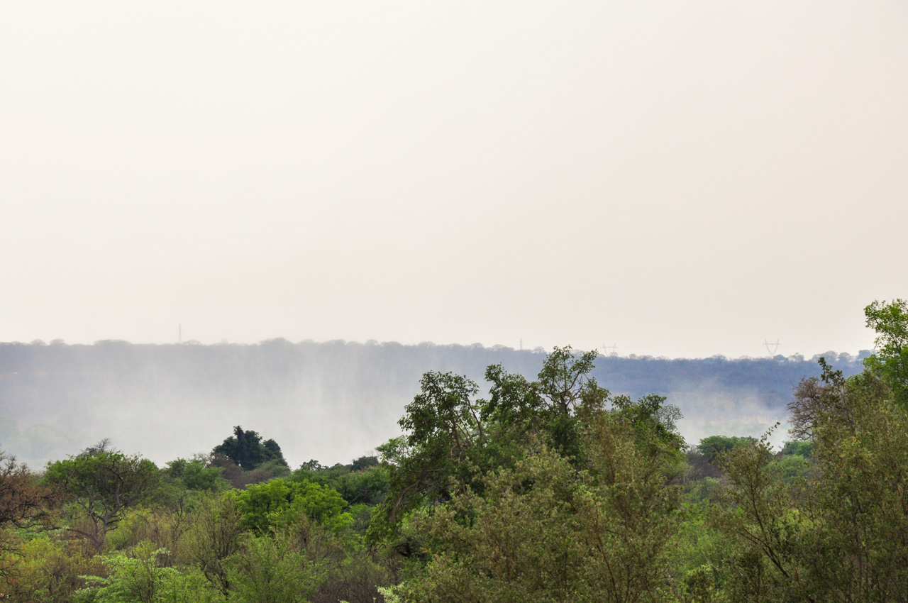
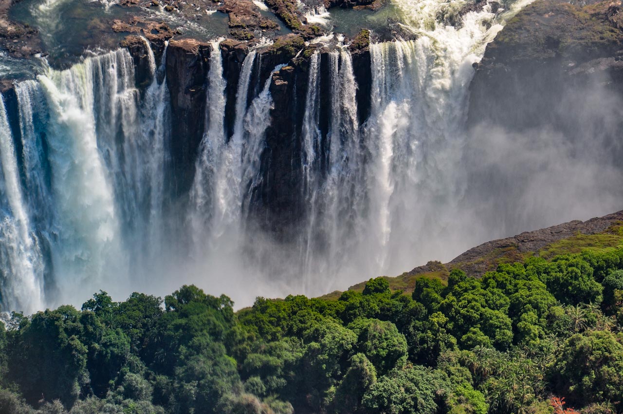
Mosi-oa-Tunya, “the smoke that thunders” is an apt name given to Victoria Falls by the Kalolo-Lozi people.
The spray that rises above Victoria Falls truly does look like smoke. And this ‘smoke’ can be seen from some distance. I had a clear view of the ‘smoke’ rising from the Falls from my hotel in Victoria Falls, Zimbabwe, one kilometre away.
The ‘smoke’ from Victoria Falls rises above the skyline
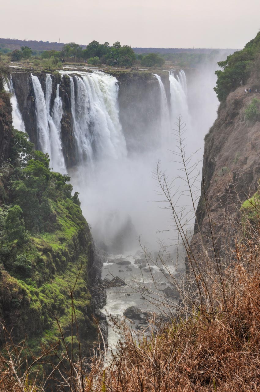
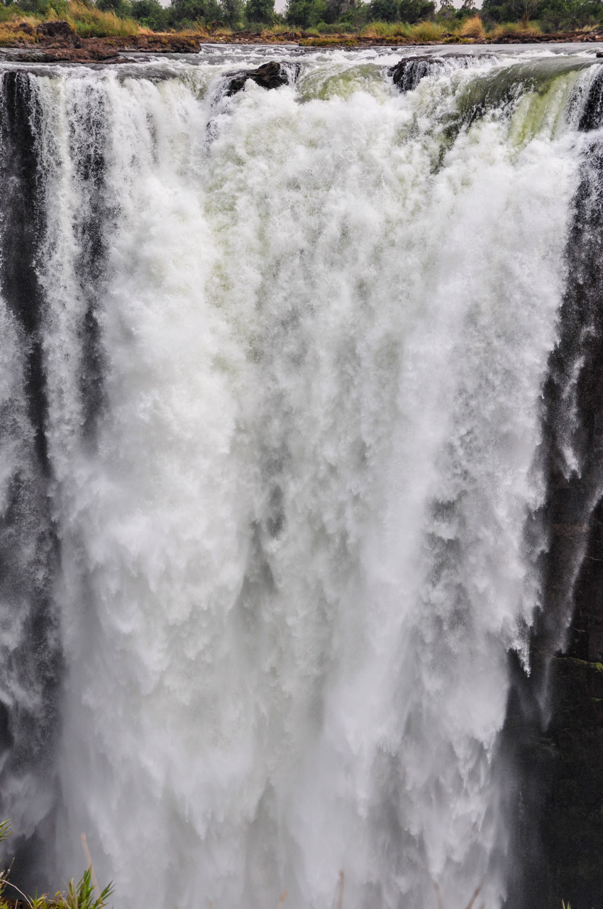
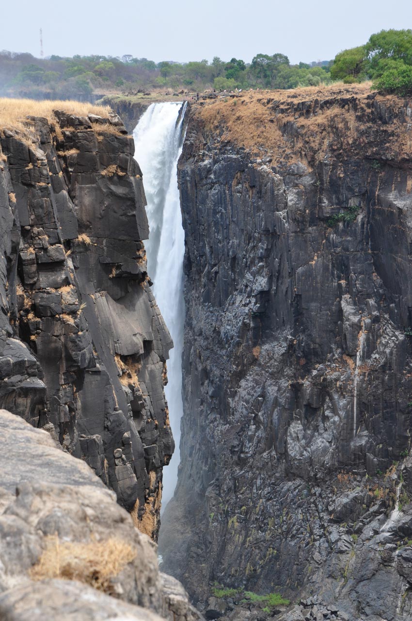
Walking around the escarpment on the Zimbabwean side of Victoria Falls, the roar the Falls produce from the volume of water crashing over the edge of the gorge makes it difficult to hear conversations.
Victoria Falls is located on the border between Zambia and Zimbabwe. I travelled to the Zimbabwean side of Victoria Falls in November 2016. It was the end of the dry season; with November being ‘low water’ for the Zambezi River. When the Zambezi River is in full flood (usually February or March), Victoria Falls forms the largest curtain of water in the world. At my time of visit, Victoria Falls was at 40% capacity. And yet, it did not disappoint.
I will be writing a detailed itinerary blog post on my visit to Victoria Falls in the near future. But for now, I just want to showcase the majesty of “the smoke that thunders” from my camera’s perspective – to let my camera do the talking.
My camera’s perspective of the smoke that thunders: a walking tour
My camera’s perspective of the smoke that thunders: a helicopter tour
Due to Victoria Falls’ reduced volume of water cascading over the edge of the gorge, I wasn’t going to take a helicopter flight over the Falls. At the last minute I changed my mind – one of my better decisions. My camera’s perspective gained a unique angle of the smoke that thunders.
Which camera perspective do you prefer?
A note on protecting your camera
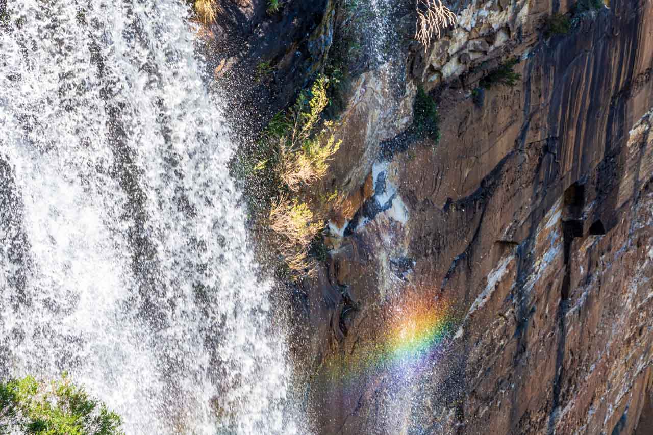
Walking along the escarpment, you and your camera are going to get wet from the spray spewed up by the sheer volume of water crashing down the cliff face to the floor below.
Whether or not you keep yourself dry is up to you. But it is important to keep your camera dry if you want it to continue working.
I have a DSLR camera and have tried two different professional ‘raincoats’ for my camera. Each time, I revert back to my tried and tested method of a plastic bag. I attach the lens hood as this provides some protection for the lens glass and filters. Then, using a wide plastic bag that is longer than my camera body and extended lens (300mm), I make a hole in the bottom of the bag. I slip the lens through the hole and secure the plastic bag to the lens with a rubber band. Pulling the plastic bag up over the camera, the camera is kept dry, I have good access to all the camera’s dials, I can clearly see through the viewfinder and see the back of the camera, and I have plenty of room for my hands. And the lens can still be extended and retracted.
My experience of professional camera raincoats is so opposite to that of my plastic bag. I found them restrictive, providing poor visibility through their plastic window, and having limited space for my hands.
I also carry a microfibre cloth so I can wipe the water droplets off the lens glass.
Disclaimer: This post contains no affiliate links. All views and opinions are my own and non-sponsored. All photos are my own and remain the copyright of Just Me Travel.
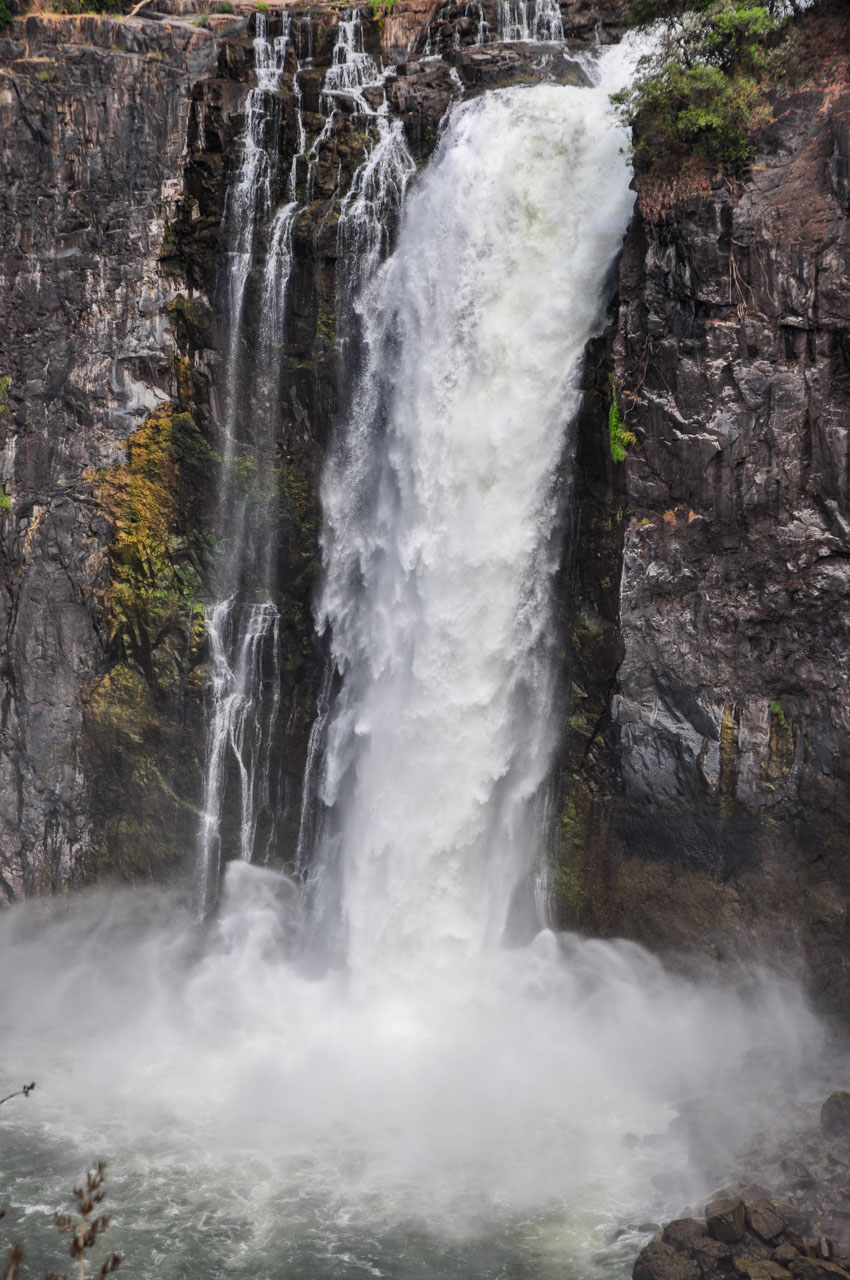
For more on waterfalls worldwide, read the post below and check out the photos.
Travel magazines and tour companies have named Sri Lanka as one of the destinations for 2019 – a must see, bucket list destination. I travelled to Sri Lanka with my sister…
Travel magazines and tour companies have named Sri Lanka as one of the destinations for 2019 – a must see, bucket list destination.
I travelled to Sri Lanka with my sister and brother-in-law for a 23-day trip around this teardrop shaped island. This was a private tour with our own driver. However, it is also possible to travel around Sri Lanka by taxi, bus or train.
I still hold mixed feelings about my trip to Sri Lanka. After all, we can’t always expect to like everything about every country we visit. That said, Sri Lanka held some highlights for me that are well worth mentioning, such as walking the railway line between Ella and Demodara and our visit to Geoffrey Bawa’s garden. I also highly recommend visiting Galle Fort. In fact, it is worth staying at least a couple of nights.
Galle Fort is a historical fortified city, with the New Town of Galle located outside the walls. Galle is situated on the southwestern tip of Sri Lanka – a distance of 126 kilometres (78 miles) down the west coast from Colombo (Sri Lanka’s capital).
Why visit Galle Fort
Galle Fort is rich in history; with 400 years of history spaning Portuguese, Dutch and British colonialism. Built by the Portuguese in 1589, the Dutch seized the Fort in 1640 and extended its fortifications, which survive to this day. The British modified the Fort after Galle was handed over to them in 1796. Galle Fort is a UNESCO World Heritage Site and remains the best example in south and southeast Asia of a fortified city built by Europeans.
Galle Fort is protected by a wall (ramparts), with 14 bastions, that has seen little change since completion by the Dutch in 1729. The fortifications run for 3 kilometres and are over 1 metre thick. Inside the Fort is a mixture of architecture, with Dutch-colonial buildings, ancient mosques and churches, and grand mansions. Here you will find cafés, restaurants, boutiques, museums, and hotels. It is also a thriving commercial centre.
With an area of only 0.52 kilometres square within the fortifications and being relatively flat, Galle Fort is easy to walk around and to see everything. It is also a good base for day trips to the southern beaches, gardens, tea factories, rain forests, and nature walks.
From Colombo to Galle Fort
At the suggestion of our driver we took the coast road to Galle rather than the expressway. While taking the expressway would have been quicker (approximately 1.5 hours as opposed to approximately 3 hours), the coast road, according to our driver, is more interesting; more scenic. And it was. Hugging the coastline, we passed through many small villages which provided a glimpse into local daily life; where farmers and fishermen continue to live and work as they have done for generations.
This was our first real experience of driving in Sri Lanka. I have been in many a country where I thought the population as a whole are terrible drivers, but Sri Lankan drivers take the prize. Their idea or practice of passing is downright scary. Picture this … You have a two-lane road just wide enough for two cars, with one lane for each direction. Suddenly, your lane has three vehicles abreast (including your own, with your driver on his mobile phone) as two vehicles want to pass one, and there is a bus coming in the opposite direction. No one gives way as all four vehicles come abreast and all you can do is close your eyes and hold your breath. And yet, I never saw an accident.
I learned a valuable lesson on this drive – don’t ever think of doing a self-drive holiday in Sri Lanka as you may never survive the experience. Their driving and use of the roads are, for these foreigners, positively frightening. My brother-in-law was never able to relax when we were driving. For some reason, he always managed to get the seat with a clear view out the front windscreen. Causing him to remain transfixed on the traffic and in a perpetual state of anxiety.
Galle Fort
We arrived in Galle Fort mid-afternoon. Our hotel for the duration of our stay in Galle Fort was the Fort Bazaar, inside the Fort itself.
The Fort Bazaar (at 26 Church Street, Galle Fort) was formerly a 17th century merchant’s townhouse. Opening in 2016 in its current status as a small, boutique spa hotel, its 18 rooms are very spacious, cool and furnished with comfortable four-poster beds. Unfortunately, at the time of stay (April 2017), the pool and spa were not yet completed, and they were still waiting on a liquor licence. However, it is in a very central location within the Fort and complimentary tea and cakes were served daily between 3.00 and 4.00pm. My kind of hotel. I could not fault the staff, who were friendly, attentive and helpful. Sri Lankan hospitality at its best.
Note: The Fort Bazaar, according to a recent view of its website, now has a pool, a spa, and a liquor licence.
Due to the lack of a liquor licence (which did not suit at all), we booked dinner in the restaurant at the Galle Fort Hotel (at 28 Church Street), which came recommended by guide books.
The Galle Fort Hotel was a former gem merchant’s mansion. The restaurant’s setting was picture perfect, with the tables set up on the wide veranda overlooking the pool and garden.
However, dinner was less than ordinary, and the service was very slow even though there were only a few diners. In the heat and humidity, all we wanted was a cold drink to start with. But, once seated, we were suddenly invisible. We were starving by the time they remembered to take our meal orders. We do not recommend the restaurant in the Galle Fort Hotel.
A walk around Galle Fort
Over dinner, we decided to make an early start for our walk around Galle Fort, its bastions and ramparts (walls) the next day, so that our walk would be completed before the day got too hot. In hindsight, it makes no difference in April, heat-wise, what time of day you venture out as it is always very hot and wet (humidity, not rain).
On this day that we decided to do our walk, the humidity was 80% and caused some havoc with our DSLR cameras – fogged up lenses and constant error messages. While I have never found out conclusively if these problems were due to the humidity, it is certainly something to be aware of.
The humidity also impacted on my clothing. I wasn’t just dripping perspiration, I was completely wet. I was wearing a dark pink t-shirt that I had washed several times prior to this trip. However, the pink dye was coming out of my t-shirt. It stained my body, and my camera strap and my camera where they were touching the t-shirt. To top it off, the colour was completed bleached out of the t-shirt where my backpack was touching it – to the point where my t-shirt looked as though it had been tie-dyed.
After a leisurely breakfast at the Fort Bazaar of fresh fruit, bacon and eggs, and freshly ground coffee, we set off on our self-guided tour (walk) of Galle Fort.
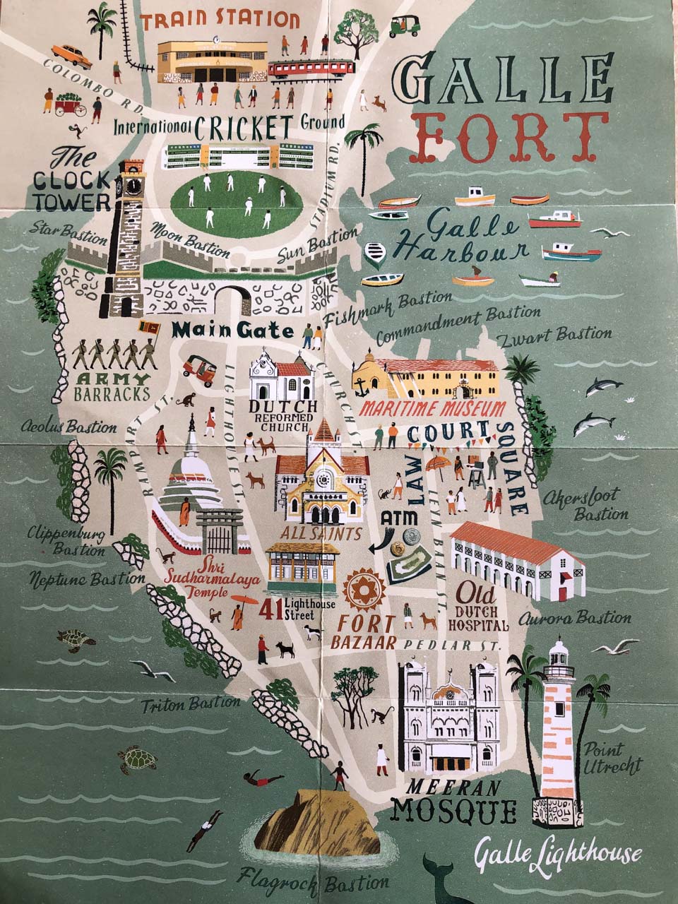
(Map courtesy of the Fort Bazaar)
All Saints Anglican Church
Walking up Church Street (Galle Fort’s main thoroughfare) towards the main gate and the Clock Tower, we passed All Saints Anglican Church (its stumpy steeple, a distinctive landmark) and the Maritime Archaeological Museum
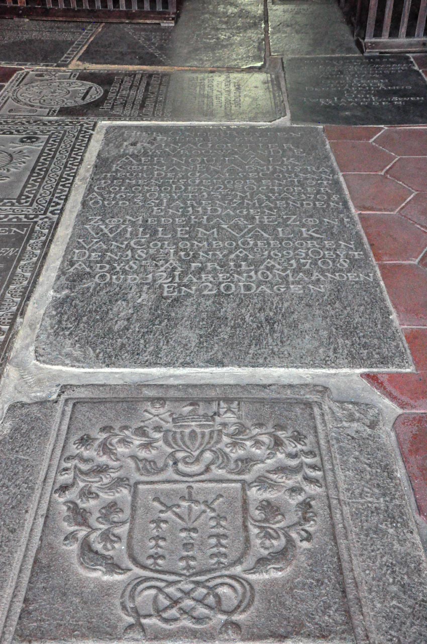
The tombstones laid in the floor of the Dutch Reform Church
Our first stop was at the Dutch Reform Church. Originally built in 1640, the floor of the Dutch Reform Church is laid with tombstones which were moved there from the Dutch cemeteries. The oldest of which dates from 1662. There are more tombstones in the grounds of the church.
Leaving the Dutch Reform Church, we continued up Church Street, making our way to the Clock Tower; our starting point for our walk along the Fort’s ramparts.
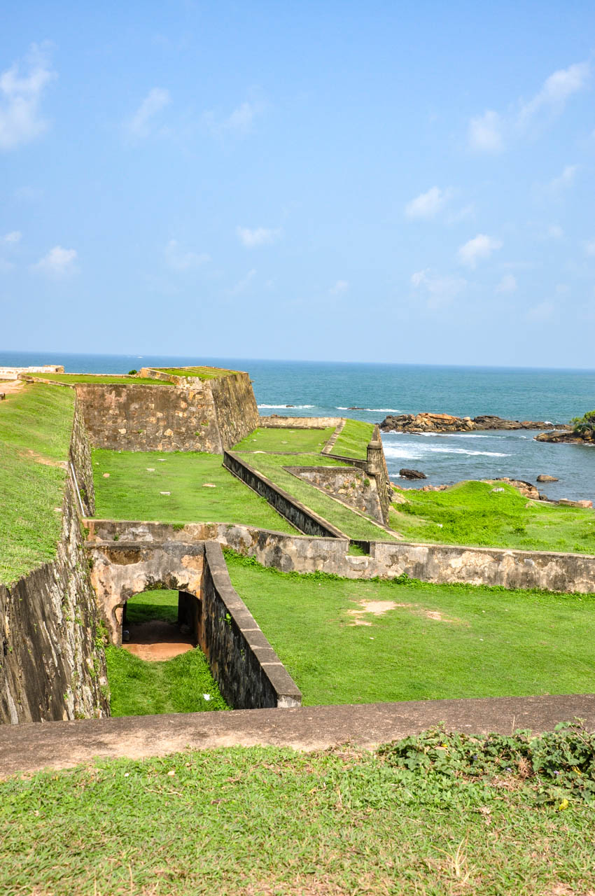
Heading east and past the Main Gate, we walked up onto the ramparts at the Moon Bastion with its Clock Tower that was built by the British in 1882. From here we were able to look down the ramparts (east and west) to the Star Bastion and Sun Bastion.
This is the most heavily fortified section of the ramparts as they protect the most vulnerable side of the Fort – the northern landward side. Galle Fort is surrounded on three sides by the Indian Ocean.
For those cricket fans…These northern ramparts provide a good view of the Galle International Cricket Stadium outside the Fort. This massive, 30,000-seater stadium has hosted more than 100 one day international matches. Australian bowler, Shane Warne claimed his 500th Test wicket at the Stadium in 2004. In 2010, Sri Lanka’s legendary cricket player, Muttiah Muralitharan played his last match at this venue. However, as at July 2018, the Galle Stadium was a risk of loosing its UNESCO World Heritage status due to the unauthorised construction of the 500-seat pavilion.
Galle Fort’s clock tower
The Moon Bastion and clock tower on Galle Fort’s ramparts
View towards the Star Bastion along Galle Fort’s ramparts
Looking towards the Sun Bastion on Galle Fort’s ramparts, Sri Lanka
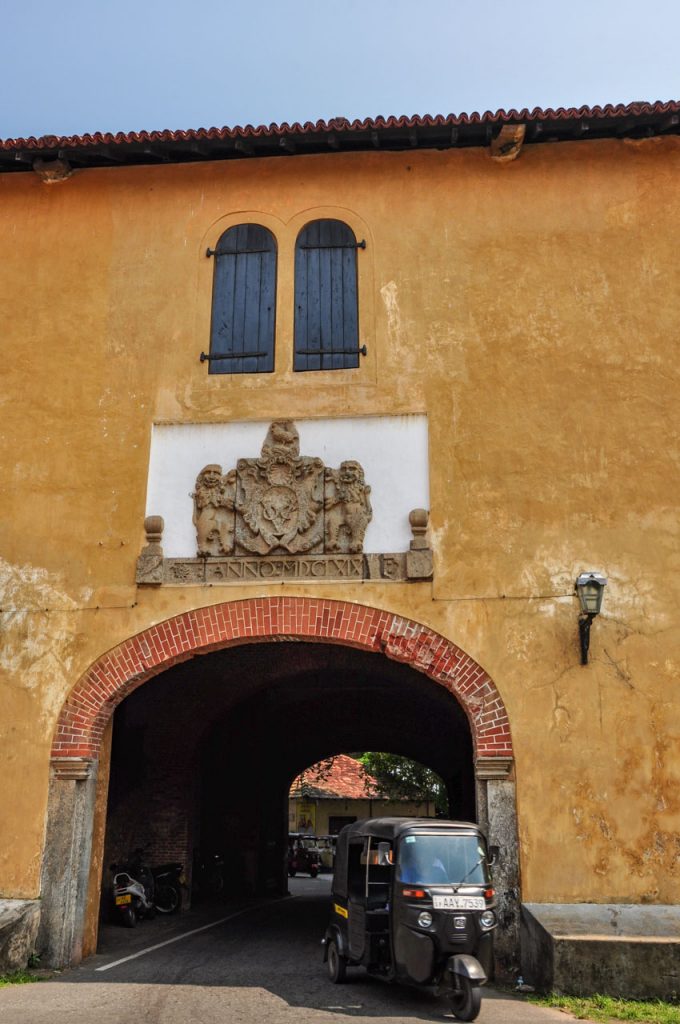
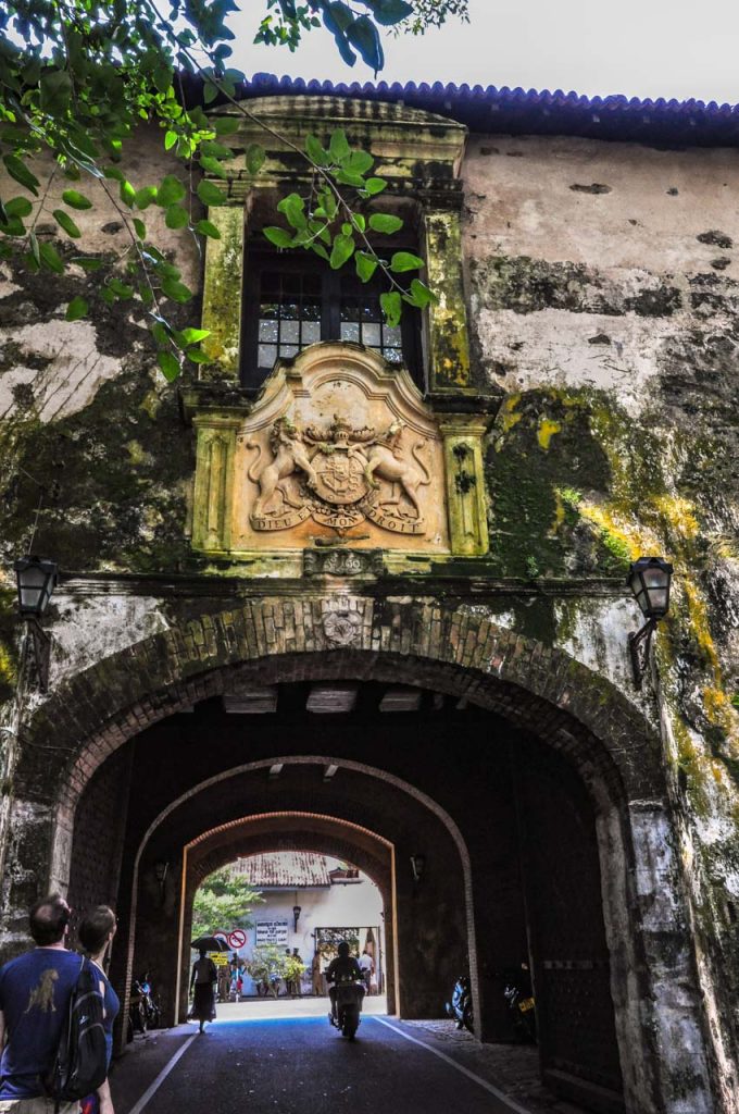
Turning south, we came to the Fish Market Bastion, where we left the ramparts to walk through Court Square. Here we stopped at the Old Gate. This was the original entrance to the Fort, with the Fort side of the gate inscribed with the Dutch East India Company’s coat of arms. The port side of the gate is adorned with a British crest (which replaced the original Dutch crest).
The Dutch East India Company’s coats of arms above Galle Fort’s ramparts’ Old Gate
The British crest adorning Galle Fort’s ramparts’ Old Gate
Court Square is shaded by magnificent, massive banyan trees with branches that seem to spread forever. The Square houses the law courts (with the lawyers standing around in their black suits) and the Old Dutch Hospital (now home to shops and cafes).
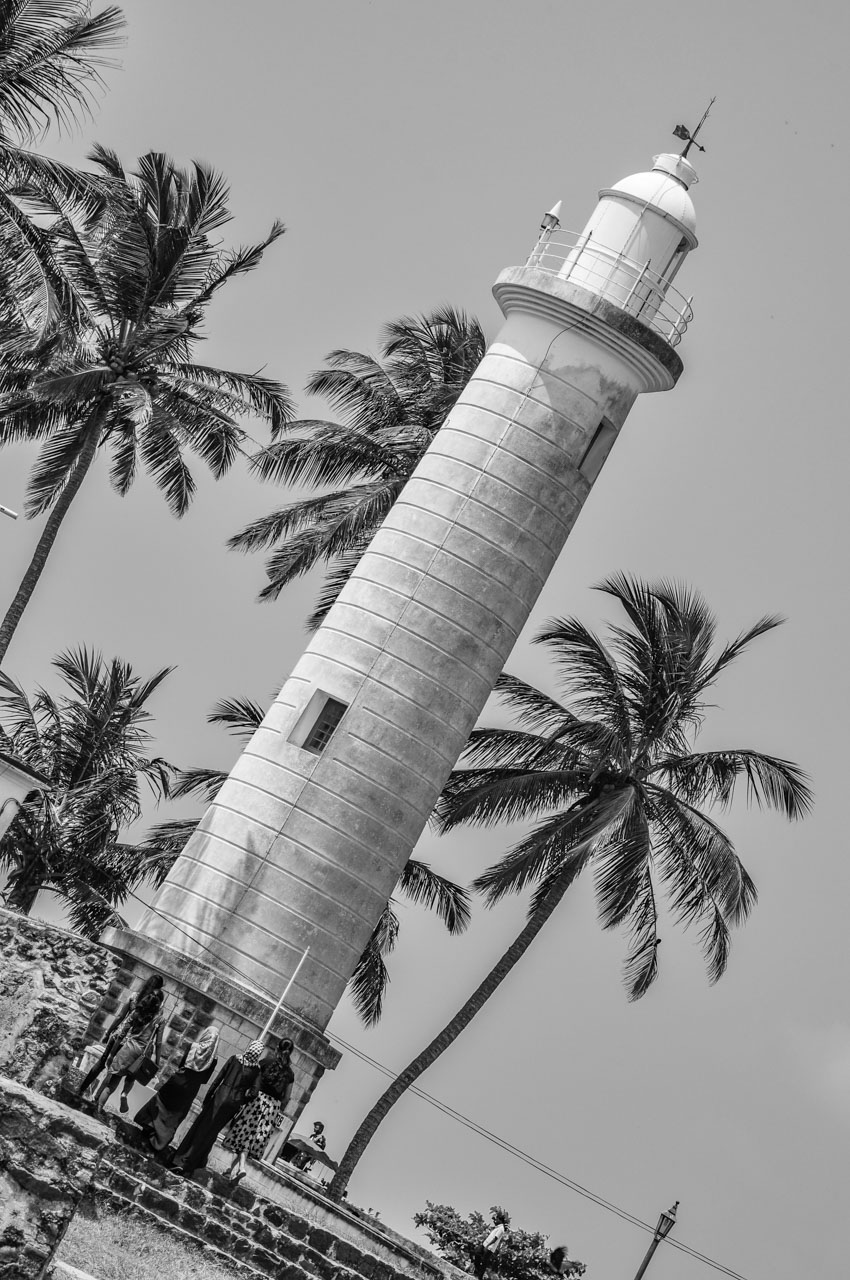
Galle Fort lighthouse on Point Utrecht Bastion
Heading south down Hospital Street, we found ourselves at Point Utrecht Bastion which is dominated by the lighthouse. Built in 1938 and standing 18 metres high, the lighthouse is still in use.
At the lighthouse, we climb back up onto the wall; walking along the southern rampart towards Flag Rock. Along this southern section of the wall, families were gathered on the shaded grass; picnicking and playing cricket.
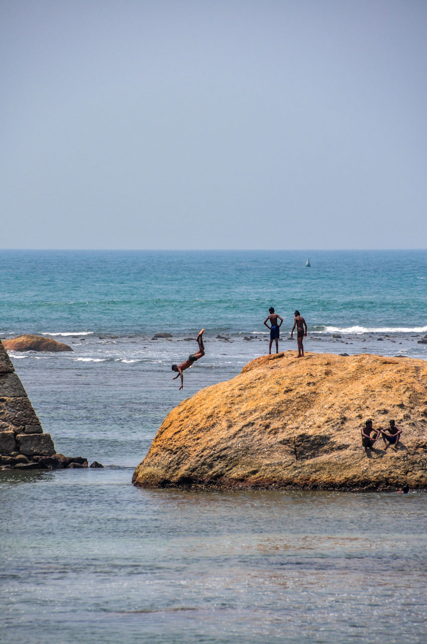
Walking past the Meeran Jumma Mosque (which looks very much like a European Baroque church), we came to Flag Rock located on the southern-most end of the Fort. People dive from Flag Rock into the ocean – described as daring free-style divers. I did see one young man run along the top of the rock and dive from it. “Idiot” might be a better description than “daring”. “Clearly potty” is how one guide book describes these jumpers. Perhaps they have insider knowledge of exactly where the submerged rocks are?
Meeran Jumma Mosque in Galle Fort, Sri Lanka
Young man jumping off Flag Rock at Galle Fort, Sri Lanka
We finally headed north as the ramparts hugged the west coast. We ended our ramble along Galle Fort’s ramparts near the army barracks, just before the Clock Tower where we had begun. Here we cut across the village green, past the Army Barracks as I had thrown a hissy fit; being upset that we were still walking in the heat. This was a short cut back to our hotel and a welcomed decision.
The guide books and tourist brochures inform you the walk along the ramparts will take 90 minutes. We took almost twice that length of time due to the heat and constant stopping to take photos. It’s surprising how hard it is to lift your feet when weighed down by heat and humidity!
We made a couple more stops before heading back to our hotel for a well-earned rest in a lovely cool room.
A long cool drink on the wide veranda of the luxury Amangalla Hotel was warranted before visiting the Manor House Museum (at 31-39 Leyn Baan Street – entrance is free). This is a private collection of antiques and miscellaneous objects (described by one guide book as “outright junk”). The collection belongs to Abdul Gaffar, a local gem merchant, and is on display in a restored Dutch house. In my opinion, Gaffar has a serious hoarding problem, with rooms and cabinets stuffed full of old typewriters, cameras, telephones, crockery, spectacles, jewellery and old Chinese memorabilia. To describe this collection as bazaar is being very kind and generous. It was just downright weird! For that reason alone, it is worth the visit. The museum does provide insight into some traditional crafts with presentations of lace embroidery, gem cutting and jewellery making. However, be cautious if you suffer from asthma because the museum is very, very dusty.
Lunch was at the Serendipity Arts Café; recommended by one guide book as a place to eat. The food was good (had a very tasty chicken club sandwich – not very imaginative of me) but I would not recommend it as it was not atmospheric; as was foretold.
We were back at the Fort Bazaar in time for a rest before partaking of the hotel’s scheduled afternoon tea and cakes served on the terrace.
This night we had dinner at The Fort Printers (39 Pedlar Street). This elegant, small private hotel (a restored 18th century mansion) was a printing facility in its former life. The original printing press is on show in the lobby of the hotel. We had discovered this hotel on our morning walk. I found the menu limiting as I am allergic to seafood and this was the speciality of the house. My sister and brother-in-law do not suffer from the same affliction and loved the menu choices. However, the menu did include chicken, lamb and vegetarian dishes. The restaurant is in a lovely setting in a courtyard around a small pool. We were tucked into an alcove at the side of the courtyard that afforded a good level of privacy. Which was just as well as our conversation became quite lively and animated. Even so, we were not forgotten. The staff were friendly, attentive, knowledgeable about their menu, and ready to answer any questions we had. The food was so good, we went back a second night.
And so, our first 24 hours comes to an end. But not so our stay in Galle Fort as we spent a further day venturing outside of the Fort and into the countryside beyond; visiting the Martin Wickramasinghe Museum, Kataluwa Temple, the coastal village of Willgama, and a final stop at the Peace Pagoda. But that’s another story.
If you like this post, PIN it for keeps
Disclaimer: This post contains no affiliate links. All views and opinions are my own and unsponsored. Unless specifically stated, all photos are my own and remain the copyright of Joanna Rath.
Dear Pip, Having travelled as much as I have, I should no longer be surprised by how easily things can get lost in translation. But on this occasion, my physical…
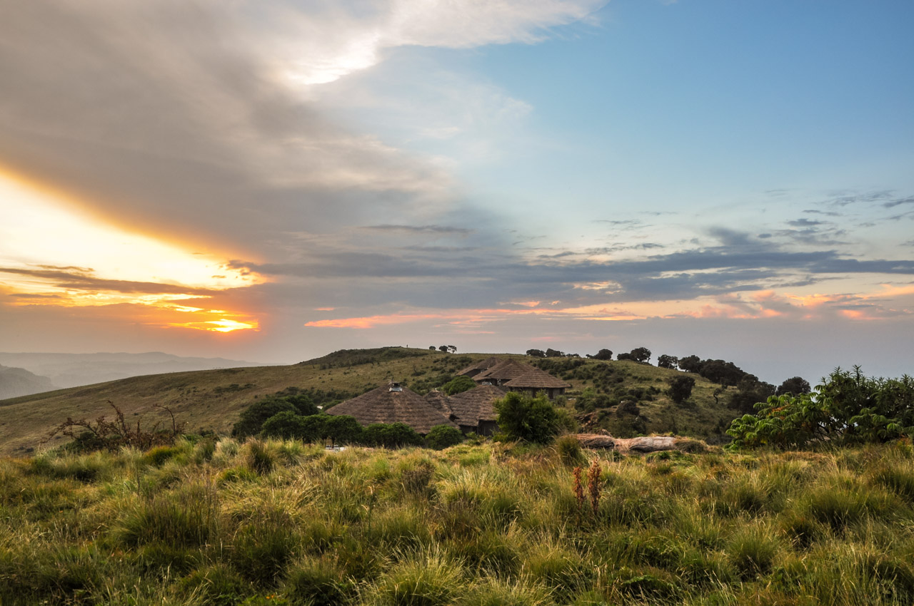
Simien Lodge – sunset in the Simien Mountains
Dear Pip,
Having travelled as much as I have, I should no longer be surprised by how easily things can get lost in translation. But on this occasion, my physical comfort, or more precisely, my physical discomfort enabled me to create my own meaning to communication.
Yesterday I arrived at the Simien Lodge in the Simien Mountains National Park and had to haul my jacket out from the bottom of my bag. This was the first time I needed my jacket since arriving in Ethiopia. It could have something to do with the Simien Lodge being at an altitude of 3,260 metres above sea level – the highest lodge in Africa.
The rooms in the Simien Lodge are spacious, with a good-sized bathroom; including a shower that I was actually able to turn around in (an issue in Ethiopian hotels). But the room was cold, and, after a very thorough search, I couldn’t see any means for heating the room.
Due to my arrival at the Simien Lodge after a very long drive (getting anywhere in Ethiopia involves a long drive), I decided to have a rest and worry about the heating when I went down for dinner. Given the altitude and my hut being on top of a hill, I wasn’t going to walk up and down unless I absolutely had to.
Piling the blankets and quilts from the spare bed onto mine, I climbed into bed thinking that at least I would be warm for my rest. How wrong could I be! Even with an extra layer of clothes and my jacket on, I was still cold. Needless to say, I went down for dinner as soon as the restaurant opened.
My first stop was at Reception where I asked if there was any way of heating my room. I was advised that after dinner I would be provided with “a plastic card for the bed”. I assumed this would be like a hotel room key card that you slot in to activate the room lights; that I would slot this card in somewhere in the room that I hadn’t as yet located, and it would activate an electric blanket. An electric blanket would be most suitable. That it would be an electric blanket I hadn’t seen yet did not register. I should have known, don’t ever assume! The ‘plastic card for the bed’ turned out to be a hot water bottle. To say that I was disheartened by this method of heating my room, is an understatement. How was I going to be warm? However, the hot water bottle worked a treat. I was snug in bed all night and had a great night’s sleep. That the room itself was cold mattered not one bit.
Tomorrow we leave for Gondar where, I am assured, it will be warmer.
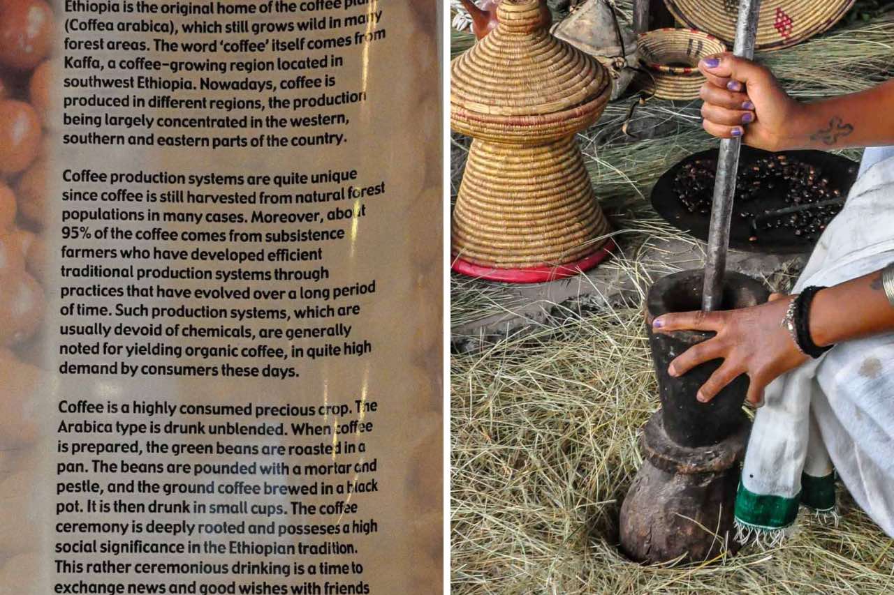
Journey to the birthplace of coffee – Ethiopia – where coffee isn’t just a drink but a ritual steeped in tradition and social significance. Learn the ritual steps of Ethiopia’s coffee ceremony.