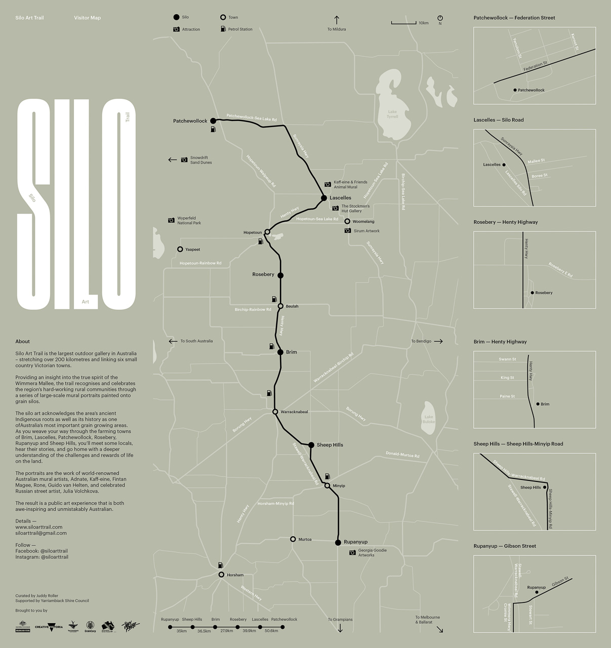
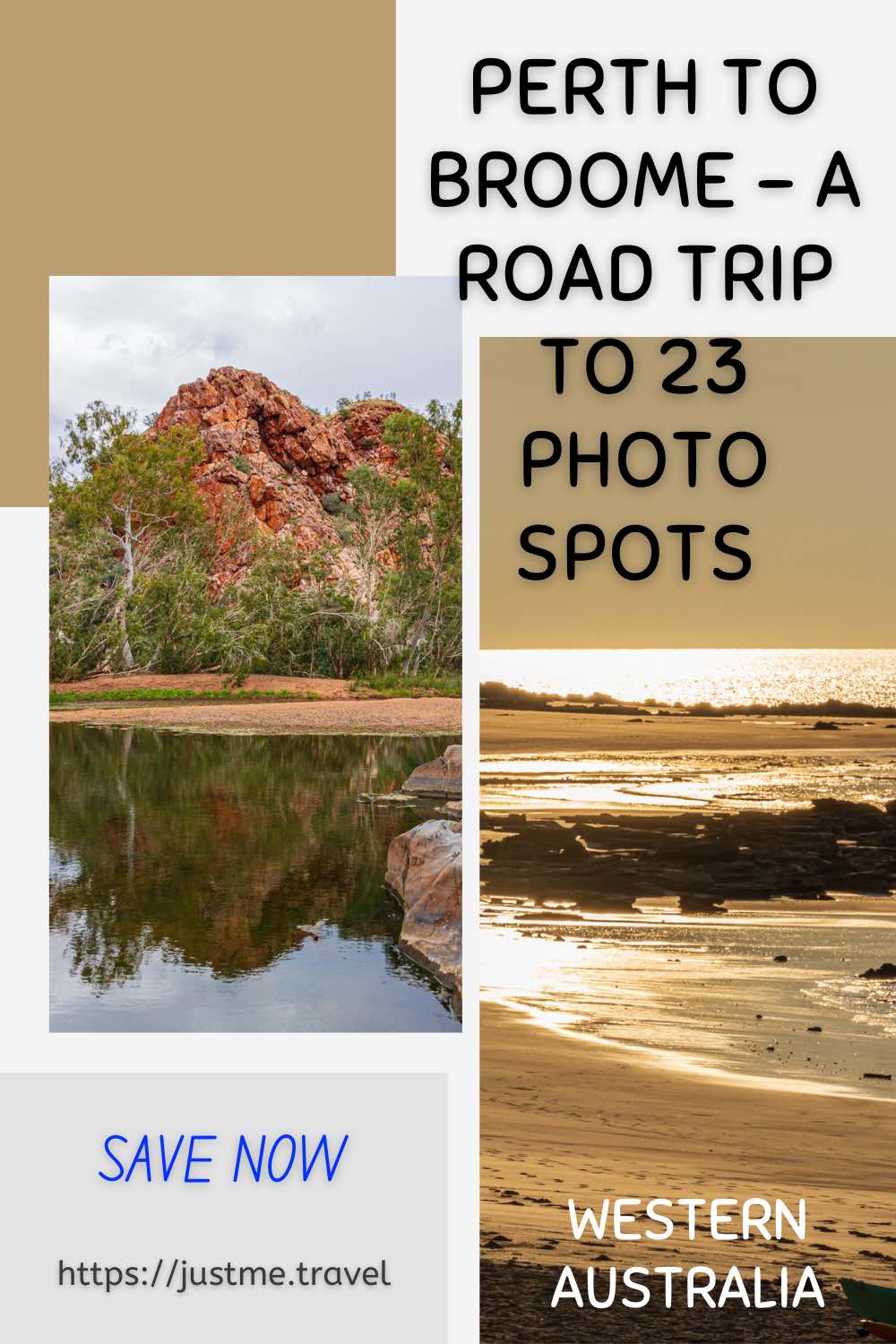
A Western Australia Road Trip from Perth to Broome is a Journey of Unique Photo Opportunities. In this post, I will take you to 23 great places you should…
A Western Australia Road Trip from Perth to Broome is a Journey of Unique Photo Opportunities.
In this post, I will take you to 23 great places you should photograph on the road from Perth to Broome. If you are travelling up Western Australia’s picturesque Coral Coast and visiting its amazing national parks, this list will provide you with some awesome holiday photography ideas.
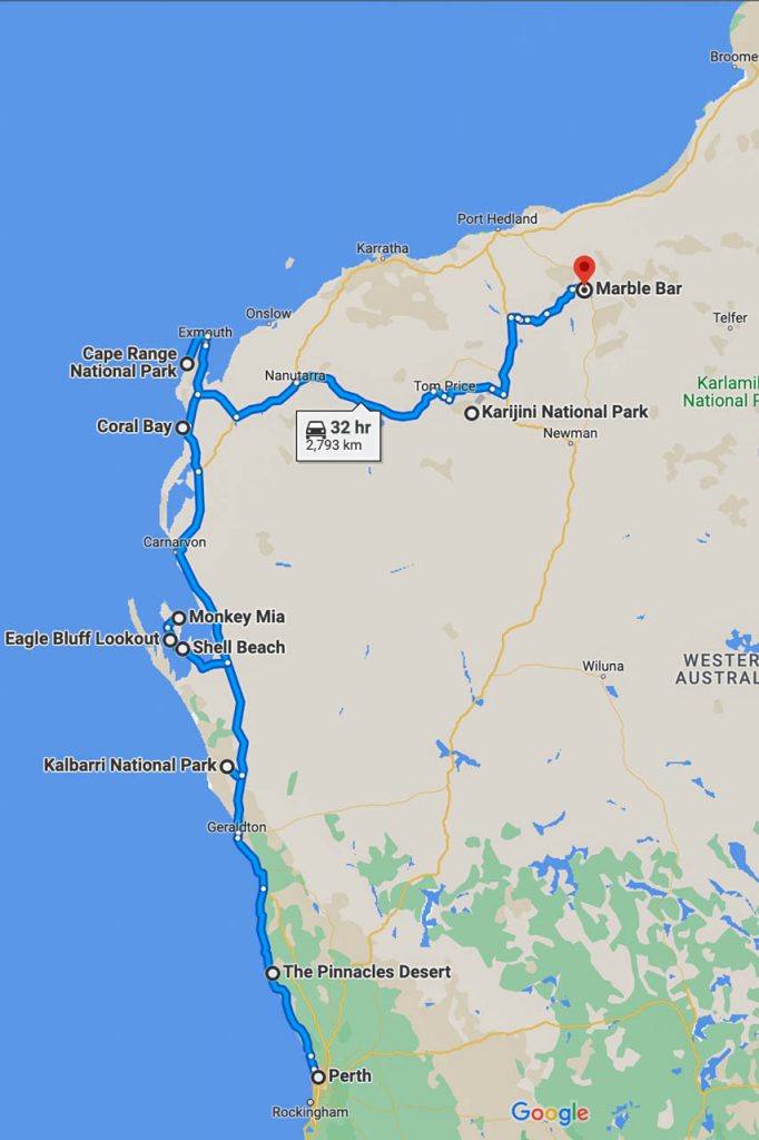
This journey of photo spots on a road trip from Perth to Broome in Australia starts in Perth, travels up the coast, heads inland before hitting the coast again, and ends in Broome.

My post is about great photo opportunities for you on the road from Perth to Broome in Western Australia. Most are in national parks, and all are accessible by 2WD. I hesitate to say “easily” accessible because the unsealed roads through much of Karijini National Park were severely corrugated when our 4WD tour bus travelled on them. Our ‘4WD’ had the body of a bus on a truck chassis, which would best be described as a bus on steroids. I don’t know how often the roads are graded through Karijini National Park, but they gave new meaning to the saying, shaken, not stirred.
The post is not about hikes you can take through the national parks, of which there are many, nor about things you can do or places to stay. It’s not even about how to get from place to place, although the maps above show you where the photo spots are in relation to each other and their location within Western Australia. In other words, this post is not an itinerary but a guide to where you can find great photo spots between Perth and Broome.
The photos have been included on this list not because they are a tourist attraction, which they are, but because they provide 23 great photo opportunities to create special holiday memories that should not be missed.
I use two cameras for all my travel photos – a Nikon D7200 DSLR camera and an iPhone 12 Pro. whichever is handy at the time.
Many of the photo spots in this post are in national parks. As I was on an escorted tour with APT, I was not concerned with park fees, infrastructure, or other relevant information. However, Western Australia’s Parks and Wildlife Service is the official site for all the information you need on the State’s national parks.
Many paths to lookouts and photo spots, whether inside national parks or not, are unsuitable for people with mobility issues. I say that with confidence as a few people on the escorted group tour had mobility issues and missed out on seeing several of the photo spots below.
Scroll through the photo spots at your leisure or jump straight to the photo spot you want to see.
- Perth
- The Pinnacles Desert, Nambung National Park
- Z Bend Lookout, Kalbarri National Park
- Kalbarri Skywalk, Kalbarri National Park
- Nature’s Window, Kalbarri National Park
- Ross Graham Lookout, Kalbarri National Park
- Abrolhos Islands, Houtman Abrolhos Islands National Park
- Eagle Bluff Lookout, Francois Peron National Park
- Monkey Mia Conservation Park
- Shell Beach, Francois Peron National Park
- Coral Bay, Ningaloo Coast
- Vlamingh Head Lighthouse
- Yardie Creek Gorge, Cape Range National Park
- Turquoise Bay, Cape Range National Park
- Joffre Gorge, Karijini National Park
- Kalamina Gorge, Karijini National Park
- Fortescue Falls, Karijini National Park
- Fern Pool, Karijini National Park
- Circular Pool Lookout, Karijini National Park
- Marble Bar
- Eighty Mile Beach
- Eco Beach Resort, Broome
- Broome
Perth

Perth cityscape
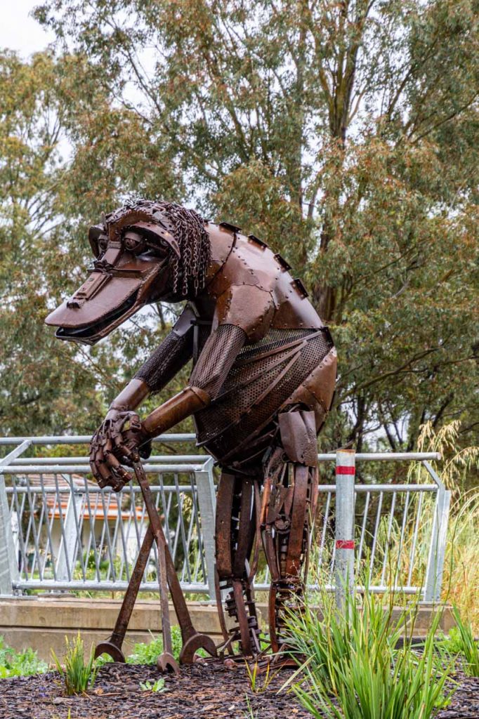
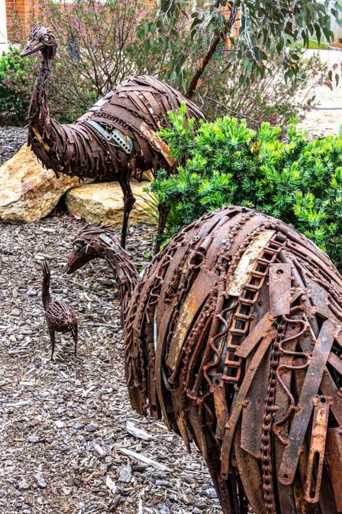
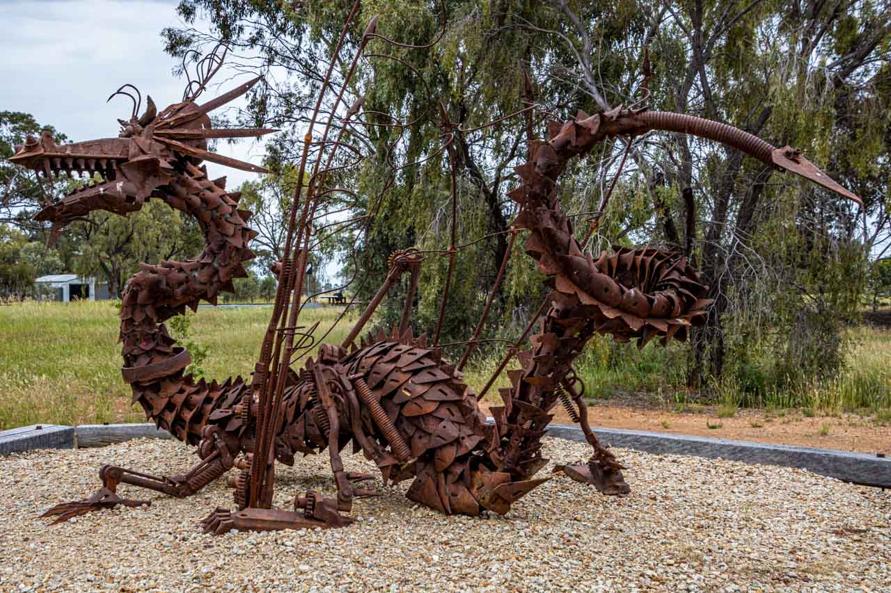
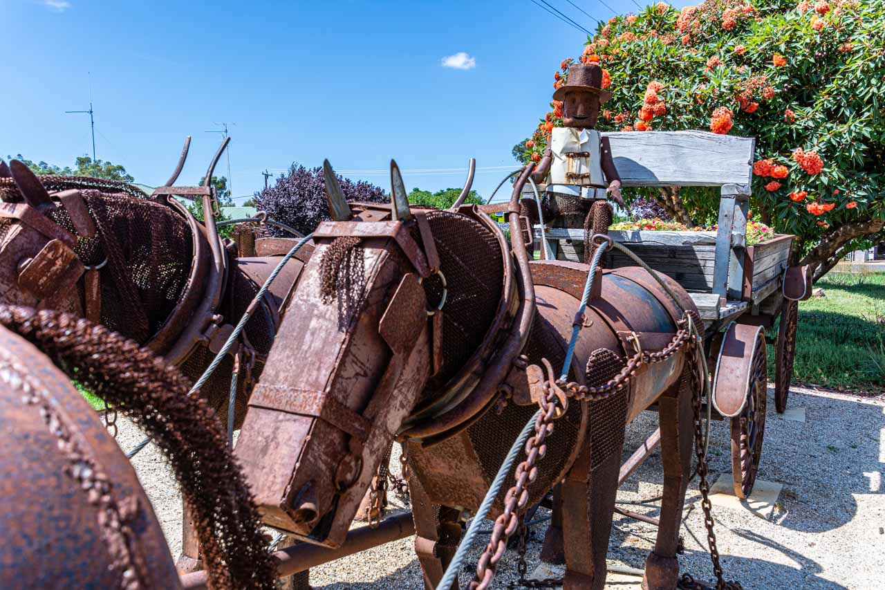
Perth is a city with many spots worth photographing – beautiful parks, attention-grabbing street sculptures, striking architecture, white sand beaches, vibrant river life, and more. Perth deserves at least spending a few days there.
I spent ten days in Perth and discovered many things to do unique to this beautiful city sitting on the Swan River. You can explore the world’s largest city park, see the happiest animal on earth, marvel at a wave-shaped rock in the middle of nowhere, photograph the largest dam mural in the world, and chime the world’s biggest musical instrument. You will find these activities, and more, in my post on 7 Top Day Trips And Things To Do In And From Perth. – all suggested from my own experience as a solo traveller.
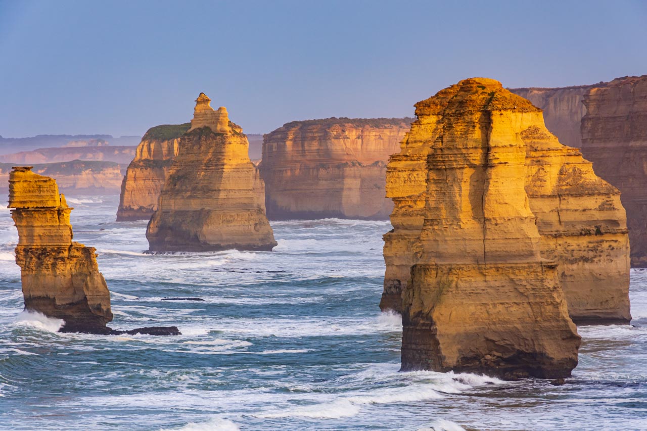
The Pinnacles Desert, Nambung National Park

The Pinnacles, Pinnacles Desert, Nambung National Park
At the southern gateway to Western Australia’s Coral Coast along the Indian Ocean Drive, the Pinnacles Desert is located within Nambung National Park, approximately 200 kilometres north of Perth, near the coastal town of Cervantes.
The Pinnacles are natural limestone structures formed approximately 25,000 to 30,000 years ago after the sea receded and left deposits of seashells. Over time, coastal winds removed the surrounding sand, leaving the pillars exposed to the elements. There are thousands of pinnacles in the Pinnacles Desert, with some reaching as high as 3.5 metres.
You can view the Pinnacles from the lookout (a paved path from the car park), drive or walk the 4-kilometre Pinnacles Loop or simply meander through the Pinnacles Desert, taking all the photos you want of this fascinating, otherworldly landscape.
Z Bend Lookout, Kalbarri National Park
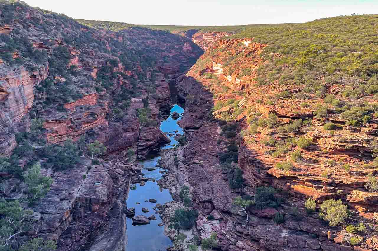
Murchison River Gorge view from Z Bend Lookout in Kalbarri National Park
Kalbarri National Park surrounds the lower reaches of the Murchison River, which has carved a magnificent 80-kilometre gorge through the red sandstone.
The Z Bend Lookout reveals dramatic views of the zig-zag section of the Murchison River Gorge. The gorge below the lookout forms the middle part of the ‘Z Bend’. Fractures within the red Tumblagooda Sandstone form this unusual shape.
Z Bend Lookout is a 1.2-kilometre return walk from the car park along a sandy path with stone steps. Walking back up is a decent cardio workout.
Kalbarri Skywalk, Kalbarri National Park

The Kalbarri Skywalk provides an excellent view over Murchison River Gorge
The Kalbarri Skywalk consists of two cantilevered viewing platforms that hang in mid-air 100 metres above the gorge. They provide stunning views of the Murchison River Gorge and its extraordinary surrounding landscape.
Just walking out on these platforms was a unique experience in itself. To be then confronted with the views on offer was truly breathtaking.
The Kalbarri Skywalk is about 150 metres from the car park on a flat, paved path.
Nature’s Window, Kalbarri National Park

Murchison River Gorge viewed through a natural rock window
Forces of nature have carved through layered sandstone to create a rock formation that frames the Murchison River below.
It is a moderate, one-kilometre return walk beginning with a flight of stairs from the lookout at the parking area. Just remember, you need to walk back up those stairs!
Beware: Access to Nature’s Window is not for the faint-hearted as there is nothing, except your excellent balance, to stop you from falling over the cliff’s edge.
Ross Graham Lookout, Kalbarri National Park
Murchison River Gorge viewed from Ross Graham Lookout in Kalbarri National Park
Ross Graham was the first headmaster of Kalbarri Primary School. He was a devoted conservationist who aided in the exploration of the Murchison River. He died in 1967, aged 31 years.
The Ross Graham Lookout offers a limited but picturesque view of the Murchison River. The lookout is 100 metres from the car park along a rocky track.
Beware: There are no safety barriers on the cliff edge at the lookout.
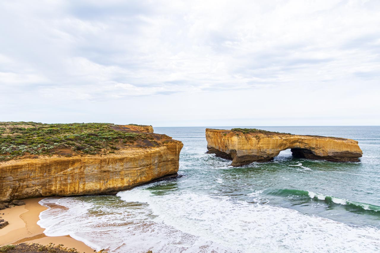
Abrolhos Islands, Houtman Abrolhos Islands National Park

A scenic flight over Abrolhos Islands
Houtman Abrolhos Islands National Park is a marine archipelago of 210 islands lying 60 to 80 kilometres off Western Australia’s mid-west coast, between Geraldton and Kalbarri.
You will need to take a scenic flight to take advantage of this photo spot of the islands and the coral reefs surrounding them. Our scenic flight was with Nationwest Aviation from Kalbarri Airport.
A couple of passengers saw migrating whales. I was on the wrong side of the plane!
Eagle Bluff Lookout, Francois Peron National Park
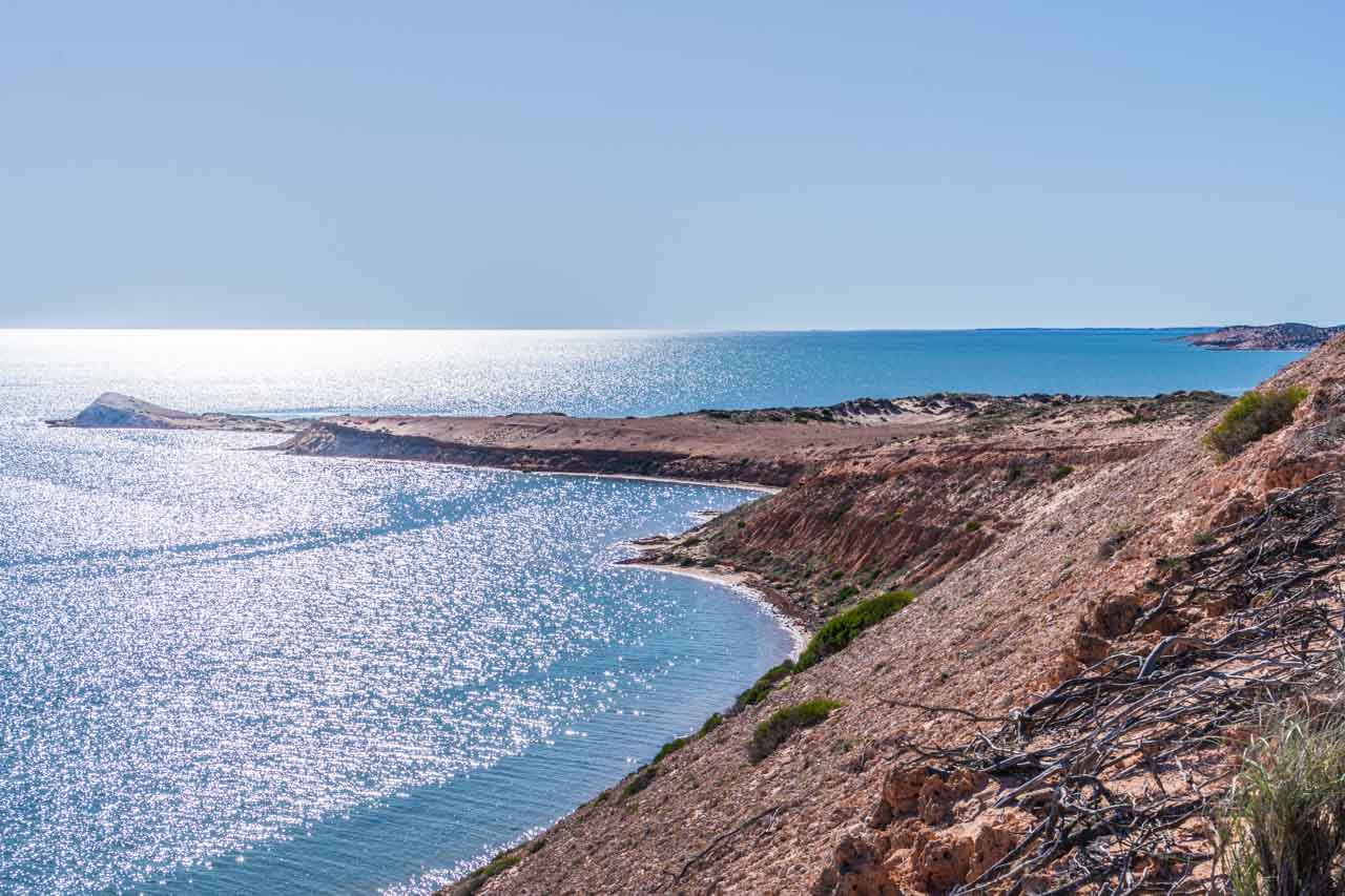
View from the Eagle Bluff boardwalk
Eagle Bluff is approximately 20 kilometres south of Denham in the UNESCO Shark Bay World Heritage Area.
A 400-metre boardwalk along the cliff edge offers stunning views of the rugged coastline, small islands, and coastal bays fringing the Indian Ocean and provides the opportunity to spot wildlife like ospreys, dugongs, dolphins, turtles, sharks, and rays.
Monkey Mia Conservation Park
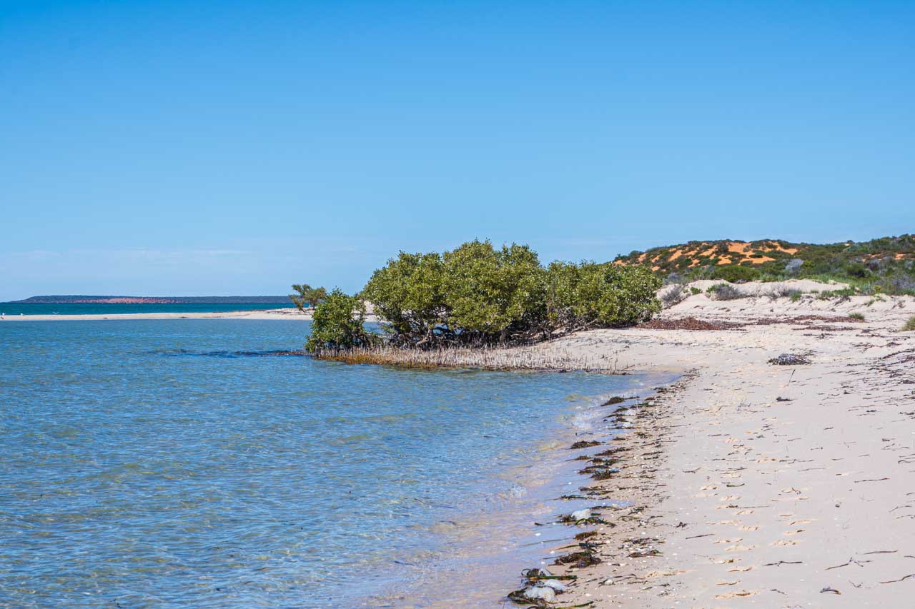
Monkey Mia Conservation Park
Monkey Mia Conservation Park is 25 kilometres northeast of the coastal town of Denham.
Monkey Mia is, first and foremost, famous for feeding wild dolphins that visit the beach at Monkey Mia Dolphin Resort. However, for me, the area was about mangroves, red dunes, sapphire blue waters, and white sandy beaches on the Indian Ocean.
Facing the jetty from the beach at Monkey Mia Dolphin Resort, where I was staying, I walked around a couple of headlands to discover the spot pictured above. It possibly holds greater significance for me as I was seeking solitude away from the resort crowds. There was not another person as far as the eye could see.
Shell Beach, Francois Peron National Park
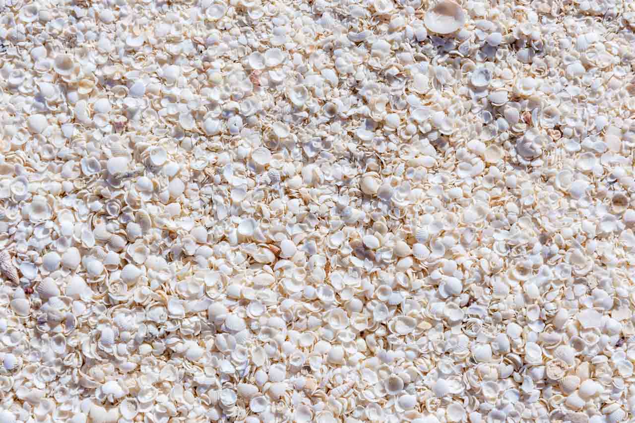
The cockle shells of Shell Beach
Shell Beach on Western Australia’s Coral Coast is 45 kilometres from Denham within the UNESCO Shark Bay World Heritage Area. The beach consists of trillions of tiny white shells up to 10 metres deep, forming a beach stretching 120 kilometres. There is no sand, only shells.
Shell Beach is one of only a handful of places on earth where shells replace sand. The shells are from the tiny Fragum Cockle, also known as Hamelin or Shark Bay Cockle. They reminded me of the pipi shells I always saw on Sydney beaches.
In the early 1900s, the shells were quarried and hard-packed, cut into blocks and used to construct buildings. There is still evidence of the historic Shell Quarry.
Coral Bay, Ningaloo Coast
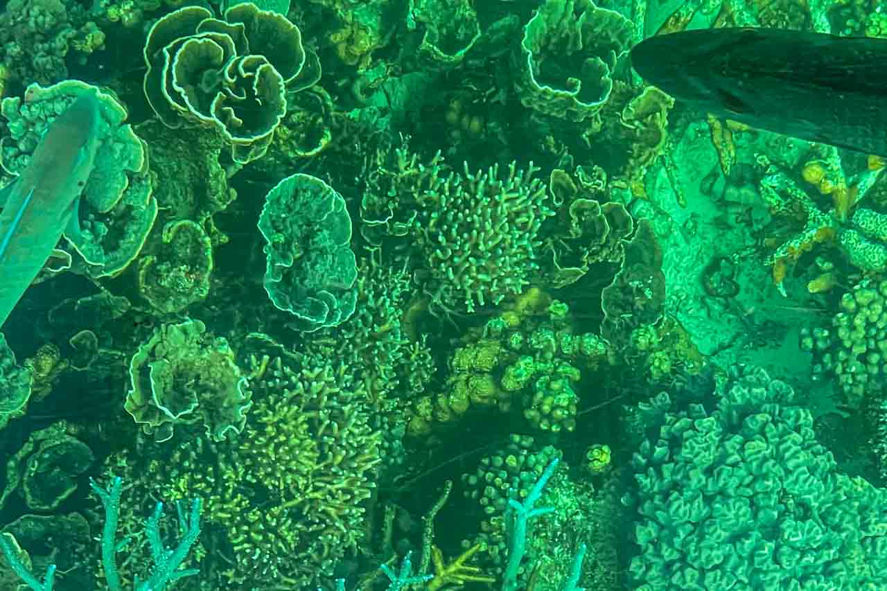
Coral garden on Ningaloo Reef at Coral Bay
The UNESCO World Heritage-listed Ningaloo Reef is a 240-kilometre-long stretch of coral gardens with over 200 coral species and clear, turquoise waters that are home to whale sharks, manta rays, dugongs, sea turtles, and reef fish.
Ningaloo Reef is Australia’s second largest reef, the world’s largest fringing reef, and includes one of the longest near-shore reefs in the world. At Coral Bay, the reef is just 500 metres from the shore.
I took this photo of the coral through a glass-bottom boat.
The Vlamingh Head Lighthouse

Vlamingh Head Lighthouse
Just 17 kilometres from Exmouth, Vlamingh Head Lighthouse is inside the UNESCO Ningaloo Coast World Heritage Area and Ningaloo Marine Park.
The lighthouse is a vantage point for magnificent views of the Indian Ocean, Ningaloo Reef, and Cape Range National Park. It is also one of the few places in Australia where you can watch both sunrise and sunset over the ocean.
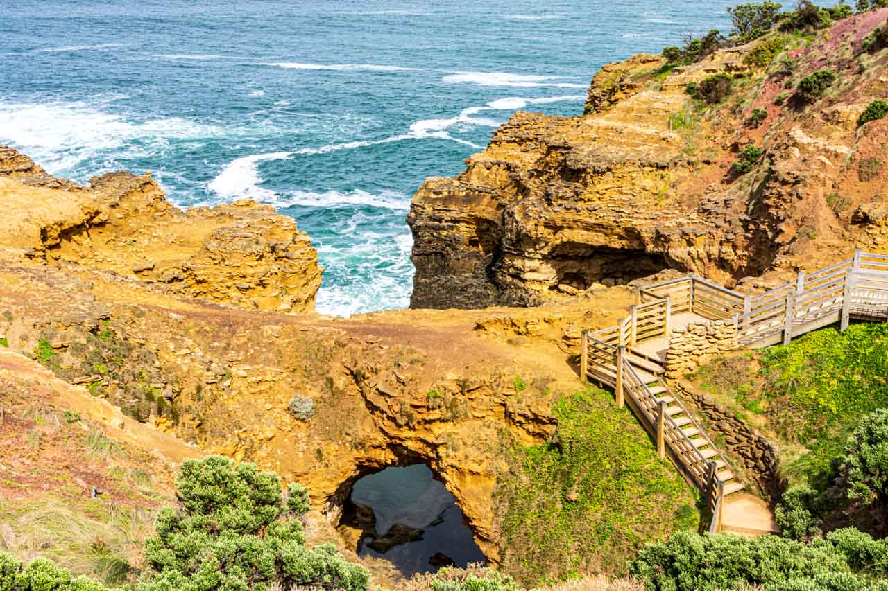
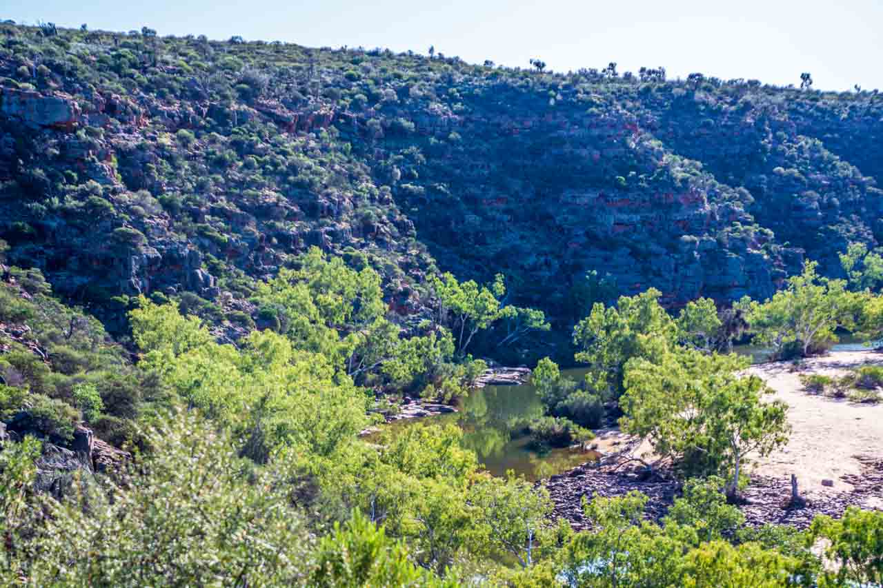
Yardie Creek Gorge, Cape Range National Park

Yardie Creek Gorge
In Cape Range National Park, which, in turn, is inside the Ningaloo Coast World Heritage Area and adjacent to Ningaloo Marine Park, Yardie Creek Gorge is a day trip from Exmouth.
Yardie Creek Gorge was reminiscent of the gorges I visited in Western Australia’s Kimberley region in 2021, where I say I lost my heart. Dramatic, sheer red cliff landscapes are a drawcard for me.
If you are curious to learn where I must return to pick up my heart, read my post on 7 Gorges in the Kimberley.
A cruise on Yardie Creek through the gorge is an opportunity to see and photograph wildlife in their natural environment. I saw many threatened black-flanked wallabies, a goanna sunning itself, and an osprey nest known to be over 100 years old (but no osprey).

The threatened Black-Flanked Wallaby
The black-flanked wallaby must be one of the most agile marsupials on Earth, given the crevasses and caves they get in and out of on sheer cliff faces.
Turquoise Bay, Cape Range National Park

Turquoise Bay
Inside Cape Range National Park and Ningaloo Coast World Heritage Area, Turquoise Bay, approximately 63 kilometres from Exmouth, is described as a slice of paradise, where white sand beaches give way to its famous, crystal-clear waters.
Turquoise Bay is one of Western Australia’s best beaches and is consistently voted among the top three beaches in Australia. It took out the number 1 beach in the South Pacific and third spot in the Top 25 Beaches in the World in Tripadvisor’s 2022 Traveller’s Choice Awards.
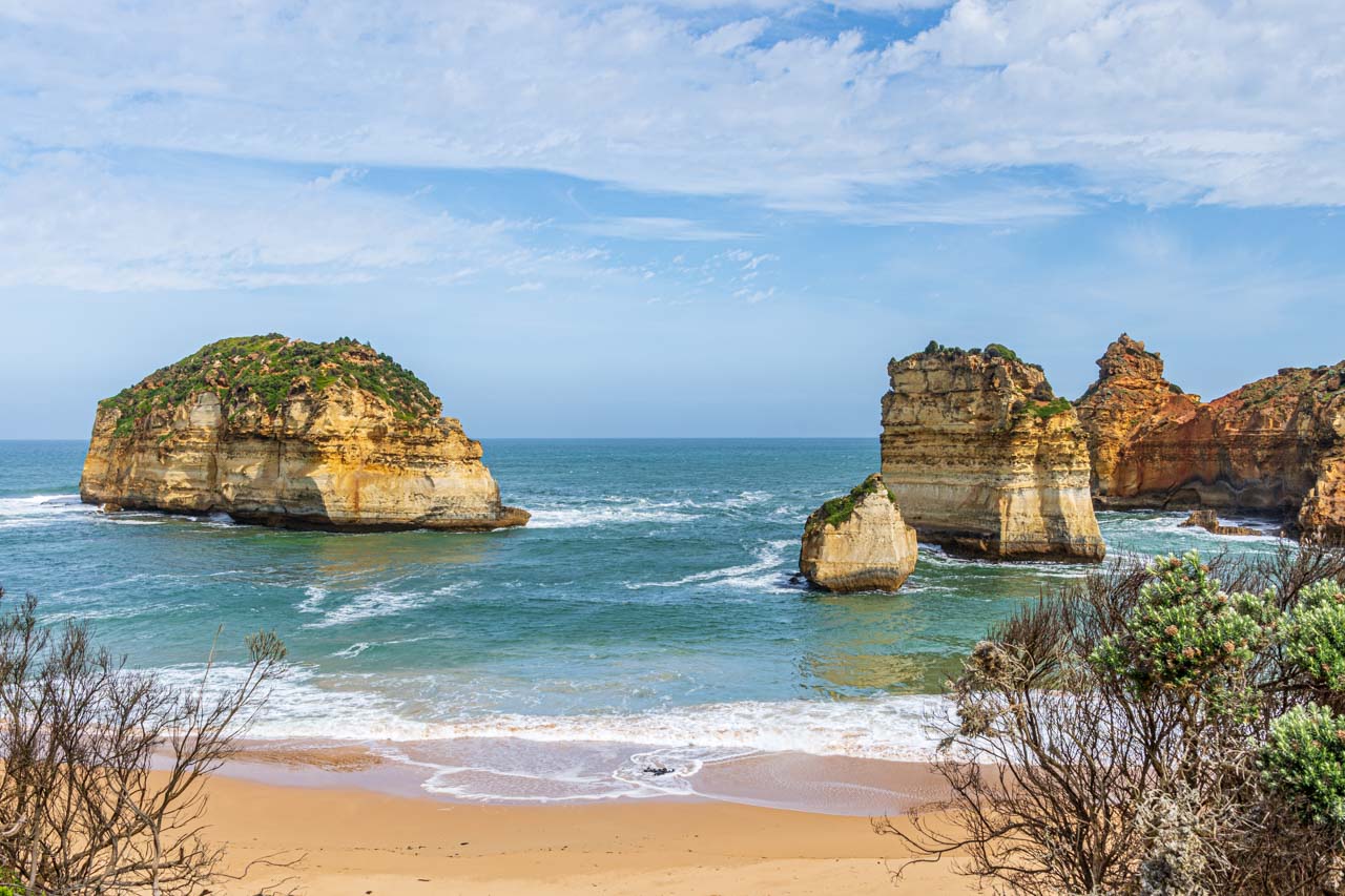
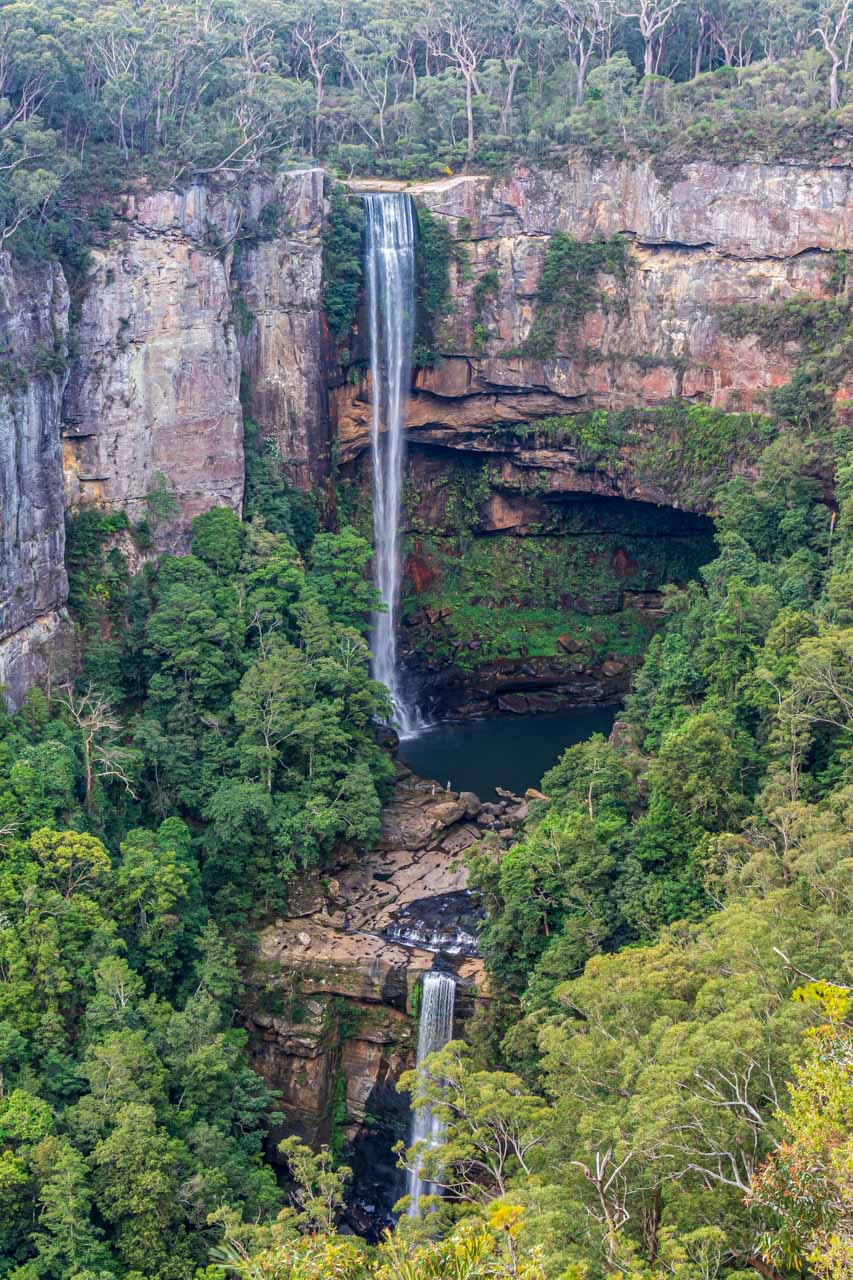
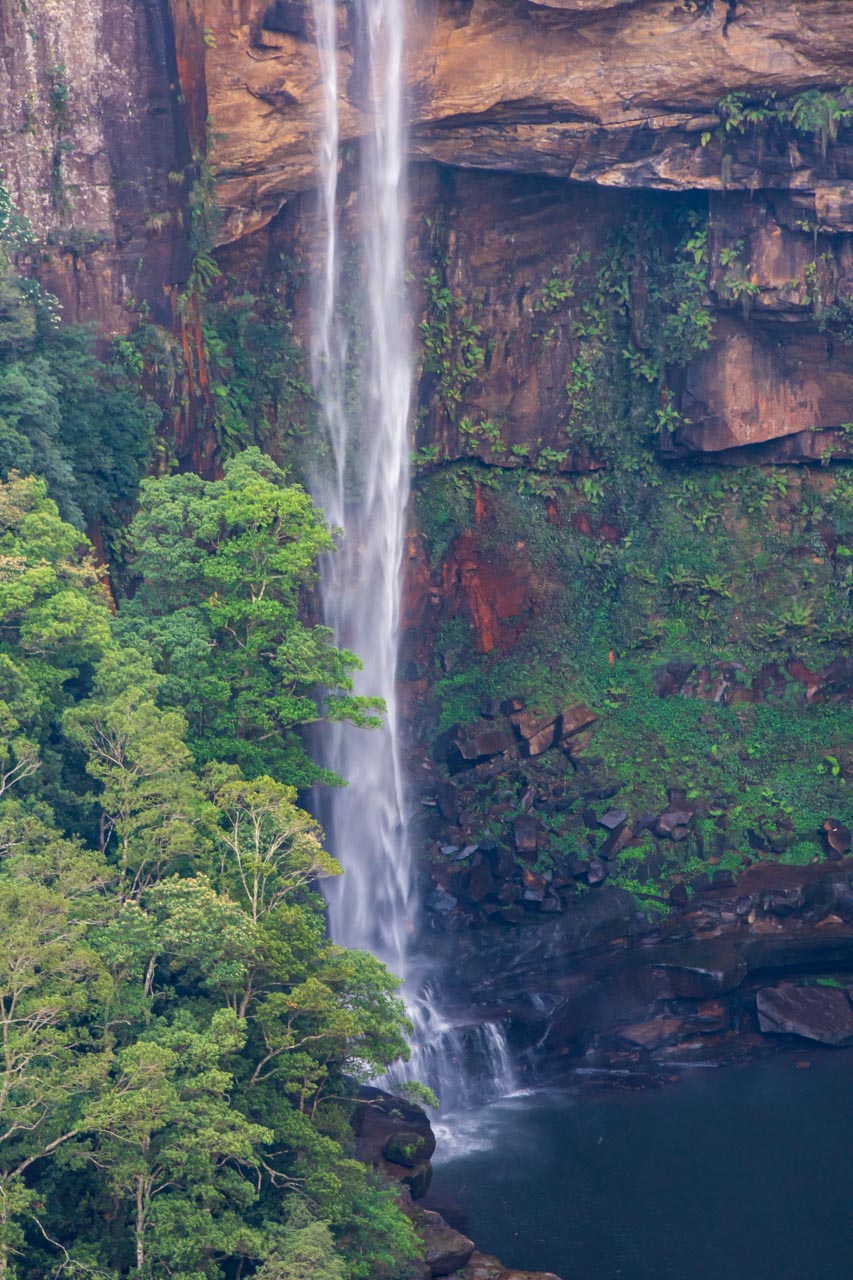
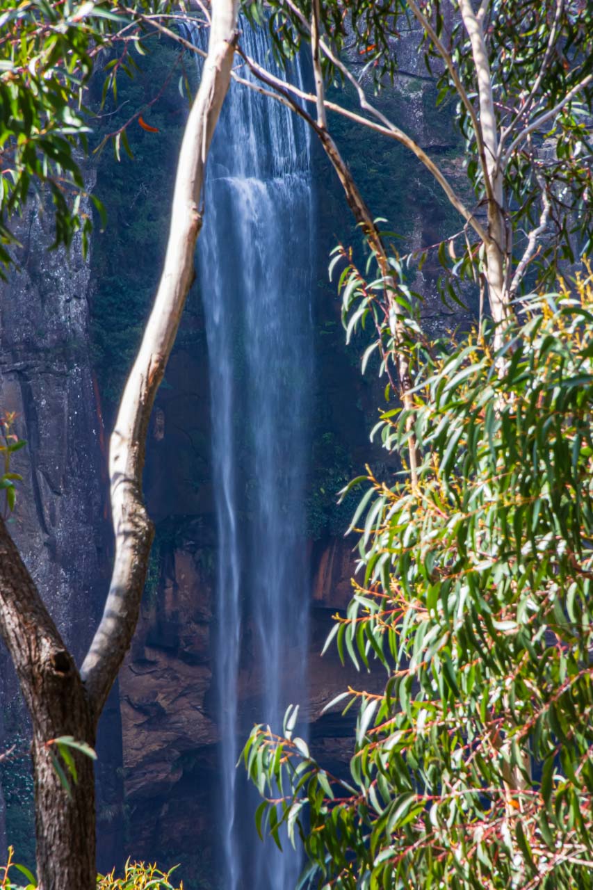
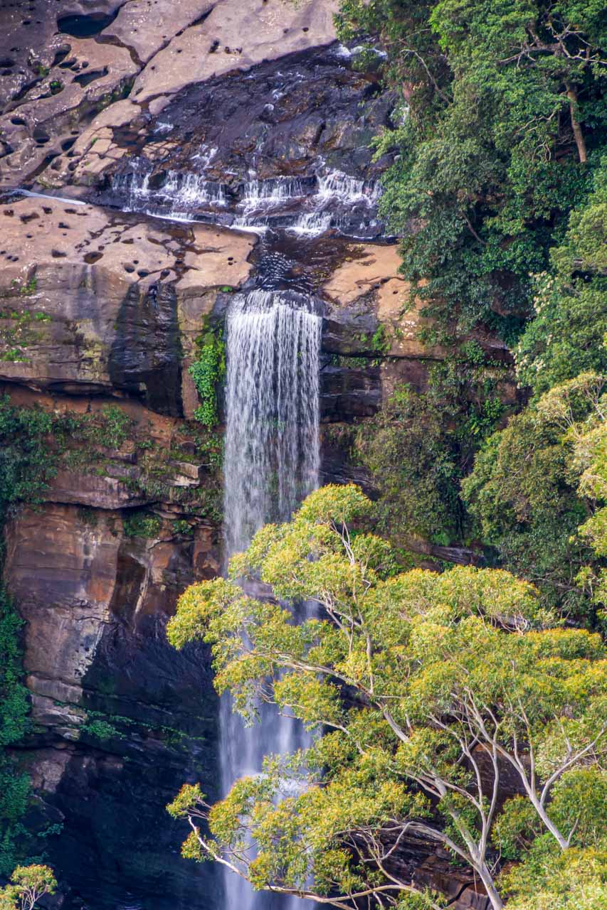
Joffre Gorge, Karijini National Park
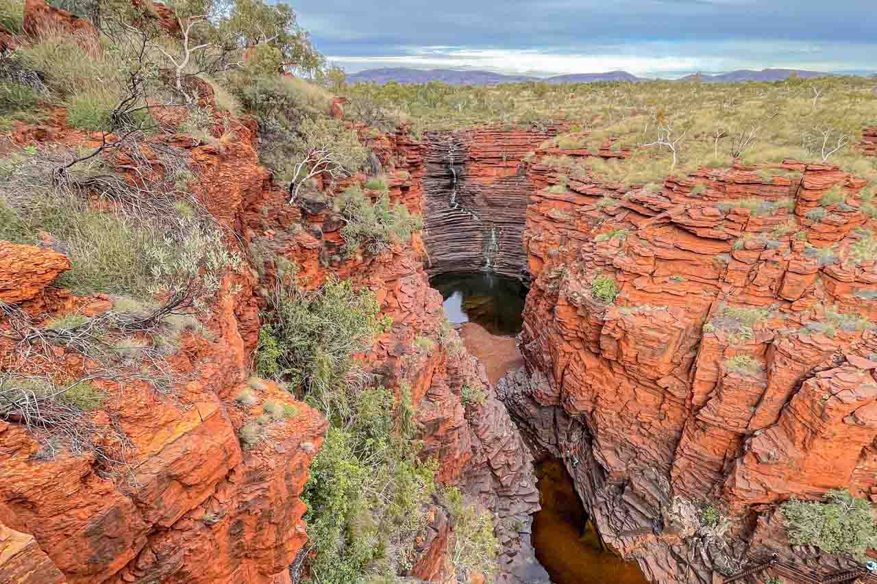
Joffre Gorge viewed from the lookout
Set in the Hamersley Range in the heart of the Pilbara and offering spectacular, rugged scenery and ancient geological formations, Karijini National Park is the second largest park in Western Australia.
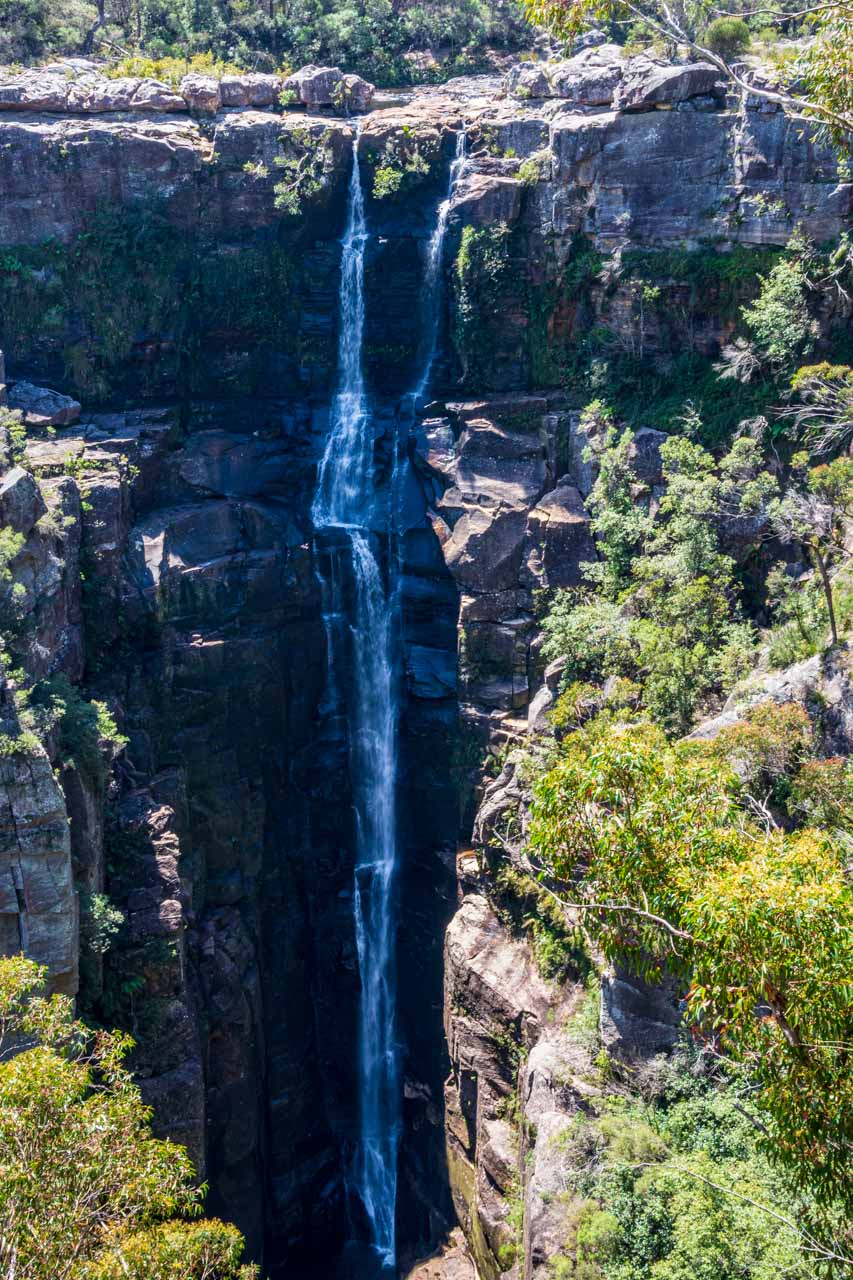
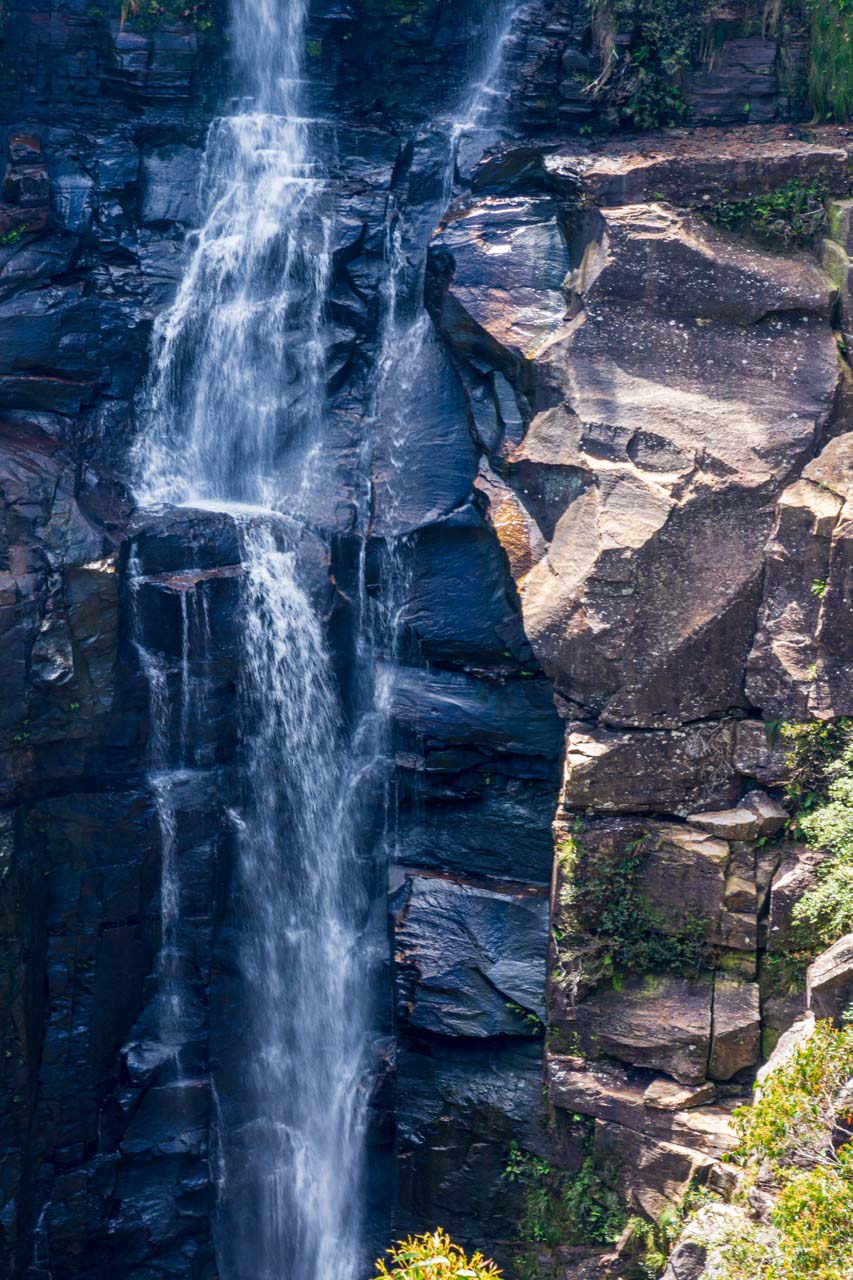
Joffre Gorge is spectacular with its steep red cliffs and 50-metre drop waterfall. Its remarkable curved waterfall forms a natural amphitheatre.
The Joffre Gorge Lookout, where I took this photo, is a 240-metre return walk from the car park. Rock steps take you down to the lookout.
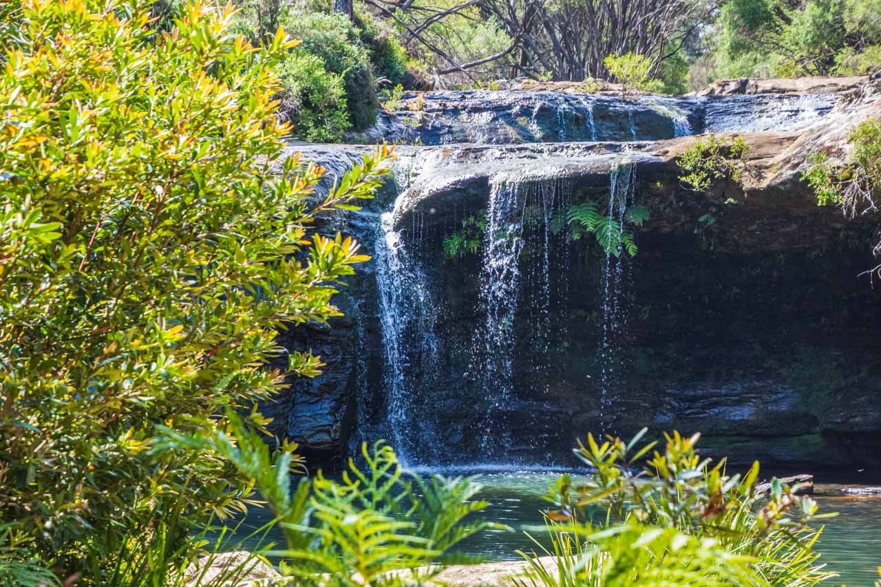
Kalamina Gorge, Karijini National Park
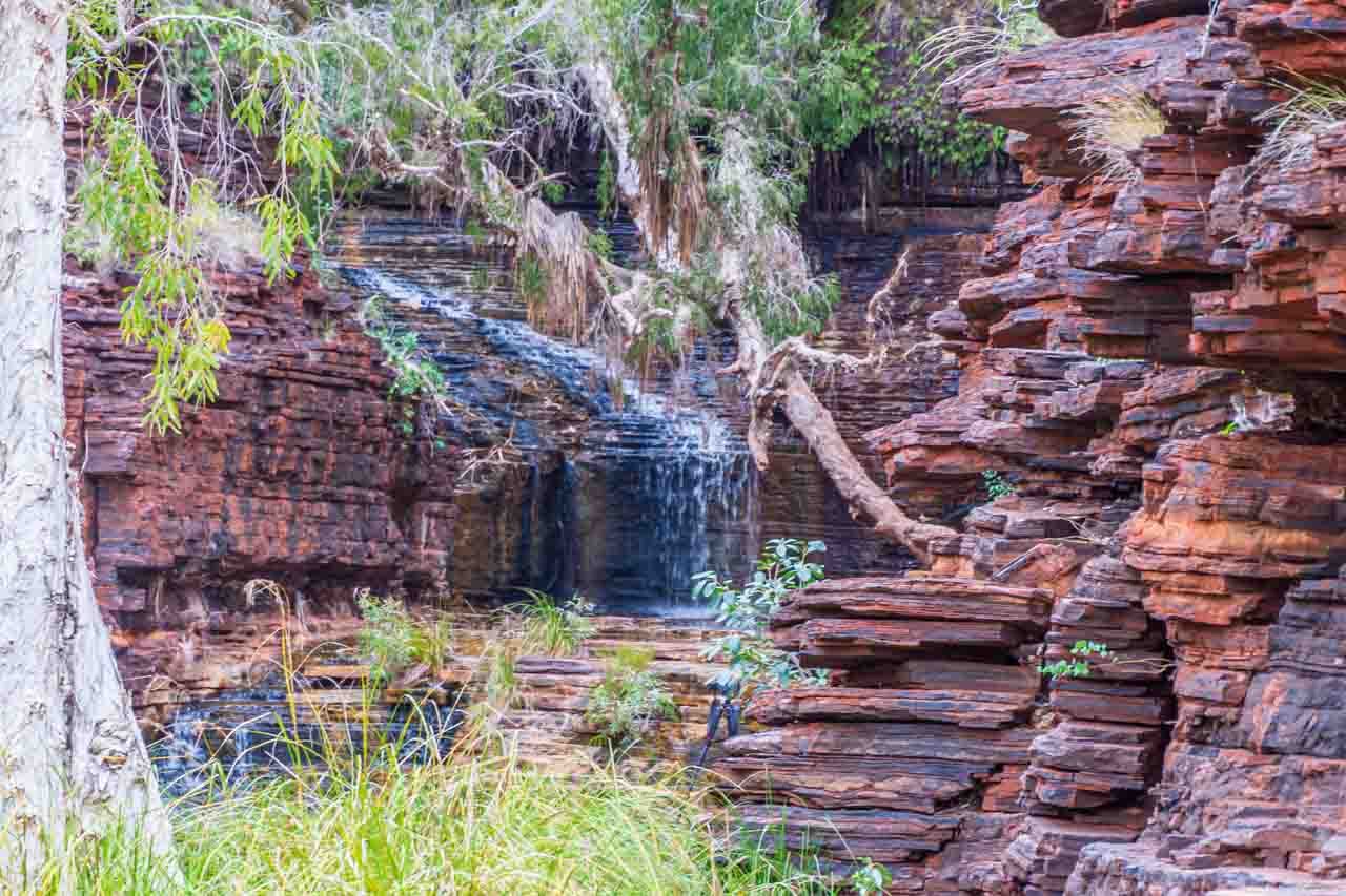
The waterfall in Kalamina Gorge
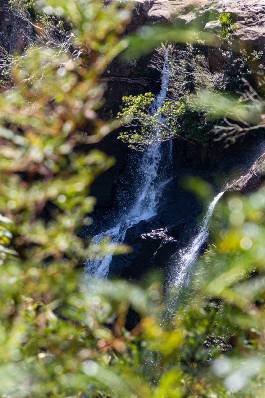
Kalamina Gorge is the shallowest of the gorges in Karijini National Park and is not among the largest, but it is one of the prettiest.
The lookout is 75 metres from the car park along a gravel path with a series of natural rock steps. On the morning I visited Kalamina Gorge, some of the track was eroded, and there were many loose stones.
Beware: The lookout has no safety railing.
It is a steep track with uneven stone steps to the base of the gorge, where a small waterfall drops into a permanent pool. I took the photo above from the bottom of the gorge.
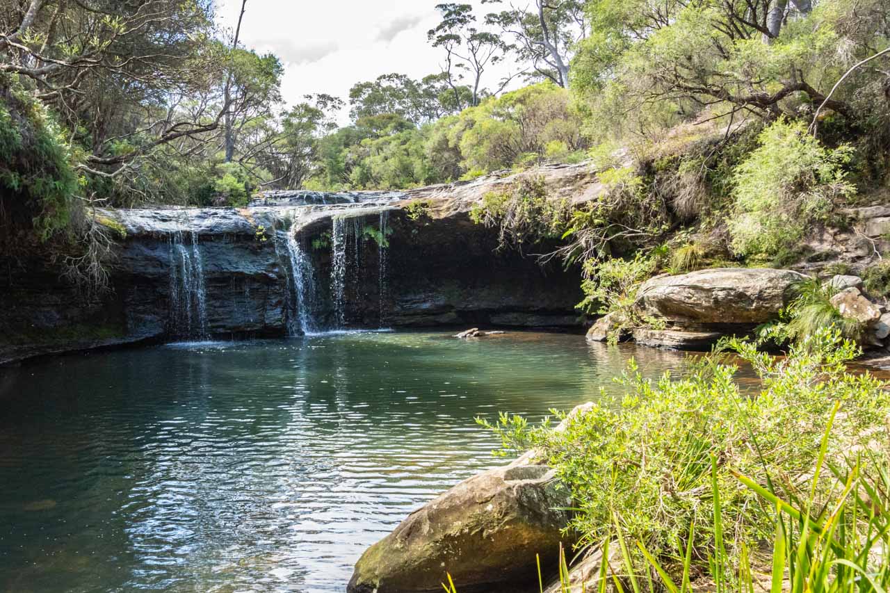
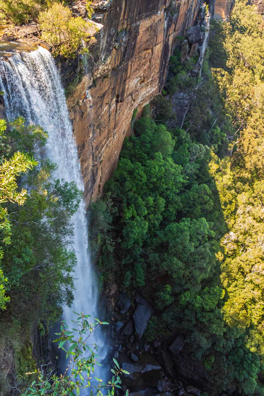
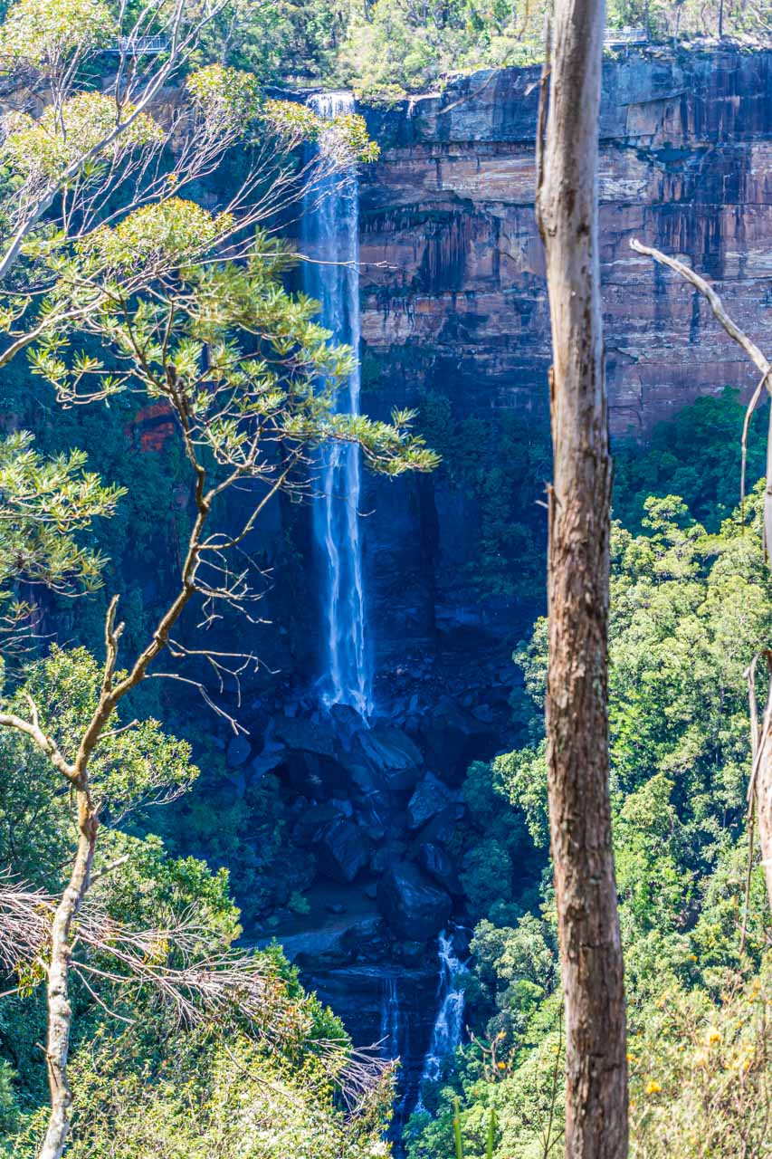
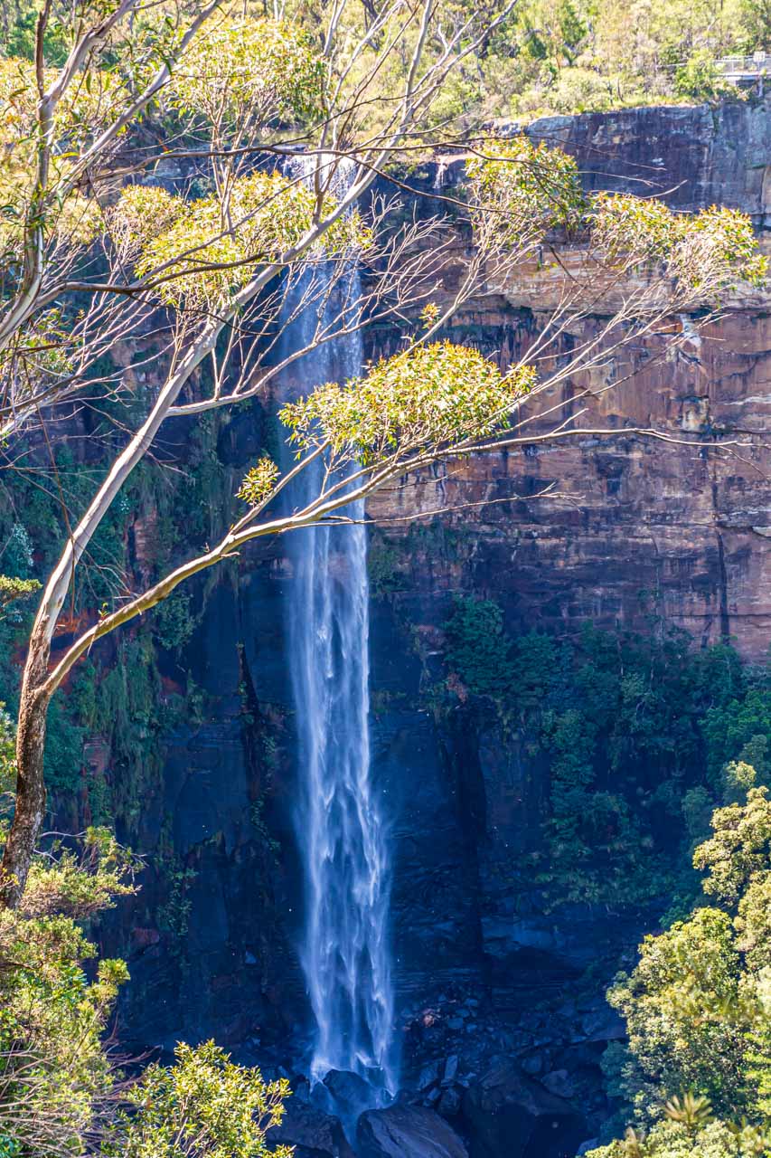
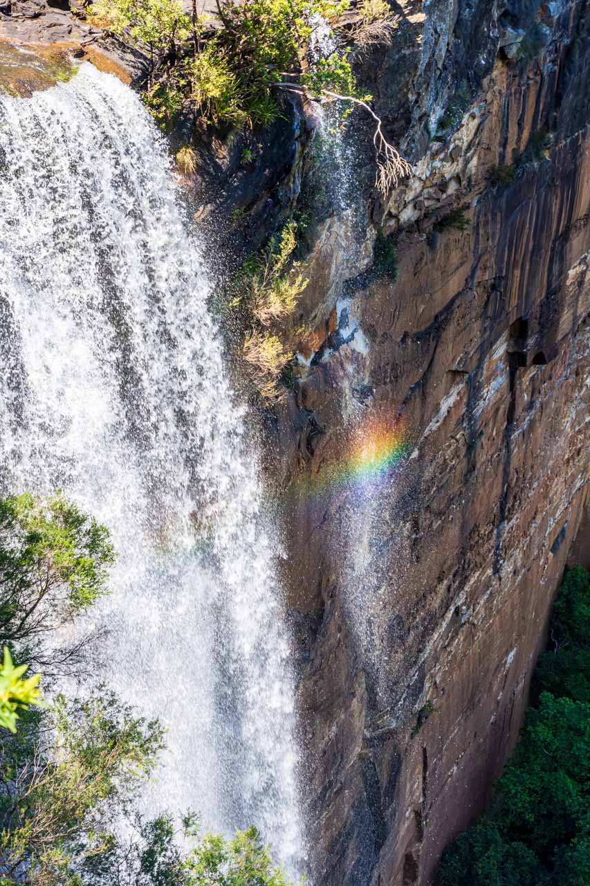
Fortescue Falls (Jubula), Karijini National Park
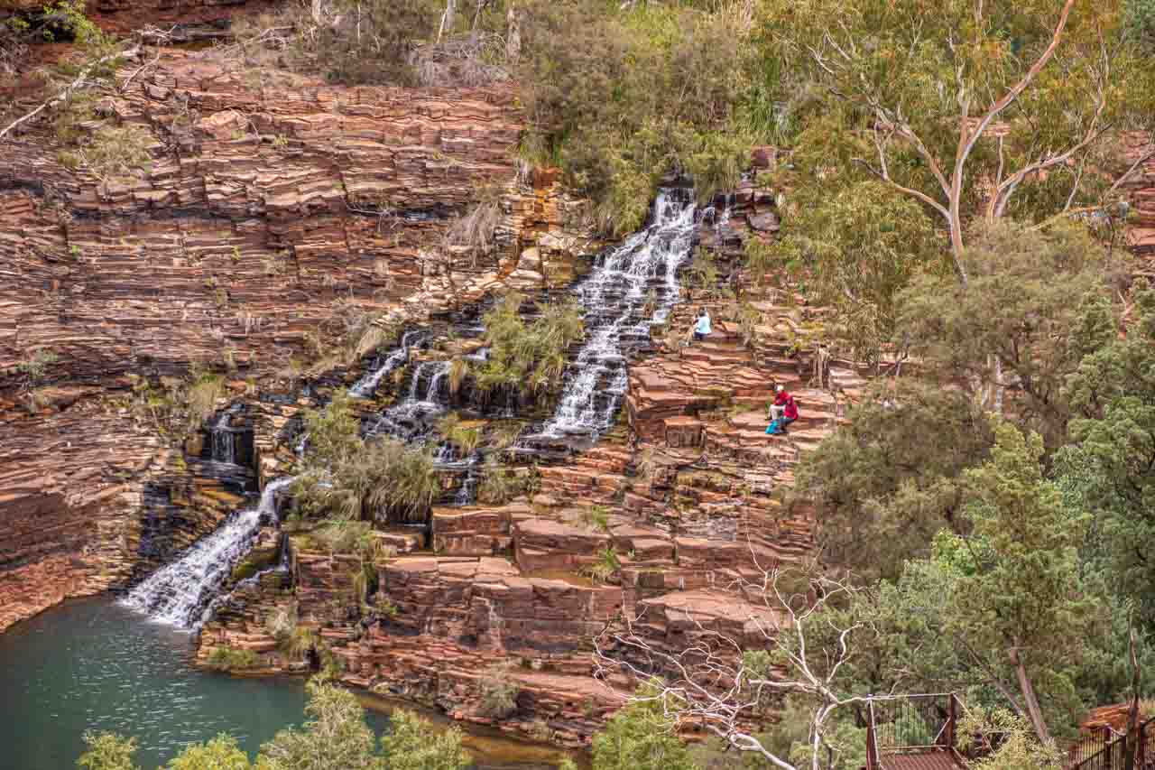
Fortescue Falls in Karijini National Park
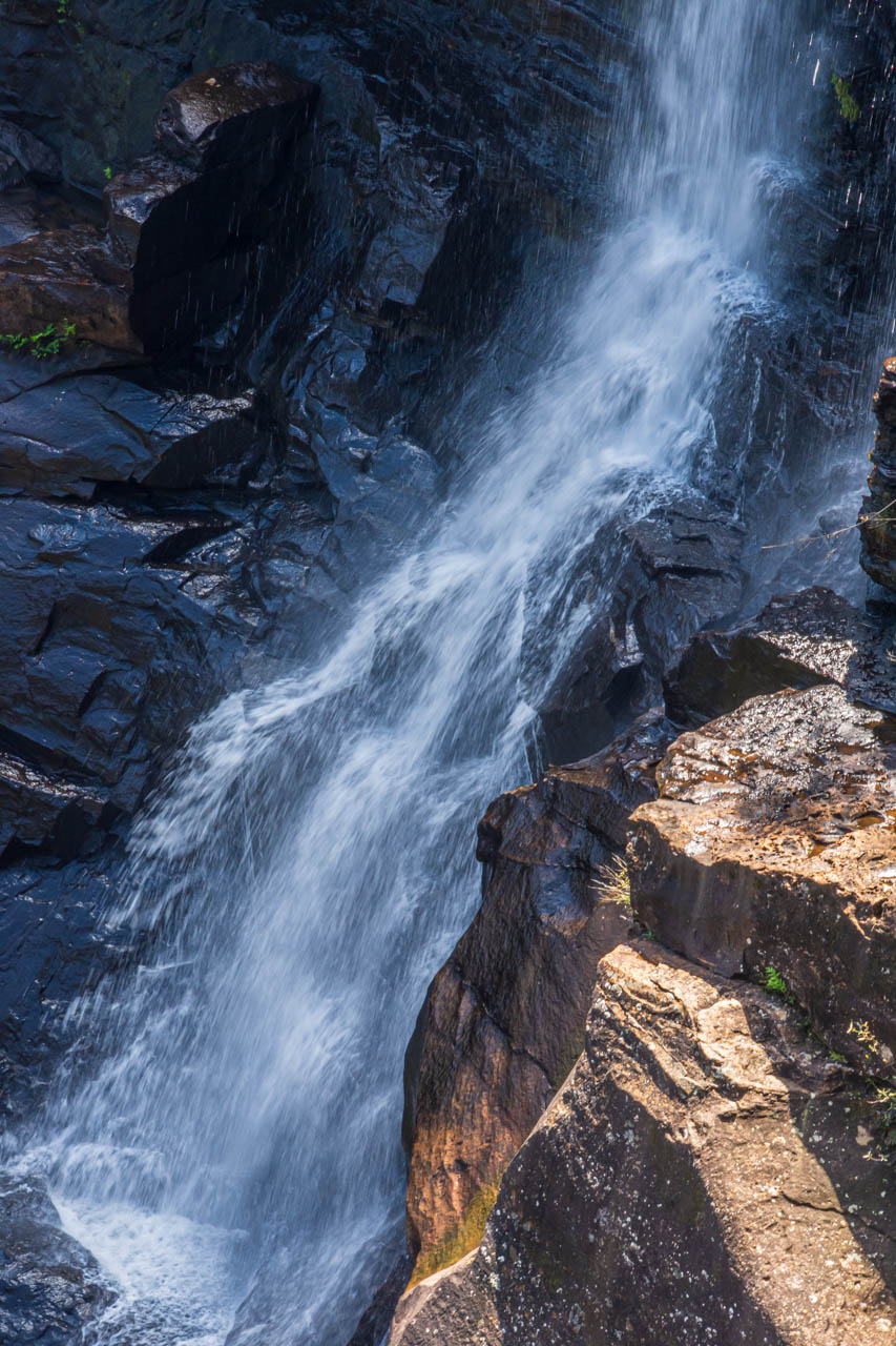
Fortescue Falls in Dales Gorge is one of Karijin National Park’s few permanent waterfalls. Spring-fed, the falls cascade more than 20 metres down a series of natural rock steps before finishing in a pool.
Fortescue Falls Lookout is 150 metres from the car park on a flat paved path. The lookout provides excellent views of the 100-metres-deep Dales Gorge and Fortescue Falls. Access to the bottom of Fortescue Falls is via 200 metal steps with railings. There are seats at regular intervals as you make your way down and back up.
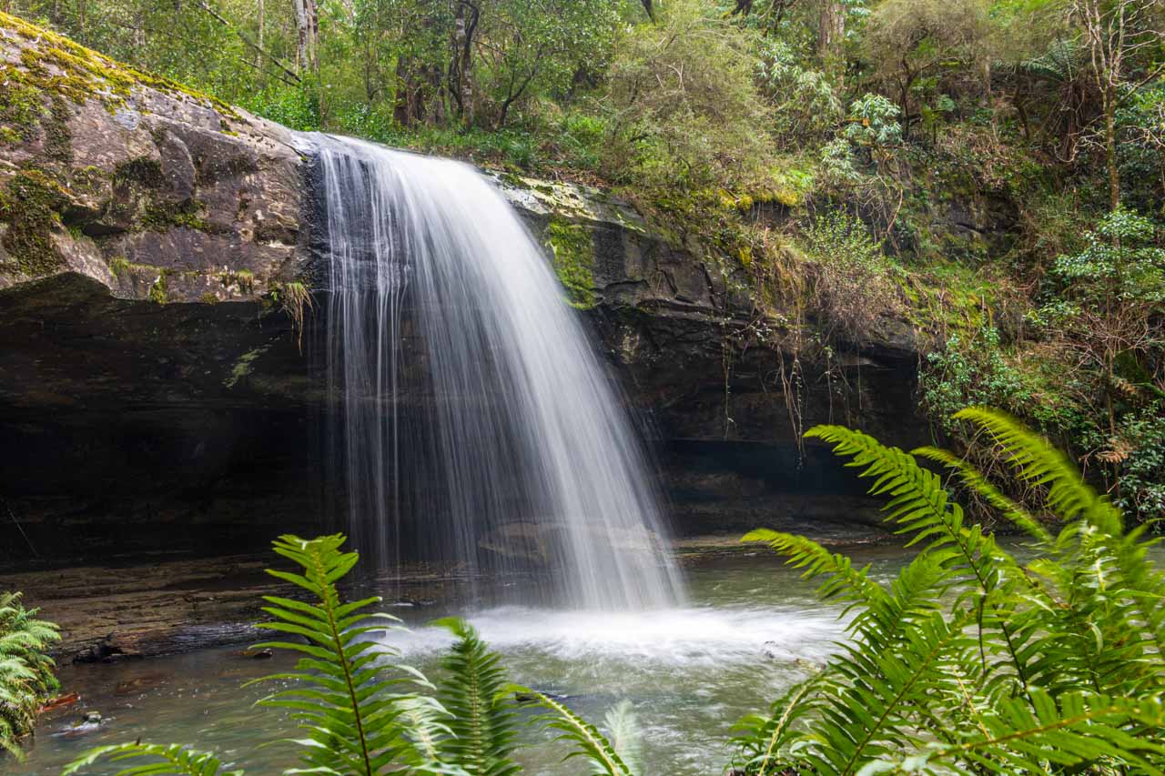
Fern Pool (Jubura), Karijini National Park
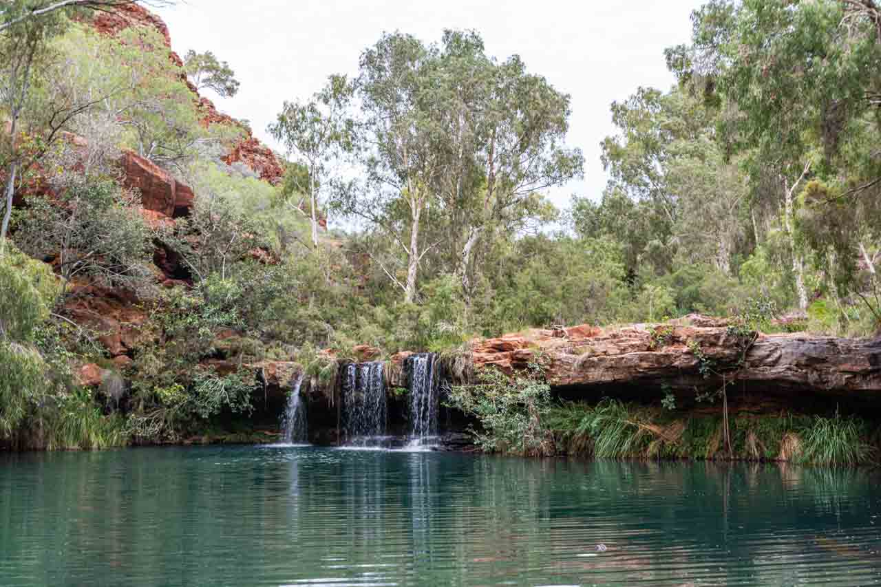
Fern Pool
From Fortescue Falls, you can take the 600-metre return track to Fern Pool, a picturesque swimming hole with a waterfall.
The dirt track required some navigation of rocks and is muddy and slippery (as I discovered) after rain.
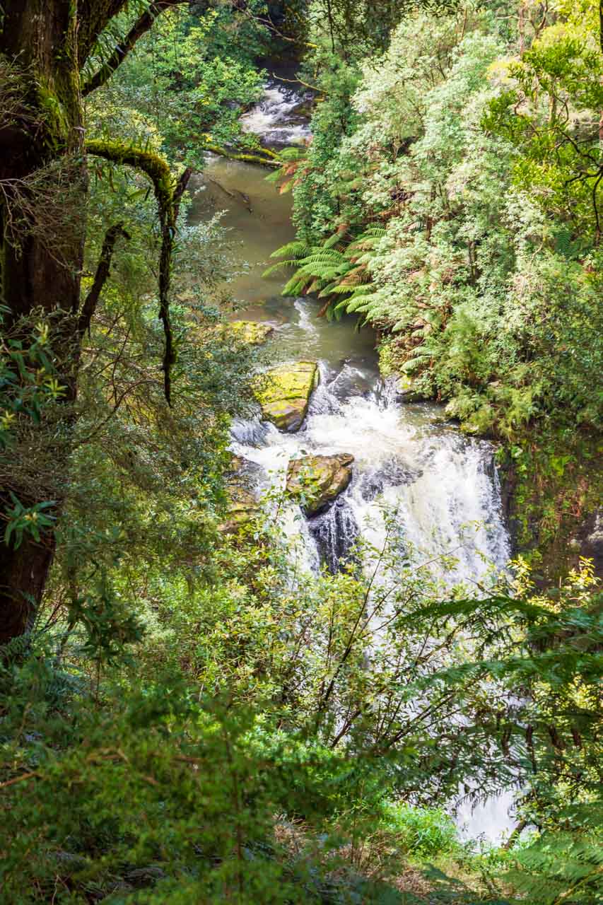
Circular Pool Lookout, Karijini National Park
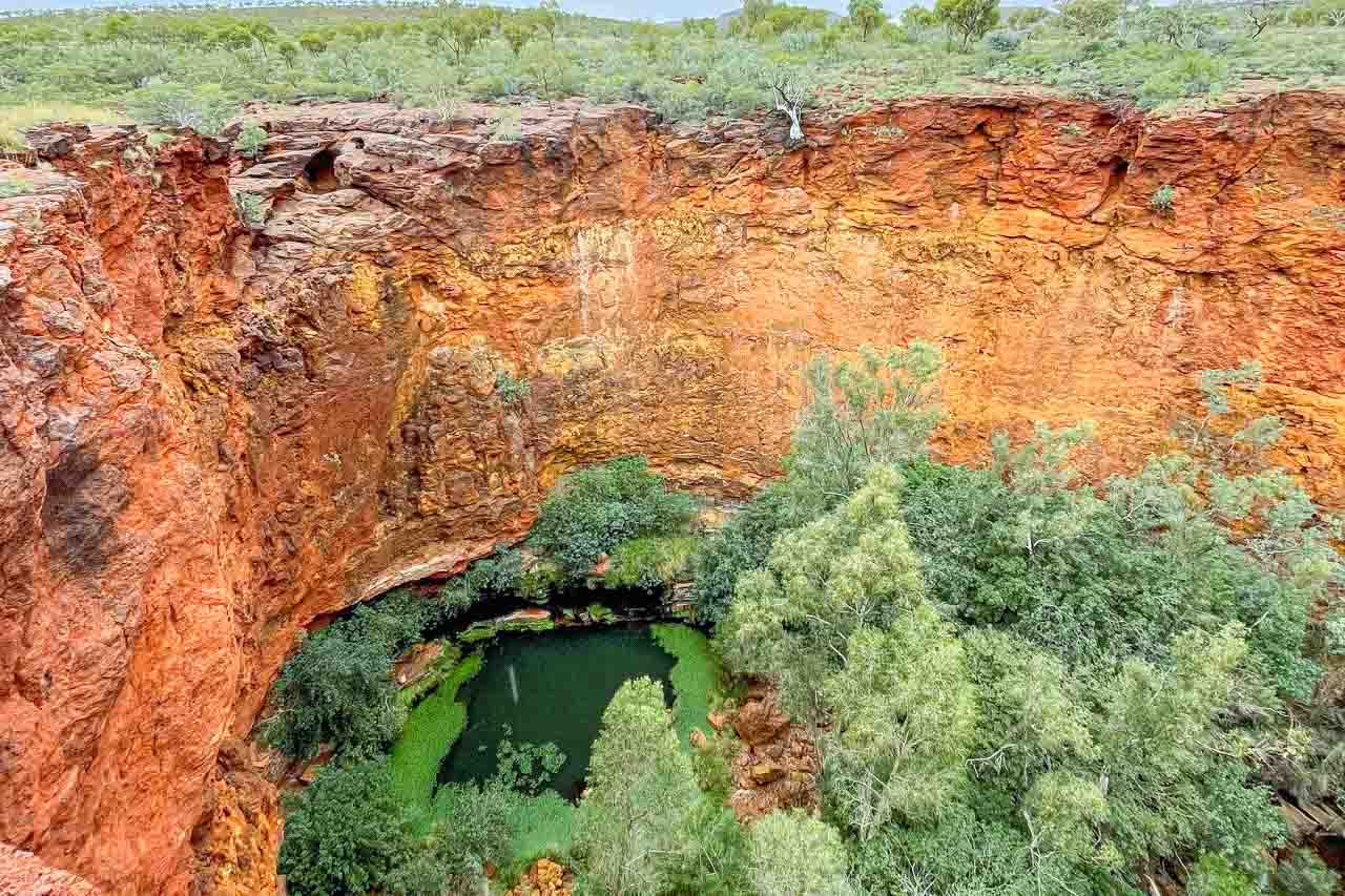
Circular Pool viewed from the lookout
Still in Dales Gorge in Kirijini National Park, Circular Pool is an impressive sight viewed from the lookout.
Marble Bar

Marble Bar Pool, Coongan River
Marble Bar is said to be the hottest town in Australia. So, what better way to cool off than at this pretty spot on the Coongan River?
Marble Bar is well known for its extremely hot weather, with a mean maximum temperature second only to Wyndham, also in Western Australia.
According to the Australian Broadcasting Corporation,
“Marble Bar earned the title of Australia’s hottest town when it recorded the longest heatwave – 160 days over 37.7 degrees – in 1923 and 1924.
It is still listed in the Guinness Book of Recordes. Its record for the town’s hottest Christmas was in 2018 when it reached 48 degrees.
Two days later, the Marble Bar mercury hit its record – a debilitating 49.6 degrees.
While the numbers are impressive, the Bureau of Meteorology instead crowns the Kimberley town of Wyndham as having the highest annual temperature at 36.1 degrees.”
Since my return from Western Australia, several people have commented that Marble Bar has nothing to offer; that the town is not worth visiting. I beg to differ. What do you think?
Eighty Mile Beach
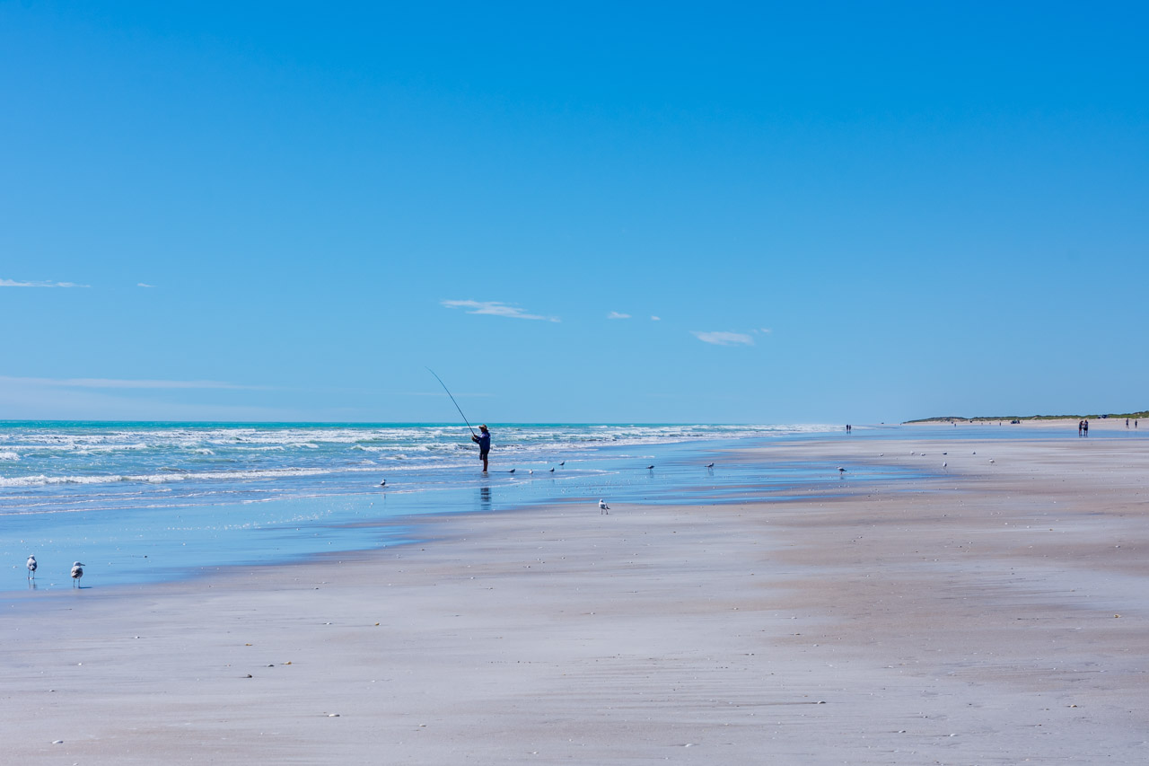
Eighty Mile Beach
Unspoilt Eighty Mile Beach is a beautiful pristine beach of white sand and turquoise water that goes on forever – for 220 kilometres, to be exact! It is the longest uninterrupted beach in Western Australia. I don’t know where the ‘Eighty Mile’ comes from, but it is obviously a misnomer.
In my opinion, Eighty Mile Beach beats Turquoise Bay hands down in the best beaches category. Picture perfect! What do you think?
Eco Beach Resort, Broome

The sun sets over the beach below Eco Beach Resort
The first rays of the sunset at Eco Beach Resort radiate a sepia glow over the sands and ocean. The sunset just got better and better.
The next and final stop is Broome, 134 kilometres from Eco Beach Resort.
Broome
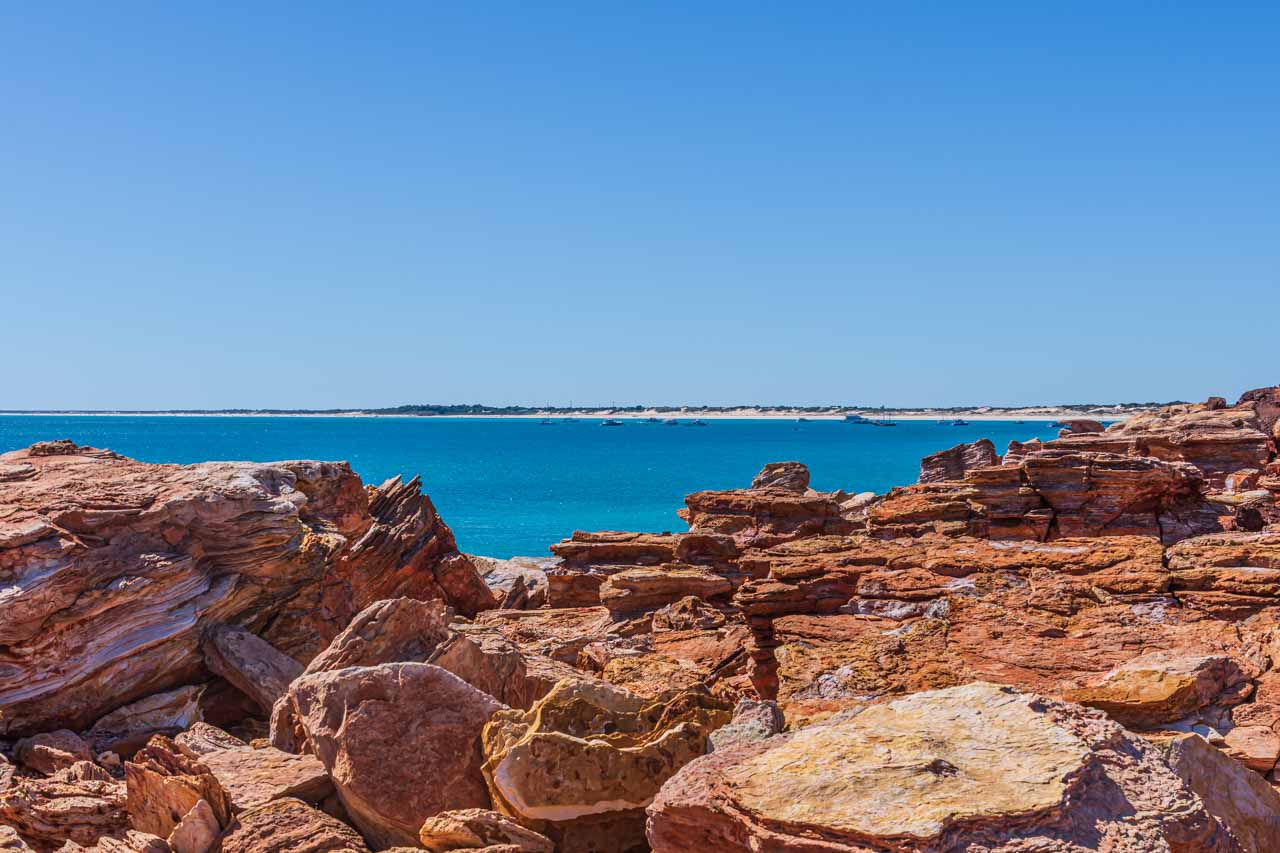
Gantheaume Point, Broome, with Cable Beach in the distance
Gantheaume Point is at the southern end of Broome’s famous Cable Beach. With the reds and yellows of the sandstone cliffs against the backdrop of a deep blue Indian Ocean, every photo is perfect.
Gantheaume Point is a less-crowded alternative from Cable Beach Resort to watch the sun spectacularly set as it sinks below the Indian Ocean.
Are you wondering what else you can do in Broome? Check out my post on 15 Photos To Inspire You To Visit Broome.
Driving Western Australia’s picturesque Coral Coast and awe-inspiring national parks on the road from Perth to Broome offers many quality photo opportunities. Limiting this post to 23 photo stops was not an easy task. Don’t hesitate to stop at every scenic sight, as a memorable photo could be just moments away.
Disclaimer: This post contains no affiliate links. All views and opinions are my own and non-sponsored. All photos are my own and remain the copyright of Just Me Travel.
© Just Me Travel 2018-2022.
Please leave a comment below to share your thoughts. In your opinion, do the photo spots in this post deserve to be included? Are there other photo spots you believe are crying out to be added?
Like this post? Save it for later!

For more posts on Western Australia, read these:
HOW TO SEE HORIZONTAL FALLS AND EPIC TIDES, AUSTRALIA
7 TOP DAY TRIPS AND THINGS TO DO IN AND FROM PERTH, AUSTRALIA
15 PHOTOS TO INSPIRE YOU TO VISIT BROOME, WESTERN AUSTRALIA
SEE 7 BEAUTIFUL GORGES IN THE KIMBERLEY – the ultimate guide
THE ULTIMATE GUIDE TO 6 SAFE SWIMMING HOLES IN THE KIMBERLEY, AUSTRALIA
Author’s Note: Please check the latest travel restrictions before planning any trip, and always follow government advice.
No Comments on 23 GREAT PHOTO SPOTS ON THE ROAD FROM PERTH TO BROOME, AUSTRALIA