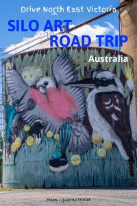
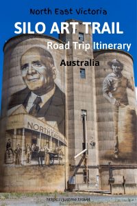
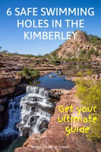
6 Breathtaking Swimming Holes in the Natural Landscape of the Kimberley Swimming in water holes in the Kimberley, Western Australia, is a magical experience. However, the Kimberley is an…
6 Breathtaking Swimming Holes in the Natural Landscape of the Kimberley
Swimming in water holes in the Kimberley, Western Australia, is a magical experience. However, the Kimberley is an ancient landscape with an ancient animal – the crocodile. Crocodiles inhabit many of the Kimberley’s waterways. So, where is it safe to swim? Where can you find crocodile-free swimming holes? Read on to discover the wonderful swimming holes I enjoyed on an escorted road trip around the Kimberley.

Be Croc Wise – crocodile safety signage
But first, be warned – crocodiles do kill. When travelling in the Kimberley, it is crucial to be croc wise. If travelling without a guide, read the croc warning signs and check with locals before swimming or even approaching the water.
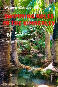
The Kimberley covers hundreds of thousands of square kilometres across northern Western Australia – 423,517 to be exact. The Kimberley is vast, with cattle stations of a million acres or more. To give this some perspective, the Kimberley is three times larger than England or slightly smaller than California. As such, the six safe swimming holes I cover in this post are just a drop in the Kimberley.
I came to the Kimberley on a 3-week holiday not knowing what to expect and not wanting to pre-empt what I would experience. I went with an open mind and left my heart there, tramped into the pindan (the red dirt that dominates the Kimberley landscape).
The Kimberley is an area of breathtaking landscapes and scenery and rivers. I don’t know why I was surprised by the number of rivers we traversed. But it is those rivers that can provide some safe swimming holes in the Kimberley. And so, I say, “thank you” to the Kimberley for an extraordinary experience.
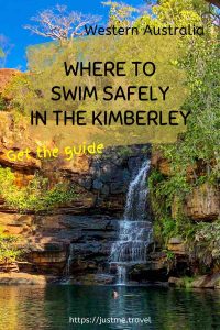
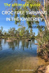
Knowing northern Australia is croc country, I was pleasantly surprised to find the Kimberley has so many safe swimming holes – safe from a predator thinking you are its next meal. Read on to discover six of the Kimberley’s safe swimming holes or jump straight to a specific waterhole.
- Zebedee Springs
- Mitchell River
- King Edward River
- Manning Creek
- Galvans Gorge
- Bell Gorge
- When to go
- Getting there and around
The order of swimming holes presented in this post is simply determined by the order in which I swam in them on a 15-day escorted four-wheel-drive (4WD) Adventure of the Kimberley with APT.
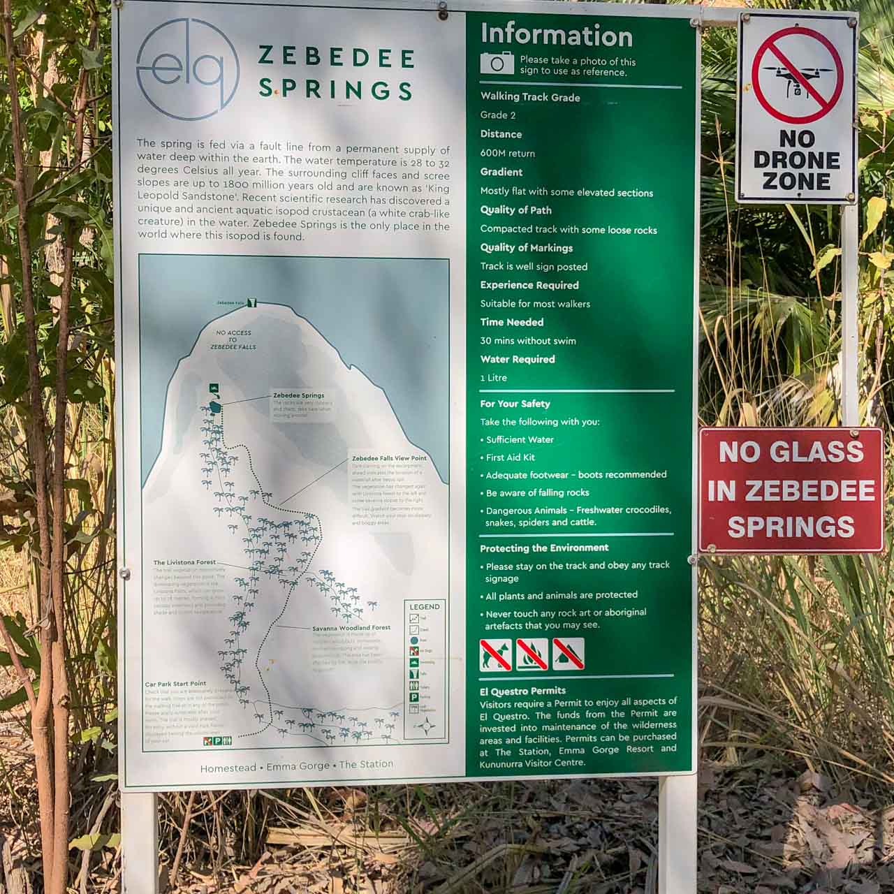
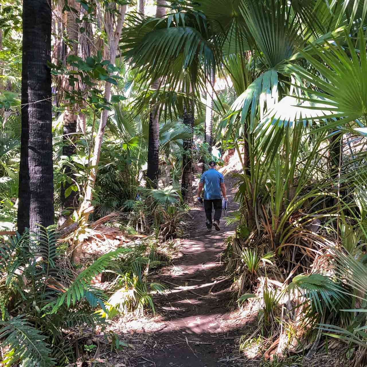
Zebedee Springs

Zebedee Springs in El Questro Wilderness Park
Relax and soak your cares away in Zebedee Springs – a series of rocky thermal pools and trickling waterfalls shaded by towering Livistona palms. Located in the El Questro Wilderness Park, Zebedee Springs is an oasis in the Kimberley.
The Springs are fed by a fault line from a permanent supply of water deep within the earth. The water temperature is a constant 28-32 degrees Celsius year-round.
Access to Zebedee Springs is only possible during the dry season – May to October. It is an easy, 10 to 15 minute walk (one way) into the thermal pools – approximately 600 metres return. The track is mostly flat with some loose rocks and the occasional muddy patch.
Take care entering the pools as the rocks can be slippery.
I had injured my shoulder prior to our visit to Zebedee Springs. I found the swim very therapeutic.
If self-driving, Zebedee Springs is open from 7 am to 12 pm. Entry into El Questro Wilderness Park requires a valid park permit. If on an escorted tour or staying at El Questro, afternoon visits to Zebedee Springs are available at allocated time slots.
El Questro is situated in the East Kimberley, 110 kilometres west of Kununurra by road. To reach Zebedee Springs and El Questro, you can drive from Kununurra on the 4WD Gibb River Road, book a transfer by road or air from Kununurra, or join a guided tour.
When self-driving into El Questro Wilderness Park or anywhere else in the Kimberley, it is crucial to remain up-to-date on road conditions and other relevant information.
Mitchell River
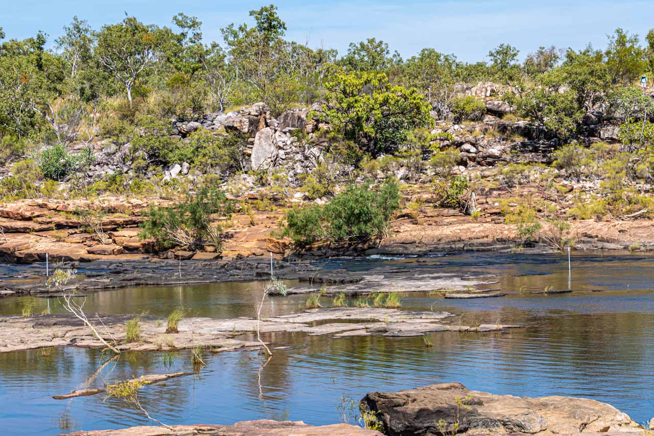
Cool off in the Mitchell River
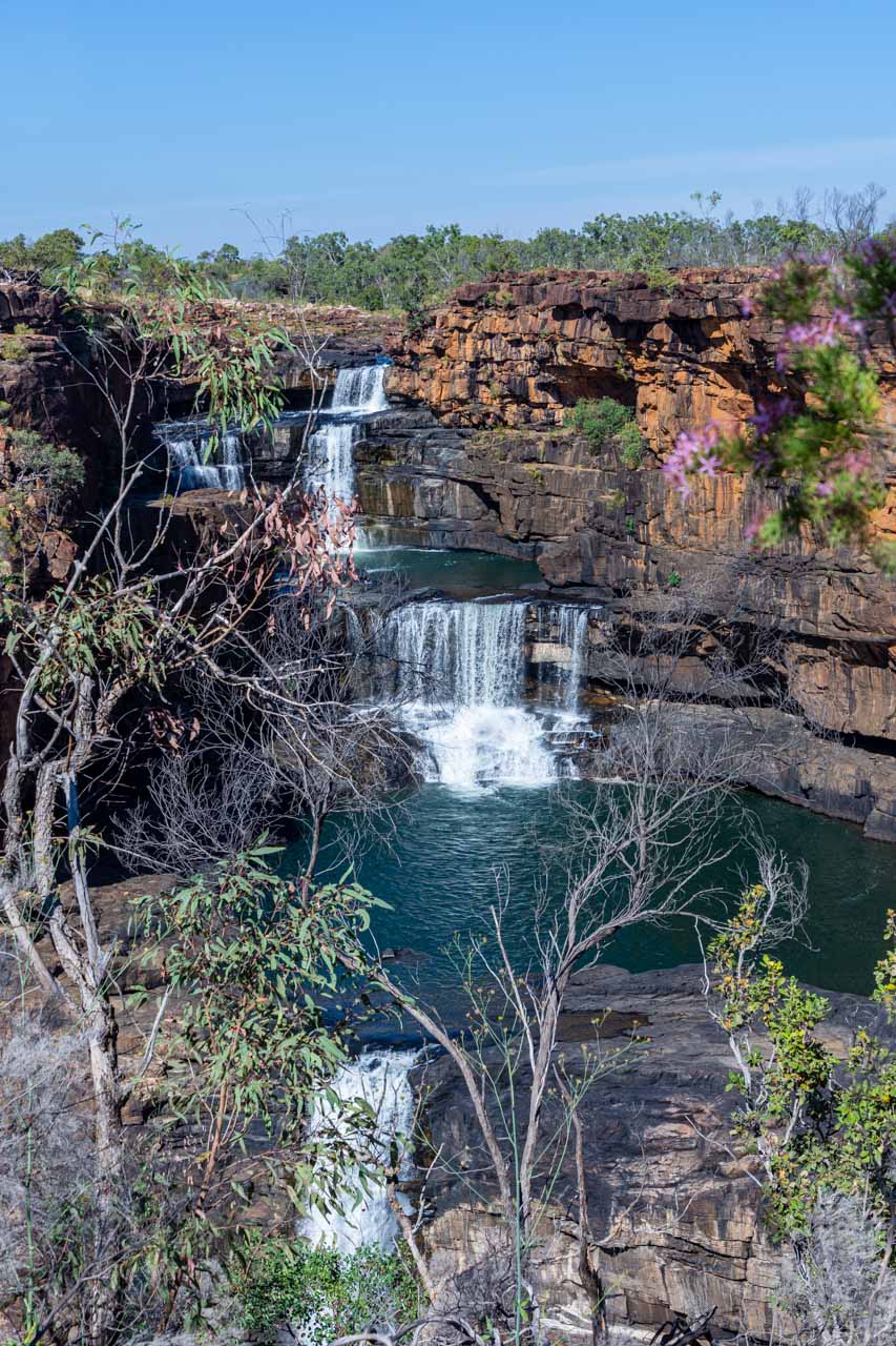
The Mitchell River cascades 97 metres over four distinct tiers to form Mitchell Falls – one of the most iconic landmarks in the Kimberley. Swimming below the sacred falls is not allowed, but there is excellent swimming in the river above. And this is where I spent an enjoyable couple of hours with a picnic lunch and a swim to cool off.
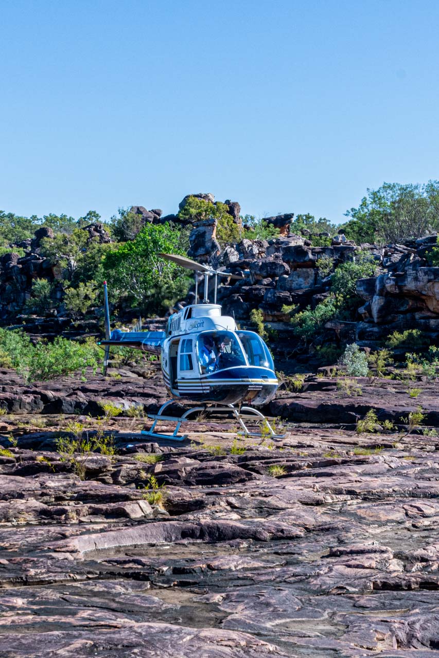
I helicoptered onto a rocky plateau beside the Mitchell River. After a hike around the ridge for great views of Mitchell Falls, I was ready for a swim. Entering the river required some bottom sliding over slippery rocks. I found it necessary to be aware of what was underneath me in the water due to submerged rocks. But it was a great swim in a magnificent landscape.
Coming from an area in Australia where my local river originates high up in the Alps, I expected Mitchell River to be freezing, no matter how hot the day. I was pleasantly surprised at how warm the river water was. Obviously not fed by snowmelt!
Mitchell Falls is in the remote Mitchell River National Park in the Kimberley. Access to the Park is by 4WD only and is closed during the wet season (November to April).
Once in the National Park, you can walk up to Mitchell Falls via a trail described as a moderate to difficult 8.6-kilometre return walk, requiring some rock hopping with areas providing little shade. Or, like me, you can get a helicopter to Mitchell River at the top of the Falls – an irreplaceable experience.
Access to Mitchell Falls requires a Uunguu Visitor Pass.
King Edward River
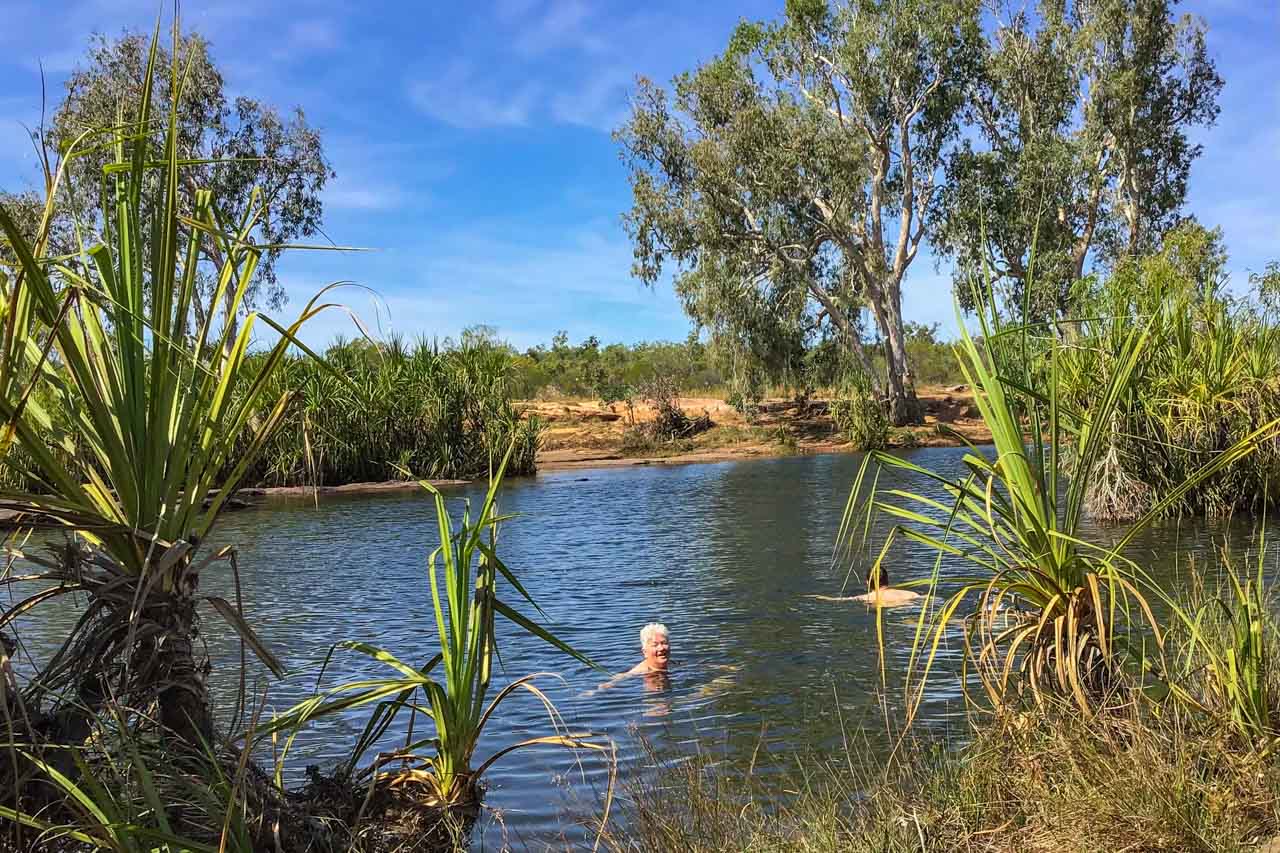
I take a swim in the King Edward river – photograph by Diana House
Still on Mitchell Plateau, a short walk from Munurru (King Edward River) Campground on Port Warrender Road, with Wandjina and Gwion-Gwion (Bradshaw) Rock Art Galleries nearby, the King Edward River provides an idyllic swimming hole.
The swimming hole offers deep, crystal clear water. There is even a pool ladder bolted to the rocks to allow easy access in and out of the water. The King Edward River is a great place to cool off from the dry season heat.
As children, my siblings and I were always told we must wait half an hour after eating before swimming. This warning, our parents told us, was to prevent downing due to having a full stomach. The walk from the shaded picnic tables where we had lunch was five minutes to our swim in the King Edward River. No one drowned!
Wunambal Gaambera Traditional Owners manage Mitchell Plateau. Please check which sites in Wunambal Gaambera Country require a Uunguu Visitor Pass to access.
Swimming in the King Edward River
Manning Creek
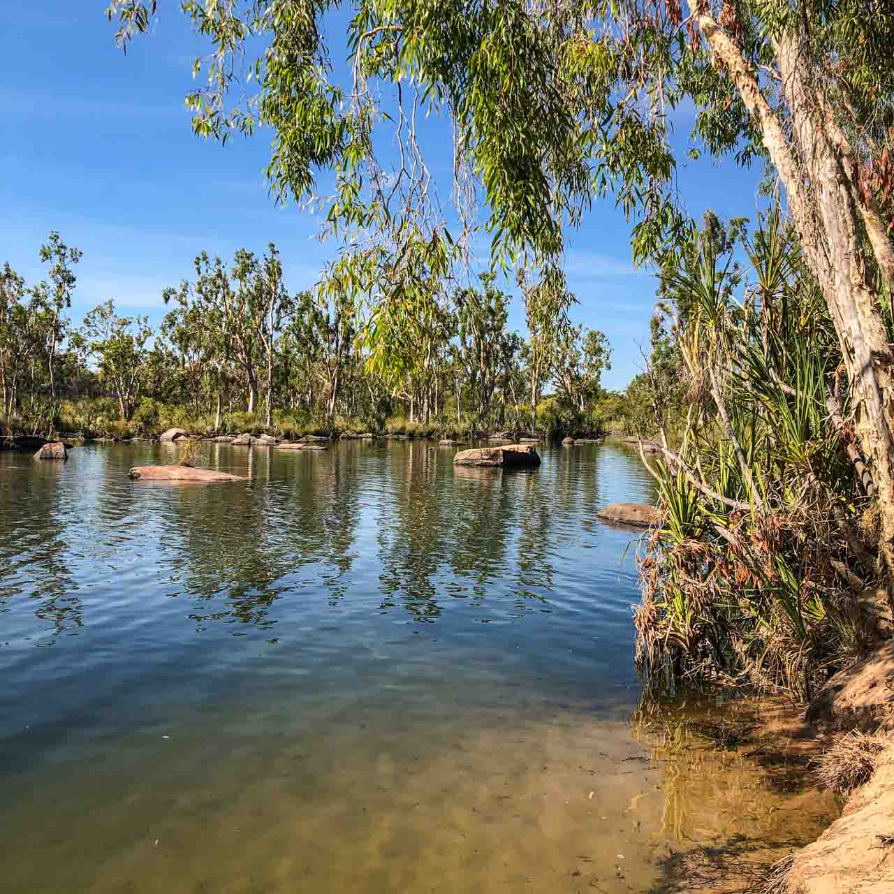
Manning Creek swimming hole
Leaving Drysdale River Station, a million-acre working cattle station where we had spent the last two nights, we headed for our next two nights stop at Bell Gorge Wilderness Camp. After a short drive (in kilometres) on the seriously corrugated Kalumburu Road, we found ourselves back on the iconic Gibb River Road (also corrugated).
Today saw us experiencing two swimming holes – Manning Creek and Galvans Gorge.
Our first stop was at Manning Gorge campground for a picnic lunch on Mount Barnett Station in the King Leopold Ranges, North West Kimberley. A few minutes walk from the campground brings you to the picturesque Manning Creek, with its trees lining the sandy riverbank. There is a rickety ladder from which you can enter the creek. Don’t dive into the creek because rocks are submerged beneath the water.
As with our swim in the King Edward River, we did not wait the ‘obligatory’ half an hour after eating before plunging into the Manning Creek. No one drowned! I am beginning to think my parents were spinning a furphy. The trouble is, I passed the same myth onto my children.
An entrance permit is required to access the Manning Creek swimming hole, purchased at the Mount Barnett Roadhouse (one of the most remote roadhouses in Australia) – about seven kilometres from Manning Gorge campground.
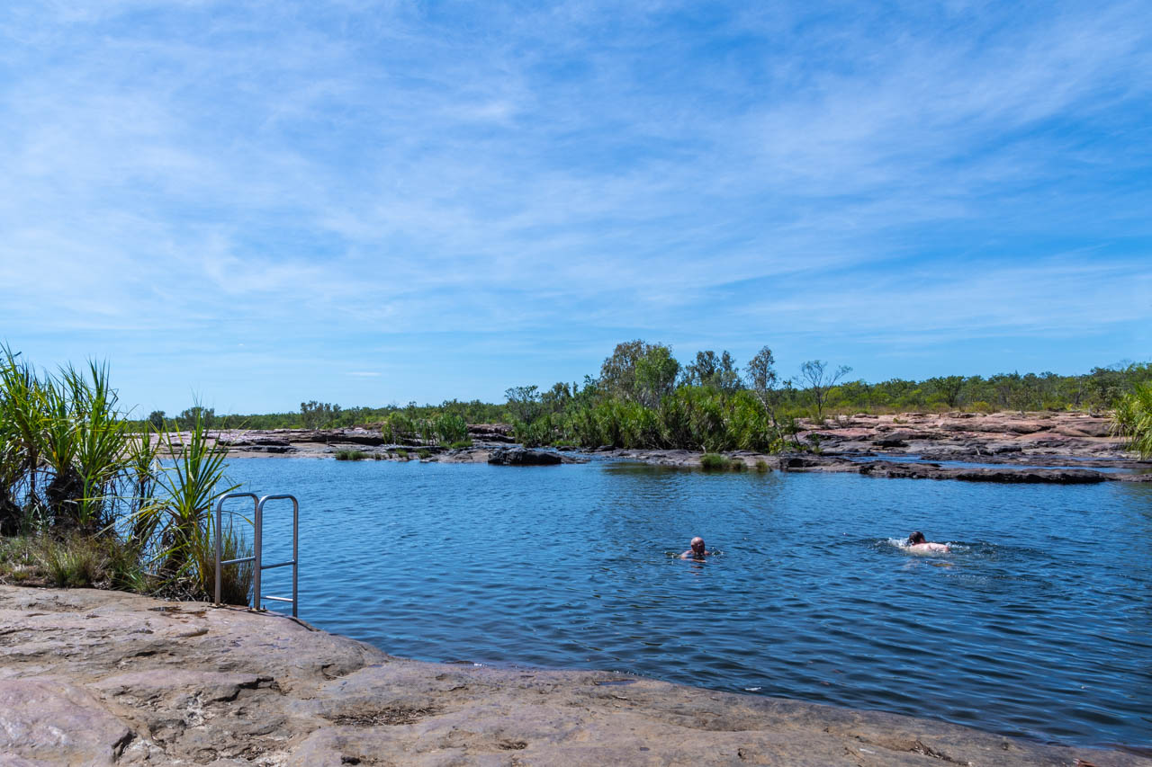
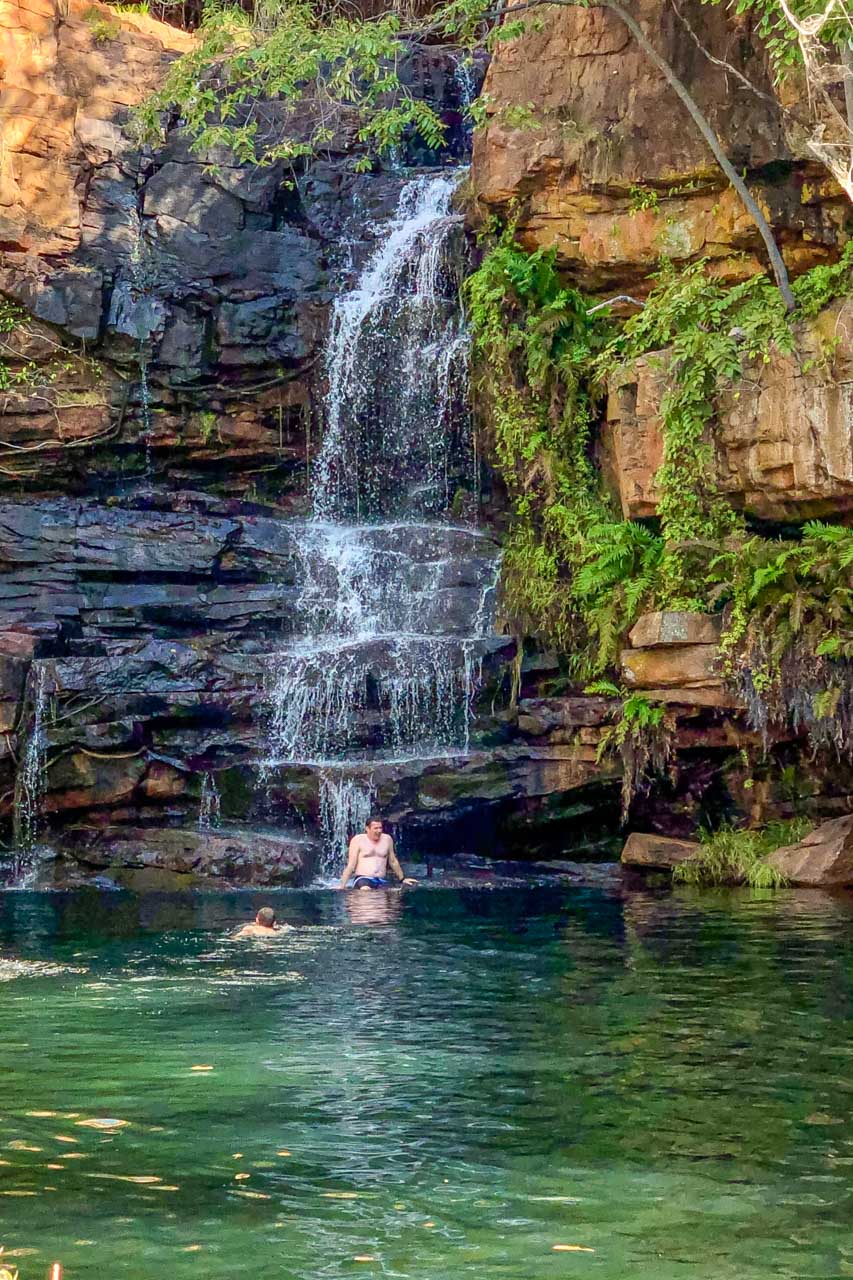
Galvans Gorge
Galvans Gorge swimming hole
Still on Mount Barnett Station, Galvans Gorge is a pretty little gorge located along the Gibb River Road in the Phillips Range about 15 kilometres west of Mount Barnett.
My guidebook describes the access to Galvans Gorge as an easy, 750-metre walk from the car park off Gibb River Road. Our guide described the path as one kilometre (one way) of flat surfaces, followed by rocky surfaces, then more flat surfaces. Both were right.
Sit on a rock with the waterfall cascading onto your shoulders and down your back for an invigorating massage. While we were at Galvans Gorge, some young people were swinging from a rope on a tree overhanging the waterhole and jumping into the swimming hole. I have read the rope swing is maintained, but I wasn’t going to risk it. On the wall behind the rope swing, you will find ancient Windjana rock art.
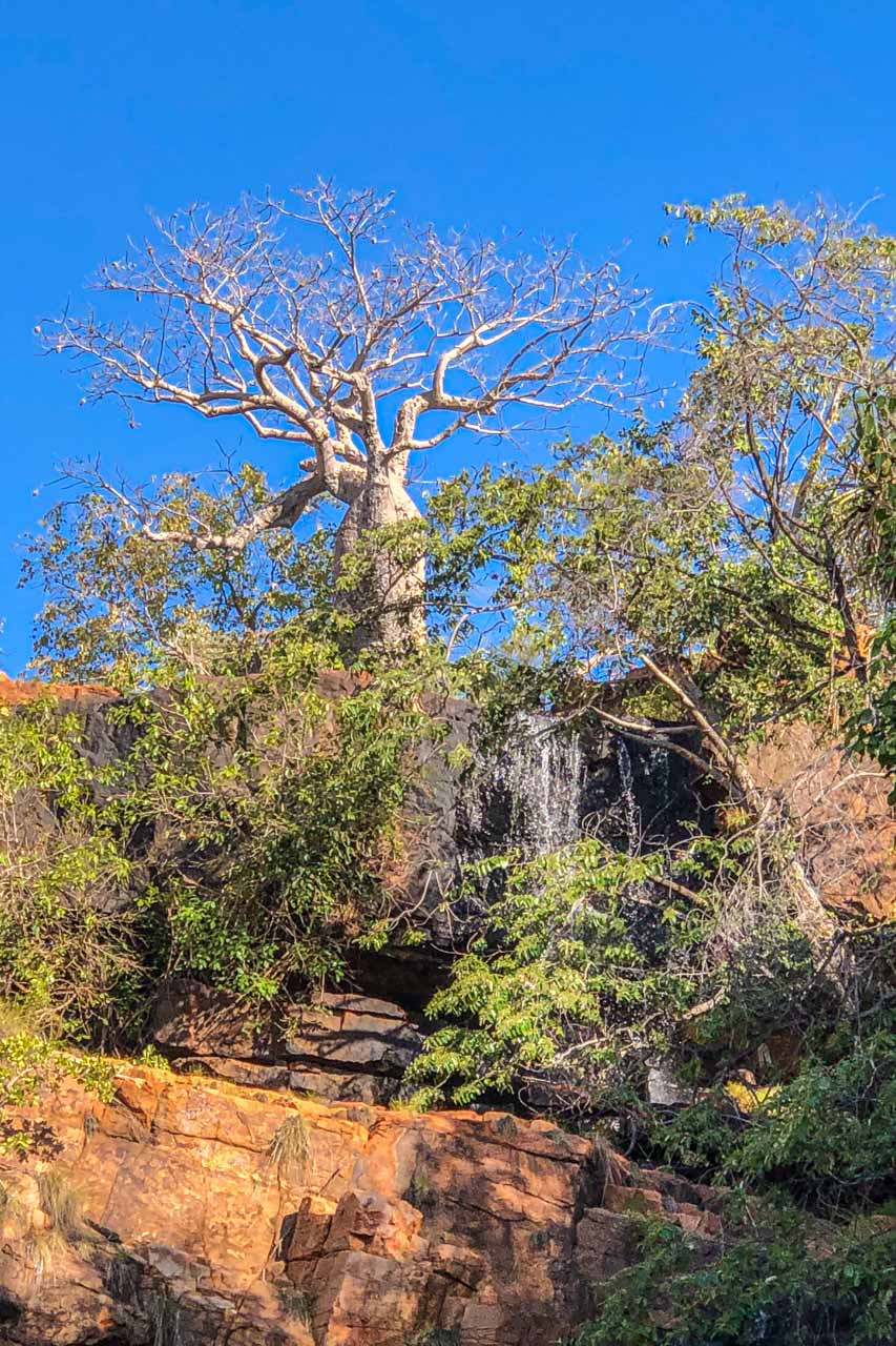
The Boab tree standing guard at the top of the waterfall is a native of the Kimberley and an iconic Kimberley symbol.
The gorge and swimming hole are shaded most of the day, making it a perfect spot to escape from the heat. Entry is free.
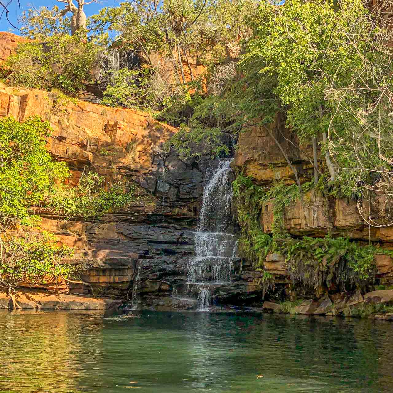
Bell Gorge

Swimming at Bell Gorge
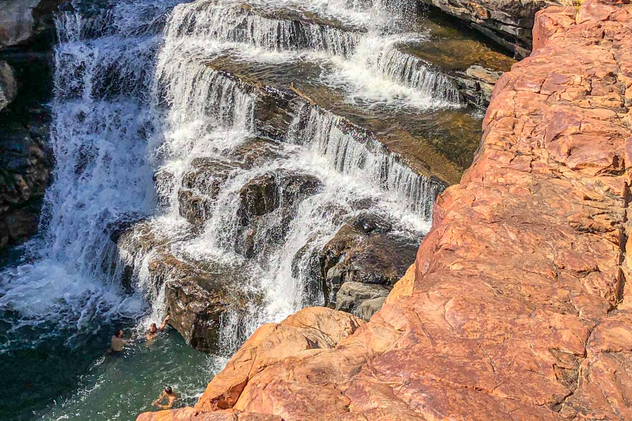
If asked which was my favourite swimming hole, unhesitantly, my response would be Bell Gorge. Its spectacular landscape is a photographer’s delight, and the swimming holes don’t disappoint.
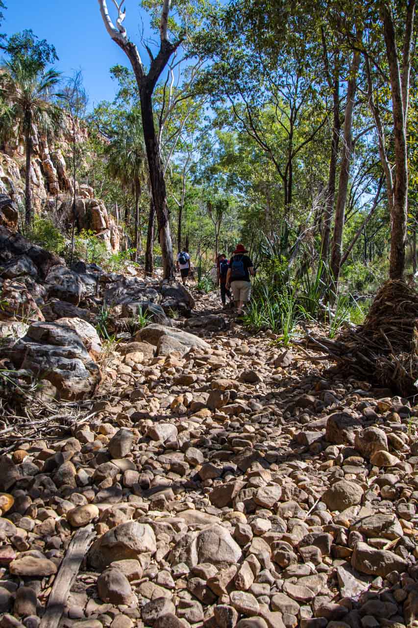
Bell Gorge is in King Leopold Ranges Conservation Park (now referred to by its Aboriginal name, Wunaamin Miliwundi Ranges Conservation Park) and about 247 kilometres east of Derby along the Gibb River Road. Turning off the Gibb River Road, Bell Gorge car park is approximately 30 kilometres along Silent Grove Road, a corrugated road requiring a 4WD.
From the car park, it is a one-kilometre walk along a challenging rocky track to reach the waterfall and swimming holes. I say ‘challenging’ for two reasons:
- there is a moderate incline at the beginning of the track, which had me puffing when walking back up on my return; and
- the rocks you are walking on are all loose, making it necessary to concentrate on your balance.
However, at the end of the track, the gorge opens up to a stunning vista and the rock pools at the top of the waterfall. One of the rock pools is a natural infinity pool, allowing you to swim right up to the edge of the waterfall.
The second swimming option at Bell Gorge is below the waterfall, where the falls form a deep pool. According to my travel companions who trekked to the bottom swimming hole, the trek is manageable but will test your hiking skills. First, you need to cross Bell Creek to the opposite side. As the rocks where you cross can be slippery, our guide recommended wearing socks (no shoes) to cross the creek. Apparently, this worked a treat. Once across the creek, you climb down a steep, rocky track (which you have to climb back up again) to access the bottom swimming hole and swim below the waterfall within the gorge. I was told the swim was delightful and well worth the challenging hike.
Bell Gorge is in a national park, so entry fees apply. It is inaccessible during the wet season. Before travelling to Bell Gorge, it is advisable to check for alerts and closures.
Don’t forget your sunscreen and take plenty of water.
The rocky track into Bell Gorge
Swimming in the pool below the waterfall at Bell Gorge
Except for Manning Creek, where you can change in the toilet/shower block, the swimming holes listed in this post do not have anywhere to change into your swimmers. Rather than bare my naked backside to my fellow travellers, I wore my swimmers under my clothes.
When to go
The Kimberley has no summer or winter, just wet or dry due to its tropical monsoon climate. I travelled to the Kimberley in June, early in the region’s dry season. The daily temperatures ranged from the high 20s to low 30s degrees Celsius. While this might sound high to some people, the humidity was so mild I didn’t feel especially hot but did appreciate the air conditioning on the bus and the wild swimming opportunities. The nights were cooler, and the only rain I experienced was one night when back in Broome at the end of the escorted tour.
If you want to avoid oppressive heat and humidity, cyclones, and flooded rivers, then travel to the Kimberley from May to October in the dry season. Much of the Kimberley is impassable during the wet season, from November to April. Flooded rivers isolate towns, accommodation, and inhabitants during the wet season.
The Gibb River Road is only accessible during the dry season.
Getting there and around
The Kimberley is truly remote. Even so, you have several options for getting to the Kimberley. I took a direct flight from Sydney to Broome (the ‘capital’ of the Kimberley) but, alternatively, you could drive, hop on a bus, or take a guided tour.
After a week on my own in Broome, I joined APT’s 15-day escorted 4WD adventure tour around the Kimberley. Our ‘4WD’ was a bus on steroids – the body of a bus on a truck chassis. It was on this tour that I was able to experience the safe swimming holes described above.
A 4WD is necessary for travelling around much of the Kimberley if you leave the tarred highway. You should also consider travelling with a satellite phone as there were several areas where there was no mobile phone coverage. At times, I did not even have SOS access on my phone.
The pleasures of travelling on an escorted tour were not having to worry about visitor passes or wondering how I would get from A to B or concerned about damaging my car (if I owned a 4WD) on severely corrugated dirt roads.
The only drawback of being on an escorted group tour was the lack of time to spend at the swimming holes; to thoroughly enjoy them and relax. Taking food and drink and a good book, I could easily have spent a whole day at each swimming hole. Instead, we were in and out of the swimming spots after a quick dip.
I would like to leave you with a related children’s song (lyrics by Jack Lawrence; © Walt Disney Music Company):
 Never smile at a crocodile
No, you can’t get friendly with a crocodile
Don’t be taken in by his welcome grin
He’s imagining how well you’d fit within his skin
Disclaimer: This post contains no affiliate links. All views and opinions are my own and non-sponsored. Unless expressly stated, all photos are my own and remain the copyright of Joanna Rath.
Comment below to share your thoughts on this blog post.
Have you been to the Kimberley? Do you have a safe swimming hole in the Kimberley you would like to share with readers?
Like this post? PIN it!
Related Kimberley posts
-> How to See Horizontal Falls and Epic Tides, Australia
-> See 7 Beautiful Gorges in the Kimberley – the ultimate guide
-> 15 Photos to Inspire You to Visit Broome, Western Australia
Are you looking for more ideas for destination Western Australia? Then don’t miss these posts:
23 GREAT PHOTO SPOTS ON THE ROAD FROM PERTH TO BROOME, AUSTRALIA
7 TOP DAY TRIPS AND THINGS TO DO IN AND FROM PERTH, AUSTRALIA
To read my other posts on Australia, check out: https://justme.travel/category/destinations/oceania/australia/
Author’s Note: Please check the latest travel restrictions before planning any trip, and always follow government advice.
No Comments on THE ULTIMATE GUIDE TO 6 SAFE SWIMMING HOLES IN THE KIMBERLEY, AUSTRALIA